
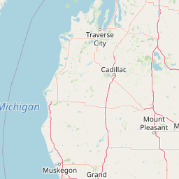
Peninsulas
Park geography
Structured data on boundary extent, terrain, and regional natural features
Geographic Profile and Landscape Mapping of Sleeping Bear Dunes National Lakeshore
Analyze the formal geographic framework of Sleeping Bear Dunes National Lakeshore within Michigan. This profile covers the total recorded area of 288.13 square kilometers, regional terrain characteristics, and associated natural features including Lake Michigan coastal elements, forest zones, and island habitats.
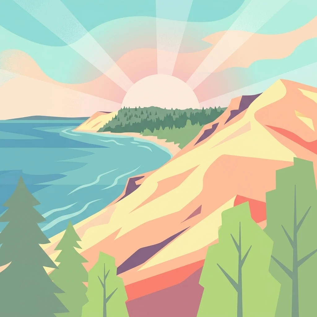
Towering perched dunes, forested bluffs, and island-studded Lake Michigan shoreline in northwestern Michigan.
Sleeping Bear Dunes National Lakeshore
Sleeping Bear Dunes National Lakeshore is a U.S. National Lakeshore that protects an approximately 35-mile stretch of Lake Michigan's eastern shoreline in northwestern Lower Michigan, together with North and South Manitou Islands. The park preserves a dramatic chain of perched sand dunes rising hundreds of feet above the lake, backed by beech and maple forests, deep glacial bluffs, freshwater rivers, and quiet inland lakes such as Glen Lake. The lakeshore is notable for blending geology, ecology, and heritage in a single landscape. Glacial deposits from the last ice age form high bluffs that are still being reshaped by wind and water, while a mosaic of dune, forest, wetland, and shoreline habitats supports species ranging from piping plovers to black bears. Layered on top of this natural setting are historic sites such as the South Manitou Island Lighthouse, Glen Haven's former company town, and the rural Port Oneida farm district. Established in 1970 and administered by the National Park Service, the lakeshore became a centerpiece of Northern Michigan's outdoor identity, gaining national attention in 2011 when it was named the "Most Beautiful Place in America" by Good Morning America. In 2014, a substantial interior portion of the park was also formally designated as the Sleeping Bear Dunes Wilderness, reinforcing its protection as one of the most striking freshwater coastal landscapes in the United States.
- Location
- United States of America
- Park type
- National park
- Established
- 1970
- Area
- 288.1 km²
Location overview
Country memberships and territorial designations in Michigan, United States
Sleeping Bear Dunes National Lakeshore Regional Geography and Location Data
Sleeping Bear Dunes National Lakeshore spans recorded administrative memberships across Michigan within the United States. Regional geographic records identify coastal and island classifications within the protected area.
- Countries
- United States of America
- Regions
- Michigan
- Primary location
- Michigan
- Geographic setting
- Coastal · Island
Boundary and coordinates
A 288.13 km² outline with geographic context
Sleeping Bear Dunes National Lakeshore mapped boundary and area
Sleeping Bear Dunes National Lakeshore has mapped geometry that frames its 288.13 km² extent without defining a legal survey. Its facts can pair the area with centre, limits, spans, and perimeter wherever available.
- Boundary area
- 278.6 km²
- Boundary perimeter
- 266.1 km
- Northernmost point
- 45.163° N
- Southernmost point
- 44.6607° N
- Easternmost point
- 85.7961° W
- Westernmost point
- 86.2068° W
- Geographic centre
- 44.9308° N, 86.0272° W
- North–south span
- 55.8 km
- East–west span
- 32.4 km
Terrain and natural features
Stored upland relief classifications and recorded landscape features
Sleeping Bear Dunes National Lakeshore Terrain and Named Natural Features
Upland terrain classifications organize the protected landscape alongside recorded named natural features. Linked feature cards supply type designations and spatial relationships for each entry.
Selected named natural features
Viewpoints
Overlook Cottenwood Trail
Peaks
Old Baldy Dune
300 m
Lakes
Round Lake
Lakes
Deer Lake
Streams
Shalda Creek
Environmental setting
Temperate climate zones, upland relief, and major water systems shaping local habitats
Environmental Classifications and Physical Setting at Sleeping Bear Dunes National Lakeshore
Recorded landscape features and habitat types structure the physical setting of Sleeping Bear Dunes National Lakeshore across varied terrain. Stored categories connect directly to corresponding protected areas within the broader atlas network.
- Relief
- Upland
- Climate
- Temperate
- Water
- Major water bodies
- Forest cover
- Partial forest
- Seasonality
- Year-round
Landscape features
Cliffs · Forest · Lakes · Rivers · Coast · Beach · Dunes · Islands
Habitat types
Temperate broadleaf forest · Temperate coniferous forest · Coastal habitat · Lacustrine habitat · Wetland · Dune habitat
Park atlas
Compare regional geography, freshwater coastlines, and connected protected landscapes
Parks Near Sleeping Bear Dunes National Lakeshore and Related Protected Areas
Browsing other parks near Sleeping Bear Dunes National Lakeshore reveals wider regional conservation patterns across Northern Michigan and the Great Lakes. Protected-area comparison expands regional landscape awareness by connecting towering perched dunes with adjacent freshwater shorelines and forested glacial terrain.

Protected landscapeUpper Peninsula of Michigan
88 km away#1 closest
North

Hiawatha National Forest: Geographic Overview and Protected Area Map of the Upper Peninsula
Coastal forest landscape and wilderness river corridors.
Hiawatha National Forest spans significant portions of the Upper Peninsula of Michigan, bridging the gap between northern hardwood forests and the boreal environments of the Great Lakes. This protected landscape encompasses extensive shorelines along Lake Superior, Lake Michigan, and Lake Huron, alongside six wilderness areas and five designated wild and scenic rivers.
- Area
- 3,621.27 km²
- Established
- 1931
- IUCN
- VI
- Relief
- Lowland
Wildlife reserveMichigan
130 km away#2 closest
Northeast
Horseshoe Bay Wilderness: A Detailed Geographic Overview of Michigan Protected Lands
Protected wetland habitat and Lake Huron coastal geography
Horseshoe Bay Wilderness represents a pristine 3,787-acre protected area located along the northwestern corner of Lake Huron in Michigan. Administered as part of the Hiawatha National Forest, this wilderness features an intricate post-glacial landscape of riparian wetlands, dense northern whitecedar stands, and quiet shallow waters that serve as vital spawning ground for local aquatic life.
- Area
- 15.33 km²
- Established
- 1987
- IUCN
- Ib
- Relief
- Lowland
Wildlife reserveMichigan
131 km away#3 closest
Northeast
Mackinac Wilderness Protected Area: Glacial Terrain and River Geography in Upper Michigan
A roadless wilderness reserve within Hiawatha National Forest
Uncover the geographic significance of Mackinac Wilderness, an IUCN Category Ib protected area in Michigan. The unit provides a distinct look at northern forest recovery through a terrain of sandy ridges, aspen and birch cover, and aquatic corridors. This study examines the interplay between postglacial landforms and the ongoing natural succession occurring along the Carp River drainage basin.
- Area
- 49.5 km²
- IUCN
- Ib
- Relief
- Lowland
- Climate
- Temperate

Wildlife reserveUnited States of America
About 132 km away#4 closest
Northeast
Round Island Wilderness: Geographic Overview of the Straits of Mackinac Wildlife Reserve
Coastal marsh, conifer forest, and hardwood interior terrain
Round Island Wilderness encompasses nearly all of a 378-acre island sanctuary, distinguished by its mature beech-maple hardwood interior and boreal-leaning conifer forests. This protected land remains an essential study of Great Lakes island ecology, standing as a quiet, undisturbed wilderness edge along the transit routes of the Michigan straits.
- Area
- 1.53 km²
- Relief
- Lowland
- Climate
- Temperate
- Access
- Remote access
Marine protected areaWisconsin
About 135 km away#5 closest
Southwest
Wisconsin Shipwreck Coast National Marine Sanctuary: Mapping Underwater Protected Cultural Landscapes
Underwater maritime archaeology and Lake Michigan basin geography.
Spanning 82 miles along the Wisconsin coastline, the Wisconsin Shipwreck Coast National Marine Sanctuary protects a unique underwater archaeological landscape. Cold, fresh water ensures the remarkable preservation of dozens of historic schooners and steamships, providing a deep look into the maritime economy of the upper Midwest. The sanctuary area offers insights into glacial lakebed terrain, bathymetric mapping, and the complex underwater geography of Lake Michigan.
- Area
- 2,490 km²
- Established
- 2021
- Relief
- Lowland
- Climate
- Temperate
Marine protected areaMichigan
139 km away#6 closest
East
Thunder Bay National Marine Sanctuary: Geography and Protected Maritime Landscape Context
Mapping underwater heritage in the Michigan Great Lakes region
Spanning 4,300 square miles of Lake Huron, Thunder Bay National Marine Sanctuary preserves a significant collection of shipwrecks within a glacially shaped freshwater terrain. This marine protected area offers a look at submerged geography ranging from shallow coastal bays to deep lake basins. It serves as a vital anchor for understanding maritime history and freshwater ecosystem stability across the Michigan shoreline.
- Area
- 11,000 km²
- Established
- 2000
- Relief
- Lowland
- Climate
- Temperate

Protected landscapeMichigan
About 149 km away#7 closest
East
Huron, Manistee National Forests: Geography, Protected Land, and Michigan Landscape Atlas
Exploration of glacial terrain, river basins, and coastal wilderness.
The Huron, Manistee National Forests stand as a significant protected landscape in northern Michigan, featuring a vast network of inland rivers and lakes. This atlas entry provides geographic context on its glacial geology, the rare dune ecosystems along Lake Michigan, and the distribution of pine-dominated forest habitats across the two administrative units.
- Area
- 3,960 km²
- IUCN
- VI
- Relief
- Lowland
- Climate
- Temperate
Wildlife reserveAlger County
151 km away#8 closest
North
Rock River Canyon Wilderness: Geographic Atlas and Protected Landscape Overview
Sandstone canyons and unmanaged forest terrain in Alger County
Covering 4,640 acres of the Upper Peninsula, Rock River Canyon Wilderness offers a rare look at natural forest processes. This protected area is defined by two 150-foot deep sandstone canyons, the flow of the Rock River, and the scenic Rock River Falls, serving as an ecological buffer within the broader Hiawatha National Forest landscape.
- Area
- 18.8 km²
- Established
- 1987
- IUCN
- Ib
- Relief
- Upland
MoriAtlas Explorer
Explore the Mapped Landscapes of Sleeping Bear Dunes National Lakeshore
Delve into the complex terrain and protected boundaries of Sleeping Bear Dunes National Lakeshore. MoriAtlas provides a comprehensive geographic perspective on the dunes, bluffs, and islands that define this essential Michigan wilderness area and its position within the Great Lakes ecosystem.
Browse next
Global natural geography
Explore related park routes
Explore MoriAtlas Global ParksBrowse All MoriAtlas ParksGlobal Park Map DiscoveryMoriAtlas: Browse All CountriesBrowse All MoriAtlas ContinentsNational Park Environment AtlasGrand Canyon National Park AtlasYellowstone National Park AtlasYosemite National Park Atlas and GeographySerengeti National Park AtlasGalápagos National Park Protected LandscapeBanff National Park Geography and AtlasKruger National Park Atlas EntryUluṟu-Kata Tjuṯa National Park AtlasExplore Uluru-Kata Tjuta National Park GeographyPlitvice Lakes National Park AtlasFiordland National Park Protected LandscapeGreat Smoky Mountains National Park AtlasAfghanistan National Parks and Protected AreasAlbania National Parks and Protected AreasAlgeria National Parks and Protected AreasAmerican Samoa National Parks and Protected AreasAndorra National Parks and Protected AreasAngola National Parks and Protected AreasAntarctica National Parks and Protected AreasAntigua and Barbuda Park List