Mori Atlas logo
Protected areaSolecka Dolina Wisły

A comprehensive look at riverine landforms, floodplain forests, and xerothermic grassland slopes

Solecka Dolina Wisły Protected Area: Geographic Mapping of the Middle Vistula River Valley

(Obszar mający znaczenie dla Wspólnoty PLH040003 Solecka Dolina Wisły)

Solecka Dolina Wisły represents a critical Natura 2000 protected landscape within the Kujawsko-Pomorskie Voivodeship of Poland. This site preserves an intact sequence of Vistula River landforms, including sandy river bars, complex floodplain terraces, and ancient oxbow lakes. The protected area serves as an essential ecological corridor for diverse migratory fish, wetland birds, and rare vascular plants, providing a clear cross-section of lowland river valley geography.

Natura 2000river valleyVistula Riverfloodplainoxbow lakesriparian forest

Solecka Dolina Wisły

Protected area

Park overview

Structured park overview, official facts, and landscape profile for Solecka Dolina Wisły

Solecka Dolina Wisły park facts, protected area profile, and essential visitor context

Review the core facts for Solecka Dolina Wisły, including designation, size, terrain, visitor scale, habitats, and operating context in one park-focused overview.

About Solecka Dolina Wisły

Solecka Dolina Wisły occupies one of the most ecologically distinctive stretches of the Polish lowlands: a continuous corridor of the Vistula River valley that links the towns of Solec Kujawski and Świecie across the Kuyavian-Pomeranian Voivodeship. Although it is not a national park in the traditional sense, it functions as a major conservation area through its status as a Natura 2000 Site of Community Importance, carrying the official designation code PLH040003.

What distinguishes this area from the nearby Special Protection Area of Dolina Dolnej Wisły is its scope. It does not limit itself to the active floodplain between the embankments but also includes the valley slopes, terraces, and forest patches that frame the river. This broader territorial approach allows the protected zone to capture the full sequence of Vistula habitats, from the shifting sandy bars that emerge each year at low water through the older floodplains with their chains of former river channels, to the steep valley edges capped by mixed forests and dry grasslands.

The site lies within three recognized physical-geographical mesoregions: the broad, flat Toruń Basin to the south, the deeply incised Fordon Valley around Bydgoszcz, and the moraine landscape of the Chełmno Lakeland to the north. This transition between basins and uplands creates strong local contrasts in slope, exposure, and soil, which in turn supports an unusually varied vegetation pattern within a relatively short river reach.

Supervision of the area is shared between two institutions: the director of the Landscape Parks of the Lower Vistula complex, who oversees the broader landscape park area, and the Regional Directorate of State Forests in Toruń, which manages the forested estate. This dual governance reflects the site's mixed character, in which active floodplain and managed forest landscapes each require different protective approaches.

Quick facts and research context for Solecka Dolina Wisły

Solecka Dolina Wisły is a Natura 2000 Site of Community Importance (PLH040003) located in the Kuyavian-Pomeranian Voivodeship in northern Poland. It spans a 49-kilometer segment of the Vistula valley between the towns of Solec Kujawski and Świecie, covering about 7,030 hectares across five administrative districts including Bydgoszcz, Toruń, Chełmno, and Świecie counties.

The site falls within three physical-geographical mesoregions: the Toruń Basin, the Fordon Valley, and the Chełmno Lakeland. Approximately 85 percent of the protected area lies within either the Nadwiślański Landscape Park or the Chełmiński Landscape Park, both belonging to the Landscape Parks of the Lower Vistula complex, while a small portion overlaps the Toruń Basin Edge Zone protected landscape area.

The site protects eleven Annex I riverine habitat types and includes four nature reserves: Wielka Kępa, Las Mariański, Ostrów Panieński, and Łęgi na Ostrowiu Panieńskim, with an additional reserve, Mała Kępa Ostromecka, proposed for designation within the Bydgoszcz meander of the river.

Protection and recognition

Documented terrestrial protection scope and official designation records for Solecka Dolina Wisły.

Solecka Dolina Wisły Protection Status and Natura 2000 Recognition Details

Solecka Dolina Wisły holds documented terrestrial protection status alongside verified Natura 2000 recognition records. Verified conservation frameworks and official designation data outline the administrative status of this protected area.
Park context

Deeper park guide and search-rich context for Solecka Dolina Wisły

Solecka Dolina Wisły history, landscape, wildlife, and travel context

Explore Solecka Dolina Wisły through its history, landscape character, ecosystems, wildlife, conservation priorities, cultural context, and seasonal travel timing in a structured park guide built for atlas discovery and search intent.

Why Solecka Dolina Wisły stands out

Solecka Dolina Wisły is best known for preserving the full ecological gradient of a Polish lowland river valley, from shifting sandy bars in the main channel to ancient oak-hornbeam forests on the highest slopes. The site captures a rare, largely intact cross-section of the Vistula as it appeared before and after the major nineteenth-century channelization works of 1880 to 1914. Its floodplain terraces still hold chains of oxbow lakes, remnant lowland meadows, willow-poplar galleries, and herb-rich riverine fringes, while the dry, sun-exposed upper slopes host patches of xerothermic grassland and mixed pine-oak forests. The combination makes the area a reference site for understanding how a large European lowland river functions ecologically, and it reinforces the Vistula's role as an international ecological corridor within the Pan-European Ecological Network.
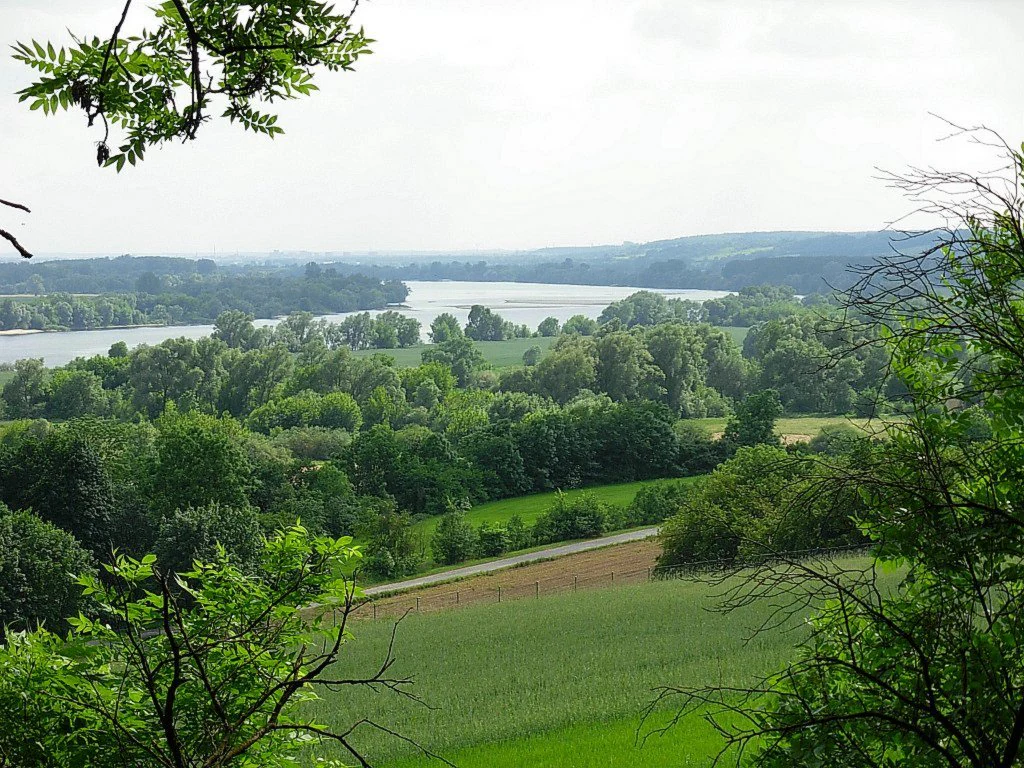
A wide, high-angle view looking out over a river valley with green fields, forests, and a section of the Vistula River winding through the background.
A view overlooking the Vistula River valley within Solecka Dolina Wisły.

Solecka Dolina Wisły history and protected-area timeline

The modern conservation story of Solecka Dolina Wisły begins in August 2007, when the area was proposed for inclusion in the Natura 2000 network of European protected sites. Following a decision by the European Commission in December 2008, the site was formally confirmed as a candidate Special Area of Conservation in March 2009, taking the official name Solecka Dolina Wisły.

Earlier protection had already taken root in the nineteenth century, when large parts of the surrounding landscape were shielded by the establishment of the embankments that still define the modern floodplain. Four nature reserves were created within the area at various points during the twentieth century: Wielka Kępa, Las Mariański, Ostrów Panieński, and Łęgi na Ostrowiu Panieńskim. A fifth reserve, Mała Kępa Ostromecka, has been proposed for the Bydgoszcz meander section of the river but has not yet been formally designated.

The deeper ecological history of the valley, however, is shaped by the great channelization works carried out between 1880 and 1914. Before that project, the river was marked by many migrating river islands, known locally as kępy. After the regulation, those islands were buried in sediment, gradually joined to the mainland, and transformed into the now-stable floodplain terraces that the present-day Natura 2000 designation seeks to protect.

Solecka Dolina Wisły landscape and geographic character

The valley unfolds in a clear sequence of landforms that together express the natural architecture of the Vistula. At the lowest level, sandy and silly river bars build up each year in the active channel and are quickly colonized by ephemeral pioneer vegetation. Above them lie the floodplain terraces that used to be the river's own wandering islands, now buried in alluvium and stitched together into a continuous plain cut by oxbow lakes and reed beds.

The nineteenth-century flood embankments form the next visible step, their grassy slopes populated by dry-meadow communities. Beyond them, the older supra-floodplain terraces carry a more varied land cover, split between arable fields, pastures, and patches of mixed forest. The valley edge itself climbs into the strongest relief along the right bank of the river, where steep, sun-exposed slopes sustain fragments of oak-hornbeam woodland and, in the driest spots, patches of xerothermic grassland and sandy dry-grass vegetation.

The most distinctive single landform within the site is the Bydgoszcz meander of the Vistula, where the river describes a large loop that concentrates riverine habitats and provides the context for one of the proposed additional reserves. The combined effect of bars, terraces, embankments, slopes, and meanders gives the protected area the character of a compact, readable cross-section through the entire Vistula valley system.
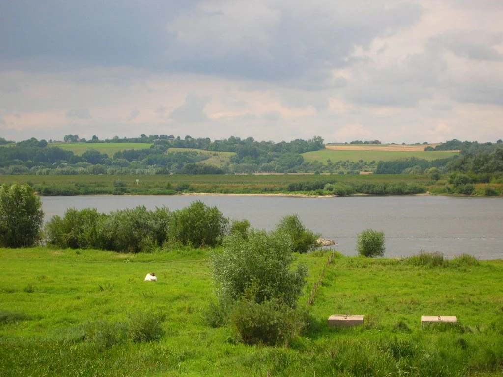
A wide view of the Vistula River with green meadows in the foreground and rolling agricultural fields in the background under a cloudy sky.
The Vistula River valley near Chelmno, characteristic of the riparian landscapes protected in Solecka Dolina Wisły.

Solecka Dolina Wisły ecosystems, habitats, and plant life

Ecologically, Solecka Dolina Wisły is organized around the river's natural zoning. The low-water sandy and silty bars host short-lived pioneer plant communities that re-establish themselves after each high-water event, while the floodplain terraces support reed beds, aquatic vegetation in former channels, and tall-herb fringes along the water's edge.

Higher still, the supra-floodplain terraces carry mosaics of fields, pastures, and mixed deciduous and mixed conifer forests. The slopes that close off the valley are clothed in oak-hornbeam woodland; in places the canopy breaks up enough for shrub thickets, dry-grass patches, and sandy xerothermic grasslands to develop on the steepest, sunniest exposures. Around the Bydgoszcz meander, fragments of willow-poplar floodplain forest have survived in especially good condition, while the lower parts of the slopes in this section still hold multi-species riparian forest remnants.

Among protected habitat types, the largest share is taken by lowland fresh meadows used extensively for farming, by oxbow lake formations, by herb-rich riverine fringes, and by riparian forests. Together, these cover a meaningful portion of the site, while agricultural land (around 44 percent) and inland waters (about 33 percent) make up the broader land cover within the protected boundary.
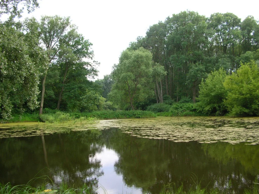
A calm, still pond with lily pads on the water surface, surrounded by lush green deciduous forest under an overcast sky.
A peaceful section of the Vistula River valley at Wielka Kepa Ostromecka.

Solecka Dolina Wisły wildlife and species highlights

The site's animal life reflects its position as a transitional landscape between river, meadow, and forest. Birdlife is one of the strongest features, with 34 species of conservation interest recorded as either breeding or migrating through the valley under Annex I of the European Birds Directive. The combination of open water, oxbow lakes, reed beds, meadows, and woodland edges supports a richly layered bird community typical of large lowland river valleys.

Among mammals, the European beaver is one of the most visible indicators of healthy riverine habitat, alongside the Eurasian otter, both of which are confirmed occupants of the oxbow lakes and channel margins. The western barbastelle bat, a species strongly associated with mature deciduous forest and old trees, has also been recorded within the protected area.

The river itself supports a range of fish species of conservation importance, including the river lamprey and the Atlantic salmon, species that depend on clean gravel reaches and free migration along the Vistula. Other notable fish include the white-finned gudgeon, the asp, Rhodeus bitterlings, and the common gudgeon. The fire-bellied toad adds an amphibian dimension to the floodplain fauna, while invertebrates of conservation interest include the large blue butterfly and the hermit beetle. Vascular plants of note include the typically steppe-influenced pasqueflower, the rare late yellow-lip orchid, and the sessile-flowered flax.

Solecka Dolina Wisły conservation status and protection priorities

The principal conservation significance of Solecka Dolina Wisły lies in the protection of eleven Annex I habitat types that together describe a near-complete ecological gradient of a large lowland river. By including not just the active floodplain but also the terraces and valley slopes, the designation preserves the structural diversity that allows the Vistula valley to function as a coherent ecological system rather than as a narrow strip of protected riverbank.

The site sits within the Pan-European Ecological Network, where the broader Lower Vistula valley is recognized as an international ecological corridor. This corridor function is one of the key justifications for the area's Natura 2000 status, since it links upstream and downstream habitats across national boundaries and supports the movement of fish, birds, and other species along the river.

Management responsibility is shared between the Landscape Parks of the Lower Vistula complex and the Regional Directorate of State Forests in Toruń, ensuring that the floodplain areas and the forested slopes are each addressed with appropriate tools. The presence of four existing nature reserves and the prospect of a fifth at Mała Kępa Ostromecka further reinforce the layered protection that the site enjoys.

Solecka Dolina Wisły cultural meaning and human context

The cultural dimension of Solecka Dolina Wisły is closely bound to the history of the Vistula itself. The river has long served as a transport route, a source of livelihood, and a defining feature for the towns along its banks, including Solec Kujawski, Bydgoszcz, Chełmno, and Świecie.

The construction of the embankments between 1880 and 1914 marked a major cultural as well as engineering intervention, transforming a wandering lowland river with many shifting islands into the more controlled, navigable waterway that runs through the protected area today. Place names such as Wielka Kępa and Mała Kępa Ostromecka preserve the memory of the older riverine landscape, where river islands were once living parts of local geography rather than buried features beneath the floodplain.

Top sights and standout views in Solecka Dolina Wisły

The site's strongest points of distinction lie in how completely it captures the Vistula's ecological structure, the integrity of its surviving floodplain forests, and the breadth of habitat types it brings under a single, coherent designation. The Bydgoszcz meander stands out as a particularly rich focal point, while the beaver, otter, Atlantic salmon, and steppe-influenced plants such as the pasqueflower give the area a strong identity as a meeting point between aquatic, wetland, and dry-grassland worlds.

Best time to visit Solecka Dolina Wisły

The valley's character shifts visibly with the seasons. Spring brings high water and active flooding across the floodplain terraces, swelling the oxbow lakes and concentrating bird activity along the river. Late spring and early summer are often the most rewarding time for viewing extensively used meadows and riverine flora at full development.

Summer exposes the contrast between the wet floodplain and the dry, sun-baked slopes, where xerothermic grasses and butterflies are at their most active. Autumn brings migration through the valley for many bird species and a quieter atmosphere on land, while in winter low water levels expose the sandy river bars and make the outlines of the channel and its shifting islands easy to read from the embankments and valley edges.

Monthly climate preview

Long-term monthly temperature and precipitation rhythm for Solecka Dolina Wisły

Solecka Dolina Wisły Climate Normals and Annual Temperature Patterns

Recorded measurements for Solecka Dolina Wisły indicate a continuous annual rhythm spanning sub-zero winter minimums and warm summer maximums alongside steady precipitation distribution. Exploring the complete monthly climate profile provides deeper context on long-term temperature swings and baseline moisture levels across the coordinate.
Annual mean8 °C
-3 °C19 °C
Jan-3°
Feb-2°
Mar
Apr
May13°
Jun17°
Jul19°
Aug19°
Sep14°
Oct
Nov
Dec-1°
Warmest month
July

19.4 °C

Coolest month
January

-3 °C

Wettest month
July

2.6 mm/day

Driest month
April

1.2 mm/day

Park location guide

Geography guide, regional context, and park location map for Solecka Dolina Wisły

Solecka Dolina Wisły park geography, regions, and map view in Poland

Understand where Solecka Dolina Wisły sits in Poland through a broader geographic reading of the surrounding landscape, nearby location context, and its mapped position within the national park landscape.

How Solecka Dolina Wisły fits into Poland

Poland, officially the Republic of Poland, is a Central European country spanning from the Baltic Sea in the north to the Carpathian Mountains in the south. It borders Germany, Czech Republic, Slovakia, Ukraine, Belarus, Lithuania, and Kaliningrad Oblast. The country has a temperate climate, diverse landscapes, and is known for its rich history, cultural heritage, and strong economic position within the EU.

Wider geography shaping Solecka Dolina Wisły in Poland

Poland occupies 312,696 km2 in Central Europe, extending from the Baltic Sea coast in the north to the Sudetes and Carpathian Mountains in the south. It borders Germany to the west, Czech Republic and Slovakia to the south, Ukraine and Belarus to the east, and Lithuania and Kaliningrad Oblast to the northeast. The landscape includes lowland plains, uplands, and mountain ranges.

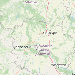
Map view of Solecka Dolina Wisły

Use this park location map to pinpoint Solecka Dolina Wisły in Poland, understand its exact geographic position, and read its mapped placement within the surrounding landscape more clearly.

Pigeon | © OpenStreetMap contributors

Location context for Solecka Dolina Wisły

Kujawsko-Pomorskie Voivodeship

Visual reference collection for Vistula river habitats and valley landforms

Solecka Dolina Wisły Landscape Photography and Protected Area Scenery

Visual documentation captures the complex terrain, river bars, and oxbow lakes that define the protected Vistula valley environment. Photographic records reveal the ecological gradient connecting active riparian channels with ancient oak-hornbeam slopes.

A wide, high-angle view looking out over a river valley with green fields, forests, and a section of the Vistula River winding through the background.

A calm, narrow waterway reflects bare-branched deciduous trees and early spring vegetation in a riparian forest setting.

A wide view of the Vistula River with green meadows in the foreground and rolling agricultural fields in the background under a cloudy sky.

A calm, still pond with lily pads on the water surface, surrounded by lush green deciduous forest under an overcast sky.

Park atlas

Compare regional valley reserves, river ecosystems, and adjacent protected areas in northern Poland

Explore Other Parks Near Solecka Dolina Wisły and Surrounding Protected Landscapes

Visitors reviewing Solecka Dolina Wisły can discover other protected natural areas and river valley habitats situated across the surrounding region. Comparing adjacent lowland reserves and riparian landscapes provides broader geographic context for northern Polish conservation corridors.
Watercolor painting of a wide, soft-focus river valley landscape with gentle hills, green vegetation, and a winding waterway.
Protected landscapeKuyavian-Pomeranian Voivodeship
Park boundaries overlap#1 closest

Northeast

Chełmiński Park Krajobrazowy: Geographic Overview of Protected Lands in Kuyavian-Pomeranian

Glacial moraine terrain and Vistula valley protected landscapes

Chełmiński Park Krajobrazowy preserves a compact, high-contrast landscape where glacial moraine hills meet the active river corridors of the Lower Vistula. The area is defined by its five distinct nature reserves that safeguard unique slope habitats, island-like floodplain forests, and post-glacial lake basins, offering an essential reference for studying the geomorphology of the Polish lowlands.

Area
223.36 km²
Established
1998
Scope
Terrestrial
Water
Major water bodies
Protected areaKuyavian-Pomeranian Voivodeship
0.4 km away#2 closest

East

Zbocza Płutowskie Protected Area: Ecological Geography and Habitat Mapping in Kuyavian-Pomeranian

A protected landscape featuring xerothermic slopes and riverine forest mosaics

Located in the Kuyavian-Pomeranian Voivodeship, Zbocza Płutowskie is a protected area preserving a mosaic of rare xerothermic grasslands and mature deciduous woodlands. The site showcases the importance of lowland habitat connectivity, including oak-hornbeam communities and riparian forests, offering a detailed perspective on regional ecological terrain.

Area
10.114 km²
Relief
Lowland
Climate
Temperate
Access
Access unknown
Protected landscapeKuyavian-Pomeranian Voivodeship
12 km away#3 closest

North

Wdecki Park Krajobrazowy: Protected Landscape Atlas and Regional Geography

Forest and river basin terrain in Poland

Examine the geographic foundation of Wdecki Park Krajobrazowy, a protected landscape characterized by the Wda River drainage, glacial erratics, and extensive pine forests. The area supports a rich variety of wetland flora, mires, and managed reservoirs such as the Żur, making it a significant conservation landmark within the wider Bory Tucholskie region of northern Poland.

Area
191.77 km²
Established
1993
Relief
Lowland
Climate
Temperate
Watercolor painting of a green and pink wetland landscape with soft, abstract horizontal washes and tall grasses in the foreground.
Protected areaKuyavian-Pomeranian Voivodeship
16 km away#4 closest

Southwest

Równina Szubińsko-Łabiszyńska: Protected Area and Noteć River Valley Geography

Natura 2000 habitat mosaic in the Kuyavian-Pomeranian Voivodeship

Równina Szubińsko-Łabiszyńska functions as a crucial ecological corridor in Poland, protecting rare lowland habitats including floodplain meadows and oak-hornbeam woodlands. This site showcases the intricate relationship between the meandering Noteć river and nineteenth-century canal infrastructure, providing a unique lens into the protected wetland terrain of the region.

Area
28.259 km²
Established
2011
Relief
Lowland
Climate
Temperate
A minimalist watercolor painting showing a calm lake or wetland surrounded by soft green trees and gentle hills under a light sky.
Protected areaKuyavian-Pomeranian Voivodeship
19 km away#5 closest

North

Sandr Wdy Protected Area: Glacial Geography and Wetland Habitats in Northern Poland

An essential reference area for Bory Tucholskie forest ecology.

Sandr Wdy is a distinctive Natura 2000 protected area shaped by post-glacial processes. The landscape features a flat outwash plain punctuated by lake basins, river valleys, and diverse mire systems. With multiple strict nature reserves integrated into its boundaries, the site provides a comprehensive view of how hydrological and soil conditions influence habitat distribution within the broader forest landscape of Poland.

Area
63.21 km²
Established
2011
Relief
Lowland
Climate
Temperate
A panoramic watercolor illustration showing a calm lake bordered by pine trees and patches of pink shrubs under a pale sky.
Nature reservePoland
About 25 km away#6 closest

North

Rezerwat przyrody Miedzno: Wetland and Peatland Protected Area in Northern Poland

Geographic atlas of the Miedzno nature reserve and its glacial valley.

Rezerwat przyrody Miedzno represents a vital ecological corridor in Poland, defined by its flow-through lake, alder-birch swamp forests, and rare marshland flora. This nature reserve, situated within the Wdecki Landscape Park, provides a detailed view into the post-glacial topography and avian conservation landscapes of the Bory Tucholskie mesoregion.

Area
0.885 km²
Established
1968
Relief
Lowland
Climate
Temperate
A watercolor painting showing a soft, atmospheric landscape with a winding body of water, green treelines, and patches of pinkish bog vegetation against a pale, warm sky.
Nature reserveKuyavian-Pomeranian Voivodeship
About 27 km away#7 closest

North

Dury Nature Reserve: Protected Wetland and Peatland Geography in Kuyavian-Pomeranian Voivodeship

Strictly protected dystrophic lake and bog habitats

Dury Nature Reserve is a specialized botanical and hydrological site in the Tuchola Forest. It preserves a distinct mosaic of four dystrophic lakes surrounded by peat bogs. The reserve is a core component of local wetland conservation, protecting rare bog species and maintaining the integrity of northern Polish forest ecosystems.

Area
0.13 km²
Established
1975
Relief
Lowland
Climate
Temperate
Nature reservePomeranian Voivodeship
About 29 km away#8 closest

North

Rezerwat przyrody Jezioro Udzierz Nature Reserve Geographic and Ecological Overview

Wetland habitat mosaic in the Pomeranian Voivodeship

Rezerwat przyrody Jezioro Udzierz protects a compact yet biodiverse wetland mosaic centered on Lake Udzierz. Located in the heart of the Bory Tucholskie forest, the reserve integrates open water, reedbeds, peatlands, and wet meadows into a single, cohesive ecological unit. This detailed view examines the reserve's protected status, landscape composition, and its vital role as a refuge for bird species within the wider geography of northern Poland.

Area
2.299 km²
Established
2000
Relief
Lowland
Climate
Temperate

Common questions about visiting, size, designation, and location context for Solecka Dolina Wisły

Solecka Dolina Wisły FAQs for park facts, access, geography, and protected area context

Find quick answers about Solecka Dolina Wisły, including protected-area facts, park geography, trail and visitor context, and how the park fits into its surrounding country and regional landscape.
MoriAtlas Explorer

Continue Your Protected Areas Search Across the Global Atlas

Deepen your exploration by continuing the structured search for national parks and protected areas worldwide. Utilize the comprehensive filtering capabilities to compare different conservation landscapes and refine your understanding of global park geography. Discover more about the distribution and characteristics of protected natural areas.

Global natural geography