

Mori Atlas logo
National parkSongnisan National Park

Discover the mapped boundaries and natural terrain of this protected area in South Korea.

Songnisan National Park: National Park Protected Landscape and Geographic Atlas

Songnisan National Park represents a significant protected landscape within South Korea, offering a unique focal point for atlas-based geographic discovery. As a designated national park, its mapped boundaries delineate a specific region of natural terrain, crucial for understanding the country's conservation areas and broader East Asian geography. This entry provides a foundational view for exploring the park's environmental context and its place within the structured data of protected lands.

Mountain parksBuddhist heritage sitesKorean national parksHistoric templesTemperate forestsSobaek Mountains

Songnisan National Park

National park

Park overview

Structured park overview, official facts, and landscape profile for Songnisan National Park

Songnisan National Park park facts, protected area profile, and essential visitor context
Review the core facts for Songnisan National Park, including designation, size, terrain, visitor scale, habitats, and operating context in one park-focused overview.

About Songnisan National Park

Songnisan National Park represents a remarkable fusion of natural mountain landscape and Korean Buddhist cultural heritage in the central-eastern region of South Korea. The park encompasses the prominent peak of Songnisan along with nine additional summits that form part of the Sobaek Mountains, creating a landscape characterized by steep ridges, forested slopes, and rocky outcrops. The area was designated as Korea's sixth national park in 1970, reflecting its significance as both a natural environment worth protecting and a cultural landscape of national importance. The park's terrain varies considerably, with the higher elevations featuring exposed rock and alpine vegetation while the lower slopes and valleys support dense forest cover. This topographic diversity creates distinct ecological zones that support a range of plant and animal communities. The park lies within a mountainous corridor that connects to broader regional ecosystems, making it an important node in Korea's network of protected areas. Visitors to Songnisan experience a landscape where natural scenery and cultural heritage intersect, with ancient temple complexes nestled among the mountains and historic trees that have been venerated for centuries.

Quick facts and research context for Songnisan National Park

Songnisan National Park is located in central-eastern South Korea, straddling the boundary between Chungcheongbuk-do and Gyeongsangbuk-do provinces. The park was established on March 24, 1970, making it Korea's sixth national park and part of the country's early protected area system. It covers 274.541 square kilometers of mountainous terrain within the Sobaek Mountains, a subrange of the larger Baekdu Mountain range. The park contains nine distinct peaks, with the central Songnisan peak rising prominently above the surrounding landscape. The area is managed by the Korea National Park Service.

Park context

Deeper park guide and search-rich context for Songnisan National Park

Songnisan National Park history, landscape, wildlife, and travel context
Explore Songnisan National Park through its history, landscape character, ecosystems, wildlife, conservation priorities, cultural context, and seasonal travel timing in a structured park guide built for atlas discovery and search intent.

Why Songnisan National Park stands out

Songnisan National Park is best known for housing Beopjusa, one of Korea's largest and most historically significant Buddhist temples, originally constructed in 553 during the Silla period. The temple complex, with its golden Buddha statue and ancient architectural structures, draws both pilgrims and tourists seeking to experience Korea's deep Buddhist heritage. The park is also famous for Jeongipumsong, a centuries-old pine tree that was awarded an official political title in Korean folklore through a royal decree by King Sejo in 1464. The combination of significant cultural landmarks, including temples and historic trees, with the park's wild mountainous terrain makes Songnisan distinctive among Korea's protected areas.

Songnisan National Park history and protected-area timeline

The origins of Songnisan's cultural significance predate the establishment of the national park by many centuries. According to Korean legend, the mountain received its current name during the Silla dynasty period when a monk named Jinpyoyulsa was traveling up the mountain toward the Buddhist temple that would become Beopjusa. Farmers along the path reportedly witnessed their oxen bowing their heads to the monk in what appeared to be an act of spiritual reverence. Struck by this display, the farmers chose to follow the monk to the temple and dedicate themselves to Buddhist practice. From this legendary episode, the mountains became known as Songnisan, literally meaning "mountain to leave the world" or "mountain of renunciation," reflecting its identity as a place of spiritual departure from worldly concerns. Prior to this naming, the mountain had been simply called Gubongsan, meaning "nine peak mountain," a reference to the nine summits that comprise the mountain group. The Beopjusa temple itself was founded in 553, making it one of the oldest Buddhist establishments in Korea, and it has served as a center for religious practice and cultural development throughout the peninsula's history.

Songnisan National Park landscape and geographic character

The physical landscape of Songnisan National Park is defined by its mountainous terrain within the Sobaek Mountains, a subrange of Korea's eastern mountain systems. The park encompasses Songnisan itself along with nine surrounding peaks that form a complex topographic arrangement of ridges, valleys, and steep slopes. The terrain rises prominently from the surrounding lowerland areas, creating a dramatic backdrop visible from vantage points such as Munjungdae peak, which offers sweeping views across the park's forested expanse. The landscape features a mix of rocky outcrops on higher elevations, particularly near the summit areas, and dense forest cover on the lower slopes and valleys. Stream corridors have carved valleys through the mountains, adding to the diversity of landforms within the park. The combination of elevation change, varied exposure, and the presence of water features creates a landscape with considerable visual and ecological diversity.

Songnisan National Park ecosystems, habitats, and plant life

The ecological character of Songnisan National Park reflects its location within the Sobaek Mountains and the broader temperate forest biome of the Korean peninsula. The park's forests cover much of the lower to mid-elevation terrain, with vegetation patterns that vary according to elevation, aspect, and moisture conditions. The mountainous setting supports diverse habitats ranging from valley forests to higher elevation areas with different tree species compositions. The park lies within a mountainous corridor that connects to other protected areas and wildland areas in the eastern part of the peninsula, facilitating ecological continuity across the landscape. The presence of streams and riparian zones adds habitat diversity and supports moisture-loving species in certain areas. The combination of forest cover, topographic variation, and protected status creates conditions that support relatively diverse plant and animal communities.

Songnisan National Park wildlife and species highlights

Songnisan National Park supports a diverse community of wildlife species across its forest and mountain habitats. The park is home to several notable bird species, including the mandarin duck and the black woodpecker, which inhabit the forested areas and contribute to the park's avian diversity. Mammalian species present in the park include otters, which are typically associated with stream and river habitats, small-eared cats, martens, and the Siberian flying squirrel, which is one of two endangered species protected within the park. The other endangered species is the Korean Berchemia, a species of buckthorn tree that represents botanical conservation significance. This combination of mammalian, avian, and botanical diversity reflects the park's role as a protected area that supports viable populations of various species, including some that face conservation pressures elsewhere in their range.

Songnisan National Park conservation status and protection priorities

Songnisan National Park plays an important role in Korea's protected area system as one of the earlier established national parks, designated in 1970 as the country's sixth national park. The park's conservation significance stems from its protection of representative mountain ecosystems within the Sobaek Mountains region, preserving both natural habitats and cultural landscapes of national importance. The presence of endangered species, including the Siberian flying squirrel and the Korean Berchemia tree, adds specific conservation value to the protected area. Management by the Korea National Park Service ensures ongoing protection and appropriate management of the park's natural and cultural resources. The park's designation reflects a commitment to preserving significant mountain landscapes, historical Buddhist temple sites, and the ecological diversity that exists within this part of central-eastern Korea.

Songnisan National Park cultural meaning and human context

Songnisan National Park carries deep cultural significance rooted in Korean Buddhist heritage and historical tradition. The park contains Beopjusa, one of Korea's largest Buddhist temples, originally constructed in 553 during the Silla dynasty and continuously maintained as a center of religious practice for over fifteen centuries. The temple complex, featuring a golden statue of Buddha, represents not only an important religious site but also a repository of Korean Buddhist art, architecture, and cultural tradition. Beyond the temple, the park preserves Jeongipumsong, a famous pine tree that was granted a political title in a notable folk tale when King Sejo awarded it the rank of government minister in 1464, creating a unique intersection of natural heritage and historical narrative. The mountain's name itself reflects cultural values, with "Songnisan" meaning "mountain to leave the world" and capturing the spiritual identity of the area as a place of Buddhist retreat and contemplation. This cultural layer, combined with the mountain's natural features, creates a landscape where natural environment and human heritage are deeply intertwined.

Top sights and standout views in Songnisan National Park

The standout features of Songnisan National Park include the ancient Beopjusa temple complex, one of Korea's largest and most historically significant Buddhist establishments, and the legendary Jeongipumsong pine tree awarded a royal title by King Sejo. The park's nine-peak mountainous landscape within the Sobaek Mountains offers dramatic scenery and diverse hiking opportunities through forested terrain. The combination of natural mountain environment and cultural heritage makes the park distinctive, providing visitors with experiences that span both ecological exploration and historical discovery. The presence of endangered species like the Siberian flying squirrel and Korean Berchemia adds conservation significance, while the legendary origin of the mountain's name connects the landscape to Korean cultural tradition.

Best time to visit Songnisan National Park

The best time to visit Songnisan National Park depends on the experience visitors seek, with each season offering distinct character. Spring and autumn typically provide the most comfortable conditions for hiking, with moderate temperatures and foliage colors that enhance the mountain scenery. Spring brings blooming vegetation throughout the park's forests and valleys, while autumn offers vibrant fall colors across the deciduous forest areas. Summer months can be warm but the forest cover provides shade along many trails, while winter snow transforms the mountain landscape though trail conditions may be more challenging. The park can be visited throughout the year, though visitors should check current conditions and trail accessibility before planning their trip.

Park location guide

Geography guide, regional context, and park location map for Songnisan National Park

Songnisan National Park park geography, regions, and map view in South Korea
Understand where Songnisan National Park sits in South Korea through a broader geographic reading of the surrounding landscape, nearby location context, and its mapped position within the national park landscape.

How Songnisan National Park fits into South Korea

South Korea is a presidential republic on the Korean Peninsula in East Asia. It has a population of about 51 million and Seoul as its capital and largest city. The country is known for its rapid economic development, high technology industry, and cultural exports.

Wider geography shaping Songnisan National Park in South Korea

South Korea occupies the southern half of the Korean Peninsula in East Asia. It borders North Korea along the Demilitarized Zone to the north, the Yellow Sea to the west, and the Sea of Japan to the east. The terrain is predominantly mountainous with coastal plains along the southern and eastern shores.

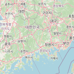
Map view of Songnisan National Park

Use this park location map to pinpoint Songnisan National Park in South Korea, understand its exact geographic position, and read its mapped placement within the surrounding landscape more clearly.

Pigeon | © OpenStreetMap contributors

Location context for Songnisan National Park

Chungcheongbuk-doGyeongsangbuk-do
Park atlas

Uncover related protected areas and mapped park geography in Songnisan's central Korean region.

Explore Other National Parks and Protected Areas Near Songnisan National Park
Continue your park discovery beyond Songnisan National Park by browsing other protected areas throughout Korea's central and eastern mountain systems. This regional view helps compare varied landscapes, from additional Sobaek Mountains peaks to diverse cultural heritage sites, tracing the connected conservation efforts across the peninsula's geographic spread.
Watercolor illustration of green hills, a body of water, and mountain peaks under a soft sky
National parkGyeongsangbuk-do

Woraksan National Park: A Key National Park in Gyeongsangbuk-do's Regional Geography

Discover its mapped mountain terrain and protected landscape identity.

Woraksan National Park offers a detailed view of protected mountain landscapes within South Korea's Gyeongsangbuk-do region. The park is characterized by its prominent Mount Worak, steep ridgelines, and dense forested terrain, contributing significantly to the nation's network of protected areas. Users can explore the geographic context, mapped boundaries, and ecological significance of this vital national park, understanding its place in the broader regional atlas and natural landscape context.

Area
287.78 km²
Established
1984
IUCN
II
Relief
Mountain
National parkChungcheongnam-do

Gyeryongsan National Park: Mapped Protected Landscape in Chungcheongnam-do

Explore its national park designation and regional geography.

Gyeryongsan National Park is a formally protected national park in Chungcheongnam-do, South Korea. This page offers critical atlas context for understanding the park's geographic scope, mapped protected boundaries, and its significance as a natural landscape within the region. Examine the terrain and explore its regional context for a deeper appreciation of its protected status.

Area
64.71 km²
Established
1968
IUCN
II
Relief
Mountain
National parkChungcheongbuk-do

Sobaeksan National Park: A Protected Landscape within Chungcheongbuk-do

Explore its park boundaries and regional geography.

Sobaeksan National Park represents a crucial protected area within the mountainous terrain of Chungcheongbuk-do, South Korea. As a designated national park, it offers a valuable point of reference for understanding regional geographic distribution and landscape context across the Korean Peninsula. This park's identity as a protected natural landscape contributes significantly to the atlas-based exploration of conservation areas and their environmental settings.

Area
322.38 km²
Established
1987
IUCN
II
Relief
Mountain
National parkJeollabuk-do

Deogyusan National Park: National Park Identity and Geographic Mapping

Explore its protected land boundaries and regional landscape context.

Examine Deogyusan National Park, a designated national park situated in the Jeollabuk-do region of South Korea. This entry provides critical geographic context, focusing on the park's mapped boundaries and its role as a protected landscape. Users can gain a structured understanding of its natural terrain and regional significance, contributing to a broader atlas of protected areas.

Area
231.65 km²
Established
1975
IUCN
V
Visitors
1M annual
National parkSouth Gyeongsang Province

Gayasan National Park: National Park Identity and Mapped Geographic Context in South Korea

Discover Protected Landscape and Regional Terrain

Gayasan National Park presents a distinct protected-area entity within South Gyeongsang Province, serving as a crucial point for atlas-driven geographic exploration. As a designated national park in South Korea, it offers insights into its specific mapped boundaries and the surrounding natural terrain. Understanding this park's role within the regional geography provides a foundational element for comprehending broader landscape patterns and protected land distribution across the country.

Area
167.6 km²
Established
1972
IUCN
II
Relief
Mountain
National parkGangwon-do

Chiaksan National Park: National Park Protected Landscape and Geographic Context in Gangwon-do

Explore mapped boundaries and regional terrain.

Chiaksan National Park is a designated national park within South Korea's Gangwon-do region, offering a focused entry point for geographic discovery. This resource details the park's protected landscape, its mapped boundaries, and its relation to the surrounding natural terrain. Delve into the atlas-style context of Chiaksan National Park to understand its significance as a protected natural area within its regional geography.

Area
181.57 km²
Established
1984
IUCN
II
Relief
Mountain
National parkSouth Korea

Juwangsan National Park: Protected Mountain Landscape and Regional Geography in South Korea

Mapped terrain, park boundaries, and natural landscapes.

Juwangsan National Park is a protected natural area situated within South Korea's Taebaek mountain range, renowned for its steep valleys, waterfalls, and dense forests. This park offers a rich landscape context, showcasing dramatic ridgelines and providing a significant example of South Korea's protected mountain terrain. Discover its geographic placement, mapped protected boundaries, and the unique natural and cultural elements that define this national park.

Area
107.42 km²
Established
1976
IUCN
II
Relief
Mountain
National parkNorth Gyeongsang Province

Gyeongju National Park: National Park Protected Landscape in North Gyeongsang Province

Mapped boundaries and regional geographic context.

Gyeongju National Park serves as a significant protected area within North Gyeongsang Province, offering a distinct national park identity. This entry focuses on its geographical significance, detailing its mapped boundaries and providing essential context for atlas exploration. Understand how this protected landscape fits within the broader regional geography and discover its place in the structured mapping of South Korea's natural heritage.

Area
137.09 km²
Established
1968
IUCN
II
Relief
Mixed relief

Common questions about visiting, size, designation, and location context for Songnisan National Park

Songnisan National Park FAQs for park facts, access, geography, and protected area context
Find quick answers about Songnisan National Park, including protected-area facts, park geography, trail and visitor context, and how the park fits into its surrounding country and regional landscape.
MoriAtlas Explorer

Continue Your Protected Areas Search Across the Global Atlas

Deepen your exploration by continuing the structured search for national parks and protected areas worldwide. Utilize the comprehensive filtering capabilities to compare different conservation landscapes and refine your understanding of global park geography. Discover more about the distribution and characteristics of protected natural areas.

Global natural geography