Peaks
Shoulder Of Mutton Hill
248 m

Structured data on regional context, recorded area, and physical terrain characteristics
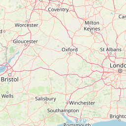
Analyze the spatial extent and environmental makeup of South Downs National Park within South East England. This profile details the 1627 square kilometer land area, maximum elevation points, and identified forest or valley features, providing a precise geographic reference for the protected landscape.

England's newest national park protecting iconic chalk downland and ancient Weald woodlands
South Downs National Park is England's newest national park, designated on 31 March 2010 and officially coming into operation on 1 April 2011. The park stretches for 140 kilometres across southern England from St Catherine's Hill near Winchester in Hampshire to Beachy Head near Eastbourne in East Sussex, encompassing the famous chalk hills of the South Downs and a substantial portion of the western Weald. This landscape of rolling chalk escarpments, dry valleys, and densely wooded sandstone hills covers approximately 1,627 square kilometres and supports a population of around 108,000 people across three counties. The park protects one of Britain's most distinctive landscapes, characterized by its white chalk cliffs along the Sussex coast—including the iconic Seven Sisters and Beachy Head—and the smooth, rolling downland hills that form a dramatic north-facing escarpment. Beyond the chalk downland, the park incorporates the western Weald, a strongly contrasting landscape of heavily wooded sandstone and clay hills and vales. The South Downs Way, the only National Trail lying wholly within a single national park, traverses the entire length of the park along the chalk ridge. The designation of South Downs as a national park represents the culmination of nearly nine decades of advocacy, with early proposals dating back to the 1920s. The park is administered by the South Downs National Park Authority, which serves as both a conservation body and a planning authority for the area. In 2016, the park achieved International Dark Sky Reserve status, recognizing the quality of its nocturnal dark skies and efforts to control artificial light pollution.
Regional Placement and Coastal Status in South East England
Interactive boundary geometry and calculated 1627 square kilometre area metrics
Upland topography with recorded forests and valleys
Peaks
248 m
Peaks
280 m
Peaks
Peaks
Viewpoints
Viewpoints
Temperate upland terrain featuring mixed woodland, grassland, and chalk cliffs
Hills · Woodland · Grassland · Cliffs · Valleys
Temperate broadleaf forest · Grassland
Trace the varied protected landscapes and regional park geography surrounding South Downs National Park, from iconic chalk hills to ancient woodlands.
East

Chalk downlands and marine ecosystems in Sussex
The Brighton and Lewes Downs Biosphere Reserve anchors a diverse range of protected habitats from the South Downs ridges to the English Channel seafloor. This mapped record details the terrestrial chalk grasslands, coastal cliffs, and rare offshore reef systems that characterize this notable biosphere reserve in Sussex. It serves as a comprehensive geographic reference for understanding the boundary between land-based conservation and marine habitat management.
Southeast
Mapped protected seabed and marine geography in East Sussex
Investigate the marine landscape of Beachy Head West, a protected zone defined by its submerged chalk reefs and gullies extending from the East Sussex cliffs into the English Channel. This record highlights the site's distinct underwater topography, seabed mosaic, and its role as a core component of the regional marine conservation network across southeast England.
South
Submerged chalk cliff systems and rocky reefs in West Sussex
The Kingmere Marine Conservation Zone protects an unusual underwater landscape of chalk ridges and rocky outcrops within the English Channel. Stretching between Littlehampton and Worthing, this area serves as a vital spawning ground and exhibits some of the finest chalk reef features in European waters.

West
Mapped heathland, ancient woodlands, and pastoral traditions.
Explore New Forest National Park, a nationally significant protected area in England renowned for its unique blend of ancient royal forest history, traditional pastoral practices, and biologically rich lowland habitats. This page provides an atlas-focused view of its mapped boundaries, distinctive terrain, and geographic context within England, highlighting its value as a living landscape shaped by centuries of common grazing rights and supporting rare wildlife.

North
Examining infrastructure, ecology, and sonar testing geography.
Wraysbury Reservoir stands as a unique example of late-twentieth-century industrial landscape design, serving as both a primary London water resource and a protected Ramsar wetland. Its earthen embankments enclose a specialized environment where sonar research and ecological conservation coexist within the wider context of the Thames Valley. This record details the site's boundaries, its function as a wintering bird refuge, and its specialized role in UK marine testing.
West
A comprehensive look at the Poole Basin heathland mosaic.
Spanning the Poole Basin, the Dorset Heaths offer a distinct geographic profile of acidic sands and diverse ecological mosaics. This protected area includes rare valley mires and coastal dunes, providing a clear window into the natural landscape history and ongoing conservation efforts within southern England's coastal regions.

West
Geological formations and chalk headland terrain on the Isle of Wight
The Needles represents a unique geological intersection of vertical chalk strata and maritime history at the edge of the Isle of Wight. This protected area encompasses dramatic sea stacks, clifftop heathland, and critical marine habitats, offering a window into the complex coastal landscape of the English Channel and the regional geology of southern England.
West
Coastal ria landscape and wetland habitat mapping
Poole Harbour stands as a prominent natural feature of the Dorset coast, defined by its shallow waters and varied estuarine terrain. This profile maps the protected landscape, including its salt marshes, seagrass meadows, and islands, offering deep geographic context for this significant southern England wetland.
Deepen your understanding of South Downs National Park by delving into its specific geographic features and protected landscape context. Our platform provides structured atlas data to explore how this park fits within South East England's regional geography and contrasts with other natural areas. Discover the mapped terrain and unique character of this significant protected territory.