
Mori Atlas logo
Nature reserveSurtsey

Tracing the geological formation and biological colonisation of a unique North Atlantic volcanic laboratory.

Surtsey Nature Reserve: An Atlas of Volcanic Evolution and Protected Coastal Landscapes in Iceland

Surtsey is a rugged volcanic island born from a submarine eruption along the Mid-Atlantic Ridge off the southern coast of Iceland. As a protected nature reserve, the island serves as an essential laboratory for observing primary ecological succession and geological formation in real time. This atlas record documents the terrain of the island, its ongoing transformation by wave erosion, and the gradual establishment of diverse marine and land ecosystems on its basaltic lava flows.

volcanic islandsubmarine volcanismSurtseyan eruptiongeological formationprimary successionbiocolonisation
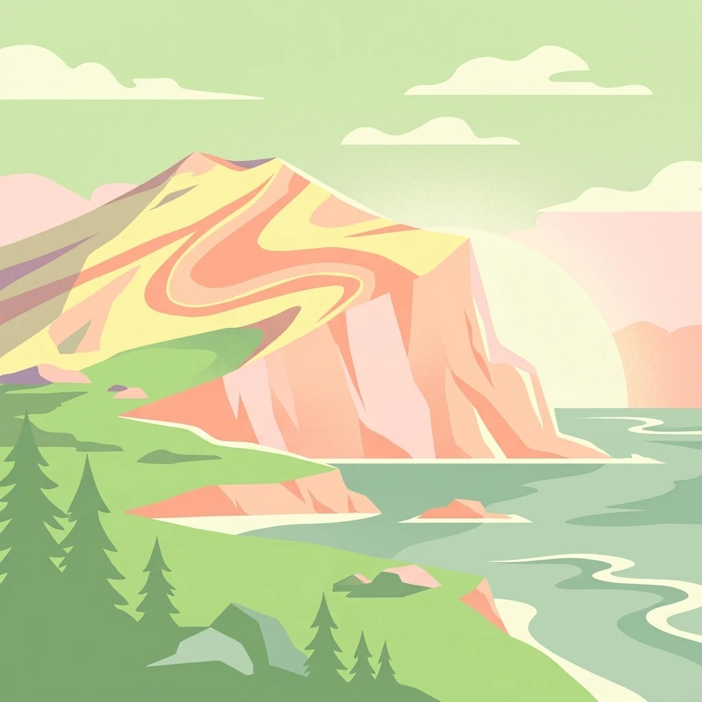
A minimalist flat illustration showing a rocky, volcanic cliff face overlooking the ocean with coniferous trees in the foreground.

Surtsey

Nature reserve

Park overview

Structured park overview, official facts, and landscape profile for Surtsey

Surtsey park facts, protected area profile, and essential visitor context

Review the core facts for Surtsey, including designation, size, terrain, visitor scale, habitats, and operating context in one park-focused overview.

About Surtsey

Surtsey is a young volcanic island in the North Atlantic that emerged during one of the longest and best-documented submarine eruptions in recorded history. It lies within the Vestmannaeyjar archipelago, a chain of volcanic islands and seamounts off Iceland's south coast, and is associated with the fissure system of the Mid-Atlantic Ridge. Its formation, beginning around 130 metres below sea level and breaking the surface on 14 November 1963, gave scientists a rare opportunity to observe an entire island coming into existence and to watch it evolve over the following decades.

What distinguishes Surtsey from many older volcanic islands is the combination of detailed scientific documentation of its birth and strict protection from most human activity. Once the eruption ceased in 1967, the island was left to the forces of erosion and biological colonisation. Loose tephra and scoria that initially made up much of the new land have been worn away on exposed coasts, while a hard cap of lava has protected the interior. In the submarine portion of the island, palagonitization, the chemical hardening of loose tephra into erosion-resistant tuff, has further stabilised the structure.

Geologically and ecologically, Surtsey is recognised as a benchmark for studying primary succession on land and the early stages of marine ecosystem development. Iceland designated it a nature reserve in 1965 while the eruption was still going on, and in 2008 UNESCO added it to the World Heritage List. Today, except for a small number of researchers, nobody is allowed to land on the island, and visitors can only view it from small aircraft or boats. This controlled access has allowed the island's ecosystems, soils, and birdlife to develop with very little human interference, making Surtsey one of the most scientifically valuable natural areas in the North Atlantic.

Quick facts and research context for Surtsey

Surtsey is a volcanic island in the Vestmannaeyjar archipelago, located roughly 20 kilometres southwest of Heimaey and about 30 kilometres southwest of Iceland's mainland coast, at approximately 63 degrees 18 minutes north latitude. It was formed between 1963 and 1967 during a submarine eruption on the Mid-Atlantic Ridge and is the southernmost point of Iceland.

The island emerged above sea level on 14 November 1963 and grew to a maximum area of about 2.7 square kilometres before erosion set in. It is now smaller and capped in many places by erosion-resistant lava that has helped preserve its core. Surtsey has been a nature reserve since 1965 and became a UNESCO World Heritage Site in 2008 in recognition of its outstanding scientific value.

Protection and recognition

Documented conservation status, designation year, and international recognition sources for Surtsey.

Surtsey Protection Status and International UNESCO Recognition History

Examine the recorded protection status, designation history, and management scope established for Surtsey since 2008. Review the official UNESCO World Heritage recognition data supporting the conservation framework of this protected area.

International recognition

Protection details

Protection scope
Mixed
Designated year
2008
Transboundary protection
No
Park context

Deeper park guide and search-rich context for Surtsey

Surtsey history, landscape, wildlife, and travel context

Explore Surtsey through its history, landscape character, ecosystems, wildlife, conservation priorities, cultural context, and seasonal travel timing in a structured park guide built for atlas discovery and search intent.

Why Surtsey stands out

Surtsey is best known as a real-time natural experiment in how a brand new island is colonised by life. The eruption that built it was observed and measured by volcanologists from the moment it broke the sea surface, and the sterile rock substrate left behind has been studied continuously ever since as mosses, lichens, vascular plants, seabirds, seals, insects, and soil organisms gradually established themselves. The island is also known for its geology as a classic example of a Surtseyan eruption, in which lava interacts explosively with seawater to build a volcanic cone from below the waves. Its origin on the Mid-Atlantic Ridge, its continuing erosion, and its near-complete isolation from human influence together make it unusually valuable for both earth and life sciences.
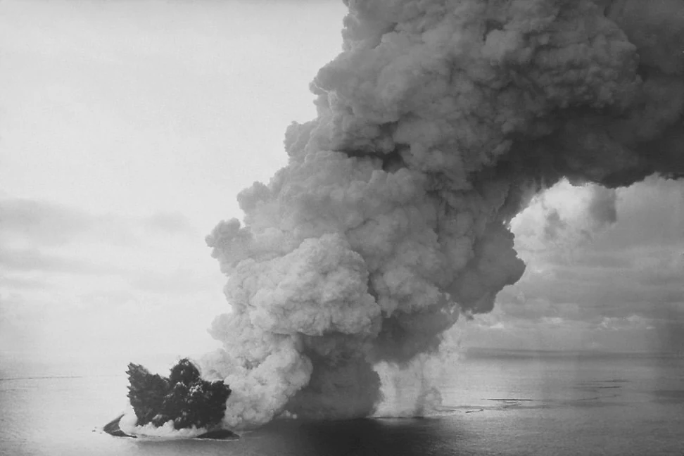
Black and white photograph showing a volcanic eruption occurring at sea; a large, dark island mass is visible with a massive plume of white smoke and ash rising into the sky.
A historic view of the volcanic eruption forming the island of Surtsey off the coast of Iceland.

Surtsey history and protected-area timeline

Surtsey has a short but exceptionally well-documented history because the eruption that created it was the subject of immediate scientific observation. The eruption began on the sea floor west-southwest of Iceland and was first hinted at by weak tremors recorded near Kirkjubæjarklaustur in early November 1963. By mid-November, residents of Vík, on Iceland's south coast, noticed a smell of hydrogen sulphide, and on 14 November 1963 the eruption broke the surface and was witnessed by the crew of the trawler Ísleifur II. Explosive activity threw up ash clouds kilometres into the atmosphere and rapidly produced an island of loose scoria that grew quickly despite winter storms.

In the first phase of the eruption, seawater had easy access to the vents, producing violent phreatomagmatic explosions and a fragile, easily eroded pile of volcanic debris. As the island grew larger and water could no longer reach the vents easily, eruptions shifted towards lava fountaining and effusive flows, laying down a hard, erosion-resistant cap over much of the loose core. Several smaller islands, including Syrtlingur and Jólnir, also appeared along the same volcanic chain, but most were quickly washed away. The main eruption finally ended on 5 June 1967, having emitted roughly one cubic kilometre of lava.

Iceland protected the island as a nature reserve in 1965, while eruptions were still ongoing, recognising both its geological novelty and its potential for biological research. After activity stopped, scientists installed benchmarks to measure subsidence, erosion, and ecological change, and a small research hut was placed on the island. In 2008, UNESCO inscribed Surtsey as a World Heritage Site, citing its exceptional value for the study of volcanic processes and biological colonisation of new land. Since then the island has been continuously monitored and remains restricted to permitted research visits, a status that has shaped its ecological history as much as its geology has.

Surtsey landscape and geographic character

Surtsey is a low but rugged volcanic cone rising out of the North Atlantic. Its highest point reaches about 155 metres above sea level, and much of its surface consists of dark basaltic lava flows and tephra. The island has a marked contrast between eroding and accreting coasts: on the exposed southeast side, heavy Atlantic surf has cut away large areas of soft scoria, while on the more sheltered northern side a sand spit called Norðurtangi has grown as eroded material has been deposited.

The submarine landscape below the island is equally distinctive. Steep volcanic slopes descend into the sea, and the rocks there are covered with algae and dense seaweed, especially between roughly 10 and 20 metres depth. Starfish, sea urchins, and limpets are abundant on these underwater surfaces. A surrounding seamount chain, including the drowned peaks Surtla, Syrtlingur, and Jólnir, shows what Surtsey itself may eventually become: eroded remnants that still carry the imprint of their volcanic origin.
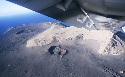
Aerial view looking down from an aircraft wing onto the dark volcanic landscape and craters of Surtsey island, Iceland.
Aerial view of the volcanic craters on the island of Surtsey.

Surtsey ecosystems, habitats, and plant life

As a pristine and almost entirely isolated volcanic surface, Surtsey offers a textbook example of ecological succession on new land. When the island first emerged, its surface was sterile rock and ash with no organic material whatsoever. The first colonisers were mosses, lichens, fungi, and a sparse set of hardy vascular plants able to survive in nutrient-poor sandy substrates, with the Arctic sea rocket recorded on the northern shore as early as 1965.

Vegetation has grown more complex over time as seabirds have enriched the soil and introduced new plant propagules. Mosses and lichens now cover much of the island, and a tea-leaved willow was recorded as the first woody plant in 1998. Although the flora remains far less diverse than that of mainland Iceland, the number of established vascular plant species continues to rise as more seeds arrive, either carried by wind or transported by birds. The interplay between bird populations, soil development, and plant colonisation is one of the key natural processes studied on the island.
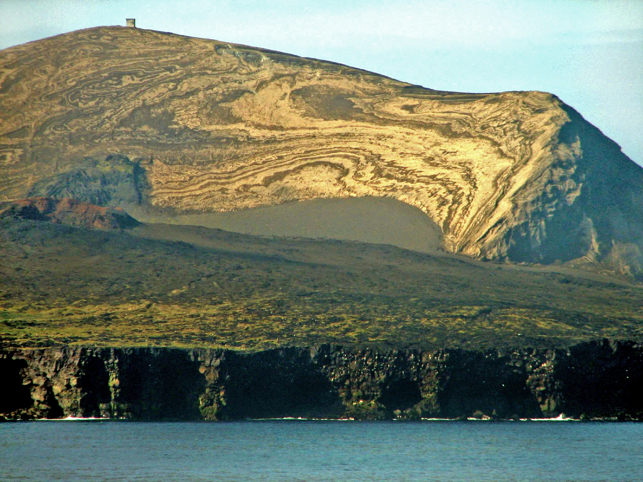
A wide view of the volcanic island of Surtsey in Iceland, featuring layered sediment slopes, dark cliffs, and a small structure atop the summit.
A view of the volcanic terrain on the island of Surtsey.

Surtsey wildlife and species highlights

Surtsey's wildlife story is closely tied to its history of colonisation. Seals, particularly grey seals, took to the island's shores early on, hauling out on the northern spit and breeding there from 1983 onward, which in turn has attracted orcas to the surrounding waters. The underwater parts of the island host rich marine life, including abundant starfish, sea urchins, limpets, and dense algal and seaweed communities.

On land, birds have transformed the island's ecology by nesting, transporting seeds, and fertilising the soil. Northern fulmars and black guillemots were among the first breeding species, followed by a gull colony from 1984 that has been especially important in promoting vegetation. Atlantic puffins, abundant elsewhere in the Vestmannaeyjar archipelago, were first confirmed nesting on Surtsey in 2004, and the island also serves as a stopover for migrating species such as whooper swans, geese, and common ravens. Insects arrived soon after the eruption, first as wind-borne arrivals and later on driftwood, and the island has gradually built up an invertebrate community that includes springtails, mites, beetles, flies, and the first earthworms recorded in the 1990s.
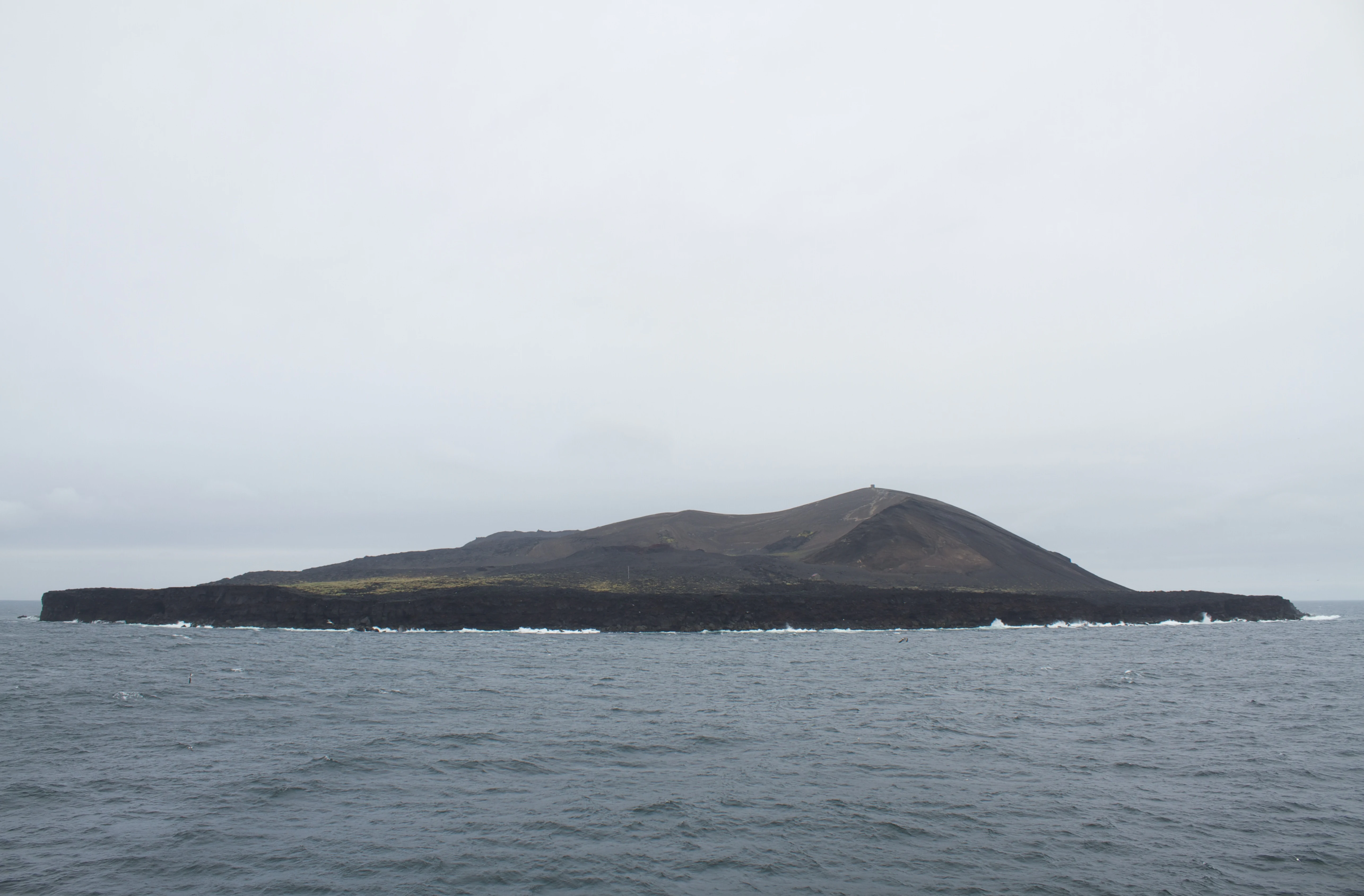
A low, dark, volcanic island rises from the gray sea under an overcast sky.
The volcanic island of Surtsey seen from the ocean.

Surtsey conservation status and protection priorities

Surtsey is protected at multiple levels because of its extraordinary scientific value. It was declared a nature reserve in 1965 while the eruption was still active, and management today lies with Iceland's Environment Agency under the Surtsey Nature Reserve, with the Surtsey Research Society coordinating scientific work on the island. Public landings and diving around Surtsey are prohibited without specific permission, and access is normally restricted to researchers and approved documentary or educational projects.

The conservation rationale for this strict protection is the opportunity to watch a complete island ecosystem develop from a zero baseline. Because Surtsey began with no soil, no plants, and no established animal population, scientists can identify exactly when and how each species arrives, how the soil evolves, and how biological communities assemble. UNESCO recognised this value by inscribing Surtsey as a World Heritage Site in 2008, listing it as a long-term natural laboratory for the study of biological colonisation and volcanism that should be preserved untouched for future generations.

Surtsey cultural meaning and human context

Surtsey is named after Surtr, a fire giant or jötunn of Norse mythology who is said to bring fire to the world during Ragnarök. The Icelandic Naming Committee chose the name by adding the island suffix -ey to the genitive form Surts, and because of this mythological origin the island sits naturally within Iceland's strong tradition of integrating Norse heritage into modern place names.

Beyond naming, the island's story has become part of Icelandic science and environmental culture. It was born during a period of intense scientific activity around the Vestmannaeyjar archipelago and has come to symbolise Iceland's relationship with its highly active volcanic landscape. Stories of early visitors, such as the French journalists from Paris Match who briefly landed on the still-erupting island in December 1963 and joked about claiming it for France, while Iceland asserted ownership, have also entered the cultural memory of Surtsey as a young but quickly iconic place.
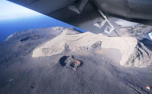
An aerial view from an airplane window showing the dark, volcanic landscape of Surtsey island, featuring a prominent crater and light-colored deposits against the ocean backdrop.
An aerial view of the volcanic craters on Surtsey island.

Top sights and standout views in Surtsey

Surtsey is one of the youngest landmasses on Earth and a rare example of a volcanic island whose entire lifespan, from formation to ongoing erosion, has been continuously observed and measured. It illustrates the Surtseyan style of eruption, in which lava interacts explosively with seawater to build a cone from the sea floor up. Because of its isolation and protected status, the island serves as a benchmark site for the study of primary ecological succession on land and of marine ecosystem development on fresh volcanic substrate.

The combination of active volcanism, ongoing geological change, and an essentially untouched biological experiment is what makes Surtsey stand out. A hard lava cap protects much of the original island, palagonitization is converting loose tephra into more durable rock, and seabird colonies are steadily deepening the soils and expanding plant cover. Together, geology, biology, and conservation policy have turned this small North Atlantic island into one of the most important natural laboratories in the world.
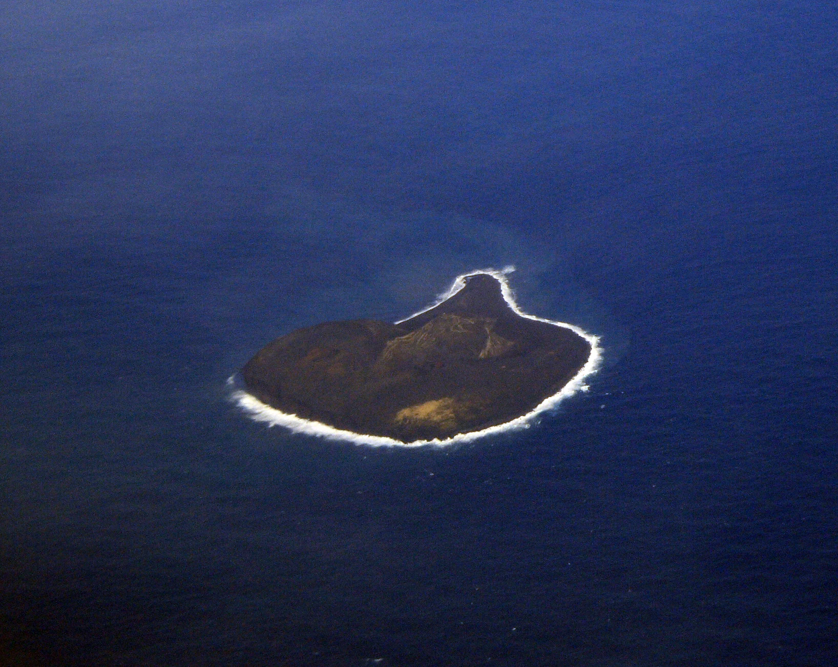
An aerial view of the small, dark, volcanic island of Surtsey surrounded by deep blue ocean.
An aerial view of the volcanic island of Surtsey off the coast of Iceland.

Best time to visit Surtsey

Surtsey itself is closed to ordinary visitors, so any visit to the island in the strict sense is effectively only possible for approved researchers. For most travellers, viewing Surtsey happens from the air or from boat excursions that circle the Vestmannaeyjar archipelago without landing. Summer and early autumn are the most useful windows for this kind of sightseeing, because the weather is calmer, daylight is long, and seabird colonies on and around the island are most active.

Outside the peak summer months, conditions in the North Atlantic off Iceland's south coast become considerably rougher, and storms may obscure views from the air and complicate boat travel. Late spring, when the first flowering plants on the mainland are emerging and Iceland's bird populations are returning, can also be a rewarding period for viewing the broader Vestmannaeyjar landscape, of which Surtsey is the youngest and southernmost member.
Monthly climate preview

Long-term temperature ranges and precipitation patterns across representative coordinates

Surtsey Average Temperature and Monthly Precipitation Normals

Surtsey records mean monthly temperatures spanning from three degrees Celsius to over eleven degrees alongside measured precipitation values varying throughout the year. Examining the full twelve-month climate profile reveals comprehensive multi-year normals for this protected volcanic island coordinate.
Annual mean6 °C
3 °C11 °C
Jan
Feb
Mar
Apr
May
Jun10°
Jul11°
Aug11°
Sep
Oct
Nov
Dec
Warmest month
July

11.4 °C

Coolest month
February

3 °C

Wettest month
February

5.3 mm/day

Driest month
June

2.2 mm/day

Park location guide

Geography guide, regional context, and park location map for Surtsey

Surtsey park geography, regions, and map view in Iceland

Understand where Surtsey sits in Iceland through a broader geographic reading of the surrounding landscape, nearby location context, and its mapped position within the national park landscape.

How Surtsey fits into Iceland

Iceland is a Nordic island nation located between Europe and North America on the Mid-Atlantic Ridge. With a population of approximately 394,000 and an area of 103,125 km², it is one of the world's most sparsely populated countries. The country features dramatic volcanic terrain, extensive glaciers, geysers, and geothermal activity, all while maintaining a temperate climate warmed by the Gulf Stream.

Wider geography shaping Surtsey in Iceland

Iceland is an island nation located in the North Atlantic Ocean between the Arctic Ocean and the Atlantic Ocean, situated on the Mid-Atlantic Ridge between Europe and North America. The interior consists of volcanic plateaus with sand and lava fields, while mountains and glaciers dominate the terrain. Numerous glacial rivers flow from the highlands through lowlands to the sea. The country sits at a latitude just south of the Arctic Circle.

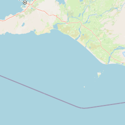
Map view of Surtsey

Use this park location map to pinpoint Surtsey in Iceland, understand its exact geographic position, and read its mapped placement within the surrounding landscape more clearly.

Pigeon | © OpenStreetMap contributors

Explore photographic records of the protected terrain, rugged lava fields, and evolving habitats of Surtsey.

Surtsey Photos and Landscape Scenery: Visualizing the Volcanic Island

Photographic collections reveal the rugged basaltic terrain, stark lava flows, and isolated coastal formations that define the geography of Surtsey. Visual documentation provides essential context for observing how raw volcanic substrate and evolving ecosystems take shape across the protected reserve.

Black and white photograph showing a volcanic eruption occurring at sea; a large, dark island mass is visible with a massive plume of white smoke and ash rising into the sky.

Aerial view from an aircraft wing showing a volcanic eruption occurring in the ocean with large white and dark plumes of smoke rising from a new island landmass.

Aerial view looking down from an aircraft wing onto the dark volcanic landscape and craters of Surtsey island, Iceland.

A wide view of the volcanic island of Surtsey in Iceland, featuring layered sediment slopes, dark cliffs, and a small structure atop the summit.

A low, dark, volcanic island rises from the gray sea under an overcast sky.

An aerial view of the Surtsey island shoreline, showing a black volcanic sand spit extending into the ocean, partially covered in snow under a cloudy, overcast sky.

An aerial view from an airplane window showing the dark, volcanic landscape of Surtsey island, featuring a prominent crater and light-colored deposits against the ocean backdrop.

An aerial view of the small, dark, volcanic island of Surtsey surrounded by deep blue ocean.

A view of the volcanic island Surtsey, showing dark coastal cliffs in the foreground and a large, layered volcanic mountain in the background under a blue sky.

Aerial view looking down at a volcanic eruption occurring in the ocean, with plumes of white steam and dark ash rising from the water, and the wing of an aircraft visible in the foreground.

Aerial view of the isolated, rocky Surtsey island surrounded by deep blue ocean, featuring a volcanic cone and sloped terrain.

An aerial photograph of the volcanic island of Surtsey surrounded by the ocean, showing its rugged cliffs and elongated landmass.

Park atlas

Compare volcanic landforms and protected coastal terrain across nearby marine reserves.

Other Parks Near Surtsey and Related Protected Landscapes in the Surrounding Region

Exploration of Surtsey naturally extends into surrounding marine protected areas and neighboring volcanic landscapes across the North Atlantic. Regional park comparison reveals shared geological foundations, marine ecosystems, and untouched conservation zones.
Watercolor painting depicting a landscape with cliffs, a body of water, and distant hills under a light sky
National parkSouthern Region
About 101 km away#1 closest

North

Þingvellir National Park: Witness Tectonic Plates and Ancient Icelandic Governance

Explore the rift valley and historic parliament site in Iceland's Southern Region.

Þingvellir National Park offers a singular opportunity for geographic discovery, situated in Iceland's Southern Region. This protected national park is globally recognized for its visible expression of the Mid-Atlantic Ridge, where the North American and Eurasian tectonic plates actively diverge, creating a dramatic rift valley. Moreover, Þingvellir served as the site of the Althing, Iceland's ancient parliament, making it a crucial historical landmark. Explore this landscape to understand both powerful geological processes and the foundations of Icelandic democratic history through its mapped terrain.

Area
92.7 km²
Established
1930
IUCN
II
Relief
Lowland
Watercolor illustration showing a landscape with green fields, a winding path, pink flowers, and mountains in the background
National parkIceland
About 118 km away#2 closest

Northeast

Vatnajökull National Park: Iceland's Expansive Protected Glacier and Volcanic Terrain

Mapped boundaries of a UNESCO World Heritage site dynamic with fire and ice.

Vatnajökull National Park offers a profound exploration of one of Earth's most dynamic natural environments. This Icelandic national park protects the vast Vatnajökull ice cap, a landscape shaped by active volcanoes and powerful glacial forces, creating a region of extraordinary geographic diversity. Discover the mapped terrain, from subglacial mountain ranges to dramatic caldera systems, and understand the unique protected area context of this significant European natural heritage.

Area
14,967 km²
Established
2008
IUCN
II
Relief
Mountain
A watercolor painting showing a wide view of a geothermal area with green hills, steam plumes rising from hot springs, and yellow-toned ground patches.
Natural monumentIceland
About 182 km away#3 closest

North

Hveravellir Natural Monument: Geothermal Plateau Geography and Highland Protected Areas

Central Iceland geothermal field and volcanic plateau

Located on the Kjölur route, Hveravellir serves as a protected natural monument characterized by high-temperature geothermal activity. The area features a concentration of fumaroles, geysers, and mineral-rich springs set upon a stark volcanic plateau. This site offers significant insights into the geological processes shaping the central highlands of Iceland, blending ancient lava fields with active thermal surface transformations.

Area
2.5 km²
Relief
Highland
Climate
Subpolar
Access
Moderate access
Watercolor illustration showing a mountain landscape with green valleys, pink mountains, and a winding river
National parkIceland
About 197 km away#4 closest

Northeast

Skaftafell National Park: Iceland's Accessible Protected Landscape with Glacial Terrain and Basalt Columns

Discover glacial landscapes and volcanic geology.

Skaftafell National Park is a vital protected area in Southeast Iceland, offering a unique atlas-level view of dramatic glacial landscapes. Located at the base of Vatnajökull, Europe's largest glacier, the park features accessible hiking trails that traverse outwash plains, birch woodlands, and glacial tongues like Skaftafellsjökull. Explore the iconic Svartifoss waterfall, framed by striking basalt columns, and understand the park's dynamic terrain shaped by volcanic activity and glacial processes, providing rich geographic context for protected landscape discovery.

Established
1967
IUCN
II
Scope
Terrestrial
Watercolor illustration of a mountain landscape with a glacier-capped peak and surrounding green fields
National parkIceland
About 228 km away#5 closest

Northwest

Snæfellsjökull National Park: Geography and Protected Landscapes of Western Iceland

Glacial volcanoes, lava fields, and coastal topography.

Snæfellsjökull National Park sits at the western tip of the Snæfellsnes peninsula, creating a unique intersection of glacial, volcanic, and maritime environments. This database provides structured insights into the park's rugged terrain, including its moss-covered lava fields, sea-carved cliffs, and the namesake glacier that dominates the local landscape.

Established
2001
IUCN
II
A horizontal watercolor illustration depicting a soft, pink-hued coastal landscape with rolling hills, rocky outcrops, and a quiet bay.
National parkIceland
About 228 km away#6 closest

Northwest

Snæfellsjökull National Park: Volcanic Stratovolcano and Coastal Protected Area in Iceland

Mapped geologic features, glacier terrain, and coastal volcanic landmarks.

Snæfellsjökull National Park features a unique assembly of volcanic landforms, including the iconic glacier-capped stratovolcano, the towering Lóndrangar basalt pinnacles, and symmetrical craters like Saxhóll. This protected area offers deep insights into the glacial and submarine origins of western Iceland through its diverse palagonite ridges and extensive lava plains.

Area
170 km²
Established
2001
Relief
Mountain
Scope
Terrestrial
National parkIceland
About 232 km away#7 closest

Northwest

Snæfellsjökull National Park: An Atlas of Volcanic Terrain and Protected Icelandic Coastlines

Volcanic peaks and coastal ecosystems of the Snæfellsnes Peninsula.

Snæfellsjökull National Park stands as a defining protected landscape in western Iceland. Defined by its central glacier-crowned stratovolcano, the park territory maps out a complex transition from high-altitude volcanic basalt and lava fields to sheltered bays and dramatic seaside cliffs. This geographic record explores the intersection of glacial ice, maritime habitats, and the volcanic belt that shapes the outer edge of the Snæfellsnes Peninsula.

Relief
Mountain
Climate
Subpolar
Scope
Mixed
Water
Major water bodies
A watercolor illustration depicting a soft, green, rolling landscape with a river winding through it, framed by distant mountains.
Nature reserveIceland
About 309 km away#8 closest

Northeast

Mývatn Nature Reserve: Mapping the Volcanic Lakes and Tephra Formations of Northern Iceland

Protected wetland landscapes and volcanic rift zone geography.

Mývatn represents a complex of protected wetlands and volcanic landforms, including the Hverfjall explosion crater and the Skútustaðir pseudocraters. This geography-rich basin in northern Iceland offers insight into post-glacial volcanic activity and serves as an internationally significant breeding site for diverse bird populations within a compact, walkable terrain.

Area
37 km²
Relief
Upland
Climate
Polar
Access
Easy access

Common questions about visiting, size, designation, and location context for Surtsey

Surtsey FAQs for park facts, access, geography, and protected area context

Find quick answers about Surtsey, including protected-area facts, park geography, trail and visitor context, and how the park fits into its surrounding country and regional landscape.
MoriAtlas Explorer

Continue Your Protected Areas Search Across the Global Atlas

Deepen your exploration by continuing the structured search for national parks and protected areas worldwide. Utilize the comprehensive filtering capabilities to compare different conservation landscapes and refine your understanding of global park geography. Discover more about the distribution and characteristics of protected natural areas.

Global natural geography