Mori Atlas logo
National parkSyniohora National Nature Park

Discover the mapped terrain and protected boundaries of the Gorgany range within Ukraine's Carpathians.

Syniohora National Nature Park: Protected Landscape & Carpathian Geography in Ivano-Frankivsk Oblast

(National Nature Park Syniohora)

Syniohora National Nature Park, situated in the Ivano-Frankivsk Oblast of Ukraine, represents a significant protected area dedicated to preserving the natural integrity of the Gorgany mountain massif. This national park, covering approximately 10,866 hectares, showcases the characteristic terrain and ecosystems of the Ukrainian Carpathians, offering a unique focal point for atlas-driven discovery of regional geography and protected landscapes. Explore the mapped boundaries and natural context of this distinctive Carpathian park.

Carpathian mountainsGorgany rangeProtected forestNational parkUkraine natureMountain landscape
Illustration showing mountain ranges, winding river, and pine forests under partly cloudy sky

Syniohora National Nature Park

National park

Park overview

Structured park overview, official facts, and landscape profile for Syniohora National Nature Park

Syniohora National Nature Park park facts, protected area profile, and essential visitor context
Review the core facts for Syniohora National Nature Park, including designation, size, terrain, visitor scale, habitats, and operating context in one park-focused overview.

About Syniohora National Nature Park

Syniohora National Nature Park represents a unique addition to Ukraine's protected area network, combining significant natural heritage with a relatively recent institutional history tied to the country's executive leadership. The park occupies a substantial tract of the Gorgany mountains within Ivano-Frankivsk Oblast, one of the western Ukrainian regions that contain the most extensive and ecologically intact Carpathian forests remaining in the country. The creation of the park in 2009 marked the formalization of conservation status for an area that had already been under limited public access due to its previous function as a presidential retreat. The park's management falls under the State Management of Affairs, reflecting its origins in the state presidential residence system. Visitors to the park operate within a regulatory framework that balances conservation objectives with controlled recreational use, consistent with Ukraine's natural protected area legislation.

Quick facts and research context for Syniohora National Nature Park

Syniohora National Nature Park covers 10,866 hectares in the Gorgany mountains of Ivano-Frankivsk Oblast in western Ukraine. Established by presidential decree in December 2009, the park occupies territory previously managed as the presidential residence Syniohora near the village of Huta. The park is administered by the State Management of Affairs and falls under IUCN category II protection status as a national park. The Gorgany range where the park is situated represents one of the more remote and less developed mountain areas in the Ukrainian Carpathians, characterized by rugged terrain and significant ecological diversity.

Park context

Deeper park guide and search-rich context for Syniohora National Nature Park

Syniohora National Nature Park history, landscape, wildlife, and travel context
Explore Syniohora National Nature Park through its history, landscape character, ecosystems, wildlife, conservation priorities, cultural context, and seasonal travel timing in a structured park guide built for atlas discovery and search intent.

Why Syniohora National Nature Park stands out

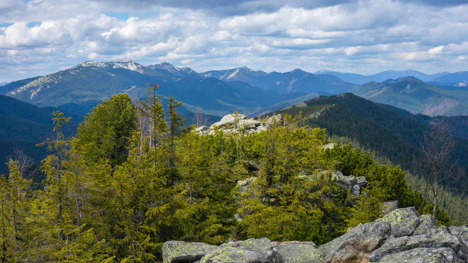
Syniohora National Nature Park is best known for its dual identity as both a modern protected area and a former presidential residence, making it distinctive among Ukrainian national parks. The park protects the Gorgany mountain massif, a less commercialized section of the Carpathian range that retains relatively pristine character compared to more accessible Carpathian destinations. The landscape features the characteristic Carpathian combination of forested slopes, alpine meadows, and rocky ridges that define this portion of the mountain system.

Mountain landscape with forested foreground, rocky outcrops, and snow-capped peaks in the distance under a partly cloudy sky
Snow-capped mountain peaks visible from a forested viewpoint in Syniohora National Nature Park

Syniohora National Nature Park history and protected-area timeline

The history of Syniohora National Nature Park traces a distinctive path from recreational facility to protected area. The site originally served as a sanatorium operated by Ivano-Frankivskghaz, with construction completed in 2001. In December 2002, during the administration of President Leonid Kuchma, the property was transferred to state ownership under the government of Viktor Yanukovych. The transformation from a restricted presidential residence into a national park occurred in 2009, when President Viktor Yushchenko issued a decree establishing the protected area. The stated purpose of the park's creation was the preservation, reproduction, and sustainable use of typical and unique natural complexes of the Gorgany mountain range within the Ukrainian Carpathians, recognizing the area's importance for conservation, scientific study, aesthetic value, recreation, and health benefits.

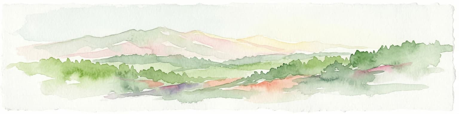
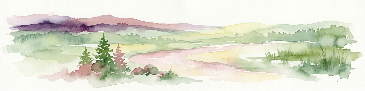
Syniohora National Nature Park landscape and geographic character

The landscape of Syniohora National Nature Park is defined by its position within the Gorgany mountain range, a subsection of the Ukrainian Carpathians characterized by relatively high elevations, steep terrain, and extensive forest cover. The park encompasses the mountain slopes and valleys that form part of this distinctive Carpathian landscape, where the terrain rises to elevations typical of the mid-mountain zone. The area features the characteristic combination of dense forest vegetation on lower and mid slopes, with alpine and subalpine meadows appearing at higher elevations. The Gorgany range differs from other Carpathian sections in its relative remoteness and lower levels of tourist development, attributes that contribute to the ecological integrity of the landscape within the park boundaries.

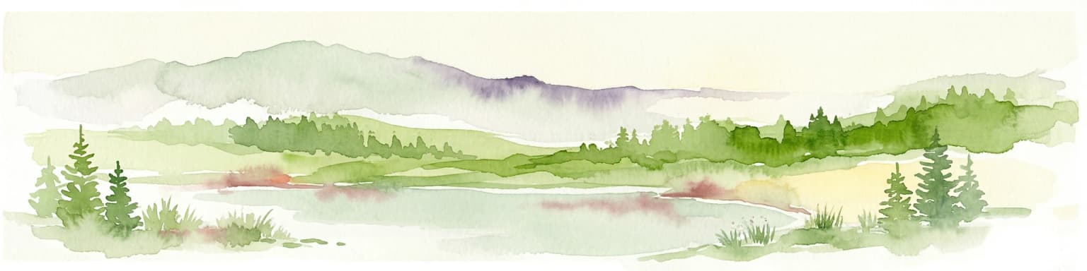
Syniohora National Nature Park ecosystems, habitats, and plant life

The natural character of Syniohora National Nature Park reflects the Carpathian ecological zone, which represents one of Europe's significant biodiversity areas. The park protects habitats within the Gorgany range that support characteristic Carpathian forest ecosystems, including both deciduous and mixed forest types that cover much of the mountain slopes. The protected area encompasses vegetation zones that transition from lower elevation forest communities through subalpine zones to alpine meadows at higher elevations, creating a vertical ecological gradient typical of Carpathian mountain environments. These habitats provide shelter for plant and animal species associated with Carpathian biodiversity, a region recognized for its ecological significance within Europe.

Syniohora National Nature Park wildlife and species highlights

The wildlife of Syniohora National Nature Park is consistent with Carpathian mountain ecosystems, where the forests and alpine zones support characteristic fauna of the region. The Carpathians host a diversity of species including large mammals such as bears, wolves, and lynx that inhabit the forested mountain terrain. The area's position within the broader Carpathian mountain system connects it to wildlife populations that move through interconnected forest habitats across the range. Birdlife in the park includes species associated with forest environments and alpine zones characteristic of Ukrainian mountain areas.

Syniohora National Nature Park conservation status and protection priorities

Syniohora National Nature Park functions as a category II protected area under the IUCN protected area classification system, representing national park status within Ukraine's protected area framework. The park contributes to the conservation of Gorgany mountain ecosystems that represent a relatively intact portion of the Ukrainian Carpathians. Conservation objectives for the protected area include maintaining the genetic resources of plant and animal species within the park boundaries and ensuring that visitor use occurs within parameters established by Ukrainian environmental protection legislation, particularly the Law on the Natural Reserved Fund of Ukraine. The park's management structure provides for staff dedicated to protection and conservation activities.

Syniohora National Nature Park cultural meaning and human context

The cultural context of Syniohora National Nature Park relates to the broader history of the Huta village area within Bohorodchany Raion, a region with traditional ties to Carpathian rural life in Ivano-Frankivsk Oblast. The park's establishment in proximity to the village of Huta reflects the historical pattern of settlement in this portion of the Ukrainian Carpathians. The former presidential residence function of the site adds a more recent layer to the area's institutional history, representing a period when the location served as a retreat for Ukraine's head of state. The park's address in the village of Huta, on Zarichna street, anchors the protected area within the local community context of this Carpathian settlement.

Top sights and standout views in Syniohora National Nature Park

Syniohora National Nature Park offers a combination of protected Carpathian mountain landscape, historical association with Ukraine's presidential institutions, and the opportunity to explore a less commercially developed section of the Gorgany range. The park's substantial area of approximately 10,866 hectares provides extensive terrain for experiencing Carpathian mountain environments. The transition from presidential residence to national park represents an unusual evolutionary path that distinguishes this protected area within Ukraine's park system.

Best time to visit Syniohora National Nature Park

The best time to visit Syniohora National Nature Park follows seasonal patterns typical of Carpathian mountain recreation. The summer months offer the most accessible period for exploring the park's trails and outdoor environments, when weather conditions in the mountains permit extended visits. Autumn brings the characteristic forest colors of the Carpathian season, while winter transforms the landscape but may present more challenging access conditions appropriate for visitors prepared for mountain winter conditions.

Park location guide

Geography guide, regional context, and park location map for Syniohora National Nature Park

Syniohora National Nature Park park geography, regions, and map view in Ukraine
Understand where Syniohora National Nature Park sits in Ukraine through a broader geographic reading of the surrounding landscape, nearby location context, and its mapped position within the national park landscape.

How Syniohora National Nature Park fits into Ukraine

Ukraine is a sovereign nation in Eastern Europe, bordered by Russia, Belarus, Poland, Slovakia, Hungary, Romania, Moldova, and the Black Sea. It is the second-largest country in Europe by area. Kyiv is the capital and largest city, followed by Kharkiv, Odesa, and Dnipro. The official language is Ukrainian. Ukraine has a population of approximately 32.9 million and operates as a unitary semi-presidential republic.

Wider geography shaping Syniohora National Nature Park in Ukraine

Ukraine occupies 603,628 km² in Eastern Europe, making it the second-largest country in Europe. It shares borders with Russia, Belarus, Poland, Slovakia, Hungary, Romania, and Moldova. The country has a southern coastline along the Black Sea and Sea of Azov. The terrain includes plains, steppes, and the Carpathian Mountains in the west.

Map view of Syniohora National Nature Park

Use this park location map to pinpoint Syniohora National Nature Park in Ukraine, understand its exact geographic position, and read its mapped placement within the surrounding landscape more clearly.

Pigeon | © OpenStreetMap contributors

Location context for Syniohora National Nature Park

Ivano-Frankivsk Oblast

Visual Exploration of Ukraine's Gorgany Mountain Protected Area, Tracing Unique Habitats and Pristine Terrain

Syniohora National Nature Park Photos: Explore Carpathian Mountain Landscapes and Forest Scenery
Explore a visual gallery showcasing Syniohora National Nature Park's distinctive Carpathian mountain landscapes, dense forest ecosystems, and high-elevation meadows of the Gorgany massif. These images provide essential visual context, aiding understanding of the park's protected terrain, ecological character, and the unique natural scenery within this less commercialized Ukrainian region.

Mountain landscape with forested foreground, rocky outcrops, and snow-capped peaks in the distance under a partly cloudy sky

Grassy hilltop with scattered trees, autumn foliage, and mountain ranges under a clear blue sky

Park atlas

Trace the geographic spread of protected Carpathian landscapes, comparing parks in this distinctive mountain range.

Discover National Parks, Protected Areas Near Syniohora National Nature Park
Explore a curated selection of national parks and protected areas geographically connected to Syniohora National Nature Park, tracing the broader Carpathian mountain range. Compare diverse mountain terrain, conservation landscapes, and regional park contexts to deepen your understanding of Ukraine's protected natural heritage.
National parkIvano-Frankivsk Oblast

Carpathian National Nature Park: Protected Landscape Within Ivano-Frankivsk Oblast

National Park mapped boundaries and regional geography.

Carpathian National Nature Park represents a significant protected area within Ivano-Frankivsk Oblast, Ukraine. This page offers detailed insights into its protected landscape identity, helping users understand its geographic setting and mapped boundaries. As part of the Carpathian region, the park serves as a key point for atlas-based discovery, providing context for its place within the broader geography of western Ukraine.

Area
515.7 km²
Established
1980
IUCN
II
Visitors
1M annual
National parkZakarpattia Oblast

Synevyr National Nature Park: National Park Protected Landscape in Zakarpattia Oblast

Mapped geographic context and protected area identity

Delve into Synevyr National Nature Park, a designated national park situated in the diverse geography of Zakarpattia Oblast, Ukraine. This page provides essential atlas-driven context, detailing the park's mapped boundaries and its significance as a protected landscape within the Carpathian region. Understand its unique place in Ukraine's network of natural areas and explore its regional geographic setting for a comprehensive overview.

Area
404 km²
Established
1974
Relief
Mountain
Climate
Temperate
National parkIvano-Frankivsk Oblast

Halych National Nature Park: Ivano-Frankivsk Oblast National Park Atlas & Geography

Mapped protected boundaries and landscape context.

Halych National Nature Park is a vital protected area situated in the Ivano-Frankivsk Oblast of Ukraine, characterized by its transitional landscape where Carpathian foothills merge with the East European Plain. This national park offers a rich tapestry of environments, including oak-hornbeam and oak-beech forests, vital wetlands, and scarce steppe remnants, creating a mosaic of habitats mapped meticulously within the MoriAtlas platform. Explore the park's geographic identity, its diverse terrain, and its significance as a conservation landscape for understanding regional biodiversity.

Area
147 km²
Established
2004
IUCN
II
Relief
Lowland
National parkVerkhovyna Raion

Verkhovyna National Nature Park: Explore Protected Landscape Geography in Verkhovyna Raion

Discover Ukraine's Verkhovyna National Nature Park mapped terrain.

Verkhovyna National Nature Park represents a vital protected area within the Verkhovyna Raion of Ukraine. This detailed atlas entry focuses on the park's geographic significance, providing insights into its mapped boundaries and its role within the regional landscape context of the Carpathian Mountains. It serves as a focused point for understanding the park's protected status and its place in a structured geographic discovery framework.

Area
120 km²
Established
2010
IUCN
II
Relief
Mountain
National parkZakarpattia Oblast

Zacharovanyi Krai National Nature Park: Protected Landscape Atlas Entry

National park within Zakarpattia Oblast, Ukraine

Navigate Zacharovanyi Krai National Nature Park, a designated national park offering vital insights into protected landscapes and regional geography. This entry provides core information about the park's protected area status and its geographic setting within Zakarpattia Oblast, essential for structured atlas discovery and understanding the mapped natural terrain of western Ukraine.

Area
61.01 km²
Established
2009
IUCN
II
Relief
Mountain
Watercolor illustration of a mountainous landscape with forests, a lake, and distant peaks.
National parkChernivtsi Oblast

Cheremosh National Nature Park: Protected Landscape and Geographic Context in UA

Explore mapped boundaries within Chernivtsi Oblast

Cheremosh National Nature Park represents a vital protected area within Ukraine's Chernivtsi Oblast. This entry offers a structured exploration of the park's geographic identity, focusing on its mapped boundaries and its significance as part of the regional natural landscape. Delve into the terrain and understand how Cheremosh National Nature Park contributes to the mapped geography of western Ukraine, providing a foundation for atlas-based discovery.

Area
71 km²
Established
2009
IUCN
II
Relief
Mountain
National parkChernivtsi Oblast

Vyzhnytsia National Nature Park: Protected National Park Landscape Exploration

Mapped boundaries and regional terrain in Chernivtsi Oblast.

Delve into the specific protected landscape of Vyzhnytsia National Nature Park, a designated national park in Ukraine's Chernivtsi Oblast. This detailed entry provides context on its geographic positioning, mapped natural features, and the surrounding regional terrain, aiding in structured atlas exploration and understanding its significance within the protected areas network.

Area
7,928.4 km²
Established
1995
IUCN
II
Relief
Mountain
Watercolor illustration of a mountainous landscape with rolling hills, a river, and green vegetation
Protected landscapeMaramureș County

Maramureș Mountains Natural Park: Protected Landscape and Carpathian Geography

Explore the mapped boundaries and dramatic terrain of Romania's largest nature park.

Delve into the Maramureș Mountains Natural Park, a protected landscape covering extensive tracts of the northern Carpathian Mountains. This page provides detailed geographic context, showcasing the park's mapped boundaries, diverse alpine terrain, and its role within the broader regional geography of Maramureș County. Understand the natural features and protected area significance of this expansive Carpathian wilderness for structured atlas exploration.

Area
1,488.5 km²
Established
2004
IUCN
V
Relief
Mountain

Common questions about visiting, size, designation, and location context for Syniohora National Nature Park

Syniohora National Nature Park FAQs for park facts, access, geography, and protected area context
Find quick answers about Syniohora National Nature Park, including protected-area facts, park geography, trail and visitor context, and how the park fits into its surrounding country and regional landscape.
MoriAtlas Explorer

Continue Your Protected Areas Search Across the Global Atlas

Deepen your exploration by continuing the structured search for national parks and protected areas worldwide. Utilize the comprehensive filtering capabilities to compare different conservation landscapes and refine your understanding of global park geography. Discover more about the distribution and characteristics of protected natural areas.

Global natural geography