Mori Atlas logo
National parkTarvagatai Nuruu National Park

Explore the unique steppe-to-forest ecological transition zone in Zavkhan Province.

Tarvagatai Nuruu National Park: Protected Mountain Landscape & Regional Geography

Tarvagatai Nuruu National Park in Mongolia's Zavkhan Province is a significant protected area defined by the dramatic mountainous terrain of the Tarvagatai Range. This park serves as a crucial ecological transition zone, safeguarding the boundary where semi-arid steppe landscapes of its southern slopes meet the coniferous forests adorning the northern aspects. Spanning approximately 5,467 square kilometers, it encompasses the highest peak of the Khangai Mountains, Mount Otgontenger, anchoring its northeastern edge and offering a clear geographic anchor for atlas exploration.

Mountain protected areaKhangai MountainsSteppe-forest transitionConiferous forestAlpine tundraGrassland ecosystem

Tarvagatai Nuruu National Park

National park

Park overview

Structured park overview, official facts, and landscape profile for Tarvagatai Nuruu National Park

Tarvagatai Nuruu National Park park facts, protected area profile, and essential visitor context

Review the core facts for Tarvagatai Nuruu National Park, including designation, size, terrain, visitor scale, habitats, and operating context in one park-focused overview.

About Tarvagatai Nuruu National Park

Tarvagatai Nuruu National Park represents one of Mongolia's significant protected areas, established in 2000 to conserve the unique ecological and landscape values of the Tarvagatai Range in the Khangai Mountains. The park's location in Zavkhan Province places it in the remote, sparsely populated western reaches of Mongolia's northern forest zone, where the continental climate produces cold, dry conditions typical of the cold semi-arid steppe climate classification. The protection of this transition zone is particularly important, as it preserves ecological processes and species adapted to both steppe and forest environments. The park stretches approximately 100 kilometers in a northeastern direction from the northern base of Mount Otgontenger, the highest peak in the Khangai Mountains at over 4,000 meters elevation. This dramatic topography creates diverse microclimates and habitat conditions across the park, with aspect playing a crucial role in determining vegetation patterns. The steep southern-facing slopes experience different wind, sun, and evaporation conditions than the more sheltered northern aspects, leading to the distinct split between steppe and forest communities that defines the park's character.

Quick facts and research context for Tarvagatai Nuruu National Park

Tarvagatai Nuruu National Park is located in Zavkhan Province in northern Mongolia, covering 5,467 square kilometers of the Tarvagatai Range in the Khangai Mountains. The park was established in 2000 and is governed by Mongolia's Ministry of Environment and Green Development. The terrain is mountainous with elevations ranging from 2,200 to 3,200 meters, featuring relatively flat-topped ridges, steep southern slopes, and wide glacially formed valleys. The park protects a critical ecological transition zone between southern steppe grasslands and northern coniferous forests. A significant wildfire in 2002 burned approximately 800 square kilometers of forest, primarily affecting larch and Siberian pine stands.

Protection and recognition

Analyzing terrestrial management scope and official designations for Mongolian conservation areas

Tarvagatai Nuruu National Park Official Protected Area Designation

Tarvagatai Nuruu National Park maintains a documented terrestrial protection status dedicated to preserving regional biodiversity and montane ecosystems. Evaluating official designation histories and management scopes provides critical geographic context for studying Mongolian conservation landscapes.

Protection details

Protection scope
Terrestrial
Transboundary protection
No
Park context

Deeper park guide and search-rich context for Tarvagatai Nuruu National Park

Tarvagatai Nuruu National Park history, landscape, wildlife, and travel context

Explore Tarvagatai Nuruu National Park through its history, landscape character, ecosystems, wildlife, conservation priorities, cultural context, and seasonal travel timing in a structured park guide built for atlas discovery and search intent.

Why Tarvagatai Nuruu National Park stands out

Tarvagatai Nuruu is best known for its remarkable ecological transition zone, where semi-arid steppe meets coniferous forest in a dramatic mountain setting. The park protects the Tarvagatai Range of the Khangai Mountains, including the region's highest peak Otgontenger, which anchors the northeastern boundary of the park. The park's altitudinal gradient creates a diversity of habitats, from grass-covered valley floors through larch and Siberian pine forests on northern slopes to alpine tundra at the highest elevations. This gradient supports high biodiversity despite the harsh continental climate, with the southern-facing steppe areas supporting approximately 70% grass cover including Alpine oatgrass, Hawkweed, Tundra fescue, and Wide-leaf low sedge.

Tarvagatai Nuruu National Park history and protected-area timeline

Tarvagatai Nuruu National Park was established in 2000 as part of Mongolia's expanding network of protected areas. The creation of the park reflected growing recognition of the ecological significance of the Khangai Mountains transition zones, which support biodiversity patterns distinct from both the more humid taiga forests to the north and the desert-steppe to the south. Management responsibility falls to Mongolia's Ministry of Environment and Green Development. The park has faced significant ecological challenges, most notably a large wildfire in 2002 that burned approximately 800 square kilometers of forest within the park boundaries. This fire represented a substantial loss of the coniferous forest ecosystem, primarily affecting stands of Siberian larch and Siberian pine that characterize the northern slope forests. The event highlighted the vulnerability of these forest systems to fire in the context of climate change and changing land management practices.

Tarvagatai Nuruu National Park landscape and geographic character

The landscape of Tarvagatai Nuruu is defined by the mountainous terrain of the Tarvagatai Range, a prominent subrange of the Khangai Mountains that extends in a northeastern direction for approximately 100 kilometers through the park. The terrain is characterized by ridges with relatively flat tops, steep southern-facing slopes, and broad glacially formed valleys that carve between the mountain spurs. Elevations within the park range from around 2,200 meters in the valley floors to peaks exceeding 3,200 meters, with Mount Otgontenger standing as the highest point in the entire Khangai region. The glacial legacy is evident in the wide U-shaped valleys and the smooth, sweeping forms of the ridge crests. The landscape presents a striking contrast between the open, grass-covered southern exposures and the forested northern slopes, creating a visually distinctive mountain environment that reflects the park's role as an ecological transition zone.

Tarvagatai Nuruu National Park ecosystems, habitats, and plant life

The nature of Tarvagatai Nuruu is defined by the interplay of altitude zones and slope aspect, which together create a diverse mosaic of habitats within a relatively compact geographic area. Rising from the grassland valleys, the northern slopes support coniferous forest communities dominated by Siberian larch and Siberian pine, while the highest elevations give way to alpine tundra vegetation. The southern-facing steppe areas, which experience more wind exposure, greater solar radiation, and higher evapotranspiration rates, support approximately 70% grass cover including Alpine oatgrass, Hawkweed, Tundra fescue, and Wide-leaf low sedge. This vegetation diversity supports corresponding animal diversity, with species adapted to both open steppe and forest environments. The cold semi-arid climate, characterized by at least one month averaging below freezing, shapes the overall ecological character of the park and constrains the species assemblages that can persist in this harsh continental environment.

Tarvagatai Nuruu National Park wildlife and species highlights

The wildlife of Tarvagatai Nuruu benefits from the diverse habitat mosaic created by the park's elevation gradient and the transition between steppe and forest environments. The forested northern slopes provide habitat for species associated with Mongolia's boreal forest zone, including various species of birds and mammals adapted to coniferous forest conditions. The steppe grasslands of the southern exposures support different species assemblages characteristic of Mongolia's semi-arid grassland ecosystems. The presence of both habitat types within a single protected area increases overall biodiversity by providing conditions for species from both ecological communities. While the specific species list for the park would require more detailed survey data, the diverse vegetation zones suggest the presence of a correspondingly diverse fauna adapted to these different environmental conditions.

Tarvagatai Nuruu National Park conservation status and protection priorities

Tarvagatai Nuruu holds conservation significance as a protected area that preserves one of Mongolia's important ecological transition zones between steppe and forest biomes. The park is designated under IUCN Category II as a national park, reflecting its primary purpose of protecting natural ecosystems while allowing for some sustainable use. The transition zone that the park protects is scientifically valuable because it contains species and ecological processes from both the steppe and forest biomes, creating unique community assemblages that cannot be found in either habitat type alone. The 2002 wildfire that burned 800 square kilometers of the park's forests serves as a reminder of the conservation challenges facing these ecosystems, particularly in the context of climate change and the increasing frequency of extreme weather events. Continued protection of this area is important for maintaining biodiversity and ecological processes in the Khangai Mountains region.

Tarvagatai Nuruu National Park cultural meaning and human context

The cultural context of Tarvagatai Nuruu is tied to the broader cultural landscape of Zavkhan Province and the traditional pastoralist heritage of Mongolia. The Khangai Mountains region has been used by Mongolian herders for centuries, with the seasonal movement of livestock between valley pastures and high-elevation grazing areas forming part of traditional land use patterns. While the park itself is sparsely populated, the surrounding region maintains connections to traditional Mongolian pastoral culture. The Mongolian name Тарвагатай Нуруу translates roughly as "Tarvagatai Range," reflecting the park's focus on this distinctive mountain landscape within the larger Khangai Mountains system.

Top sights and standout views in Tarvagatai Nuruu National Park

The primary highlights of Tarvagatai Nuruu include the dramatic mountain landscape of the Tarvagatai Range with its flat-topped ridges and glacial valleys, the ecological transition between steppe and forest environments visible in the contrast between southern and northern slopes, and the protection of Mongolia's highest Khangai peak at Otgontenger. The park offers visitors access to a remote mountain environment relatively untouched by development, with opportunities to experience the distinctive character of this transition zone ecosystem. The varied topography and vegetation create visually striking scenery, particularly where the forested northern slopes meet the open steppe of the southern exposures.

Best time to visit Tarvagatai Nuruu National Park

The best time to visit Tarvagatai Nuruu would be during the summer months of June through August, when temperatures are most moderate and the high-elevation trails are most accessible. Summer brings the grass-covered steppe into full growth and allows for travel through the mountain valleys without the severe winter cold. However, visitors should be prepared for the continental climate's variability, with warm days and cool nights typical of high-elevation mountain environments. The spring and autumn seasons offer different but potentially rewarding experiences, though access may be more difficult due to weather conditions. Winter visits would be challenging given the extreme cold and snow conditions that characterize this region of Mongolia.
Monthly climate preview

Long term temperature ranges and precipitation averages across Zavkhan Province highland terrain

Tarvagatai Nuruu National Park Climate Normals and Monthly Weather Patterns

Long-term weather by month records at 2433 meters elevation show an extreme annual cycle, shifting from deep sub-zero winters to mild, wetter conditions in summer. Accessing the complete monthly climate normals for Tarvagatai Nuruu National Park reveals precise daily precipitation rates and temperature spreads for regional comparison.
Annual mean-4 °C
-21 °C13 °C
Jan-21°
Feb-18°
Mar-12°
Apr-2°
May
Jun10°
Jul13°
Aug10°
Sep
Oct-4°
Nov-13°
Dec-19°
Warmest month
July

12.9 °C

Coolest month
January

-21.5 °C

Wettest month
July

2.1 mm/day

Driest month
January

0.1 mm/day

Park location guide

Geography guide, regional context, and park location map for Tarvagatai Nuruu National Park

Tarvagatai Nuruu National Park park geography, regions, and map view in Mongolia

Understand where Tarvagatai Nuruu National Park sits in Mongolia through a broader geographic reading of the surrounding landscape, nearby location context, and its mapped position within the national park landscape.

How Tarvagatai Nuruu National Park fits into Mongolia

Mongolia is a landlocked sovereign state in East Asia, known for its vast steppe landscapes, nomadic culture, and historical significance as the heartland of the Mongol Empire founded by Genghis Khan in 1206. The country has a population of approximately 3.5 million people and is the world's most sparsely populated sovereign state. Ulaanbaatar is the capital and largest city, home to roughly half the population.

Wider geography shaping Tarvagatai Nuruu National Park in Mongolia

Mongolia is located in East Asia, landlocked between Russia to the north and China to the south. The country occupies the Mongolian Plateau and features diverse terrain including grassy steppe, mountains in the north and west, and the Gobi Desert in the south. It covers 1,564,116 km2, making it the second largest landlocked country in the world.

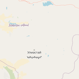
Map view of Tarvagatai Nuruu National Park

Use this park location map to pinpoint Tarvagatai Nuruu National Park in Mongolia, understand its exact geographic position, and read its mapped placement within the surrounding landscape more clearly.

Pigeon | © OpenStreetMap contributors

Location context for Tarvagatai Nuruu National Park

Zavkhan Province
Park atlas

Map the geographic spread of protected areas and comparable mountain landscapes across Mongolia's vast Khangai region.

Discover Related Protected Areas and Mountain Landscapes Beyond Tarvagatai Nuruu National Park

After exploring Tarvagatai Nuruu National Park, expand your geographic understanding by browsing other national parks and protected areas across Mongolia's Khangai Mountains and surrounding regions. Compare diverse mountain landscapes, ecological transition zones, and conservation efforts throughout this part of Northern Asia.
National parkZavkhan Province
About 146 km away#1 closest

West

Ulaagchinii Khar Nuur National Park: Protected National Park in Zavkhan Province

Mapped landscape context and regional geographic setting.

As a dedicated national park, Ulaagchinii Khar Nuur National Park serves as a key protected area within Zavkhan Province. This detail page provides an atlas-oriented view of its mapped boundaries and its role in the regional geography of western Mongolia. Understand the park's specific protected landscape characteristics and its contribution to the mapped natural terrain of the Khangai Mountain region.

Area
2,594 km²
Established
2010
IUCN
II
Relief
Mixed relief
National parkArkhangai Province
About 167 km away#2 closest

East

Khorgo-Terkhiin Tsagaan Nuur National Park: Volcanic Terrain and Lake Geography

A protected highland landscape in Arkhangai Province

Explore the distinct physical geography of Khorgo-Terkhiin Tsagaan Nuur National Park, where the extinct Khorgo volcano borders a vast freshwater lake. This protected area offers a look at the mosaic of birch forest and alpine slopes within the Khangai range. The mapping of this central Mongolian site reveals how volcanic activity and mountain hydrology converge to shape its unique natural horizon.

Relief
Mountain
Climate
Alpine
Scope
Terrestrial
Water
Water-dominated
National parkMongolia
About 173 km away#3 closest

East

Khorgo-Terkhiin Tsagaan Nuur National Park: A Volcanic Landscape and Wetland Atlas

Mapping volcanic terrain and migratory bird habitats in the Khangai Mountains.

This protected area features the dramatic remnants of the Taryatu-Chulutu volcanic field, centered on the extinct Khorgo volcano and the deep waters of Terkhiin Tsagaan Lake. The park provides an essential refuge for avian populations in its western marshlands, contrasting with the surrounding forest steppe. Explore the unique topography and ecological boundaries of this significant Mongolian conservation landscape.

Area
8 km²
Established
1965
IUCN
II
Relief
Mountain
National parkUvs Province
About 254 km away#4 closest

Northwest

Khan-Khokhi Khyargas Mountain National Park: Mapped Boundaries and Protected Landscape

Uvs Province National Park Geography

Khan-Khokhi Khyargas Mountain National Park is a designated national park offering critical insights into Mongolia's protected natural landscapes. This entry supports structured geographic discovery, detailing the park's mapped boundaries and its environmental context within Uvs Province. Engage with the park's identity as a protected area, uncovering its role in the regional atlas and its unique contribution to the mapped terrain.

Area
3,413 km²
Established
2000
IUCN
II
Relief
Mountain
National parkMongolia
About 306 km away#5 closest

East

Khangai Nuruu National Park: Discover Mongolia's Protected Mountain Landscape and Atlas Context

Explore mapped boundaries and diverse ecosystems across its terrain.

Khangai Nuruu National Park stands as a vast national park in central Mongolia, characterized by its diverse protected landscapes and significant geographic scope. Spanning the Khangai Mountains, it presents a remarkable ecological transition from alpine meadows and taiga forests to steppe and riparian environments. This park offers a rich atlas exploration opportunity, highlighting its mapped boundaries and the unique regional geography that defines its protected status, making it a key point of discovery for understanding Mongolian conservation areas.

Area
8,885 km²
Established
1996
IUCN
II
Relief
Mountain
Protected areaUvs Province
About 318 km away#6 closest

West

Airag Lake Protected Area: Geographic Context and Steppe Wetland Mapping

Hydrological features within the Uvs Province regional landscape

Airag Lake serves as a critical freshwater habitat in the Uvs Province of western Mongolia. This detailed overview covers the lake's shallow basin, its seasonal thermal patterns, and the outflow canal connecting it to the broader Great Lakes Depression system, providing an essential look at this unique steppe wetland environment.

Area
143.3 km²
Established
1999
National parkUvs Province
About 327 km away#7 closest

Northwest

Khyargas Lake National Park: Geography and Protected Area Mapping in Western Mongolia

A comprehensive look at saline and freshwater steppe ecosystems.

Khyargas Lake National Park, situated in Uvs Province, offers a rare glimpse into the saline and freshwater lake systems of the Mongolian steppe. This protected area encompasses an endorheic basin characterized by its wide, open shoreline and unique ecological contrast. Use our atlas to analyze the mapped terrain and the expansive, undisturbed wetlands that define this notable region of western Mongolia.

Area
3,328 km²
Established
2000
Relief
Lowland
Climate
Arid
Protected areaBayankhongor Province
About 353 km away#8 closest

Southeast

Valley of the Lakes: Protected Intermontane Basin and Wetland Geography in Mongolia

A vast depression defined by saline lake chains and arid steppe ecosystems.

Stretching between the Khangai and Gobi-Altai mountain systems, the Valley of the Lakes features a complex mosaic of solonchak soils, takir flats, and barchan sand dunes. This protected area is recognized for its internationally significant wetland habitats and its role as a key geographic link in the Central Asian migratory flyway.

Area
456 km²
Established
1998
Relief
Upland
Scope
Terrestrial

Common questions about visiting, size, designation, and location context for Tarvagatai Nuruu National Park

Tarvagatai Nuruu National Park FAQs for park facts, access, geography, and protected area context

Find quick answers about Tarvagatai Nuruu National Park, including protected-area facts, park geography, trail and visitor context, and how the park fits into its surrounding country and regional landscape.
MoriAtlas Explorer

Continue Your Protected Areas Search Across the Global Atlas

Deepen your exploration by continuing the structured search for national parks and protected areas worldwide. Utilize the comprehensive filtering capabilities to compare different conservation landscapes and refine your understanding of global park geography. Discover more about the distribution and characteristics of protected natural areas.

Global natural geography