Why Te Ārai Regional Park stands out
Te Ārai is best known for having the largest sand dune system in the Auckland Region. These dunes shape nearly every aspect of the park's identity, from its sweeping coastal scenery to its ecological importance. The dunes are a regionally significant biodiversity area and connect southward to the Poutakiri Dunes focus area, forming a broader corridor of coastal dune habitat along northern Auckland. Alongside the dunes, Te Ārai is notable for its role in protecting rare species. It supports one of the few remaining breeding populations of the New Zealand fairy tern, and the endangered katipō spider is present among the dune vegetation. This mix of dune landscape and threatened wildlife gives the park a strong conservation identity beyond its appeal as a coastal recreation destination.
Te Ārai Regional Park history and protected-area timeline
The landscape of Te Ārai was already being shaped by human intervention well before it became a public park. During the 1930s, pine trees were planted across the dunes to stabilise shifting sand, and these plantings remain part of the park's character today.
As a formal protected area, the park's history began in 2008, when the Auckland Regional Council purchased an initial 50 hectare block. In 2014, Te Uri-o-Hau gifted land that expanded the park to 250 hectares, embedding iwi involvement directly into the park's growth. A further expansion came through Ngāti Manuhiri vesting 154 hectares of coastal land into the regional park, extending its boundaries southward to the Poutawa Stream.
These additions transformed Te Arāi from a small coastal reserve into a continuous stretch of protected shoreline, while also grounding its management in partnerships with local iwi. The layered growth of the park, from early dune stabilisation planting to modern iwi land contributions, reflects a transition from single-purpose erosion control toward a broader conservation and recreation mandate.
Te Ārai Regional Park landscape and geographic character
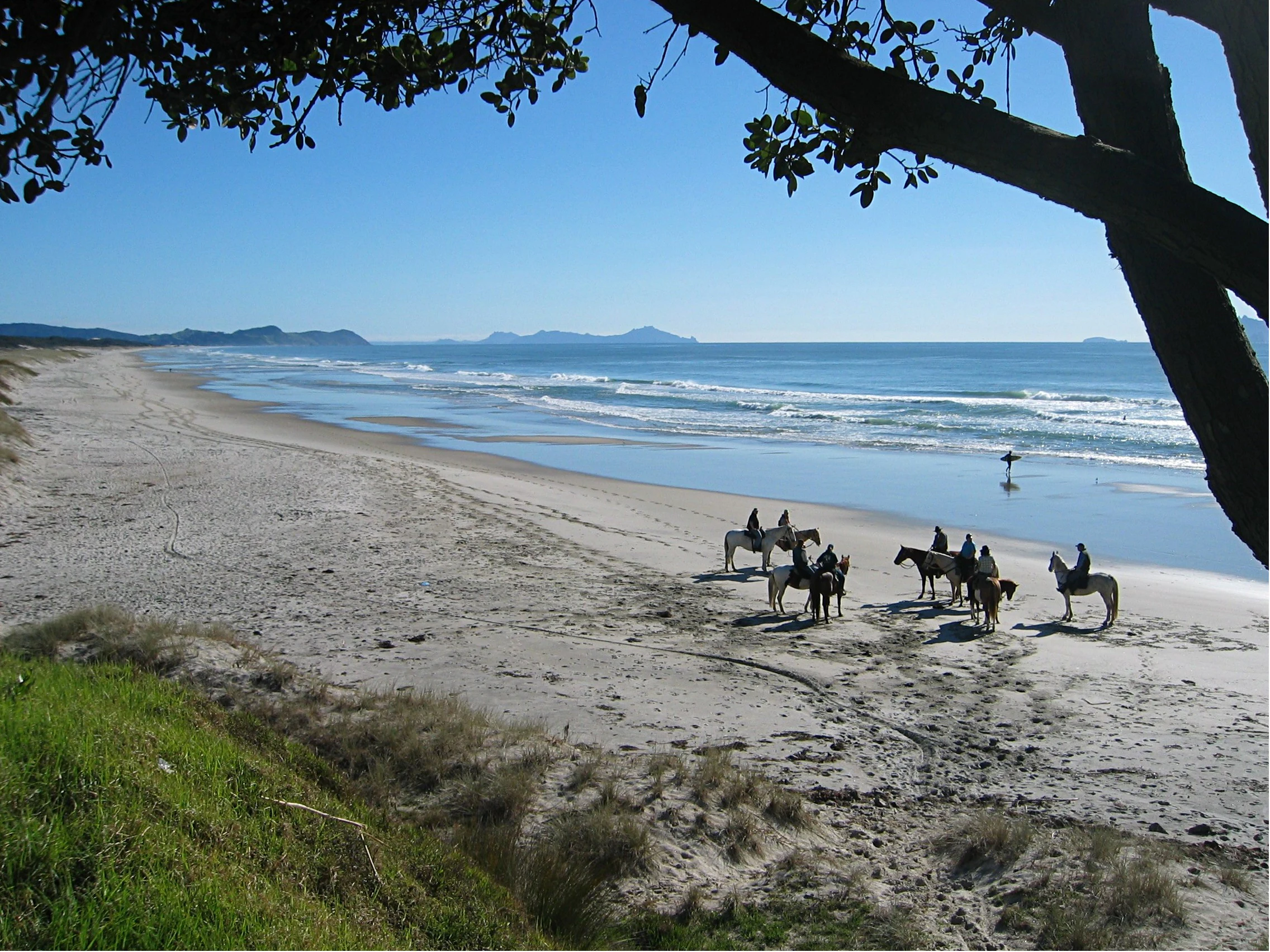
Te Arāi's landscape is shaped above all by sand. The park contains the largest dune system in the Auckland Region, creating a broad coastal environment where dune ridges, beach faces, and intervening flats define much of the terrain. This dune landscape gives the park a wide, open feel, with sweeping sandy surfaces stretching between the surf zone and the inland forest edge.
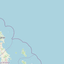
The park extends as a long strip of coastline in Rodney, running from near the most northern point of the Auckland Region southward toward the Poutawa Stream. Inland, the park is bordered by the Mangawhai Forest, creating a clear transition from open dune country to dense planted forest. This boundary adds visual contrast and reinforces the park's identity as a coastal strip defined by its dune interior.
An 85 metre headland, also called Te Arai, rises within the park and provides the most prominent topographic feature in an otherwise flat coastal setting. Headlands like this anchor the dune system and often concentrate both scenery and ecological variability, contributing to the park's distinct profile along this stretch of northern Auckland coast.
Te Ārai Regional Park ecosystems, habitats, and plant life
The natural environment of Te Ārai is anchored by its dune ecosystems. The sand dunes form a regionally significant biodiversity area, recognised not only for their physical extent but also for the specialised habitats they support. Dune systems of this scale are uncommon in the Auckland Region, and their ecological value comes from the unusual combination of salt spray, sandy substrates, and patches of stabilising vegetation.
Te Ārai adjoins the Pākiri Dunes biodiversity focus area to the south, forming a larger connected zone of valued coastal dune habitat. This adjacency increases the regional importance of Te Ārai's dune environment, as it contributes to a wider corridor of similar habitat that supports specialist coastal species.
Vegetation in the park reflects both natural dune processes and historical management. Native dune plants share space with the pine trees planted in the 1930s to stabilise shifting sand, producing a mosaic of native and introduced vegetation across the dune landscape. This mixture continues to influence how the dunes function ecologically, even as the park's conservation role has expanded.
Te Ārai Regional Park wildlife and species highlights
Te Ārai's wildlife significance is closely tied to its status as one of the few remaining breeding areas for the New Zealand fairy tern, one of the country's rarest coastal birds. The presence of an active breeding population gives the park an outsized conservation role relative to its size, and places it among the most important coastal sites in the Auckland Region for this species.
The park also supports populations of the endangered katipō spider among its dunes. The spiders present in Te Ārai are typically black in colour and lack the distinctive red markings more commonly associated with katipō elsewhere. This colour variation makes local populations harder to recognise visually, but it does not diminish the conservation significance of their presence in the dune habitat.
Together, the fairy tern breeding population and the katipō spider presence define Te Ārai's wildlife identity. Both species depend on the specific conditions of the dune system, reinforcing the strong link between the park's landscape and its conservation value.
Te Ārai Regional Park conservation status and protection priorities
Te Ārai holds clear conservation importance at both regional and species-specific levels. Its dune system is formally recognised as a regionally significant biodiversity area, an acknowledgement usually reserved for habitats that make an outsized contribution to the ecological character of the Auckland Region.
The park's role in protecting the New Zealand fairy tern is one of its most distinctive conservation functions. As one of the few remaining breeding areas for this highly threatened species, Te Ārai contributes directly to the survival prospects of a bird that exists in very small numbers nationally. The endangered katipō spider adds a second layer of threatened species value, with local populations occupying the dune habitats that define the park.
The park's conservation profile has been built progressively through land additions. Initial Auckland Regional Council purchase, Te Uri-o-Hau's 2014 gifting of land, and Ngāti Manuhiri's vesting of 154 hectares of coastal land together broadened both the area and the ecological coherence of the reserve. These expansions, alongside the original dune stabilisation plantings from the 1930s, illustrate a conservation history that blends long-term habitat management with culturally grounded land contributions.
Te Ārai Regional Park cultural meaning and human context
The development of Te Ārai as a regional park is closely tied to the iwi of the northern Auckland coast. In 2014, Te Uri-o-Hau gifted land that grew the park to 250 hectares, and later Ngāti Manuhiri vested 154 hectares of coastal land into the park, extending its boundaries south to the Poutawa Stream.
These iwi contributions mean that the park is not just an inherited reserve but an actively shaped partnership between Auckland Council and mana whenua. The continued presence of Te Ārai's Māori place name within the park's official identity reflects this cultural grounding, and the layered iwi involvement gives the park a distinctive origin story compared with purely council-acquired reserves.
Top sights and standout views in Te Ārai Regional Park
Te Ārai's strongest highlights sit at the intersection of dune landscape, threatened species, and coastal recreation. The park contains the largest dune system in the Auckland Region, paired with the 85 metre Te Arai headland, giving it one of the most visually striking northern coastlines in the area. Its role as a breeding ground for the New Zealand fairy tern and a home for the endangered katipō spider adds a meaningful conservation dimension that distinguishes it from purely scenic coastal parks.
Best time to visit Te Ārai Regional Park
Te Ārai's character shifts with the seasons in ways typical of exposed northern Auckland coastline. Summer brings warmer sea surface conditions and longer days, making the surf beaches and open dune landscape most accessible for beach-going and walking. Winter tends to bring stronger surf and more variable weather, which can reshape the dunes and intensify coastal scenery while making some exposed areas less comfortable for casual visitors.
Wildlife viewing and dune scenery remain part of the experience year round, and the presence of breeding fairy terns means that bird-focused visits benefit from careful seasonal timing aligned to known nesting periods. For general coastal scenery, surf watching, and walking sections of the Te Araroa trail through the park, late spring through early autumn tends to offer the most settled conditions, while winter brings the most dynamic surf and dune weather.