

Mori Atlas logo
Nature reserveThe Dutchmans Stern Conservation Park

Discover the rugged ridgelines, eucalypt woodlands, and dramatic topography of this South Australian nature reserve.

The Dutchmans Stern Conservation Park: A Protected Landscape in the Southern Flinders Ranges

The Dutchmans Stern Conservation Park covers 3,695 hectares of rugged, elevated ridgelines and foothills in the southern Flinders Ranges of South Australia. Anchored by the prominent peak of The Dutchmans Stern, this protected area preserves a vital transition zone where diverse eucalypt woodland communities and wildlife reach their northernmost range limits. The park serves as a significant natural refuge, contrasting sharply with the surrounding pastoral landscape through its complex mosaic of rocky crests, deep gullies, and seasonal watercourses.

flinders rangesridge landscapesconservation parkeucalypt woodlanddry sclerophyllwildlife refuge
A flat-style graphic illustration showing a high rocky mesa in the distance, a waterfall flowing over a cliff face, a river winding through the foreground, and lush trees, all rendered in a soft, muted pastel color palette.

The Dutchmans Stern Conservation Park

Nature reserve

Park overview

Structured park overview, official facts, and landscape profile for The Dutchmans Stern Conservation Park

The Dutchmans Stern Conservation Park park facts, protected area profile, and essential visitor context

Review the core facts for The Dutchmans Stern Conservation Park, including designation, size, terrain, visitor scale, habitats, and operating context in one park-focused overview.

About The Dutchmans Stern Conservation Park

The Dutchmans Stern Conservation Park is a compact but ecologically rich protected area in South Australia's Flinders Ranges, anchored by the mountain from which it takes its name. It lies only a few kilometres from the historic town of Quorn and a short drive north-east of Port Augusta, placing it at the edge of the populated and agricultural corridor that connects the Spencer Gulf to the inland ranges. Despite its modest total area of 3,695 hectares, the park encompasses a complete cross-section of elevation and aspect, from the high rocky crests of The Dutchmans Stern ridge down to seasonally damp foothills and watercourses below.

What makes the park especially significant is the way it preserves a transition between the more typical arid landscapes of the region and the moister, more wooded Flinders Ranges environments found further south. The higher crests support the most northerly occurrence of South Australian inland blue gum woodland along middle and lower slopes, alongside grey box communities in the easterly sections near Pichi Richi Pass. Seasonally damp foothill gullies host large river red gums, while the higher southerly facing ridges carry sugar gum, northern cypress pine, and sheoak in open woodland formations, again at the northern limit of their distribution.

The park was established specifically to protect this combination of geological features, scenic values, and native flora and fauna, recognising that long-surrounding pastoral use had reduced the natural cover across much of the neighbouring country. As an IUCN Category VI protected area, it permits a measure of sustainable use compatible with conservation, while still providing a refuge for species that do not range further north. This blend of compact scale, dramatic topography, and range-edge ecology gives the park a distinctive character within the network of South Australian conservation reserves.

Quick facts and research context for The Dutchmans Stern Conservation Park

The Dutchmans Stern Conservation Park is located in the Flinders Ranges of South Australia, north-west of Quorn and north-east of Port Augusta. It covers 3,695 hectares and protects a ridge exceeding 850 metres in elevation, including the range's namesake mountain at its northern end.

Proclaimed on 17 September 1987 under the National Parks and Wildlife Act 1972 and managed by the Department for Environment and Water, the park is classified as an IUCN Category VI protected area. It safeguards a notable transition zone of eucalypt woodland, with several species reaching their most northerly occurrence in South Australia within its ridges and foothills.

Protection and recognition

Documented terrestrial protection status, management scope, and international recognition facts

The Dutchmans Stern Conservation Park Protection Status and Recognition

Terrestrial protection status, management scope, and designated recognition details for The Dutchmans Stern Conservation Park provide clear oversight. Conservation data highlights the documented framework governing this protected area without implying unverified international listings.

Protection details

Protection scope
Terrestrial
Transboundary protection
No
Park context

Deeper park guide and search-rich context for The Dutchmans Stern Conservation Park

The Dutchmans Stern Conservation Park history, landscape, wildlife, and travel context

Explore The Dutchmans Stern Conservation Park through its history, landscape character, ecosystems, wildlife, conservation priorities, cultural context, and seasonal travel timing in a structured park guide built for atlas discovery and search intent.

Why The Dutchmans Stern Conservation Park stands out

The Dutchmans Stern Conservation Park is best known for its dramatic ridgeline scenery in the southern Flinders Ranges, centred on the prominent peak of The Dutchmans Stern. The ridge and its surrounding foothills support an unusually concentrated meeting point of eucalypt woodland communities, including the most northerly occurrence of South Australian inland blue gum in the area. It is also recognised for harbouring wildlife and plant species at their northern range limit in South Australia. Lace goannas, kookaburras, sugar gums, and grey box woodland communities all reach the edge of their regional distribution here, giving the park an outsized ecological importance relative to its modest size.
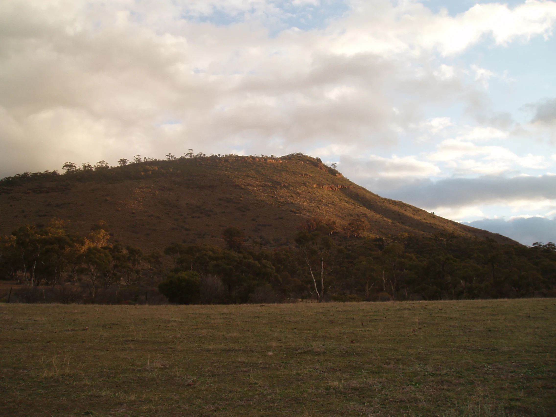
A low-angle view of a rounded, brown, sunlit hill rising above a dry, grassy field under a cloudy sky.
The summit of The Dutchmans Stern in the Flinders Ranges, South Australia.

The Dutchmans Stern Conservation Park history and protected-area timeline

The Dutchmans Stern Conservation Park was proclaimed on 17 September 1987 under the National Parks and Wildlife Act 1972. Its establishment was driven by the need to protect the park's geological features, scenic qualities, and native flora and fauna, with the diversity of landforms and habitats identified as a key factor in its conservation value, particularly given that surrounding land had been used for grazing for more than a century.

The land had been held under pastoral lease from the 1880s until it was acquired for conservation purposes in 1985, only two years before the formal proclamation of the park. In addition to grazing history, parts of the area had been developed as a water catchment. On the eastern side, Stoney Creek had been diverted into an engineered channel feeding the Mount Arden dam to supplement the Quorn water supply, while on the western side runoff drained into South Creek and was piped to properties further west.

During the 1960s, mineral exploration activity also shaped parts of the landscape, with works including the construction of the Dutchman Valley track on the western side of what would later become the conservation park. By the late twentieth century, the area was recognised as the traditional country of the Nukunu Aboriginal people, with possible overlapping interests from the Adnyamathanha to the north and the Parnkalla to the west, reflecting the broader Indigenous heritage of the Flinders Ranges region surrounding the park.

The Dutchmans Stern Conservation Park landscape and geographic character

The dominant feature of the park is a single elongated ridge that rises above 850 metres, with The Dutchmans Stern itself anchoring the northern end of the range. The conservation park wraps around the western, northern, and eastern sides of this ridge, capturing a horseshoe of slopes and foothills beneath the high crest line. From the ridgeline, the land falls away into a mosaic of foot­hill slopes, seasonal gullies, watercourse lines, and lower open country that contrasts strongly with the surrounding pastoral plains.

To the east, the park meets the dramatic topography of Pichi Richi Pass, while to the west and north the slopes descend more gradually toward creek lines and run-on zones that drain into the broader Quorn and Port Augusta catchments. The combination of high exposed crests, shaded southerly ridges, sheltered gullies, and exposed limestone westerly faces creates a varied topographic mosaic within a relatively small area. Walkers crossing the ridge encounter steep rocky climbs, panoramic summit views down to the Spencer Gulf, and quieter wooded slopes where the landscape transitions from open rocky terrain to denser eucalypt canopy.
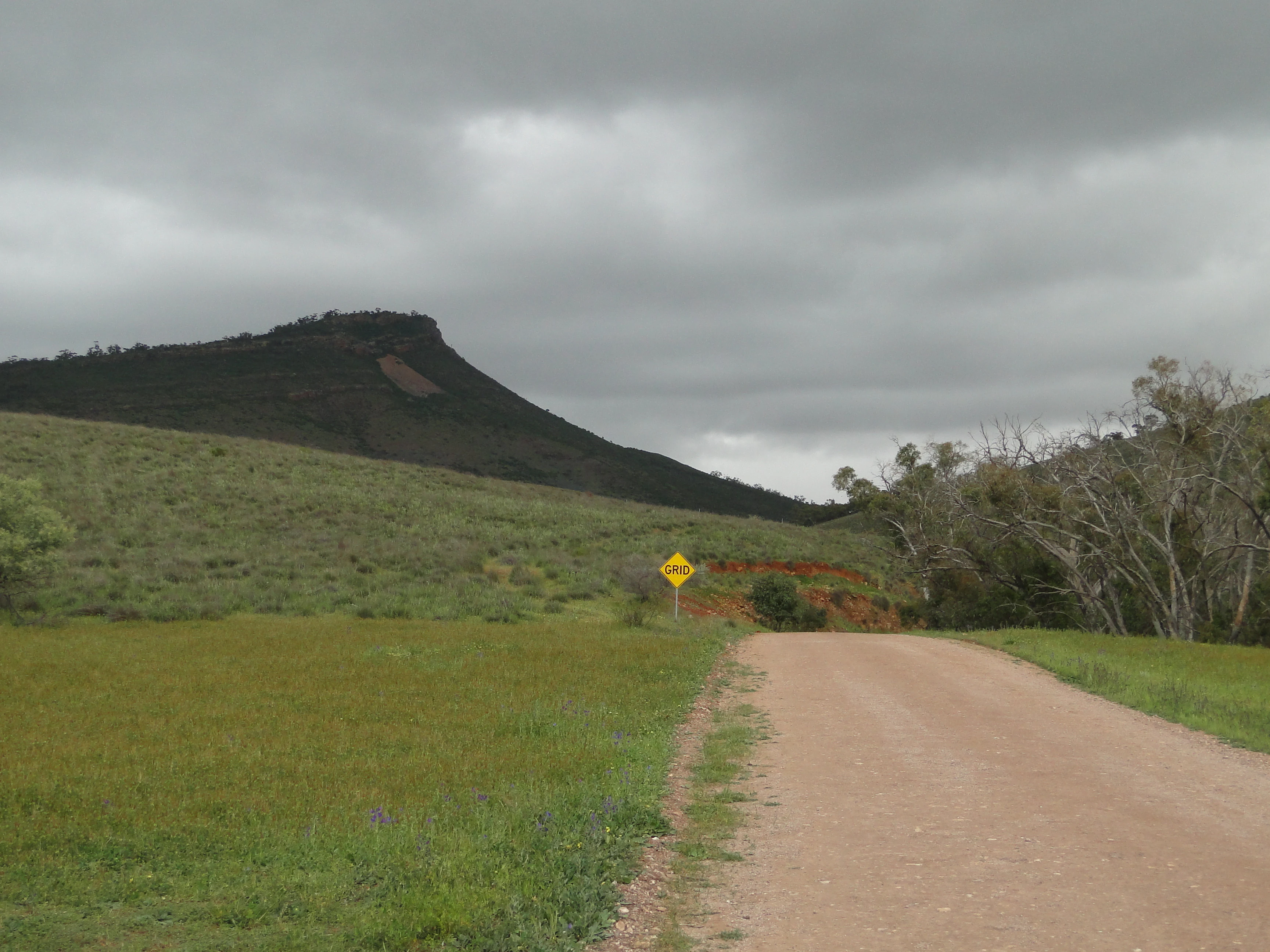
A dirt track leads through a grassy field toward a dark, rocky ridgeline under an overcast sky, with a yellow road sign visible in the midground.
A dirt road leading toward the prominent ridge of The Dutchmans Stern under a cloudy sky.

The Dutchmans Stern Conservation Park ecosystems, habitats, and plant life

The Dutchmans Stern Conservation Park protects an unusually diverse set of vegetation communities for its size, because the varied topography concentrates several very different woodland types within close range of one another. Moist southerly facing ridges carry sugar gum woodland, one of the few forest-forming eucalypts in the region, growing alongside northern cypress pine and sheoak.

Higher crests and middle slopes support the most northerly South Australian occurrence of Eucalyptus leucoxylon pruinosa, the inland form of the SA blue gum, while easterly sections near Pichi Richi Pass carry stands of grey box woodland. Lower, drier westerly facing ridges and limestone outcrops support red and green mallee shrublands, and seasonally damp foothill gullies host large river red gums. Eastern foothills are clothed in quorn wattle and quorn box woodland, completing a vegetation gradient that reflects the park's elevation, aspect, and moisture variability in unusual detail.

The Dutchmans Stern Conservation Park wildlife and species highlights

The Dutchmans Stern Conservation Park is noted less for sheer species richness than for its role as a northern limit refuge for several widely recognised species. Lace goannas and kookaburras are both recorded here at or near the edge of their range, with the conservation park's ridge system providing one of the last reliable habitats for these species before the landscape becomes too arid further north.

This pattern extends across other woodland fauna associated with the eucalypt communities the park protects. The presence of sugar gum, inland blue gum, and grey box woodlands creates layered habitat structure attractive to a range of birds, reptiles, and arboreal mammals typical of the southern Flinders Ranges. As surrounding pastoral land has been heavily modified over more than a century, the park functions as an important stepping stone for wildlife moving between the moister ranges further south and the drier country beyond the park's northern and western edges.

The Dutchmans Stern Conservation Park conservation status and protection priorities

The park's conservation significance lies primarily in the contrast it provides with the heavily grazed land that surrounds it. Proclamation in 1987 followed a century of pastoral use that had removed much of the natural vegetation cover across the wider district. By protecting a complete ridge and its surrounding foothills, the park safeguards a representative example of the original vegetation communities and geological structure of the southern Flinders Ranges edge.

Its classification as an IUCN Category VI protected area reflects a balance between conservation and sustainable use, allowing limited activities compatible with the protection of geological features, scenic values, and native flora and fauna. The presence of several species and vegetation communities at their most northerly occurrence in South Australia gives the park a particular role in conserving range-edge populations that are vulnerable to further climatic and land-use change in the surrounding region.

The Dutchmans Stern Conservation Park cultural meaning and human context

The landscape of the Dutchmans Stern Conservation Park lies within the traditional country of the Nukunu Aboriginal people, who are recognised as the traditional owners of the area. There is also a possibility of overlapping cultural interests with the Adnyamathanha people to the north and the Parnkalla people to the west, reflecting the broader Indigenous heritage of the Flinders Ranges.

European land use of the area began in the 1880s with pastoral leases, followed by later mineral exploration in the 1960s and the development of water catchment infrastructure tied to the town of Quorn. The transformation of the former pastoral and water catchment country into a conservation park in 1987 marks an important shift in the area's human history, moving it from a working landscape shaped primarily by grazing and water supply into one managed for ecological, scenic, and cultural values.

Top sights and standout views in The Dutchmans Stern Conservation Park

The park's main highlight is the ridgeline walk to The Dutchmans Stern summit, which rewards visitors with panoramic views over the Spencer Gulf and surrounding Flinders Ranges country. Equally notable is the chance to walk through vegetation communities that reach their northern limit within the park, from inland blue gum and sugar gum woodland on the ridges to river red gum-lined gullies below.

The network of three short hiking trails, anchored by the Dutchmans Valley Hike and the Dutchmans Stern Hike, makes these contrasting landscapes highly accessible from a single entrance carpark. The passage of the long-distance Heysen Trail along the same ridgeline adds further importance, placing the park firmly on the itinerary of walkers exploring the broader Flinders Ranges.

Best time to visit The Dutchmans Stern Conservation Park

The Dutchmans Stern Conservation Park is best experienced in the cooler and milder months of the South Australian calendar, when temperatures in the Flinders Ranges foothills are more comfortable for walking the exposed ridgeline trails. Spring brings fresh conditions in the woodlands and a more active bird presence, while autumn offers stable weather and softer light over the surrounding pastoral country.

Camping is permitted on the western side of the park only outside the Fire Danger Season, which runs from April through November, meaning that visits during the cooler half of the year align naturally with low-impact camping opportunities. Visitors planning ridge-top walks should also consider that southerly facing slopes remain shadier and retain more moisture, while the exposed higher crests can be significantly windier and harsher than the sheltered gullies below at any time of year.
Monthly climate preview

Long-term monthly temperature averages and precipitation records for South Australia

The Dutchmans Stern Conservation Park Climate Normals and Temperature Rhythms

The Dutchmans Stern Conservation Park exhibits measured long-term temperature swings alongside steady baseline precipitation across representative coordinates. Examining the complete twelve-month statistical profile clarifies the full annual climate rhythm and monthly weather variations.
Annual mean18 °C
9 °C26 °C
Jan26°
Feb26°
Mar22°
Apr18°
May13°
Jun10°
Jul
Aug11°
Sep14°
Oct17°
Nov21°
Dec24°
Warmest month
January

26.1 °C

Coolest month
July

9.3 °C

Wettest month
June

1 mm/day

Driest month
March

0.4 mm/day

Park location guide

Geography guide, regional context, and park location map for The Dutchmans Stern Conservation Park

The Dutchmans Stern Conservation Park park geography, regions, and map view in Australia

Understand where The Dutchmans Stern Conservation Park sits in Australia through a broader geographic reading of the surrounding landscape, nearby location context, and its mapped position within the national park landscape.

How The Dutchmans Stern Conservation Park fits into Australia

Australia is a constitutional monarchy and federal parliamentary democracy comprising six states and ten territories. With a population of nearly 28 million, it is one of the world's most urbanised countries, with most people concentrated on the eastern seaboard. The country has a high Human Development Index and is known for its cultural diversity, ancient Aboriginal heritage, and unique wildlife.

Wider geography shaping The Dutchmans Stern Conservation Park in Australia

Australia occupies the entire Australian continent, the island of Tasmania, and numerous smaller islands. It is the world's flattest and driest inhabited continent, featuring vast deserts in the interior (the Outback), tropical rainforests along the eastern coast, and a coastline bordering the Indian and Pacific Oceans.

Map view of The Dutchmans Stern Conservation Park

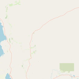
Use this park location map to pinpoint The Dutchmans Stern Conservation Park in Australia, understand its exact geographic position, and read its mapped placement within the surrounding landscape more clearly.

Pigeon | © OpenStreetMap contributors

Location context for The Dutchmans Stern Conservation Park

South Australia

Visual exploration of ridge terrain, eucalypt woodlands, and protected habitats in South Australia

The Dutchmans Stern Conservation Park Photos, Scenery, and Landscapes

Visual documentation provides a clear look at the dramatic ridgeline scenery, steep rocky crests, and sheltered eucalypt gullies defining the protected environment. Reviewing these landscape photographs helps reveal the topographic diversity and ecological character of the southern Flinders Ranges.

A low-angle view of a rounded, brown, sunlit hill rising above a dry, grassy field under a cloudy sky.

A dirt access road leading into The Dutchmans Stern Conservation Park, marked by a green sign and a metal gate structure with a corrugated water tank overhead.

A dirt track leads through a grassy field toward a dark, rocky ridgeline under an overcast sky, with a yellow road sign visible in the midground.

Park atlas

Compare adjacent protected areas and surrounding regional ridge landscapes

Explore Other Parks Near The Dutchmans Stern Conservation Park

Browse nearby national parks and protected areas sharing the rugged terrain of the southern Flinders Ranges. Expanding your search reveals connected conservation landscapes and regional wilderness reserves across South Australia.
Nature reserveSouth Australia
About 32 km away#1 closest

North

Buckaringa Sanctuary: Geographic Atlas and Protected Landscape Overview

Nature reserve terrain in the southern Flinders Ranges

Buckaringa Sanctuary serves as a key case study in arid landscape conservation within South Australia. This entry examines the reserve's unique geological features, including the deeply incised gorges and rocky ridges that define the Flinders Ranges. Through a focus on mapped boundaries and regional ecology, the content provides a clear understanding of the sanctuary's position in the Australian landscape, highlighting its role as a protected refuge of sandstone formations and native scrubland.

Area
20 km²
Established
1990
Relief
Mountain
Climate
Arid
National parkSouth Australia
About 44 km away#2 closest

South

Mount Remarkable National Park: Protected Landscape Atlas and South Australia Geography

Explore mapped boundaries and natural terrain.

Mount Remarkable National Park serves as a vital protected area within South Australia's unique geographic setting. This MoriAtlas entry details the park's mapped boundaries and surrounding natural terrain, providing structured insight into its landscape character and regional geographic importance. Understand the park as a key element of Australia's protected lands atlas.

Area
166.18 km²
Established
1972
IUCN
VI
Visitors
50K annual
National parkSouth Australia
About 45 km away#3 closest

North

Lake Torrens National Park: Explore South Australia's Remarkable Inland Salt Lake Geography

A unique protected landscape of arid plains and expansive salt flats.

Lake Torrens National Park offers an unparalleled exploration of Australia's remote outback, centered around a vast, ancient salt lake basin. This national park in South Australia provides a canvas of stark, minimalist terrain, featuring shimmering saltpans, arid gibber plains, and rocky outcrops. Understand the park's unique geographic identity, its ecological significance as a temporary wetland habitat, and its dramatic visual appeal for landscape photography and geological interest. It is a key protected area showcasing the extreme environment of Australia's interior.

Area
5,676.68 km²
Established
1991
IUCN
VI
Relief
Lowland
National parkSouth Australia
About 81 km away#4 closest

South

Wapma Thura, Southern Flinders Ranges National Park: South Australia's Protected Natural Landscape

Explore mapped boundaries and regional geography.

Wapma Thura, Southern Flinders Ranges National Park offers a distinct protected landscape within South Australia. This page serves as a portal for understanding its geographic setting, its role as a national park, and its place within the state's atlas of natural areas. Examine the mapped terrain and protected boundaries to grasp the park's unique geographic characteristics.

Established
2021
IUCN
II
Relief
Mountain
Scope
Terrestrial
Nature reserveSouth Australia
About 91 km away#5 closest

Southeast

Black Rock Conservation Park: Protected Woodlands and Regional Geography in South Australia

Mapping ecological boundaries and outwash plain terrain

Black Rock Conservation Park provides a protected glimpse into the mid-north South Australian environment. This 119 hectare nature reserve preserves low woodland and chenopod understorey, serving as a significant bird habitat characterized by steep creek banks and outwash slopes originating from the surrounding rocky high points.

Area
1.19 km²
Established
1972
IUCN
III
Relief
Lowland
National parkAustralia
About 123 km away#6 closest

Northeast

Ikara-Flinders Ranges National Park: Mapped Boundaries and Regional Geography

Australia's protected landscape and national park terrain.

Investigate the geographic characteristics and protected-area identity of Ikara-Flinders Ranges National Park. This entry highlights its mapped boundaries and landscape context, offering a foundational understanding of this Australian national park for atlas-based discovery. Users can explore the natural terrain and regional setting that define Ikara-Flinders Ranges National Park.

National parkSouth Australia
About 130 km away#7 closest

North

Nilpena Ediacara National Park: South Australia National Park and Protected Landscape Identity

Mapped protected area within the regional geography of South Australia.

Nilpena Ediacara National Park represents a significant protected landscape within South Australia. This entry provides a detailed geographic context for the park, focusing on its role as a national park and its mapped boundaries. Delve into the specific atlas-driven understanding of this protected area, its landscape context, and its significance within the broader geographic framework of the Australian state.

Area
606.17 km²
Established
2021
IUCN
VI
Relief
Mountain
Natural monumentSouth Australia
About 130 km away#8 closest

South

Clements Gap Conservation Park: A South Australian Natural Monument and Cultural Landscape

Mapping bushland corridors and historic heritage in the Mid North region.

Clements Gap Conservation Park occupies a 7.9 square kilometre footprint, offering a glimpse into the natural terrain of the Mid North region. The area functions as a protected monument that preserves native bushland alongside the built traces of a historic township, showcasing the layered human and environmental geography characteristic of the Spencer Gulf hinterland.

Area
7.9 km²
Established
1963
IUCN
III
Relief
Upland

Common questions about visiting, size, designation, and location context for The Dutchmans Stern Conservation Park

The Dutchmans Stern Conservation Park FAQs for park facts, access, geography, and protected area context

Find quick answers about The Dutchmans Stern Conservation Park, including protected-area facts, park geography, trail and visitor context, and how the park fits into its surrounding country and regional landscape.
MoriAtlas Explorer

Continue Your Protected Areas Search Across the Global Atlas

Deepen your exploration by continuing the structured search for national parks and protected areas worldwide. Utilize the comprehensive filtering capabilities to compare different conservation landscapes and refine your understanding of global park geography. Discover more about the distribution and characteristics of protected natural areas.

Global natural geography