
Cliffs
Park geography
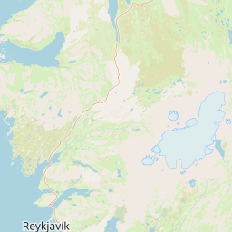
Mapped boundaries, terrain relief, and regional landscape context in the Southern Region
Comprehensive Geographic and Environmental Profile of Þingvellir National Park
Examine the detailed geographic configuration of Þingvellir National Park within the Southern Region. This profile presents the 92.7 km² protected area, featuring lowland terrain, temperate forest and grassland habitats, and specific natural landmarks including waterfalls, cliffs, and peaks.
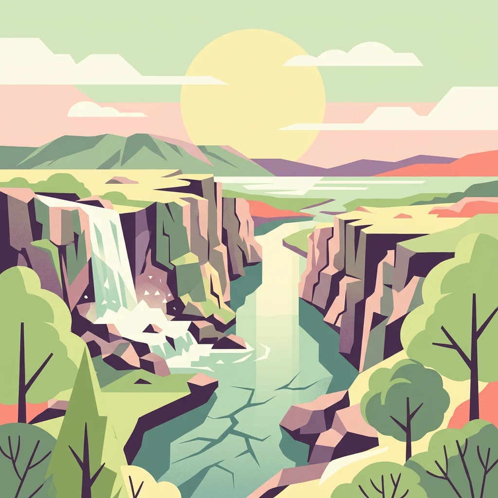
Iceland's ancient parliament site on the Mid-Atlantic Ridge
Þingvellir National Park
Þingvellir National Park is a place of profound historical and geological significance in southwestern Iceland, situated approximately 40 kilometers northeast of Reykjavík within the municipality of Bláskógabyggð. The park occupies a dramatic rift valley that marks the visible boundary between the North American and Eurasian tectonic plates, making it one of the few places on Earth where continental drift can be observed directly at the surface. This extraordinary geological setting, characterized by deep fissures, scarps, and volcanic formations, creates a landscape of stark beauty that has drawn visitors for centuries. The park's cultural significance is equally remarkable. Þingvellir was the site of the Althing, Iceland's national parliament, from its founding in 930 until the final assembly session was held there in 1798—making it one of the oldest parliamentary sites in the world. The Law Rock (Lögberg) served as the focal point where chieftains and citizens gathered to debate laws, settle disputes, and conduct the business of the emerging Icelandic nation. This 868-year period of continuous parliamentary activity at Þingvellir laid the foundation for Icelandic national identity and political tradition. Established as Iceland's first national park in 1930 to commemorate the thousandth anniversary of the Althing, Þingvellir was designated a UNESCO World Heritage Site in 2004 in recognition of its outstanding universal value as a cultural landscape. The park encompasses the historic assembly grounds, the beautiful Þingvallavatn lake—the largest natural lake in Iceland—and the remarkable geological features of the rift valley.
- Location
- Iceland
- Park type
- National park
- Established
- 1930
- Area
- 92.7 km²
Location overview
Analyzing regional placement within the Southern Region of Malawi
Geographic Positioning of Þingvellir National Park in Malawi
Located in the Southern Region of Malawi, Þingvellir National Park occupies a defined inland terrestrial territory. Official records confirm the landlocked designation as a non-transboundary and entirely terrestrial reserve.
- Countries
- Iceland, Malawi
- Regions
- Southern Region
- Primary location
- Southern Region
- Geographic setting
- Inland
Boundary and coordinates
Analyzed geographic area and mapped park perimeter coordinates
Þingvellir National Park Boundary Map and Spatial Extent
Mapped boundary geometry provides clear spatial context for the protected landscape. Derived measurements outline total geographic area and coordinate spans without survey precision.
- Boundary area
- 227.9 km²
- Boundary perimeter
- 65.6 km
- Northernmost point
- 64.3582° N
- Southernmost point
- 64.1972° N
- Easternmost point
- 20.8949° W
- Westernmost point
- 21.2901° W
- Geographic centre
- 64.2853° N, 21.0742° W
- North–south span
- 18 km
- East–west span
- 19.1 km
Terrain and natural features
Catalog of lowland relief classifications and recorded landscape features
Þingvellir National Park Terrain and Named Natural Features
Recorded terrain classifications indicate lowland relief across the protected landscape. Linked feature cards document specific natural landforms located within the park boundaries.
Selected named natural features
Cliffs
Hvannagjá
Cliffs
Nikulásargjá
Rock formations
Nónþúfa
Cliffs
Klofningur
Lakes
Thingvallavatn
Environmental setting
Subpolar lowland terrain featuring valleys, rivers, and sparse forest cover
Þingvellir National Park Environmental Classification and Physical Setting
Recorded landscape features and habitat types provide interpretive categories for reading the physical setting of Þingvellir National Park. Stored classifications connect recorded environmental markers to relevant atlas destinations across the protected area.
- Relief
- Lowland
- Climate
- Subpolar
- Water
- Minor water
- Forest cover
- Sparse forest
- Seasonality
- Year-round
Landscape features
Valleys · Rivers · Lakes · Waterfalls · Cliffs
Habitat types
Temperate broadleaf forest · Grassland
Park atlas
Extend your exploration of Icelandic protected areas, mapping their unique geological formations and historical landscapes beyond Þingvellir.
Compare National Parks and Protected Areas Adjacent to Þingvellir National Park's Rift Valley
Continue your park discovery from Þingvellir National Park by browsing other national parks and protected areas within Iceland, exploring their diverse geological formations and significant historical landscapes. Comparing these protected geographies provides crucial context for understanding Iceland's unique conservation efforts, tracing the regional spread of tectonic activity, and appreciating its rich heritage.
Natural monumentIceland
About 87 km away#1 closest
Northeast

Hveravellir Natural Monument: Geothermal Plateau Geography and Highland Protected Areas
Central Iceland geothermal field and volcanic plateau
Located on the Kjölur route, Hveravellir serves as a protected natural monument characterized by high-temperature geothermal activity. The area features a concentration of fumaroles, geysers, and mineral-rich springs set upon a stark volcanic plateau. This site offers significant insights into the geological processes shaping the central highlands of Iceland, blending ancient lava fields with active thermal surface transformations.
- Area
- 2.5 km²
- Relief
- Highland
- Climate
- Subpolar
- Access
- Moderate access
Nature reserveIceland
About 101 km away#2 closest
South
Surtsey Nature Reserve: Mapping Volcanic Landscapes and Ecological Succession in Iceland
A pristine laboratory of North Atlantic volcanic terrain.
Surtsey represents a rare geological event, a volcanic island created by sustained eruptions and now protected as a strict nature reserve. The island acts as a primary research site for observing how life colonizes barren volcanic substrates, from mosses and insects to seabird colonies. Its mapped boundaries encompass dramatic basaltic lava flows and tephra deposits, providing a vital window into the formative processes of oceanic islands.
- Area
- 1.4 km²
- Established
- 1963
- Relief
- Upland
- Climate
- Subpolar
National parkIceland
103 km away#3 closest
East
Vatnajökull National Park: Iceland's Expansive Protected Glacier and Volcanic Terrain
Mapped boundaries of a UNESCO World Heritage site dynamic with fire and ice.
Vatnajökull National Park offers a profound exploration of one of Earth's most dynamic natural environments. This Icelandic national park protects the vast Vatnajökull ice cap, a landscape shaped by active volcanoes and powerful glacial forces, creating a region of extraordinary geographic diversity. Discover the mapped terrain, from subglacial mountain ranges to dramatic caldera systems, and understand the unique protected area context of this significant European natural heritage.
- Area
- 14,967 km²
- Established
- 2008
- IUCN
- II
- Relief
- Mountain
National parkIceland
About 131 km away#4 closest
Northwest
Snæfellsjökull National Park: Volcanic Stratovolcano and Coastal Protected Area in Iceland
Mapped geologic features, glacier terrain, and coastal volcanic landmarks.
Snæfellsjökull National Park features a unique assembly of volcanic landforms, including the iconic glacier-capped stratovolcano, the towering Lóndrangar basalt pinnacles, and symmetrical craters like Saxhóll. This protected area offers deep insights into the glacial and submarine origins of western Iceland through its diverse palagonite ridges and extensive lava plains.
- Area
- 170 km²
- Established
- 2001
- Relief
- Mountain
- Scope
- Terrestrial
National parkIceland
About 131 km away#5 closest
Northwest
Snæfellsjökull National Park: Geography and Protected Landscapes of Western Iceland
Glacial volcanoes, lava fields, and coastal topography.
Snæfellsjökull National Park sits at the western tip of the Snæfellsnes peninsula, creating a unique intersection of glacial, volcanic, and maritime environments. This database provides structured insights into the park's rugged terrain, including its moss-covered lava fields, sea-carved cliffs, and the namesake glacier that dominates the local landscape.
- Established
- 2001
- IUCN
- II
National parkIceland
About 136 km away#6 closest
Northwest
Snæfellsjökull National Park: An Atlas of Volcanic Terrain and Protected Icelandic Coastlines
Volcanic peaks and coastal ecosystems of the Snæfellsnes Peninsula.
Snæfellsjökull National Park stands as a defining protected landscape in western Iceland. Defined by its central glacier-crowned stratovolcano, the park territory maps out a complex transition from high-altitude volcanic basalt and lava fields to sheltered bays and dramatic seaside cliffs. This geographic record explores the intersection of glacial ice, maritime habitats, and the volcanic belt that shapes the outer edge of the Snæfellsnes Peninsula.
- Relief
- Mountain
- Climate
- Subpolar
- Scope
- Mixed
- Water
- Major water bodies
National parkIceland
About 193 km away#7 closest
East
Skaftafell National Park: Iceland's Accessible Protected Landscape with Glacial Terrain and Basalt Columns
Discover glacial landscapes and volcanic geology.
Skaftafell National Park is a vital protected area in Southeast Iceland, offering a unique atlas-level view of dramatic glacial landscapes. Located at the base of Vatnajökull, Europe's largest glacier, the park features accessible hiking trails that traverse outwash plains, birch woodlands, and glacial tongues like Skaftafellsjökull. Explore the iconic Svartifoss waterfall, framed by striking basalt columns, and understand the park's dynamic terrain shaped by volcanic activity and glacial processes, providing rich geographic context for protected landscape discovery.
- Established
- 1967
- IUCN
- II
- Scope
- Terrestrial
Nature reserveIceland
About 232 km away#8 closest
Northeast
Mývatn Nature Reserve: Mapping the Volcanic Lakes and Tephra Formations of Northern Iceland
Protected wetland landscapes and volcanic rift zone geography.
Mývatn represents a complex of protected wetlands and volcanic landforms, including the Hverfjall explosion crater and the Skútustaðir pseudocraters. This geography-rich basin in northern Iceland offers insight into post-glacial volcanic activity and serves as an internationally significant breeding site for diverse bird populations within a compact, walkable terrain.
- Area
- 37 km²
- Relief
- Upland
- Climate
- Polar
- Access
- Easy access
MoriAtlas Explorer
Continue Exploring Þingvellir National Park's Unique Geographic and Historical Atlas
Delve deeper into the mapped context of Þingvellir National Park, a protected landscape of immense geological and historical significance within Iceland's Southern Region. Understanding its position on the Mid-Atlantic Ridge and its role as the Althing's ancient seat provides vital geographic insights. Continue your atlas exploration to grasp the full scope of this extraordinary protected area and its relationship to the surrounding regional geography.
Browse next
Global natural geography
Explore related park routes
Explore MoriAtlas Global ParksBrowse All MoriAtlas ParksGlobal Park Map DiscoveryMoriAtlas: Browse All CountriesBrowse All MoriAtlas ContinentsNational Park Environment AtlasGrand Canyon National Park AtlasYellowstone National Park AtlasYosemite National Park Atlas and GeographySerengeti National Park AtlasGalápagos National Park Protected LandscapeBanff National Park Geography and AtlasKruger National Park Atlas EntryUluṟu-Kata Tjuṯa National Park AtlasExplore Uluru-Kata Tjuta National Park GeographyPlitvice Lakes National Park AtlasFiordland National Park Protected LandscapeGreat Smoky Mountains National Park AtlasAfghanistan National Parks and Protected AreasAlbania National Parks and Protected AreasAlgeria National Parks and Protected AreasAmerican Samoa National Parks and Protected AreasAndorra National Parks and Protected AreasAngola National Parks and Protected AreasAntarctica National Parks and Protected AreasAntigua and Barbuda Park List