

Mori Atlas logo
State or regional parkToorale State Conservation Area

A vast outback sanctuary defined by the Darling-Baaka river system and collaborative conservation management.

Toorale State Conservation Area: Exploring Protected Floodplain Landscapes and Riverine Geography in Western New South Wales

Toorale State Conservation Area represents a significant protected landscape in the far western outback of New South Wales. This reserve encompasses broad riverine floodplains and semi-arid terrain once part of a historic pastoral station. Through its unique joint management between the state and the Kurnu-Baakandji people, the conservation area serves as a critical refuge for arid-zone ecosystems within the larger Murray-Darling Basin. Visitors can trace the contours of the Darling-Baaka River system and observe the shifting patterns of floodplain moisture that organize this vast, open country.

floodplainDarling-Baaka Riveroutbacksemi-aridriparian habitatindigenous co-management

Toorale State Conservation Area

State or regional park

Park overview

Structured park overview, official facts, and landscape profile for Toorale State Conservation Area

Toorale State Conservation Area park facts, protected area profile, and essential visitor context

Review the core facts for Toorale State Conservation Area, including designation, size, terrain, visitor scale, habitats, and operating context in one park-focused overview.

About Toorale State Conservation Area

Toorale State Conservation Area is a substantial protected landscape in one of the most remote corners of New South Wales, located in the Far West region roughly 80 kilometres southwest of Bourke. Set in the river country of the Darling-Baaka system, it covers former pastoral land from Toorale Station and now functions as a conservation reserve within a vast semi-arid floodplain environment.

The character of Toorale is shaped by its riverine and outback context. Wide floodplain country, fringing riparian corridors, and open arid landscapes define the visual and ecological experience of the reserve. The Mount Talowla lookout provides elevated vantage points over this terrain, helping visitors appreciate the sheer scale of the floodplain and the influence of river flows on the surrounding country.

A defining institutional feature of Toorale is its joint management model. The NSW National Parks and Wildlife Service and the local indigenous Kurnu-Baakandji people share responsibility for the area, recognising the long-standing cultural attachment of the Barkandji Traditional Owners to the river and its surroundings. This approach places Toorale among a growing number of New South Wales reserves where indigenous co-management is central to how the land is looked after.

As a state conservation area, Toorale aims to protect habitat and cultural values while allowing low-key public enjoyment of the landscape. The reserve contributes to broader efforts to maintain functioning floodplain systems in the western Murray-Darling Basin, providing refuge for native flora and fauna in a region that has experienced significant environmental and pastoral-change pressures over recent decades.

Quick facts and research context for Toorale State Conservation Area

Toorale State Conservation Area covers around 54,385 hectares in the Far West region of New South Wales, near the town of Bourke. It lies along the Darling-Baaka River floodplain and was established in November 2010 on land formerly used as Toorale Station. The reserve is jointly managed by the NSW National Parks and Wildlife Service and the Kurnu-Baakandji people, the local indigenous Traditional Owners of the area.

Protection and recognition

Examine documented terrestrial protection metrics and official conservation status records

Toorale State Conservation Area Protection Status and Regional Recognition Data

Toorale State Conservation Area maintains documented terrestrial protection status within a regional conservation framework. Official records compile management scope and recognition details without relying on external international designations.

Protection details

Protection scope
Terrestrial
Transboundary protection
No
Park context

Deeper park guide and search-rich context for Toorale State Conservation Area

Toorale State Conservation Area history, landscape, wildlife, and travel context

Explore Toorale State Conservation Area through its history, landscape character, ecosystems, wildlife, conservation priorities, cultural context, and seasonal travel timing in a structured park guide built for atlas discovery and search intent.

Why Toorale State Conservation Area stands out

Toorale is best known for two defining features: its enormous Darling-Baaka floodplain landscape in the far western outback, and its pioneering joint management arrangement between the NSW National Parks and Wildlife Service and the Kurnu-Baakandji Traditional Owners. The combination of semi-arid floodplain ecosystems, riverine habitat, and indigenous-led co-management gives the conservation area a distinctive profile among New South Wales reserves. The Mount Talowla lookout, with sweeping views across the floodplain, is one of the park's signature visitor features and is closely associated with the area's identity.

Toorale State Conservation Area history and protected-area timeline

Toorale State Conservation Area has a relatively recent formal establishment, having been created in November 2010. Its foundation marked a major shift in land use for what had previously been Toorale Station, a large pastoral holding in the Far West of New South Wales.

The transition from a working pastoral property to a conservation reserve reflected growing recognition of the ecological and cultural importance of the Darling-Baaka floodplain and a broader push to return large tracts of outback river country to public conservation ownership. The conversion process brought together government conservation agencies and the Barkandji people, the local indigenous group with deep historical connections to the river and surrounding lands.

A defining outcome of this history is the joint management agreement that now characterises Toorale. Rather than being administered solely by the state, the reserve is co-managed by the NSW National Parks and Wildlife Service and the Kurnu-Baakandji people. This model acknowledges indigenous connection to country and embeds traditional knowledge and cultural oversight into the day-to-day operation of the park. The establishment of Toorale is therefore best understood not only as a conservation action but also as a recognition of indigenous land relationships in the western outback.

Toorale State Conservation Area landscape and geographic character

The landscape of Toorale is defined by the vast floodplain country of the Darling-Baaka River system. Wide, often flat terrain stretches out from the river corridors, shaped by episodic flooding that distributes sediment, moisture, and vegetation patterns across the floodplain. The result is a sweeping, open environment where the horizon dominates views and the river itself becomes the central organising feature of the landscape.

Away from the immediate river influence, the reserve transitions into semi-arid outback country, characterised by sparse tree cover, hardy grassland patches, and the muted colour palette typical of western New South Wales. The contrast between the greener riparian edges and the drier surrounding plains gives the area a layered visual character that shifts according to recent flooding and seasonal conditions.

The Mount Talowla lookout anchors visitors' experience of this landscape. From this elevated point, the broad expanse of the floodplain is laid out in a way that is difficult to appreciate from ground level, conveying both the scale of Toorale and the dominant role of the river in shaping the surrounding country.

Toorale State Conservation Area ecosystems, habitats, and plant life

Toorale's ecological identity is built around the Darling-Baaka floodplain and the arid-zone environments that border it. The floodplain provides a relatively narrow but ecologically important corridor of moisture-dependent habitat in an otherwise dry landscape, supporting vegetation and animal communities that contrast with those of the surrounding plains.

Riparian and floodplain plant communities along the river and across the broader alluvial flats are central to the area's ecology. These plant communities respond to flood cycles, with periods of inundation and drier intervals shaping vegetation composition, regeneration cycles, and overall habitat structure. The interplay between flood-driven and drought-driven conditions gives the area a dynamic ecological character.

Beyond the immediate river environment, the reserve includes semi-arid woodland and grassland habitats typical of the Far West of New South Wales. These dry-country ecosystems contribute additional layers of habitat connectivity, supporting species that rely on the interface between floodplain and outback environments. The combined ecology makes Toorale a significant node in the broader conservation network of the western Murray-Darling region.

Toorale State Conservation Area wildlife and species highlights

Wildlife at Toorale reflects the combination of riverine floodplain habitat and surrounding arid-country environments. The floodplain supports animals associated with seasonally inundated land, including waterbirds and other species drawn to the river corridor during wet phases. The Darling-Baaka itself and its associated wetlands provide key habitat for native fauna that depends on water in a region where surface water is scarce for much of the year.

On the broader reserve, typical western New South Wales fauna can be found, with species adapted to semi-arid conditions moving across the plains and through the more sheltered riparian zones. The mixture of floodplain, river corridor, and dry-country habitat supports a range of ecological niches, giving Toorale value as a refuge area in a part of the state where natural habitat has been heavily modified by past pastoral and river-management activities.

The reserve's size and its position along a major river system enhance its importance for wildlife conservation. By protecting a substantial expanse of connected floodplain and outback country, Toorale contributes to maintaining habitat availability for species that rely on these increasingly threatened landscapes in western New South Wales.

Toorale State Conservation Area conservation status and protection priorities

Toorale State Conservation Area holds strong conservation significance as one of the largest protected floodplain complexes in the Far West of New South Wales. By removing former pastoral land from grazing and placing it under conservation management, the reserve contributes to the protection of habitat along the Darling-Baaka River, a system that has experienced major ecological stress through altered flow regimes, drought, and land-use change.

Its joint management by the NSW National Parks and Wildlife Service and the Kurnu-Baakandji people gives the conservation effort a distinctive cultural and ecological dimension. Indigenous knowledge of river behaviour, seasonal cycles, and country is integral to management decisions, embedding a long-term land-care perspective that complements formal conservation planning.

Toorale's location within the broader Murray-Darling Basin landscape amplifies its conservation value. The reserve helps maintain ecological function across a large area of floodplain and outback country, providing habitat continuity and refuge values in a region where remaining intact habitat is under sustained pressure.

Toorale State Conservation Area cultural meaning and human context

The cultural dimension of Toorale is central rather than incidental. The reserve lies in the traditional country of the Barkandji people, and management is shared with the Kurnu-Baakandji people, the local indigenous community. This co-management arrangement acknowledges the deep and continuing connection between the Barkandji and the Darling-Baaka River system, which has long been a focus of cultural, spiritual, and everyday life.

For the Kurnu-Baakandji, the river and its floodplain are not only ecological features but also cultural foundations. Recognising this in formal conservation management reflects a broader shift in New South Wales toward partnerships that centre indigenous leadership and responsibility for country.

While the reserve is primarily a natural area, visitors are implicitly engaging with a landscape that carries strong indigenous heritage. The presence of the Mount Talowla lookout and the wider cultural context of co-management mean that Toorale is experienced as much as a cultural landscape as a strictly natural one, with cultural values woven into how the park is governed and presented.

Top sights and standout views in Toorale State Conservation Area

Toorale's standout qualities include its sheer size as a floodplain conservation area, the visual drama of the Darling-Baaka landscape, and the Mount Talowla lookout that frames the visitor experience. The reserve also stands out for its joint management model, making it both an ecological and a cultural landmark in the New South Wales protected-area network.

Equally important is Toorale's role in protecting large-scale riverine habitat in a part of the Murray-Darling system that has experienced significant ecological pressure. As a former pastoral station now under conservation management, it represents a meaningful shift in how the far western outback is cared for, balancing habitat protection, indigenous partnership, and quiet public access.

Best time to visit Toorale State Conservation Area

Visiting Toorale is shaped by the dramatic seasonal rhythm of the Darling-Baaka floodplain. Periods following significant river flows tend to bring the floodplain to life, with greener vegetation, more visible birdlife, and more dynamic landscapes, while drier periods emphasise the outback character of the surrounding country. Both states offer distinct experiences of the area.

Milder months outside the peak of summer heat are generally more comfortable for exploring this far western New South Wales location, where temperatures can be extreme. Visitors drawn to floodplain scenery and waterbird activity may find post-flow periods particularly rewarding, while those more interested in stark outback landscapes and quiet stillness may prefer drier stretches of the year. As always in remote outback reserves, conditions and access can vary with weather and river behaviour, so planning around local context is important.

Monthly climate preview

Long-term representative monthly temperature and precipitation data patterns

Toorale State Conservation Area Annual Climate Normals and Temperature Rhythms

Toorale State Conservation Area exhibits measured long-term temperature swings alongside steady monthly precipitation averages recorded across twelve distinct periods. Examining the complete monthly climate profile reveals deeper baseline shifts in temperature and precipitation records.
Annual mean21 °C
11 °C30 °C
Jan30°
Feb29°
Mar25°
Apr21°
May15°
Jun12°
Jul11°
Aug13°
Sep17°
Oct21°
Nov25°
Dec28°
Warmest month
January

30.3 °C

Coolest month
July

10.9 °C

Wettest month
February

1.5 mm/day

Driest month
August

0.5 mm/day

Park location guide

Geography guide, regional context, and park location map for Toorale State Conservation Area

Toorale State Conservation Area park geography, regions, and map view in Australia

Understand where Toorale State Conservation Area sits in Australia through a broader geographic reading of the surrounding landscape, nearby location context, and its mapped position within the national park landscape.

How Toorale State Conservation Area fits into Australia

Australia is a constitutional monarchy and federal parliamentary democracy comprising six states and ten territories. With a population of nearly 28 million, it is one of the world's most urbanised countries, with most people concentrated on the eastern seaboard. The country has a high Human Development Index and is known for its cultural diversity, ancient Aboriginal heritage, and unique wildlife.

Wider geography shaping Toorale State Conservation Area in Australia

Australia occupies the entire Australian continent, the island of Tasmania, and numerous smaller islands. It is the world's flattest and driest inhabited continent, featuring vast deserts in the interior (the Outback), tropical rainforests along the eastern coast, and a coastline bordering the Indian and Pacific Oceans.

Map view of Toorale State Conservation Area

Use this park location map to pinpoint Toorale State Conservation Area in Australia, understand its exact geographic position, and read its mapped placement within the surrounding landscape more clearly.

Pigeon | © OpenStreetMap contributors

Location context for Toorale State Conservation Area

New South Wales
Natural feature types

Browse the Natural Geography of Toorale State Conservation Area

Navigate the complete collection of named natural features found within Toorale State Conservation Area. This MoriAtlas resource maps the diverse outback landscape, providing geographic context for the floodplains and river systems that define this significant Australian conservation zone.
Park atlas

Compare regional outback geography and connected riverine reserves

Explore Parks Near Toorale State Conservation Area and Surrounding Protected Landscapes

Browse nearby national parks and protected areas located throughout the surrounding western outback region. Continuing into adjacent reserves reveals broader geographic patterns across the expansive riverine floodplains and semi-arid terrain.
National parkNew South Wales
Park boundaries overlap#1 closest

East

Toorale National Park: Inland Floodplain and Wetland Protected Area in New South Wales

Discover its unique geography at the Darling and Warrego River confluence.

Toorale National Park is a critical protected area in the arid interior of New South Wales, Australia, recognized for its expansive inland floodplain and a significant wetland system formed by historic water management. Situated at the convergence of the Darling and Warrego Rivers, the park's terrain is predominantly flat, characterized by riparian floodplains and occasional low ridges. This landscape supports diverse vegetation communities, including river red gum forests and extensive chenopod shrublands, offering a unique insight into inland Australian geography and conservation values. Explore the mapped boundaries and natural context of this important national park.

Area
308.66 km²
Established
2010
IUCN
II
Relief
Lowland
National parkNew South Wales
23 km away#2 closest

Southeast

Gundabooka National Park: Australian Protected Landscape Geography

Mapped boundaries and regional context within New South Wales.

Gundabooka National Park serves as a vital national park entity within the Australian protected areas system. This entry focuses on its specific geographic footprint and landscape character, offering a foundation for understanding its role and distribution within New South Wales. Explore the mapped context and regional geography that define Gundabooka National Park as a protected natural landscape.

Area
639.02 km²
Established
1996
IUCN
II
Relief
Mountain
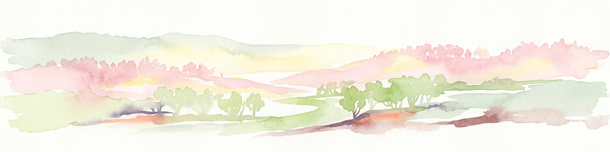
A horizontal watercolor painting showing abstract, soft-edged rolling hills in shades of pink, pale green, and yellow, with light green clusters representing trees or bushes in the foreground.
Nature reserveNew South Wales
80 km away#3 closest

West

Nocoleche Nature Reserve: Mapping the Paroo River Floodplains in New South Wales

A large-scale protected wetland and arid-zone woodland ecosystem.

Nocoleche Nature Reserve preserves the largest wetland network of its kind in New South Wales, characterized by its position along the unregulated Paroo River. The landscape transitions from vibrant riverine corridors with rare yapunyah woodlands to dry mulga and box shrublands. This protected expanse is an essential refuge for wildlife in the surrounding pastoral outback, offering a distinct study in arid-zone hydrology and land management.

Area
711.08 km²
Established
1979
IUCN
Ia
Relief
Lowland
National parkAustralia
117 km away#4 closest

Southwest

Paroo-Darling National Park: Mapped Boundaries and Protected Landscape Geography

Explore the geographic context of this Australian national park.

Paroo-Darling National Park is a protected national park offering insights into Australia's natural geography. This section provides details on its mapped protected area, highlighting the landscape and regional context. Understand the park's geographic footprint and its importance as a conservation landscape within the Australian continent.

Area
1,780.53 km²
Established
2000
IUCN
II
Relief
Upland
National parkAustralia
168 km away#5 closest

Northeast

Culgoa National Park: Iconic Coolabah Woodlands and River Floodplain Landscapes of Australia

Explore mapped boundaries and regional geography in this New South Wales protected area.

Culgoa National Park is a premier example of a preserved semi-arid outback landscape in Australia, celebrated for its extensive and intact coolabah woodlands. This national park protects vital river floodplains and a chain of permanent waterholes along the Culgoa River, contributing significantly to the biodiversity of the Darling River catchment. Understanding its geographic setting and the mapped distribution of its unique vegetation communities offers deep insight into Australia's natural heritage.

Area
352.39 km²
Established
1996
IUCN
II
Relief
Lowland
National parkQueensland
About 184 km away#6 closest

Northwest

Currawinya National Park: Queensland's Ramsar Wetland and Mulga Lands National Park

Discover its arid landscape and protected area identity.

Currawinya National Park is a major protected area in Queensland, Australia, recognized for its significant Ramsar-listed wetland system, including Lakes Numalla and Wyara. These ephemeral lakes are vital drought refuges for waterbirds across inland Australia and represent a unique ecological feature within the park's expansive mulga lands landscape. The park also champions conservation initiatives, notably a large predator-exclusion enclosure for the greater bilby, showcasing its commitment to arid-zone biodiversity and landscape preservation.

Area
1,513 km²
Established
1991
IUCN
II
Relief
Lowland
National parkQueensland
About 187 km away#7 closest

Northeast

Culgoa Floodplain National Park: Queensland National Park and Protected Landscape Identity

Explore mapped boundaries and regional geographic context.

Culgoa Floodplain National Park is a designated national park located in Queensland, Australia. This page details its identity as a protected landscape, emphasizing its geographical placement within the northeastern Australian region. Users can discover the park's mapped boundaries, understand its role within Queensland's geography, and engage with atlas-style exploration tools focused on conservation lands and natural terrain.

Area
428.59 km²
Established
1994
IUCN
II
Relief
Lowland
Nature reserveNew South Wales
196 km away#8 closest

East

Macquarie Marshes Nature Reserve: Protected Wetland Boundaries and Geographic Context

An essential inland wetland reserve in New South Wales

Spanning approximately 19,800 hectares, Macquarie Marshes Nature Reserve represents the most hydrologically active portion of the lower Macquarie floodplain. The area is defined by its characteristic gradient of reedbeds and river red gum woodlands, serving as a primary sanctuary for breeding waterbirds within the broader Murray-Darling region.

Area
198.24 km²
Established
1971
IUCN
Ia
Relief
Lowland

Common questions about visiting, size, designation, and location context for Toorale State Conservation Area

Toorale State Conservation Area FAQs for park facts, access, geography, and protected area context

Find quick answers about Toorale State Conservation Area, including protected-area facts, park geography, trail and visitor context, and how the park fits into its surrounding country and regional landscape.
MoriAtlas Explorer

Continue Your Protected Areas Search Across the Global Atlas

Deepen your exploration by continuing the structured search for national parks and protected areas worldwide. Utilize the comprehensive filtering capabilities to compare different conservation landscapes and refine your understanding of global park geography. Discover more about the distribution and characteristics of protected natural areas.

Global natural geography