

Mori Atlas logo
Wildlife reserveTutuaca Flora and Fauna Protection Area

Analyzing the forest cover, mapped boundaries, and regional ecological connectivity in northwestern Mexico

Tutuaca Flora and Fauna Protection Area: Protected Sierra Madre Occidental Mountain Landscapes

Tutuaca Flora and Fauna Protection Area represents a significant expanse of montane terrain within the Sierra Madre Occidental, covering approximately 4,370 square kilometers across the border region of Chihuahua. This protected wildlife reserve safeguards a continuous corridor of pine-oak forests, providing essential habitat connectivity and watershed protection in northwestern Mexico. Through its association with the adjacent Papigochic reserve, the area forms a foundational element of the regional mountain ecosystem, preserving a high density of plant and animal species within a complex, deeply eroded landscape.

Sierra Madre Occidentalpine-oak forestsmountain forestsflora and fauna protection areaIUCN Category VIChihuahua

Tutuaca Flora and Fauna Protection Area

Wildlife reserve

Park overview

Structured park overview, official facts, and landscape profile for Tutuaca Flora and Fauna Protection Area

Tutuaca Flora and Fauna Protection Area park facts, protected area profile, and essential visitor context

Review the core facts for Tutuaca Flora and Fauna Protection Area, including designation, size, terrain, visitor scale, habitats, and operating context in one park-focused overview.

About Tutuaca Flora and Fauna Protection Area

Tutuaca Flora and Fauna Protection Area is a federally designated protected natural area in northwestern Mexico, situated where the states of Chihuahua and Sonora meet along the western flank of the country. The reserve sits within the Sierra Madre Occidental, a vast and rugged mountain system that carries pine-oak forests across much of its elevation range and shapes the climate, hydrology, and biodiversity of the surrounding interior.

Spanning roughly 4,370 square kilometers, Tutuaca is among the larger flora and fauna protection areas in Mexico. Its size allows it to capture a wide gradient of elevation, slope, and forest types typical of the Sierra Madre Occidental pine-oak forests ecoregion. Rather than focusing on a single peak, valley, or hot spring like some Mexican protected areas, Tutuaca functions as a broad landscape-scale reserve, holding together a continuous mosaic of forested habitat across multiple sub-basins and mountain ridges.

The reserve was established in 2001 and is administered by the National Commission of Natural Protected Areas, the federal body responsible for managing Mexico's system of natural protected areas. Tutuaca is classified within IUCN Category VI, a designation for protected areas that emphasize the sustainable use of natural resources alongside conservation goals. This reflects the reality of the surrounding region, where forestry, livestock raising, and community livelihoods have long shaped the landscape and continue to interact with the protected area.

Geographically, one of Tutuaca's most important attributes is its adjacency to Papigochic Flora and Fauna Protection Area, which lies to the southeast. Together, the two reserves protect adjoining stretches of the same mountain ecosystem, greatly expanding the effective scale of habitat conservation along the Sierra Madre. This spatial connection is a defining feature of Tutuaca's conservation role and gives the protected area a regional rather than purely local significance.

Ecologically, the reserve is recognized for an unusually rich recorded biodiversity. National biodiversity inventories credit Tutuaca with more than 1,510 plant and animal species, including a meaningful share of species considered to be at risk and a documented presence of exotic species that reflect ongoing management challenges. These figures underline why Tutuaca matters not only as a forest reserve but also as a living laboratory of northwestern Mexico's natural heritage.

Quick facts and research context for Tutuaca Flora and Fauna Protection Area

Tutuaca Flora and Fauna Protection Area is located in northwestern Mexico, spanning the states of Chihuahua and Sonora where they meet along the Sierra Madre Occidental. The reserve covers approximately 4,370 square kilometers, a substantial area that captures a continuous belt of mountain forest habitat.

Designated in 2001, the area is managed by Mexico's National Commission of Natural Protected Areas and carries IUCN Category VI status. It protects a portion of the Sierra Madre Occidental pine-oak forests, one of Mexico's most biologically significant forest ecoregions. To the southeast, the reserve links directly with Papigochic Flora and Fauna Protection Area, extending the effective footprint of protected forest habitat across the Sierra Madre.

Protection and recognition

Documented terrestrial protection scope, designation year, and management details

Tutuaca Flora and Fauna Protection Area Protection Status and History

Tutuaca Flora and Fauna Protection Area holds a documented terrestrial protection status established in 2001. Structured records outline the formal designation history, management scope, and recognition parameters for this protected landscape.

Protection details

Protection scope
Terrestrial
Designated year
2001
Transboundary protection
No
Park context

Deeper park guide and search-rich context for Tutuaca Flora and Fauna Protection Area

Tutuaca Flora and Fauna Protection Area history, landscape, wildlife, and travel context

Explore Tutuaca Flora and Fauna Protection Area through its history, landscape character, ecosystems, wildlife, conservation priorities, cultural context, and seasonal travel timing in a structured park guide built for atlas discovery and search intent.

Why Tutuaca Flora and Fauna Protection Area stands out

Tutuaca is best known for protecting a large, contiguous block of the Sierra Madre Occidental pine-oak forests, one of Mexico's defining mountain ecosystems. The reserve's sheer size and its position linking directly to Papigochic Flora and Fauna Protection Area give it regional-scale significance for forest and wildlife conservation in northwestern Mexico. Beyond its forest cover, Tutuaca stands out for hosting more than 1,510 recorded plant and animal species within its boundaries. Among these, 57 are documented as being in some category of conservation risk, while 50 are classified as exotic, highlighting the reserve's role as both a stronghold for sensitive native biodiversity and a frontline area for managing invasive species pressures in the Sierra Madre.

Tutuaca Flora and Fauna Protection Area history and protected-area timeline

Tutuaca Flora and Fauna Protection Area was formally designated in 2001, when Mexico's federal government incorporated it into the national system of natural protected areas administered by the National Commission of Natural Protected Areas. Its establishment reflected growing recognition of the importance of the Sierra Madre Occidental pine-oak forests and the need to safeguard large, connected sections of that ecosystem against the cumulative pressures of logging, grazing, land conversion, and habitat fragmentation.

Following designation, Tutuaca joined the framework of Mexican protected areas that combine biodiversity conservation with the sustainable use of natural resources. Its IUCN Category VI classification signaled this hybrid conservation purpose, acknowledging that communities already present in or around the reserve would continue to interact with the land through traditional and regulated resource uses.

Over time, Tutuaca's significance has been reinforced by its physical connection to the Papigochic Flora and Fauna Protection Area, which abuts it to the southeast. While Papigochic had its own designation history, the two reserves together form a much larger landscape-level network of protected forest along the Sierra Madre, an outcome that has enhanced the long-term value of both individual designations.

Tutuaca Flora and Fauna Protection Area landscape and geographic character

The landscape of Tutuaca is shaped by the Sierra Madre Occidental, the long, deeply eroded mountain chain that runs through northwestern Mexico. Within the reserve, terrain is dominated by forested ridges, steep canyons, and the upper watersheds of multiple river systems that drain westward toward the Pacific and eastward toward the interior. Elevation gradients create a layered environment in which vegetation, soils, and microclimates shift gradually from lower foothills up into cooler, moister mountain zones.

Rather than standing out as a single iconic landform, the reserve reads as an extended sweep of mountain country. Vegetation cover is largely continuous forest, broken by variations in slope and exposure that produce a mosaic of denser stands, more open pine-oak woodlands, and valley corridors. This continuity of forested terrain is one of Tutuaca's defining physical characteristics and the reason it pairs so naturally with the adjacent Papigochic reserve.

Tutuaca Flora and Fauna Protection Area ecosystems, habitats, and plant life

Tutuaca protects a substantial portion of the Sierra Madre Occidental pine-oak forests, an ecoregion characterized by mixed stands of pines and oaks adapted to the seasonal montane climate of the Sierra Madre. The forests at these elevations provide habitat structure ranging from dense canopy in sheltered valleys to more open, parklike stands on exposed slopes, a diversity that supports a wide array of plant and animal life.

Because the reserve covers a large and largely contiguous area, it preserves ecological gradients rather than isolated fragments. This allows for the natural movement of wildlife through different elevation bands and vegetation types, an important feature for species that require seasonal access to varied habitats. The combination of climatic, topographic, and vegetation diversity gives Tutuaca its ecological richness, both in terms of recorded species and in terms of the functional complexity of its ecosystems.

Biodiversity inventories, including data compiled by Mexico's National Biodiversity Information System, document more than 1,510 plant and animal species within the reserve. Within that total, 57 species are recorded as being in some conservation risk category, underscoring the reserve's relevance for protecting vulnerable and threatened elements of northwestern Mexico's flora and fauna.

Tutuaca Flora and Fauna Protection Area wildlife and species highlights

The wildlife of Tutuaca reflects the broader biological richness of the Sierra Madre Occidental pine-oak forests. The reserve's mixture of forest types, elevation zones, and continuous habitat supports a varied array of mammals, birds, reptiles, insects, and plants typical of montane northwestern Mexico. Animals associated with pine-oak woodlands, including various species that depend on closed canopy, snags, and understory vegetation for feeding and shelter, are characteristic of the area.

Beyond ordinary forest wildlife, Tutuaca's recorded fauna includes a notable number of species considered to be at risk, making the reserve an important refuge for sensitive populations that may face pressure elsewhere in the region. The presence of around 50 documented exotic species points to the additional challenge of managing non-native wildlife and plants, a common reality in protected areas embedded within long-used working landscapes.

Overall, the wildlife character of Tutuaca is less about a single iconic species and more about the cumulative value of an extensive, well-connected mountain forest that supports the full range of ecological interactions typical of the Sierra Madre.

Tutuaca Flora and Fauna Protection Area conservation status and protection priorities

Tutuaca Flora and Fauna Protection Area plays a significant role in conserving the Sierra Madre Occidental pine-oak forests, one of Mexico's most important mountain ecoregions. By protecting approximately 4,370 square kilometers of largely continuous forest, the reserve helps maintain habitat connectivity across the Sierra Madre, a key factor in allowing wildlife populations to remain viable and in reducing the risk of local extinctions.

The reserve's IUCN Category VI status reflects a conservation model that pairs strict ecosystem protection with sustainable use of natural resources by surrounding communities, recognizing that the long-term success of the protected area depends on integration with the regional economy and land-use traditions. This balance is particularly relevant in the Sierra Madre, where forestry and livestock raising have shaped the land for generations.

Tutuaca also gains conservation importance from its adjacency to the Papigochic Flora and Fauna Protection Area. Together, the two reserves create a larger, more resilient protected landscape along the Sierra Madre, allowing conservation benefits to extend across administrative boundaries and administrative categories.

With more than 1,510 recorded species, including 57 in at-risk categories, Tutuaca is an important site for monitoring biodiversity trends in northwestern Mexico. Its size, habitat connectivity, and ecological gradients make it especially valuable for tracking how the Sierra Madre's pine-oak forests respond to climate, land-use, and invasive-species pressures over time.

Tutuaca Flora and Fauna Protection Area cultural meaning and human context

Although Tutuaca is primarily recognized for its ecological value rather than for built cultural heritage, its setting in the Chihuahua-Sonora borderlands of the Sierra Madre Occidental ties it to a long human history of mountain resource use. Communities in this region have traditionally relied on the Sierra Madre's forests for timber, grazing, and small-scale agriculture, and these land uses continue to shape the relationship between local people and the protected area.

The reserve's IUCN Category VI designation reflects the importance of recognizing these ongoing human relationships and managing them in ways that maintain both ecological health and the livelihoods of residents in and around the protected area. In this sense, Tutuaca's cultural context is closely bound up with the rhythms of the mountain forests themselves.

Top sights and standout views in Tutuaca Flora and Fauna Protection Area

Tutuaca stands out for the sheer scale of forest it preserves, with roughly 4,370 square kilometers of Sierra Madre Occidental pine-oak habitat contained within a single protected area designation. Few reserves in northwestern Mexico can match that size, and fewer still are so directly linked to another major flora and fauna protection area, Papigochic, along the same mountain chain.

The reserve's biodiversity profile is equally notable: more than 1,510 documented plant and animal species, including 57 considered to be at risk and around 50 exotic species that reflect active management needs. Combined with its Category VI sustainable-use framework and its connections to surrounding communities and landscapes, this makes Tutuaca a significant example of large-scale, ecologically grounded conservation in the Sierra Madre.

Best time to visit Tutuaca Flora and Fauna Protection Area

The character of a visit to Tutuaca is strongly influenced by the seasonality typical of the Sierra Madre Occidental. Cooler months tend to bring clearer conditions across the higher elevations and more comfortable temperatures for exploring forested terrain, while summer brings the monsoonal rains that give the pine-oak forests much of their greenery and productivity. Vegetation, water availability, and wildlife activity all shift with these seasonal patterns, shaping how the reserve feels at different times of year.

Because Tutuaca is a remote and rugged mountain protected area primarily oriented toward conservation rather than mass tourism, planning around seasonal weather and road conditions in the Sierra Madre is essential for a meaningful experience. The reserve's elevation range means microclimatic variation can be significant, even within a single visit.

Monthly climate preview

Long-term representative temperature ranges and precipitation patterns for Chihuahua

Tutuaca Flora and Fauna Protection Area Climate and Monthly Weather Normals

Tutuaca Flora and Fauna Protection Area records sustained monthly shifts in temperature and precipitation across a representative high-elevation coordinate. Examining the complete twelve-month climatology profile reveals comprehensive data for regional comparison and research.
Annual mean14 °C
6 °C21 °C
Jan
Feb
Mar10°
Apr13°
May17°
Jun21°
Jul20°
Aug19°
Sep18°
Oct14°
Nov10°
Dec
Warmest month
June

21.3 °C

Coolest month
January

6.1 °C

Wettest month
July

6.4 mm/day

Driest month
April

0.3 mm/day

Park location guide

Geography guide, regional context, and park location map for Tutuaca Flora and Fauna Protection Area

Tutuaca Flora and Fauna Protection Area park geography, regions, and map view in Mexico

Understand where Tutuaca Flora and Fauna Protection Area sits in Mexico through a broader geographic reading of the surrounding landscape, nearby location context, and its mapped position within the national park landscape.

How Tutuaca Flora and Fauna Protection Area fits into Mexico

Mexico, officially the United Mexican States, is a country in North America spanning the Sierra Madre mountain ranges, coastal plains, and tropical regions. It borders the United States to the north, Guatemala and Belize to the southeast, and has coastlines along the Pacific Ocean, Gulf of Mexico, and Caribbean Sea. With a population exceeding 130 million, Mexico is home to one of the world's most significant concentrations of Indigenous languages alongside Spanish.

Wider geography shaping Tutuaca Flora and Fauna Protection Area in Mexico

Mexico occupies a land area of 1,972,550 km2, making it the thirteenth-largest country in the world. The terrain is highly diverse, featuring the Sierra Madre Occidental and Sierra Madre Oriental mountain ranges, the Mexican Plateau, coastal lowlands along the Pacific and Gulf/Caribbean margins, and the Yucatan Peninsula. The country spans multiple climate zones from desert in the north to tropical rainforest in the south.

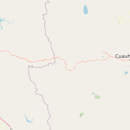
Map view of Tutuaca Flora and Fauna Protection Area

Use this park location map to pinpoint Tutuaca Flora and Fauna Protection Area in Mexico, understand its exact geographic position, and read its mapped placement within the surrounding landscape more clearly.

Pigeon | © OpenStreetMap contributors

Location context for Tutuaca Flora and Fauna Protection Area

ChihuahuaSonora
Park atlas

Compare nearby protected areas across the Sierra Madre Occidental mountain spine.

Parks Near Tutuaca Flora and Fauna Protection Area and Adjacent Reserves

Browsing nearby protected areas reveals connected mountain ecosystems and adjacent forest reserves spanning the northwestern interior. Comparing these regional reserves highlights broader habitat continuity across the Sierra Madre Occidental.
National parkOcampo Municipality
About 39 km away#1 closest

South

Basaseachic Falls National Park: National Park Geography and Mapped Boundaries

Explore protected lands within Ocampo Municipality.

Basaseachic Falls National Park serves as a key protected area within Ocampo Municipality, Mexico. This page provides detailed geographic information and mapped boundaries, essential for understanding its landscape context and its significance as a national park. Dive into the atlas-style data to appreciate the park's protected terrain and its contribution to the regional geography, offering a factual discovery experience.

Area
58.03 km²
Established
1981
IUCN
II
Relief
Mountain
Wildlife reserveChihuahua
About 54 km away#2 closest

Southeast

Papigochic Flora and Fauna Protection Area: Sierra Madre Occidental Forest Geography

An expansive mountain wildlife reserve in Chihuahua, Mexico.

Spanning over 2,200 square kilometers, this reserve preserves vital pine and oak forest ecosystems in the Sierra Tarahumara. The area is defined by its deep canyons, high-elevation forested ridgelines, and important role in safeguarding temperate montane habitats within northwestern Mexico.

Area
2,227.64 km²
Established
2003
IUCN
VI
Relief
Mountain
Nature reserveSonora
About 141 km away#3 closest

Northwest

Northern Jaguar Reserve: Geography and Protected Landscape Atlas of Sonora

Foothill bushland between the Aros and Bavispe River valleys

Northern Jaguar Reserve represents a key protected block of dry tropical bushland in the Sierra Madre foothills of Sonora. This map-focused profile examines the topography, drainage systems, and structural habitat corridors that support one of the northernmost wild jaguar populations within a transition zone of mountain slopes and river-fed canyons.

Area
222 km²
Relief
Mountain
Climate
Subtropical
Access
Remote access
Wildlife reserveChihuahua
About 162 km away#4 closest

North

Campo Verde Flora and Fauna Protection Area: Atlas and Landscape Discovery in Chihuahua

A significant wildlife reserve in the Sierra Madre Occidental

Spanning the transition from high montane forests to semi arid desert, Campo Verde Flora and Fauna Protection Area represents a core component of Mexico's northern conservation network. Documented for its endemic flora and fauna, this wildlife reserve provides a rare look at the ecological mosaic of the Sierra Madre Occidental region.

Area
1,080.67 km²
Established
1938
IUCN
VI
Relief
Mountain
Protected areaSonora
About 165 km away#5 closest

South

Área de protección de flora y fauna Sierra de Álamos-Río Cuchujaqui: Geography and Park Boundaries

Detailed atlas view of the Sonora biodiversity enclave and canyon systems.

Spanning over 92,000 hectares in Sonora, this protected area is defined by its dramatic transition from coastal plains to the Sierra Madre range. The geography centers on the deep, moisture-trapping barrancas of the Cuchujaqui River, which sustain a rare mixture of Neotropical and temperate species. Examine the structural complexity of these forested slopes and river-carved valleys that function as a essential habitat for large predators and diverse flora alike.

Area
928.9 km²
Established
1996
National parkChihuahua
About 176 km away#6 closest

East

Cumbres de Majalca National Park: National Park Discovery and Geographic Context in Chihuahua

Mapped protected landscape exploration in Chihuahua.

Delve into the protected landscape of Cumbres de Majalca National Park, a national park situated in the Chihuahua region of Mexico. This entry provides essential geographic context and details on its mapped boundaries, serving as a key point for atlas-based exploration of Mexico's protected areas. Understand its specific contribution to the regional geography and conservation landscape.

Area
47.72 km²
Established
1939
IUCN
II
Relief
Mountain
Wildlife reserveSonora
About 274 km away#7 closest

Northwest

Bavispe Flora and Fauna Protection Area: Sierra Madre Occidental Mountain Geography

Mapped protected forest tracts across Sonora ranges

Spanning five distinct mountain tracts in Sonora, this wildlife reserve preserves rare pine-oak forest communities within the Sierra Madre Occidental. Learn how these ridges and basins act as a vital hydrological anchor for the Yaqui River and provide critical corridors for wildlife through the diverse, transition-heavy terrain of northern Mexico.

Area
2,009 km²
Established
1936
IUCN
VI
Relief
Mountain
A soft watercolor illustration of rolling green hills, distant purple mountains, and stylized trees.
Protected areaChihuahua
About 304 km away#8 closest

Southeast

Cerro Mohinora: Protected Volcanic Summit and Alpine Geography in Chihuahua

An analysis of volcanic terrain and high-elevation protected ecosystems.

Cerro Mohinora dominates the skyline as a prominent volcanic landmark within the Sierra Madre Occidental. This record details the protected area's geographic reach, examining its complex igneous history and the dramatic vertical transition from pine-covered slopes to its snowy summit, offering a clear map-oriented view of this significant Chihuahua natural landmark.

Established
2012
Relief
Mountain
Water
Minor water
Season
Seasonal

Common questions about visiting, size, designation, and location context for Tutuaca Flora and Fauna Protection Area

Tutuaca Flora and Fauna Protection Area FAQs for park facts, access, geography, and protected area context

Find quick answers about Tutuaca Flora and Fauna Protection Area, including protected-area facts, park geography, trail and visitor context, and how the park fits into its surrounding country and regional landscape.
MoriAtlas Explorer

Continue Your Protected Areas Search Across the Global Atlas

Deepen your exploration by continuing the structured search for national parks and protected areas worldwide. Utilize the comprehensive filtering capabilities to compare different conservation landscapes and refine your understanding of global park geography. Discover more about the distribution and characteristics of protected natural areas.

Global natural geography