
Mori Atlas logo
Protected landscapeVienna Woods

Geologic transitions from sandstone Flysch to limestone peaks defining the Alpine terminus

Vienna Woods: Exploring the Protected Landscape and Forested Alpine Foothills of Lower Austria

The Vienna Woods span a vast range of forested highlands that form the northeastern gateway to the Northern Limestone Alps. This protected landscape represents a critical geographic transition between the sandstone Flysch zone in the north and the rugged limestone terrain in the south. Featuring deep river gorges, diverse forest cover, and elevation shifts ranging from valley floors to the Schöpfl summit, the area offers a complex mosaic of natural terrain mapped within the state of Lower Austria.

forested highlandsNorthern Limestone AlpsAlpine foothillsFlysch zonelimestone zoneprotected landscape
A stylized, flat vector illustration of a river flowing through a lush, forested valley flanked by rocky cliffs under a pastel-colored sky.

Vienna Woods

Protected landscape

Park overview

Structured park overview, official facts, and landscape profile for Vienna Woods

Vienna Woods park facts, protected area profile, and essential visitor context

Review the core facts for Vienna Woods, including designation, size, terrain, visitor scale, habitats, and operating context in one park-focused overview.

About Vienna Woods

The Vienna Woods occupy a special position in the geography of Austria, being the easternmost extension of the Northern Limestone Alps and the northeastern end of the Alpine chain as a whole. Covering around 105,000 hectares across Lower Austria and Vienna, the region combines hilly to medium-mountain terrain with altitudes ranging roughly from 300 metres to just under 900 metres. The forest is dense and almost continuous in many parts, interspersed with small valleys, meadows, orchards, and historic villages that have grown along the rivers draining toward the Danube.

The area carries deep cultural and ecological significance. For centuries it served as royal hunting ground and as a source of wood and water for Vienna. Today it functions as the principal outdoor recreation area for the metropolitan region, offering hiking trails, viewpoints, monasteries, castles, caves, and nature parks within easy reach of the city. Its geography, with the thermal line defining its eastern edge and a series of rivers bounding its other sides, creates a clearly demarcated highland region that feels distinct from both the Vienna Basin and the higher Alpine areas further west.

Protected under multiple legal frameworks and recognised internationally through its UNESCO Biosphere Reserve status since 2005, the Vienna Woods represent a successful example of long-term landscape conservation around a major city. They are also a working landscape, with forestry, farming, vineyards along the warmer eastern slopes, and tourism all shaping everyday land use. Symbolic landmarks such as the Kahlenberg and Leopoldsberg overlook the city of Vienna and connect the forest both visually and historically to the story of the Austrian capital.

Quick facts and research context for Vienna Woods

The Vienna Woods are a 45-kilometre-long and 20 to 30-kilometre-wide forested highland range located in Lower Austria and Vienna, forming the northeastern end of the Northern Limestone Alps. Its highest peak is Schöpfl at 893 metres, on which the Leopold Figl Observatory sits, while the Leopoldsberg overlooking the Danube marks the northeastern tip of the entire Alpine chain. The area has been a protected landscape since the late 1980s and was recognised as a UNESCO Biosphere Reserve in 2005, with the Vienna Woods Declaration of 1987 marking a key step in regional cooperation on conservation across Vienna, Lower Austria, and Burgenland.

Protection and recognition

Explore terrestrial protection records, designation timelines, and official recognition metrics for Vienna Woods.

Vienna Woods Protection Status and Documented Conservation History

Vienna Woods holds documented terrestrial protection status established in 2005 for regional conservation oversight. This profile compiles official designation history and management scope into a structured reference for geographic study.

Protection details

Protection scope
Terrestrial
Designated year
2005
Transboundary protection
No
Park context

Deeper park guide and search-rich context for Vienna Woods

Vienna Woods history, landscape, wildlife, and travel context

Explore Vienna Woods through its history, landscape character, ecosystems, wildlife, conservation priorities, cultural context, and seasonal travel timing in a structured park guide built for atlas discovery and search intent.

Why Vienna Woods stands out

The Vienna Woods are best known as the forested counterpart to the city of Vienna: a vast, accessible green landscape of beech and oak forests in the north and pine and fir forests in the south, crossed by scenic valleys such as the Helenental and the Hagenbachklamm gorge. The range is also recognised for its geological transition between the sandstone Flysch zone and the limestone Alps, its numerous caves including the Seegrotte, Europe's largest underground lake, and its long-standing role as a protected recreational wilderness neighbouring a major European capital.
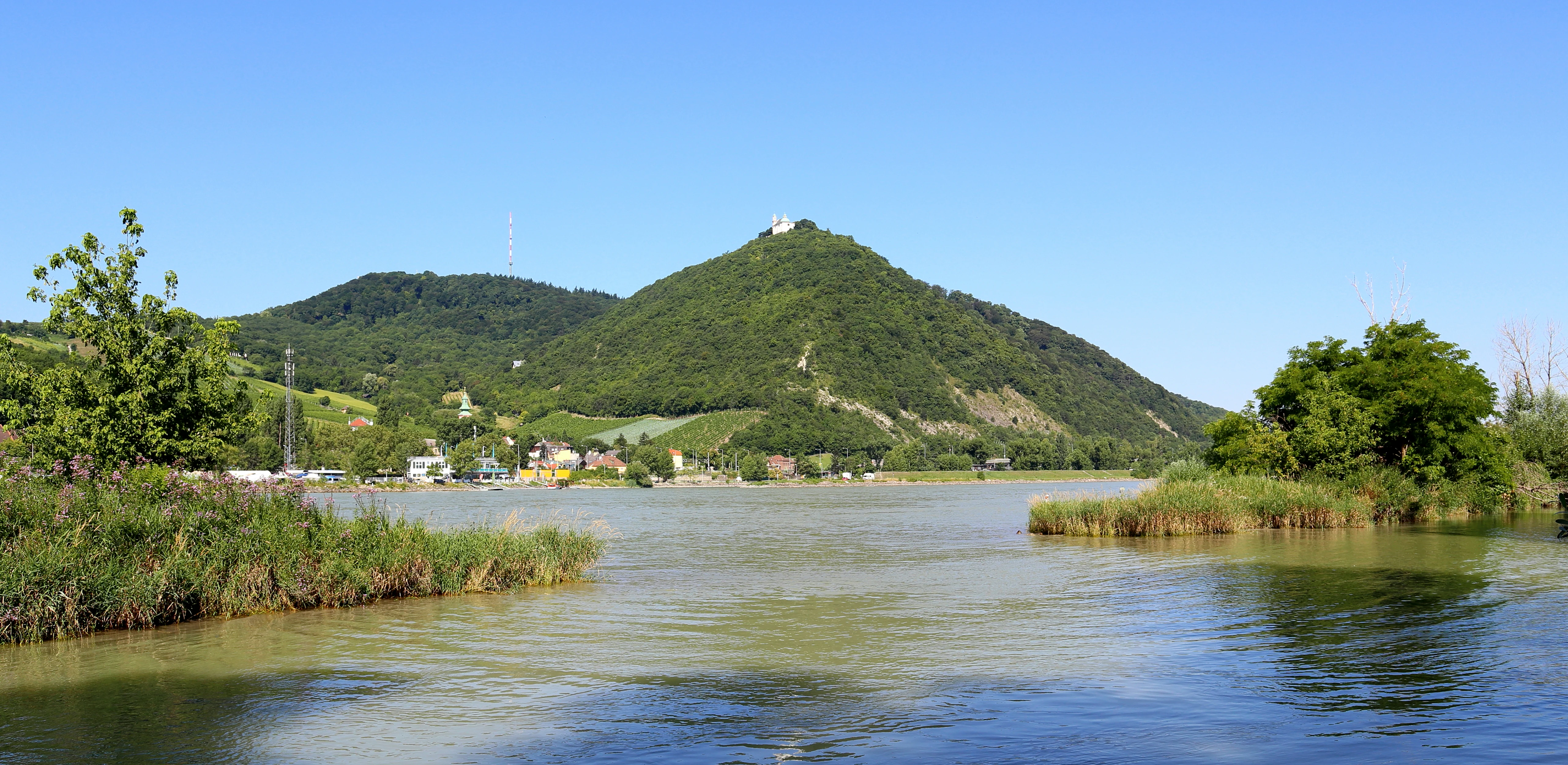
A wide, eye-level shot of a calm river in the foreground, with lush, tree-covered hills rising in the background under a clear blue sky; a small church is visible on the summit of the central peak.
A view across the Danube toward the forested slopes of Leopoldsberg in the Vienna Woods.

Vienna Woods history and protected-area timeline

The Vienna Woods have a long human history layered over their natural landscape. From the 11th century until 1850, the forests functioned as royal hunting grounds for the ruling dynasty, a status that kept them largely off-limits to large-scale logging or settlement for many generations. In the early medieval period, Slavic populations settled in the area under the influence of the Avars, a presence still echoed today in place names such as Döbling, Liesing, and Gablitz.

From the 16th century onward, organised forestry began in the woods, supplying timber and fuel to the growing city of Vienna. Industrial development starting around 1840 brought new pressures, with settlement expanding into previously forested areas and the wider Vienna Basin becoming increasingly urbanised.

A decisive moment came in 1870, when plans emerged to clear most of the forest. Strong public resistance, led by the journalist and political figure Josef Schöffel between 1870 and 1872, ultimately saved large parts of the Vienna Woods from destruction. A century later, in 1987, the governors of Vienna, Lower Austria, and Burgenland signed the Vienna Woods Declaration, a milestone of cross-state cooperation for nature protection in the region. Conservation efforts culminated in 2005 when UNESCO designated the Vienna Woods as a Biosphere Reserve, formalising their role as a protected landscape and recreational area surrounding the Austrian capital.

Vienna Woods landscape and geographic character

The Vienna Woods form a distinctive transitional landscape between the Eastern Alps and the Carpathians, separated by the Danube and the tectonic lines near Vienna. Geologically, the region splits into two zones: the Flysch Wienerwald in the north, dominated by sandstone, and the Kalk Wienerwald in the south, belonging to the Northern Limestone Alps. This geological divide produces a visible shift in scenery, with softer, forested sandstone ridges giving way southward to more rugged limestone terrain.

Terrain elevations vary from about 300 metres in the valley floors to 893 metres at Schöpfl, the range's highest peak, which hosts the Leopold Figl Observatory and offers views that can stretch more than 100 kilometres toward higher Alpine summits such as the Ötscher and Schneeberg. The northeastern end of the chain terminates dramatically at the Leopoldsberg overlooking the Danube and the Vienna Basin, while steep eastern slopes along the thermal line drop quickly toward the warmer lowlands.

The woodland valleys, mostly running east to west and lying between 200 and 400 metres in altitude, alternate between quiet, isolated stretches and more developed, populated areas. Particularly striking are the Helenental near the spa town of Baden and the Hagenbachklamm gorge. Numerous caves punctuate the range, including the Dreidärrischenhöhle beneath the Anninger, the Arnsteinhöhle, and the Seegrotte, a former gypsum mine that now contains Europe's largest underground lake. Among the most distinctive natural landmarks are rock formations such as the Peilstein climbing wall, the Jammerwandl, and the overhanging Engelstein near Baden.
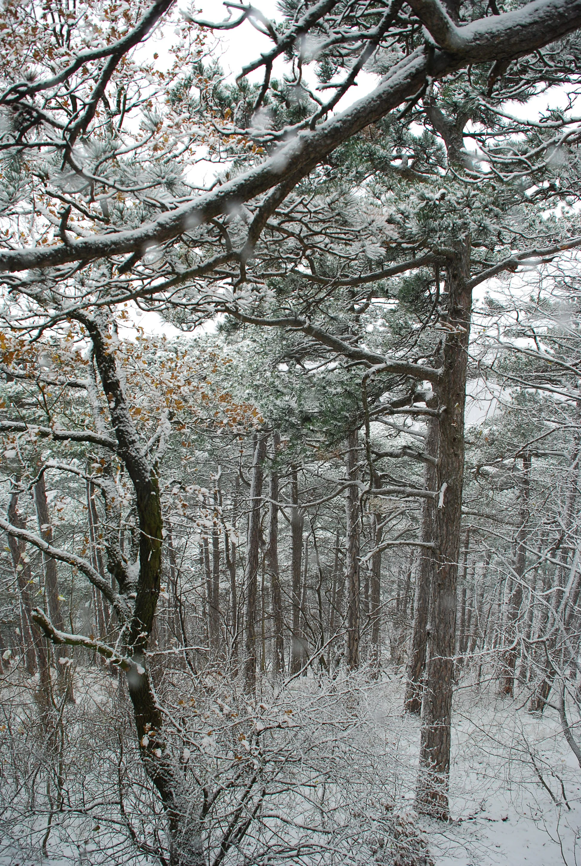
A dense forest of tall, thin pine trees with branches and the forest floor lightly dusted with snow on a cloudy winter day.
A snow covered winter forest scene at Teufelstein in the Vienna Woods.

Vienna Woods ecosystems, habitats, and plant life

Ecologically, the Vienna Woods reflect their underlying geology. The northern Flysch zone is dominated by broadleaf forest, with beech, oak, and hornbeam covering roughly three-quarters of the surface, while the southeastern limestone zone carries about 46 percent coniferous cover, primarily Scots pine, spruce, black pine, fir, and larch. Along the warmer eastern slopes, the natural vegetation transitions to vineyard belt, taking advantage of the pannonic climate influence along the thermal line.

The wooded landscape is interspersed with meadows, orchards, and, in the western Wiesenwienerwald, traditional fruit-growing country, where the wild service tree is cultivated as a regional speciality. Caves, gorges, and old-growth forest reserves add further habitat diversity, supporting populations of typical woodland animals such as red deer and roe deer, along with wild boar in enclosed areas such as the Lainzer Tiergarten. Surveys have recorded roughly 150 breeding bird species and 15 bat species within the biosphere reserve, underscoring the region's importance for Central European forest biodiversity.
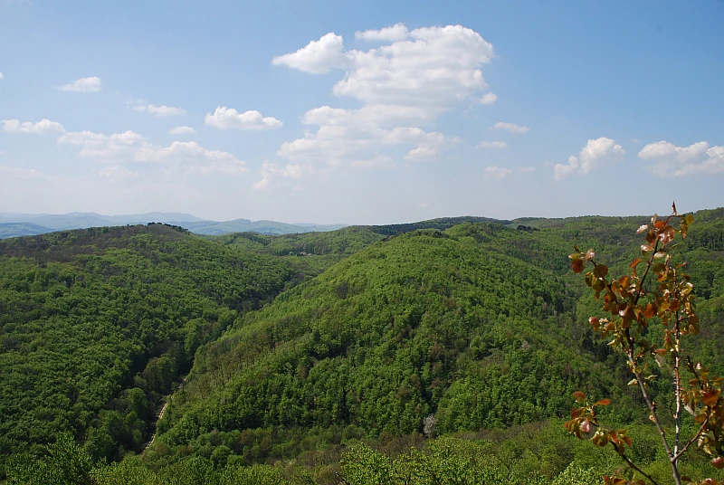
A wide, elevated landscape view of lush, green, rolling forested hills under a blue sky with scattered white clouds.
A view overlooking the dense, rolling forests of the Vienna Woods.

Vienna Woods wildlife and species highlights

The Vienna Woods support a typical Central European forest fauna in a remarkably accessible setting. Red deer and roe deer range through the forest, with wild boar populations established in the historic enclosed grounds of the Lainzer Tiergarten on the edge of Vienna. Smaller woodland mammals are widespread, and the region's cave systems and old-growth forest stands provide habitat for fifteen recorded bat species, making the biosphere reserve an important area for bat conservation.

Birdlife is notably rich for an area of this size, with around 150 breeding bird species documented. The variety stems from the mosaic of habitats, from broadleaf and coniferous forest to meadowland, gorges, vineyards along the thermal line, and the meadows of the Wiesenwienerwald. The proximity to the Danube and the Vienna Basin also brings the forest into contact with wetland and lowland species that move up into the wooded foothills, further diversifying the ornithological character of the range.
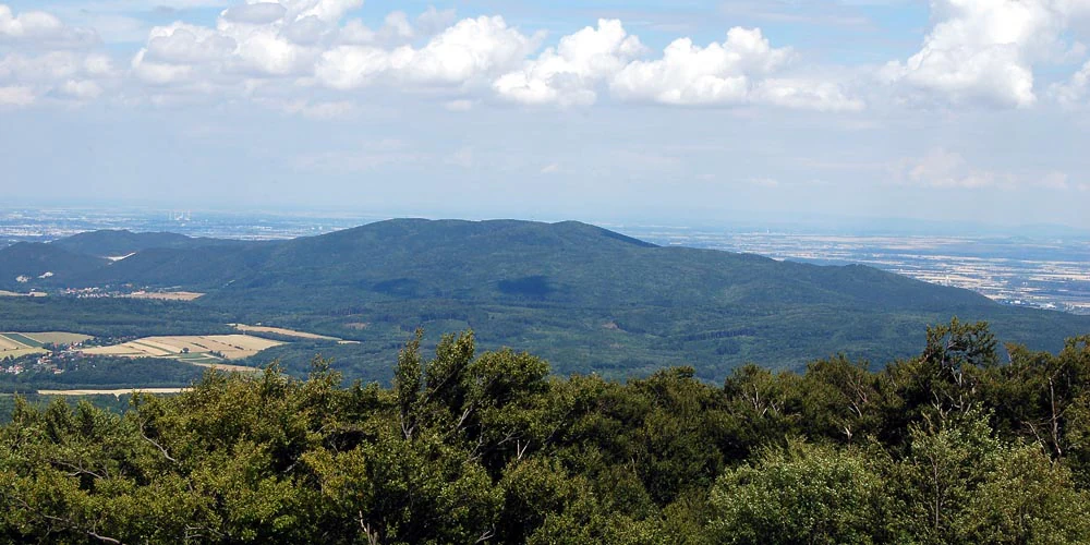
A distant, rounded, forested mountain stands against a blue sky with white clouds, viewed from an elevated position overlooking a valley.
A wide view of the forested Anninger mountain within the Vienna Woods.

Vienna Woods conservation status and protection priorities

The Vienna Woods have been the focus of progressive conservation efforts stretching back more than a century. The earliest turning point came in the 1870s, when journalist Josef Schöffel helped block plans to clear the forest, preserving much of its present-day extent. In 1987, the Vienna Woods Declaration brought the governors of Vienna, Lower Austria, and Burgenland together around a shared commitment to protect the regional landscape.

Since 2005, the Vienna Woods have been recognised internationally as a UNESCO Biosphere Reserve, bringing together protections under natural forest reserves, Natura 2000 sites, and both nature conservation and landscape conservation legislation. The Lainzer Tiergarten, located within Vienna, has been formally designated as a nature reserve, and four dedicated nature parks have been established in parts of the biosphere reserve: Eichenhain, Sandstein-Wienerwald near Purkersdorf, Sparbach, and the Föhrenberge in the limestone zone. Together these layers of protection safeguard forest habitats, species diversity, and the UNESCO Biosphere Reserve's role in research, education, and sustainable regional development. Equally significant is the conservation challenge that remains, as the Vienna Woods continue to face pressure from urban sprawl radiating outward from the metropolitan area.

Vienna Woods cultural meaning and human context

For the people of Vienna, the Vienna Woods are inseparable from the cultural identity of the city. The forest appears in folk song, poetry, painting, and popular tradition as the green counterpoint to urban life, a place of Sunday walks, Heuriger wine tavern visits on the eastern slopes, and summer escapes into cooler highland air. Literary and musical references to the Wienerwald reach back generations, embedding the landscape in the cultural imagination of Austria.

The region carries a layered heritage of monastic life, with notable abbeys such as Heiligenkreuz and Klosterneuburg, as well as Charterhouse Mauerbach and Klein-Mariazell, anchoring centuries of religious tradition within the forest. Hilltop churches on the Kahlenberg and Leopoldsberg recall the historical sieges of Vienna, while castle ruins near Mödling and the famous Höllenstein, Anninger, and Hoher Lindkogel viewpoints give the landscape an enduring Romantic character. Today, the woods are also closely tied to Viennese recreation culture, serving Viennese spas such as Baden, regional cycling and mountain-biking networks, and a strong tradition of family-run Heuriger wine taverns along the thermal line.
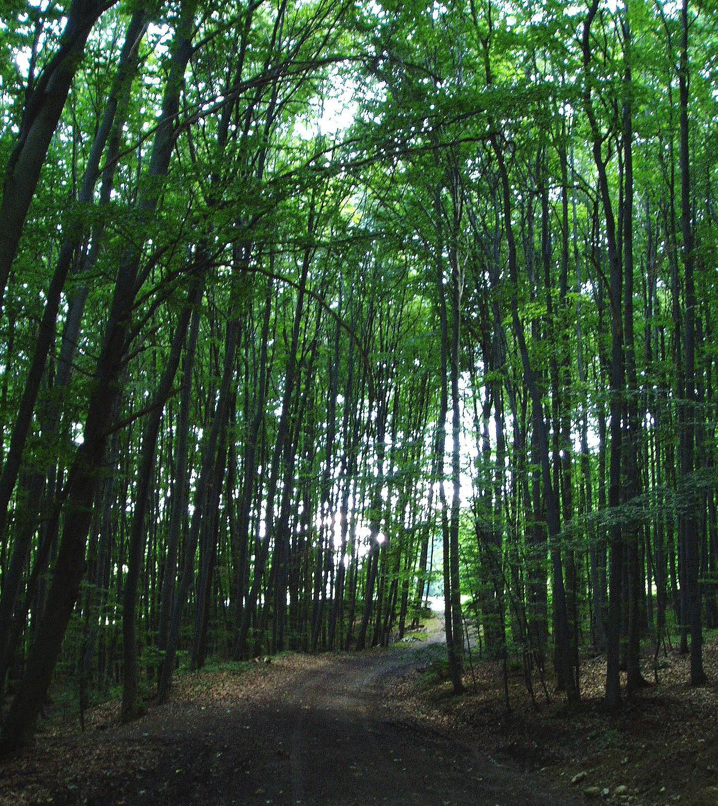
A dirt path leading into a dense, green deciduous forest with tall tree trunks lining the way.
A shaded dirt path winding through the dense canopy of the Vienna Woods.

Top sights and standout views in Vienna Woods

The Vienna Woods stand out for the rare combination of a large, well-preserved forested landscape placed directly alongside a major European capital. Peak experiences include panoramic views from the Schöpfl and the Anninger, dramatic gorges such as the Hagenbachklamm, and the distinct sight of the dolomite Peilstein rising above the surrounding forest. Underground attractions like the Seegrotte, Europe's largest underground lake, and traditional sandstone caves add a geological dimension. For cultural depth, the historic abbeys, hilltop churches above the Danube, and the deep roots of Viennese recreation culture make the Wienerwald a landscape of both natural and human significance.
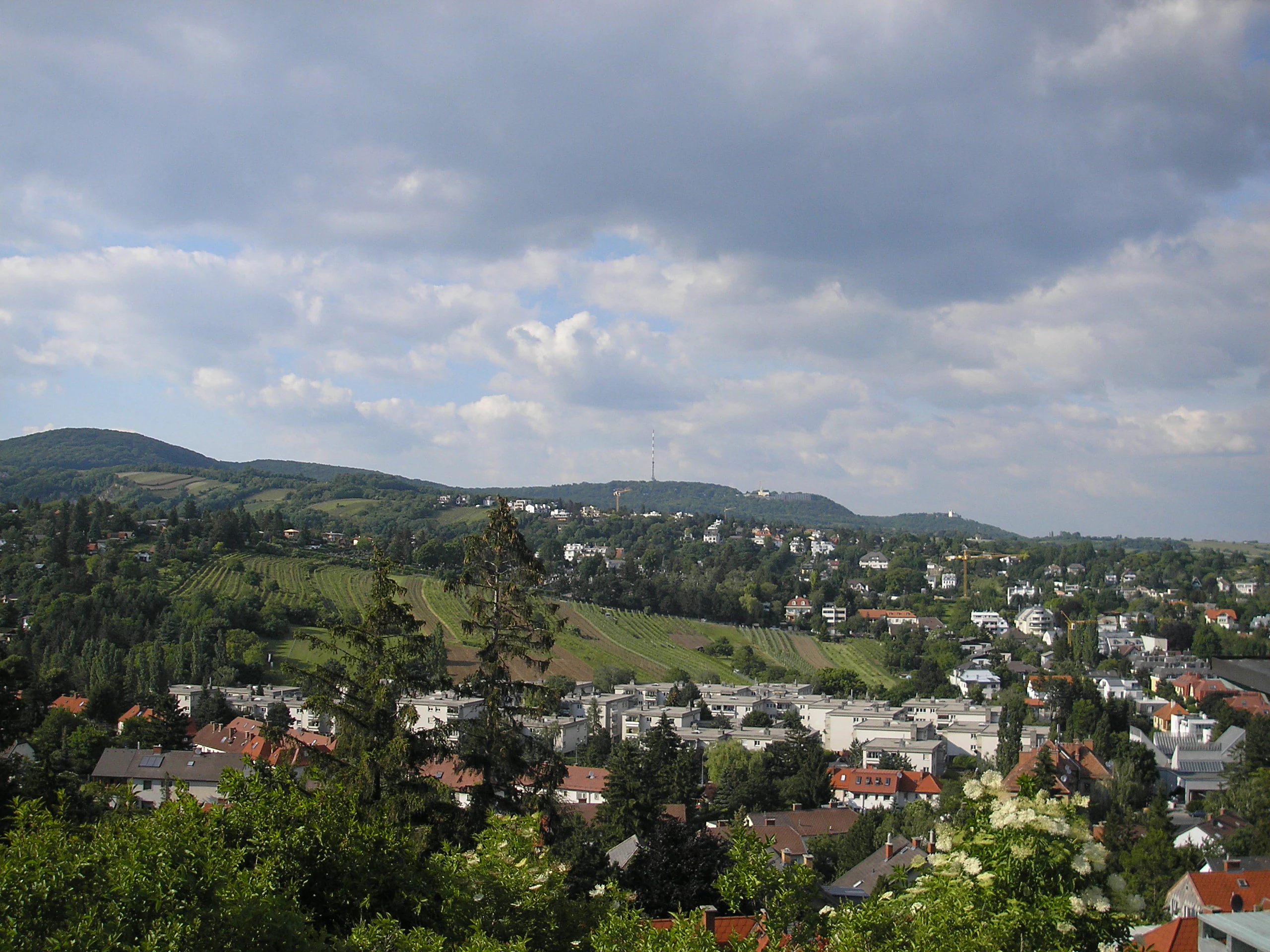
An elevated view looking out over residential buildings in the foreground towards rolling green forested hills under a cloudy sky.
A view overlooking the Dobling district toward the hills of the Vienna Woods.

Best time to visit Vienna Woods

The Vienna Woods are a year-round landscape, with each season offering a distinct character. Spring and early summer bring fresh green foliage, blooming meadows in the Wiesenwienerwald, and mild conditions ideal for longer hikes through the broadleaf Flysch zone. Summer is the warmest period, with cooler temperatures in the higher western and southwestern reaches and lively activity around the wine villages of the thermal line. Autumn is traditionally considered one of the most rewarding seasons to visit, as the mixed broadleaf and coniferous forest turns colour and fruiting orchards across the region come into harvest. Winter transforms the woods into a quieter scene of snow-covered ridges and frosted valleys, with the northern Wienerwald sometimes experiencing fog and more difficult weather that only adds to the atmospheric quality of the range.


Monthly climate preview

Measured monthly averages for representative park coordinates in Lower Austria

Vienna Woods Climate Normals and Long Term Temperature Patterns

Representative coordinates record long term temperature variations alongside shifting precipitation rates across twelve distinct intervals. Detailed monthly records supply complete baseline data for evaluating historical climate conditions across the protected landscape.
Annual mean8 °C
-3 °C18 °C
Jan-3°
Feb-2°
Mar
Apr
May12°
Jun16°
Jul18°
Aug18°
Sep13°
Oct
Nov
Dec-2°
Warmest month
July

17.8 °C

Coolest month
January

-2.7 °C

Wettest month
July

3.9 mm/day

Driest month
January

1.7 mm/day

Park location guide

Geography guide, regional context, and park location map for Vienna Woods

Vienna Woods park geography, regions, and map view in Austria

Understand where Vienna Woods sits in Austria through a broader geographic reading of the surrounding landscape, nearby location context, and its mapped position within the national park landscape.

How Vienna Woods fits into Austria

Austria is a landlocked country in Central Europe, bordered by Germany, Czech Republic, Slovakia, Hungary, Slovenia, Italy, Switzerland, and Liechtenstein. The country is a federal semi-presessional republic composed of nine states, with Vienna as its capital and largest city. It has a population of approximately 9.1 million people.

Wider geography shaping Vienna Woods in Austria

Austria is located in Central Europe, lying in the Eastern Alps. It is bordered by Germany and Czech Republic to the north, Slovakia to the northeast, Hungary to the east, Slovenia and Italy to the south, and Switzerland and Liechtenstein to the west.

Map view of Vienna Woods

Use this park location map to pinpoint Vienna Woods in Austria, understand its exact geographic position, and read its mapped placement within the surrounding landscape more clearly.

Pigeon | © OpenStreetMap contributors

Location context for Vienna Woods

Lower AustriaVienna

Explore photographic documentation of forest canopies, rugged gorges, and limestone terrain.

Vienna Woods Photos and Landscape Scenery: Visualizing Protected Alpine Foothills

Visual documentation captures the forested highlands, deep river valleys, and distinct geological transitions shaping the Vienna Woods protected landscape. Detailed photography illustrates the woodland terrain and native habitats, offering clear visual insight into the park environment.

A wide, eye-level shot of a calm river in the foreground, with lush, tree-covered hills rising in the background under a clear blue sky; a small church is visible on the summit of the central peak.

A mountain refuge building with solar panels on its roof, surrounded by a terrace with red umbrellas and wooden tables in the Vienna Woods.

A dense forest of tall, thin pine trees with branches and the forest floor lightly dusted with snow on a cloudy winter day.

A wide, elevated landscape view of lush, green, rolling forested hills under a blue sky with scattered white clouds.

A distant, rounded, forested mountain stands against a blue sky with white clouds, viewed from an elevated position overlooking a valley.

A wide shot of a forested hill featuring a prominent white limestone rock face at its summit, with a green grassy field in the foreground.

A dirt path leading into a dense, green deciduous forest with tall tree trunks lining the way.

An elevated view looking out over residential buildings in the foreground towards rolling green forested hills under a cloudy sky.

A narrow dirt trail leads into a lush green forest with tall, slender tree trunks and dappled sunlight filtering through the canopy.

A high-angle scenic view of the village of Alland in Austria, showing houses surrounded by lush green deciduous forests and rolling hills under a clear sky.

A shallow, clear river flows over a rocky riverbed with grassy banks and lush green trees in the background.

A close-up view of a large, mature pine tree with a flat-topped canopy, known as a Schirmföhre, set against a distant landscape view in the Vienna Woods.

An overgrown, abandoned wooden mine structure set against a rocky limestone cliff surrounded by dense green forest.

Park atlas

Compare adjacent highland reserves, forested valleys, and regional limestone terrain.

Exploring Parks Near Vienna Woods and Surrounding Protected Landscapes

Continue browsing other national parks and protected areas situated around the Vienna Woods to examine wider Alpine foothill geography. Comparing adjacent woodland reserves provides broader regional context on the transitional landscapes bordering the capital.
A stylized digital illustration of a mountainous landscape at sunset, featuring prominent steep limestone cliffs in the foreground and a vast valley extending into the distance under a warm-toned sky.
Nature reserveLower Austria
About 30 km away#1 closest

South

Hohe Wand Nature Park: Mapped Geography and Protected Landscapes in Lower Austria

A limestone plateau mountain at the Alpine-Pannonian transition

Located in Lower Austria, Hohe Wand Nature Park encompasses a distinct limestone plateau and dramatic southeastern cliffs. Its protected status reflects the convergence of Alpine and Pannonian geography, offering a unique opportunity to study karst geology, exposed cliff habitats, and the transition zone between high mountain ranges and the Vienna Basin lowlands.

Relief
Mountain
Climate
Temperate
Access
Easy access
Scope
Terrestrial
National parkLower Austria
About 43 km away#2 closest

East

Danube-Auen National Park: Protected Floodplain Ecosystem and Regional Geography

Mapped boundaries and vital riparian landscape in Lower Austria.

Delve into the unique protected landscape of Danube-Auen National Park, a cornerstone of Central European riparian conservation. This page offers detailed insights into its mapped boundaries, the dynamic interplay of river channels, lowland forests, and wetlands, and its significant role within the geographic context of Lower Austria. Understand the atlas value of this protected area, ideal for discovering rich natural terrain and ecosystem context.

Area
93 km²
Established
1996
IUCN
II
Relief
Lowland
A horizontal watercolor illustration depicting a quiet riverbank with soft green trees, light vegetation, and calm water reflecting the landscape.
Nature reserveVienna
About 46 km away#3 closest

East

Lobau Nature Reserve: Mapping the Protected Danube Floodplain Landscapes of Vienna

Riparian forests, oxbow lakes, and historic wetland ecosystems.

Lobau preserves the ecological memory of the Danube through a landscape of slow-moving water bodies and dense forest stands. Situated within Vienna, this protected area features a distinct topography of dry gravel terraces, reedy ponds, and riparian corridors, offering significant insights into the region's natural history and riverine geography.

Area
22 km²
Established
1905
Relief
Lowland
Climate
Temperate
Watercolor illustration of a landscape with green hills, a body of water, and trees under a soft sky
National parkGyőr-Moson-Sopron
About 67 km away#4 closest

Southeast

Fertő-Hanság National Park: Central European Wetland and Salt Lake Protected Area

Mapped Geographic Boundaries and Landscape Context

Fertő-Hanság National Park, situated in Győr-Moson-Sopron, Hungary, is a vital protected landscape renowned for its shallow salt lake and expansive marshlands. This page provides an atlas-focused discovery of its protected area, highlighting the unique interplay of reed beds and alkaline grasslands. Understand the park's geographic setting and its role as a significant wetland ecosystem for bird populations and specialized flora.

Area
235.88 km²
Established
1991
IUCN
II
Relief
Lowland
Watercolor painting of a shallow lake scene with green reeds in the foreground, small trees on the shoreline, and rolling hills in the soft, hazy background.
Nature reserveAustria
About 69 km away#5 closest

Southeast

Lake Neusiedl: Protected Nature Reserve and Pannonian Steppe Geography in Austria

An endorheic lake system and critical wetland sanctuary.

Lake Neusiedl is a distinct nature reserve representing a rare European steppe lake environment. Its geography includes a vast ring of Phragmites reed beds, saline wetlands, and surrounding lowlands that form a vital migratory corridor. The lake serves as a cornerstone for protected landscapes in Austria, blending natural marshland dynamics with a deeply storied cultural history.

Area
315 km²
Established
1993
Relief
Lowland
Climate
Temperate
Watercolor painting showing a landscape with rolling terrain, water features, and distant mountains
National parkBurgenland
About 71 km away#6 closest

Southeast

Neusiedler See-Seewinkel National Park: Protected Steppe Lake Landscape in Burgenland

Explore mapped wetland geography and birdwatching significance.

Neusiedler See-Seewinkel National Park showcases a rare steppe lake environment and extensive wetland habitats at the eastern edge of Austria, within the Burgenland region. This protected area is globally recognized for its exceptional avian diversity and the unique ecological mosaic formed by reed beds, salt marshes, and seasonal pools. Explore its mapped boundaries and distinctive Pannonian geography for a deep understanding of this vital European protected landscape.

Area
97 km²
Established
1993
IUCN
II
Relief
Lowland
Watercolor painting of a rolling hilly landscape with green slopes, sparse trees, and a winding path in the foreground.
Nature reserveLower Austria
About 76 km away#7 closest

East

Hundsheimer Berg Nature Reserve: Protected Landscapes of the Lower Austrian Carpathians

Mapped dry steppe, karst topography, and pannonian forest habitats

Rising abruptly from the Danube lowlands, Hundsheimer Berg preserves a compact range of crystalline and limestone hills. This nature reserve provides vital insights into the pannonian biogeographic region, featuring a diverse mosaic of rocky slopes and dry grasslands that support a high concentration of rare insects and plants.

Area
1.66 km²
Established
1965
IUCN
IV
Relief
Mountain
Nature reserveLower Austria
About 76 km away#8 closest

East

Spitzerberg Nature Reserve: Geography and Protected Landscapes of Lower Austria

A vital conservation site featuring arid rock steppes and limestone slopes.

Located in the province of Lower Austria, Spitzerberg serves as a essential nature reserve protecting a rare concentration of Pannonian dry habitats. The site is defined by its steep-sided hill structure, rocky limestone outcrops, and thin soils that support a variety of specialized plant and animal species adapted to this arid environment.

Area
226 km²
Established
1981
IUCN
IV
Relief
Upland

Common questions about visiting, size, designation, and location context for Vienna Woods

Vienna Woods FAQs for park facts, access, geography, and protected area context

Find quick answers about Vienna Woods, including protected-area facts, park geography, trail and visitor context, and how the park fits into its surrounding country and regional landscape.
MoriAtlas Explorer

Continue Your Protected Areas Search Across the Global Atlas

Deepen your exploration by continuing the structured search for national parks and protected areas worldwide. Utilize the comprehensive filtering capabilities to compare different conservation landscapes and refine your understanding of global park geography. Discover more about the distribution and characteristics of protected natural areas.

Global natural geography