Mori Atlas logo
Nature reserveVikerfjell naturreservat

Explore the diverse terrain of mountain plateaus, ancient coniferous forests, and wetland ecosystems across the Ringerike landscape.

Vikerfjell naturreservat: A Comprehensive Geographic Atlas of Protected Old-Growth Forests in Ringerike

Vikerfjell naturreservat represents a nationally significant protected area covering eighty square kilometers of high-lying southern Norwegian terrain. This vast landscape transitions from forested valleys to rugged mountain summits, showcasing near-virgin pine forests and rare lichen populations. Through this atlas, trace the geographic boundaries and mosaic of mire complexes that define one of the most important old-growth forest reserves in the inland region of Østlandet.

nature reserveold-growth forestpine forestspruce forestmountain plateaumires

Vikerfjell naturreservat

Nature reserve

Park overview

Structured park overview, official facts, and landscape profile for Vikerfjell Nature Reserve

Vikerfjell Nature Reserve park facts, protected area profile, and essential visitor context

Review the core facts for Vikerfjell Nature Reserve, including designation, size, terrain, visitor scale, habitats, and operating context in one park-focused overview.

About Vikerfjell Nature Reserve

Vikerfjell Nature Reserve represents one of the most substantial continuous stretches of relatively undisturbed coniferous forest remaining in inland southeastern Norway. Created in 2016 through the cooperation of landowners and the Norwegian Ministry of Climate and Environment, the reserve unites large tracts of forest and mountain across Ringerike municipality under a single protection framework.

The reserve stretches across a diverse but ecologically coherent landscape, reaching from Elgedalen in the southwest and Blankvatnet in the southeast northward through the Ådalsfjellene mountains to the area near Maurkloppa, just north of Fossholmfjellet. Within this range, the terrain features a mix of lower mountain summits, high-elevation plateau, mire systems, lakes, and forested valleys and hillsides. Bedrock throughout much of the reserve is nutrient-poor, which has shaped an equally modest vegetation cover dominated by pine and spruce forests with thin alpine zones at the highest elevations.

The old pine forests of Vikerfjell are especially valued for their minimal modern forestry impact, while the spruce forests show lighter signs of historical selective logging. Core areas within the reserve contain forest stands approaching virgin-forest character, supporting ecological processes that have largely been suppressed elsewhere in the region. Beyond its forests, the reserve includes ecologically valuable mire complexes in the Strømsoddbygda area, including the former Sandvann nature reserve, which has become a sub-area within Vikerfjell.

Vikerfjell now borders the older Vassfaret and Vidalen landscape protection area, which it complements rather than overlaps, expanding the network of formally protected natural landscapes in southern Norway.

Quick facts and research context for Vikerfjell Nature Reserve

Vikerfjell Nature Reserve is located in Ringerike municipality in southeastern Norway, covering roughly 80,000 decares across the Strømsoddbygda lowlands and the Ådalsfjellene highlands. Created by Royal Resolution on 10 June 2016 under the Norwegian Nature Diversity Act, it is the largest nature reserve in Ringerike by physical extent.

The reserve includes extensive areas of coniferous forest, high mountain plateaus, lakes, and mires, with much of its forest classified as old-growth or near old-growth in character. Landowners participated voluntarily in its establishment, and a former separate reserve, Sandvann nature reserve, was incorporated into Vikerfjell when it was created.

Protection and recognition

Documented terrestrial protection metrics and official conservation status details.

Vikerfjell Naturreservat Protection Status and Designated Area Framework

Vikerfjell naturreservat maintains a documented terrestrial protection status within the regional conservation framework. Official records compile available designation data and management parameters for geographic analysis.

Protection details

Protection scope
Terrestrial
Transboundary protection
No
Park context

Deeper park guide and search-rich context for Vikerfjell Nature Reserve

Vikerfjell Nature Reserve history, landscape, wildlife, and travel context

Explore Vikerfjell Nature Reserve through its history, landscape character, ecosystems, wildlife, conservation priorities, cultural context, and seasonal travel timing in a structured park guide built for atlas discovery and search intent.

Why Vikerfjell Nature Reserve stands out

Vikerfjell is best known for its vast, continuous tracts of old coniferous forest dominated by pine, with significant areas of near-virgin forest structure. It stands out as a nationally valuable type area for the higher-lying forest belts of southern Norway, a landscape increasingly rare in modern Nordic ecosystems. The reserve also holds particular conservation importance for rare and vulnerable lichen species that depend on ancient trees and natural decay processes. These features combine to make Vikerfjell one of the more significant large-scale old-growth forest reserves in the inland southern Norwegian region.

Vikerfjell Nature Reserve history and protected-area timeline

Vikerfjell Nature Reserve was formally established by Royal Resolution on 10 June 2016, with the proposal initiated by the Norwegian Ministry of Climate and Environment. Its protection was carried out under the Nature Diversity Act of 19 June 2009, which governs biodiversity protection in Norway.

The reserve's creation was supported through voluntary participation by landowners, who chose to set aside their land for long-term protection. This cooperative approach was a defining feature of the establishment process and contributed to the smooth integration of multiple landholdings into a single, coherent reserve.

When Vikerfjell was created, the earlier Sandvann Nature Reserve ceased to exist as an independent protected area and was incorporated as a designated sub-area within the larger reserve. This consolidation brought together adjacent forest, mountain, and mire landscapes under unified management, strengthening overall protection of the area's ecological values.

Vikerfjell Nature Reserve landscape and geographic character

The landscape of Vikerfjell Nature Reserve is shaped by the transition between forested lowlands in the south and the higher mountain systems of Ådalsfjellene to the north. From open valley floors, the terrain rises through forested slopes into broad mountain plateaus and rocky summits. Lower mountain peaks and open plateau areas dominate much of the central reserve, while extensive forested areas occupy the valleys and sheltered slopes.

Much of the reserve sits on nutrient-poor bedrock, giving rise to relatively sparse vegetation cover and frequent exposures of bare rock near summits. Mire and wetland complexes punctuate the plateau and valley sections, particularly in Strømsoddbygda, where the former Sandvann reserve contributes a network of sloping mires, raised hummocks, and flat mires shaped by local topography.

The largest and most ecologically mature forests occur in Vidalen and around Fossholmfjellet, where continuous forest cover extends across broad slopes. Lakes and small water bodies are scattered throughout the reserve, adding to the mosaic of habitats across this high-lying southern Norwegian terrain.

Vikerfjell Nature Reserve ecosystems, habitats, and plant life

Ecologically, Vikerfjell is defined by forest, mountain, mire, and freshwater habitats shaped by poor soils and minimal modern disturbance. The dominant ecosystem is extensive coniferous forest, particularly pine forest on the higher and drier sites, with spruce in somewhat more sheltered positions. The open mountain vegetation that occurs at the highest elevations remains sparse due to the underlying bedrock, leaving broad stretches of bare alpine rock and thin vegetation cover.

The reserve also contains a significant network of minerotrophic mires, including sloping mires with gradients reaching about 13 degrees, string mires with hummock relief of up to roughly 2.5 meters, and flat mires. The vegetation in these mire systems shows unusual suboceanic (western) plant elements for the region, including structurally notable features such as string formations supporting the rare plant rome.

Together, these forest, mire, alpine, and freshwater systems form a connected ecological landscape that supports a wide range of biological diversity, with particular emphasis on habitats tied to long ecological continuity.

Vikerfjell Nature Reserve wildlife and species highlights

The wildlife and broader biological value of Vikerfjell Nature Reserve is closely linked to the reserve's extensive stands of old and near-virgin coniferous forest. These forests support specialized species, particularly lichens, that depend on the presence of ancient trees, deadwood, and uninterrupted natural processes. The reserve is nationally important for these rare and vulnerable lichen communities, which find both refuge and continuity in the protected forest landscape.

Beyond its lichen populations, Vikerfjell supports a broader community of species associated with old-growth forest and undisturbed high-mountain terrain. The continuous cover of mature forest across large areas provides habitat for species that require extensive territories, while the surrounding mires and lakes add wetland habitat value. The reserve's combination of habitat types contributes to a forest and mountain ecosystem with notable biological richness for southeastern Norway.

Vikerfjell Nature Reserve conservation status and protection priorities

Vikerfjell lies at the centre of a broader network of protected natural areas in Ringerike and southeastern Norway, sitting adjacent to the Vassfaret and Vidalen landscape protection area without overlapping it. This positioning strengthens regional conservation connectivity by ensuring that large tracts of natural forest and mountain landscape remain undeveloped and ecologically intact.

The reserve's primary conservation objective is to preserve biodiversity across a wide range of habitats, including forest, mountain, lakes, and mires, with their associated natural types, ecosystems, species, and ecological processes. Particular emphasis is placed on protecting old-growth coniferous forest, especially areas approaching virgin-forest condition, and ensuring that rare lichen communities dependent on ancient trees and natural disturbance regimes are maintained.

Management goals aim to retain the reserve's existing conservation values in their best possible condition and, where appropriate, to support their further development over time. Vikerfjell is regarded as nationally valuable for conservation, particularly as a type area representing the most elevated forest belts of southeastern Norway.

Vikerfjell Nature Reserve cultural meaning and human context

Vikerfjell Nature Reserve lies within landscapes that have historically supported low-intensity land use typical of inland Norway, including grazing, hunting, and selective forest use. The cooperative establishment process with landowners reflects a long tradition of negotiated land protection in Norwegian conservation policy, in which private landholders play an active role in the creation of nature reserves.

The surrounding rural communities in Strømsoddbygda, Soknedalen, and Ådal have long-standing connections to the forests and mountains that now form the reserve. By voluntarily contributing their land to the reserve, these landowners have accepted new constraints on traditional land uses in exchange for the long-term preservation of the landscape and its natural values, reflecting regional attachment to the area as both a working and natural environment.

Top sights and standout views in Vikerfjell Nature Reserve

Among the defining features of Vikerfjell Nature Reserve are its exceptionally extensive pine forests, which remain largely untouched by modern forestry. These forests contain core zones of near-virgin forest structure, which are rare at both the regional and national level in Norway.

The reserve also stands out for the presence of nationally important populations of rare and vulnerable lichen species dependent on ancient trees, and for its position as a major type area representing the upper forest belts of southeastern Norway. Adjacency to the Vassfaret and Vidalen landscape protection area adds further value, situating Vikerfjell within a substantial regional network of protected natural landscapes.
Monthly climate preview

Long-term representative point measurements tracking monthly temperature and precipitation cycles

Vikerfjell Naturreservat Climate Normals, Annual Temperature, and Precipitation Rhythm

Vikerfjell naturreservat records long-term monthly temperature averages ranging from deep winter lows to positive summer maximums alongside varying daily precipitation rates. Examining the complete twelve-month climatology profile provides detailed insight into annual weather patterns across the sampled coordinate.
Annual mean2 °C
-8 °C14 °C
Jan-8°
Feb-8°
Mar-4°
Apr
May
Jun11°
Jul14°
Aug13°
Sep
Oct
Nov-4°
Dec-8°
Warmest month
July

14 °C

Coolest month
January

-8.1 °C

Wettest month
August

4.3 mm/day

Driest month
February

2 mm/day

Park location guide

Geography guide, regional context, and park location map for Vikerfjell Nature Reserve

Vikerfjell Nature Reserve park geography, regions, and map view in Norway

Understand where Vikerfjell Nature Reserve sits in Norway through a broader geographic reading of the surrounding landscape, nearby location context, and its mapped position within the national park landscape.

How Vikerfjell Nature Reserve fits into Norway

Norway, officially the Kingdom of Norway, is a Nordic country in Northern Europe located on the Scandinavian Peninsula. It encompasses mainland Norway, the Arctic islands of Svalbard and Jan Mayen, and maintains dependencies including Bouvet Island and Antarctic claims. The country has a population of about 5.6 million and is bordered by Sweden, Finland, and Russia. Norway is a unitary parliamentary constitutional monarchy with Oslo as its capital and largest city.

Wider geography shaping Vikerfjell Nature Reserve in Norway

Norway occupies the western and northern portions of the Scandinavian Peninsula in Northern Europe. The country shares a long eastern border with Sweden, and borders Finland and Russia to the northeast. Norway has an extensive coastline facing the Skagerrak, North Sea, Norwegian Sea, and Barents Sea. The terrain is predominantly mountainous with numerous fjords along the coastline.

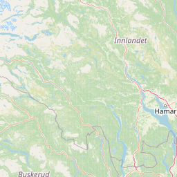
Map view of Vikerfjell Nature Reserve

Use this park location map to pinpoint Vikerfjell Nature Reserve in Norway, understand its exact geographic position, and read its mapped placement within the surrounding landscape more clearly.

Pigeon | © OpenStreetMap contributors

Location context for Vikerfjell Nature Reserve

Ringerike
Park atlas

Compare adjacent forest reserves and mountain terrain across the southern Norwegian inland region.

Exploring Parks Near Vikerfjell Naturreservat and Surrounding Protected Landscapes

Browse protected areas and connected forest landscapes located near Vikerfjell naturreservat in the Østlandet region. Comparing adjacent reserves reveals broader ecological patterns across southern Norwegian mountain plateaus and old-growth pine valleys.
Nature reserveInnlandet
About 75 km away#1 closest

Northeast

Åkersvika naturreservat: Protected Wetland Ecosystems and Geography in Innlandet

A vital Ramsar wetland and avian sanctuary in Southern Norway

Åkersvika naturreservat functions as a key wetland protected area at the northern end of Lake Mjøsa. The reserve preserves diverse aquatic habitats including shallow bays, reed beds, and shoreline meadows. It serves as a landmark example of lowland wetland conservation in Norway, providing essential breeding and migration grounds for waterfowl and waders within the Innlandet geographic context.

Area
3.25 km²
Established
1974
National parkInnlandet
About 83 km away#2 closest

North

Langsua National Park: Protected Mountain Forests and Inland Wilderness in Innlandet, Norway

Discover mapped boundaries and regional geographic context.

Langsua National Park, a designation expanded in 2011, is a prominent protected area in Norway's Innlandet county. This national park encompasses 537.1 square kilometers of diverse mountainous terrain, characterized by extensive mountain forests and inland wilderness habitats. Its creation consolidates fragmented nature reserves into a significant contiguous protected landscape, offering valuable insight into Norway's conservation strategies and the geographic context of its eastern mountain regions.

Area
537.1 km²
Established
2011
IUCN
II
Relief
Mixed relief
Watercolor painting of rolling green hills, a body of water, and pink flowers
National parkVestland
About 90 km away#3 closest

West

Hardangervidda National Park: Vast Arctic Plateau and European Peneplain Discovery

Explore Norway's largest national park and its unique tundra ecosystem.

Delve into the geography of Hardangervidda National Park, Norway's largest national park, featuring the expansive Arctic plateau and Europe's largest peneplain. This protected landscape offers a unique mapped environment characterized by treeless moorland, numerous lakes, and important wildlife habitats, including significant wild reindeer populations. Understand its position within the Vestland region and its value as a key protected area for geographic exploration and landscape context.

Area
3,422 km²
Established
1981
IUCN
II
Relief
Highland
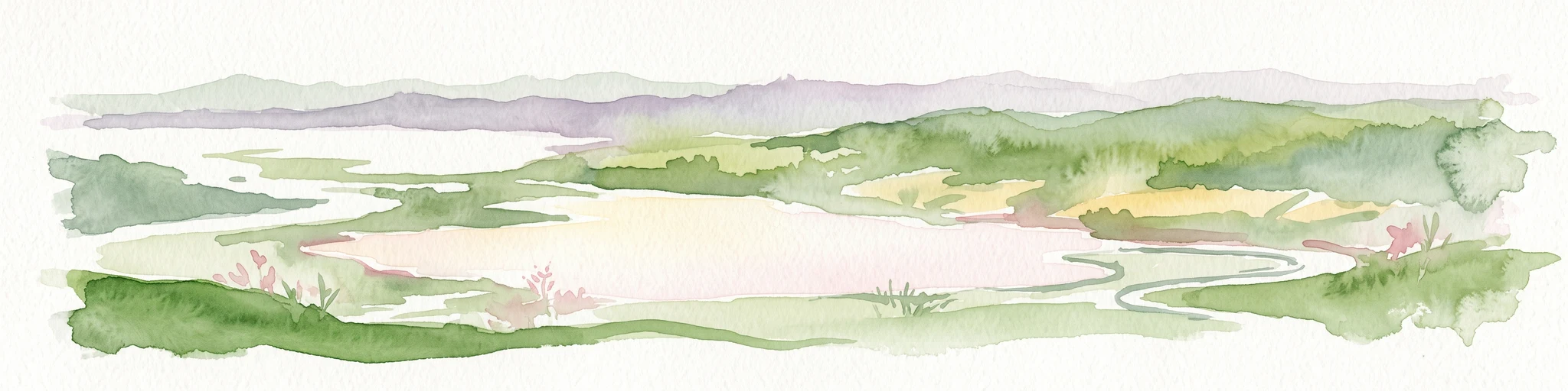
A watercolor landscape illustration showing a broad river delta with winding waterways, marshy banks, and distant hills.
Nature reserveAkershus
About 93 km away#4 closest

Southeast

Nordre Øyeren naturreservat: Mapped Geography of Norway's Largest Inland Delta

Protected wetland landscapes and river delta terrain in Akershus

The protected land of Nordre Øyeren naturreservat comprises a vast mosaic of mudflats, islands, and river channels formed where three major rivers meet lake Øyeren. This detailed atlas entry explores the geographic significance of the bird's foot delta structure, providing context on its role as a critical inland wetland for migratory waterfowl within the Akershus region.

Area
62.568 km²
Established
1975
Relief
Lowland
Climate
Boreal
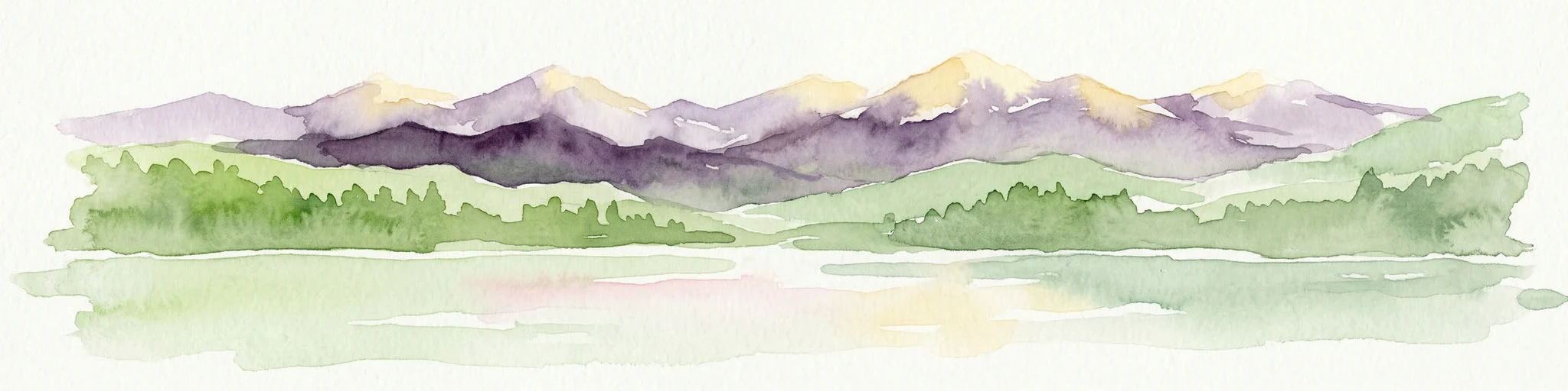
Watercolor illustration of a mountain range with green hills and a lake in the foreground
National parkNorway
About 121 km away#5 closest

Northwest

Jotunheimen National Park: Norway's Iconic Alpine Protected Landscape and Geographic Core

Explore mapped glacial terrain and alpine geography.

Jotunheimen National Park stands as a monument to Norway's alpine grandeur, protecting over 1,151 square kilometers of spectacular mountainous terrain. This protected area is defined by its dramatic glacial features, including sharp peaks exceeding 1,900 meters, U-shaped valleys, and pristine alpine lakes, making it a significant focus for geographic exploration and mapped landscape study. Delve into the core of Norway's mountain heartland, understanding the mapped boundaries and regional geological context that shape this iconic protected landscape.

Area
1,151 km²
Established
1980
IUCN
II
Relief
Mountain
Abstract watercolor landscape with soft pastel hues of green, pink, yellow, and purple
National parkNorway
About 121 km away#6 closest

West

Hallingskarvet National Park: Norway's High Mountain Plateau and Protected Wilderness

Mapping glacial terrain, alpine environments, and wild reindeer habitat.

Hallingskarvet National Park offers a unique window into Norway's geological history and alpine ecology. This protected landscape encompasses the striking Hallingskarvet plateau and the Vargebreen glacier, along with deep valleys carved by ancient ice. Users can explore the park's mapped boundaries, understand its regional geographic setting in Scandinavia, and appreciate its conservation value as a habitat for wild reindeer. The park's terrain provides a concrete example of glacial shaping and high-altitude ecosystems within the Nordic context.

Area
450 km²
Established
2006
IUCN
II
Relief
Mountain
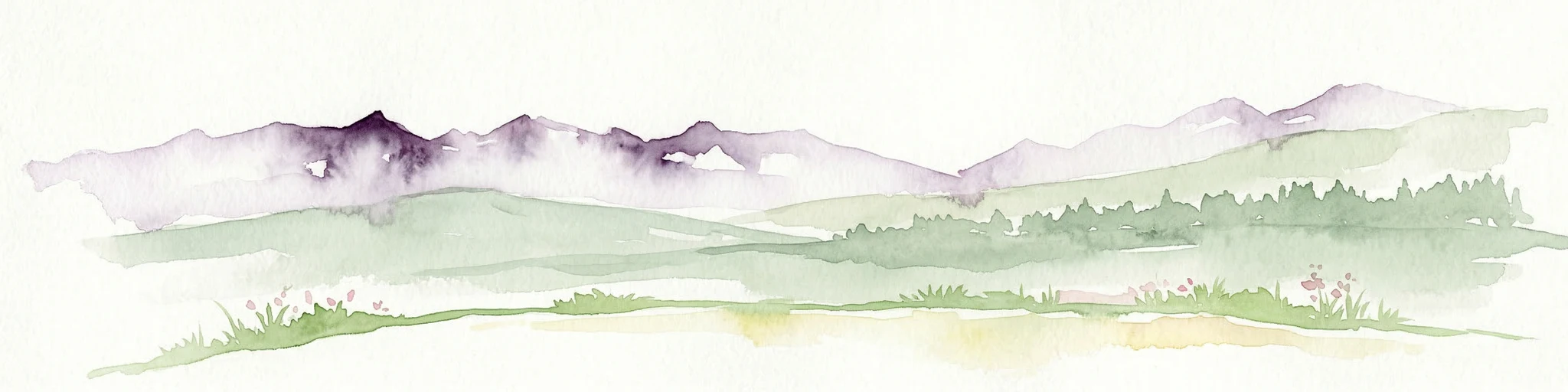
Watercolor painting of mountain peaks with green valleys and grassy foreground
National parkInnlandet
About 135 km away#7 closest

North

Rondane National Park: Norway's Premier Alpine Protected Landscape and Historic National Park

Mapped glacial terrain, iconic peaks, and wild reindeer sanctuary.

As Norway's first national park, Rondane offers a profound exploration of a protected alpine environment. Situated in Innlandet county, its 963 square kilometers showcase a landscape sculpted by glaciers, featuring a striking array of ten peaks exceeding 2,000 meters. This page details Rondane National Park's distinct mapped boundaries, dramatic mountain geography, and its ecological significance as a refuge for wild reindeer, making it a cornerstone of Scandinavian natural heritage.

Area
963 km²
Established
1962
IUCN
II
Relief
Mountain
Watercolor illustration of a coastal landscape with reeds in shallow water and distant green hills under a pale yellow sky
National parkFærder Municipality
About 155 km away#8 closest

South

Færder National Park: Norway's Coastal Archipelago & Marine Protected Area Atlas

Explore mapped landscapes and regional geography.

Færder National Park represents a significant protected landscape in Norway, characterized by its extensive marine environment and scattered archipelago. Situated east of Færder Municipality, the park's geography is defined by a mosaic of granite islands, coastal waters, and the iconic Færder Lighthouse. This entry provides atlas-level insight into the park's mapped boundaries, its role as a protected coastal ecosystem, and its contribution to the broader regional geography of Norway's southern coast.

Area
340 km²
Established
2013
IUCN
II
Relief
Lowland

Common questions about visiting, size, designation, and location context for Vikerfjell Nature Reserve

Vikerfjell Nature Reserve FAQs for park facts, access, geography, and protected area context

Find quick answers about Vikerfjell Nature Reserve, including protected-area facts, park geography, trail and visitor context, and how the park fits into its surrounding country and regional landscape.
MoriAtlas Explorer

Continue Your Protected Areas Search Across the Global Atlas

Deepen your exploration by continuing the structured search for national parks and protected areas worldwide. Utilize the comprehensive filtering capabilities to compare different conservation landscapes and refine your understanding of global park geography. Discover more about the distribution and characteristics of protected natural areas.

Global natural geography