Mori Atlas logo
National parkHardangervidda National Park

Explore the mapped geography and unique tundra ecosystem of this expansive Norwegian national park.

Hardangervidda National Park: Norway's Vast Arctic Plateau and Protected Landscape

(Hardangervidda nasjonalpark)

Hardangervidda National Park represents Norway's largest protected area, an expansive arctic plateau of treeless moorland and countless lakes situated within the Vestland region. This national park, spanning 3,422 square kilometers, protects the largest peneplain in Europe, offering a distinct glimpse into a vital tundra ecosystem and its associated wildlife, including significant wild reindeer herds. Its unique landscape and rich Stone Age archaeological sites make it a key destination for understanding protected lands and regional geography.

Alpine plateauArctic wildlifeMountain landscapeNational parkReindeer habitatNorthern Europe

Hardangervidda National Park

National park

Park overview

Structured park overview, official facts, and landscape profile for Hardangervidda National Park

Hardangervidda National Park park facts, protected area profile, and essential visitor context
Review the core facts for Hardangervidda National Park, including designation, size, terrain, visitor scale, habitats, and operating context in one park-focused overview.

About Hardangervidda National Park

Hardangervidda National Park protects one of Europe's most distinctive and ecologically significant mountain landscapes. The park occupies the heart of the Hardangervidda plateau, a vast expanse of alpine terrain that spans the transition between western and eastern Norway. This is not a park of dramatic peaks or deep valleys, but rather a landscape of subtle beauty—gentle ridges, expansive moorlands, endless pools and lakes, and long vistas across rolling terrain. The plateau's geological foundations are extraordinarily ancient, consisting of Precambrian and Cambro-Silurian bedrock that has been worn smooth by glacial action over countless ice ages. What makes Hardangervidda truly remarkable is its ecological character: despite lying at relatively southerly latitudes, the park supports true Arctic ecosystems because of its altitude. The tree line has been pushed far below the plateau surface, leaving a landscape of mosses, lichens, and hardy grasses that resembles subarctic tundra more typical of latitudes far to the north. This creates a unique ecological laboratory and provides critical habitat for species at the southern edge of their range. The park also serves as a living cultural landscape, where ancient trails still traverse the plateau connecting the Hardanger fjord region with the Numedal valley, and where the evidence of Stone Age human presence remains visible in the form of settlements, hunting grounds, and travel routes.

Quick facts and research context for Hardangervidda National Park

Norway's largest national park at 3,422 km², located across Buskerud, Vestland, and Telemark counties. The Hardangervidda plateau is Europe's largest peneplain with an average elevation of 1,100 metres. The park contains the southernmost Arctic wildlife populations in Europe, including globally significant reindeer herds that have been declining from approximately 15,000 animals in 1996 to around 8,000 by 2008. The highest point is Hardangerjøkulen glacier at 1,863 metres. The Bergen Line railway and Norwegian National Road 7 both traverse the plateau, making it one of Norway's most accessible wilderness areas.

Park context

Deeper park guide and search-rich context for Hardangervidda National Park

Hardangervidda National Park history, landscape, wildlife, and travel context
Explore Hardangervidda National Park through its history, landscape character, ecosystems, wildlife, conservation priorities, cultural context, and seasonal travel timing in a structured park guide built for atlas discovery and search intent.

Why Hardangervidda National Park stands out

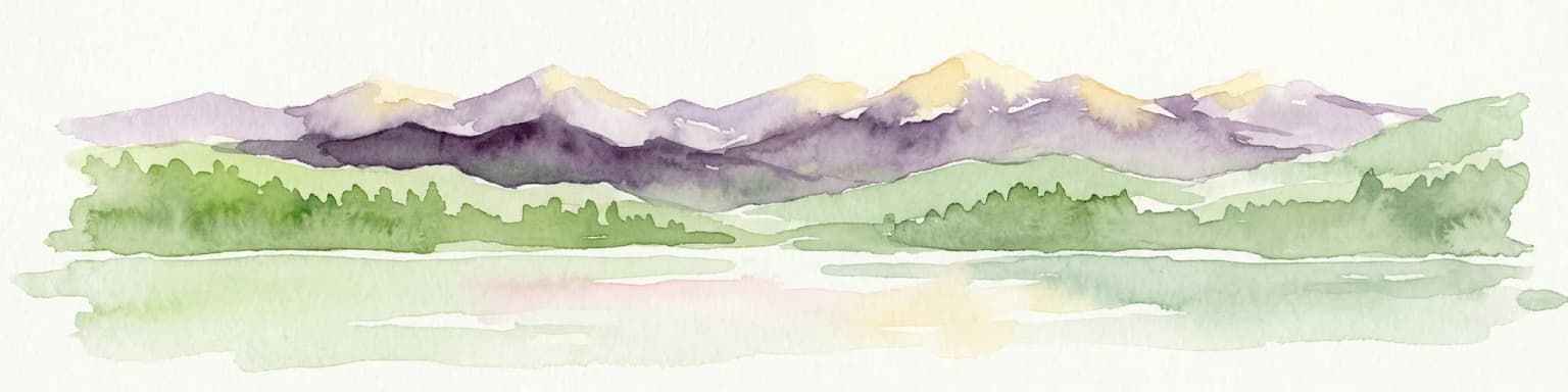
Hardangervidda is best known for its extraordinary Arctic wildlife at unusually southern latitudes, particularly its world-renowned wild reindeer herds that represent one of the last great semi-nomadic cervid populations in Europe. The plateau also contains the largest concentration of Stone Age archaeological sites in Norway, with several hundred nomadic settlements related to ancient reindeer migration routes. The landscape itself is exceptional, a vast, rolling alpine plateau that is the largest of its kind in Europe, with distinctive western and eastern characters: the wet, rocky west side versus the drier, more vegetated east side. The prominent peak of Hårteigen (1,690m) anchors the visual identity of this expansive wilderness.

Hardangervidda National Park history and protected-area timeline

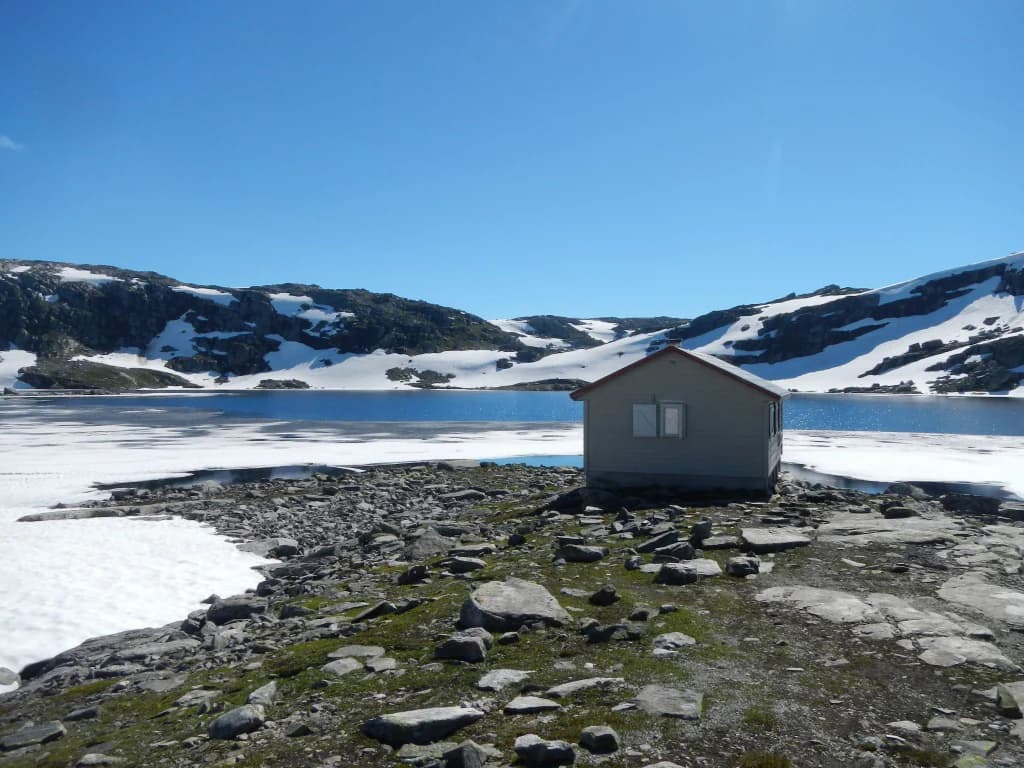
Hardangervidda was designated as a national park in 1981, making it one of Norway's younger protected areas, though the ecological and cultural significance of the plateau had been recognized for decades prior. The establishment of the park came during a period of increased environmental awareness in Norway and reflected a growing commitment to preserving the country's most distinctive natural landscapes. Prior to national park status, the plateau had long been used for seasonal grazing, travel, and recreation, with the Norwegian Mountain Touring Association (DNT) establishing its network of mountain huts and trails across the region beginning in the late 19th and early 20th centuries. The archaeological significance of the area has been understood since the early 20th century, when researchers began documenting the remarkable density of Stone Age settlements across the plateau. These sites, numbering in the hundreds, represent some of the most important archaeological evidence of prehistoric human adaptation to Alpine environments in Northern Europe. The establishment of the park also coincided with growing recognition of the need to protect the reindeer populations, which had been subject to increasing pressure from habitat fragmentation and human disturbance. Today, the park is managed by the Norwegian Directorate for Nature Management, with visitor centres at Øvre Eidfjord in Vestland and at Skinnarbu near Møsvatnet in Telemark providing educational programming and resource information.

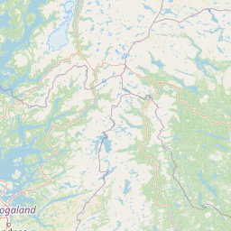
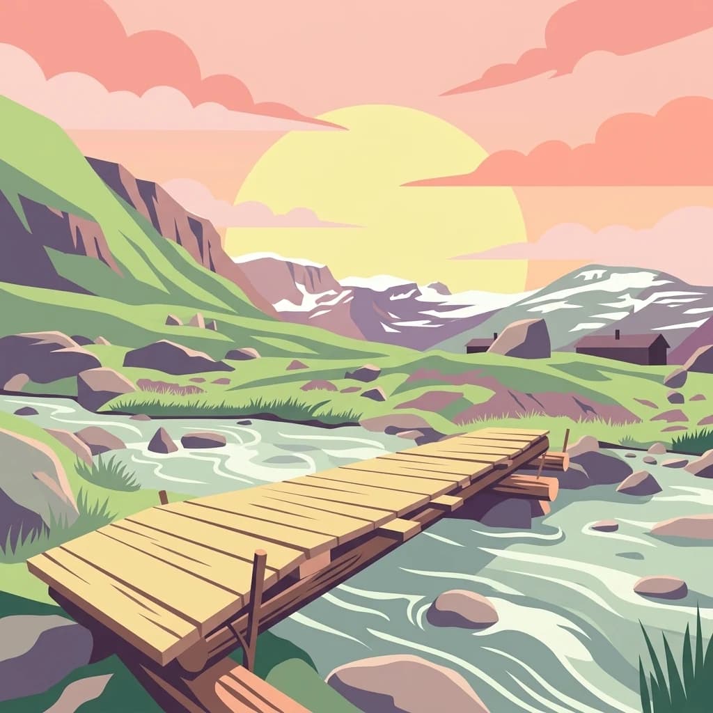
Hardangervidda National Park landscape and geographic character

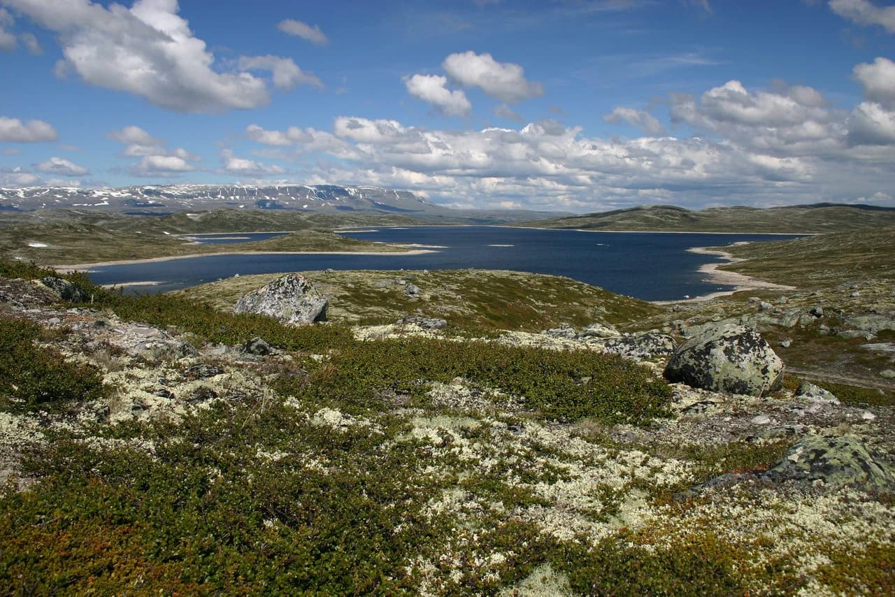
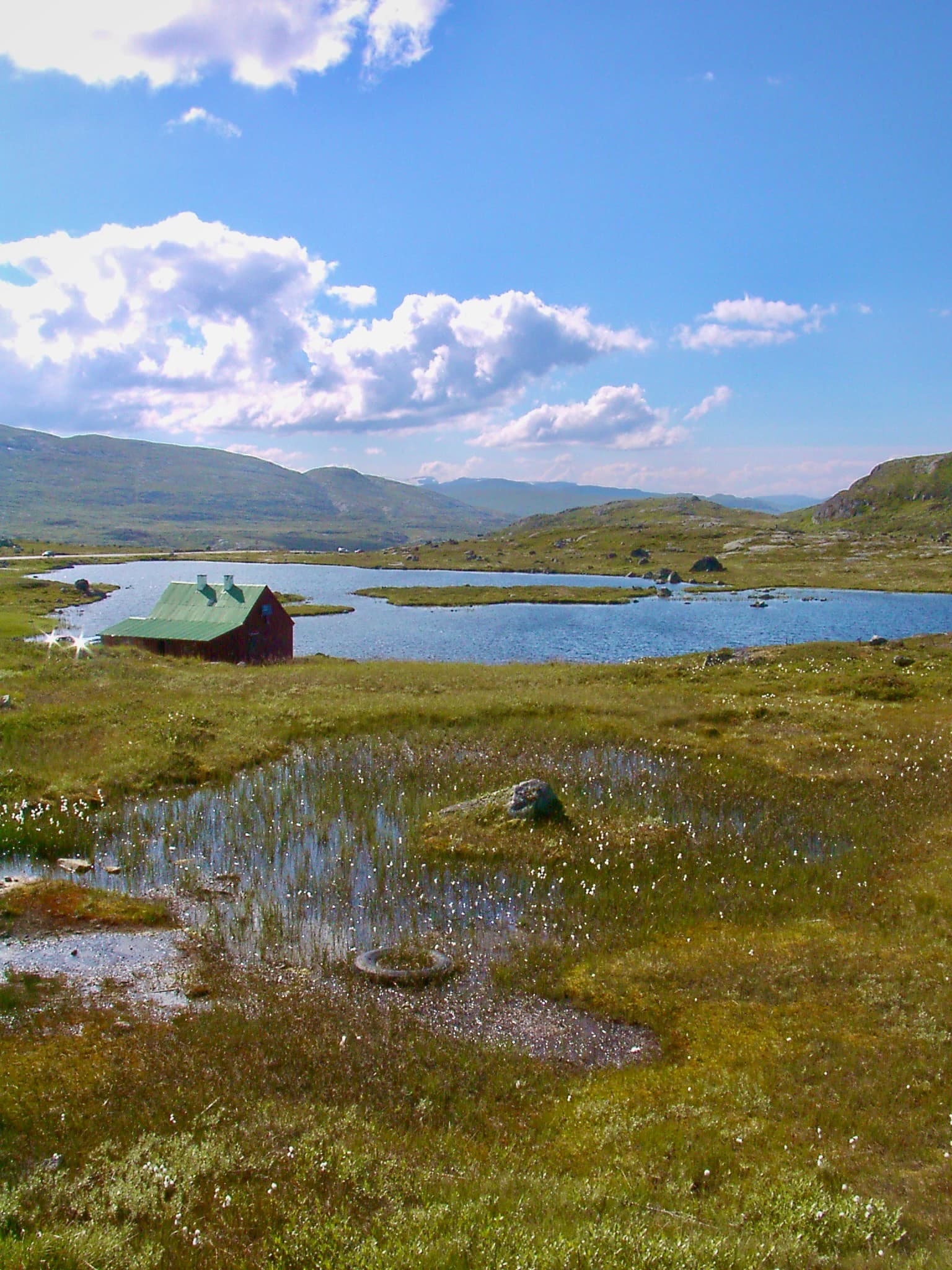
The landscape of Hardangervidda is defined by its extraordinary flatness at altitude—a vast peneplain exposed by the erosive work of glaciers during the ice ages. The plateau covers approximately 6,500 square kilometres at an average elevation of 1,100 metres, making it the largest continuous high-altitude landscape in Europe. The terrain is characterized by gentle, rolling hills, extensive moorlands, and countless bodies of water ranging from small pools to substantial lakes. The western and eastern portions of the plateau present markedly different characters: the west is dominated by rocky terrain, exposed bedrock, and more dramatic relief, while the east is flatter, more vegetated, and tends toward marshy conditions. Several notable peaks punctuate the plateau, most prominently Hardangerjøkulen at 1,863 metres (the highest point within the park) and the distinctive Hårteigen at 1,690 metres, which is visible from much of the plateau and serves as an iconic landmark. The climate varies significantly across the plateau, with the western edge receiving over 1,000 millimetres of precipitation annually while the eastern areas are considerably drier. This climatic gradient contributes to the ecological diversity of the park and creates distinct visual characters between the two sides.

Hardangervidda National Park ecosystems, habitats, and plant life

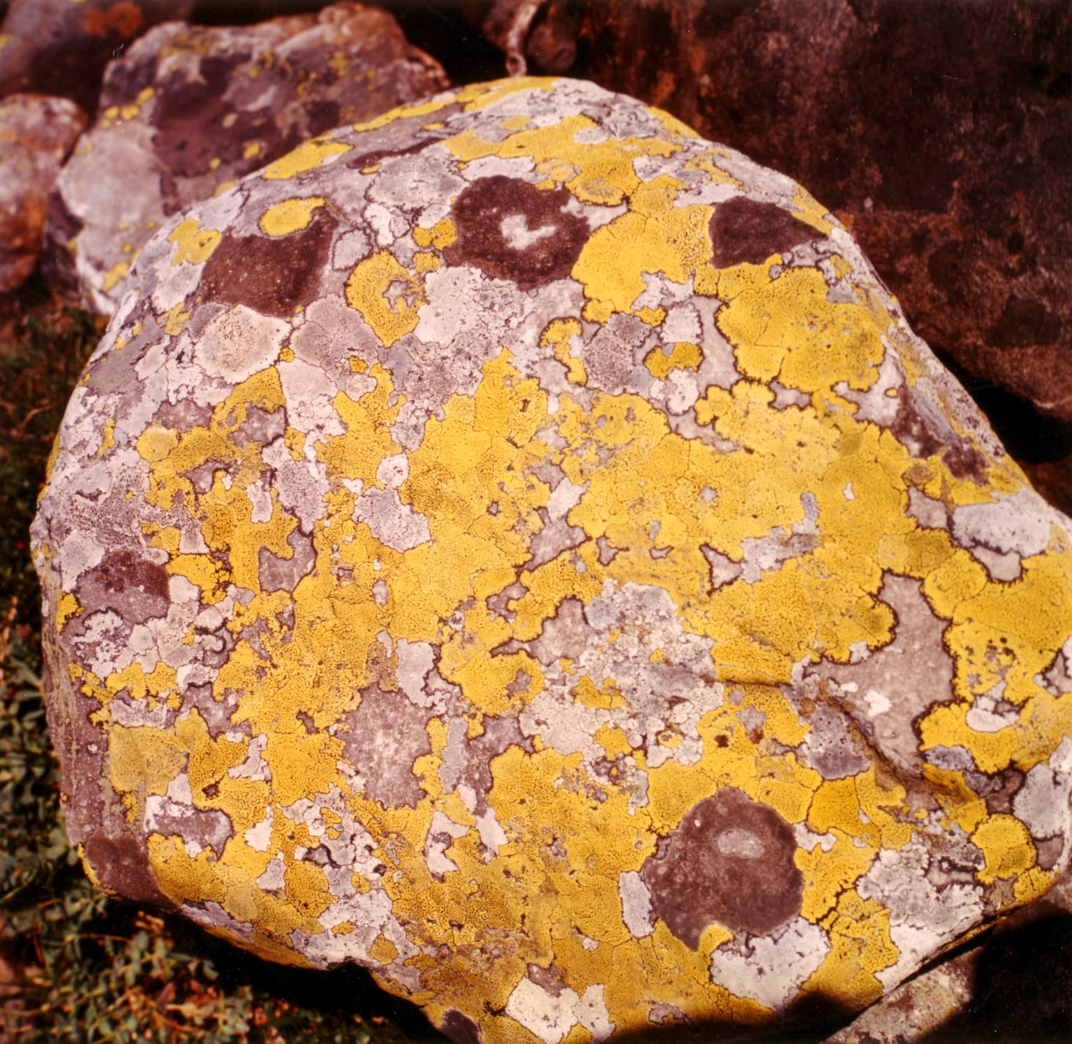
The nature of Hardangervidda is defined by its position as a southern outlier of true Arctic ecosystems. The entire plateau sits above the tree line, creating conditions that allow Arctic species to thrive at latitudes much further south than anywhere else in Europe. This makes the park a critical refuge for cold-adapted species and a living laboratory for understanding climate-driven ecological patterns. The flora of the plateau reflects the climatic gradient between wet west and drier east, with the western side supporting richer vegetation communities including various mosses, grasses, and lichens, while the eastern portions feature more sparse cover. The dominant vegetation across most of the plateau consists of coarse grasses, sphagnum mosses, and lichens, with extensive areas of bare rock and moorland. During the Holocene climatic optimum (approximately 9,000 to 5,000 years ago), the climate was warm enough to support extensive pine forest across the plateau, and preserved logs can still be found in bogs well above today's tree line—a record of past ecosystems that provides context for understanding potential future changes under warming conditions.

Hardangervidda National Park wildlife and species highlights

Hardangervidda supports one of the most significant wildlife populations in Norway, most notably its wild reindeer herds, which are among the largest in the world. These herds represent a remarkable ecological phenomenon: large populations of semi-nomadic reindeer that migrate seasonally across the plateau, moving from winter grazing lands on the eastern side (where they feed primarily on lichen) to more fertile breeding grounds on the western plateau. The herds have historically numbered in the tens of thousands, though populations have shown significant fluctuation, from approximately 15,000 individuals in 1996 to around 8,000 by 2008, reflecting the ecological challenges facing this and other reindeer populations. Beyond reindeer, the park hosts a range of Arctic and alpine species adapted to the harsh conditions, including various bird species that breed on the plateau during the short summer season. The 2016 lightning strike tragedy that killed 323 reindeer (including 70 calves) on the plateau serves as a stark reminder of the vulnerability of these populations to extreme weather events.

Hardangervidda National Park conservation status and protection priorities

Hardangervidda National Park represents one of Norway's most important conservation achievements, protecting a landscape and ecosystem that cannot be found anywhere else in the country or indeed in Europe. The park's designation as IUCN Category II reflects its primary purpose of preserving natural ecosystems while allowing for sustainable recreation and research. The conservation significance of the park is multifaceted: it protects the largest remaining contiguous Alpine landscape in Europe, preserves critical habitat for Arctic species at the southern edge of their range, and safeguards one of the world's last great semi-nomadic reindeer ecosystems. The archaeological heritage of the plateau, with its hundreds of Stone Age sites, adds a cultural dimension to the conservation mandate, as these sites are intimately connected to the ecological patterns (particularly reindeer migration) that the park protects. The challenges facing the park include climate change impacts on both wildlife and vegetation, particularly for the reindeer populations that depend on specific seasonal patterns of forage availability, and ongoing pressures from tourism and infrastructure development along the plateau's edges.

Hardangervidda National Park cultural meaning and human context

The cultural history of Hardangervidda extends back thousands of years and is deeply intertwined with the ecological patterns that define the plateau today. The hundreds of Stone Age settlements discovered across the Hardangervidda represent one of the densest concentrations of prehistoric sites in Norway, and their distribution clearly follows the ancient migration routes of reindeer across the plateau. These nomadic settlements, dating from various periods of the Stone Age, document a pattern of human adaptation in which groups followed the reindeer herds as they moved between seasonal grazing areas, creating a cultural landscape that predates the park by millennia. Ancient trails such as the Nordmannsslepa still cross the plateau, linking the Hardanger fjord region with the Numedal valley and serving as historic corridors between western and eastern Norway. The plateau has never supported permanent settlement, but its role as a transit route and seasonal hunting ground has given it continuous cultural significance from prehistoric times through the present day. The crossing of the plateau by both the Bergen Line railway and Norwegian National Road 7 represents the latest chapter in this long history of human movement across the Hardangervidda.

Top sights and standout views in Hardangervidda National Park

The defining highlights of Hardangervidda include its extraordinary size and accessibility as Norway's largest national park, offering visitors a true wilderness experience within reach of major cities. The wild reindeer herds represent a globally significant wildlife spectacle, visible across the open plateau as one of the last great semi-nomadic cervid populations. The archaeological richness of the landscape, with its hundreds of Stone Age sites, provides a unique window into prehistoric human adaptation to extreme environments. The distinctive visual character of the plateau—vast moorlands, countless lakes, the iconic Hårteigen peak, and the contrast between wet west and dry east—creates one of Norway's most recognizable mountain landscapes. The accessibility of the park, with the Bergen Line railway and National Road 7 crossing the plateau, combined with the extensive DNT hut and trail network, makes it one of Norway's most visited wilderness areas year-round.

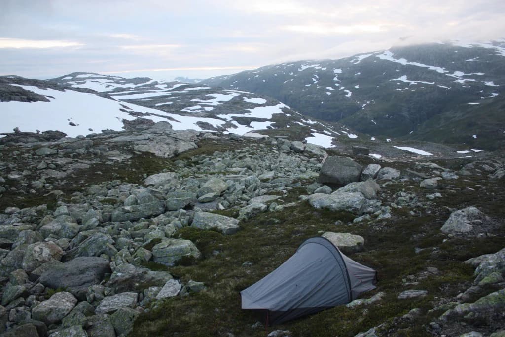
Best time to visit Hardangervidda National Park

Hardangervidda is accessible throughout the year, with each season offering distinct experiences. The summer months from June through September represent the most popular time for visitors, when the plateau is ideal for hiking, wildlife viewing, fishing, and camping under the famous midnight sun. The reindeer are most easily observed during this period as they graze on the western plateau, and the long days provide maximum opportunity for exploration. Autumn (September to October) brings spectacular autumn colours across the moorland and offers a quieter, more solitary experience as the summer crowds diminish. Winter transforms the plateau into one of Norway's premier cross-country skiing destinations, with the DNT huts providing shelter for multi-day ski tours across the snow-covered landscape. The harsh winter conditions, with heavy snow and extreme temperatures, demand proper preparation but reward experienced winter visitors with extraordinary silence and stark beauty. Spring (May to June) is a transitional period when the snow recedes and the plateau awakens, though access can be limited as snow fields persist in higher areas.

Park location guide

Geography guide, regional context, and park location map for Hardangervidda National Park

Hardangervidda National Park park geography, regions, and map view in Norway
Understand where Hardangervidda National Park sits in Norway through a broader geographic reading of the surrounding landscape, nearby location context, and its mapped position within the national park landscape.

How Hardangervidda National Park fits into Norway

Norway, officially the Kingdom of Norway, is a Nordic country in Northern Europe located on the Scandinavian Peninsula. It encompasses mainland Norway, the Arctic islands of Svalbard and Jan Mayen, and maintains dependencies including Bouvet Island and Antarctic claims. The country has a population of about 5.6 million and is bordered by Sweden, Finland, and Russia. Norway is a unitary parliamentary constitutional monarchy with Oslo as its capital and largest city.

Wider geography shaping Hardangervidda National Park in Norway

Norway occupies the western and northern portions of the Scandinavian Peninsula in Northern Europe. The country shares a long eastern border with Sweden, and borders Finland and Russia to the northeast. Norway has an extensive coastline facing the Skagerrak, North Sea, Norwegian Sea, and Barents Sea. The terrain is predominantly mountainous with numerous fjords along the coastline.

Map view of Hardangervidda National Park

Use this park location map to pinpoint Hardangervidda National Park in Norway, understand its exact geographic position, and read its mapped placement within the surrounding landscape more clearly.

Pigeon | © OpenStreetMap contributors

Location context for Hardangervidda National Park

BuskerudTelemarkVestland
Park atlas

Compare protected areas across Norway's Western Fjords and the expansive mountain plateau geography.

Find Nearby National Parks and Protected Areas Beyond Hardangervidda National Park, Vestland
After exploring Hardangervidda National Park, browse additional national parks and protected areas across Norway's Vestland region and connected mountain landscapes. Compare diverse wilderness areas and trace their geographic spread to understand the regional conservation landscape of Western Norway.
Watercolor illustration of a mountain landscape with green vegetation and pastel-colored peaks
National parkVestland

Folgefonna National Park: Norway's Premier Glacier Protected Landscape

Mapped glacial terrain and park boundaries in Vestland.

Folgefonna National Park in Vestland, Norway, stands as a premier protected area defined by its vast ice cap and dramatic glacial geography. This page details the park's mapped boundaries, showcasing its impressive glacial formations, U-shaped valleys, and distinct alpine landscapes. Understand the geographic context and protected status of Folgefonna National Park, a key destination for exploring Norway's glacier heritage through an atlas-driven lens.

Area
545.2 km²
Established
2005
IUCN
II
Relief
Mountain
Abstract watercolor landscape with soft pastel hues of green, pink, yellow, and purple
National park

Hallingskarvet National Park: Norway's High Mountain Plateau and Protected Wilderness

Mapping glacial terrain, alpine environments, and wild reindeer habitat.

Hallingskarvet National Park offers a unique window into Norway's geological history and alpine ecology. This protected landscape encompasses the striking Hallingskarvet plateau and the Vargebreen glacier, along with deep valleys carved by ancient ice. Users can explore the park's mapped boundaries, understand its regional geographic setting in Scandinavia, and appreciate its conservation value as a habitat for wild reindeer. The park's terrain provides a concrete example of glacial shaping and high-altitude ecosystems within the Nordic context.

Area
450 km²
Established
2006
IUCN
II
Relief
Mountain
Watercolor illustration of a mountain range with green hills and a lake in the foreground
National park

Jotunheimen National Park: Norway's Iconic Alpine Protected Landscape and Geographic Core

Explore mapped glacial terrain and alpine geography.

Jotunheimen National Park stands as a monument to Norway's alpine grandeur, protecting over 1,151 square kilometers of spectacular mountainous terrain. This protected area is defined by its dramatic glacial features, including sharp peaks exceeding 1,900 meters, U-shaped valleys, and pristine alpine lakes, making it a significant focus for geographic exploration and mapped landscape study. Delve into the core of Norway's mountain heartland, understanding the mapped boundaries and regional geological context that shape this iconic protected landscape.

Area
1,151 km²
Established
1980
IUCN
II
Relief
Mountain
National parkInnlandet

Langsua National Park: Protected Mountain Forests and Inland Wilderness in Innlandet, Norway

Discover mapped boundaries and regional geographic context.

Langsua National Park, a designation expanded in 2011, is a prominent protected area in Norway's Innlandet county. This national park encompasses 537.1 square kilometers of diverse mountainous terrain, characterized by extensive mountain forests and inland wilderness habitats. Its creation consolidates fragmented nature reserves into a significant contiguous protected landscape, offering valuable insight into Norway's conservation strategies and the geographic context of its eastern mountain regions.

Area
537.1 km²
Established
2011
IUCN
II
Relief
Mixed relief
National parkTelemark

Jomfruland National Park: Coastal Archipelago and Skagerrak Marine Atlas

Norway's unique marine-focused national park landscape.

Jomfruland National Park is a significant protected landscape in Telemark, Norway, renowned for its coastal island geography and a landscape predominantly composed of marine waters. Covering 117 square kilometers, this national park emphasizes the conservation of both terrestrial island habitats and the surrounding Skagerrak coastal ecosystem. Explore the park's mapped boundaries and discover its regional geographic context, offering a unique perspective on Norway's protected areas and maritime natural heritage through MoriAtlas.

Area
117 km²
Established
2016
IUCN
II
Scope
Mixed
National parkVestland

Jostedalsbreen National Park: Europe's Premier Glacial Protected Landscape

Mapped terrain and protected area discovery in Vestland, Norway.

Jostedalsbreen National Park represents a unique geographic entity, safeguarding the largest glacier on the European mainland. This national park, situated in Norway's Vestland region, offers profound insights into glacial landscapes and mountain geography. Users can explore the vast ice mass that dominates the terrain, observe the U-shaped valleys carved by its movement, and understand the geological processes shaping this dynamic environment. The park's protected status highlights its importance for understanding glacial science and preserving a critical component of Norway's natural heritage.

Area
1,310 km²
Established
1991
IUCN
II
Relief
Mountain
National parkInnlandet

Breheimen National Park: Protected Glacial Landscapes and Mountain Terrain in Innlandet

Norway's prominent national park featuring active glaciers and alpine geography.

Breheimen National Park represents a significant protected landscape within Norway's Innlandet region, dedicated to conserving its unique glacial formations and dramatic alpine terrain. The park's vast area encompasses active glaciers, soaring peaks, and a notable diversity of natural environments, from lush valleys to barren plateaus. MoriAtlas facilitates a detailed exploration of Breheimen National Park, highlighting its mapped protected boundaries and its integral role in the regional geography and protected areas atlas.

Area
1,671 km²
Established
2009
IUCN
II
Relief
Mountain
Watercolor painting of coastal waters, islands, rocky shore, and distant hills
National parkAgder

Raet National Park: A Coastal National Park Defined by Glacial Moraine Landscape in Agder

Explore Norway's southern coast geography and protected marine area.

Raet National Park offers a profound exploration of Norway's post-glacial landscape, anchored by its namesake 12,000-year-old glacial moraine. This unique protected area, predominantly marine, reveals a striking combination of terrestrial moraine features, extensive pebble beaches, and submerged geological formations. Understanding its mapped boundaries within Agder provides critical context for appreciating this significant coastal protected landscape, its marine ecosystems, and its role in the regional geography.

Area
607 km²
Established
2016
IUCN
II
Relief
Lowland

Common questions about visiting, size, designation, and location context for Hardangervidda National Park

Hardangervidda National Park FAQs for park facts, access, geography, and protected area context
Find quick answers about Hardangervidda National Park, including protected-area facts, park geography, trail and visitor context, and how the park fits into its surrounding country and regional landscape.
MoriAtlas Explorer

Continue Your Protected Areas Search Across the Global Atlas

Deepen your exploration by continuing the structured search for national parks and protected areas worldwide. Utilize the comprehensive filtering capabilities to compare different conservation landscapes and refine your understanding of global park geography. Discover more about the distribution and characteristics of protected natural areas.

Global natural geography