Mori Atlas logo
National parkHallingskarvet National Park

Mapping the distinct high mountain terrain, valleys, and Vargebreen glacier.

Hallingskarvet National Park: Norway's Protected Alpine Plateau and Glacial Landscape

(Hallingskarvet nasjonalpark)

Hallingskarvet National Park in Norway protects a significant high-mountain plateau and its adjacent alpine environments, covering approximately 450 square kilometers of rugged terrain. Established to preserve unique ecological communities and geological heritage shaped by ice ages, the park features dramatic formations like the Hallingskarvet plateau and the Vargebreen glacier. Discover the mapped boundaries of this protected wilderness, its varied terrain including major valleys, and its role within the broader Scandinavian geography through detailed atlas exploration.

National ParkNorwayAlpine EnvironmentGlacial LandscapeWild ReindeerProtected Wilderness
Stylized illustration of a mountainous landscape with a waterfall, river, forested areas, and snow-capped peaks under a sunlit sky

Hallingskarvet National Park

National park

Park overview

Structured park overview, official facts, and landscape profile for Hallingskarvet National Park

Hallingskarvet National Park park facts, protected area profile, and essential visitor context
Review the core facts for Hallingskarvet National Park, including designation, size, terrain, visitor scale, habitats, and operating context in one park-focused overview.

About Hallingskarvet National Park

Hallingskarvet National Park protects a substantial area of Norway's high mountain landscape in the central part of the country. The park was formally established by the Norwegian government in December 2006, with the primary objectives of preserving the natural landscape, its ecosystems, and the populations of wild reindeer that depend on this habitat.

The park encompasses the Hallingskarvet mountain range itself, a prominent geological feature in the Norwegian highlands. The protected area extends westward from the main plateau to include the Vargebreen glacier, one of the significant ice bodies in this region. Several glacial valleys penetrate the park boundary, including Såtedalen, Lengjedalen, Ynglesdalen, and portions of Raggsteindalen, creating a complex topography of valleys, ridges, and exposed plateau surfaces.

The establishment of the park reflected recognition that this area represents a relatively unmodified high-mountain environment in the Norwegian context. Unlike many Norwegian mountain areas that have seen extensive human modification, Hallingskarvet retains much of its natural character, with the geological formations, glacial features, and ecological communities largely intact. This made the area suitable for national park designation aimed at long-term preservation.

Access to the park is limited, particularly on the southern side where no road infrastructure exists. The Bergen Line railway provides the primary access point through Finse Station, which serves as a gateway for visitors seeking to explore the park's southern portions. The railway itself runs along the park's southern boundary, while Norwegian County Road 50 passes near the northern edge.

Quick facts and research context for Hallingskarvet National Park

Hallingskarvet National Park occupies 450 square kilometres of Norwegian high mountain terrain in Hol, Ulvik, and Aurland municipalities across Buskerud and Vestland counties. The park centers on the Hallingskarvet plateau and extends westward to include the Vargebreen glacier system. Wild reindeer populations have been a key factor in the park's protection status, with the park preserving important grazing grounds for these animals. The geology reflects multiple glacial periods, creating a landscape that serves as a natural laboratory for understanding Norwegian mountain formation and ecological adaptation.

Park context

Deeper park guide and search-rich context for Hallingskarvet National Park

Hallingskarvet National Park history, landscape, wildlife, and travel context
Explore Hallingskarvet National Park through its history, landscape character, ecosystems, wildlife, conservation priorities, cultural context, and seasonal travel timing in a structured park guide built for atlas discovery and search intent.

Why Hallingskarvet National Park stands out

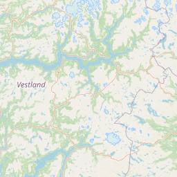
Hallingskarvet National Park is best known for its dramatic alpine plateau landscape, the Vargebreen glacier, and significant wild reindeer populations that inhabit the high mountain terrain. The park preserves one of Norway's more accessible high-altitude wilderness areas, with the Bergen Line railway running along its southern boundary and Finse Station providing rare public access to this otherwise roadless landscape. The geological significance of the area, demonstrating the connection between glacial history and current biodiversity patterns, represents another defining characteristic of the park.

Mountain lake with turquoise water surrounded by rocky slopes and snow-capped peaks under a partly cloudy sky
Scenic mountain lake view from Knutshøi looking towards Jotunheimen

Hallingskarvet National Park history and protected-area timeline

Hallingskarvet National Park was established on 22 December 2006 through formal government action, representing a relatively recent addition to Norway's system of protected areas. The creation of the park reflected growing recognition during the 1990s and early 2000s of the ecological and geological importance of Norway's high mountain landscapes.

The wild reindeer populations of the Hallingskarvet area were a significant factor in the establishment of the park. These animals depend on the alpine and sub-nival habitats within the park boundaries for their seasonal movements and grazing. The protection of these wild reindeer stocks provided a biological rationale for preserving a large contiguous area of mountain terrain.

The Norwegian Directorate for Nature Management serves as the governing body responsible for the park's administration and management. The park's designation as an IUCN Category II protected area reflects its primary objective of landscape and ecosystem conservation while allowing for continued traditional outdoor use of the area.

Hallingskarvet National Park landscape and geographic character

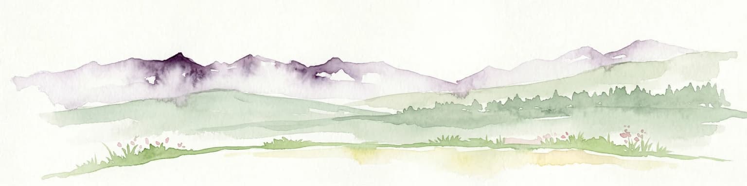
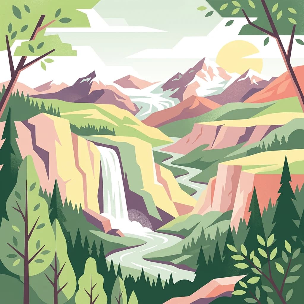
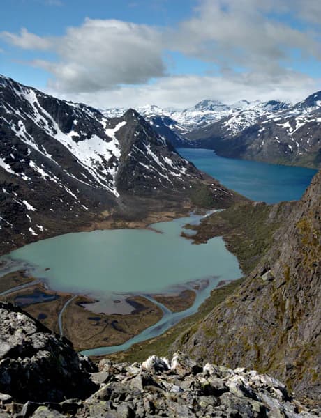
The Hallingskarvet landscape is defined by its high mountain plateau character, the result of geological processes extending through multiple ice ages. The Hallingskarvet plateau rises above the surrounding terrain, creating a distinctive flat-topped mountain formation that dominates the eastern portion of the park. From this elevated surface, the terrain descends westward toward the glacier and the major valleys that carve through the protected area.

The Vargebreen glacier represents a significant glacial feature within the park, occupying the western reaches of the protected area. This ice body, like others in the Norwegian highlands, is a remnant of the extensive glaciation that shaped the current landscape. The glacier's presence influences local hydrology, microclimate, and ecological conditions.

The valleys within the park—Såtedalen, Lengjedalen, Ynglesdalen, and Raggsteindalen—provide lower-elevation corridors through the alpine terrain. These valleys have been shaped by glacial action and subsequent erosion, creating the characteristic U-shaped profiles typical of glacial valleys. The variation in elevation across the park, from valley floors to the plateau surface and culminating at Folarskardnuten at 1,933 metres, creates diverse environmental conditions within a relatively compact area.

Hallingskarvet National Park ecosystems, habitats, and plant life

The ecological character of Hallingskarvet National Park reflects the harsh but productive conditions of Norwegian high mountain environments. The park spans elevation zones from valley bottoms through alpine heaths to nival zones near the glacier and highest peaks. This vertical zonation supports distinct plant communities adapted to each altitude band.

The geological history preserved in the park's landforms has direct relevance to understanding current biodiversity patterns. The variation in substrate, moisture availability, and exposure across the park creates a mosaic of microhabitats supporting different species assemblages. Areas of particular ecological value within the park support species that are threatened or vulnerable in broader Norwegian contexts.

The Draba cacuminum, a species of whitlow-grass, represents one of the specialized alpine plants found in the park. This species, along with Botrychium lanceolatum (lance-leaf grapefern), occupies habitats within the park that provide the specific conditions these species require for survival. These botanical occurrences contribute to the park's conservation significance beyond the more visible mammal populations.

Hallingskarvet National Park wildlife and species highlights

Wild reindeer constitute the most prominent large mammal species within Hallingskarvet National Park. These animals have maintained populations in the Norwegian mountain regions through centuries of traditional land use and represent a key element of the park's ecological character. The high mountain terrain provides seasonal grazing opportunities, with the animals moving between different elevations throughout the year.

The reindeer populations of Hallingskarvet were a primary justification for the park's establishment, reflecting both their conservation importance and their role as an indicator of ecosystem health. The maintenance of viable reindeer stocks depends on the preservation of connected habitat areas that allow for traditional migration patterns and genetic exchange between populations.

The park's position within the broader Norwegian mountain ecosystem means it contributes to the network of protected areas that support biodiversity in this landscape type. While the Wikipedia source emphasizes the wild reindeer populations, the diverse habitats from valley to plateau also support various bird species and smaller mammals adapted to alpine conditions.

Hallingskarvet National Park conservation status and protection priorities

Hallingskarvet National Park serves multiple conservation objectives within Norway's protected area network. The preservation of wild reindeer populations represents a primary conservation goal, with the park protecting essential habitat for these animals in an era when such populations face pressures from development, climate change, and habitat fragmentation. The park forms part of a broader network of protected areas that collectively maintain viable populations of this species across its traditional range.

The geological conservation dimension of the park reflects Norway's approach to preserving representative examples of landscape types and geological processes. The Hallingskarvet area demonstrates clear connections between glacial history and current ecological patterns, making it valuable for both scientific understanding and conservation education. The protection of this geological context ensures that these relationships remain observable and interpretable.

The presence of vulnerable plant species including Draba cacuminum and Botrychium lanceolatum adds botanical conservation significance to the park. These species depend on specific habitat conditions that the park's protection helps maintain. The broader conservation framework also considers cultural heritage elements within the protected area, recognizing the long history of human presence and traditional use that has shaped this landscape.

Hallingskarvet National Park cultural meaning and human context

The name Hallingskarvet provides insight into the cultural geography of the region. The first element, "halling," refers to an inhabitant of the Hallingdal valley, linking the mountain to the human communities that have historically utilized this landscape. The second element derives from "skarv," the Norwegian term for mountain or mountainous area lacking vegetation, describing the character of the exposed high terrain.

This naming convention reflects the traditional relationship between Norwegian valley communities and the mountain areas that border their settlements. The Hallingdal valley has been inhabited for centuries, with communities maintaining connections to the high mountain terrain for grazing, hunting, and other traditional activities. The park encompasses landscape that would have been part of this historical land-use pattern.

The Bergen Line railway, completed in the early twentieth century, introduced new forms of access to this mountain landscape. Finse Station, situated near the park boundary, represents a point where modern infrastructure meets the wilderness character that the park now protects. This railway connection has made the area more accessible to visitors while still maintaining the remote character of the high mountain terrain.

Top sights and standout views in Hallingskarvet National Park

Hallingskarvet National Park protects one of Norway's most distinctive high mountain landscapes, with the dramatic plateau of Hallingskarvet rising above surrounding terrain and the Vargebreen glacier adding glacial character to the western reaches of the park. The wild reindeer populations that depend on this terrain represent a conservation priority and provide a wildlife viewing focus for visitors. The geological significance of the area, demonstrating clear relationships between glacial history and biodiversity patterns, makes the park valuable for environmental education and scientific research. Access via the Bergen Line railway at Finse provides a unique approach to this wilderness area, arriving by train to a landscape largely free of road access.

Best time to visit Hallingskarvet National Park

The optimal time to visit Hallingskarvet National Park corresponds to the Norwegian summer season, typically from June through September, when the high mountain terrain is most accessible and conditions allow for outdoor exploration. During this period, the weather is generally more stable, temperatures are suitable for extended outdoor activities, and the wildflower displays in the alpine zones add botanical interest to the landscape. The summer months also coincide with the active season for wildlife viewing, including the reindeer that inhabit the park.

Winter visits are possible but require appropriate equipment and preparation for harsh mountain conditions. The park's high elevation means snow cover persists for most of the year outside the summer months, and temperatures can be severe. The off-season period offers a different character, with the landscape transformed by winter conditions and fewer visitors, but access challenges increase significantly.

The shoulder seasons of late spring and early autumn present transitional conditions that may offer intermediate character, though weather unpredictability is higher during these periods. Visitors planning trips should be aware that the alpine environment can change rapidly regardless of season, and preparation for variable conditions is essential.

Park location guide

Geography guide, regional context, and park location map for Hallingskarvet National Park

Hallingskarvet National Park park geography, regions, and map view in Norway
Understand where Hallingskarvet National Park sits in Norway through a broader geographic reading of the surrounding landscape, nearby location context, and its mapped position within the national park landscape.

How Hallingskarvet National Park fits into Norway

Norway, officially the Kingdom of Norway, is a Nordic country in Northern Europe located on the Scandinavian Peninsula. It encompasses mainland Norway, the Arctic islands of Svalbard and Jan Mayen, and maintains dependencies including Bouvet Island and Antarctic claims. The country has a population of about 5.6 million and is bordered by Sweden, Finland, and Russia. Norway is a unitary parliamentary constitutional monarchy with Oslo as its capital and largest city.

Wider geography shaping Hallingskarvet National Park in Norway

Norway occupies the western and northern portions of the Scandinavian Peninsula in Northern Europe. The country shares a long eastern border with Sweden, and borders Finland and Russia to the northeast. Norway has an extensive coastline facing the Skagerrak, North Sea, Norwegian Sea, and Barents Sea. The terrain is predominantly mountainous with numerous fjords along the coastline.

Map view of Hallingskarvet National Park

Use this park location map to pinpoint Hallingskarvet National Park in Norway, understand its exact geographic position, and read its mapped placement within the surrounding landscape more clearly.

Pigeon | © OpenStreetMap contributors

Location context for Hallingskarvet National Park

BuskerudVestland

Visual Insights into Hallingskarvet's Protected Terrain, Unique Glaciers, and Wild Reindeer Habitats

Hallingskarvet National Park Photos: Explore Norway's High-Mountain Glacial Landscapes and Alpine Scenery
Browse comprehensive imagery of Hallingskarvet National Park to understand its distinctive alpine plateau, glacial features, and rugged mountain landscapes. Explore the visual character of this Norwegian protected area, from high peaks like Folarskardnuten to the Vargebreen glacier and its vital wild reindeer ecosystems.

Mountain lake with turquoise water surrounded by rocky slopes and snow-capped peaks under a partly cloudy sky

Snow-covered mountain plateau under clear blue sky with distant mountain range

Park atlas

Compare surrounding high-mountain landscapes and protected wilderness areas, tracing regional geographic patterns.

Discover Other Alpine National Parks and Protected Areas Near Hallingskarvet National Park
Continue your exploration beyond Hallingskarvet National Park by browsing other national parks and protected areas across Norway's distinctive high-mountain landscapes. This detailed view provides crucial geographic context, enabling direct comparison of alpine environments, glacial features, and critical wild reindeer conservation areas.
National parkVestland

Hardangervidda National Park: Vast Arctic Plateau and European Peneplain Discovery

Explore Norway's largest national park and its unique tundra ecosystem.

Delve into the geography of Hardangervidda National Park, Norway's largest national park, featuring the expansive Arctic plateau and Europe's largest peneplain. This protected landscape offers a unique mapped environment characterized by treeless moorland, numerous lakes, and important wildlife habitats, including significant wild reindeer populations. Understand its position within the Vestland region and its value as a key protected area for geographic exploration and landscape context.

Area
3,422 km²
Established
1981
IUCN
II
Relief
Highland
Watercolor illustration of a mountain landscape with green vegetation and pastel-colored peaks
National parkVestland

Folgefonna National Park: Norway's Premier Glacier Protected Landscape

Mapped glacial terrain and park boundaries in Vestland.

Folgefonna National Park in Vestland, Norway, stands as a premier protected area defined by its vast ice cap and dramatic glacial geography. This page details the park's mapped boundaries, showcasing its impressive glacial formations, U-shaped valleys, and distinct alpine landscapes. Understand the geographic context and protected status of Folgefonna National Park, a key destination for exploring Norway's glacier heritage through an atlas-driven lens.

Area
545.2 km²
Established
2005
IUCN
II
Relief
Mountain
Watercolor illustration of a mountain range with green hills and a lake in the foreground
National park

Jotunheimen National Park: Norway's Iconic Alpine Protected Landscape and Geographic Core

Explore mapped glacial terrain and alpine geography.

Jotunheimen National Park stands as a monument to Norway's alpine grandeur, protecting over 1,151 square kilometers of spectacular mountainous terrain. This protected area is defined by its dramatic glacial features, including sharp peaks exceeding 1,900 meters, U-shaped valleys, and pristine alpine lakes, making it a significant focus for geographic exploration and mapped landscape study. Delve into the core of Norway's mountain heartland, understanding the mapped boundaries and regional geological context that shape this iconic protected landscape.

Area
1,151 km²
Established
1980
IUCN
II
Relief
Mountain
National parkInnlandet

Langsua National Park: Protected Mountain Forests and Inland Wilderness in Innlandet, Norway

Discover mapped boundaries and regional geographic context.

Langsua National Park, a designation expanded in 2011, is a prominent protected area in Norway's Innlandet county. This national park encompasses 537.1 square kilometers of diverse mountainous terrain, characterized by extensive mountain forests and inland wilderness habitats. Its creation consolidates fragmented nature reserves into a significant contiguous protected landscape, offering valuable insight into Norway's conservation strategies and the geographic context of its eastern mountain regions.

Area
537.1 km²
Established
2011
IUCN
II
Relief
Mixed relief
National parkVestland

Jostedalsbreen National Park: Europe's Premier Glacial Protected Landscape

Mapped terrain and protected area discovery in Vestland, Norway.

Jostedalsbreen National Park represents a unique geographic entity, safeguarding the largest glacier on the European mainland. This national park, situated in Norway's Vestland region, offers profound insights into glacial landscapes and mountain geography. Users can explore the vast ice mass that dominates the terrain, observe the U-shaped valleys carved by its movement, and understand the geological processes shaping this dynamic environment. The park's protected status highlights its importance for understanding glacial science and preserving a critical component of Norway's natural heritage.

Area
1,310 km²
Established
1991
IUCN
II
Relief
Mountain
National parkInnlandet

Breheimen National Park: Protected Glacial Landscapes and Mountain Terrain in Innlandet

Norway's prominent national park featuring active glaciers and alpine geography.

Breheimen National Park represents a significant protected landscape within Norway's Innlandet region, dedicated to conserving its unique glacial formations and dramatic alpine terrain. The park's vast area encompasses active glaciers, soaring peaks, and a notable diversity of natural environments, from lush valleys to barren plateaus. MoriAtlas facilitates a detailed exploration of Breheimen National Park, highlighting its mapped protected boundaries and its integral role in the regional geography and protected areas atlas.

Area
1,671 km²
Established
2009
IUCN
II
Relief
Mountain
Watercolor painting of mountain peaks with green valleys and grassy foreground
National parkInnlandet

Rondane National Park: Norway's Premier Alpine Protected Landscape and Historic National Park

Mapped glacial terrain, iconic peaks, and wild reindeer sanctuary.

As Norway's first national park, Rondane offers a profound exploration of a protected alpine environment. Situated in Innlandet county, its 963 square kilometers showcase a landscape sculpted by glaciers, featuring a striking array of ten peaks exceeding 2,000 meters. This page details Rondane National Park's distinct mapped boundaries, dramatic mountain geography, and its ecological significance as a refuge for wild reindeer, making it a cornerstone of Scandinavian natural heritage.

Area
963 km²
Established
1962
IUCN
II
Relief
Mountain
National parkInnlandet

Reinheimen National Park: Norway's Vast Protected Wilderness Landscape and Alpine Geography

Map of protected boundaries and diverse mountain terrain.

Reinheimen National Park is a cornerstone of Norway's protected areas, encompassing a substantial portion of Western Norway's alpine wilderness. This national park protects a dynamic landscape characterized by dramatic western peaks and gentler eastern plateaus, providing critical habitat for wild reindeer and other wildlife. Its extensive mapped boundaries and varied natural terrain offer a rich subject for geographic discovery and atlas exploration, highlighting the ecological significance of well-preserved mountain ecosystems within Innlandet.

Area
1,969 km²
Established
2006
IUCN
II
Relief
Mountain

Common questions about visiting, size, designation, and location context for Hallingskarvet National Park

Hallingskarvet National Park FAQs for park facts, access, geography, and protected area context
Find quick answers about Hallingskarvet National Park, including protected-area facts, park geography, trail and visitor context, and how the park fits into its surrounding country and regional landscape.
MoriAtlas Explorer

Continue Your Protected Areas Search Across the Global Atlas

Deepen your exploration by continuing the structured search for national parks and protected areas worldwide. Utilize the comprehensive filtering capabilities to compare different conservation landscapes and refine your understanding of global park geography. Discover more about the distribution and characteristics of protected natural areas.

Global natural geography