Mori Atlas logo
National parkFolgefonna National Park

Mapping the dramatic glacial terrain and protected boundaries of Folgefonna's ice cap.

Folgefonna National Park: Norway's Vast Glacier Protected Landscape in Vestland

(Folgefonna nasjonalpark)

Folgefonna National Park in Vestland county, Norway, is a protected area renowned for its spectacular glacial environment. Anchored by Norway's third-largest ice cap, Folgefonna, the park showcases dramatic ice formations, steep valleys, and a unique transition from alpine terrain to forested lowlands. This page provides detailed geographic context and mapped boundaries for Folgefonna National Park, enabling structured discovery of its significant protected landscape and its place within the Nordic atlas.

GlaciersAlpine EnvironmentsNorwayVestlandNational ParksProtected Areas
Illustration showing a mountain lake with waterfall, wooden boat, green hills, and partly cloudy sky

Folgefonna National Park

National park

Park overview

Structured park overview, official facts, and landscape profile for Folgefonna National Park

Folgefonna National Park park facts, protected area profile, and essential visitor context
Review the core facts for Folgefonna National Park, including designation, size, terrain, visitor scale, habitats, and operating context in one park-focused overview.

About Folgefonna National Park

Folgefonna National Park protects one of Norway's most significant glacial landscapes on the Folgefonna peninsula in western Vestland county. The park was established in 2005 and encompasses 545.2 square kilometers of mountainous terrain spanning the municipalities of Kvinnherad, Etne, and Ullensvang. The park's central feature is Folgefonna, a collective term for three interconnected glaciers forming the third-largest ice cap in Norway at 168 square kilometers. This substantial glacier mass likely reaches maximum thicknesses of 300 to 400 meters, with its highest point at 1,662 meters above sea level. The surrounding landscape features steep valleys carved by glacial action, with outlet glaciers descending from the ice cap into U-shaped valleys. Lake Bondhus, fed by the Bondhusbreen glacier, exemplifies the park's scenic glacial lakes. The park sits within one of Norway's wettest regions, with the high precipitation feeding the glacier system and creating a distinctive maritime-influenced alpine environment.

Quick facts and research context for Folgefonna National Park

Folgefonna National Park is located on the Folgefonna peninsula in Vestland county, western Norway, spanning three municipalities. The park protects 545.2 km² of mountainous terrain centered on Norway's third-largest ice cap. The glacier reaches up to 1,662 meters elevation and sits in one of Norway's wettest regions, receiving an estimated 5,500 mm of annual precipitation. The park name derives from Norwegian 'folge' (thin layer of snow) and 'fonn' (mass of snow or glacier). The nearest town is Odda.

Park context

Deeper park guide and search-rich context for Folgefonna National Park

Folgefonna National Park history, landscape, wildlife, and travel context
Explore Folgefonna National Park through its history, landscape character, ecosystems, wildlife, conservation priorities, cultural context, and seasonal travel timing in a structured park guide built for atlas discovery and search intent.

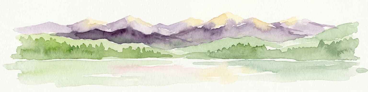
Why Folgefonna National Park stands out

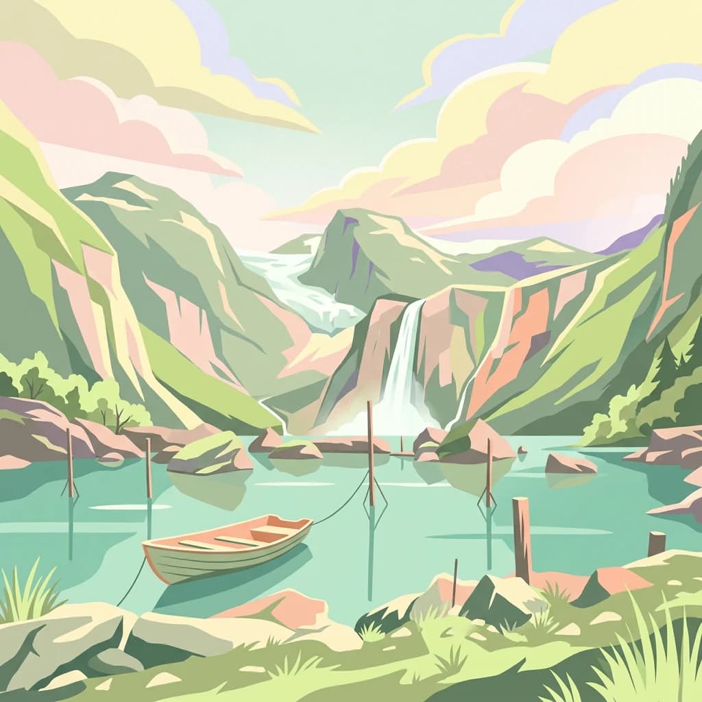
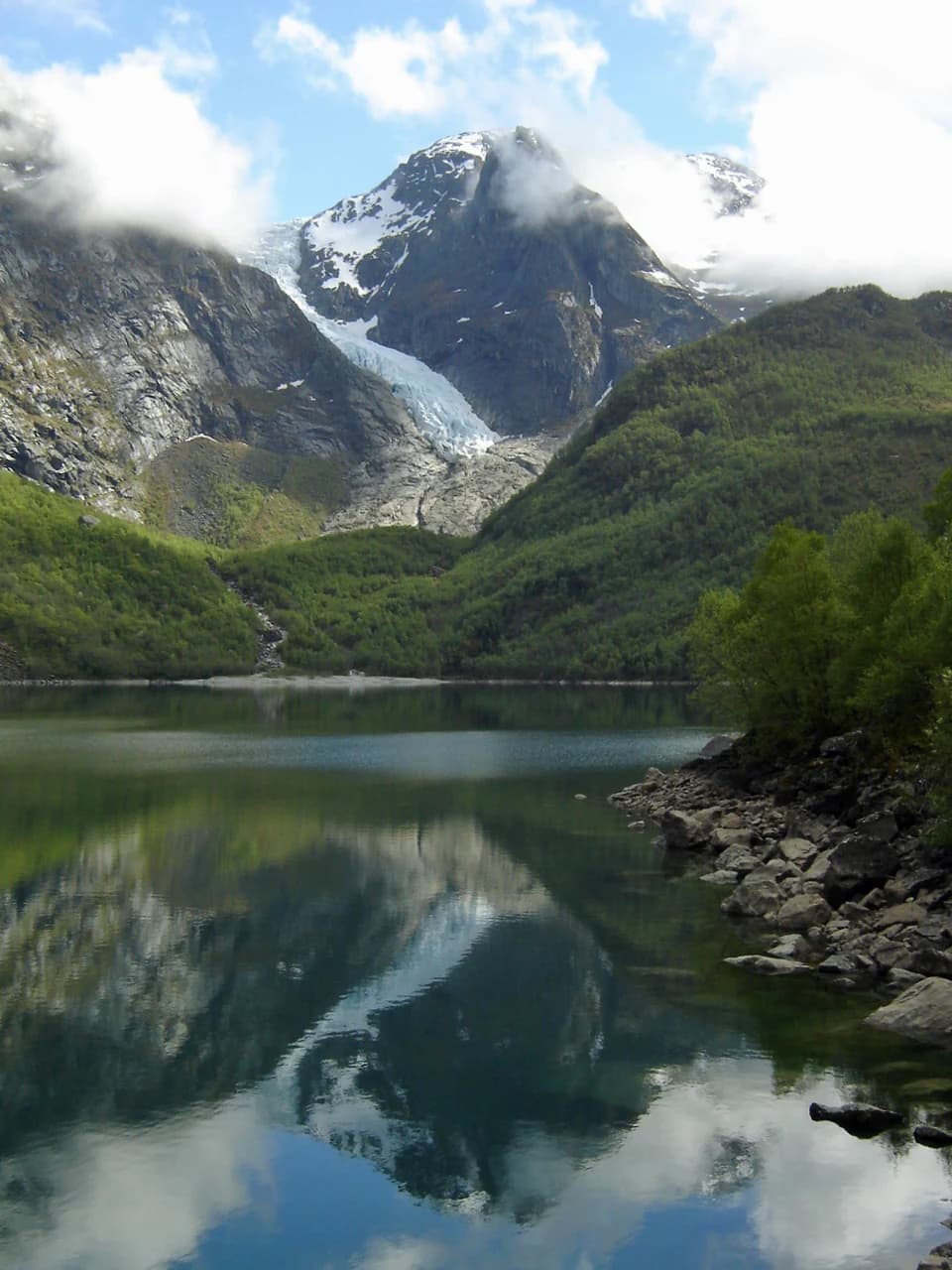
Folgefonna National Park is best known for its spectacular glacial environment. The Folgefonna ice cap dominates the landscape, with outlet glaciers such as Bondhusbreen descending into glacial valleys and feeding pristine lakes like Lake Bondhus. The park offers rare access to experience Norway's glacier heritage in a protected setting, with the ice cap reaching thicknesses of 300 to 400 meters. The combination of dramatic glacial terrain, wet maritime climate creating lush conditions, and the contrast between barren high-alpine zones and forested valleys makes this a distinctive Norwegian mountain protected area.

A lake reflecting a mountain range with a glacier front, surrounded by green valleys and rocky shoreline
Bondhusbreen glacier front reflecting in Bondhus Lake with mountain peaks in the background

Folgefonna National Park history and protected-area timeline

Folgefonna National Park was established on 29 April 2005 and formally opened by Queen Sonja on 14 May 2005, representing one of Norway's more recent additions to its national park system. The creation of the park reflected growing recognition of the need to protect Norway's glacier heritage and the unique high-alpine ecosystems of the Folgefonna peninsula. Prior to national park designation, the Folgefonna glaciers and surrounding mountain areas had various levels of protection, but the national park status provided comprehensive protection across the entire peninsula. The park is governed by the Norwegian Directorate for Nature Management, which oversees conservation efforts and visitor access. The establishment followed decades of increasing awareness about the environmental and scientific value of Norway's glaciers as indicators of climate change and as unique habitats.

Folgefonna National Park landscape and geographic character

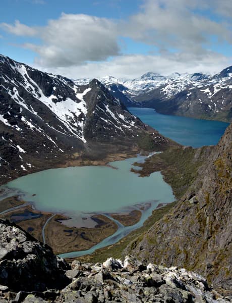
The landscape of Folgefonna National Park is defined by its glacial geography. The Folgefonna ice cap sits at the heart of the park, a massive dome of ice covering approximately 168 square kilometers that serves as the water source for numerous outlet glaciers descending into the surrounding valleys. Bondhusbreen is among the most prominent of these glaciers, flowing down from the main ice cap into a dramatic U-shaped valley toward Lake Bondhus. The terrain above the tree line is predominantly barren alpine terrain with exposed rock, permanent snow patches, and glacial moraines. Below the tree line, the valleys support coniferous forests, primarily pine, which provide a green contrast to the white and gray of the alpine zone. The steep-sided valleys and the transition from valley floor to alpine heights create a landscape of considerable vertical relief and visual drama.

Panoramic view of mountainous landscape with turquoise lake, snow-capped peaks, and rocky terrain under partly cloudy sky
Panoramic view of Folgefonna National Park featuring turquoise glacial lake and snow-capped mountain ridges

Folgefonna National Park ecosystems, habitats, and plant life

The nature of Folgefonna National Park reflects its position in a wet, maritime climate zone at northern latitudes. The high mountains above the tree line present harsh conditions that limit vegetation to hardy alpine species adapted to thin soils, wind exposure, and short growing seasons. Mossy mountain heather, arctic cottongrass, and stiff sedge can grow right up to the glacier edges. Purple gentian and mountain queen represent notable flowering plants that add seasonal color to the alpine landscape. Three-leaved rush and dwarf willow are among the hardy species that survive in this demanding environment. Below the tree line, the pine forests support a different community, though the wet conditions and poor soils keep forest density moderate. The park's position in one of Norway's wettest areas, with annual precipitation around 5,500 millimeters, creates conditions that support both the glacier system and the surrounding ecosystems.

Folgefonna National Park wildlife and species highlights

The wildlife of Folgefonna National Park reflects the park's diverse habitats, from alpine zones to forested valleys. Ptarmigans thrive in the high, barren mountain areas where few other creatures can survive, their camouflage making them well-suited to the rocky, snow-patched terrain. Golden eagles nest in several valleys leading up toward the glacier and hunt ptarmigans in the glacial areas, representing the park's apex avian predator. Meadow pipits are the most abundant bird species above the tree line. In the forested areas below the tree line, red deer are abundant, with Kvinnherad Municipality holding the highest red deer harvest in all of Norway. Black grouse and capercaillie inhabit the pine forests. Of particular conservation significance, this is one of the last strongholds of the white-backed woodpecker in Western Europe, a species that relies on dead wood in forest clearings created by avalanches—the very habitat that the park's avalanche-prone valleys provide.

Folgefonna National Park conservation status and protection priorities

Folgfonna National Park serves as an important protected area for Norway's glacier heritage and alpine biodiversity. The park protects the Folgefonna ice cap, which has scientific value as a monitor of climate change and represents a significant portion of Norway's remaining glacial mass. The protection of this area safeguards habitats for species of conservation concern, including the white-backed woodpecker, which has become increasingly rare across Western Europe. The park's avalanche-prone terrain, while presenting management challenges, creates the deadwood habitat this woodpecker requires. The coastal-influenced climate and the transition from valley to alpine zone represent an ecosystem type that benefits from coordinated protection across the Folgefonna peninsula.

Folgefonna National Park cultural meaning and human context

Folgefonna National Park sits within a landscape of traditional Norwegian mountain farming communities. The municipalities of Kvinnherad, Etne, and Ullensvang have histories rooted in valley agriculture and seasonal mountain use. The name Folgefonna itself reflects the Norwegian language's connection to snow and ice, with 'folge' meaning thin layer of snow and 'fonn' meaning mass of snow or glacier. The valleys below the park have historically supported farming communities whose relationship with the mountain landscape and its glaciers extends back generations. The proximity of the park to the town of Odda provides a human settlement context within this mountainous region.

Top sights and standout views in Folgefonna National Park

Folgefonna National Park offers visitors access to Norway's third-largest glacier system in a protected setting. The Bondhusbreen glacier descending to Lake Bondhus represents one of the park's most accessible and scenic glacial viewpoints. The park's combination of substantial ice mass, wet maritime climate creating lush conditions, and the contrast between barren alpine terrain and forested valleys provides a distinctive mountain landscape. The presence of golden eagles, the last Western European strongholds of the white-backed woodpecker, and abundant red deer adds wildlife significance to the glacial and landscape attractions.

Best time to visit Folgefonna National Park

The best time to visit Folgefonna National Park is during the summer and early autumn months from June through September, when the weather is most stable and access to the park's mountain terrain is most feasible. The high altitude and northern latitude mean that snow persists in the higher elevations well into summer, while winter conditions bring heavy snowfall and difficult access. The summer months offer the warmest temperatures, longest days, and the most opportunity to explore the alpine terrain, though visitors should be prepared for changeable mountain weather regardless of season. The wet climate means that rain is common throughout the year, and the glacier areas can be misty or cloudy even when valleys are clear.

Park location guide

Geography guide, regional context, and park location map for Folgefonna National Park

Folgefonna National Park park geography, regions, and map view in Norway
Understand where Folgefonna National Park sits in Norway through a broader geographic reading of the surrounding landscape, nearby location context, and its mapped position within the national park landscape.

How Folgefonna National Park fits into Norway

Norway, officially the Kingdom of Norway, is a Nordic country in Northern Europe located on the Scandinavian Peninsula. It encompasses mainland Norway, the Arctic islands of Svalbard and Jan Mayen, and maintains dependencies including Bouvet Island and Antarctic claims. The country has a population of about 5.6 million and is bordered by Sweden, Finland, and Russia. Norway is a unitary parliamentary constitutional monarchy with Oslo as its capital and largest city.

Wider geography shaping Folgefonna National Park in Norway

Norway occupies the western and northern portions of the Scandinavian Peninsula in Northern Europe. The country shares a long eastern border with Sweden, and borders Finland and Russia to the northeast. Norway has an extensive coastline facing the Skagerrak, North Sea, Norwegian Sea, and Barents Sea. The terrain is predominantly mountainous with numerous fjords along the coastline.

Map view of Folgefonna National Park

Use this park location map to pinpoint Folgefonna National Park in Norway, understand its exact geographic position, and read its mapped placement within the surrounding landscape more clearly.

Pigeon | © OpenStreetMap contributors

Location context for Folgefonna National Park

Vestland

Visual Guide to Norway's Third-Largest Ice Cap, Dramatic Valleys, and Protected Mountain Environments

Folgefonna National Park Photography: Explore Glacial Landscapes and Alpine Scenery
Browse an immersive photo gallery showcasing the distinctive glacial landscapes of Folgefonna National Park, including its massive ice cap, dramatic outlet glaciers, and diverse alpine terrain. These high-quality images provide essential visual context, helping you understand the park's unique protected-area character and the striking contrast between its barren mountain peaks and lush forested valleys.

A lake reflecting a mountain range with a glacier front, surrounded by green valleys and rocky shoreline

Yellow boat docked at rocky shore beside turquoise lake with mountains and glacier in background

Panoramic view of mountainous landscape with turquoise lake, snow-capped peaks, and rocky terrain under partly cloudy sky

Park atlas

Map the broader protected landscape and regional park geography across Vestland county, extending your exploration from Folgefonna National Park.

Explore Related National Parks and Protected Areas Surrounding Folgefonna National Park
Browse a curated selection of national parks and protected areas geographically related to Folgefonna National Park, encompassing diverse conservation landscapes within Norway's Vestland county. This focused collection aids in comparing various park geographies and understanding the distribution of protected alpine, glacial, and fjord environments across the region.
National parkVestland

Hardangervidda National Park: Vast Arctic Plateau and European Peneplain Discovery

Explore Norway's largest national park and its unique tundra ecosystem.

Delve into the geography of Hardangervidda National Park, Norway's largest national park, featuring the expansive Arctic plateau and Europe's largest peneplain. This protected landscape offers a unique mapped environment characterized by treeless moorland, numerous lakes, and important wildlife habitats, including significant wild reindeer populations. Understand its position within the Vestland region and its value as a key protected area for geographic exploration and landscape context.

Area
3,422 km²
Established
1981
IUCN
II
Relief
Highland
Abstract watercolor landscape with soft pastel hues of green, pink, yellow, and purple
National park

Hallingskarvet National Park: Norway's High Mountain Plateau and Protected Wilderness

Mapping glacial terrain, alpine environments, and wild reindeer habitat.

Hallingskarvet National Park offers a unique window into Norway's geological history and alpine ecology. This protected landscape encompasses the striking Hallingskarvet plateau and the Vargebreen glacier, along with deep valleys carved by ancient ice. Users can explore the park's mapped boundaries, understand its regional geographic setting in Scandinavia, and appreciate its conservation value as a habitat for wild reindeer. The park's terrain provides a concrete example of glacial shaping and high-altitude ecosystems within the Nordic context.

Area
450 km²
Established
2006
IUCN
II
Relief
Mountain
National parkVestland

Jostedalsbreen National Park: Europe's Premier Glacial Protected Landscape

Mapped terrain and protected area discovery in Vestland, Norway.

Jostedalsbreen National Park represents a unique geographic entity, safeguarding the largest glacier on the European mainland. This national park, situated in Norway's Vestland region, offers profound insights into glacial landscapes and mountain geography. Users can explore the vast ice mass that dominates the terrain, observe the U-shaped valleys carved by its movement, and understand the geological processes shaping this dynamic environment. The park's protected status highlights its importance for understanding glacial science and preserving a critical component of Norway's natural heritage.

Area
1,310 km²
Established
1991
IUCN
II
Relief
Mountain
National parkInnlandet

Breheimen National Park: Protected Glacial Landscapes and Mountain Terrain in Innlandet

Norway's prominent national park featuring active glaciers and alpine geography.

Breheimen National Park represents a significant protected landscape within Norway's Innlandet region, dedicated to conserving its unique glacial formations and dramatic alpine terrain. The park's vast area encompasses active glaciers, soaring peaks, and a notable diversity of natural environments, from lush valleys to barren plateaus. MoriAtlas facilitates a detailed exploration of Breheimen National Park, highlighting its mapped protected boundaries and its integral role in the regional geography and protected areas atlas.

Area
1,671 km²
Established
2009
IUCN
II
Relief
Mountain
Watercolor illustration of a mountain range with green hills and a lake in the foreground
National park

Jotunheimen National Park: Norway's Iconic Alpine Protected Landscape and Geographic Core

Explore mapped glacial terrain and alpine geography.

Jotunheimen National Park stands as a monument to Norway's alpine grandeur, protecting over 1,151 square kilometers of spectacular mountainous terrain. This protected area is defined by its dramatic glacial features, including sharp peaks exceeding 1,900 meters, U-shaped valleys, and pristine alpine lakes, making it a significant focus for geographic exploration and mapped landscape study. Delve into the core of Norway's mountain heartland, understanding the mapped boundaries and regional geological context that shape this iconic protected landscape.

Area
1,151 km²
Established
1980
IUCN
II
Relief
Mountain
National parkInnlandet

Langsua National Park: Protected Mountain Forests and Inland Wilderness in Innlandet, Norway

Discover mapped boundaries and regional geographic context.

Langsua National Park, a designation expanded in 2011, is a prominent protected area in Norway's Innlandet county. This national park encompasses 537.1 square kilometers of diverse mountainous terrain, characterized by extensive mountain forests and inland wilderness habitats. Its creation consolidates fragmented nature reserves into a significant contiguous protected landscape, offering valuable insight into Norway's conservation strategies and the geographic context of its eastern mountain regions.

Area
537.1 km²
Established
2011
IUCN
II
Relief
Mixed relief
National parkTelemark

Jomfruland National Park: Coastal Archipelago and Skagerrak Marine Atlas

Norway's unique marine-focused national park landscape.

Jomfruland National Park is a significant protected landscape in Telemark, Norway, renowned for its coastal island geography and a landscape predominantly composed of marine waters. Covering 117 square kilometers, this national park emphasizes the conservation of both terrestrial island habitats and the surrounding Skagerrak coastal ecosystem. Explore the park's mapped boundaries and discover its regional geographic context, offering a unique perspective on Norway's protected areas and maritime natural heritage through MoriAtlas.

Area
117 km²
Established
2016
IUCN
II
Scope
Mixed
Watercolor painting of coastal waters, islands, rocky shore, and distant hills
National parkAgder

Raet National Park: A Coastal National Park Defined by Glacial Moraine Landscape in Agder

Explore Norway's southern coast geography and protected marine area.

Raet National Park offers a profound exploration of Norway's post-glacial landscape, anchored by its namesake 12,000-year-old glacial moraine. This unique protected area, predominantly marine, reveals a striking combination of terrestrial moraine features, extensive pebble beaches, and submerged geological formations. Understanding its mapped boundaries within Agder provides critical context for appreciating this significant coastal protected landscape, its marine ecosystems, and its role in the regional geography.

Area
607 km²
Established
2016
IUCN
II
Relief
Lowland

Common questions about visiting, size, designation, and location context for Folgefonna National Park

Folgefonna National Park FAQs for park facts, access, geography, and protected area context
Find quick answers about Folgefonna National Park, including protected-area facts, park geography, trail and visitor context, and how the park fits into its surrounding country and regional landscape.
MoriAtlas Explorer

Continue Your Protected Areas Search Across the Global Atlas

Deepen your exploration by continuing the structured search for national parks and protected areas worldwide. Utilize the comprehensive filtering capabilities to compare different conservation landscapes and refine your understanding of global park geography. Discover more about the distribution and characteristics of protected natural areas.

Global natural geography