
Mori Atlas logo
Protected landscapeWaldpark Mannheim

Examining the fluvial terrain and dynamic riverside boundaries within Baden-Württemberg

Waldpark Mannheim: A Distinctive Protected Floodplain Landscape and Riparian Ecosystem

(Landschaftsschutzgebiet „Waldpark“)

Waldpark Mannheim serves as a vital protected landscape situated within a natural meander of the Rhine in southwestern Germany. This area features a complex mosaic of open woodland, riverside meadows, and old river arms that are periodically reshaped by natural flooding events. As a recognized part of the Natura 2000 network, the territory provides a unique intersection of riparian ecology and regional landscape conservation, offering a clear view of floodplain forest dynamics within an urban setting.

floodplain forestAuwaldRhine riparian landscapeurban nature reservenear-urban recreationNatura 2000
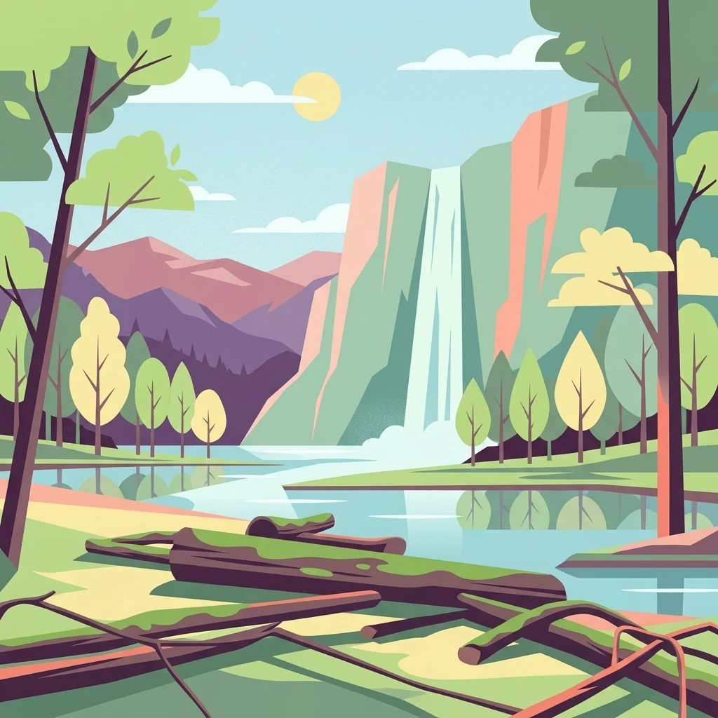
A flat-style digital illustration depicting a waterfall cascading down a cliff into a calm lake, surrounded by forest trees and fallen logs in the foreground.

Waldpark Mannheim

Protected landscape

Park overview

Structured park overview, official facts, and landscape profile for Waldpark Mannheim

Waldpark Mannheim park facts, protected area profile, and essential visitor context

Review the core facts for Waldpark Mannheim, including designation, size, terrain, visitor scale, habitats, and operating context in one park-focused overview.

About Waldpark Mannheim

Waldpark Mannheim represents a rare example of a large, near-natural protected landscape directly within a major German city. Located on the western and southwestern fringes of the Lindenhof, Niederfeld, and Neckarau districts, the park occupies a wide meander of the Upper Rhine that has never been fully diked against flooding. This deliberate absence of rigid flood protection has allowed the area to retain much of its natural floodplain character, with periodic inundations replenishing soils and reshaping habitat patterns.

The landscape combines loosely wooded areas with open meadows, a riverside promenade, an old Rhine arm known as the Bellenkrappen, and the Strandbad Mannheim lido. Numerous footpaths, some of which are also open to cyclists and riders, weave through the area, with seating and rest areas offering easy access for residents and visitors. Because the area combines active conservation, Natura 2000 recognition, and dense recreational use, it functions both as a biodiversity anchor and as one of Mannheim's most popular urban-adjacent green spaces.

The Waldpark is managed by the City of Mannheim and is part of the broad Rheinniederung ecological corridor. Its integration into the Natura 2000 Fauna-Flora-Habitat area in 2006 marked a turning point in its ecological profile, aligning local landscape protection with European-level habitat and species protection. Today, the area balances the demands of urban recreation with those of dynamic floodplain conservation, restoration of old river arms, and protection of native flora and fauna.

Quick facts and research context for Waldpark Mannheim

Waldpark Mannheim is a protected landscape (Landschaftsschutzgebiet) of around 150 hectares along the Rhine in southwestern Mannheim, established on 2 May 1975. It encompasses the Rhine promenade, the wooded park zone, the Strandbad lido, and the Schindkaut area within a broad Rhine meander used by anglers, walkers, and cyclists.

Protection and recognition

Examine terrestrial protection details and official designation records for Waldpark Mannheim.

Waldpark Mannheim Protection Status and International Recognition Data

Terrestrial protection status, management scope, and documented designation records provide clear insight into the conservation framework governing Waldpark Mannheim. Official database metrics and administrative entries outline the verified legal standing and recognized boundaries of this protected area.

Protection details

Protection scope
Terrestrial
Transboundary protection
No
WDPA ID
325614
Park context

Deeper park guide and search-rich context for Waldpark Mannheim

Waldpark Mannheim history, landscape, wildlife, and travel context

Explore Waldpark Mannheim through its history, landscape character, ecosystems, wildlife, conservation priorities, cultural context, and seasonal travel timing in a structured park guide built for atlas discovery and search intent.

Why Waldpark Mannheim stands out

Waldpark Mannheim is best known for being a near-natural floodplain forest (Auwald) in the middle of a major city, where periodic Rhine flooding drives a natural exchange of plants and animals. It is also recognized for combining protected floodplain habitats with classical park leisure infrastructure such as the Strandbad and Promenadenweg.
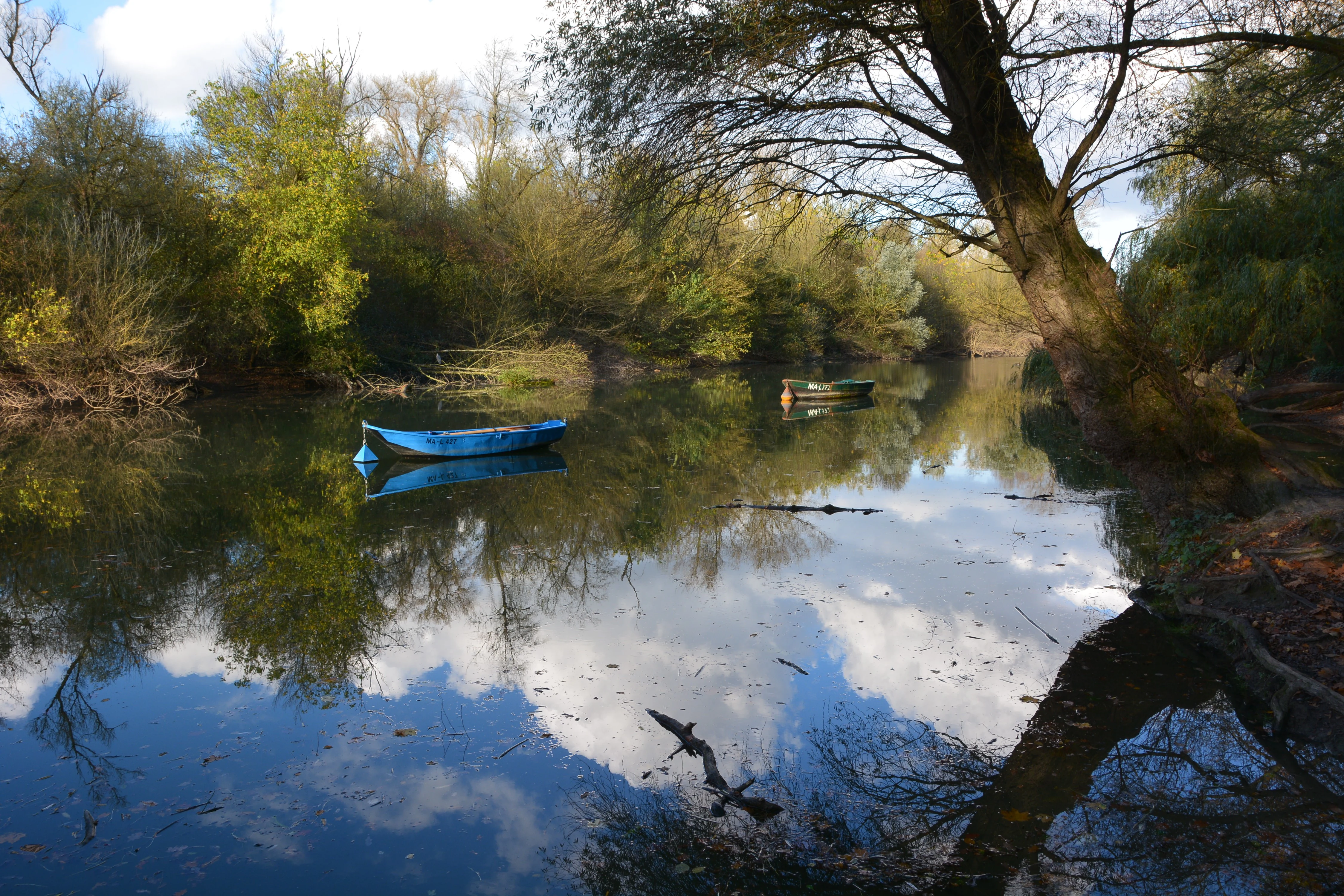
A peaceful, reflective body of water surrounded by dense trees, with two small rowing boats floating on the surface.
A serene view of the Bellenkrappen waterway in Waldpark Mannheim, featuring calm water with boat reflections.

Waldpark Mannheim history and protected-area timeline

The forest area that would become the Waldpark was originally not Mannheimer property but belonged to the still-independent community of Neckarau to the south. It functioned as communal forest and extended in a more open form toward the Neckarau settlement, where it was known locally as the „Busch." A protected status appeared early: in 1798 a prohibition was issued against cutting wood without permission. Despite this, larger-scale clearing took place in the early 19th century to service war debts and to obtain brushwood fascines for river-engineering works, and an early plan for a Rhine cutoff was abandoned in 1832 after doubts raised by Prussia.

Parts of the original wooded area were felled for agriculture, including the Stollenwörth and later the Rottfeld, leaving roughly the same forested extent that persists today. Mannheim became interested in the Neckarau woods as early as around 1870, when the city was permitted to place benches at its own expense. After Neckarau was incorporated into Mannheim in 1899, the area was officially renamed „Waldpark" in 1905, reflecting the meadow clearings and thinning carried out within it.

Further recreational development followed: in 1911 the Restaurant „Stern" opened at a central point of the park, accommodating up to 400 guests indoors and as many as 2000 outdoor seats. Motor traffic to the restaurant was permitted from 1931. Around 1930 a small animal park enriched the experiences on offer; lions donated by the Sarrasani circus, bears, monkeys, birds, and a riding donkey. A 1944 air-mine strike heavily damaged the restaurant building, and continued flood damage led to its demolition in the 1950s.

Institutional protection came in 1975, when the area was formally designated as the Landschaftsschutzgebiet „Waldpark" on 2 May by municipal action. Ecological significance deepened further with its 2006 inclusion in the Natura 2000 FFH area and in 2010 within a bird protection area.

Waldpark Mannheim landscape and geographic character

The Waldpark lies within a substantial Rhine meander southwest of central Mannheim, stretching roughly 3 kilometers north to south and up to about 2.6 kilometers at its widest east-west point. The terrain is shaped entirely by fluvial processes, combining low-lying riverside zones, a partially dry old river arm, and softly structured floodplain forest that opens onto grassy meadows.

Along the river runs the Rheinpromenade, the Strandbad zone offers broad open meadow areas for recreation, and the bell-shaped Bellenkrappen, an old Rhine arm densely lined with poplars, gives the area a distinctive riparian silhouette. Toward the south, the park includes the Schindkaut zone, with quiet, lightly wooded sections transitioning into meadow clearings. The lack of high dikes means that high water events from the Rhine regularly reshape the visible conditions of the landscape, leaving subtle traces in the form of drainage water on meadows, altered water levels in old river arms, and shifting forest edges.
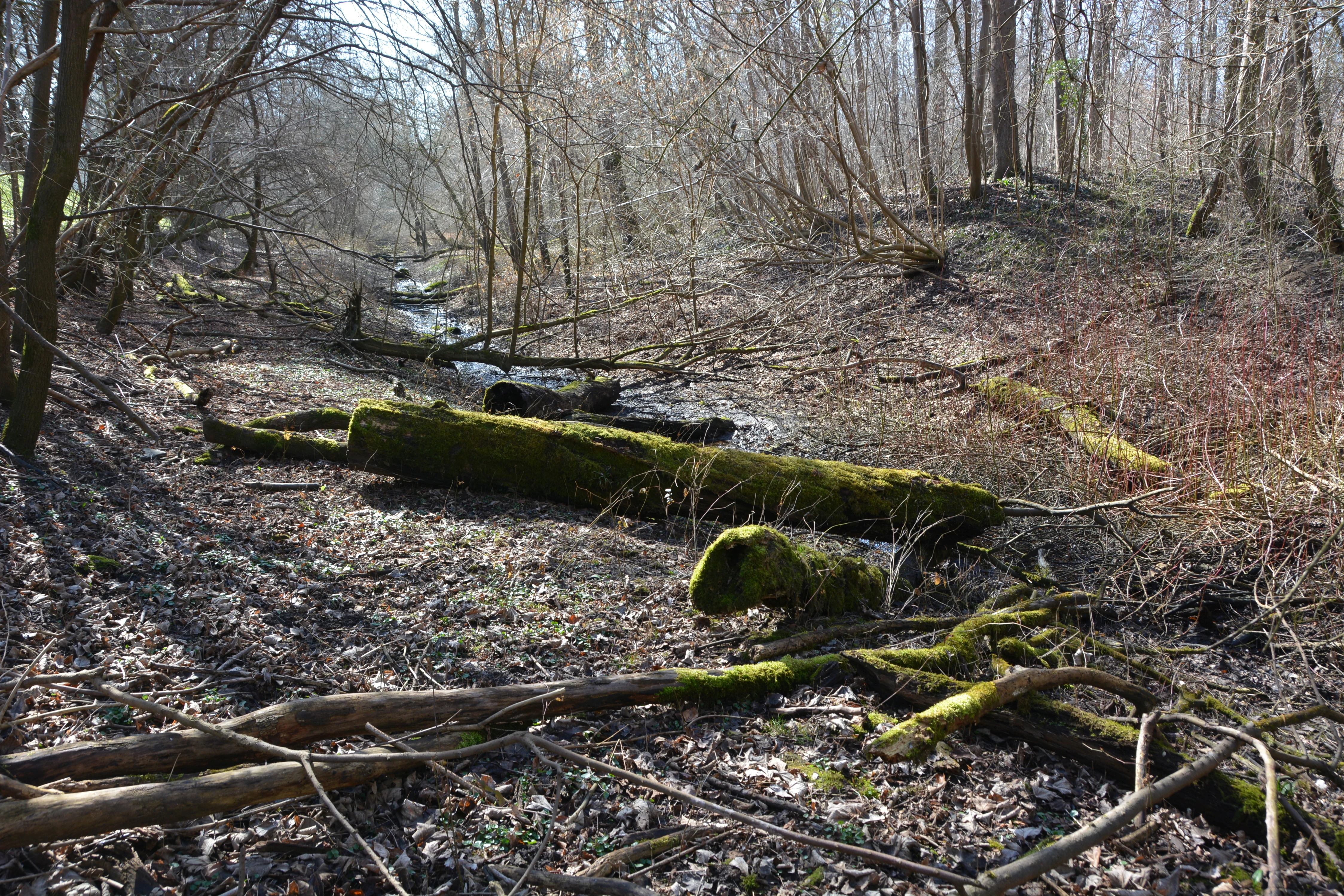
A dried-out, leaf-covered river bed in a dense forest, with moss-covered fallen logs and bare deciduous trees during the winter.
The Schlauch side arm of the Rhine in Waldpark Mannheim, featuring a seasonal floodplain forest habitat.

Waldpark Mannheim ecosystems, habitats, and plant life

The defining ecological feature of the Waldpark is its Auwald, or floodplain forest, shaped by the natural rise and fall of the Rhine. Periodic flooding permits a continuous exchange of seeds, nutrients, and organisms, supporting a particularly high biodiversity relative to its size. Meadow clearings, dense stands of poplars along old river arms, and open grassy patches create a mosaic of habitats.

The Bellenkrappen, the Schlauch, and the Schlauchgraben are all old Rhine arms or related channels whose shifting water levels sustain amphibians and a range of moisture-loving plants. Because the area is anchored within the Natura 2000 network through its FFH-area integration and bird protection area status, its ecological functions are formally protected at the European level, focusing on threatened native species and natural habitat compositions.
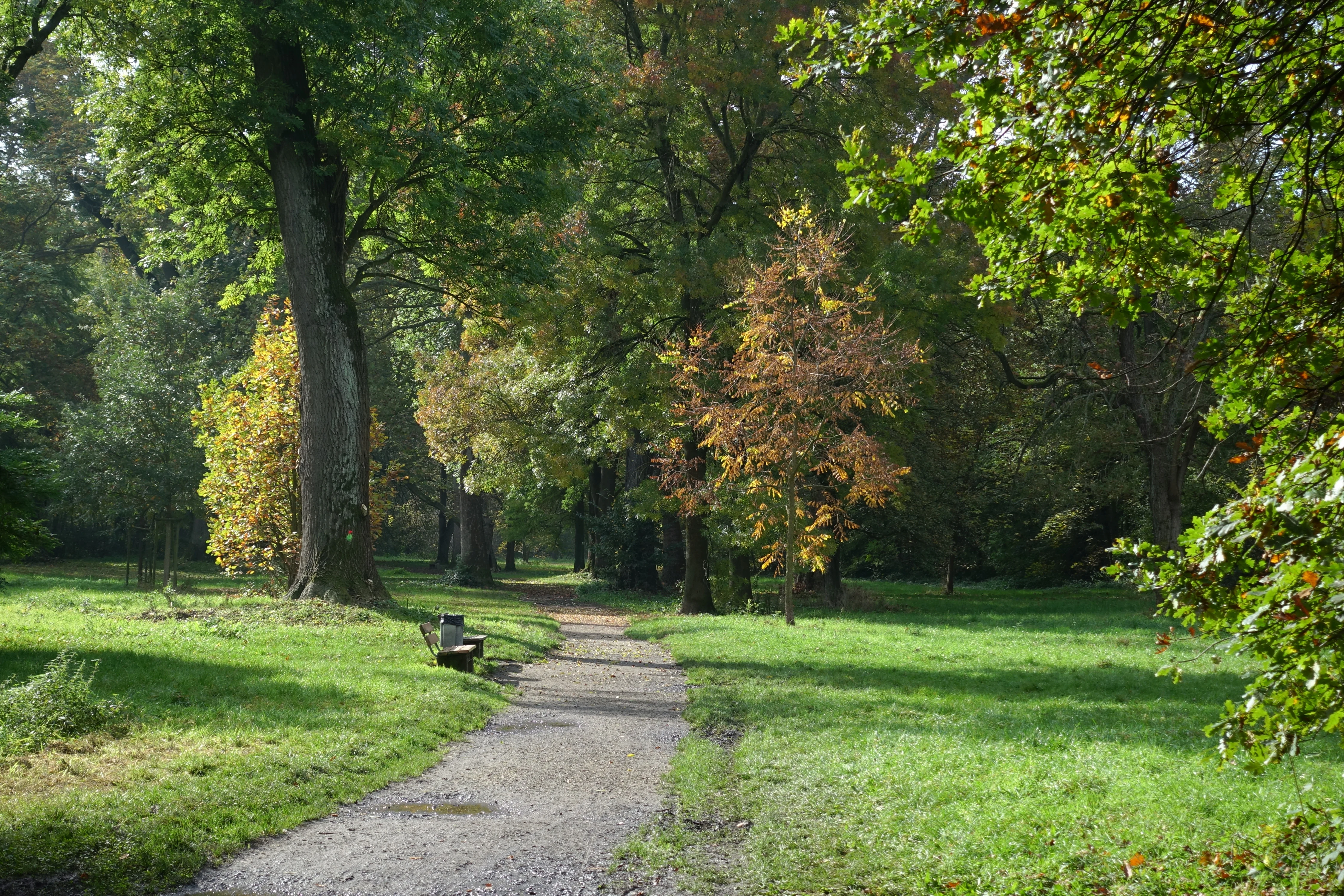
A dirt walking path leads into a dense forest, with a small park bench on the left and tall deciduous trees showing early signs of autumn colors.
A peaceful walking path winding through the mature trees of Waldpark Mannheim.

Waldpark Mannheim wildlife and species highlights

The floodplain mosaic of forest, meadow, and open water at the Waldpark provides habitat for a wide spectrum of species typical of Rhine floodplain environments. Native amphibians benefit from dynamic water-flow conditions, particularly through the renatured Schlauchgraben that is expected to carry water through the area on around 155 days per year. The combination of mature trees, old river arms, meadow clearings, and adjacent open river waters supports a varied bird community, a key reason for the area's inclusion in a bird protection area since 2010.

Other fauna associated with the wooded mosaic includes small mammals, insects tied to floodplain vegetation, and fish communities along the riverside and old Rhine arms. The park is not primarily a charismatic-species destination but rather an example of how structured urban-adjacent floodplain habitat can sustain meaningful species diversity.
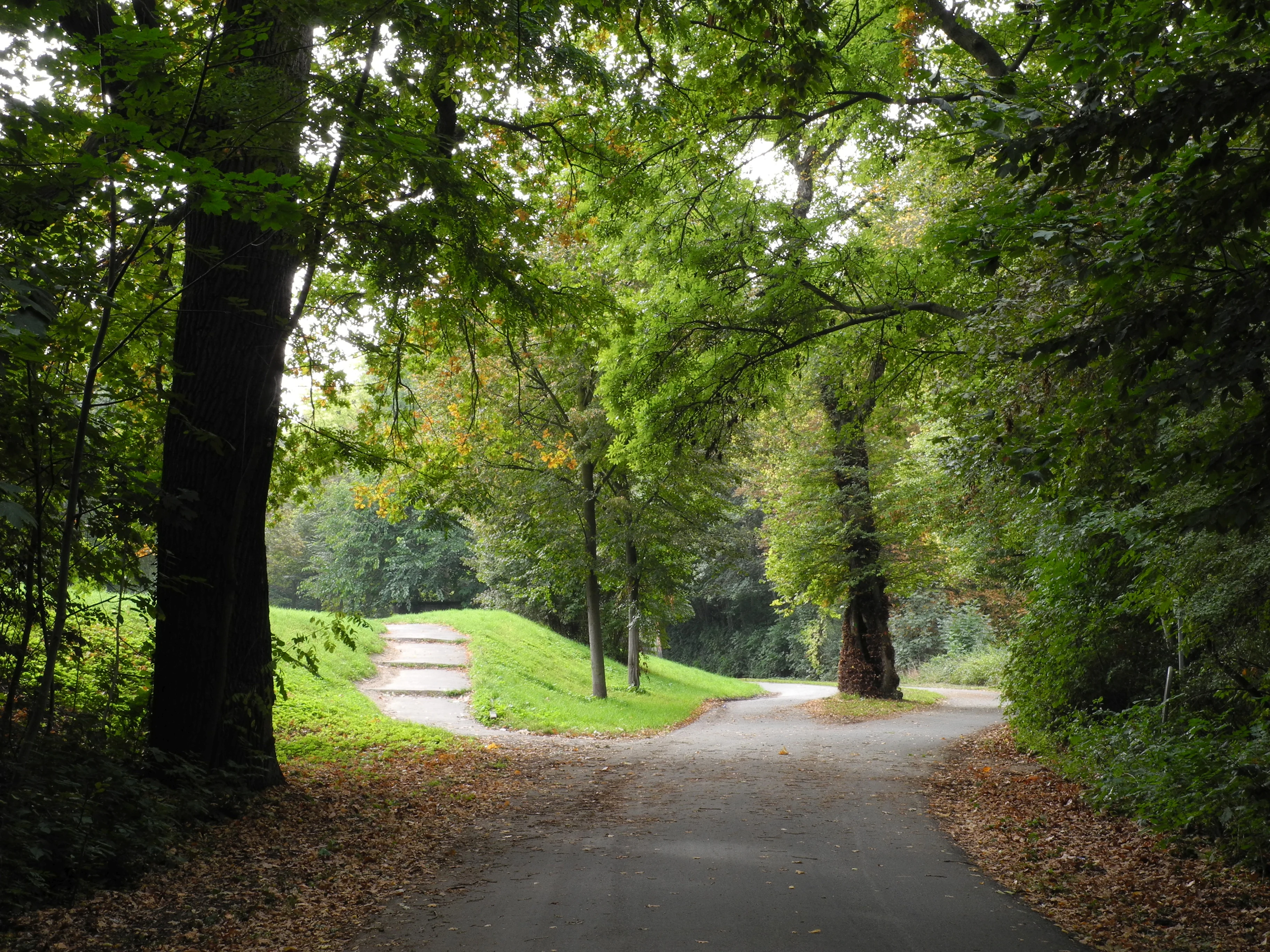
A paved path forks into two directions in a dense green forest, with mature trees and grassy slopes surrounding the trail.
A shaded path through the lush floodplain forest of Waldpark Mannheim.

Waldpark Mannheim conservation status and protection priorities

Conservation at the Waldpark operates on two intertwined layers: the local 1975 landscape protection designation and its later integration into the European Natura 2000 network through the FFH area „Rheinniederung von Philippsburg bis Mannheim" and a bird protection area. Together these frameworks protect threatened native plant and animal species and their natural habitats across administrative boundaries.

The landscape protection regulations restrict any activity that could materially distort the landscape, damage nature, or impair nature-based enjoyment. Prohibited actions include construction, pipeline installation, excavation, alteration of soil surfaces, changes to paths and roads, camping, and dumping. A 2015 renaturation of the Schlauchgraben, reconnecting it with the Hagbau schlute to enhance water morphology and benefit native amphibians, illustrates how active habitat management complements the static protection framework.

Waldpark Mannheim cultural meaning and human context

The Waldpark has long been woven into Mannheim's identity as a place of urban relaxation. From the late 19th century it functioned as a managed city-outing destination, with benches installed by Mannheim in Neckarau woods even before incorporation. The 1905 renaming to „Waldpark" was an act of civic identity-building, framing the woods as a consciously designed recreation landscape. The Restaurant „Stern," the small animal park, and the 1927 Strandbad are each testaments to the 20th-century cultural habit of using near-urban forests for leisure, and to the later integration of swimming and family recreation. The site's continuing importance as one of Mannheim's preferred local destinations reflects this layered local tradition.
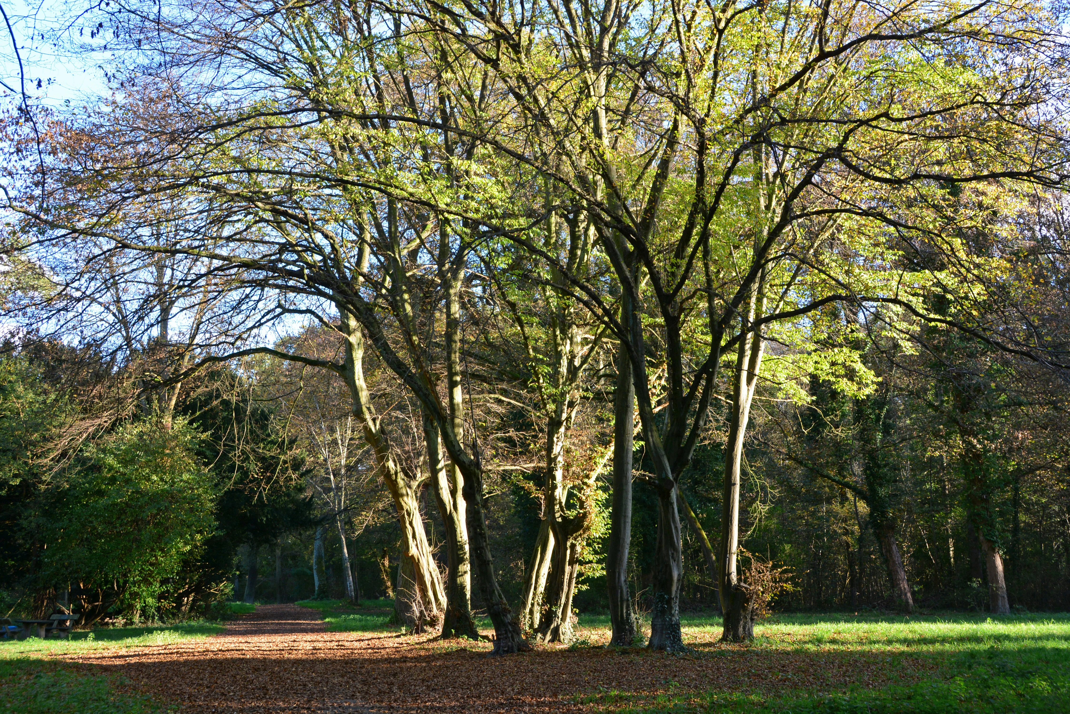
A dirt path leads past large deciduous trees with autumn leaves in a forest clearing.
A shaded path through the woodland of Waldpark Mannheim.

Top sights and standout views in Waldpark Mannheim

The Waldpark stands out for combining a functional floodplain forest right on the Rhine with high-quality recreational infrastructure within Mannheim. The Strandbad lido, the Rhine promenade, and the broad network of trails ensure that a protected floodplain landscape is also widely used by residents.

Equally important are the ecological features behind the scenes: the Bellenkrappen and the renatured Schlauchgraben as living old Rhine arms, the role of periodic Rhine flooding in maintaining habitat diversity, and the area's formal footing in the European Natura 2000 network for both habitats and birds.

Best time to visit Waldpark Mannheim

The Waldpark is a year-round green space, but its mood shifts strongly with the seasons and with Rhine water levels. Spring and early summer draw visitors for blooming floodplain vegetation, varied bird activity, and freshly grown meadows. Summer is naturally the busiest period thanks to the Strandbad lido and outdoor gatherings.

Autumn brings quiet, golden-toned forest walks along the Promenadenweg, while winter can deliver dramatic scenes when Rhine high water reaches the meadows, creating temporary shallow water zones in the park's low-lying sections. Seasonal high-water events, rather than disrupting the experience, are a defining part of the area's landscape character.

Monthly climate preview

Long-term representative point measurements tracking monthly averages across the protected terrain

Waldpark Mannheim Climate Normals, Annual Temperature and Precipitation Rhythm

Recorded baseline data captures multi-year monthly temperature ranges and daily precipitation averages at a representative coordinate within Waldpark Mannheim. Opening the complete monthly climate record reveals deeper variations across the full twelve-month cycle.
Annual mean10 °C
0 °C20 °C
Jan
Feb
Mar
Apr
May14°
Jun18°
Jul20°
Aug20°
Sep15°
Oct10°
Nov
Dec
Warmest month
July

20.3 °C

Coolest month
January

0.1 °C

Wettest month
July

2.4 mm/day

Driest month
April

1.5 mm/day

Park location guide

Geography guide, regional context, and park location map for Waldpark Mannheim

Waldpark Mannheim park geography, regions, and map view in Germany

Understand where Waldpark Mannheim sits in Germany through a broader geographic reading of the surrounding landscape, nearby location context, and its mapped position within the national park landscape.

How Waldpark Mannheim fits into Germany

Germany is a federal republic in Western and Central Europe with a population of over 83 million across sixteen constituent states. It is Europe's largest economy by nominal GDP and a major global exporter and importer. The capital is Berlin, and the country borders Denmark, Poland, Czech Republic, Austria, Switzerland, France, Luxembourg, Belgium, and the Netherlands.

Wider geography shaping Waldpark Mannheim in Germany

Germany is located in Western and Central Europe, spanning 357,022 km². It borders Denmark to the north, Poland and the Czech Republic to the east, Austria and Switzerland to the south, and France, Luxembourg, Belgium, and the Netherlands to the west. The country has coastlines on the Baltic Sea and North Sea to the north, with the Alps located in the southern region.

Map view of Waldpark Mannheim

Use this park location map to pinpoint Waldpark Mannheim in Germany, understand its exact geographic position, and read its mapped placement within the surrounding landscape more clearly.

Pigeon | © OpenStreetMap contributors

Location context for Waldpark Mannheim

Baden-Württemberg

Visualizing floodplain forests, old river arms, and protected riparian habitats

Waldpark Mannheim Photos and Landscape Scenery Exploration

Photographic collections reveal the dynamic floodplain forest, open riverside meadows, and riparian terrain defining Waldpark Mannheim along the Rhine. Detailed visual records help researchers and visitors understand how periodic flood events shape natural habitats and protected landscapes across the region.

A peaceful, reflective body of water surrounded by dense trees, with two small rowing boats floating on the surface.

A wide dirt path covered in fallen autumn leaves winds through a lush forest in Waldpark Mannheim.

A dried-out, leaf-covered river bed in a dense forest, with moss-covered fallen logs and bare deciduous trees during the winter.

A dirt walking path leads into a dense forest, with a small park bench on the left and tall deciduous trees showing early signs of autumn colors.

A paved path forks into two directions in a dense green forest, with mature trees and grassy slopes surrounding the trail.

A low-lying meadow area in a forest is partially flooded with standing water reflecting the sky, surrounded by bare trees in late autumn or winter.

A dirt path leads past large deciduous trees with autumn leaves in a forest clearing.

Park atlas

Compare regional riparian reserves and connected floodplain ecosystems

Explore Parks Near Waldpark Mannheim and Surrounding Protected Landscapes

Discover other protected areas near Waldpark Mannheim to analyze similar fluvial terrain, old river arms, and dynamic riparian habitats along the Rhine valley. Comparing adjacent regional green spaces reveals the broader ecological patterns shaping southwestern Germany conservation zones.
A pale, soft watercolor painting showing a flat, grassy landscape with distant rolling hills and patches of trees.
Nature reserveRhineland-Palatinate
About 2.1 km away#1 closest

Southwest

Pfälzische Rheinauen Nature Reserve: Protected Alluvial Landscapes in Rhineland-Palatinate

Regional floodplain geography and protected area map context

The Pfälzische Rheinauen is a major landscape protection area encompassing a mosaic of habitats along the Upper Rhine. From the Haardt mountains eastward, this region features rare alluvial forests, reclaimed gravel pit lakes, and complex river systems. It remains a focal point for understanding the integration of floodplain biodiversity with long-standing human activity in Western Germany.

Area
208.33 km²
Established
1971
Relief
Lowland
Climate
Temperate
A soft watercolor painting depicting a winding river landscape with lush green vegetation, grassy banks, and a treeline in the distance, set against a plain white background.
Nature reserveRheinland-Pfalz
About 4.6 km away#2 closest

Southeast

Horreninsel Nature Reserve: Detailed Rhine Floodplain Geography and Protected Land Map

A preserved riparian zone in Rheinland-Pfalz, Germany.

Horreninsel represents a significant protected floodplain along the Upper Rhine, featuring a narrow, elongated strip of habitat between the river and its western dike. This reserve hosts diverse terrain, from old river channels and lush Auwald forests to unique Stromtalhalbtrockenrasen dry grasslands, offering a deep look into regional fluvial ecosystems.

Area
0.55 km²
Established
1978
Relief
Lowland
Climate
Temperate
A soft watercolor illustration of a wetland scene with a small pool of water in the foreground, a line of deciduous trees in the midground, and rolling hills in the background.
Nature reserveRheinland-Pfalz
About 5.9 km away#3 closest

Southwest

Neuhofener Woog Nature Reserve: Exploring Rhine Floodplain Geography in Rheinland-Pfalz

Mapping protected swamp forests and ancient river meander ecosystems

Neuhofener Woog serves as a vital protected area in the Rhein-Pfalz-Kreis district. This former Rhine meander preserves a natural transition between water-dominated basins, ash-alder swamp woodlands, and reed beds. It stands as a defined natural landscape within the heavily modified Upper Rhine Plain, offering a clear view of floodplain hydrological patterns.

Area
1 km²
Established
1999
A minimalist watercolor illustration of a wetland scene with soft green hills in the distance, a central water body, and faint pink and green vegetation in the foreground against a white background.
Protected areaRhineland-Palatinate
About 6.4 km away#4 closest

West

Maudacher Bruch: Protected Wetland and Historical Meander in Rhineland-Palatinate

Mapping the urban marshes and meadows of Ludwigshafen

Maudacher Bruch is a significant protected area in Rhineland-Palatinate, defined by its origin as an ancient silted-up meander of the River Rhine. This horseshoe-shaped landscape sustains diverse wetland habitats and serves as a natural counterpoint to the surrounding industrial city. Explore its complex geography, from the central marshland meadows and ponds to the elevated views across the Upper Rhine Plain.

Area
5.23 km²
Relief
Lowland
Climate
Temperate
Access
Easy access
A watercolor painting showing a winding river flowing through a green valley with rolling hills in the background, executed in a soft, impressionistic style with light greens, purples, and pinks.
Protected landscapeRhein-Neckar-Kreis
About 9.1 km away#5 closest

East

Neckartal I-Kleiner Odenwald: Protected Landscape and Regional Geography in Rhein-Neckar-Kreis

Mapping the sandstone ridges and river valley systems of southwestern Germany.

The Neckartal I-Kleiner Odenwald protected landscape serves as a prime example of a transitional natural region where the Neckar river cuts through the Odenwald highlands. This record provides a detailed look at the area's physical geography, including its signature abandoned river bends, block-strewn slopes, and the dense forest canopy that characterizes this significant protected land in the Rhein-Neckar-Kreis district.

Area
63.159 km²
Established
2002
IUCN
V
Relief
Mountain
A horizontal watercolor painting showing a stylized, soft-focus forest landscape with green trees against a pale, warm-toned ground.
Protected areaRhineland-Palatinate
About 11 km away#6 closest

Southwest

Speyerer Wald: Protected Alluvial Forest and Inland Sand Dune Landscape

Regional geography and protected area context in Rhineland-Palatinate.

Speyerer Wald offers a look into the formation of Rhine Plain alluvial fans and the survival of forest ecosystems on poor, sandy soils. This protected expanse showcases the intersection of inland dunes, dry sand grasslands, and riparian stream corridors. It serves as a key case study in regional landscape evolution, highlighting how ice age deposits continue to dictate current habitat distribution and nature conservation priorities.

Established
1981
Relief
Lowland
Climate
Temperate
Access
Easy access
A watercolor-style illustration of a soft, grassy landscape featuring sparse coniferous trees and a gently rolling, light-colored horizon.
Nature reserveHessen
About 11 km away#7 closest

Northeast

Glockenbuckel von Viernheim: Mapping the Protected Dunes of Hessen

Nature reserve featuring dry grassland and inland sand biotopes

Located in the Bergstrasse district, Glockenbuckel von Viernheim is a protected area preserving rare inland sand dune landscapes. The site features nutrient-poor sandy soils and open grassland patches maintained for specialized species, reflecting an unusual conservation history born from former military training grounds within the Upper Rhine plain.

Area
0.411 km²
Established
1998
IUCN
IV
Watercolor painting showing a calm river shoreline with soft green trees and light pinkish ground accents.
Protected areaRhineland-Palatinate
About 12 km away#8 closest

South

Angelhofer Altrhein: Protected Riparian Environment in Rhineland-Palatinate

Historic river oxbow, floodplain forests, and Natura 2000 habitats

Located in the heart of the Upper Rhine plain, the Angelhofer Altrhein constitutes an essential protected area known for its distinct floodplain meadow and forest ecosystems. This backwater environment, once a main channel of the Rhine, provides critical habitat for diverse species and serves as a natural contrast to the surrounding industrial and recreational landscapes of the region.

Relief
Lowland
Climate
Temperate
Access
Easy access
Scope
Terrestrial

Common questions about visiting, size, designation, and location context for Waldpark Mannheim

Waldpark Mannheim FAQs for park facts, access, geography, and protected area context

Find quick answers about Waldpark Mannheim, including protected-area facts, park geography, trail and visitor context, and how the park fits into its surrounding country and regional landscape.
MoriAtlas Explorer

Continue Your Protected Areas Search Across the Global Atlas

Deepen your exploration by continuing the structured search for national parks and protected areas worldwide. Utilize the comprehensive filtering capabilities to compare different conservation landscapes and refine your understanding of global park geography. Discover more about the distribution and characteristics of protected natural areas.

Global natural geography