Mori Atlas logo
Nature reserveWallis Island Nature Reserve

A coastal lagoon and wetland sanctuary preserving diverse heathland and regional estuarine history

Wallis Island Nature Reserve: Mapping Estuarine Protected Landscapes in New South Wales Australia

Wallis Island Nature Reserve represents a key protected area within the expansive Wallis Lake estuarine system of New South Wales. This reserve encompasses a distinctive mosaic of wet heathlands, shrublands, swamps, and a permanent central lagoon. The landscape serves as a vital record of both regional ecological character and long term human history, characterized by its low-lying coastal terrain and extensive buffer zones within the mid-north coast geography.

estuarine islandcoastal lagoonwet heathlandshrublandswampnature reserve

Wallis Island Nature Reserve

Nature reserve

Park overview

Structured park overview, official facts, and landscape profile for Wallis Island Nature Reserve

Wallis Island Nature Reserve park facts, protected area profile, and essential visitor context

Review the core facts for Wallis Island Nature Reserve, including designation, size, terrain, visitor scale, habitats, and operating context in one park-focused overview.

About Wallis Island Nature Reserve

Wallis Island Nature Reserve is a coastal protected area set on Wallis Island, a piece of land surrounded by the brackish waters of Wallis Lake on the mid-north coast of New South Wales. The lake itself is a large, relatively shallow estuarine body of water that opens to the Tasman Sea near Forster and Tuncurry, and the reserve sits within this estuarine context rather than on open ocean shoreline.

The reserve's character is shaped by its varied wetland and heath habitats. Wet heathlands, shrublands, swamps, and a permanent lagoon define the island's natural landscape, with the lagoon crossed by the Wallis Island Main Trail, an elevated graveled route that provides the main public access across this part of the island. The combination of freshwater wetland, heath, and estuarine influence gives the reserve a notably transitional ecological profile.

Beyond its natural values, the reserve is layered with cultural and historical significance. Indigenous middens and tool sites on the island document a long Worimi presence, while European contact from 1790 onward added layers of timber cutting, fishing settlement, scientific study by the University of New South Wales until the 1980s, and later private estate development. The reserve's creation in 1983, followed by significant expansions in 1997 and 2005, reflects a deliberate effort to secure the island's natural heritage within a region otherwise shaped by tourism, fishing, and coastal settlement.

Quick facts and research context for Wallis Island Nature Reserve

Wallis Island Nature Reserve was formally created in January 1983 and has since grown in two expansion stages, reaching a current area of 584 hectares. It occupies most of Wallis Island, a landmass sitting in Wallis Lake on the northern coast of New South Wales, just south of where the Coolongolook River widens into that estuarine system. The reserve is the largest of a cluster of eight nature reserves surrounding the lake.

Protection and recognition

Documented protection history and official conservation framework metrics for Wallis Island Nature Reserve

Wallis Island Nature Reserve Protection Status and Designated Terrestrial Conservation Scope

Terrestrial protection status and administrative conservation frameworks define the regulatory boundaries surrounding Wallis Island Nature Reserve. Official designation records outline the governing parameters and baseline management scope established for the natural reserve.

Protection details

Protection scope
Terrestrial
Park context

Deeper park guide and search-rich context for Wallis Island Nature Reserve

Wallis Island Nature Reserve history, landscape, wildlife, and travel context

Explore Wallis Island Nature Reserve through its history, landscape character, ecosystems, wildlife, conservation priorities, cultural context, and seasonal travel timing in a structured park guide built for atlas discovery and search intent.

Why Wallis Island Nature Reserve stands out

Wallis Island Nature Reserve is best known for protecting a sizeable tract of estuarine island habitat within the Wallis Lake system, including wet heathlands, shrublands, swamps, and a permanent lagoon that can be crossed on a graveled walking trail. It is also notable as a protected landscape layered over a long Indigenous and European cultural history, with the Worimi people as the traditional custodians of the surrounding region. The reserve is the flagship of a broader group of eight nature reserves encircling Wallis Lake, and it represents one of the more substantial coastal heath and lagoon systems preserved along the New South Wales mid-north coast.

Wallis Island Nature Reserve history and protected-area timeline

The lands and waters around Wallis Lake have a deep Indigenous history. The Worimi people are the traditional custodians of this stretch of the New South Wales coast, and Wallis Island preserves physical evidence of their long occupation in the form of shell middens and tool sites.

European contact began turbulently in 1790, when five convicts escaping from the Second Fleet reached the broader region before being recaptured. Sustained contact soon followed and had a heavy impact on the Worimi. In 1818, explorer John Oxley visited the area and named the lake after Captain Samuel Wallis, the commander of that mission. In 1825 the Australian Agricultural Company received a grant of around a million acres for farming but later returned the land because the soil proved unsuitable, after which the region turned to timber harvesting by lumberjacks. By the 1850s, Chinese workers who had been brought in as shepherds by the company had begun settling locally and engaging in fishing, and by the late 1800s several English settlers had also established themselves in the area.

The University of New South Wales ran a research station on or near the island until the 1980s, and during this period growing recognition of the island's natural values led to its formal protection. Wallis Island Nature Reserve was established in January 1983. An initial area of 133 hectares was later expanded by 340 hectares in December 1997 and by another 111 hectares in December 2005, bringing the reserve to its current substantial footprint within the Wallis Lake system.

Wallis Island Nature Reserve landscape and geographic character

Wallis Island sits within Wallis Lake, a broad, relatively shallow estuarine water body of around 99 square kilometers that connects to the Tasman Sea near Forster and Tuncurry. The reserve occupies most of the island, with the lake surrounding its edges and the Coolongolook River flowing into the same estuarine system just to the north.

The island's terrain is low-lying and defined by wetland and heath vegetation rather than dramatic relief. A permanent lagoon is a defining landscape feature on the island itself, and it is crossed by the Wallis Island Main Trail, an elevated gravelled road that ties together the reserve's interior. Wet heathlands, shrublands, and swamps dominate the natural ground cover, producing an open, scrubby coastal landscape quite distinct from dense forest.

Wallis Island Nature Reserve ecosystems, habitats, and plant life

The reserve's ecological character is shaped by the meeting of estuarine, wetland, and coastal heath environments. Wallis Lake provides brackish, sheltered water conditions, while the island's interior carries freshwater-influenced habitats in the form of the permanent lagoon and surrounding swamps.

The vegetation pattern is dominated by wet heathlands and shrublands, with swamps filling the wetter low-lying areas. This combination gives the reserve an open, mosaic-like habitat structure typical of low-elevation coastal environments on the New South Wales mid-north coast, and supports the ecological transition between true marine influence and inland terrestrial systems.

Wallis Island Nature Reserve wildlife and species highlights

The source material does not provide detailed species-level information about Wallis Island Nature Reserve's fauna. The reserve's mix of wet heathland, shrubland, swamp, and estuarine lagoon suggests conditions typical of New South Wales coastal lagoon environments, but specific wildlife identities, bird lists, or mammal records are not documented in the available content.

Wallis Island Nature Reserve conservation status and protection priorities

Wallis Island Nature Reserve is significant as the largest protected area within a cluster of eight nature reserves encircling Wallis Lake, securing a substantial portion of an estuarine island under formal protection on the New South Wales mid-north coast.

Its establishment in 1983 and subsequent expansions in 1997 and 2005 reflect ongoing recognition of the island's natural values, including its heath, swamp, and lagoon habitats, as well as the cultural landscape associated with long Indigenous use of the broader lake region. The reserve represents a meaningful commitment to protecting coastal wetland and heath ecosystems in a region otherwise shaped by tourism, settlement, and recreational fishing.

Wallis Island Nature Reserve cultural meaning and human context

Wallis Island carries a layered cultural history. The Worimi people are the traditional custodians of the Wallis Lake region, and the island preserves middens and tool sites that record their long occupation of these waters and shores.

European arrival began with the 1790 Second Fleet convicts and was followed by John Oxley's 1818 exploration that gave the lake its current name. Nineteenth-century land use brought Australian Agricultural Company farming experiments, timber harvesting by lumberjacks, Chinese settlement tied originally to shepherding work, and English farming families. A University of New South Wales research station operated locally until the 1980s, and more recent decades have seen private estate development on parts of the island, including the well-known Chateau Le Marais retreat and a private airfield.

Top sights and standout views in Wallis Island Nature Reserve

Wallis Island Nature Reserve's strongest distinguishing features are its size within the Wallis Lake reserve network, its combination of wet heathland, shrubland, swamp, and a permanent lagoon, and its layered cultural heritage from Worimi occupation through 19th-century settlement to modern protection. The elevated gravelled Wallis Island Main Trail, which crosses the island's lagoon, is a defining access feature, and the reserve's location within a 99-square-kilometer estuarine lake system gives it a distinctive coastal-lagoon character that sets it apart from open-ocean national parks along the New South Wales coast.

Best time to visit Wallis Island Nature Reserve

The available source material does not provide reliable enough seasonality detail to support substantive visit-timing guidance for Wallis Island Nature Reserve. A general understanding of the New South Wales mid-north coast climate would suggest milder and drier conditions outside the warmest and wettest months, but this level of operational advice is not anchored in the provided content.
Monthly climate preview

Long term representative temperature ranges and monthly precipitation rhythm for New South Wales

Wallis Island Nature Reserve Climate Normals and Annual Weather Patterns

Representative coordinate records show average monthly temperatures spanning from 13.63 degrees Celsius to 23.78 degrees Celsius alongside recorded daily precipitation rates. Detailed twelve month climate profiles provide comprehensive historical baseline data for analytical comparison across the reserve.
Annual mean19 °C
14 °C24 °C
Jan24°
Feb23°
Mar22°
Apr20°
May17°
Jun15°
Jul14°
Aug14°
Sep17°
Oct19°
Nov21°
Dec22°
Warmest month
January

23.8 °C

Coolest month
July

13.6 °C

Wettest month
February

5.4 mm/day

Driest month
August

1.6 mm/day

Park location guide

Geography guide, regional context, and park location map for Wallis Island Nature Reserve

Wallis Island Nature Reserve park geography, regions, and map view in Australia

Understand where Wallis Island Nature Reserve sits in Australia through a broader geographic reading of the surrounding landscape, nearby location context, and its mapped position within the national park landscape.

How Wallis Island Nature Reserve fits into Australia

Australia is a constitutional monarchy and federal parliamentary democracy comprising six states and ten territories. With a population of nearly 28 million, it is one of the world's most urbanised countries, with most people concentrated on the eastern seaboard. The country has a high Human Development Index and is known for its cultural diversity, ancient Aboriginal heritage, and unique wildlife.

Wider geography shaping Wallis Island Nature Reserve in Australia

Australia occupies the entire Australian continent, the island of Tasmania, and numerous smaller islands. It is the world's flattest and driest inhabited continent, featuring vast deserts in the interior (the Outback), tropical rainforests along the eastern coast, and a coastline bordering the Indian and Pacific Oceans.

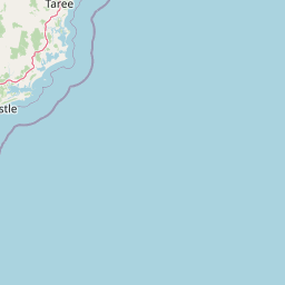
Map view of Wallis Island Nature Reserve

Use this park location map to pinpoint Wallis Island Nature Reserve in Australia, understand its exact geographic position, and read its mapped placement within the surrounding landscape more clearly.

Pigeon | © OpenStreetMap contributors

Location context for Wallis Island Nature Reserve

New South Wales
Park atlas

Compare regional coastal reserves and protected wetlands across the mid north coast

Other Parks Near Wallis Island Nature Reserve and Surrounding Protected Areas

Browse protected areas and coastal reserves situated near Wallis Island Nature Reserve to compare regional wetland habitats. Expanding the view helps trace connected estuarine ecosystems and protected landscapes across the surrounding region.
National parkNew South Wales
About 3.9 km away#1 closest

Southeast

Booti Booti National Park: New South Wales National Park Protected Landscape Atlas

Mapped boundaries and regional geography for this Australian national park.

Delve into the specifics of Booti Booti National Park, a designated national park within New South Wales, Australia. This resource facilitates a detailed understanding of its protected area status, landscape characteristics, and precise geographic placement. Explore its mapped features and regional context to enrich your atlas-based discovery of Australia's protected lands.

Area
15.67 km²
Established
1992
IUCN
II
Relief
Highland
National parkNew South Wales
About 4.7 km away#2 closest

Southwest

Wallingat National Park: Explore Protected Landscape and Regional Geography in New South Wales

Discover mapped park boundaries and terrain context.

Wallingat National Park in New South Wales is a protected landscape crucial for understanding Australia's natural geography. This canonical page detail provides essential information for atlas exploration, focusing on the park's protected status, mapped contours, and its place within the regional context. Discover the unique geographic features that distinguish this national park from others in the atlas.

Area
65.57 km²
Established
1999
IUCN
II
Relief
Lowland
National parkNew South Wales
About 20 km away#3 closest

Southwest

Myall Lakes National Park National Park: Mapped Boundaries and Protected Landscape Exploration

Discover its regional geography and natural terrain context.

Delve into the specific protected landscape and geographic features of Myall Lakes National Park. As a national park located in New South Wales, it provides critical atlas context for understanding protected areas and their distribution. Explore its mapped terrain and boundaries to gain a deeper appreciation for this significant natural area within Australia's geography.

Area
448 km²
Established
1972
IUCN
II
Relief
Lowland
National parkNew South Wales
About 31 km away#4 closest

West

Ghin-Doo-Ee National Park: National Park Protected Area Exploration in New South Wales

Mapped landscape and regional geography for Ghin-Doo-Ee National Park.

Ghin-Doo-Ee National Park represents a key component of Australia's protected lands, situated within the diverse geography of New South Wales. This park offers a structured point of entry for understanding its specific mapped boundaries, terrain characteristics, and its role as a national park. Users can delve into its unique landscape features and regional geographic context, contributing to a broader appreciation of conservation areas and natural atlas exploration.

Area
47.936 km²
Established
1999
IUCN
II
Relief
Upland
A soft watercolor painting of a riverbank scene with trees along a shoreline and rolling hills in the background.
Nature reserveNew South Wales
About 33 km away#5 closest

North

Coocumbac Island Nature Reserve: Mapping Rare Rainforest on the Manning River

Protected island geography in New South Wales

Coocumbac Island Nature Reserve represents a key protected area on the mid-north coast of New South Wales, safeguarding a distinct subtropical lowland rainforest community. The reserve features a dense canopy of strangler figs, mangroves, and alluvial river terrain that serves as a sanctuary for rainforest-dependent wildlife. Its geography provides a clear window into the ecological history of the Manning River and its traditional significance as an Indigenous meeting place.

Area
0.06 km²
Established
1981
IUCN
IV
Water
Water-dominated
Nature reserveNew South Wales
About 39 km away#6 closest

North

Wingham Brush Nature Reserve: Protected Rainforest and Manning River Floodplain Geography

An essential ecological sanctuary in coastal New South Wales.

Wingham Brush Nature Reserve represents a critical protected landscape featuring subtropical rainforests on the Manning River floodplain. This unique site, known for its massive Moreton Bay figs and successful regeneration methods, provides a sanctuary for avian and reptilian life amidst the broader coastal plains of eastern Australia.

Area
0.08 km²
Established
2000
IUCN
IV
Relief
Lowland
Nature reserveNew South Wales
About 42 km away#7 closest

West

The Glen Nature Reserve: Protected Forest Geography and Mapped Sanctuary in New South Wales

Conservation-focused landscape in the Hunter Region

Covering over 2,700 hectares, The Glen Nature Reserve protects a rich mosaic of sub-tropical sclerophyll forest and creek-lined gullies in the Hunter Region. The reserve provides essential habitat for threatened wildlife and represents a key node in the protected land network of eastern New South Wales, highlighting the intersection of forest types and local watershed topography.

Area
27.5 km²
Established
1999
IUCN
Ia
Relief
Upland
National parkNew South Wales
About 50 km away#8 closest

Northeast

Crowdy Bay National Park: New South Wales Protected Coastal Landscape and Terrain Map

Explore mapped boundaries and diverse natural geography within this national park.

Crowdy Bay National Park offers a compelling example of coastal protected landscape in New South Wales, Australia. This page facilitates a detailed atlas exploration of its natural geography, focusing on the interaction between ocean beaches, headlands, and inland forested terrain. Understand the park's specific location and its characteristic ecosystems, providing a structured view of this significant national park for geographic discovery.

Area
102 km²
Established
1972
IUCN
II
Relief
Lowland

Common questions about visiting, size, designation, and location context for Wallis Island Nature Reserve

Wallis Island Nature Reserve FAQs for park facts, access, geography, and protected area context

Find quick answers about Wallis Island Nature Reserve, including protected-area facts, park geography, trail and visitor context, and how the park fits into its surrounding country and regional landscape.
MoriAtlas Explorer

Continue Your Protected Areas Search Across the Global Atlas

Deepen your exploration by continuing the structured search for national parks and protected areas worldwide. Utilize the comprehensive filtering capabilities to compare different conservation landscapes and refine your understanding of global park geography. Discover more about the distribution and characteristics of protected natural areas.

Global natural geography