Mori Atlas logo
National parkWarro National Park

Trace the protected boundaries and geographic setting of Warro National Park in Queensland.

Warro National Park: Queensland National Park Protected Landscape and Map Atlas

Warro National Park represents a key protected land entity within Queensland, Australia, offering a distinct focal point for geographic discovery. This canonical detail page serves as an entry point for understanding the park's specific national park designation and its place within the mapped landscape of northeastern Australia. Explore its geographic context, natural terrain, and protected area boundaries as part of a comprehensive atlas-driven understanding of Queensland's natural heritage.

National ParksQueenslandAustraliaDry RainforestEucalyptus ForestProtected Areas

Warro National Park

National park

Park overview

Structured park overview, official facts, and landscape profile for Warro National Park

Warro National Park park facts, protected area profile, and essential visitor context
Review the core facts for Warro National Park, including designation, size, terrain, visitor scale, habitats, and operating context in one park-focused overview.

About Warro National Park

Warro National Park represents a significant addition to Queensland's protected area network, established in 2006 to preserve unique dry rainforest and eucalyptus forest ecosystems in the Wide Bay-Burnett region. The park occupies roughly 60 square kilometres of terrain that rises to approximately 410 metres above sea level, creating conditions suitable for vegetation communities that are not widely represented in other protected areas of the state. The dry rainforest found within the park boundaries is particularly noteworthy, as this habitat type has restricted distribution across Queensland and faces ongoing conservation pressures. Eucalyptus forest communities complement the rainforest areas, creating a mosaic of vegetation that supports diverse fauna populations. Located approximately 340 kilometres north of Brisbane and accessible from Gin Gin via the Bruce Highway, the park remains relatively undeveloped with no visitor facilities currently available. The southern boundary of the park adjoins Lake Monduran, a major reservoir that influences the broader landscape context. Nearby protected areas including Bulburin National Park, Littabella National Park, and Mount Colosseum National Park form a regional network of conservation reserves that collectively contribute to biodiversity protection in southeast Queensland.

Quick facts and research context for Warro National Park

Warro National Park is located in the Wide Bay-Burnett region of Queensland, Australia, about 340 kilometres north of Brisbane and 185 kilometres southeast of Rockhampton. The nearest town is Gin Gin, which provides access via the Bruce Highway. The park covers approximately 60.32 square kilometres and was established in 2006 as an IUCN Category II protected area. The terrain reaches elevations of up to 410 metres and features distinctive dry rainforest ecosystems alongside eucalyptus forest communities.

Park context

Deeper park guide and search-rich context for Warro National Park

Warro National Park history, landscape, wildlife, and travel context
Explore Warro National Park through its history, landscape character, ecosystems, wildlife, conservation priorities, cultural context, and seasonal travel timing in a structured park guide built for atlas discovery and search intent.

Why Warro National Park stands out

Warro National Park is notable for protecting rare dry rainforest communities at elevations reaching 410 metres, a habitat type that is limited in distribution across Queensland. The park also supports significant populations of bird species including the coconut lorikeet, rufous whistler, grey shrikethrush, and noisy friarbird. Additionally, the reserve contains several endangered plant species that are endemic to the area, making it botanically significant within the broader region.

Warro National Park history and protected-area timeline

Warro National Park was established in 2006 as part of Queensland's ongoing efforts to expand the protected area network and preserve regionally significant natural landscapes. The declaration of this national park followed recognition of the area's ecological value, particularly the dry rainforest communities and endangered plant species found within its boundaries. As a relatively recent addition to Queensland's national park system, the park represents contemporary conservation priorities focused on protecting lesser-known but ecologically important habitat types. The establishment also reflects the broader trend of identifying and reserving areas that contain endemic species or specialized ecosystems rather than only focusing on highly visible or famous landscapes.

Warro National Park landscape and geographic character

The terrain within Warro National Park is characterized by elevations reaching approximately 410 metres, creating a hilly landscape that supports diverse vegetation communities. The park's elevated positioning is significant as it provides the moisture and microclimate conditions necessary for dry rainforest persistence in what is otherwise a relatively dry region. The landscape features a mix of ridgelines and valleys that create varied exposure and moisture regimes, supporting the coexistence of rainforest and eucalyptus forest communities. While the park does not contain dramatic geological features or dramatic topographical changes, the subtle complexity of the terrain contributes to habitat diversity and ecological richness.

Warro National Park ecosystems, habitats, and plant life

Warro National Park protects significant dry rainforest communities that represent a specialized habitat type within Queensland's ecological landscape. These forests occur at higher elevations within the park and feature species adapted to the somewhat drier conditions that distinguish dry rainforests from their wetter counterparts. The eucalyptus forests that dominate other portions of the park provide a contrasting habitat structure and support different assemblages of plant and animal species. The combination of these two vegetation types within a relatively compact protected area creates ecological diversity that would be difficult to achieve in more uniform landscapes. The presence of several endangered plant species including Argophyllum nullumense, Kunzea flavescens, and Eucalyptus decolor indicates the botanical significance of this area and the importance of its protection.

Warro National Park wildlife and species highlights

The bird communities of Warro National Park are particularly well-documented, with the park supporting populations of several notable species. The coconut lorikeet, rufous whistler, grey shrikethrush, and noisy friarbird are all present within the park boundaries, representing both nectar-feeding and insectivorous bird species. These birds utilize the various habitat layers provided by the rainforest and eucalyptus forests, from the canopy where lorikeets feed on nectar to the mid-story where whistlers and shrikethrushes forage for insects. Amphibian populations are also present, with frog species from the Hylidae family and the Australian common frog group recorded in the park. The Platyplectrum ornatum species specifically inhabits the area, reflecting the moist microhabitats that exist within the forest understory.

Warro National Park conservation status and protection priorities

The conservation significance of Warro National Park stems from its protection of dry rainforest ecosystems that have limited distribution and face ongoing threats from land clearing and fragmentation. The presence of multiple endangered plant species, including Argophyllum nullumense, Kunzea flavescens, and Eucalyptus decolor, elevates the park's importance within Queensland's conservation portfolio. These species are endemic to specific localities and rely on the protected habitat within the park for their continued survival. As an IUCN Category II protected area, the national park designation provides formal recognition of the area's ecological value and establishes a framework for long-term conservation management. The park contributes to regional biodiversity conservation by connecting with other protected areas in the Wide Bay-Burnett region.

Warro National Park cultural meaning and human context

The cultural context of Warro National Park is not extensively documented in the available source material, suggesting that the primary significance of the area is ecological rather than cultural-historical. The park is situated within the traditional lands of the Wide Bay-Burnett region, though specific indigenous connections or heritage values are not detailed in the current information. The landscape surrounding the park includes Lake Monduran to the south, indicating the presence of water bodies that may have historically supported local communities.

Top sights and standout views in Warro National Park

The standout features of Warro National Park include its significant dry rainforest communities at elevations up to 410 metres, its populations of colorful bird species such as the coconut lorikeet, and its protection of rare and endangered plant species endemic to the region. The combination of dry rainforest and eucalyptus forest within a single protected area creates ecological diversity that distinguishes this park from more common protected area types. The park's proximity to Lake Monduran adds landscape context, while its location in the Wide Bay-Burnett region positions it as part of a network of conservation reserves in southeastern Queensland.

Best time to visit Warro National Park

The best time to visit Warro National Park would generally be during the cooler months of autumn and winter in Queensland, from approximately April through September, when temperatures are more moderate and outdoor exploration is comfortable. The dry rainforest and eucalyptus forest environments are accessible year-round given the relatively mild climate of southeastern Queensland, though summer months can bring hot and humid conditions. Visitors should note that the park currently lacks visitor facilities, so preparation for self-sufficient exploration is essential. Wildlife viewing opportunities, particularly for bird species, may be most productive in the early morning hours when birds are most active.


Park location guide

Geography guide, regional context, and park location map for Warro National Park

Warro National Park park geography, regions, and map view in Australia
Understand where Warro National Park sits in Australia through a broader geographic reading of the surrounding landscape, nearby location context, and its mapped position within the national park landscape.

How Warro National Park fits into Australia

Australia is a constitutional monarchy and federal parliamentary democracy comprising six states and ten territories. With a population of nearly 28 million, it is one of the world's most urbanised countries, with most people concentrated on the eastern seaboard. The country has a high Human Development Index and is known for its cultural diversity, ancient Aboriginal heritage, and unique wildlife.

Wider geography shaping Warro National Park in Australia

Australia occupies the entire Australian continent, the island of Tasmania, and numerous smaller islands. It is the world's flattest and driest inhabited continent, featuring vast deserts in the interior (the Outback), tropical rainforests along the eastern coast, and a coastline bordering the Indian and Pacific Oceans.

Map view of Warro National Park

Use this park location map to pinpoint Warro National Park in Australia, understand its exact geographic position, and read its mapped placement within the surrounding landscape more clearly.

Pigeon | © OpenStreetMap contributors

Location context for Warro National Park

Queensland
Park atlas

Explore the geographical context of protected areas and compare national parks surrounding Warro National Park in Queensland.

Discover Other National Parks and Protected Areas Near Warro National Park in Queensland
Continue your exploration from Warro National Park by browsing other national parks and protected areas in the surrounding Wide Bay-Burnett region of Queensland, Australia. This allows for a deeper geographical comparison of diverse landscapes, from elevated dry rainforests to extensive eucalyptus forests, revealing the interconnected network of conservation efforts.
National parkQueensland

Bulburin National Park: Central Queensland's Significant Subtropical Rainforest Preserve

Mapped protected landscape and ecological refuge.

Bulburin National Park represents the most substantial remaining area of subtropical rainforest in central Queensland, established as a protected national park. Its dense forest ecosystem provides crucial habitat for numerous species, including endangered marsupials and notable birdlife. Exploring Bulburin National Park reveals a distinct natural landscape within Queensland, offering insights into regional conservation and the geographic distribution of vital protected areas.

Established
2015
IUCN
II
Relief
Lowland
Climate
Subtropical
National parkQueensland

Mount Colosseum National Park: Queensland's Premier Protected Landscape Discovery

Mapped natural terrain and regional geographic context.

Mount Colosseum National Park offers a detailed view into Australia's protected natural areas, specifically within the state of Queensland. This entry focuses on its identity as a national park, providing essential context for its mapped boundaries, surrounding regional geography, and the unique character of its natural landscape. It serves as a key reference for understanding the park's protected status and geographic significance.

Area
8.4 km²
Established
1977
IUCN
II
Relief
Mountain
National parkQueensland

Littabella National Park: Queensland National Park Atlas and Geographic Context

Mapped protected area and natural landscape details.

Littabella National Park offers a distinct perspective on Queensland's protected areas. As a designated national park, its mapped boundaries and geographic setting are crucial for understanding Australia's conservation landscapes. Explore this entity for its regional context, mapped terrain features, and its role within the larger atlas of protected lands.

Area
83.8 km²
Established
1980
IUCN
II
Relief
Lowland
National parkQueensland

Deepwater National Park: Queensland National Park Geography and Protected Landscape

Explore mapped boundaries and regional geographic context.

Deepwater National Park represents a vital point of discovery within Queensland's extensive geography. As a designated national park, it provides crucial insights into protected landscape identity and mapped features. This page serves as a focused entry for understanding the park's specific geographic setting and its contribution to the atlas of Australian protected areas, offering a clear view of its distinct regional context.

Area
43.9 km²
Established
1988
IUCN
II
Relief
Lowland
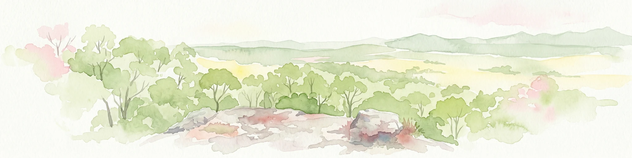
Watercolor illustration showing green trees and distant hills under a pastel sky
National parkQueensland

Eurimbula National Park: Central Queensland's Diverse Coastal Protected Landscape

Explore mapped terrain and protected ecosystem boundaries.

Eurimbula National Park in Queensland is an exceptional example of a protected coastal wilderness, featuring a remarkable array of habitats including mangroves, littoral rainforests, and extensive paperbark wetlands. Its diverse landscape supports significant biodiversity and offers a clear representation of central Queensland's natural heritage. Understanding Eurimbula National Park's geography through its mapped protected area helps situate its ecological importance within the broader Australian atlas.

Area
125 km²
Established
1977
IUCN
II
Relief
Lowland
National parkQueensland

Goodnight Scrub National Park: Protected Dry Rainforest and Hoop Pine Ecosystems

Explore the mapped terrain and conservation significance of this Queensland park.

Goodnight Scrub National Park safeguards a rare dry rainforest ecosystem, a significant ecological asset within Queensland's protected area network. Dominated by iconic hoop pine trees, this national park showcases a unique landscape characterized by its distinct vegetation and geographic setting. The park's conservation value is highlighted by its role in preserving a habitat type uncommon in Australia, offering insights into regional landscape dynamics and protected land importance.

Area
63.3 km²
IUCN
II
Relief
Lowland
Access
Moderate access
National parkQueensland

Castle Tower National Park: Queensland National Park with Granite Peaks and Woodland

Mapped terrain and protected landscape in the Gladstone Region.

Castle Tower National Park in Queensland represents a significant protected natural area characterized by striking granite peak formations and expansive eucalypt woodlands. Established in 1932, the park's rugged terrain, including Mount Stanley, offers a unique geographic perspective within Central Queensland. This national park provides an opportunity to explore its mapped boundaries and distinctive landscape context, distinguishing it as a notable protected area in the Gladstone Region.

Area
49.8 km²
Established
1932
IUCN
II
Relief
Mountain
National parkQueensland

Cania Gorge National Park: A Distinct Queensland National Park with Dramatic Sandstone Cliff Formations

Explore mapped gorge terrain, rock art sites, and diverse Queensland landscapes.

Cania Gorge National Park represents a significant protected area within Queensland, Australia, distinguished by its dramatic 70-meter sandstone cliffs and the ancient Aboriginal rock art found within its caves. The park's rugged gorge terrain, shaped by Three Moon Creek, offers a unique geographic context and landscape to explore. Its mapped boundaries encompass diverse ecological communities and geological features, making it a focal point for understanding regional park identity and natural heritage within Queensland's broader atlas.

Area
30 km²
Established
1977
IUCN
II
Relief
Upland

Common questions about visiting, size, designation, and location context for Warro National Park

Warro National Park FAQs for park facts, access, geography, and protected area context
Find quick answers about Warro National Park, including protected-area facts, park geography, trail and visitor context, and how the park fits into its surrounding country and regional landscape.
MoriAtlas Explorer

Continue Your Protected Areas Search Across the Global Atlas

Deepen your exploration by continuing the structured search for national parks and protected areas worldwide. Utilize the comprehensive filtering capabilities to compare different conservation landscapes and refine your understanding of global park geography. Discover more about the distribution and characteristics of protected natural areas.

Global natural geography