
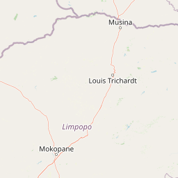
Streams
Park geography
Analyzing the topography, mapped boundaries, and environmental features of the Limpopo region
Comprehensive Geographic and Terrain Profile of the Waterberg Biosphere Protected Area
This geographic profile details the physical landscape of the Waterberg Biosphere, encompassing over 6540 square kilometers of protected territory in South Africa. The data covers elevation variations ranging from 600 meters to 1830 meters, alongside categorized terrain features including mountains, plateaus, and river systems. Explore the intersection of montane forests, savannas, and grassland habitats.
Related tags
biosphere reservesandstone massifdry deciduous forestBushveldsavanna
A sandstone massif in northern South Africa, designated as the country's first northern UNESCO Biosphere Reserve.
Waterberg Biosphere
The Waterberg Biosphere is a mountainous massif and protected landscape in the northern part of South Africa's Limpopo Province, designated as a UNESCO Biosphere Reserve in 2001. It is the first region in northern South Africa to receive this international biosphere status, recognizing both its ecological and cultural significance. The massif forms a broad sandstone upland shaped by hundreds of millions of years of riverine erosion, producing distinctive bluffs, buttes, mesas, and kopje outcrops. Some cliffs rise several hundred meters above the surrounding plains. Ecologically, the area is fundamentally a dry deciduous forest or Bushveld system, with savanna grasslands, shaded cliff vegetation, and riparian zones supporting a wide array of plant and animal life. The Waterberg also carries deep human history, from Stone Age occupation and Bushman rock art to early Iron Age settlements and later colonial-era encounters. Today, the biosphere combines conservation, ecotourism, and active land restoration, anchored by reserves such as Marakele National Park, Welgevonden Game Reserve, and the Lapalala Wilderness.
- Location
- South Africa
- Park type
- Biosphere reserve
- Established
- 2001
- Area
- 6,540.3 km²
- Highest point
- 1,830 m
Location overview
Country memberships and regional boundaries across South Africa
Geographic Overview and Regional Location of Waterberg Biosphere
Recorded country and regional memberships place Waterberg Biosphere firmly within South Africa and Limpopo. Administrative records outline the exact territorial scope without relying on coastal or transboundary designations.
- Countries
- South Africa
- Regions
- Limpopo
- Primary location
- Limpopo
- Geographic setting
- Inland
Boundary and coordinates
Interactive boundary geometry and calculated area metrics
Waterberg Biosphere Boundary Map and Spatial Extent Explorer
Mapped geographic outlines provide spatial context for protected boundaries across the region. Accompanying facts outline derived area measurements, coordinate limits, and regional spans.
- Boundary area
- 6,623.6 km²
- Boundary perimeter
- 714.2 km
- Northernmost point
- 23.1659° S
- Southernmost point
- 24.5719° S
- Easternmost point
- 28.7219° E
- Westernmost point
- 27.4489° E
- Geographic centre
- 24.0096° S, 28.1415° E
- North–south span
- 155.7 km
- East–west span
- 129.7 km
Elevation and terrain
Mountain relief metrics and recorded natural water features
Waterberg Biosphere Terrain and Elevation Summary
Elevation ranges span from six hundred to eighteen hundred thirty meters across the mountain terrain. Recorded natural features include rivers, peaks, and reservoirs located within the protected boundary.
- Minimum elevation
- 600 m
- Maximum elevation
- 1,830 m
- Highest point
- 1,830 m
Selected named natural features
Viewpoints
Lily Dam
Streams
Grootfonteinspruit
Streams
Mmadikiri
Peaks
Pramkop
1,423.7 m
Rivers
Klein-Sterkrivier
Environmental setting
Interpreting subtropical relief, plateau topography, and habitat diversity
Waterberg Biosphere Environmental Settings and Physical Classification Profile
Recorded mountain relief, subtropical climate markers, and partial forest cover combine to form structured environmental categories for the region. Mapped classes link directly to related protected areas and contextual terrain data across the atlas.
- Relief
- Mountain
- Climate
- Subtropical
- Water
- Minor water
- Forest cover
- Partial forest
- Seasonality
- Year-round
Landscape features
Mountains · Cliffs · Plateau · Valleys · Rivers · Cave · Forest
Habitat types
Savanna · Grassland · Riverine habitat · Montane forest
Park atlas
Compare adjacent game reserves and regional conservation areas in Limpopo Province
Explore Other Parks Near Waterberg Biosphere and Surrounding Protected Landscapes
Continue geographic comparison by browsing other protected areas located near Waterberg Biosphere. Discovering adjacent reserves reveals how surrounding Bushveld savanna and sandstone terrain connect across the regional ecosystem.
Nature reserveLimpopo
Mapped location lies within the park boundary#1 closest
Northeast

Lapalala Wilderness Nature Reserve: Geographic Atlas and Park Landscape Mapping
Protected bushveld terrain in the Limpopo province of South Africa
Lapalala Wilderness represents an influential private conservation landscape featuring over forty-eight thousand hectares of bushveld habitat. Gain insight into the reserve's structural diversity, including its sixty kilometers of priority river systems and distinct land types that define this protected territory in Limpopo.
- Area
- 480 km²
- Established
- 1981
- Relief
- Upland
- Climate
- Subtropical
National parkLimpopo Province
Park boundaries overlap#2 closest
Southwest
Marakele National Park: National Park Protected Landscape and Geographic Context
Explore its Limpopo Province regional setting and mapped boundaries.
Marakele National Park represents a vital protected national park within the diverse geography of Limpopo Province, South Africa. This entry provides detailed atlas-style information on its protected landscape, focusing on mapped geographic boundaries and its context within the regional natural terrain. It serves as a key resource for understanding the park's specific role as a conservation area and its place within the broader atlas of South African protected lands.
- Area
- 670 km²
- Established
- 1994
- Relief
- Mountain
- Climate
- Subtropical
Wildlife reserveLimpopo
Mapped location lies within the park boundary#3 closest
Southwest
Welgevonden Game Reserve: A Comprehensive Geographic Profile of a Limpopo Wildlife Haven
Mapped terrain across the Waterberg mountain bushveld
Welgevonden Game Reserve stands as a focal point for protected land discovery in South Africa. The reserve features complex geological formations, ranging from steep cliffs to open plateau grasslands. Gain insights into the physical boundaries and landscape diversity that define this significant conservation area located within the northern Limpopo province.
- Area
- 382 km²
- Relief
- Mountain
- Access
- Access unknown
- Scope
- Terrestrial
Wildlife reserveLimpopo
About 28 km away#4 closest
South
Mabula Game Reserve: Protected Bushveld and Geographic Landscape Profile
Exploration of the Limpopo bushveld and wildlife habitat boundaries
Mabula Game Reserve provides a detailed look at the bushveld ecosystems of South Africa. Spanning 12,000 hectares in Limpopo, the reserve features a unique blend of rocky ridges, open savanna, and riverine woodlands. Its structural diversity creates a distinct natural corridor that serves as a focal point for understanding regional wildlife distribution and the transition zone between the Waterberg and the northern plains.
- Area
- 120 km²
- Scope
- Terrestrial
Nature reserveLimpopo Province
34 km away#5 closest
Southeast
Nylsvley Nature Reserve: A Geographical Overview of Limpopo Province's Wetland Landscapes
Protected floodplain ecosystems and seasonal riverine terrain
Nylsvley Nature Reserve protects a vast, shallow floodplain and surrounding open woodland, creating a high-density conservation zone in the Limpopo Province. Its terrain is defined by the seasonal interaction of the Nyl River, extensive reedbeds, and unique botanical communities. This profile examines the reserve as a significant reference point for understanding the interplay between floodplain geography, savanna bushveld, and inland wetland habitats.
- Area
- 40 km²
- Established
- 1998
- Relief
- Lowland
- Access
- Access unknown
Nature reserveLimpopo
About 44 km away#6 closest
South
Mabalingwe Nature Reserve: Protected Bushveld Geography and Terrain Analysis
Mapping the Limpopo reserve landscape and habitat features
Examine the 8,800-hectare landscape of Mabalingwe Nature Reserve. From its malaria-free bushveld habitat to its network of seasonal dams and mixed woodland terrain, this entry provides a clear look at the environmental context of this private Limpopo protected area.
- Area
- 88 km²
- Established
- 1989
- Relief
- Upland
- Climate
- Subtropical
Nature reserveLimpopo Province
About 46 km away#7 closest
Northeast
Blouberg Nature Reserve: Geographic Map and Protected Landscape Overview in Limpopo, South Africa
Tracing the savanna and mountain transition zones of a northern protected area
Blouberg Nature Reserve offers a distinctive look at the Limpopo landscape, encompassing steep sandstone cliffs, old-growth mountain forest patches, and open baobab-studded plains. This protected area stands as a focal point for understanding the ecological transition between the Soutpansberg range and the Limpopo lowveld. Use this atlas resource to understand the park's internal topography, its specific habitat boundaries, and its regional position as a significant node for raptor conservation in southern Africa.
- Area
- 93.6 km²
- Established
- 1990
- Relief
- Mountain
- Climate
- Subtropical
Nature reserveLimpopo
About 67 km away#8 closest
West
Atherstone Nature Reserve: Mapping the Savannah and Bushveld of Limpopo, South Africa
A collaborative conservation landscape of plains and grasslands
Atherstone Nature Reserve features a distinctive blend of classic bushveld thickets and open Kalahari-influenced grasslands. Situated in Limpopo, the 23,500 hectare protected area serves as a primary hub for large mammal conservation and savannah ecology, offering researchers and atlas enthusiasts a focused look at South Africa’s northern provincial wilderness.
- Area
- 235 km²
- Established
- 1994
- Relief
- Upland
- Climate
- Subtropical
MoriAtlas Explorer
Examine the Mapped Geography and Protected Landscapes of the Waterberg Biosphere
Trace the boundaries and terrain of the Waterberg Biosphere through this detailed geographic overview. This MoriAtlas entry provides insights into the sandstone massifs, plateau ecosystems, and ecological connectivity that define this significant northern South African protected area.
Browse next
Global natural geography
Explore related park routes
Explore MoriAtlas Global ParksBrowse All MoriAtlas ParksGlobal Park Map DiscoveryMoriAtlas: Browse All CountriesBrowse All MoriAtlas ContinentsNational Park Environment AtlasGrand Canyon National Park AtlasYellowstone National Park AtlasYosemite National Park Atlas and GeographySerengeti National Park AtlasGalápagos National Park Protected LandscapeBanff National Park Geography and AtlasKruger National Park Atlas EntryUluṟu-Kata Tjuṯa National Park AtlasExplore Uluru-Kata Tjuta National Park GeographyPlitvice Lakes National Park AtlasFiordland National Park Protected LandscapeGreat Smoky Mountains National Park AtlasAfghanistan National Parks and Protected AreasAlbania National Parks and Protected AreasAlgeria National Parks and Protected AreasAmerican Samoa National Parks and Protected AreasAndorra National Parks and Protected AreasAngola National Parks and Protected AreasAntarctica National Parks and Protected AreasAntigua and Barbuda Park List