
Mori Atlas logo
Protected landscapeWertheim

A historic protected area preserving the characteristic Main-Franconian sandstone plateau and river valley landscapes.

Wertheim Protected Landscape: Exploring the Sandstone Geography and Regional Terrain of Baden-Württemberg

(Landschaftsschutzgebiet „Wertheim“)

The Wertheim Protected Landscape spans 39 square kilometers of the Main-Tauber district in Baden-Württemberg. This area preserves the Marktheidenfelder Platte, a gently rolling plateau shaped by Lower Triassic red sandstone that defines the rural character of the Tauber-Main border region. Its mosaic of agricultural fields, mixed forests, and stream-side meadows offers a representative look at the historic Main-Franconian countryside.

protected landscapeMain-Tauber regionBaden-Württembergsandstone landscapeMain-FranconiaMarktheidenfelder Platte
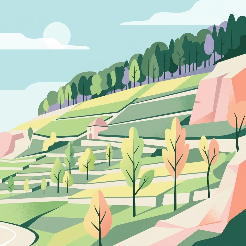
A flat-style digital illustration showing terraced fields on a hillside, punctuated by small trees and distinctive pinkish rock faces under a soft sky.

Wertheim

Protected landscape

Park overview

Structured park overview, official facts, and landscape profile for Wertheim Protected Landscape

Wertheim Protected Landscape park facts, protected area profile, and essential visitor context

Review the core facts for Wertheim Protected Landscape, including designation, size, terrain, visitor scale, habitats, and operating context in one park-focused overview.

About Wertheim Protected Landscape

The Wertheim Protected Landscape forms part of the southern fringe of a wider sandstone region that extends into neighboring Bavaria. Its terrain belongs to the Marktheidenfelder Platte, a natural unit defined by Lower Triassic red sandstone layers that erode into broad plateaus separated by shallow valley systems. Across the protected area, this geological base supports a mosaic of mixed forest, meadows, fields, and small valley brooks, creating a varied yet harmonious rural landscape.

The designation places particular value on the preservation of the area's character, which has developed gradually through centuries of traditional agriculture. The protected zone is intended to safeguard not only scenic qualities but also the ecological functions of the landscape: habitats for native flora and fauna, the buffering of soils and waters, and the continuing viability of low-intensity land use patterns that have long defined the cultural identity of the Tauber-Main region.

Although its size has been reduced several times through the introduction of stricter nature reserves within its borders, the protected landscape still represents an important part of the regional conservation network. Today it complements other protected landscape and nature reserve areas of the Main-Tauber-Kreis, contributing to a contiguous belt of recognized countryside along the Baden-Württemberg side of the Main valley.

Quick facts and research context for Wertheim Protected Landscape

Wertheim Protected Landscape lies in the Main-Tauber-Kreis district of Baden-Württemberg in southwestern Germany. It was established by decree on 18 December 1979 and carries the LSG designation number 1.28.002.

The protected area spans the municipal territories of Freudenberg, Külsheim, Werbach, and Wertheim, and covers roughly 39 square kilometers. It belongs to the Marktheidenfelder Platte natural region and is characterized by typical Main-Franconian red sandstone scenery of gently wooded uplands, small valleys, and rural farmland. Administration falls under the Regierungspräsidium Stuttgart.

Protection and recognition

Explore terrestrial protection metrics and official conservation designations

Wertheim Protection Status and International Recognition Overview

Examine the documented terrestrial protection status and management scope recorded for Wertheim within global conservation databases. Review verified designation parameters and international recognition records structured for environmental research.

Protection details

Protection scope
Terrestrial
WDPA ID
321868
Park context

Deeper park guide and search-rich context for Wertheim Protected Landscape

Wertheim Protected Landscape history, landscape, wildlife, and travel context

Explore Wertheim Protected Landscape through its history, landscape character, ecosystems, wildlife, conservation priorities, cultural context, and seasonal travel timing in a structured park guide built for atlas discovery and search intent.

Why Wertheim Protected Landscape stands out

The Wertheim Protected Landscape is best known for preserving an intact Main-Franconian Buntsandstein (red sandstone) landscape in the Tauber-Main border region. The gently undulating plateau, traditional agricultural land use, and scattered woodland patches together form a representative example of the historically evolved countryside around the meeting point of the Tauber and Main rivers. It is also notable as one of the earliest protected landscape designations in the Main-Tauber-Kreis, predating many of the nature reserves that later overlapped its boundaries.
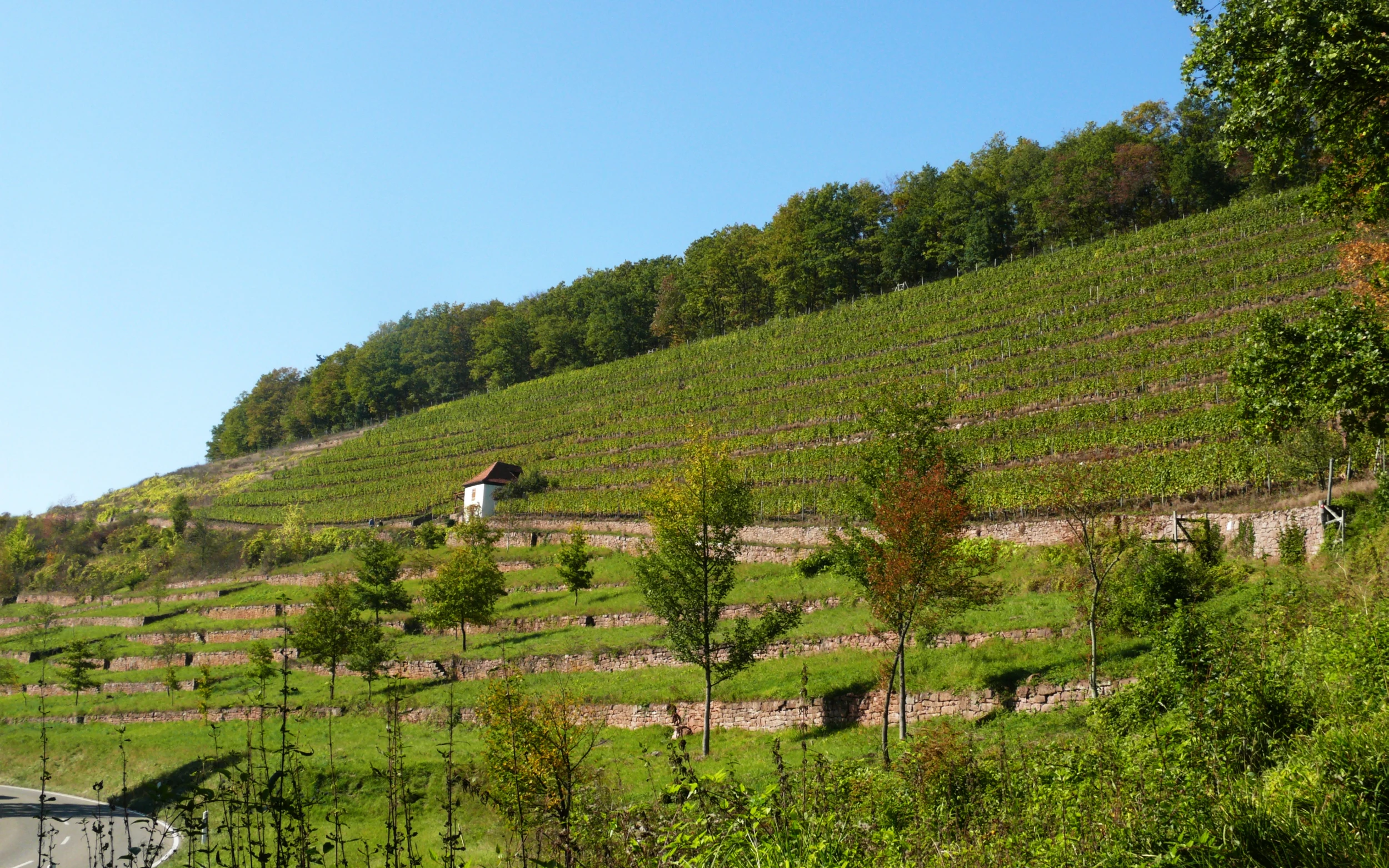
A sunny hillside in the Wertheim region featuring agricultural terraces, vineyards, and a small building surrounded by trees.
A terraced vineyard hillside near the Satzenberg in the Wertheim protected landscape.

Wertheim Protected Landscape history and protected-area timeline

Wertheim is among the older formally protected landscapes in the Main-Tauber district. It was designated by decree of the responsible regional authority on 18 December 1979, making it one of the earliest protected landscape areas in what is today the Main-Tauber-Kreis.

When originally established, the landscape protection area covered about 5,170 hectares. Over the following years, its boundaries were reduced several times as more strictly regulated nature reserves and additional protected landscape zones were carved out of its territory. In 1984, the creation of the Gutenberg Nature Reserve removed a small section; further reductions followed in 1985 with the Kembachtal protected landscape, in 1986 with the Ellenberg-Kapf nature reserve, and again in 1992 through an amendment to the original decree.

Today the area stands at roughly 3,932 hectares, reflecting both the long-standing importance of the region for nature conservation and a gradual refinement of its protective zoning over time. The landscape is administered by the Regierungspräsidium Stuttgart and is registered internationally with the World Database on Protected Areas.

Wertheim Protected Landscape landscape and geographic character

The terrain of the Wertheim Protected Landscape is shaped by the Lower Triassic Buntsandstein, a red sandstone that weathers into deeply toned soils and rocky outcrops. Across the Marktheidenfelder Platte, these layers form a gently rolling plateau crossed by shallow valleys and small streams, with occasional steeper edges and woodland-fringed slopes along the valley sides.

The typical Main-Franconian character of the area is expressed in a modest, human-scaled countryside: open agricultural fields interspersed with patches of mixed forest, hedgerows, meadows, orchards, and small stream-side vegetation. Settlements and historic village centers, including the picturesque old townscape of Wertheim, are embedded within the protected area, giving the landscape a strong cultural-historical dimension alongside its natural features.

Overall, the protected landscape represents a coherent and well-preserved example of traditional sandstone countryside, where geology, land use, and settlement pattern together determine the visual identity of the region.

Wertheim Protected Landscape ecosystems, habitats, and plant life

Ecologically, the Wertheim Protected Landscape reflects the conditions of a warm and moderately dry sandstone region. The combination of open farmland, semi-natural grasslands, and small woodland fragments supports a variety of habitat types, from sun-exposed field margins and orchard meadows to shaded valley woodlands along the brooks draining into the Main and Tauber systems.

The sandstone substrate influences both soil chemistry and drainage, producing acidic to neutral substrates that support characteristic vegetation communities of the region, including mixed broadleaf forests with oak and pine, extensively used hay meadows, and species-rich field edges. Smaller valleys and stream corridors add pockets of more humid habitat within an otherwise open agricultural matrix.

Although the landscape protection designation is primarily focused on cultural landscape values rather than strict nature protection, the area nevertheless contributes meaningfully to regional biodiversity and serves as an important connective element between the more strictly protected nature reserves of the district.

Wertheim Protected Landscape wildlife and species highlights

The variety of open and wooded habitats within the Wertheim Protected Landscape supports a typical range of central German lowland and sandstone wildlife. Open farmland and orchard meadows provide habitat for common farmland birds and small mammals, while the mosaic of small forests, field margins, and valley vegetation creates favorable conditions for many woodland and edge-of-forest species.

Stream corridors and wooded valley slopes offer cover and foraging areas for a range of native fauna, and the larger interconnected landscape supports typical regional species movements across the Tauber-Main borderland. Although the landscape protection designation is not primarily aimed at managing wildlife populations, its preservation of habitat diversity gives it ecological relevance for the broader species community of the region.

Wertheim Protected Landscape conservation status and protection priorities

The principal aim of the Wertheim Protected Landscape is the preservation of the characteristic regional landscape, its protection against aesthetic and ecological deterioration, and its long-term safeguarding as a living environment and recreational space.

Designated as an IUCN Category V protected landscape, the area emphasizes harmonized conservation alongside traditional human land use, rather than strict nature preservation. In that sense, it complements the nature reserves and additional landscape protection areas of the Main-Tauber-Kreis by maintaining the wider countryside that supports and buffers these stricter core zones.

Through its protected status and its inclusion in regional and international databases, the area contributes to the continuity of recognized protected landscapes along the Baden-Württemberg side of the Main and Tauber valleys, ensuring that the cultural and ecological value of this sandstone region is maintained for future generations.

Wertheim Protected Landscape cultural meaning and human context

The Wertheim Protected Landscape is strongly tied to the cultural identity of the Tauber-Main region, a historic borderland between Baden-Württemberg and Bavaria known for its well-preserved market towns, half-timbered villages, and traditional agricultural land use. The medieval old town of Wertheim itself, lying within the protected area, anchors the regional sense of place and exemplifies the layered cultural heritage of the area.

Generations of farming, viticulture on the warmer slopes, and careful forest management have produced the current character of the countryside. The protected landscape therefore reads as much as a cultural artifact as a natural one, expressing centuries of human interaction with the sandstone terrain.

Top sights and standout views in Wertheim Protected Landscape

Among the most distinctive qualities of the Wertheim Protected Landscape are its classic Main-Franconian sandstone scenery, its early designation history dating back to 1979, and its integration of the historic townscape of Wertheim into the protected area. The mosaic of fields, orchard meadows, mixed woodland, and small stream valleys gives the area a coherent and visually appealing character typical of the broader Tauber-Main region.

Best time to visit Wertheim Protected Landscape

The protected landscape around Wertheim can be appreciated year-round. Late spring and early summer offer the freshest greenery, flowering orchard meadows, and mild conditions for walking; autumn brings rich color across the mixed sandstone forests and harvest activity in the surrounding farmland, while winter reveals the gentle topography of the sandstone plateau at its most open and quiet.


Monthly climate preview

Track representative annual temperature ranges and monthly precipitation patterns across Baden-Württemberg.

Wertheim Climate Normals and Long-Term Weather by Month Preview

Representative coordinate records show measured long-term averages for monthly temperature and precipitation rhythms across the protected landscape. Examining the complete twelve-month climatology profile reveals detailed shifts in baseline thermal conditions and moisture distribution.
Annual mean9 °C
-1 °C19 °C
Jan-1°
Feb
Mar
Apr
May13°
Jun17°
Jul19°
Aug19°
Sep14°
Oct
Nov
Dec
Warmest month
July

19.5 °C

Coolest month
January

-0.6 °C

Wettest month
July

2.4 mm/day

Driest month
April

1.5 mm/day

Park location guide

Geography guide, regional context, and park location map for Wertheim Protected Landscape

Wertheim Protected Landscape park geography, regions, and map view in Germany

Understand where Wertheim Protected Landscape sits in Germany through a broader geographic reading of the surrounding landscape, nearby location context, and its mapped position within the national park landscape.

How Wertheim Protected Landscape fits into Germany

Germany is a federal republic in Western and Central Europe with a population of over 83 million across sixteen constituent states. It is Europe's largest economy by nominal GDP and a major global exporter and importer. The capital is Berlin, and the country borders Denmark, Poland, Czech Republic, Austria, Switzerland, France, Luxembourg, Belgium, and the Netherlands.

Wider geography shaping Wertheim Protected Landscape in Germany

Germany is located in Western and Central Europe, spanning 357,022 km². It borders Denmark to the north, Poland and the Czech Republic to the east, Austria and Switzerland to the south, and France, Luxembourg, Belgium, and the Netherlands to the west. The country has coastlines on the Baltic Sea and North Sea to the north, with the Alps located in the southern region.

Map view of Wertheim Protected Landscape

Use this park location map to pinpoint Wertheim Protected Landscape in Germany, understand its exact geographic position, and read its mapped placement within the surrounding landscape more clearly.

Pigeon | © OpenStreetMap contributors

Location context for Wertheim Protected Landscape

Baden-Württemberg

Visualizing the sandstone plateau, valley slopes, and mixed woodland environments of Wertheim

Wertheim Landscape Photos and Protected Area Scenery

Visual records reveal the rolling sandstone terrain, mixed forests, and traditional agricultural mosaics that define the protected landscape of Wertheim. Photographic documentation provides clear insight into the regional topography, habitat patterns, and enduring rural character of the Main-Franconian countryside.

A sunny hillside in the Wertheim region featuring agricultural terraces, vineyards, and a small building surrounded by trees.

Park atlas

Compare adjacent river valleys, sandstone terrain, and regional nature reserves

Parks Near Wertheim: Explore Other Protected Landscapes and Regional Reserves

Browse other protected areas and regional reserves located across the surrounding Main-Tauber landscape. Expanding the geographic comparison reveals how neighboring terrain shares the distinctive sandstone geology and river valley features found around Wertheim.
A watercolor painting showing a soft, stylized landscape of rolling hills, grassy meadows, and patches of forest under a light sky.
Nature reserveBayern
About 19 km away#1 closest

Northwest

Rohrberg Nature Reserve: Mapped Protected Oak Forest and Hochspessart Landscape in Bayern

Historic ancient oak woodland and rare habitat geography

Rohrberg Nature Reserve is an essential protected area in Bayern, distinguished by its ancient, open oak canopy and rich deadwood mosaic. This historic woodland landscape in the Hochspessart region offers a deep look into cultural forest management and the resulting specialized habitats for rare birds, beetles, and fungi within a singular protected environment.

Area
0.099 km²
Established
1928
Protected landscapeBaden-Württemberg
About 19 km away#2 closest

West

Freudenberg Protected Landscape: Regional Geography and Main Valley Conservation Mapping

Main-Tauber-Kreis protected land and river valley mosaic.

Freudenberg represents a significant protected landscape in Baden-Württemberg, spanning the confluence of historical settlement patterns and natural river corridors. This area preserves the integrity of the Main Valley through careful stewardship of open fields, wooded ridges, and traditional orchard landscapes that define the local regional character.

Area
17.032 km²
Established
1979
IUCN
V
Scope
Terrestrial
Nature reserveLandkreis Main-Spessart
About 34 km away#3 closest

North

Sinngrund Nature Reserve: Geographic Map and Protected Landscape Overview

Riverine corridor and wet meadow habitats in Landkreis Main-Spessart

Sinngrund preserves a unique floodplain landscape along the Sinn river in Bavaria. The area features a complex mosaic of wet meadows, oxbow channels, and forest fragments that support significant botanical populations and regional wildlife. This record details the protected boundaries and landscape context of the reserve within the broader Naturpark Spessart.

Area
3.79 km²
Established
1999
Relief
Upland
Climate
Temperate
A horizontal watercolor illustration depicting a meandering stream through green valley meadows, flanked by soft foliage and rolling hills in the background.
Nature reserveOdenwaldkreis
About 36 km away#4 closest

West

Geierstal von Vielbrunn Nature Reserve: Odenwald Landscape and Geography

Protected brook valley and floodplain ecosystems

Geierstal von Vielbrunn is a distinct nature reserve in Odenwaldkreis, characterized by a narrow valley floor carved by the Ohrenbach stream. The site preserves rare sedge fens, tall herb communities, and black alder galleries that provide essential refuge for regional wildlife. This protected landscape highlights the complex ecological transition between Hessian and Bavarian forest zones in a compact, valley-bottom geography.

Area
0.16 km²
Established
2000
Relief
Upland
Climate
Temperate
Protected landscapeBaden-Württemberg
About 40 km away#5 closest

Southeast

Weikersheim Protected Landscape: Mapping the Tauberland Terrain in Baden-Württemberg

Historic stone ridges and forested Klingen valleys.

Encompassing a wide stretch of the Tauberland, the Weikersheim Protected Landscape represents a significant conservation effort in Baden-Württemberg. The territory features a varied patchwork of slopes, meadows, and woodlands, anchored by rare dry-stone ridge formations that trace the historic patterns of regional agriculture. Examine the geographic boundaries and habitat distribution within this extensive protected landscape zone.

Area
27.18 km²
Established
1993
IUCN
V
Scope
Terrestrial
A watercolor illustration of rolling hills in shades of purple and green against a white background.
Nature reserveBaden-Württemberg
About 41 km away#6 closest

South

Jagsttal Dörzbach-Krautheim Protected Area: Landscape Geography and Atlas Map Context

Nature reserve featuring karst features and riparian corridors

Spanning the Jagst river valley in Baden-Württemberg, Jagsttal Dörzbach-Krautheim showcases a sophisticated mosaic of dry calcareous grasslands and wet floodplain woodlands. This atlas entry focuses on the park boundary geography, identifying the intersection of limestone scree slopes, plateau forests, and karst caves that create its distinct ecological profile. Gain a comprehensive view of how these features form a vital conservation link within the regional river network.

Area
17.502 km²
Established
2005
Relief
Mixed relief
Climate
Temperate
A soft, light watercolor painting of a pastoral landscape with rolling green fields, scattered trees, and distant hills under a pale yellow sky.
Nature reserveBavaria
About 42 km away#7 closest

East

Sandgrasheiden am Elgersheimer Hof Nature Reserve and Main Valley Protected Landscapes

Rare sand grassland geography and conservation status in Lower Franconia, Bavaria

Sandgrasheiden am Elgersheimer Hof protects two distinct parcels of sand grassland, a rare habitat type that provides a refuge for specialized plant communities like Jurinea cyanoides. Situated within the Maintal between Schweinfurt and Dettelbach, the reserve creates a critical ecological link between agricultural plains and riverine meadow landscapes. This atlas entry details the geographic context and habitat mosaic of this significant Bavarian nature reserve.

Area
0.035 km²
Established
1999
IUCN
IV
A horizontal watercolor illustration of a soft, hazy landscape with rolling hills, meadows, and indistinct patches of vegetation against a light background.
Nature reserveHessen
About 42 km away#8 closest

West

Bruchwiesen von Dorndiel Nature Reserve in Hessen: Protected Landscape and Geography

Wetland habitat and stream valley terrain in the Buntsandstein Odenwald

Bruchwiesen von Dorndiel represents a rare, compact concentration of wetland habitats, including open water, reedbeds, and moisture-gradient meadows. Located in the Amorbach stream corridor, this nature reserve is a key node for local biodiversity and regional landscape preservation within the broader Odenwald mountain range.

Area
0.087 km²
Established
1977
IUCN
IV
Relief
Upland

Common questions about visiting, size, designation, and location context for Wertheim Protected Landscape

Wertheim Protected Landscape FAQs for park facts, access, geography, and protected area context

Find quick answers about Wertheim Protected Landscape, including protected-area facts, park geography, trail and visitor context, and how the park fits into its surrounding country and regional landscape.
MoriAtlas Explorer

Continue Your Protected Areas Search Across the Global Atlas

Deepen your exploration by continuing the structured search for national parks and protected areas worldwide. Utilize the comprehensive filtering capabilities to compare different conservation landscapes and refine your understanding of global park geography. Discover more about the distribution and characteristics of protected natural areas.

Global natural geography