Mori Atlas logo
National parkWestern Area Peninsula National Park

Examining the ecological terrain and forest canopy boundaries on the Freetown Peninsula

Western Area Peninsula National Park: A Comprehensive Geographic and Protected Area Atlas Profile

(Western Area Peninsula Forest National Park)

Western Area Peninsula National Park represents the westernmost semi-deciduous closed canopy forest in Sierra Leone. Stretching across the Freetown Peninsula, this protected landscape serves as a vital ecological corridor for endangered species and avian populations. The following atlas profile details the forest terrain and geographic conservation framework governing this significant West African wilderness area.

national parkforest reserveImportant Bird Areasemi-deciduous forestFreetown PeninsulaWest Africa

Western Area Peninsula National Park

National park

Park overview

Structured park overview, official facts, and landscape profile for Western Area Peninsula National Park

Western Area Peninsula National Park park facts, protected area profile, and essential visitor context

Review the core facts for Western Area Peninsula National Park, including designation, size, terrain, visitor scale, habitats, and operating context in one park-focused overview.

About Western Area Peninsula National Park

Western Area Peninsula National Park occupies a significant position in Sierra Leone's conservation landscape as the nation's westernmost remaining semi-deciduous closed canopy forest. Located on the Freetown Peninsula near the capital city of Freetown, the park covers approximately 18,337 hectares of terrain that has been protected in some form since 1916. The park's elevation to national park status in 2012 marked a significant milestone in Sierra Leone's protected area system, becoming the twelfth national park in the country. The forest ecosystem represents a critical ecological refuge in West Africa, with the park serving as a biodiversity hotspot that supports numerous endangered species. The area's proximity to Freetown, while providing accessibility for research and education, also presents ongoing conservation challenges related to urban encroachment. The park's inclusion as a tentative UNESCO World Heritage site alongside Tiwai Island and Gola Forest National Park reflects its international recognition as a site of outstanding universal value.

Quick facts and research context for Western Area Peninsula National Park

Located on the Freetown Peninsula in western Sierra Leone, the park encompasses 18,337 hectares of semi-deciduous forest ecosystem. Originally designated as a forest reserve in 1916, it became Sierra Leone's twelfth national park in 2012. The park is the westernmost remaining closed-canopy forest in the country and has been recognized as an Important Bird Area due to its significant bird populations. Charles Lane Poole, Sierra Leone's first Conservator of Forests, originally demarcated the reserve. The area has been proposed for UNESCO World Heritage status alongside Tiwai Island and Gola Forest National Park.

Protection and recognition

Documented terrestrial protection metrics and official conservation boundaries

Western Area Peninsula National Park Protection Status and Regional Scope

Terrestrial protection status and management scope provide clear administrative context for Western Area Peninsula National Park. Documented conservation boundaries establish reliable baseline facts for the protected landscape.

Protection details

Protection scope
Terrestrial
Transboundary protection
No
Park context

Deeper park guide and search-rich context for Western Area Peninsula National Park

Western Area Peninsula National Park history, landscape, wildlife, and travel context

Explore Western Area Peninsula National Park through its history, landscape character, ecosystems, wildlife, conservation priorities, cultural context, and seasonal travel timing in a structured park guide built for atlas discovery and search intent.

Why Western Area Peninsula National Park stands out

The park is best known for its ancient semi-deciduous forest ecosystem, which represents the westernmost remaining closed-canopy forest in Sierra Leone. It serves as a critical habitat for endangered bird species and three duiker species, earning Important Bird Area status. The Tacugama Chimpanzee Sanctuary within the park provides refuge for orphaned and rehabilitated chimpanzees, offering environmental education to over 2,000 local schoolchildren annually. The park's history as a century-old forest reserve and its recent elevation to national park status in 2012 also contribute to its distinctive profile.

Western Area Peninsula National Park history and protected-area timeline

The Western Area Peninsula National Park traces its protected status to 1916, when the area was first designated as a forest reserve with an initial extent of 17,688 hectares. The demarcation was conducted by Charles Lane Poole, who holds the distinction of being Sierra Leone's first Conservator of Forests and the founder of the Sierra Leonean Forestry Department. For nearly a century, the reserve served as a protected forest area under various management frameworks. In 2012, the Government of Sierra Leone officially proclaimed the area as a national park through Statutory Instrument, formally establishing the Western Area Peninsula National Park with boundaries defined by the WAPFoR Project. The park's application for tentative UNESCO World Heritage status was accepted by UNESCO, linking it with Tiwai Island and Gola Forest National Park as a potential transboundary heritage site. The WAPFoR Project also conducted a detailed deforestation study and subsequent re-demarcation proposal to address conservation challenges.

Western Area Peninsula National Park landscape and geographic character

The park encompasses the westernmost extension of semi-deciduous closed canopy forest in Sierra Leone, situated on the Freetown Peninsula. The landscape is characterized by rolling terrain typical of the peninsula's geology, with the forest ecosystem forming a critical green corridor between the capital Freetown and the surrounding rural areas. The forest features a closed canopy structure with semi-deciduous tree species that lose their leaves during the dry season. The park's position on the peninsula provides it with a coastal-influenced climate that supports unique ecological communities. Despite its proximity to the urban center of Freetown, the park maintains significant forest cover that provides watershed protection and ecosystem services to the surrounding region.

Western Area Peninsula National Park ecosystems, habitats, and plant life

The park's semi-deciduous forest ecosystem supports a rich diversity of habitats and ecological communities. As the westernmost remaining closed-canopy forest in Sierra Leone, the area represents a critical refuge for forest-dependent species in West Africa. The forest supports various endangered species, with particular significance for avifauna. BirdLife International has designated the park as an Important Bird Area due to its population of numerous bird species, some of which are considered endangered. The forest also provides habitat for three species of duiker, small antelope species that inhabit the understory and forest edges. The ecosystem faces pressures from deforestation primarily driven by urban expansion from Freetown and agricultural activities, a challenge that was exacerbated during the Sierra Leone civil war. The WAPFoR Project has undertaken detailed studies to understand deforestation patterns and propose conservation interventions.

Western Area Peninsula National Park wildlife and species highlights

The park supports significant wildlife populations, with particular importance for endangered bird species and forest mammals. The Important Bird Area designation reflects the presence of numerous bird species that depend on the forest habitat, including several species of conservation concern. Three species of duiker inhabit the forest, using the dense understory and forest clearings. The Tacugama Chimpanzee Sanctuary, located within the park boundary, provides refuge for orphaned and abandoned common chimpanzees. Founded in 1995, the sanctuary has cared for chimpanzees that were kept as pets or mistreated, offering rehabilitation and permanent care. The sanctuary also conducts educational programs, with more than 2,000 local rural school children visiting annually. While the sanctuary provides ex-situ conservation for chimpanzees, the forest itself supports populations of various other mammals that depend on the intact forest ecosystem.

Western Area Peninsula National Park conservation status and protection priorities

Western Area Peninsula National Park represents a critical conservation priority in Sierra Leone due to its role as the westernmost remaining semi-deciduous forest in the country. The Important Bird Area designation by BirdLife International highlights its international significance for avian biodiversity. The park's inclusion as a tentative UNESCO World Heritage site reflects its outstanding universal value. However, the protected area faces significant conservation challenges, including ongoing deforestation driven primarily by urban encroachment from the expanding capital Freetown and agricultural activities. The Sierra Leone civil war further exacerbated these pressures. The WAPFoR Project has conducted detailed deforestation studies and proposed re-demarcation to strengthen protection. Conservation efforts focus on preserving the forest ecosystem, protecting endangered species populations, and managing the relationship between the park and surrounding communities.

Western Area Peninsula National Park cultural meaning and human context

The park holds cultural significance for local communities on the Freetown Peninsula, particularly through the educational outreach conducted by the Tacugama Chimpanzee Sanctuary. The sanctuary has engaged with over 2,000 local rural school children annually, fostering environmental awareness and promoting chimpanzee conservation. The park's history as a forest reserve since 1916 reflects a long tradition of forest management in Sierra Leone, established during the colonial period under Charles Lane Poole. The surrounding communities have historical connections to the peninsula landscape, with the forest providing ecosystem services including watershed protection and non-timber forest products. The proximity of the park to Freetown creates a unique dynamic where urban populations have access to a significant natural area, presenting both opportunities for environmental education and challenges related to human pressure on the ecosystem.

Top sights and standout views in Western Area Peninsula National Park

The park's defining highlight is its status as Sierra Leone's westernmost remaining semi-deciduous closed canopy forest, a rare ecosystem in West Africa. The Important Bird Area designation underscores exceptional avian diversity. The presence of three duiker species and numerous endangered birds reflects the forest's ecological significance. The Tacugama Chimpanzee Sanctuary provides a tangible conservation success story, having rescued and rehabilitated numerous chimpanzees since 1995. The park's century-long protection history dating to 1916, combined with its 2012 elevation to national park status, demonstrates enduring conservation commitment. The tentative UNESCO World Heritage listing positions the park within a broader framework of Sierra Leone's natural heritage.

Best time to visit Western Area Peninsula National Park

The park can be visited year-round, though the dry season from November to April typically offers more comfortable conditions for forest exploration with reduced rainfall. The wet season from May to October brings heavier rainfall that may limit some activities but supports lush vegetation and excellent birdwatching opportunities. The forest ecosystem maintains its character throughout the year, with the semi-deciduous trees showing seasonal leaf changes. Wildlife viewing may be more productive during the drier months when animals congregate around water sources. Visitors interested in the Tacugama Chimpanzee Sanctuary should check availability in advance, as the sanctuary operates with specific visiting schedules and educational programs.

Monthly climate preview

Long-term representative measurements of temperature and precipitation rhythms across the park coordinate

Western Area Peninsula National Park Climate Normals and Monthly Weather Patterns

Representative coordinate records show measured variations in monthly temperature and precipitation spanning twelve distinct periods. Examining the complete monthly climate normals reveals deeper shifts in long-term atmospheric conditions across the protected area.
Annual mean26 °C
25 °C28 °C
Jan26°
Feb26°
Mar27°
Apr28°
May27°
Jun26°
Jul25°
Aug25°
Sep25°
Oct26°
Nov26°
Dec26°
Warmest month
April

27.7 °C

Coolest month
August

25 °C

Wettest month
August

21.5 mm/day

Driest month
January

0 mm/day

Park location guide

Geography guide, regional context, and park location map for Western Area Peninsula National Park

Western Area Peninsula National Park park geography, regions, and map view in Sierra Leone

Understand where Western Area Peninsula National Park sits in Sierra Leone through a broader geographic reading of the surrounding landscape, nearby location context, and its mapped position within the national park landscape.

How Western Area Peninsula National Park fits into Sierra Leone

Sierra Leone is a West African country located on the Atlantic coast, bordered by Liberia to the southeast and Guinea to the north and east. The country has a tropical climate and diverse terrain ranging from coastal plains to mountainous interior regions. It was a British colony that gained independence in 1961 and became a republic in 1971. Following a devastating civil war that ended in 2002, Sierra Leone has experienced political stability and economic recovery.

Wider geography shaping Western Area Peninsula National Park in Sierra Leone

Sierra Leone is situated on the West African Atlantic coast, occupying a rectangular territory stretching from the Atlantic ocean inland. The country borders Liberia to the southeast and Guinea to the north and east. Terrain includes a coastal plain, the Sierra Leone Peninsula, the mountainous interior around the Loma Mountains, and an eastern plateau region.

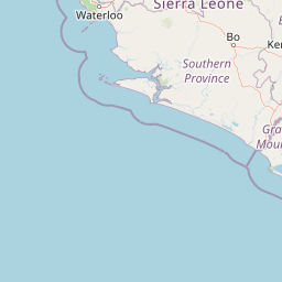
Map view of Western Area Peninsula National Park

Use this park location map to pinpoint Western Area Peninsula National Park in Sierra Leone, understand its exact geographic position, and read its mapped placement within the surrounding landscape more clearly.

Pigeon | © OpenStreetMap contributors

Location context for Western Area Peninsula National Park

Freetown Peninsula
Park atlas

Compare regional conservation areas and nearby protected terrain

Other Parks Near Western Area Peninsula National Park and Protected Landscapes

Browse nearby national parks and protected areas to compare regional forest ecosystems and coastal terrain. Extending the search beyond Western Area Peninsula National Park reveals connected conservation landscapes across the surrounding region.
National parkSierra Leone
Mapped park locations coincide#1 closest

Western Area Peninsula National Park: Sierra Leone Protected Coastal Rainforest Atlas

Mapped terrain, forest boundaries, and regional watershed geography

Discover the geographic identity of Western Area Peninsula National Park, a key protected area situated along the coast of Sierra Leone. This record details the park's dense tropical forest canopy, steep slopes, and vital role in watershed management across the peninsula, offering a clear view of its natural boundaries.

IUCN
II
Protected areaConakry Region
About 149 km away#2 closest

North

Forêt classée de Kakimbo: Protected Forest Geography and Coastal Landscape Mapping

Analyzing peri-urban protected areas within Conakry Region

Forêt classée de Kakimbo represents a significant peri-urban forest and protected area characterized by its tall canopy trees and karst-like cave formations. This record details the reserve's strategic position in the Conakry coastal plain, emphasizing its dual role in urban groundwater supply and carbon storage within the Ratoma commune landscape.

Established
1945
Relief
Lowland
Water
Minor water
Protected areaGuinea
About 200 km away#3 closest

Northwest

Rio Pongo: A Protected Estuarine Wetland Landscape in Coastal Guinea

Mapping mangrove forests, tidal mudflats, and coastal ecology

Rio Pongo is a prominent protected area in Guinea, characterized by a complex network of brackish tidal channels and dense mangrove forests. The site serves as a crucial habitat for waterbirds and aquatic mammals, while its position at the edge of the Atlantic Ocean defines a dynamic, low-lying coastal terrain that remains vital for regional conservation and ecological research.

Area
300 km²
Established
1992
Water
Water-dominated
National parkKarene District
About 201 km away#4 closest

Northeast

Outamba-Kilimi National Park: Sierra Leone National Park and Protected Landscape Atlas

Mapped natural terrain within Karene District.

Investigate Outamba-Kilimi National Park as a protected area, examining its geographic footprint and significance within Sierra Leone's natural landscapes. This detailed entry provides context on the park's mapped boundaries and its contribution to regional geography, serving as a key point for atlas-based exploration of conservation lands in the Karene District.

Area
1,109 km²
Established
1986
IUCN
II
Relief
Lowland
Nature reserveIvory Coast
About 259 km away#5 closest

Northeast

Forêt classée de Pinselly: Protected Area Geography and Landscape Mapping

Nature reserve analysis and regional atlas context

Examine the formal boundaries and landscape character of Forêt classée de Pinselly. This atlas entry focuses on the geographic structure and environmental positioning of this nature reserve in Ivory Coast, offering a clear view of its role as a protected landscape.

Established
1945
Relief
Mountain
Climate
Tropical
Access
Moderate access
National parkEastern Province
About 264 km away#6 closest

East

Gola Rainforest National Park: Sierra Leone's Premier Rainforest Protected Area

Explore mapped boundaries and biodiversity in Eastern Province's vast tropical rainforest.

Gola Rainforest National Park is Sierra Leone's second national park and the largest intact rainforest landscape in the country, located in the Eastern Province. As part of the Upper Guinea Forest biodiversity hotspot, it is renowned for its exceptional wildlife, including western chimpanzees and pygmy hippopotamuses. This protected area's mapped extent covers over 71,000 hectares, contributing significantly to regional conservation and providing a vital natural resource for both wildlife and local communities.

Area
710.7 km²
Established
2010
IUCN
II
Relief
Lowland
Protected areaMamou Region
About 272 km away#7 closest

Northeast

Bafing-Source Protected Area: A Highland Wetland Landscape in the Mamou Region

Tracing the headwaters and plateau geography of the Bafing River basin

The Bafing-Source protected area serves as a significant hydrological anchor within the Fouta Djallon highlands of Guinea. This expansive site protects critical wetland catchments and plateau terrain that feed into the broader Senegal River system, demonstrating the vital link between highland ecosystems and downstream water security.

Area
3,172 km²
Established
2007
Relief
Highland
Climate
Tropical
Nature reserveGrand Cape Mount County
About 275 km away#8 closest

Southeast

Lake Piso Nature Reserve in Grand Cape Mount County: Protected Landscape Atlas

Coastal lagoon geography and wetland habitat mapping.

Lake Piso functions as a vital coastal nature reserve in Liberia, spanning roughly 103 square kilometers of brackish water, islands, and tidal forest. This protected area serves as an essential geographic anchor in Grand Cape Mount County, offering a complex terrain of mangrove ecosystems and river-fed channels that support significant biodiversity.

Area
103 km²
Established
1999
Relief
Lowland
Scope
Terrestrial

Common questions about visiting, size, designation, and location context for Western Area Peninsula National Park

Western Area Peninsula National Park FAQs for park facts, access, geography, and protected area context

Find quick answers about Western Area Peninsula National Park, including protected-area facts, park geography, trail and visitor context, and how the park fits into its surrounding country and regional landscape.
MoriAtlas Explorer

Continue Your Protected Areas Search Across the Global Atlas

Deepen your exploration by continuing the structured search for national parks and protected areas worldwide. Utilize the comprehensive filtering capabilities to compare different conservation landscapes and refine your understanding of global park geography. Discover more about the distribution and characteristics of protected natural areas.

Global natural geography