
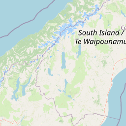
Streams
Park geography
Detailed analysis of land area, regional boundaries, elevation metrics, and natural features.
Comprehensive Geographic and Terrain Profile of Westland Tai Poutini National Park, New Zealand
Examine the physical structure and environmental characteristics of Westland Tai Poutini National Park on the West Coast of New Zealand. This profile details the 1319.8 square kilometer land area, spanning from coastal sea level to peaks at 3498 meters, supported by structured data on glacial, forest, and mountain terrain.
Related tags
National ParksGlaciersTemperate RainforestWorld Heritage SiteAlpine Environments
Glaciated wilderness on New Zealand's wild West Coast
Westland Tai Poutini National Park
Westland Tai Poutini National Park is a vast protected wilderness area spanning 1,320 square kilometres along the western coast of New Zealand's South Island. Established in 1960, the park encompasses a remarkable diversity of landscapes, from towering alpine peaks exceeding 3,400 metres to coastal wetlands and temperate rainforests. The park shares its eastern border with Aoraki / Mount Cook National Park along the Southern Alps Main Divide and contains some of New Zealand's most accessible glaciers, including the renowned Fox and Franz Josef glaciers. This UNESCO World Heritage Site forms part of the Te Wāhipounamu cultural landscape, recognized for its outstanding natural value. The area holds deep significance for Ngāi Tahu, the indigenous Māori people, who historically traveled throughout the region gathering pounamu (greenstone) and established settlements at locations that now fall within the park boundaries.
- Location
- New Zealand
- Park type
- National park
- Established
- 1960
- Area
- 1,319.8 km²
- Highest point
- 3,498 m
Location overview
Protected coastal landscape of the West Coast region in New Zealand
Geographic Setting of Westland Tai Poutini National Park
Westland Tai Poutini National Park is situated within the West Coast region of New Zealand. Designated as a coastal park, the protected area operates under a single national jurisdiction rather than transboundary management.
- Countries
- New Zealand
- Regions
- West Coast
- Primary location
- West Coast
- Geographic setting
- Coastal
Boundary and coordinates
Interactive boundary geometry, land area, and geographic coordinate limits
Westland Tai Poutini National Park Boundary Map and Spatial Extent
Mapped park outlines provide spatial context for the protected landscape and its regional limits. Accompanying facts detail the recorded land area, perimeter, centre coordinates, and geographic spans.
- Boundary area
- 1,319.4 km²
- Boundary perimeter
- 398.7 km
- Northernmost point
- 43.0975° S
- Southernmost point
- 43.7525° S
- Easternmost point
- 170.484° E
- Westernmost point
- 169.768° E
- Geographic centre
- 43.47° S, 170.0753° E
- North–south span
- 72.8 km
- East–west span
- 58 km
Elevation and terrain
Mountain relief range spanning glaciers, peaks, and river valleys
Westland Tai Poutini National Park Terrain and Elevation Profile
Recorded elevation records indicate a mountain terrain spanning from sea level up to three thousand four hundred ninety-eight meters. Linked feature cards supply names, types, and spatial relationships for glaciers, peaks, and streams contained within.
- Minimum elevation
- 0 m
- Maximum elevation
- 3,498 m
- Highest point
- 3,498 m
Selected named natural features
Rivers
Douglas River
Rivers
Waikūkūpa River
Mountain saddles
Engineer Pass
3,093 m
Peaks
Mount Christie
2,636 m
Rivers
Ōmoeroa River
Environmental setting
Recorded landscape features, temperate climate zones, and dominant forest cover.
Westland Tai Poutini National Park Environmental Classification and Physical Setting
Stored classifications combine mountain relief, glacial valleys, and coastal habitats to frame the physical setting. Mapped categories connect directly to related atlas destinations across the protected area.
- Relief
- Mountain
- Climate
- Temperate
- Water
- Major water bodies
- Forest cover
- Dense forest cover
Landscape features
Mountains · Forest · Glacier · Tundra · Wetland · Coast · Beach · Rivers · Lakes · Valleys
Habitat types
Tundra habitat · Wetland · Coastal habitat · Temperate broadleaf forest · Lacustrine habitat · Riverine habitat · Glacial habitat · Alpine meadow
Park atlas
Explore the interconnected geography of protected areas and national parks across New Zealand's South Island.
Discover Other National Parks and Protected Areas Near Westland Tai Poutini National Park
Discover other national parks and protected areas geographically linked to Westland Tai Poutini National Park, encompassing neighboring alpine, glacial, and coastal protected landscapes across the South Island. Use this regional context to compare unique conservation areas, map their geographic spread, and deepen your understanding of New Zealand's diverse park atlas.
National parkCanterbury Region
Park boundaries overlap#1 closest
South

Aoraki / Mount Cook National Park: New Zealand's Iconic Alpine Protected Landscape Exploration
Mapped glacial terrain and mountain peaks in the Canterbury Region.
Delve into the heart of New Zealand's alpine grandeur with Aoraki / Mount Cook National Park. This page offers an atlas-style exploration of its protected boundaries, dramatic glacial formations like the Tasman Glacier, and the towering peaks of the Southern Alps. Understand the park's significant geographic context within the Canterbury Region and discover the mapped landscape that defines this premier national park.
- Area
- 707 km²
- Established
- 1953
- IUCN
- II
- Visitors
- 1M annual
National parkOtago
35 km away#2 closest
Southwest
Mount Aspiring National Park: Glaciated Alpine Wilderness & Protected Landscape Atlas
Explore the U-shaped valleys and mapped boundaries of this iconic national park.
Mount Aspiring National Park showcases a breathtaking glacial landscape defined by steep-sided U-shaped valleys, active glaciers, and soaring alpine summits. As a designated national park within New Zealand's South Island, its protected status preserves a vast area of wilderness crucial for understanding regional geography and alpine terrain. This page provides an atlas-style exploration of its mapped boundaries and the stark, natural beauty that characterizes this significant conservation landscape in the Otago region.
- Area
- 3,562 km²
- Established
- 1964
- IUCN
- II
- Relief
- Mountain
National parkNew Zealand
75 km away#3 closest
Northeast
Arthur's Pass National Park: Dramatic Alpine Protected Landscape in the Southern Alps
Explore the unique geography and mapped boundaries of this South Island national park.
Arthur's Pass National Park, a substantial protected area within New Zealand's Southern Alps, presents a compelling focus for geographic and atlas exploration. Characterized by dramatic alpine terrain shaped by ancient glacial forces, the park exhibits a striking ecological contrast between its drier eastern beech forests and wetter western rainforests. Users can delve into the mapped park boundaries and understand the regional landscape context of this unique protected area, making it a key destination for understanding New Zealand's natural geography.
- Area
- 1,184.7 km²
- Established
- 1929
- IUCN
- II
- Relief
- Mountain
Nature reserveNew Zealand
About 85 km away#4 closest
East
Peel Forest Park Nature Reserve: Mapped Geography and Protected Forest Landscapes
Canterbury Foothills and Southern Alps transition zone
Located in the foothills of New Zealand, Peel Forest Park preserves a significant fragment of native podocarp forest. This reserve features a diverse landscape of river valleys and forested slopes, offering a clear view of the transition from the Canterbury Plains to the Southern Alps massif.
- Area
- 7.686 km²
- Established
- 1909
- Relief
- Mountain
- Climate
- Temperate
Protected landscapeSouth Island
About 101 km away#5 closest
East
Craigieburn Forest Park: Protected Alpine Landscape and Southern Alps Geography
High country terrain from beech forests to alpine ridges.
Situated along the eastern flanks of the Southern Alps, Craigieburn Forest Park offers a complex mountain geography that serves as both a recreational hub and an ecological restoration zone. The area features a clear transition from beech-clad valley floors and glacial terraces to wide tussock basins and craggy summits, providing a detailed look at the diverse natural terrain of the Canterbury region.
- Area
- 446.948 km²
- Established
- 1967
- Relief
- Mountain
- Climate
- Alpine
National parkWest Coast Region
123 km away#6 closest
Northeast
Paparoa National Park: Detailed Geographic Atlas of Karst Formations and Coastal Terrain
Discover protected landscape boundaries and unique New Zealand geology.
Paparoa National Park, located in the West Coast Region of New Zealand, offers a unique window into complex karst geology and dynamic coastal landscapes. This national park is characterized by extensive limestone cave systems, underground rivers, and the famous Pancake Rocks and Blowholes. The park's geography includes dramatic mountain terrain within the Paparoa Range and a striking coastline, providing a rich dataset for mapping protected area context and understanding regional natural features. It stands apart for its subterranean wonders and eroded limestone formations.
- Area
- 429.7 km²
- Established
- 1987
- IUCN
- II
- Relief
- Mountain
Marine protected areaWest Coast
About 131 km away#7 closest
Northeast
Punakaiki Marine Reserve: Mapped Protected Waters and West Coast Geographic Context
Exploring marine habitats and coastal land-sea corridors
Punakaiki Marine Reserve provides a critical look at marine conservation geography in New Zealand. Located along the West Coast, the reserve encompasses a variety of seafloor substrates and coastal formations that define the boundary between the Tasman Sea and the rugged limestone landscapes of the region. This atlas entry provides essential context for understanding the reserve's role in linking terrestrial and marine ecosystems.
- Area
- 35.2 km²
- Established
- 2014
- Relief
- Lowland
- Climate
- Temperate
National parkSouthland Region
151 km away#8 closest
Southwest
Fiordland National Park: A Protected Landscape of Glacier-Carved Fiords and Alpine Wilderness
Explore its vast boundaries and unique temperate rainforest.
Fiordland National Park, located in the Southland Region of New Zealand, is a testament to dramatic geological forces, featuring fifteen major fiords like Milford Sound, whose Mitre Peak rises majestically from the water. This protected national park encompasses an immense wilderness of alpine terrain, ancient beech forests, and numerous waterfalls, fueled by exceptional rainfall. Its inclusion in the Te Wāhipounamu World Heritage Area underscores its global significance for biodiversity and natural landscape preservation.
- Area
- 12,607 km²
- Established
- 1952
- IUCN
- II
- Visitors
- 500K annual
MoriAtlas Explorer
Continue Exploring the Geography of Westland Tai Poutini National Park's Protected Landscapes
Understanding the detailed geography and mapped boundaries of Westland Tai Poutini National Park reveals its unique position within New Zealand's natural heritage. This protected area offers a prime example of glacial landscape formation and the ecological diversity found from alpine environments to coastal regions. Further exploration highlights the park's significance in the broader atlas of protected lands.
Browse next
Global natural geography
Explore related park routes
Explore MoriAtlas Global ParksBrowse All MoriAtlas ParksGlobal Park Map DiscoveryMoriAtlas: Browse All CountriesBrowse All MoriAtlas ContinentsNational Park Environment AtlasGrand Canyon National Park AtlasYellowstone National Park AtlasYosemite National Park Atlas and GeographySerengeti National Park AtlasGalápagos National Park Protected LandscapeBanff National Park Geography and AtlasKruger National Park Atlas EntryUluṟu-Kata Tjuṯa National Park AtlasExplore Uluru-Kata Tjuta National Park GeographyPlitvice Lakes National Park AtlasFiordland National Park Protected LandscapeGreat Smoky Mountains National Park AtlasAfghanistan National Parks and Protected AreasAlbania National Parks and Protected AreasAlgeria National Parks and Protected AreasAmerican Samoa National Parks and Protected AreasAndorra National Parks and Protected AreasAngola National Parks and Protected AreasAntarctica National Parks and Protected AreasAntigua and Barbuda Park List