

Mori Atlas logo
National parkWollemi National Park

Explore the mapped boundaries and regional geography of this significant Australian national park.

Wollemi National Park: Discover New South Wales' Premier Protected Landscape

Wollemi National Park stands as a key protected landscape within New South Wales, offering a unique lens through which to understand Australia's natural geography. As a designated national park, it represents a vital area for conservation and geographic study. This page serves as your entry point to exploring the park's mapped boundaries, understanding its placement within the regional context of New South Wales, and appreciating its distinct natural terrain.

Wilderness AreaWorld Heritage SiteAncient ForestSandstone LandscapesDeep CanyonsAboriginal Heritage

Wollemi National Park

National park

Park overview

Structured park overview, official facts, and landscape profile for Wollemi National Park

Wollemi National Park park facts, protected area profile, and essential visitor context
Review the core facts for Wollemi National Park, including designation, size, terrain, visitor scale, habitats, and operating context in one park-focused overview.

About Wollemi National Park

Wollemi National Park represents one of Australia's most significant protected areas, encompassing a diverse range of ecosystems within its vast 5,017 square kilometre boundary. The park's position on the western edge of the Sydney Basin exposes visitors to a complex geological foundation of sedimentary rocks, including the Narrabeen group, Sydney sandstone, and coal measures, which have been sculpted by millions of years of weathering to create the park's characteristic deep valleys and dramatic cliff lines. The park is bounded by several other protected areas including Goulburn River National Park to the north, Yengo National Park to the east, and Blue Mountains National Park to the south, creating a contiguous corridor of wilderness that stretches from Sydney's western outskirts into the central western plains. The Wollemi Wilderness area within the park remains one of the most remote and undeveloped landscapes in eastern Australia, with many canyons still awaiting exploration by humans. The discovery of the Wollemi pine in 1994 transformed scientific understanding of ancient conifer evolution and brought international attention to the park's unique conservation values.

Quick facts and research context for Wollemi National Park

Wollemi National Park spans 501,703 hectares in New South Wales, making it the second largest national park in the state. Established in December 1979, it holds IUCN Category Ib wilderness area designation. The park is the most north-westerly of the eight protected areas comprising the Greater Blue Mountains Area World Heritage Site. It contains the Colo River, regarded as the last unpolluted river in New South Wales, and is managed by the NSW National Parks and Wildlife Service.

Park context

Deeper park guide and search-rich context for Wollemi National Park

Wollemi National Park history, landscape, wildlife, and travel context
Explore Wollemi National Park through its history, landscape character, ecosystems, wildlife, conservation priorities, cultural context, and seasonal travel timing in a structured park guide built for atlas discovery and search intent.

Why Wollemi National Park stands out

Wollemi National Park is best known as the site of the Wollemi pine discovery, where the only known living wild specimens of this ancient conifer were found in 1994. The park also contains Australia's largest wilderness area, the Wollemi Wilderness, which remains largely unexplored due to its rugged terrain. The park is renowned for its dramatic sandstone landscapes featuring deep canyons, spectacular cliffs, and cascading waterfalls, as well as its significant Aboriginal heritage sites including cave paintings and rock carvings.

Wollemi National Park history and protected-area timeline

The Wollemi National Park region has been cared for by Aboriginal peoples for tens of thousands of years, primarily the Wiradjuri, Darkinjung, Dharug, Wonnarua, and Yuun nations. The land holds deep cultural significance for ceremony, travel, food gathering, and storytelling, with numerous archaeological sites including rock art, engravings, grinding grooves, and stone tools distributed throughout the park. The park's name is believed to derive from an Aboriginal phrase meaning "watch out" or "look around you." European settlers largely avoided the area during the 1800s due to its steep terrain and dense vegetation, though limited activities such as timber getting, cattle grazing, and mining occurred on the periphery. The interior remained relatively unexplored until the late 20th century. Wollemi National Park was officially established in December 1979 to preserve New South Wales's largest wilderness area. The pivotal moment in the park's history came in 1994 when botanists discovered the Wollemi pine in remote canyons, a species previously known only from fossil records dating back over 200 million years. The precise location of the living trees remains protected to safeguard them from disease and disturbance.

Wollemi National Park landscape and geographic character

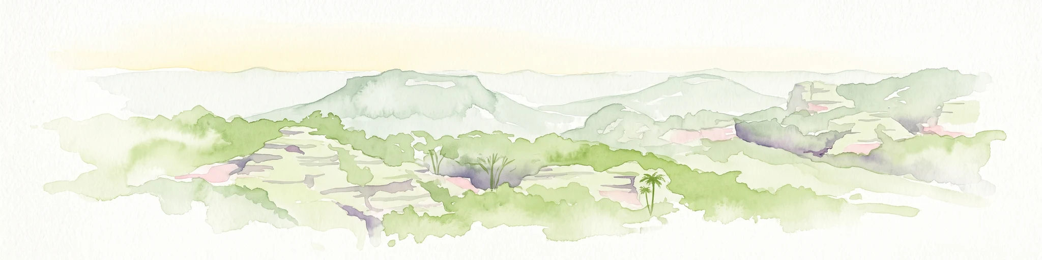
The landscape of Wollemi National Park is dominated by the erosive forces that have sculpted the Narrabeen group sedimentary rocks into a terrain of extraordinary depth and complexity. Deep valleys, narrow canyons, towering cliffs, and spectacular waterfalls characterize much of the park's terrain, with the sandstone and claystone formations creating a distinctive visual character. The western portions of the park feature more undulating terrain where the Wianamatta shale has produced deeper, more nutrient-rich soils supporting greater plant diversity. Tertiary basalt flows in the northwestern sections have formed prominent peaks including Mount Coriaday, Mount Monundilla, and Mount Coricudgy, the highest point in the northern Blue Mountains. The park incorporates several significant river systems including the Wolgan, Colo, and Capertee rivers, with the Colo River particularly notable as the last unpolluted river in New South Wales due to its course through the park's protected heartland.

Wollemi National Park ecosystems, habitats, and plant life

Eucalypt-dominated open forests cover approximately 90 percent of Wollemi National Park, with more than 70 species of eucalypt recorded throughout the park. The remaining vegetation includes pockets of rainforest in sheltered gullies, heath communities on sandstone ridges, and grassland in higher areas. This diverse habitat mosaic supports remarkable biodiversity, with 58 reptile species, 38 frog species, 235 bird species, and 46 mammal species documented within the park's boundaries. The discovery of the Wollemi pine in 1994 remains the botanical highlight, representing a species thought to have become extinct approximately two million years ago. The park also supports several other rare plant species including the Wollemi Mint Bush and Banksia penicillata, which was only described scientifically in 1981.

Wollemi National Park wildlife and species highlights

The wildlife population of Wollemi National Park reflects the diversity of its habitats, from the extensive eucalypt forests to the rare rainforest patches and sandstone heathlands. Birdlife is particularly diverse with 235 species recorded, while the reptile fauna includes 58 species and mammals total 46 species. The park's amphibian population of 38 frog species thrives in the numerous streams and湿地 areas. The Wollemi pine groves, though kept secret to protect them, represent a unique ecological community. The Colo River and other watercourses support aquatic species while providing important habitat for birds and mammals that depend on riparian corridors.

Wollemi National Park conservation status and protection priorities

Wollemi National Park holds exceptional conservation significance as both a Wilderness Area under IUCN Category Ib and as a component of the UNESCO Greater Blue Mountains Area World Heritage Site, inscribed in 2000. The Wollemi Wilderness at 361,113 hectares represents Australia's largest wilderness area, preserving a landscape largely untouched by modern development. The Wollemi pine discovery intensified conservation efforts, and special protective measures were implemented during the 2019-20 Australian bushfires to safeguard the remaining wild specimens. The park plays a critical role in maintaining water quality for the Hawkesbury River and Goulburn-Hunter River catchments, with the Colo River representing one of the last unpolluted river systems in New South Wales.

Wollemi National Park cultural meaning and human context

The cultural landscape of Wollemi National Park encompasses tens of thousands of years of Aboriginal connection to country, with the Wiradjuri, Darkinjung, Dharug, Wonnarua, and Yuun nations maintaining ongoing relationships with this country. The park contains numerous Aboriginal sites including cave paintings, axe grinding grooves, and rock carvings that demonstrate long-term cultural use and spiritual connection. The discovery of Eagle's Reach cave in 2003, containing art estimated to be up to 4,000 years old with over 200 separate images, represents one of the most significant rock art sites in southeastern Australia. The local Wiradjuri people know the Ganguddy camping area as Ganguddy, also known as Dunns Swamp, reflecting the continued importance of place names and traditional knowledge.

Top sights and standout views in Wollemi National Park

The Wollemi pine groves represent the park's most internationally significant feature, a living fossil discovered in 1994 that predates the dinosaurs. The Wollemi Wilderness offers Australia's most extensive wilderness experience with vast tracts of untouched landscape. The dramatic sandstone canyons and cliff lines provide spectacular scenery and world-class canyoning opportunities. Aboriginal rock art sites, particularly Eagle's Reach cave, offer insight into thousands of years of Indigenous heritage. The Colo River provides canoeing opportunities through pristine wilderness, while the network of tracks and camping areas allows exploration of one of Australia's least-visited large wilderness areas.

Best time to visit Wollemi National Park

The park's oceanic climate means conditions vary significantly throughout the year. Summer months from December to February bring warm temperatures and the peak precipitation period, making this a vibrant time for exploring the park's waterfalls at their most powerful though afternoon thunderstorms can occur. Autumn from March to May offers mild temperatures and generally stable weather, ideal for bushwalking and camping. Winter from June to August brings cooler conditions and occasional snow on higher peaks, with the landscape displaying crisp, clear days perfect for scenic drives and wilderness exploration. Spring from September to November sees warming temperatures and wildflower displays, though windier conditions prevail. The Colo River and other waterways are at their lowest during late summer and autumn.

Park location guide

Geography guide, regional context, and park location map for Wollemi National Park

Wollemi National Park park geography, regions, and map view in Australia
Understand where Wollemi National Park sits in Australia through a broader geographic reading of the surrounding landscape, nearby location context, and its mapped position within the national park landscape.

How Wollemi National Park fits into Australia

Australia is a constitutional monarchy and federal parliamentary democracy comprising six states and ten territories. With a population of nearly 28 million, it is one of the world's most urbanised countries, with most people concentrated on the eastern seaboard. The country has a high Human Development Index and is known for its cultural diversity, ancient Aboriginal heritage, and unique wildlife.

Wider geography shaping Wollemi National Park in Australia

Australia occupies the entire Australian continent, the island of Tasmania, and numerous smaller islands. It is the world's flattest and driest inhabited continent, featuring vast deserts in the interior (the Outback), tropical rainforests along the eastern coast, and a coastline bordering the Indian and Pacific Oceans.

Map view of Wollemi National Park

Use this park location map to pinpoint Wollemi National Park in Australia, understand its exact geographic position, and read its mapped placement within the surrounding landscape more clearly.

Pigeon | © OpenStreetMap contributors

Location context for Wollemi National Park

New South Wales
Park atlas

Uncover adjacent protected landscapes and national parks near Wollemi National Park, tracing regional conservation geography.

Compare National Parks Near Wollemi National Park: Regional Protected Areas & Landscapes
After exploring Wollemi National Park, browse other national parks and protected areas situated within its surrounding regional geography of New South Wales, Australia. Compare different protected landscapes and their distinct conservation values, extending your atlas discovery across connected wilderness areas.
National parkNew South Wales

Yengo National Park: Protected Landscape Identity and Geographic Context

Explore its mapped terrain and wilderness character.

Yengo National Park in New South Wales, Australia, is a vast protected area known for its remote wilderness character and significant geographical landmarks such as Mount Yengo. As a vital part of the Greater Blue Mountains World Heritage Site, the park showcases rugged mountainous terrain and diverse natural landscapes. This entry focuses on its atlas-value, detailing the park's mapped boundaries, regional geography, and its identity as a significant protected landscape for nature exploration.

Area
1,543.28 km²
Established
1988
IUCN
Ib
Relief
Mountain
National parkNew South Wales

Gardens of Stone National Park: National Park Protected Landscape and Geographic Atlas

New South Wales protected area and mapped terrain exploration.

Delve into the protected landscape of Gardens of Stone National Park, an important national park situated in New South Wales, Australia. This page offers an atlas-centric view, focusing on the park's distinct geographic identity, its mapped protected boundaries, and its contribution to the regional context of protected lands. Understand the fundamental landscape character and terrain that define this significant natural area for structured geographic discovery.

Area
150.8 km²
Established
1994
IUCN
II
Relief
Highland
National parkNew South Wales

Turon National Park National Park: Protected Landscape and Geographic Atlas Details

Mapped boundaries and regional context within New South Wales.

Turon National Park is a protected national park in New South Wales, Australia, offering a distinct geographic identity for atlas exploration. This entry focuses on its mapped boundaries, natural terrain, and its role as a conservation landscape. Users can discover its specific features and regional context, enhancing their understanding of Australia's protected areas.

Established
2002
IUCN
II
Relief
Mixed relief
Climate
Temperate
National parkAustralia

Belford National Park: Strict Nature Reserve and Endangered Forest Landscape in Australia

Mapped boundaries and ecological context for a vital protected area.

Belford National Park, located in Australia's Hunter Valley, functions as a strict nature reserve focused on preserving the endangered Central Hunter Ironbark-Spotted Gum-Grey Box Forest. This protected area, though modest in size, is crucial for safeguarding vulnerable wildlife species and maintaining a significant example of a rare ecological community. Its clearly defined mapped boundaries highlight its role as a dedicated conservation landscape, offering essential habitat and serving as a reference point for the region's natural geography and biodiversity.

Area
2.88 km²
Established
2003
IUCN
Ia
Access
Highly restricted
National parkAustralia

Cattai National Park: Australia's Premier Colonial Heritage Protected Landscape

Mapped riverfront geography and historical Australian park context.

Cattai National Park represents a vital entry in Australia's atlas of protected areas, offering unparalleled insight into the nation's early colonial history alongside its natural riverine landscapes. The park's designation as a national park highlights its importance in preserving not only the unique geography of the Hawkesbury River floodplain but also significant historical sites like the Hope Farm Mill, Australia's oldest industrial site. Exploring Cattai National Park allows for a deep dive into mapped protected boundaries and the layered cultural and natural terrain of the Sydney region.

Area
4.24 km²
Established
1992
IUCN
II
Access
Easy access
National parkNew South Wales

Werakata National Park: Protected Area Exploration and Eucalypt Forest Atlas

Mapping New South Wales' unique spotted gum-ironbark woodlands.

Werakata National Park is a significant protected area in New South Wales, Australia, dedicated to conserving the valuable spotted gum-ironbark vegetation communities of the Lower Hunter Region. This national park offers insight into the region's natural landscape, featuring undulating terrain with eucalypt forests and woodlands that are crucial for threatened species and avian biodiversity. Its distinct geographic character and mapped boundaries provide a clear focus for atlas-driven discovery of protected lands and their ecological significance.

Area
33.37 km²
Established
1999
IUCN
II
Relief
Lowland
National parkNew South Wales

Goulburn River National Park: New South Wales National Park with River Ecosystems and Heritage

Explore mapped protected lands and regional geography.

Goulburn River National Park offers a significant protected landscape within New South Wales, Australia, celebrated for its expansive Goulburn River frontage and diverse natural terrain. This national park is pivotal for understanding regional geography, featuring sandstone geological formations and serving as a critical habitat for endangered species, including the regent honeyeater. Its extensive river corridor also protects numerous Aboriginal heritage sites, contributing a rich layer of cultural significance to its conservation value. MoriAtlas helps users explore the mapped boundaries and environmental context of this vital protected area.

Area
722.96 km²
Established
1983
IUCN
II
Relief
Mixed relief
National parkNew South Wales

Watagans National Park: National Park Protected Landscape in New South Wales

Explore its mapped boundaries and regional geography.

Watagans National Park stands as a key protected area within New South Wales, Australia. This detail page focuses on its specific role as a national park, offering insights into its mapped geographic boundaries and its place within the regional landscape. Understand the protected natural identity of Watagans National Park through a structured, atlas-informed lens.

Area
77.51 km²
Established
1999
IUCN
II
Climate
Temperate

Common questions about visiting, size, designation, and location context for Wollemi National Park

Wollemi National Park FAQs for park facts, access, geography, and protected area context
Find quick answers about Wollemi National Park, including protected-area facts, park geography, trail and visitor context, and how the park fits into its surrounding country and regional landscape.
MoriAtlas Explorer

Continue Your Protected Areas Search Across the Global Atlas

Deepen your exploration by continuing the structured search for national parks and protected areas worldwide. Utilize the comprehensive filtering capabilities to compare different conservation landscapes and refine your understanding of global park geography. Discover more about the distribution and characteristics of protected natural areas.

Global natural geography