
Mori Atlas logo
Protected areaWulingyuan Scenic and Historic Interest Area

A detailed look at the protected terrain, vertical sandstone pillars, and forested plateau geography within Hunan Province.

Wulingyuan Scenic and Historic Interest Area: Mapping the Quartz-Sandstone Peak and Gorge Landscapes

Wulingyuan Scenic and Historic Interest Area encompasses a distinct geological landscape in northwest Hunan, defined by thousands of towering quartz-sandstone pillars rising above dense, stream-threaded forest plateaus. This protected expanse integrates diverse scenic zones into a complex network of gorges, karst caves, and waterfalls, forming a singular site for studying vertical tectonic geomorphology. The area serves as a primary reference for understanding the structural and hydrological processes that shape China’s iconic mountain ecosystems.

quartz-sandstone peakspeak forestkarst landscapesubtropical forestrelict plant speciesmountain streams
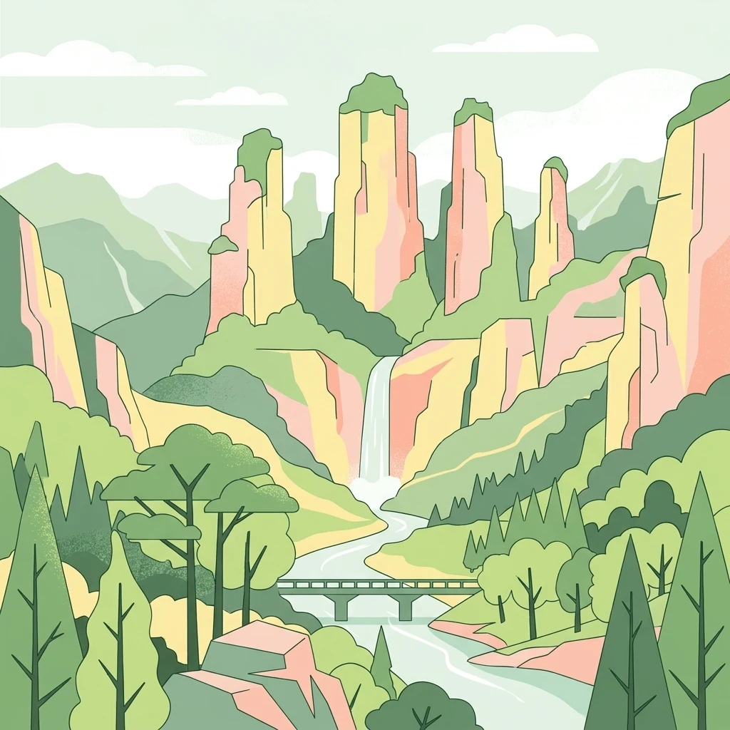
A flat-style digital illustration showing towering sandstone pillars, a waterfall, a river flowing under a bridge, and surrounding forest vegetation.

Wulingyuan Scenic and Historic Interest Area

Protected area

Park overview

Structured park overview, official facts, and landscape profile for Wulingyuan Scenic and Historic Interest Area

Wulingyuan Scenic and Historic Interest Area park facts, protected area profile, and essential visitor context

Review the core facts for Wulingyuan Scenic and Historic Interest Area, including designation, size, terrain, visitor scale, habitats, and operating context in one park-focused overview.

About Wulingyuan Scenic and Historic Interest Area

Wulingyuan Scenic and Historic Interest Area is the central natural landmark of the Zhangjiajie region in northwestern Hunan Province, occupying a broad tract of the middle Wuling Mountains. Although popular imagination often links the landscape to the name Zhangjiajie, the park is in fact a composite protected area, bringing together four traditionally managed scenic zones under a single institutional structure established in the 1980s. Its forests, peaks, and stream valleys form one of the most extensive conserved natural landscapes in south-central China.

The protected area is structured around Zhangjiajie National Forest Park and Zhangjiajie National Geopark on the western side, with three adjoining nature reserves: Suoxiyu to the east, Tianzi Mountain to the north, and Yangjiajie, which was added to the complex after its discovery in 1992. These four zones share a continuous landscape of forested ridges, stone peaks, gorges, and watercourses, but each retains its own scenic character: Tianzi Mountain is famous for expansive panoramic vistas from its elevated ridges, Suoxiyu is known for tightly packed peaks, deep gullies, and individually named rock formations, while Yangjiajie preserves a wilder and less-visited cluster of canyons and pillar formations.

What truly distinguishes Wulingyuan is the sheer density of its quartz-sandstone peak forest. More than three thousand rock peaks rise from heavily vegetated valleys, with individual pillars ranging from modest outcrops to formations several hundred meters tall. The peaks are interspersed with hundreds of named streams, waterfalls, and pools, as well as significant karst cave systems. The climate of the area is mild and humid, supporting lush forest cover with very high canopy density. Wulingyuan is therefore not only a geological showcase but also a substantial forest landscape, in which surviving natural vegetation, rare relict species, and dramatic landforms combine into a single integrated ecological and visual experience.

Quick facts and research context for Wulingyuan Scenic and Historic Interest Area

Wulingyuan is a national scenic and historic interest area in northwest Hunan Province, belonging administratively to Zhangjiajie City. It is a UNESCO World Heritage Site inscribed in 1992 under natural criterion (vii), a UNESCO Global Geopark since 2004, and a national key scenic area of China since 1988. The protected landscape lies in the central Wuling Mountains and covers roughly 391 square kilometers in total, with a core scenic area of more than 250 square kilometers.

The area is best characterized by its quartz-sandstone peak forest and gorge geomorphology, supported by dense subtropical forest, karst features, and a network of streams and waterfalls. It combines four distinct scenic zones under a single management framework, and is widely regarded as one of the most visually distinctive mountain landscapes in China.

Protection and recognition

Documented protection history and international designation records for the landscape

Wulingyuan Scenic and Historic Interest Area Protection Status and UNESCO Recognition

Wulingyuan Scenic and Historic Interest Area holds established terrestrial protection status backed by a documented UNESCO World Heritage designation established in 1992. Official records outline the formal conservation framework and international recognition history governing the protected landscape.

International recognition

Protection details

Protection scope
Terrestrial
Designated year
1992
Transboundary protection
No
Core area
250 km²
Buffer area
126.8 km²
Park context

Deeper park guide and search-rich context for Wulingyuan Scenic and Historic Interest Area

Wulingyuan Scenic and Historic Interest Area history, landscape, wildlife, and travel context

Explore Wulingyuan Scenic and Historic Interest Area through its history, landscape character, ecosystems, wildlife, conservation priorities, cultural context, and seasonal travel timing in a structured park guide built for atlas discovery and search intent.

Why Wulingyuan Scenic and Historic Interest Area stands out

Wulingyuan is best known for its extraordinary quartz-sandstone peak forest, a landscape of more than three thousand towering stone columns and peaks rising from a deeply dissected forest plateau. The rock pillars, often compared visually to natural skyscrapers, are the result of unusually pure and thick quartz sandstone shaped by tectonic uplift, vertical jointing, fluvial erosion, and gravitational collapse. Equally important to its identity are the surrounding forests, gorges, and karst features: more than eight hundred named streams, numerous waterfalls, karst caves, and forests with very high canopy cover. This combination of densely forested valley floors and emergent vertical rock spires is what gives Wulingyuan its distinctive silhouette and has made it an archetype of Chinese mountain scenery.
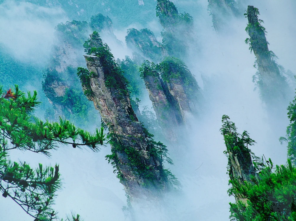
Tall, jagged sandstone pillars covered in greenery rise above a thick layer of white clouds.
Sandstone pillars emerging from a sea of clouds in Wulingyuan Scenic and Historic Interest Area.

Wulingyuan Scenic and Historic Interest Area history and protected-area timeline

The modern Wulingyuan area was assembled from three separate scenic territories that previously belonged to Dayong, Cili, and Sangzhi counties: Zhangjiajie in the west, Suoxiyu in the east, and Tianzi Mountain to the north. Zhangjiajie became China's first national forest park in 1982, and the rapid growth of tourism there prompted neighboring Suoxiyu and Tianzi Mountain to be developed as well. As visitor numbers increased, the three territories became embroiled in administrative and boundary disputes, leading the Hunan provincial government to consolidate them into a single management zone.

The consolidated area was given the name Wulingyuan in 1984, suggested by the painter Huang Yongyu, who drew on the region's geography and on the long literary tradition associating the name Wulingyuan with the legendary Peach Blossom Spring utopia of Chinese poetry. The proposal was approved by the provincial government, endorsed by Deng Xiaoping, and finalized when Hu Yaobang, then General Secretary of the Chinese Communist Party, inscribed the characters for Wulingyuan in 1985. The official Hunan provincial report submitted to the State Council that year is generally regarded as marking the formal establishment of the Wulingyuan Scenic and Historic Interest Area.

In 1988 the State Council designated Wulingyuan as a national key scenic area of China. In December 1992, UNESCO inscribed it as a World Heritage Site under the natural criteria for its exceptional geological and scenic value. In February 2004, UNESCO's Global Geopark assessment panel accepted Wulingyuan into the first group of Global Geoparks, formally recognizing the site's international geological significance as well as its scenic value.

Wulingyuan Scenic and Historic Interest Area landscape and geographic character

The landscape of Wulingyuan is dominated by a quartz-sandstone peak forest that rises abruptly from a deeply dissected forest plateau. The region lies within the New Cathaysian third uplift belt and has been shaped by successive tectonic phases, including the Wuling-Xuefeng, Indosinian, Yanshan, and Himalayan movements, with the latest phases responsible for the unusual form of the modern peaks. The bedrock consists of Middle to Upper Devonian quartz sandstone of exceptional purity and thickness, with quartz content typically between roughly seventy-five and ninety-five percent and individual strata measuring several hundred meters thick.

More than three thousand named stone peaks stand within the protected area, most of them at elevations between roughly 500 and 1100 meters above sea level, with individual pillars extending anywhere from a few tens of meters to about 400 meters above the surrounding terrain. Vertical jointing in the sandstone, combined with long-term erosion by flowing water and the slow collapse of rock masses under gravity, has carved these strata into isolated columns, ridges, and sheer-walled gorges. The result is a landscape in which densely forested valleys give way almost without transition to bare vertical stone pinnacles.

Beyond the quartz-sandstone peaks, Wulingyuan also preserves significant karst landscapes including numerous caves, sinkholes, and underground drainage features, as well as a dense network of more than eight hundred streams and numerous waterfalls. The contrast between soft, rolling forested ridges and abruptly vertical stone pillars is one of the most striking visual signatures of the area, and it remains the principal reason Wulingyuan is considered a singular geological phenomenon both within China and worldwide.
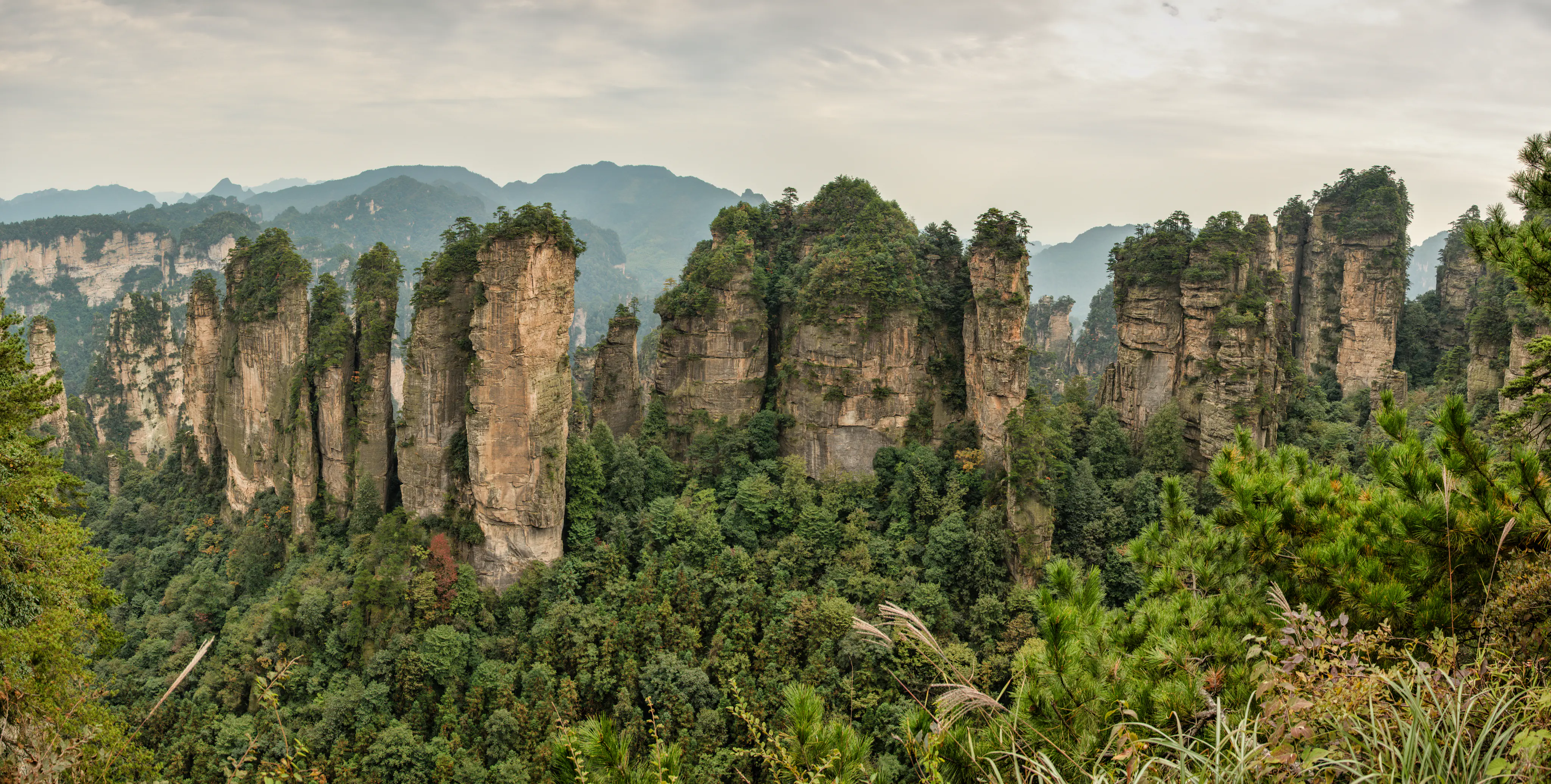
Panoramic shot of vertical sandstone rock formations rising from a lush green forest, under a cloudy, overcast sky.
A panoramic view of the towering quartzite sandstone pillars and dense forest canopy at Huangshizhai in Wulingyuan.

Wulingyuan Scenic and Historic Interest Area ecosystems, habitats, and plant life

Wulingyuan occupies a humid subtropical climate zone where mild temperatures and abundant rainfall support exceptionally well-developed forest vegetation. The native forest cover in much of the area exceeds eighty percent, including extensive stands of original secondary forest, and the protected area plays a significant regional role as a forest reserve in addition to its scenic role. The combination of rugged topography, varied microclimates, and minimal recent disturbance in many zones has allowed a relatively complete representation of the regional forest community to survive.

The flora includes a substantial number of woody plant species, comprising both broadleaf and coniferous trees, with conifer species such as the locally endemic Wuling pine contributing to the forest character. Among the most ecologically notable plants are several relict Tertiary species that have survived here from the warmer geological past, including the dove tree (Davidia involucrata), Bretschneidera sinensis, southern Chinese yew, white yew, and Cephalotaxus oliveri. The presence of these relict species gives Wulingyuan considerable botanical significance beyond its scenic importance.
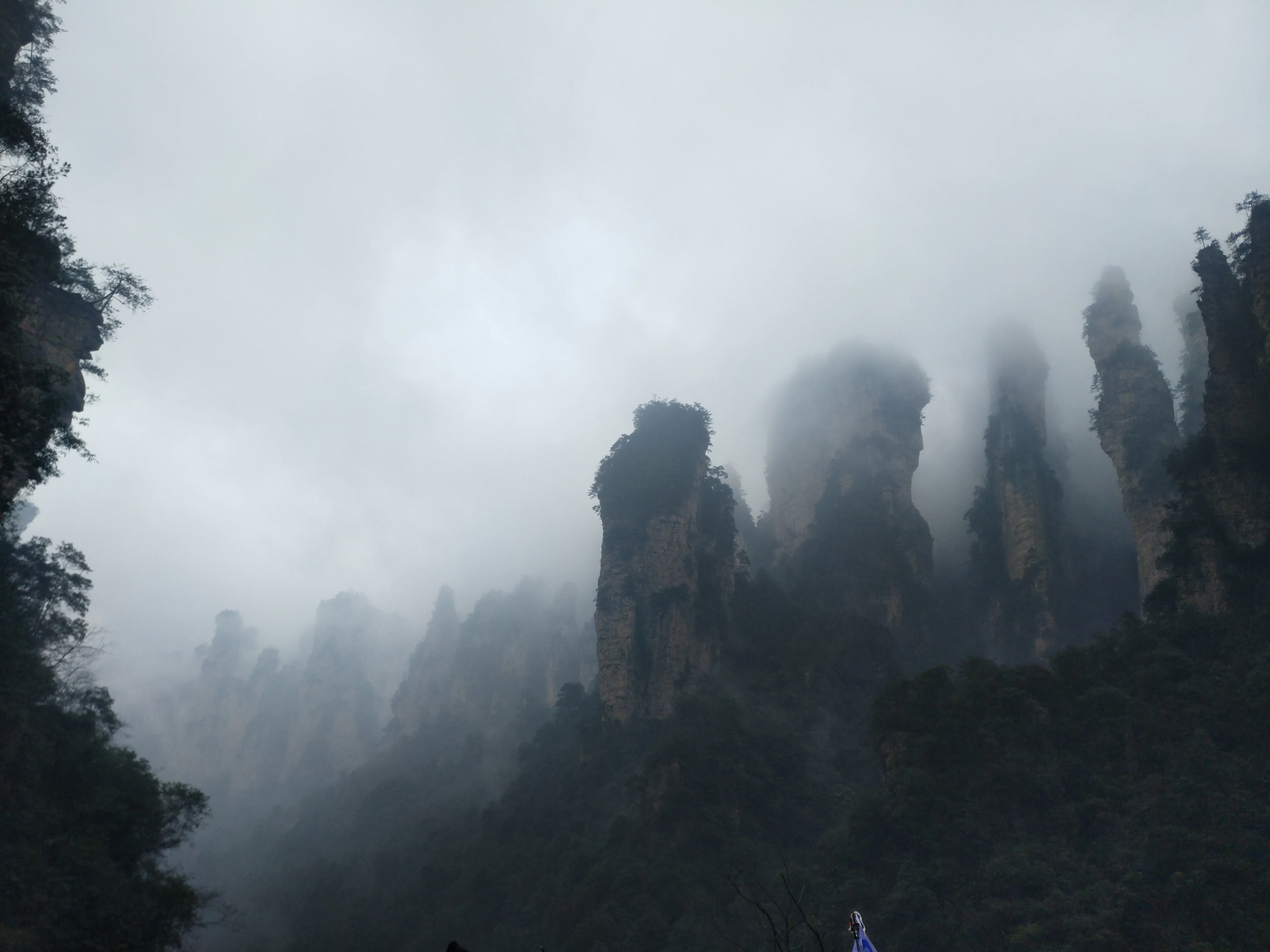
Tall sandstone pillar rock formations emerging from thick mist and fog in a mountainous forest landscape.
Misty sandstone pillars in Wulingyuan Scenic and Historic Interest Area.

Wulingyuan Scenic and Historic Interest Area wildlife and species highlights

Wulingyuan supports a relatively diverse vertebrate fauna typical of south-central China's forested mountains, including several nationally protected mammal species. The forests are known to host large predators such as the clouded leopard and the leopard, among a broader group of nationally protected animals recorded within the protected area. The area's streams and caves provide habitat for the Chinese giant salamander, one of the region's most distinctive and conservation-sensitive amphibians.

The varied vertical relief of the landscape, from forested valley floors to exposed cliffs and high ridges, supports a wide range of birdlife and smaller fauna, and the dense forest cover provides important refuge habitat across multiple elevation bands. While the spectacular peak formations are the dominant visual element of the park, the intact forest communities between the pillars are essential to maintaining the ecological integrity of the protected area and to sustaining the wildlife populations that depend on them.
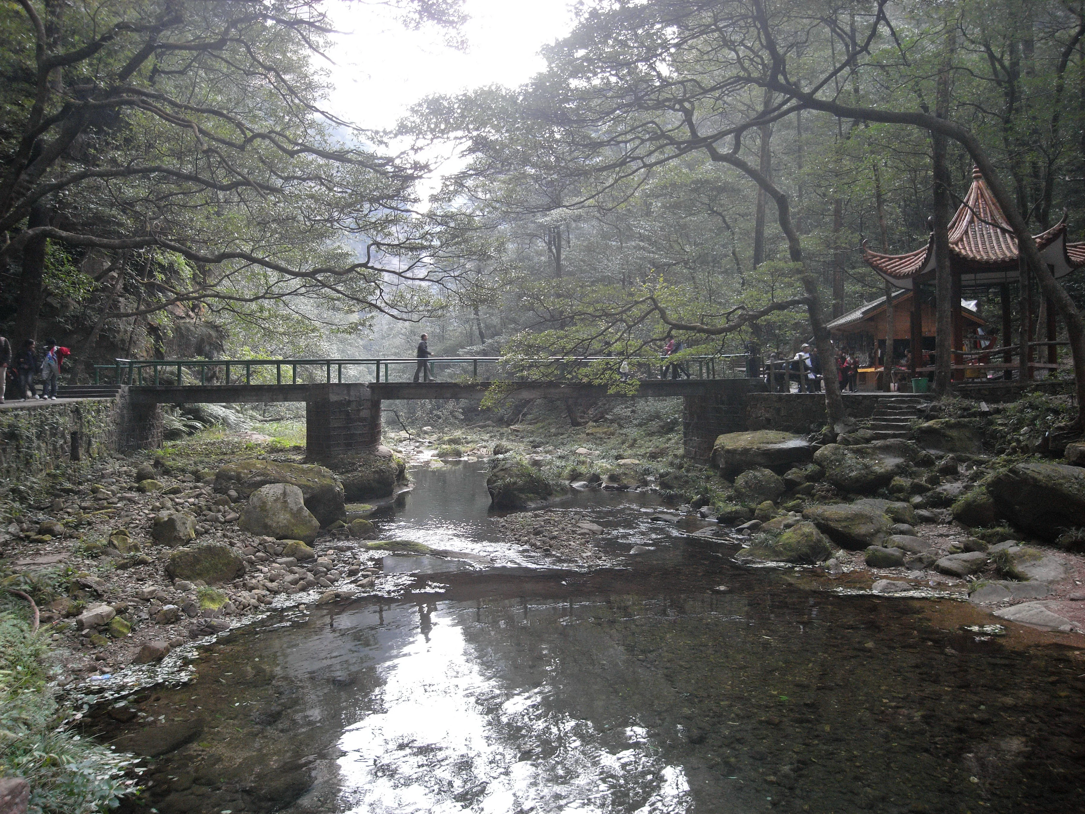
A stone footbridge spans a clear stream in a lush, wooded valley, with a traditional Chinese-style pavilion visible on the bank.
A footbridge crosses the Golden Whip Stream, surrounded by forested landscape in the Wulingyuan Scenic Area.

Wulingyuan Scenic and Historic Interest Area conservation status and protection priorities

Wulingyuan's conservation significance lies in its rare combination of an internationally important sandstone peak-forest landform and an unusually well-preserved forested setting. The site has been protected through a layered system of designations: a national forest park, multiple nature reserves, a national geopark, a national key scenic area, and ultimately UNESCO World Heritage and Global Geopark recognition. Each designation has contributed to long-term protection of the landscape from excessive development and to the management of tourism pressure.

The Wulingyuan ecosystem is also of conservation interest as a refuge for relict plant species that survived the Tertiary period and as habitat for nationally protected mammals and amphibians, including clouded leopard, leopard, and Chinese giant salamander. Maintaining the high forest canopy cover is a central conservation objective, both for biodiversity and for protecting the visual integrity of the peak-and-forest landscape that underpins the site's World Heritage value.

Wulingyuan Scenic and Historic Interest Area cultural meaning and human context

Long before Wulingyuan became a formal protected area, the name itself carried deep cultural meaning in Chinese literary tradition. Since at least the Tang dynasty, Wulingyuan had been a poetic allusion to Peach Blossom Spring, the legendary hidden utopia described by the poet Tao Yuanming, and it appears repeatedly in classical verse. When the modern scenic area was consolidated in the 1980s, the choice of the name Wulingyuan deliberately drew on this literary heritage.

The region also retains local cultural elements connected to the Tujia ethnic minority, whose language and traditions are still present in the surrounding counties. Some scenic features preserve place names drawn from Tujia history and folklore, including legends surrounding Tianzi Mountain and the historical figure Xiang Wang, said to have proclaimed himself king there in the late Southern Song dynasty. The Yangjiajie area carries its own local legend, traditionally linked to the Yang family warriors of the Northern Song dynasty. These layered cultural associations, from classical poetry to Tujia oral history, give Wulingyuan a richer human context than its purely geological features would suggest.

Top sights and standout views in Wulingyuan Scenic and Historic Interest Area

The defining highlight of Wulingyuan is its concentration of more than three thousand quartz-sandstone peak pillars rising from a near-continuous forest cover, a landscape widely regarded as unique in both scale and visual impact. Among its most celebrated features are the panoramic vistas from Tianzi Mountain, the dense gorge scenery and cliff formations of Suoxiyu, the Jiandao Stream and signature peak clusters around Zhangjiajie National Forest Park, and the wilder, less-developed peak formations of Yangjiajie.

Beyond the geological spectacle, the site's value as a UNESCO World Heritage Site and Global Geopark, its high forest canopy cover, and its surviving populations of relict plant species, large predators, and Chinese giant salamander together make Wulingyuan a landscape of both global natural and cultural significance.

Best time to visit Wulingyuan Scenic and Historic Interest Area

Wulingyuan lies in a humid subtropical climate with mild temperatures in spring and autumn, frequent cloud and mist in the cooler months, and lush green vegetation during summer. Spring and autumn generally offer the most pleasant conditions for viewing both the forest and the stone peaks, with stable weather, soft light, and autumn color in the deciduous and mixed broadleaf forests.

Summer brings dense vegetation and dramatic thunderstorms that create powerful waterfalls and atmospheric mist among the peaks, although humidity and rain can reduce visibility on some days. Winter is colder and quieter, with reduced foliage and a different, sharper visual profile of the peaks. Mist and cloud are recurring features of the area throughout much of the year, and visitors often experience the peak forest both in clear and in shrouded conditions.
Monthly climate preview

Long-term representative point measurements of annual temperature and precipitation patterns

Wulingyuan Scenic and Historic Interest Area Climate Normals and Weather by Month

Wulingyuan Scenic and Historic Interest Area records long term temperature and precipitation normals across twelve distinct monthly cycles based on representative coordinate data. Reviewing the complete monthly climate profile provides deeper context for regional meteorological patterns and baseline environmental conditions.
Annual mean15 °C
2 °C25 °C
Jan
Feb
Mar10°
Apr15°
May20°
Jun23°
Jul25°
Aug25°
Sep21°
Oct16°
Nov10°
Dec
Warmest month
July

25.3 °C

Coolest month
January

2.4 °C

Wettest month
July

7.3 mm/day

Driest month
December

0.8 mm/day

Park location guide

Geography guide, regional context, and park location map for Wulingyuan Scenic and Historic Interest Area

Wulingyuan Scenic and Historic Interest Area park geography, regions, and map view in China

Understand where Wulingyuan Scenic and Historic Interest Area sits in China through a broader geographic reading of the surrounding landscape, nearby location context, and its mapped position within the national park landscape.

How Wulingyuan Scenic and Historic Interest Area fits into China

China is a unitary communist state in East Asia, governed by the Chinese Communist Party. The country's capital is Beijing, while Shanghai is the largest city by urban population. China has 33 province-level divisions including provinces, autonomous regions, municipalities, and special administrative regions. The nation has a long history spanning thousands of years, with achievements including the invention of gunpowder, paper, printing, and the compass.

Wider geography shaping Wulingyuan Scenic and Historic Interest Area in China

China is located in East Asia, bordering fourteen countries: Russia, North Korea, Vietnam, Laos, Myanmar, India, Bhutan, Nepal, Pakistan, Afghanistan, Tajikistan, Kyrgyzstan, Kazakhstan, and Mongolia. The country spans diverse terrain including deserts, mountains, plateaus, and river valleys. Major river systems include the Yellow River and Yangtze River. The coastline stretches along the East China Sea, South China Sea, and Yellow Sea.

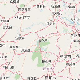
Map view of Wulingyuan Scenic and Historic Interest Area

Use this park location map to pinpoint Wulingyuan Scenic and Historic Interest Area in China, understand its exact geographic position, and read its mapped placement within the surrounding landscape more clearly.

Pigeon | © OpenStreetMap contributors

Location context for Wulingyuan Scenic and Historic Interest Area

Hunan

Visual reference of quartz sandstone pillars, deep gorges, and forest canopy

Wulingyuan Scenic and Historic Interest Area Photos and Landscape Scenery

Photographic collections reveal the towering quartz sandstone peak forest and dissected plateaus that define the protected landscape. Visual exploration of the terrain clarifies the geological formations, river valleys, and subtropical environments across the mountain reserves.

Tall, jagged sandstone pillars covered in greenery rise above a thick layer of white clouds.

A wide, hazy mountain landscape in China featuring multiple vertical, pillar-like sandstone rock formations covered in green vegetation.

Panoramic shot of vertical sandstone rock formations rising from a lush green forest, under a cloudy, overcast sky.

Tall sandstone pillar rock formations emerging from thick mist and fog in a mountainous forest landscape.

A stone footbridge spans a clear stream in a lush, wooded valley, with a traditional Chinese-style pavilion visible on the bank.

Park atlas

Compare surrounding regional geography and connected mountain reserves

Parks Near Wulingyuan Scenic and Historic Interest Area and Related Protected Landscapes

Browse protected areas and regional park geography connected to Wulingyuan Scenic and Historic Interest Area. Regional comparison helps trace wider geological patterns across the Wuling mountain ranges.
National parkChina
496 km away#1 closest

Northwest

Giant Panda National Park: China's Premier Panda Habitat and Protected Landscape

Mapped terrain and conservation significance in the mountains of western China.

Giant Panda National Park is a critically important protected area in China, established to conserve the primary habitat for the giant panda. This national park, spanning a vast mountainous region across Sichuan, Gansu, and Shaanxi, integrates numerous former reserves into a unified landscape. It serves as a vital sanctuary, protecting approximately 80 percent of the world's wild panda population and offering deep insights into the geographic distribution and ecological requirements of these endangered animals.

Area
27,134 km²
Established
2020
IUCN
II
Relief
Mountain
Nature reserveChina
About 541 km away#2 closest

Northwest

Changqing Nature Reserve: Mountain Forest Geography and Conservation Mapping

A vital Qinling Range protected area in Shaanxi Province, China

This reserve provides a deep look at the biodiversity of the Qinling Mountains, featuring steep terrain, bamboo-rich slopes, and vital forest river corridors. It serves as a globally recognized model for protected area management and provides a habitat for rare species within its vertical landscape.

Area
300 km²
Established
1995
Relief
Mountain
Access
Access unknown
Protected landscapeHenan
About 678 km away#3 closest

Northeast

郑州黄河风景名胜区: Geographic Profile of a Henan Protected Landscape

Mapping the confluence of the Yellow River and Mang Mountain

The 郑州黄河风景名胜区 is a prominent protected landscape in Henan that highlights the dynamic geography of the Yellow River basin. Characterized by the transition between loess highlands and river floodplains, this area offers an essential study of how terrain and water define regional boundaries. Users can examine the specific topographical features, including Wulong Peak and the river-facing ridges, that distinguish this site within the broader Central China atlas.

Area
20 km²
Established
1981
Relief
Upland
Climate
Temperate
Nature reserveSichuan
698 km away#4 closest

West

Wolong National Nature Reserve: Mapping Sichuan's Rugged Mountain Protected Lands

A critical mountain nature reserve in the Qionglai range.

Delve into the geography of Wolong National Nature Reserve, a cornerstone of China's protected areas. This site offers insight into the vertical ecology of the eastern Qionglai Mountains, where steep river valleys and extensive bamboo forests characterize the transition toward the Tibetan Plateau. Access map-based insights into this essential wildlife corridor and its role in the larger regional landscape.

Area
2,000 km²
Established
1963
Relief
Mountain
Climate
Alpine
A soft, watercolor painting of a terraced landscape with shallow pools, grassy slopes, and distant tree-lined hills.
Protected areaSichuan
705 km away#5 closest

Northwest

Huanglong Scenic and Historic Interest Area: Protected Alpine Landscapes and Travertine Map

High-altitude karst geography in the Minshan Mountains of Sichuan

Huanglong Scenic and Historic Interest Area presents a unique geological profile centered on a long valley of stepped travertine pools that cascade through alpine forests and meadows. This protected area offers a distinct look at the high-mountain geography of Sichuan, providing a clear view of how mineral-rich springs, deep canyons, and glaciated summits create a layered and ecologically significant environment for rare wildlife.

Area
600 km²
Established
1992
Protected landscapeFujian
About 723 km away#6 closest

East

Wuyi Mountains Protected Landscape: A Geographic Atlas of Subtropical Forests and Danxia Terrain

Mapped boundaries, regional geography, and ancient landscape context.

The Wuyi Mountains in Fujian, China, are a crucial protected landscape, recognized for their exceptional subtropical forest biodiversity and iconic Danxia landforms. This destination offers a detailed exploration of its mapped geography, including the striking red sandstone cliffs, meandering river valleys, and significant cave systems. Understand the park's protected boundaries and its role as a vital natural and cultural heritage site within China's regional geography, perfect for atlas-based discovery.

Area
1,278.63 km²
Established
1999
IUCN
II
Relief
Mountain
A horizontal watercolor illustration depicting a soft, rolling landscape with green fields, a winding stream, a line of trees, and distant hills against a plain background.
National parkSichuan
729 km away#7 closest

Northwest

Jiuzhaigou National Park: Mapped Geography and Protected Area Overview in Sichuan, China

Travertine terrace systems and high mountain forest landscapes

Located on the edge of the Qinghai-Tibet Plateau, Jiuzhaigou is a protected landscape characterized by a network of clear alpine lakes known as haizi and extensive coniferous forest blocks. The park showcases a rare interplay of water and mineral-rich rock, creating expansive travertine dams and cascading waterfalls across its three main gullies. This atlas entry focuses on the regional geography, habitat distribution, and natural terrain that constitute the essential character of this prominent conservation area within the Min Mountains.

Area
720 km²
Established
1978
Relief
Mountain
Climate
Alpine
Nature reserveZhaotong
About 729 km away#8 closest

West

Dashanbao Black-necked Crane National Nature Reserve Geographic and Atlas Overview

Protected highland wetlands within the Zhaotong regional geography.

Dashanbao Black-necked Crane National Nature Reserve is a nationally significant protected area in Zhaotong, representing a rare high-elevation wintering habitat for migratory cranes. This rugged plateau landscape features shallow marshlands, alpine grasslands, and an interconnected system of lakes that support delicate highland ecological zones. Use this atlas resource to understand the park terrain and its formal conservation boundaries within the broader context of northeast Yunnan.

Area
192 km²
Established
1990
Relief
Mountain
Climate
Subtropical

Common questions about visiting, size, designation, and location context for Wulingyuan Scenic and Historic Interest Area

Wulingyuan Scenic and Historic Interest Area FAQs for park facts, access, geography, and protected area context

Find quick answers about Wulingyuan Scenic and Historic Interest Area, including protected-area facts, park geography, trail and visitor context, and how the park fits into its surrounding country and regional landscape.
MoriAtlas Explorer

Continue Your Protected Areas Search Across the Global Atlas

Deepen your exploration by continuing the structured search for national parks and protected areas worldwide. Utilize the comprehensive filtering capabilities to compare different conservation landscapes and refine your understanding of global park geography. Discover more about the distribution and characteristics of protected natural areas.

Global natural geography