Mori Atlas logo
Nearby park discovery

Mapping the geographic spread of surrounding protected lands in Hunan Province

Protected Areas and Natural Landscapes Near Wulingyuan Scenic and Historic Interest Area

Identify protected areas and natural landscapes situated in the regional geography surrounding Wulingyuan Scenic and Historic Interest Area. This atlas view highlights the distribution of parks across the Hunan province, providing a clear perspective on the spatial relationship between individual protected zones, forest plateaus, and regional terrain features.

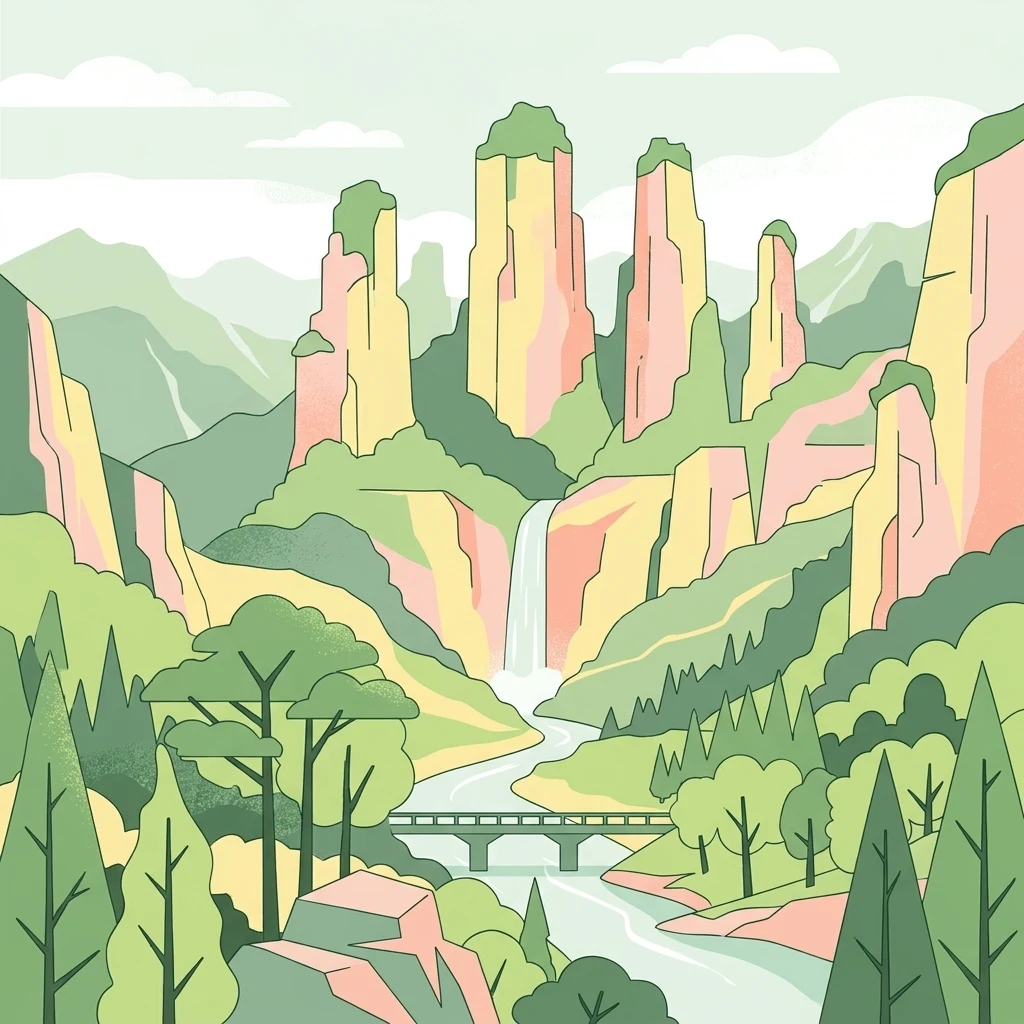
A flat-style digital illustration showing towering sandstone pillars, a waterfall, a river flowing under a bridge, and surrounding forest vegetation.

A forest of towering quartz-sandstone peaks in the Wuling Mountains of Hunan.

Wulingyuan Scenic and Historic Interest Area

Wulingyuan Scenic and Historic Interest Area is a vast protected landscape in the northwest of Hunan Province, China, set in the middle reaches of the Wuling Mountains between Sangzhi and Cili counties and administered from Zhangjiajie. The protected area is composed of four major scenic zones: Zhangjiajie National Forest Park (which overlaps with Zhangjiajie National Geopark), and the three nature reserves of Suoxiyu, Tianzi Mountain, and Yangjiajie. The defining feature of Wulingyuan is its extraordinary quartz-sandstone peak-and-gorge landscape, comprising more than three thousand individual stone pillars and peaks, along with hundreds of streams, karst caves, waterfalls, and dense natural forest. Long celebrated in Chinese poetry as an allegory of the Peach Blossom Spring, the area was formally developed for tourism in the early 1980s and rapidly emerged as one of China's most iconic natural landmarks. Wulingyuan was designated a national key scenic area by the State Council in 1988 and inscribed as a UNESCO World Heritage Site in 1992 for its outstanding natural value. In 2004 it was also accepted among the first group of UNESCO Global Geoparks. Today it remains both a globally significant natural heritage site and the scenic core of Zhangjiajie's tourism identity.

Location
China
Park type
Protected area
Established
1982
Area
264 km²
Highest point
1,262 m
Wulingyuan Scenic and Historic Interest Area Atlas
Regional park map

See the ranked park cluster in its geographic setting

Nearby parks around Wulingyuan Scenic and Historic Interest Area

This regional map shows the same 20 nearby parks ranked below around Wulingyuan Scenic and Historic Interest Area. Select a ranked marker to highlight that park’s boundary where boundary data is available.
Reference park: Wulingyuan Scenic and Historic Interest AreaRanked nearby parkSelected boundary: Wulingyuan Scenic and Historic Interest Area20 nearby parks shown
20 nearby parks

Distance-ranked collection mapping regional park geography and surrounding protected landscapes

Parks and Protected Areas Geographically Near Wulingyuan Scenic and Historic Interest Area

Examine the ranked collection of protected areas situated within geographic proximity to Wulingyuan Scenic and Historic Interest Area based on mapped boundary separation. Comparing surrounding regional park geography reveals broader environmental patterns across the wider conservation landscape.
National parkChina
496 km away#1 closest

Northwest

Giant Panda National Park: China's Premier Panda Habitat and Protected Landscape

Mapped terrain and conservation significance in the mountains of western China.

Giant Panda National Park is a critically important protected area in China, established to conserve the primary habitat for the giant panda. This national park, spanning a vast mountainous region across Sichuan, Gansu, and Shaanxi, integrates numerous former reserves into a unified landscape. It serves as a vital sanctuary, protecting approximately 80 percent of the world's wild panda population and offering deep insights into the geographic distribution and ecological requirements of these endangered animals.

Area
27,134 km²
Established
2020
IUCN
II
Relief
Mountain
Nature reserveChina
About 541 km away#2 closest

Northwest

Changqing Nature Reserve: Mountain Forest Geography and Conservation Mapping

A vital Qinling Range protected area in Shaanxi Province, China

This reserve provides a deep look at the biodiversity of the Qinling Mountains, featuring steep terrain, bamboo-rich slopes, and vital forest river corridors. It serves as a globally recognized model for protected area management and provides a habitat for rare species within its vertical landscape.

Area
300 km²
Established
1995
Relief
Mountain
Access
Access unknown
Protected landscapeHenan
About 678 km away#3 closest

Northeast

郑州黄河风景名胜区: Geographic Profile of a Henan Protected Landscape

Mapping the confluence of the Yellow River and Mang Mountain

The 郑州黄河风景名胜区 is a prominent protected landscape in Henan that highlights the dynamic geography of the Yellow River basin. Characterized by the transition between loess highlands and river floodplains, this area offers an essential study of how terrain and water define regional boundaries. Users can examine the specific topographical features, including Wulong Peak and the river-facing ridges, that distinguish this site within the broader Central China atlas.

Area
20 km²
Established
1981
Relief
Upland
Climate
Temperate
Nature reserveSichuan
698 km away#4 closest

West

Wolong National Nature Reserve: Mapping Sichuan's Rugged Mountain Protected Lands

A critical mountain nature reserve in the Qionglai range.

Delve into the geography of Wolong National Nature Reserve, a cornerstone of China's protected areas. This site offers insight into the vertical ecology of the eastern Qionglai Mountains, where steep river valleys and extensive bamboo forests characterize the transition toward the Tibetan Plateau. Access map-based insights into this essential wildlife corridor and its role in the larger regional landscape.

Area
2,000 km²
Established
1963
Relief
Mountain
Climate
Alpine
A soft, watercolor painting of a terraced landscape with shallow pools, grassy slopes, and distant tree-lined hills.
Protected areaSichuan
705 km away#5 closest

Northwest

Huanglong Scenic and Historic Interest Area: Protected Alpine Landscapes and Travertine Map

High-altitude karst geography in the Minshan Mountains of Sichuan

Huanglong Scenic and Historic Interest Area presents a unique geological profile centered on a long valley of stepped travertine pools that cascade through alpine forests and meadows. This protected area offers a distinct look at the high-mountain geography of Sichuan, providing a clear view of how mineral-rich springs, deep canyons, and glaciated summits create a layered and ecologically significant environment for rare wildlife.

Area
600 km²
Established
1992
Protected landscapeFujian
About 723 km away#6 closest

East

Wuyi Mountains Protected Landscape: A Geographic Atlas of Subtropical Forests and Danxia Terrain

Mapped boundaries, regional geography, and ancient landscape context.

The Wuyi Mountains in Fujian, China, are a crucial protected landscape, recognized for their exceptional subtropical forest biodiversity and iconic Danxia landforms. This destination offers a detailed exploration of its mapped geography, including the striking red sandstone cliffs, meandering river valleys, and significant cave systems. Understand the park's protected boundaries and its role as a vital natural and cultural heritage site within China's regional geography, perfect for atlas-based discovery.

Area
1,278.63 km²
Established
1999
IUCN
II
Relief
Mountain
A horizontal watercolor illustration depicting a soft, rolling landscape with green fields, a winding stream, a line of trees, and distant hills against a plain background.
National parkSichuan
729 km away#7 closest

Northwest

Jiuzhaigou National Park: Mapped Geography and Protected Area Overview in Sichuan, China

Travertine terrace systems and high mountain forest landscapes

Located on the edge of the Qinghai-Tibet Plateau, Jiuzhaigou is a protected landscape characterized by a network of clear alpine lakes known as haizi and extensive coniferous forest blocks. The park showcases a rare interplay of water and mineral-rich rock, creating expansive travertine dams and cascading waterfalls across its three main gullies. This atlas entry focuses on the regional geography, habitat distribution, and natural terrain that constitute the essential character of this prominent conservation area within the Min Mountains.

Area
720 km²
Established
1978
Relief
Mountain
Climate
Alpine
Nature reserveZhaotong
About 729 km away#8 closest

West

Dashanbao Black-necked Crane National Nature Reserve Geographic and Atlas Overview

Protected highland wetlands within the Zhaotong regional geography.

Dashanbao Black-necked Crane National Nature Reserve is a nationally significant protected area in Zhaotong, representing a rare high-elevation wintering habitat for migratory cranes. This rugged plateau landscape features shallow marshlands, alpine grasslands, and an interconnected system of lakes that support delicate highland ecological zones. Use this atlas resource to understand the park terrain and its formal conservation boundaries within the broader context of northeast Yunnan.

Area
192 km²
Established
1990
Relief
Mountain
Climate
Subtropical
Protected landscapeFujian
About 750 km away#9 closest

East

Wuyishan Scenic and Historic Interest Area: Danxia Protected Landscape Geography

Mapping red sandstone cliffs and river valleys in Fujian

Wuyishan Scenic and Historic Interest Area anchors a significant protected landscape in Fujian, defined by dramatic red cliff formations and the sinuous Jiuqu Xi. This geographic summary details the terrain, including its iconic rock outcrops and interconnected forest zones, offering a clear perspective on the area's physical distribution and landscape character.

Established
1979
Visitors
7.1M annual
Relief
Mountain
Climate
Subtropical
Wide watercolor painting of tall pale rock formations in a green field under a pastel sky.
Protected landscapeYunnan
About 862 km away#10 closest

Southwest

Shilin Scenic Area: Mapping the Karst Pinnacles and Protected Landscape of Yunnan

A detailed look at limestone morphology and plateau geography.

Shilin Scenic Area offers a comprehensive study of karst pinnacle development within the Yunnan province. The terrain is characterized by jagged limestone towers, deep solution fissures, and intricate subsurface drainage, providing a clear example of plateau-based geological processes. This protected area stands as a central feature in regional geography, showcasing both surface stone forests and hidden cave environments.

Established
1982
Nature reserveGuangxi
About 879 km away#11 closest

South

Guangxi Hepu Dugong National Nature Reserve: Coastal Geography and Marine Protected Area

Protected marine landscape in the Gulf of Tonkin, China.

Gain insights into the geographic extent and marine environment of Guangxi Hepu Dugong National Nature Reserve. This protected area in the Beibu Gulf anchors regional conservation efforts through its distinct seagrass beds, tidal flats, and extensive shallow-water habitats that support rare marine life.

Area
350 km²
Established
1992
Relief
Lowland
Climate
Subtropical
Watercolor painting depicting a lake with green hills and vegetation
National parkBắc Kạn Province
893 km away#12 closest

Southwest

Ba Bể National Park: Vietnam's Largest Freshwater Karst Lake and Protected Landscape

Discover the mapped geography of this unique protected wetland in Bắc Kạn.

Ba Bể National Park is distinguished by Vietnam's largest natural freshwater lake, a perennial karst water body set within a dramatic limestone landscape. This national park in Bắc Kạn Province protects a vital wetland ecosystem and its surrounding highland forests, offering a rich geographic context for atlas exploration. Explore the park's unique terrain, mapped boundaries, and the remarkable biodiversity it preserves, making it a cornerstone of regional natural landscape discovery.

Area
100.48 km²
Established
1992
IUCN
II
Relief
Mixed relief
National parkKinmen County
938 km away#13 closest

Southeast

Kinmen National Park: National Park Protected Landscape and Geographic Context

Mapped boundaries and regional park geography for atlas exploration.

Kinmen National Park stands as a significant protected area within Kinmen County, Taiwan. This page focuses on its identity as a national park, detailing its mapped boundaries and contributing to an understanding of its regional geographic context. It is designed for users seeking to explore the park's protected landscape features and its position within the broader atlas of natural areas.

Area
35.29 km²
Established
1995
IUCN
II
Relief
Upland
Watercolor painting showing a coastal landscape with distant islands, green vegetation, and a horizon line
National parkQuảng Ninh Province
About 952 km away#14 closest

South

Bái Tử Long National Park: Protected Island Archipelago and Marine Landscape Discovery

Explore the geography and mapped protected boundaries.

Bái Tử Long National Park, located in Vietnam's Quảng Ninh Province, is a protected national park distinguished by its archipelago of approximately 40 limestone islands and significant marine environments. As one of Vietnam's few national parks designated to protect both land and sea, it provides critical atlas-level insights into coastal karst topography, marine biodiversity, and the interconnectedness of island ecosystems. Discover the park's unique geographic features and its role as a vital protected landscape within the broader regional context.

Area
157.83 km²
Established
2001
IUCN
II
Relief
Mixed relief
National parkVĩnh Phúc Province
979 km away#15 closest

Southwest

Tam Dao National Park: Vietnam's Mountain National Park and Biodiversity Hotspot

Explore mapped boundaries and regional landscape context.

Tam Dao National Park is a key protected area in northern Vietnam, defined by its rugged mountain terrain featuring over 20 peaks exceeding 1,000 meters. This national park is a vital habitat for diverse flora and fauna, including numerous endemic species, and showcases transitional forest ecosystems from tropical to montane zones. Understanding Tam Dao National Park involves exploring its geographic setting within Vĩnh Phúc Province and appreciating its role as a significant protected landscape.

Area
368.83 km²
Established
1996
IUCN
II
Relief
Mountain
National parkVietnam
996 km away#16 closest

South

Cát Bà National Park: Vietnam's Critically Endangered Species Sanctuary & Karst Landscape

Mapped protected area with diverse terrestrial and marine ecosystems.

As a critical national park in Vietnam, Cát Bà National Park protects a remarkable limestone karst landscape central to the Hạ Long Bay region. This area is renowned for its steep peaks, narrow valleys, and coastal mangrove environments, supporting a uniquely diverse array of flora and fauna. Its status as a protected area highlights its global importance for conservation, particularly as the exclusive habitat of the Cát Bà langur. Explore the mapped geography and ecological significance of this vital Vietnamese protected land.

Area
161.968 km²
Established
1986
IUCN
II
Relief
Highland
A minimalist watercolor painting featuring soft, abstract layers of rolling green hills in the midground and pale, hazy mountain peaks in the background, set against a light background.
Nature reserveSichuan
About 997 km away#17 closest

West

Sichuan Yading National Nature Reserve: Mapped Protected Landscapes in Western Sichuan

High altitude terrain, glaciated peaks, and alpine geography.

Sichuan Yading National Nature Reserve is a significant protected area in the Garzê Tibetan Autonomous Prefecture, home to the Three Holy Mountains and extensive glacial features. This entry details the reserve geography, focusing on the distribution of alpine meadows, high elevation forests, and the dramatic vertical landscape carved by the Litang River tributaries.

Area
3,815.06 km²
Established
1996
Relief
Mountain
Climate
Alpine
Watercolor painting of a tranquil wetland landscape featuring a winding river, green shoreline vegetation, and soft, rolling hills in the background against a white backdrop.
Nature reserveHainan
About 1,032 km away#18 closest

South

海南东寨港国家级自然保护区: Geographic Profile and Mangrove Wetland Boundaries

Coastal wetland landscapes on the northern edge of Hainan

Understand the physical landscape of 海南东寨港国家级自然保护区 through its complex tidal networks and brackish estuaries. This nature reserve provides essential insights into mangrove forest stability, sediment accumulation, and coastal resilience within the broader geography of Hainan province.

Area
33.376 km²
Established
1986
IUCN
V
Relief
Lowland
National parkHanoi
About 1,045 km away#19 closest

Southwest

Ba Vì National Park: Ancient Volcanic Mountains and Protected Landscape Near Hanoi

Discover the mapped geography and biodiversity of this national park.

Ba Vì National Park, a protected natural area near Hanoi, showcases a dramatic landscape shaped by ancient volcanic activity. The park features three significant peaks, including Vua Mountain, creating a distinct topographical profile. Spanning over 10,800 hectares, it is recognized for its ecological diversity, harboring a wealth of plant and animal species. This national park serves as a vital protected landscape, offering a unique opportunity for geographic exploration and understanding the natural terrain surrounding the Vietnamese capital.

Area
108.15 km²
Established
1991
IUCN
II
Relief
Mountain
National parkLào Cai Province
About 1,046 km away#20 closest

Southwest

Hoàng Liên National Park: Vietnam's Highest Mountain and Botanical Treasure in Lào Cai Province

Discover exceptional mountain terrain and unique endemic species habitat.

Hoàng Liên National Park stands as a critical protected landscape in Lào Cai Province, Vietnam, centered around the iconic Fansipan mountain, the highest point in the Indochinese Peninsula. This national park is renowned as a globally important center for plant diversity, showcasing varied mountain terrain from lush evergreen forests to subalpine ecosystems. Explore the mapped boundaries and geographic context of this significant highland protected area, a key destination for understanding Southeast Asian botanical richness.

Area
685.69 km²
Established
2002
IUCN
II
Relief
Mountain
Distance methodology

Geographic measurements, not driving distances

How nearby park distances are calculated

Distances use park boundaries whenever the available geometry allows it. When one or both boundaries are missing, the mapped park locations provide a clearly labelled estimate. Every value represents straight-line geographic separation and does not use roads or routing.

Boundary distance

Calculated between the nearest points of both park boundaries.

Location-to-boundary estimate

Estimated from one mapped park location to the nearest boundary of the other park.

Mapped-location estimate

Estimated between the mapped locations of both parks.

MoriAtlas Explorer

Trace the Geological Boundaries of Wulingyuan Scenic and Historic Interest Area

Follow the complex mountain terrain and protected valley geography of Wulingyuan Scenic and Historic Interest Area through the MoriAtlas dataset. Access mapped features and regional context to understand how this expansive sandstone peak forest functions within the broader Hunan ecosystem and Central China landscape.