

Mori Atlas logo
Regional parkParque regional Yacuma

A sprawling riparian mosaic featuring seasonal floodplains and diverse aquatic wildlife habitats.

Parque regional Yacuma: Mapping the Protected Wetlands and Forested Terrain of Beni, Bolivia

Parque regional Yacuma protects a critical 120,000 hectare landscape in the northern Bolivian lowlands of Beni. The area encompasses a continuous riparian ecosystem where pre-Andean forests merge into vast seasonal savannas and intricate river networks. This protected territory maintains essential ecological integrity within a wider corridor of indigenous lands and biological reserves, characterized by slow-moving rivers and dense wetlands that define the regional geography.

floodplain savannapre-Andean forestinundable savannariver ecosystempink river dolphinlowland wildlife

Parque regional Yacuma

Regional park

Park overview

Structured park overview, official facts, and landscape profile for Yacuma Regional Park

Yacuma Regional Park park facts, protected area profile, and essential visitor context

Review the core facts for Yacuma Regional Park, including designation, size, terrain, visitor scale, habitats, and operating context in one park-focused overview.

About Yacuma Regional Park

Yacuma Regional Park sits in the heart of the Bolivian Beni, a region defined by slow rivers, vast seasonal floodplains, and patches of forest that survive between open wetlands. The protected area was created in 1990 as a regional reserve to safeguard these complex ecosystems from the pressures of agricultural expansion, logging, and unregulated river use that were affecting much of the surrounding lowlands.

Geographically, the park extends across parts of three provinces and three municipalities, anchoring a large area of lowland terrain between the Andean foothills to the west and the open Llanos de Moxos to the east. Within its boundaries, two major habitat types dominate: pre-Andean forests that establish on better-drained ground, and inundable savannas that pulse with water across the wet season. Together, they form a transitional landscape where Amazonian forest meets southern savanna, creating a mosaic of habitats that supports a wide variety of plant and animal communities.

The hydrology of the park is central to its character. Rivers such as the Yacuma and tributaries of the Beni move slowly across the flat lowland, and during the rainy months large areas remain submerged for extended periods. This seasonal rhythm shapes both the vegetation patterns and the seasonal presence of wildlife. Aquatic species flourish in the river channels and permanent lagoons, while terrestrial mammals and forest birds use the higher ground as refuge during high water.

Yacuma does not function as an isolated reserve. It is an integral piece of a much larger conservation framework that includes the Chimanes Indigenous Territory, the Beni Biological Station Biosphere Reserve, and the Eva Eva;Mosetenes watershed protection zone. This wider network gives the park strong ecological meaning, as it protects a portion of one of Bolivia's most intact lowland forest and wetland corridors and provides a buffer for indigenous land management in the region.

Quick facts and research context for Yacuma Regional Park

Yacuma Regional Park is a departmental protected area in the Beni department of northern Bolivia. Established on 24 September 1990 under Supreme Decree 22611, the park covers approximately 120,000 hectares. It extends across three provinces (General José Ballivián, Moxos, and Yacuma) and the municipalities of San Borja, San Ignacio de Moxos, and Santa Ana del Yacuma.

The park protects pre-Andean forest alongside seasonally flooded savanna ecosystems, and forms part of a broader protection network surrounding the Chimanes Indigenous Territory and the Beni Biological Station Biosphere Reserve.

Park context

Deeper park guide and search-rich context for Yacuma Regional Park

Yacuma Regional Park history, landscape, wildlife, and travel context

Explore Yacuma Regional Park through its history, landscape character, ecosystems, wildlife, conservation priorities, cultural context, and seasonal travel timing in a structured park guide built for atlas discovery and search intent.

Why Yacuma Regional Park stands out

Yacuma is best known for its seasonally flooded landscape where pre-Andean rainforest meets open savanna plains. The park's river and lagoon system supports a distinctive concentration of aquatic and semi-aquatic wildlife, especially pink river dolphins, which are regularly observed along the Yacuma River and have become emblematic of the park's identity. The protected area is also recognized for its role as part of the conservation complex surrounding the Chimanes Indigenous Territory. This places Yacuma within one of the most important continuous blocks of lowland forest and wetland habitat in northern Bolivia, where ecological integrity depends on coordinated protection across multiple reserves and indigenous lands.
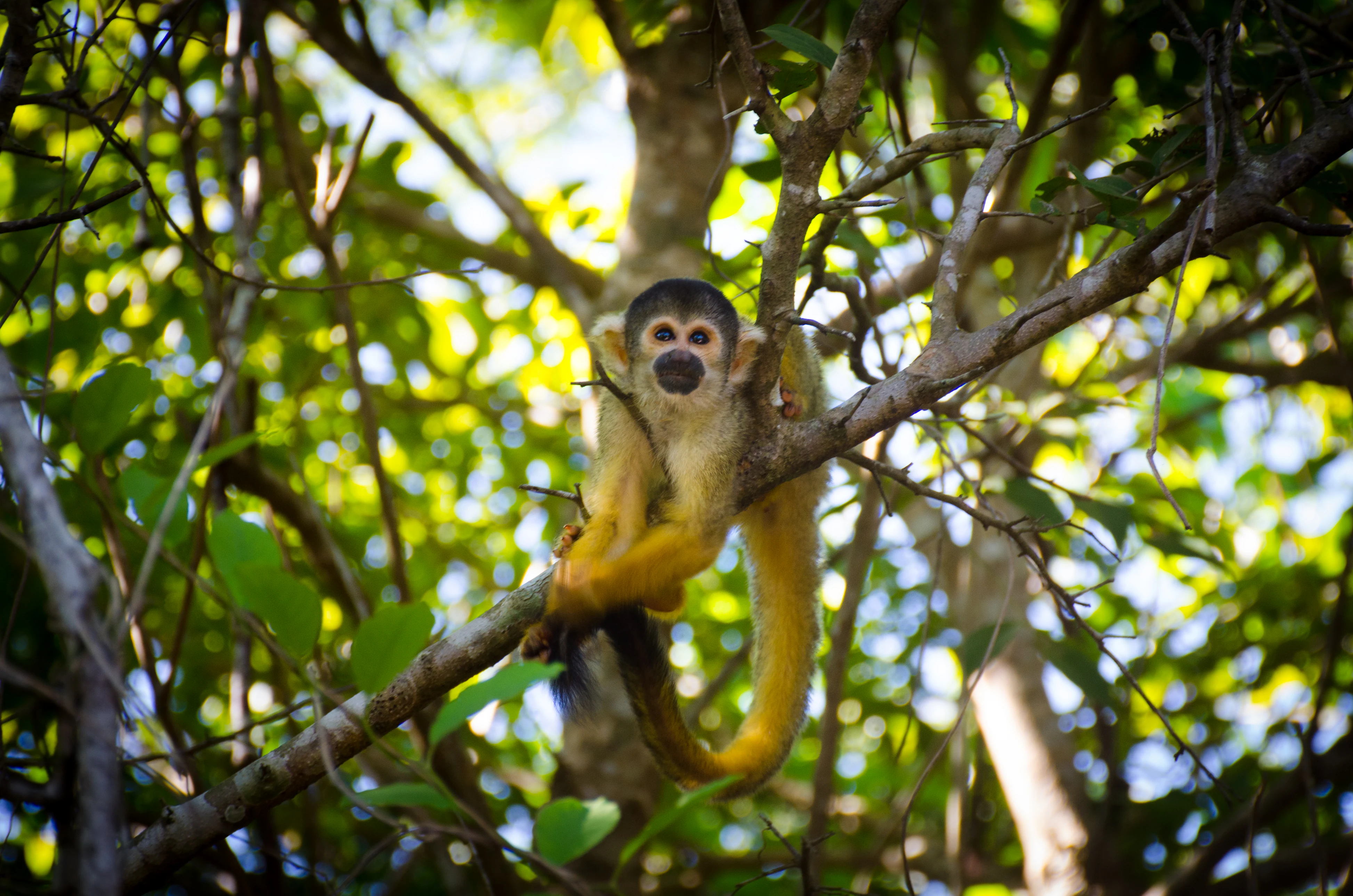
A squirrel monkey with yellow fur and a black face sitting on a tree branch surrounded by green leaves.
A squirrel monkey perched on a tree branch in the forest canopy.

Yacuma Regional Park history and protected-area timeline

Yacuma Regional Park was formally established on 24 September 1990 through Bolivian Supreme Decree 22611, creating a regional protected area under departmental jurisdiction rather than federal national park status. The decree gave the Beni department responsibility for managing the new reserve and set the legal foundation for protecting the area's forests, wetlands, and river systems.

The park emerged during a period when Bolivia was formalizing its system of protected natural areas in response to growing threats to lowland ecosystems from colonists, resource extraction, and infrastructure projects. By designating the Yacuma landscape as a regional park, authorities sought to anchor conservation efforts along an important northwestern front of the Beni, near the Andean foothills.

Over time, Yacuma became part of a broader conservation complex that includes the Chimanes Indigenous Territory and the Beni Biological Station Biosphere Reserve. This integration gave the park a wider role within northern Bolivia's protected area network, although its on-the-ground management has remained modest and the area continues to depend heavily on its natural isolation.

Yacuma Regional Park landscape and geographic character

The landscape of Yacuma Regional Park is defined by the gentle topography of the northern Bolivian lowlands. Elevations change only marginally across the entire reserve, which is dominated by flat plains that shift between flooded savanna and forested patches depending on the season.

Pre-Andean forest forms the western and upland character of the park, with tree cover that becomes denser as the terrain rises slightly toward the foothills. In contrast, the broad central and eastern portions of the reserve open into vast periodically flooded savannas, locally known as sabanas inundables, where grasses and scattered palms dominate the landscape.

Slow-moving rivers and seasonal lagoons cut across the terrain, including the Yacuma River and tributaries of the Beni, which give the park its name and define much of its hydrology. During the wet season, water spreads expansively across the floodplain, fragmenting the higher ground into temporary islands, while in the dry months the same rivers contract and concentrate wildlife around permanent water bodies.
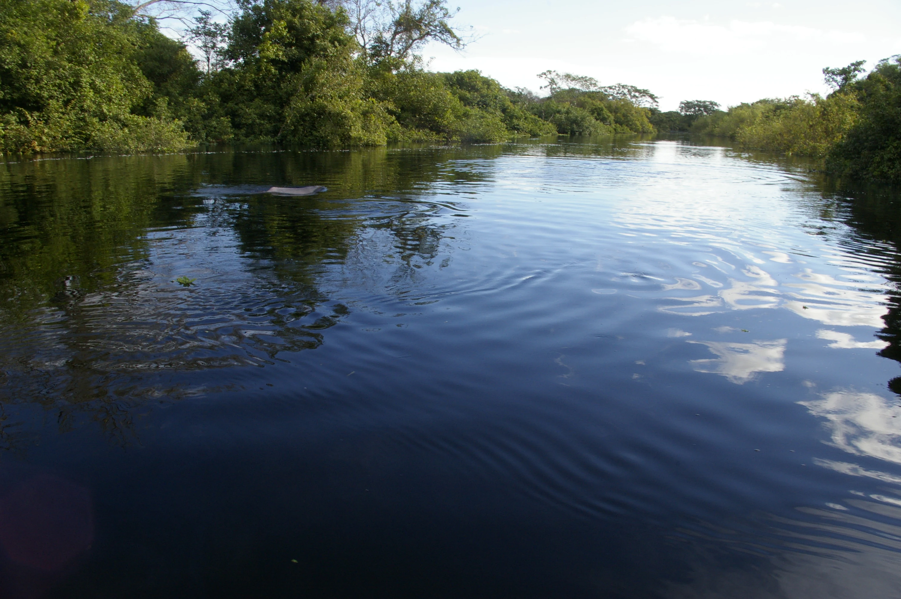
A wide river with dark water reflecting the sky and clouds, bordered by dense green trees and vegetation on both banks.
The Yacuma River flowing through dense tropical forest in Beni, Bolivia, with ripples on the dark water surface.

Yacuma Regional Park ecosystems, habitats, and plant life

Ecologically, Yacuma Regional Park functions as a transition zone between pre-Andean forest and Llanos de Moxos savanna. This interface zone is biologically very rich because two major ecosystem types converge, with the boundary between them shifting with rainfall patterns year after year.

The primary ecosystems are pre-Andean forest on better-drained soils and inundable savanna on the flatter floodplain. The pre-Andean forests harbor typical lowland Amazonian tree species and a dense understory that thrives in taller canopies. The savannas, in contrast, are dominated by tough grasses adapted to seasonal flooding, with isolated patches of gallery forest following the river courses.

The connectivity of these habitats creates a continuous ecological landscape, where forest species and open-country species occur close to one another. Rivers, lagoons, and inundated grasslands form a habitat mosaic that supports both resident and migratory species, and the park plays a meaningful role in maintaining hydrological and ecological connectivity across northern Bolivia.
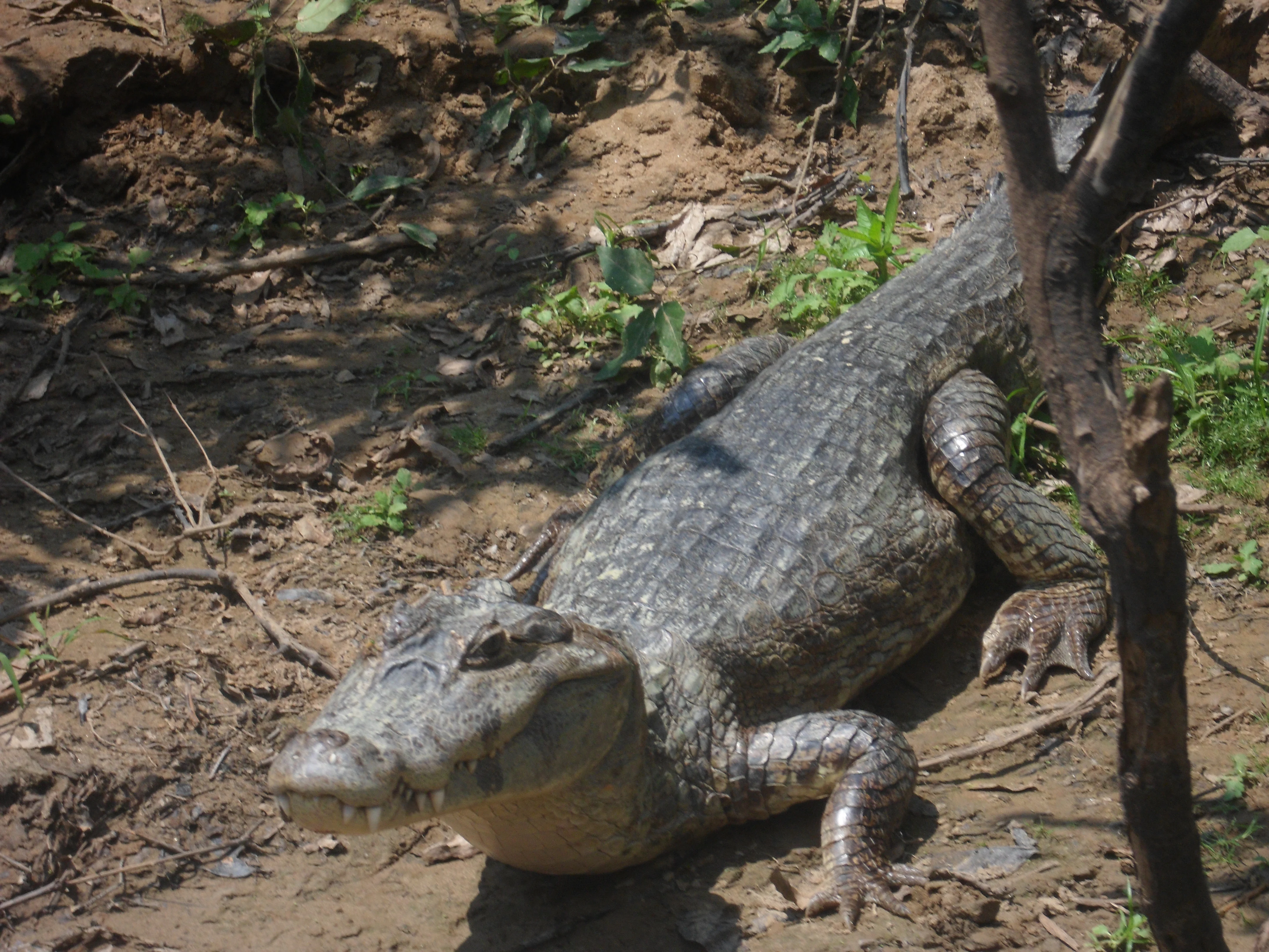
A large caiman lying on muddy ground with sparse green vegetation and a tree trunk visible nearby.
A caiman resting on the muddy banks of the Beni River near Santa Rosa del Yacuma.

Yacuma Regional Park wildlife and species highlights

Yacuma Regional Park supports a varied fauna typical of the northwestern Bolivian lowlands, with species strongly tied to its seasonal water cycles. Aquatic and semi-aquatic animals are among the park's most visible residents, with pink river dolphins commonly observed in the channels of the Yacuma and adjacent river systems.

Reptiles are well represented along the park's riverbanks and lagoons, where caimans and turtles are regularly reported. In the gallery forests and wet savannas, primates such as squirrel monkeys use the more forested patches, while the forests also host a wide range of birds and smaller mammals typical of the southwestern Amazon.

Seasonal flooding strongly influences wildlife behavior. During the wet season, animals concentrate on higher ground and along permanent rivers, making them easier to observe. In the dry months, as waters recede, fish activity intensifies in the contracting rivers, drawing predatory birds and supporting breeding aggregations of aquatic species across the floodplain.

Yacuma Regional Park conservation status and protection priorities

Yacuma Regional Park was designated to protect a critical block of lowland habitat in the Beni, where forest conversion and unregulated resource use have historically threatened the region's hydrology and biodiversity. The park's importance lies less in its high-profile infrastructure and more in its role as a stabilizing ecological presence within a much larger landscape.

Within Bolivia's conservation architecture, Yacuma functions as part of a multi-layered protection system that includes the Chimanes Indigenous Territory, the Beni Biological Station Biosphere Reserve, and the Eva Eva;Mosetenes watershed protection zone. Together, these areas form a continuous buffer that maintains forest cover, water quality, and habitat connectivity across northern Bolivia, with Yacuma contributing its pre-Andean forests and floodplain wetlands to this broader ecological network.

Yacuma Regional Park cultural meaning and human context

The park overlaps with the territory of indigenous communities of the Beni, including groups associated with the wider Chimanes Indigenous Territory. Indigenous presence in the broader region is long-standing, and lands adjacent to the park continue to support traditional livelihoods connected to the rivers, forests, and seasonal floodplains.

Local towns such as San Borja, San Ignacio de Moxos, and Santa Ana del Yacuma serve as gateways to the park and link the reserve to regional Bolivian culture that blends lowland indigenous heritage with colonial and missionary influences. The annual rhythms of the Beni, marked by the rise and fall of rivers, continue to shape both the cultural identity and the economy of communities around the park.

Top sights and standout views in Yacuma Regional Park

Yacuma Regional Park stands out for its seamless connection between river, lagoon, forest, and flooded savanna, where wildlife is concentrated around the Yacuma River system. Pink river dolphins, caimans, turtles, and squirrel monkeys are emblematic of the reserve, and the interplay between terrestrial and aquatic life gives the park a strong ecological identity.

Equally important is its position within a wider conservation and indigenous landscape. By anchoring a continuous corridor between the Chimanes Indigenous Territory and the Beni Biological Station Biosphere Reserve, Yacuma provides a key piece of northern Bolivia's lowland conservation network.

Best time to visit Yacuma Regional Park

The character of a visit to Yacuma Regional Park shifts noticeably with the seasons, and these shifts are tied to the annual flood pulse of the Beni lowlands. During the dry season, which generally runs from roughly May through September, water levels are lowest and animals concentrate around rivers, lagoons, and the limited patches of dry land. This is often the most rewarding period for observing wildlife such as pink river dolphins, caimans, and wading birds, as the receding water draws fauna into smaller, more visible areas.

The wet season, from roughly November through March, transforms the park into a vast flooded landscape where the savannas remain submerged for long periods. Roads and trails become more difficult to traverse, and the experience shifts from classic dry-season game viewing to an immersive flooded-forest atmosphere. For visitors interested in landscape and forest atmosphere rather than compact wildlife encounters, this season offers striking scenery, while for those seeking more accessible travel and concentrated sightings, the dry months are typically preferred.
Monthly climate preview

Long-term representative measurements showing monthly temperature and precipitation variation across Beni

Parque regional Yacuma Climate Normals, Annual Temperature and Precipitation

Historical climate records for Parque regional Yacuma trace a measured annual rhythm of monthly average temperatures and precipitation totals from representative coordinates in Beni. Detailed monthly normals provide deeper analytical comparison across the complete twelve-month temperature and rainfall cycle.
Annual mean26 °C
24 °C28 °C
Jan26°
Feb26°
Mar26°
Apr25°
May24°
Jun24°
Jul24°
Aug26°
Sep28°
Oct28°
Nov27°
Dec26°
Warmest month
October

28.2 °C

Coolest month
June

23.8 °C

Wettest month
February

9.9 mm/day

Driest month
August

1.4 mm/day

Park location guide

Geography guide, regional context, and park location map for Yacuma Regional Park

Yacuma Regional Park park geography, regions, and map view in Bolivia

Understand where Yacuma Regional Park sits in Bolivia through a broader geographic reading of the surrounding landscape, nearby location context, and its mapped position within the national park landscape.

How Yacuma Regional Park fits into Bolivia

Bolivia, officially the Plurinational State of Bolivia, is a landlocked country in central South America. It features diverse geography including the Andean mountain range, Amazonian plains, Gran Chaco, and the Pantanal wetland. The country has a population of approximately 11.4 million and is administratively divided into nine departments, with La Paz as the seat of government and Sucre as the constitutional capital.

Wider geography shaping Yacuma Regional Park in Bolivia

Bolivia is located in central South America, bordered by Brazil to the north and east, Paraguay to the southeast, Argentina to the south, Chile to the southwest, and Peru to the west. The country is divided between a western Andean region and tropical lowlands to the east and north. It includes the Amazonian plain, Gran Chaco, temperate valleys, the high-altitude Altiplano plateau, and part of the Pantanal wetland along its eastern border.

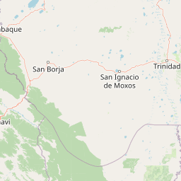
Map view of Yacuma Regional Park

Use this park location map to pinpoint Yacuma Regional Park in Bolivia, understand its exact geographic position, and read its mapped placement within the surrounding landscape more clearly.

Pigeon | © OpenStreetMap contributors

Location context for Yacuma Regional Park

Beni

Visual reference guide for floodplain savannas, pre-Andean forests, and river habitats

Parque regional Yacuma Photos and Landscape Scenery Visual Explorer

Visual documentation captures the seasonal transition between inundated grasslands and dense forest patches across the northern Bolivian lowlands. Detailed imagery reveals the river networks and wildlife habitats that define the protected landscape character of the region.

A squirrel monkey with yellow fur and a black face sitting on a tree branch surrounded by green leaves.

Two dark-shelled turtles mating on a fallen log partially submerged in dark water, with their reflections visible below.

A wide river with dark water reflecting the sky and clouds, bordered by dense green trees and vegetation on both banks.

A large caiman lying on muddy ground with sparse green vegetation and a tree trunk visible nearby.

Park atlas

Compare surrounding lowland wetlands, river corridors, and adjacent conservation reserves.

Parks Near Parque Regional Yacuma and Related Protected Areas in Northern Bolivia

Continue exploring protected areas near Parque regional Yacuma by browsing connected lowland habitats and seasonal river networks across northern Bolivia. Comparing these adjacent reserves reveals the broader ecological context of the Beni basin and regional savanna ecosystems.
Biosphere reserveBolivia
About 46 km away#1 closest

Northwest

Reserva de Biosfera Estación Biológica del Beni: Protected Landscape and Geographic Atlas

Examining the Amazonian lowland mosaic of northern Bolivia

The Reserva de Biosfera Estación Biológica del Beni sits within the wide alluvial plains of the Llanos de Moxos. This protected area features a unique, flat terrain where tropical forest fragments persist as islands amidst seasonally flooded palm savannas, cyperaceous marshes, and shallow lagoons, providing a critical study area for Amazonian biodiversity.

Area
1,350 km²
Established
1982
Relief
Lowland
Climate
Tropical
Protected areaBeni Department
About 99 km away#2 closest

East

Área Protegida Municipal Ibare-Mamoré: Geography and Protected Area Context

Riverine landscapes and wetlands in Bolivia's Beni Department

The Área Protegida Municipal Ibare-Mamoré encompasses a diverse range of ecosystems, from upland forests to open grasslands and shifting river channels. As a key conservation unit near the city of Trinidad, this area highlights the ecological importance of the Llanos de Moxos region through its interconnected aquatic and terrestrial habitats.

Area
256.08 km²
Established
2011
Relief
Lowland
Climate
Tropical
Nature reserveBeni Department
About 110 km away#3 closest

North

Reserva natural Barba Azul: A Protected Savanna Sanctuary in the Beni Department

Mapping flooded grasslands and gallery forest ecosystems

Reserva natural Barba Azul stands as a key protected area within the Bolivian Amazon lowlands. This nature reserve, centered in the Beni Department, preserves a rare mosaic of motacú palm forests and seasonal wetlands that serve as a critical stronghold for endangered parrots and migratory shorebirds within the larger Llanos de Moxos region.

Area
110 km²
Established
2008
Relief
Lowland
Climate
Tropical
Protected areaBeni
About 118 km away#4 closest

Northwest

Área protegida municipal Pampas del río Yacuma: Protected Area and Wetland Geography

A large-scale municipal sanctuary in the Bolivian Amazon

This significant protected area encompasses the expansive floodable savannas of the Llanos de Moxos. Its mosaic of forest islands and riverine wetlands provides a critical refuge for endemic species and iconic Amazonian wildlife. The geography is shaped by the Yacuma River, creating a seasonal environment that bridges indigenous heritage with modern conservation land management.

Area
6,164.53 km²
Established
2007
Visitors
16K annual
Relief
Lowland
Biosphere reserveBolivia
About 134 km away#5 closest

West

Reserva de la Biosfera y Tierra Comunitaria de Origen Pilón Lajas Protected Landscape Atlas

Mapping the Andean Amazonian transition in northern Bolivia

Spanning from high mountain ridges to the river plains of the Beni, this protected area features a unique vertical gradient of ecosystems including cloud forests and terra firme. It represents a significant model for indigenous co governance and biodiversity protection within the broader Andean and Amazonian geographic context.

Area
4,000 km²
Established
1992
Relief
Mountain
Climate
Tropical
National parkBolivia
About 138 km away#6 closest

South

Isiboro Sécure National Park and Indigenous Territory: Bolivian Protected National Park Atlas

Mapped protected boundaries and regional landscape context.

Investigate Isiboro Sécure National Park and Indigenous Territory as a key protected national park within Bolivia's expansive geography. This resource offers detailed views of its mapped natural landscape and its regional significance as a protected area. Understand the park's geographic attributes and its contribution to the country's conservation atlas through structured map-based exploration.

Area
13,721.8 km²
Established
1965
IUCN
II
Relief
Mixed relief
Protected landscapeBeni
About 140 km away#7 closest

East

Parque Municipal y Área Natural de Manejo Integrado Gran Mojos: Regional Geography

Protected floodplain ecosystems in the Beni department of Bolivia.

Analyze the spatial distribution of this large protected area located in the Mamoré River basin. Learn about its dual-designation structure, bridging core municipal forests with integrated management zones that preserve vital lowland Amazonian habitats and endemic biodiversity within the Llanos de Moxos ecoregion.

Area
5,804.3 km²
Established
2017
Relief
Lowland
Scope
Terrestrial
Protected areaBeni Department
About 159 km away#8 closest

Northwest

Área Protegida Municipal Rhukanrhuka: Mapping Amazonian Biodiversity and Riverine Terrain

A transitional protected landscape in the Beni Department of Bolivia

Spanning a vast transition from Andean slopes to the Llanos de Moxos floodplain, Área Protegida Municipal Rhukanrhuka protects a dynamic mosaic of white-water rivers, gallery forests, and tectonic lakes. This significant municipal reserve serves as a refuge for threatened species and sustains indigenous Maropa communities within its borders, anchoring an essential conservation corridor in the northern Amazon.

Area
8,594.51 km²
Established
2019
Relief
Lowland
Climate
Tropical

Common questions about visiting, size, designation, and location context for Yacuma Regional Park

Yacuma Regional Park FAQs for park facts, access, geography, and protected area context

Find quick answers about Yacuma Regional Park, including protected-area facts, park geography, trail and visitor context, and how the park fits into its surrounding country and regional landscape.
MoriAtlas Explorer

Continue Your Protected Areas Search Across the Global Atlas

Deepen your exploration by continuing the structured search for national parks and protected areas worldwide. Utilize the comprehensive filtering capabilities to compare different conservation landscapes and refine your understanding of global park geography. Discover more about the distribution and characteristics of protected natural areas.

Global natural geography