Why Yambaru National Park stands out
Yambaru National Park is renowned for its exceptional concentration of endemic species, particularly the endangered Yambaru long-armed scarab beetle and the flightless Yanbaru rail. The park protects Japan's northernmost subtropical evergreen laurel forest, a rare ecosystem type within the country's protected area network. It is also recognized for its potential as a World Heritage Site component, representing the unique biodiversity of the Ryukyu Islands. The park's dramatic landscape features rugged mountains including Mount Yonahadake and Mount Hedomisaki, pristine rivers, coastal cliffs, and mangrove ecosystems.
Yambaru National Park history and protected-area timeline
The establishment of Yambaru National Park represents the culmination of over two decades of advocacy and administrative process. In 1996, the then-Environment Agency director first proposed national park status for Yambaru during discussions about the future use of the US military Northern Training Area lands. The policy framework shifted in 2007 when the Ministry of the Environment revised park selection guidelines to incorporate biodiversity and ecosystem considerations beyond scenic landscape values. By 2010, the national park inspection project had identified Yambaru as a priority area, and the prefecture formally agreed to pursue national park designation in early 2016. The formal designation occurred on September 15, 2016, with the date chosen to commemorate the 1983 discovery of the endemic Yambaru long-armed scarab beetle. In 2018, approximately 3,700 hectares of returned US military training land were incorporated into the park, expanding its protected boundary.
Yambaru National Park landscape and geographic character
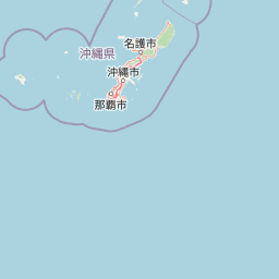
The physical landscape of Yambaru National Park features a dramatic backdrop of rugged mountain ridges and steep coastal terrain characteristic of northern Okinawa Island. The park's mountainous interior includes peaks such as Mount Yonahadake, Mount Hedomisaki, and Mount Iyu, which rise from the surrounding terrain creating distinctive silhouette views. Numerous river systems including the Beniki River, Yonagawa River, and Kesaz River descend from the mountains through forested valleys, maintaining perennial flow that supports downstream ecosystems. The coastline features dramatic promontories like Cape Hedo, rocky shores, and pocket beaches. Marine areas include small offshore islands such as Yagajishima and Miyagijima, as well as the mangrove-dominated Kesaz Bay. The terrain transitions sharply from near-shore coastal flatlands to steep mountain slopes within short horizontal distances.
Yambaru National Park ecosystems, habitats, and plant life
The ecological character of Yambaru National Park centers on subtropical evergreen laurel forest, a vegetation type that reaches its northern global limit in this area. The forest ecosystem features dense canopies of broadleaf evergreen trees adapted to the warm, humid climate and distinct wet and dry seasons. The park's ecological significance stems from the remarkable degree of endemism, with numerous species found only within the Yambaru region or broader Ryukyu Islands. The forest supports complex food webs and provides critical habitat for species adapted to specific microhabitats within the canopy and forest floor. Marine environments within the park boundaries include coral reef communities, seagrass beds, and mangrove forests that transition from terrestrial to fully marine ecosystems.
Yambaru National Park wildlife and species highlights
Yambaru National Park supports extraordinary biodiversity with a high concentration of endemic species found nowhere else on Earth. The park is particularly known for its endemic insects, including the remarkable Yambaru long-armed scarab beetle, one of Japan's largest beetles, whose discovery anniversary marks the park's establishment date. The Yanbaru rail represents one of only two flightless bird species in Japan, and the critically endangered Okinawa woodpecker, known locally as the Noguchigera, inhabits the forest canopy. The park provides crucial habitat for endemic mammals, reptiles, amphibians, and countless invertebrate groups. Marine environments support coral reef fish populations, sea turtles, and the mangrove-dependent species communities. The park's significance for migratory birds also exists, as the islands serve as stepping stones in the East Asian Australasian flyway.
Yambaru National Park conservation status and protection priorities
Yambaru National Park holds significant conservation importance as Japan's northernmost example of subtropical evergreen laurel forest ecosystem. The park was designated as a component of the World Heritage Site inscription recognizing the exceptional universal value of the Amami-Oshima, Tokunoshima, northern Okinawa, and Iriomote Island forests. Conservation challenges include managing the impacts of invasive species, particularly feral cats and dogs that predate native wildlife, and addressing concerns about illegal collection of endemic species. The park incorporates special protection zones and multiple restricted-use designations totaling over 5,000 hectares designated as the most protected categories. The park management works closely with local communities in the three villages to balance conservation with sustainable use and traditional forest practices.
Yambaru National Park cultural meaning and human context
The Yambaru region has been shaped by centuries of human presence and traditional land use practices within the forest environment. The three villages of Kunigami, Ōgimi, and Higashi maintain cultural connections to the landscape, and historically the forests provided timber, firewood, bamboo, and other resources to the broader Okinawa Island population. Kunigami Village remains Okinawa's largest timber-producing area and retains active forestry operations that intersect with park boundaries in some areas. The park theme emphasizes the connection between the mountain forest and human activities, recognizing that Yambaru's natural values exist within a cultural landscape shaped by local communities. Traditional practices such as sustainable forest management continue to interact with conservation objectives.
Top sights and standout views in Yambaru National Park
Yambaru National Park offers visitors access to pristine subtropical forest environments that are unique within Japan. The trail systems provide opportunities to experience the towering laurel forest ecosystem and views from mountain summits. The park includes dramatic coastal features such as Cape Hedo, the northernmost point of Okinawa Island, where visitors can observe coastal cliffs and seasonal whale migration. The Kesaz Bay mangrove area represents one of the largest mangrove forests in Okinawa. The Yanbaru Wildlife Protection Center serves as an educational facility offering interpretation about the park's endemic species. The combination of terrestrial forest, river, coastal, and marine environments creates a remarkably diverse visitor experience within a compact area.
Best time to visit Yambaru National Park
The subtropical climate of Yambaru influences seasonal conditions throughout the year, with warm temperatures persisting even in winter months when compared to mainland Japan. The summer season brings higher temperatures, increased humidity, and the peak of the rainy season, which supports the lush forest appearance but may limit some trail activities. The winter months from December through February typically offer the most comfortable conditions for hiking, with milder temperatures and reduced precipitation. The spring season brings flowering of subtropical plants and represents a popular period for nature observation. The timing of park visits should consider personal tolerance for heat and humidity, with the cooler winter period generally more comfortable for active pursuits such as trail hiking.