

Mori Atlas logo
Protected areaZona Protectora Forestal los terrenos constitutivos de las cuencas de los ríos Valle de Bravo, Malacatepec, Tilostoc y Temascaltepec

A vital forested watershed mapping the rugged mountainous terrain of the Trans-Mexican Volcanic Belt

Zona Protectora Forestal los terrenos constitutivos de las cuencas de los ríos Valle de Bravo, Malacatepec, Tilostoc y Temascaltepec Protected Area

Discover the complex geographic footprint of the Zona Protectora Forestal los terrenos constitutivos de las cuencas de los ríos Valle de Bravo, Malacatepec, Tilostoc y Temascaltepec. This expansive protected area serves as a critical continental divide and watershed for the Cutzamala and Temascaltepec rivers. Its diverse vertical zonation transitions from tropical dry deciduous forests to high-altitude pine and fir stands across the volcanic landscape of the State of Mexico.

forest watershedpine-oak foresttropical dry forestheadwatersCutzamala basinTemascaltepec basin

Zona Protectora Forestal los terrenos constitutivos de las cuencas de los ríos Valle de Bravo, Malacatepec, Tilostoc y Temascaltepec

Protected area

Park overview

Structured park overview, official facts, and landscape profile for Zona Protectora Forestal los terrenos constitutivos de las cuencas de los ríos Valle de Bravo, Malacatepec, Tilostoc y Temascaltepec

Zona Protectora Forestal los terrenos constitutivos de las cuencas de los ríos Valle de Bravo, Malacatepec, Tilostoc y Temascaltepec park facts, protected area profile, and essential visitor context

Review the core facts for Zona Protectora Forestal los terrenos constitutivos de las cuencas de los ríos Valle de Bravo, Malacatepec, Tilostoc y Temascaltepec, including designation, size, terrain, visitor scale, habitats, and operating context in one park-focused overview.

About Zona Protectora Forestal los terrenos constitutivos de las cuencas de los ríos Valle de Bravo, Malacatepec, Tilostoc y Temascaltepec

Zona Protectora Forestal los terrenos constitutivos de las cuencas de los ríos Valle de Bravo, Malacatepec, Tilostoc y Temascaltepec is one of the most strategically located forest protection areas in central Mexico. It occupies a substantial block of the mountainous country in the State of Mexico, bridging the upper catchments of several rivers whose waters ultimately reach the Balsas basin. The park takes its long name from the specific watersheds it protects: Valle de Bravo, Malacatepec, Tilostoc, and Temascaltepec, four streams that originate in forested highlands and supply downstream communities and irrigation systems.

In geographic terms, the area sits within the Trans-Mexican Volcanic Belt, a volcanic spine that crosses central Mexico and produces dramatic elevation changes over relatively short distances. The protected area lies on the divide between the Lerma River basin draining north and the Balsas River basin draining south, so that its forests effectively act as a sponge and filter for waters moving in both directions. This hydrological position gives the park an importance well beyond its regional boundaries, because the Cutzamala basin is part of the Cutzamala-Lerma water system that conveys water to Mexico City, one of the largest metropolitan areas in the world.

Ecologically, the slopes hold a vertical sequence of plant communities shaped by elevation, rainfall patterns, and soil conditions. Lower slopes carry tropical dry deciduous and semi-deciduous forests adapted to seasonal drought. Mid-elevations are dominated by oak forests and mixed pine-oak woodlands, while the highest reaches support pine and fir forests. The elevational gradient produces habitat diversity that supports a wide variety of mammals, birds of prey, and forest-dependent songbirds, as well as the overwintering colonies of monarch butterflies for which the wider region of central Mexico is internationally known.

Quick facts and research context for Zona Protectora Forestal los terrenos constitutivos de las cuencas de los ríos Valle de Bravo, Malacatepec, Tilostoc y Temascaltepec

The protected area lies in the State of Mexico, in the central portion of the country, and covers more than 1,400 square kilometers of mountainous terrain. It was first decreed by President Manuel Ávila Camacho in 1941 to protect the river basins, and was redesignated in 2005 under Mexico's natural resources protection area category.

It is administered by the National Commission of Natural Protected Areas and sits within the Trans-Mexican Volcanic Belt, a region of volcanic mountains that forms the divide between major river systems of central Mexico. Its neighbors include Nevado de Toluca National Park to the east, Bosencheve National Park to the north, and the Monarch Butterfly Biosphere Reserve to the northwest.

Protection and recognition

A Mexican protected area established in 1941 with Category VI context

Valle de Bravo watershed protection status and designation history

The Zona Protectora Forestal covering the Valle de Bravo, Malacatepec, Tilostoc, and Temascaltepec river basins is a Mexican protected area established in 1941. Its profile places that watershed designation alongside IUCN Category VI and documented terrestrial scope without implying legal or conservation outcomes.

Protection details

Protection scope
Terrestrial
Designated year
2005
Park context

Deeper park guide and search-rich context for Zona Protectora Forestal los terrenos constitutivos de las cuencas de los ríos Valle de Bravo, Malacatepec, Tilostoc y Temascaltepec

Zona Protectora Forestal los terrenos constitutivos de las cuencas de los ríos Valle de Bravo, Malacatepec, Tilostoc y Temascaltepec history, landscape, wildlife, and travel context

Explore Zona Protectora Forestal los terrenos constitutivos de las cuencas de los ríos Valle de Bravo, Malacatepec, Tilostoc y Temascaltepec through its history, landscape character, ecosystems, wildlife, conservation priorities, cultural context, and seasonal travel timing in a structured park guide built for atlas discovery and search intent.

Why Zona Protectora Forestal los terrenos constitutivos de las cuencas de los ríos Valle de Bravo, Malacatepec, Tilostoc y Temascaltepec stands out

The protected area is best known for safeguarding the forested headwaters of the Cutzamala and Temascaltepec rivers, which are vital for freshwater supply to Mexico City. It is also recognized for its diverse elevation-driven vegetation zones, ranging from tropical dry forests to pine and fir forests, and for providing winter habitat for monarch butterflies within the broader Trans-Mexican Volcanic Belt landscape.
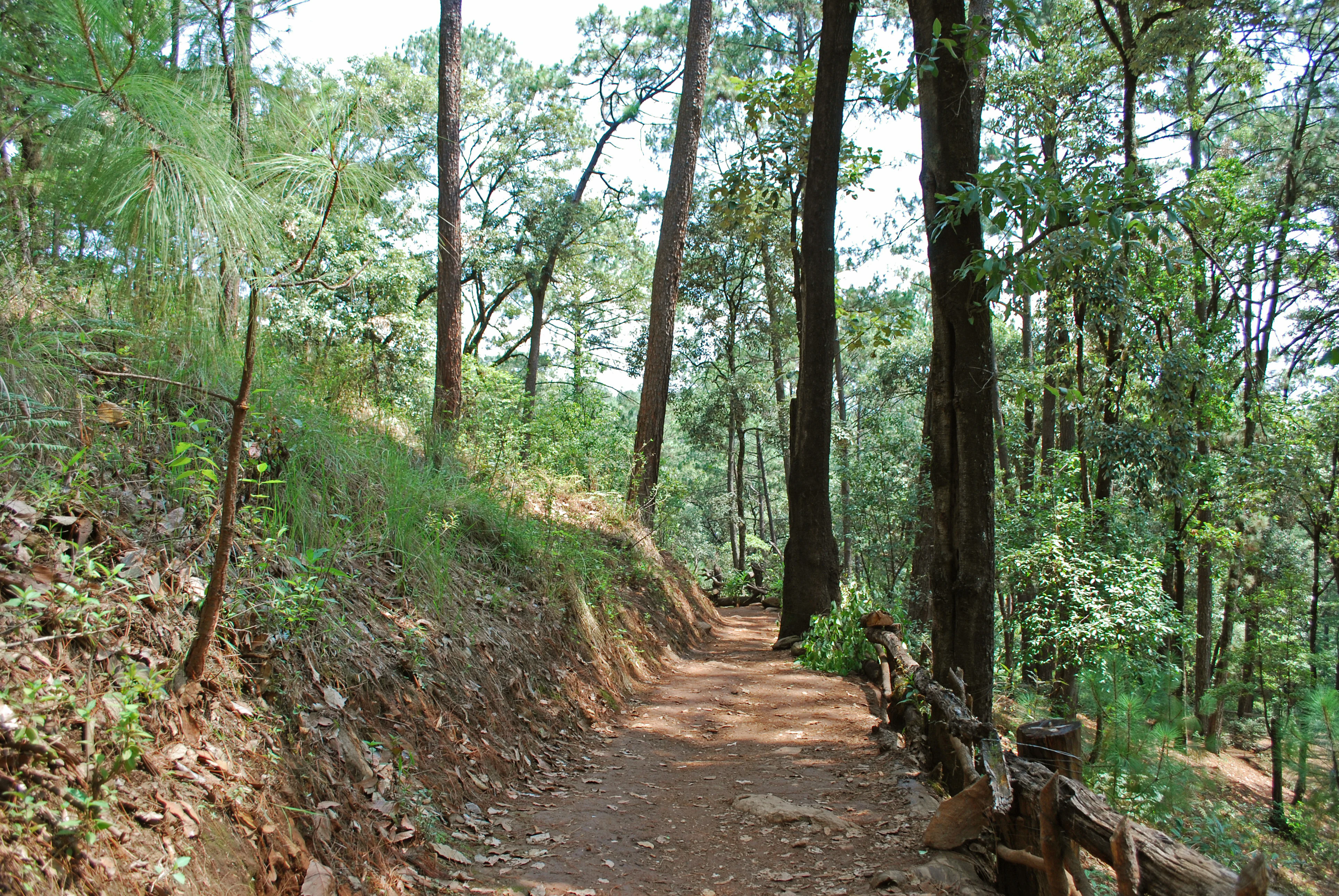
A narrow dirt hiking trail travels through a dense forest with tall pine trees, a steep earthen bank on the left, and a wooden log fence on the right.
A shaded dirt walking path winding through a pine forest in Velo de Novia Park.

Zona Protectora Forestal los terrenos constitutivos de las cuencas de los ríos Valle de Bravo, Malacatepec, Tilostoc y Temascaltepec history and protected-area timeline

The history of the protected area begins in 1941, when President Manuel Ávila Camacho issued a decree on 15 November designating the territory as a protected watershed. The original intent was to safeguard the river basins that supply water to central Mexico, an early example of Mexico using forest conservation as a tool for watershed management and urban water security.

In the decades that followed, the environmental framework of Mexico evolved, and the area's legal status was updated. On 23 June 2005, the original watershed protection designation was converted into a natural resources protection area under the country's broader system of protected area categories. Today it is administered by the National Commission of Natural Protected Areas as a category VI protected landscape, recognizing both its conservation value and its role in sustaining human uses of the landscape.

Zona Protectora Forestal los terrenos constitutivos de las cuencas de los ríos Valle de Bravo, Malacatepec, Tilostoc y Temascaltepec landscape and geographic character

The landscape is defined by the rolling, forested mountains of the Trans-Mexican Volcanic Belt, where volcanic geology has produced varied terrain with ridges, valleys, and steep slopes cut by numerous small streams. Elevations vary enough to generate distinct vegetation zones within relatively short horizontal distances, creating the layered scenery of dry lowland forest, oak and pine-oak woodlands, and high coniferous forests on the upper slopes.

The protected area sits astride the continental divide between the Lerma basin and the Balsas basin, with the Cutzamala and Temascaltepec rivers cutting their headwaters into these volcanic highlands. The terrain is not associated with a single dramatic peak but with a network of forested catchment valleys, of which the Valle de Bravo basin near the town of the same name is the most recognizable. Neighboring protected landscapes, including Nevado de Toluca National Park to the east and the Monarch Butterfly Biosphere Reserve to the northwest, frame the area in a larger mosaic of high-elevation Mexican conservation territory.

Zona Protectora Forestal los terrenos constitutivos de las cuencas de los ríos Valle de Bravo, Malacatepec, Tilostoc y Temascaltepec ecosystems, habitats, and plant life

The protected area's vegetation follows a classic elevational pattern for the Trans-Mexican Volcanic Belt. At the lowest elevations, tropical dry deciduous and semi-deciduous forests endure the seasonal drought typical of central Mexico's lower zones. Middle elevations transition to oak-dominated forests and mixed pine-oak woodlands, while the highest elevations carry closed-canopy pine and fir forests, including stands of the distinctive oyamel fir that is deeply associated with Mexico's highland forest identity.

The plant communities are not uniform blocks but mosaics shaped by slope, exposure, and soil. Mid-elevation slopes feature mixed broadleaf and conifer associations with species such as American hornbeam, Populus simaroa, and madroño, while lower and warmer zones host flame coral trees and a notable suite of orchids, several of which are Mexican endemics of conservation interest. This combination of deciduous, mixed, and coniferous elements gives the area an unusually rich ecological profile for a watershed protection zone.

Zona Protectora Forestal los terrenos constitutivos de las cuencas de los ríos Valle de Bravo, Malacatepec, Tilostoc y Temascaltepec wildlife and species highlights

The forest mosaic supports a diverse vertebrate community typical of central Mexico's mountain landscapes. Mammals include small felids such as the margay and jaguarundi, which depend on intact forest cover, as well as the more aquatic neotropical otter along the river corridors and the southern flying squirrel in mature woodland.

The area is also notable for its birdlife, with raptors such as Cooper's hawk, sharp-shinned hawk, and peregrine falcon hunting along the ridges and forest edges. Ground-dwelling birds of the oak and pine-oak forests include Montezuma quail and long-tailed wood partridge, while the canopy and understory host species such as the brown-backed solitaire and Strickland's woodpecker, a species strongly associated with Mexican pine-oak woodlands. The wider region also serves as the winter home of monarch butterflies, whose overwintering colonies in nearby high-elevation fir forests make this part of central Mexico among the most important insect habitats in North America.

Zona Protectora Forestal los terrenos constitutivos de las cuencas de los ríos Valle de Bravo, Malacatepec, Tilostoc y Temascaltepec conservation status and protection priorities

The protected area's conservation significance is fundamentally hydrological as much as ecological. By protecting the forested upper catchments of the Cutzamala and Temascaltepec rivers, it sustains the water yield and quality of streams that ultimately feed the Cutzamala-Lerma system supplying Mexico City. Forest cover in the watershed regulates runoff, reduces erosion, and helps maintain base flows during the dry season, linking the park's protection directly to urban water security.

Ecologically, the area preserves a continuous block of the Trans-Mexican Volcanic Belt, connecting with neighboring protected areas such as Nevado de Toluca National Park, Bosencheve National Park, and the Monarch Butterfly Biosphere Reserve. This connectivity strengthens conservation outcomes for wide-ranging species, including migratory butterflies and forest-dependent mammals. Its designation as a category VI protected area under the International Union for Conservation of Nature framework reflects a balance between active conservation and the sustainable use of natural resources by local communities.

Zona Protectora Forestal los terrenos constitutivos de las cuencas de los ríos Valle de Bravo, Malacatepec, Tilostoc y Temascaltepec cultural meaning and human context

The protected area surrounds the town of Valle de Bravo, a long-established settlement in the State of Mexico whose name is embedded in the park's official title. The region has a long tradition of rural land use, including forestry, agriculture, and small-scale grazing, which has shaped both the forest mosaic and the local economy. Indigenous and mestizo communities in the surrounding municipalities have historically depended on the watershed for water, timber, and subsistence farming, making the contemporary balance between protection and sustainable use a defining feature of the area's cultural context.

Top sights and standout views in Zona Protectora Forestal los terrenos constitutivos de las cuencas de los ríos Valle de Bravo, Malacatepec, Tilostoc y Temascaltepec

The protected area stands out for the unusual combination of a large forested watershed with direct urban water-supply importance, an elevational gradient that supports four distinct forest types, and a position within a network of high-value protected landscapes that includes monarch butterfly overwintering habitat and iconic Mexican national parks. Its long, descriptive name reflects the precision of its original 1941 watershed-protection purpose and the breadth of the basins it covers.

Best time to visit Zona Protectora Forestal los terrenos constitutivos de las cuencas de los ríos Valle de Bravo, Malacatepec, Tilostoc y Temascaltepec

The climate of central Mexico makes the cooler dry season, generally from late autumn through early spring, the most comfortable window for outdoor exploration in these mountains. During this period, the lower-elevation deciduous forests lose their leaves, opening up views across the landscape, while higher forests of pine and fir retain their greenery. The dry months also tend to offer clearer skies, better road conditions, and more reliable access to remote parts of the watershed than the rainy summer season, when downpours can make forest tracks difficult. Visitors interested in monarch butterflies typically time trips to the broader region during the overwintering months, when the surrounding fir forests host one of the most remarkable wildlife gatherings in North America.

Monthly climate preview

Twelve-month evidence from a representative point in high volcanic terrain

Valle de Bravo protected watershed monthly climate normals and annual pattern

The protected Valle de Bravo, Malacatepec, Tilostoc, and Temascaltepec river basins have 1991–2020 climate normals from a representative coordinate near 1,916 metres. The full profile compares monthly mean, minimum, and maximum temperatures with daily precipitation while avoiding one-point claims for the watershed's broad elevation range.
Annual mean18 °C
15 °C21 °C
Jan15°
Feb17°
Mar19°
Apr21°
May21°
Jun20°
Jul19°
Aug18°
Sep18°
Oct17°
Nov16°
Dec15°
Warmest month
May

21.4 °C

Coolest month
January

15.1 °C

Wettest month
August

6 mm/day

Driest month
December

0.2 mm/day

Park location guide

Geography guide, regional context, and park location map for Zona Protectora Forestal los terrenos constitutivos de las cuencas de los ríos Valle de Bravo, Malacatepec, Tilostoc y Temascaltepec

Zona Protectora Forestal los terrenos constitutivos de las cuencas de los ríos Valle de Bravo, Malacatepec, Tilostoc y Temascaltepec park geography, regions, and map view in Mexico

Understand where Zona Protectora Forestal los terrenos constitutivos de las cuencas de los ríos Valle de Bravo, Malacatepec, Tilostoc y Temascaltepec sits in Mexico through a broader geographic reading of the surrounding landscape, nearby location context, and its mapped position within the national park landscape.

How Zona Protectora Forestal los terrenos constitutivos de las cuencas de los ríos Valle de Bravo, Malacatepec, Tilostoc y Temascaltepec fits into Mexico

Mexico, officially the United Mexican States, is a country in North America spanning the Sierra Madre mountain ranges, coastal plains, and tropical regions. It borders the United States to the north, Guatemala and Belize to the southeast, and has coastlines along the Pacific Ocean, Gulf of Mexico, and Caribbean Sea. With a population exceeding 130 million, Mexico is home to one of the world's most significant concentrations of Indigenous languages alongside Spanish.

Wider geography shaping Zona Protectora Forestal los terrenos constitutivos de las cuencas de los ríos Valle de Bravo, Malacatepec, Tilostoc y Temascaltepec in Mexico

Mexico occupies a land area of 1,972,550 km2, making it the thirteenth-largest country in the world. The terrain is highly diverse, featuring the Sierra Madre Occidental and Sierra Madre Oriental mountain ranges, the Mexican Plateau, coastal lowlands along the Pacific and Gulf/Caribbean margins, and the Yucatan Peninsula. The country spans multiple climate zones from desert in the north to tropical rainforest in the south.

Map view of Zona Protectora Forestal los terrenos constitutivos de las cuencas de los ríos Valle de Bravo, Malacatepec, Tilostoc y Temascaltepec

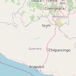
Use this park location map to pinpoint Zona Protectora Forestal los terrenos constitutivos de las cuencas de los ríos Valle de Bravo, Malacatepec, Tilostoc y Temascaltepec in Mexico, understand its exact geographic position, and read its mapped placement within the surrounding landscape more clearly.

Pigeon | © OpenStreetMap contributors

Location context for Zona Protectora Forestal los terrenos constitutivos de las cuencas de los ríos Valle de Bravo, Malacatepec, Tilostoc y Temascaltepec

State of Mexico

Volcanic relief, river basins, and forest transitions across elevation zones

Valle de Bravo protected watershed landscape and terrain in images

Images of the Zona Protectora Forestal for the Valle de Bravo, Malacatepec, Tilostoc, and Temascaltepec river basins reveal an extensive watershed landscape. Visual shifts from lower dry forest to high-elevation pine and fir terrain help explain the protected area's volcanic relief and continental-divide setting.

A narrow dirt hiking trail travels through a dense forest with tall pine trees, a steep earthen bank on the left, and a wooden log fence on the right.

Park atlas

Extend discovery across volcanic terrain, river basins, and regional forests

Compare other parks around the Valle de Bravo watershed landscape

Move from the protected Valle de Bravo, Malacatepec, Tilostoc, and Temascaltepec watersheds into other parks across the State of Mexico and surrounding geography. Comparing protected records gives the continental divide, volcanic relief, river systems, and elevation-linked forest transitions a broader regional frame.
National parkState of Mexico
About 24 km away#1 closest

North

Bosencheve National Park: National Park Protected Landscape within State of Mexico

Explore mapped boundaries and regional geographic context.

Bosencheve National Park, a key national park designation, offers a focused area for understanding protected landscapes and their geographic distribution. This entry provides detailed insights into its mapped boundaries and how it fits within the regional geography of the State of Mexico. It serves as a vital point for exploring Mexico's protected natural areas from a structured, atlas-driven perspective.

Area
146 km²
Established
1940
IUCN
II
Scope
Terrestrial
A watercolor illustration showing a misty mountain peak in the background and a grassy meadow with a winding path in the foreground.
Wildlife reserveEstado de México
About 34 km away#2 closest

East

Área de protección de flora y fauna Nevado de Toluca: Geography and Protected Landscapes

High-altitude volcanic massif and hydrological protected area

Situated in the State of Mexico, this wildlife reserve preserves the dramatic volcanic slopes of the Nevado de Toluca. The protected area features significant elevation gradients, crater lakes, and transition forests that anchor the regional watershed and provide a habitat for a wide array of plant and animal species.

Area
467.84 km²
Established
1936
IUCN
II
Relief
Mountain
National parkMexico State
About 34 km away#3 closest

East

Nevado de Toluca National Park: Protected Landscape Atlas and Geographic Context

Explore mapped boundaries and regional terrain within Mexico State.

Nevado de Toluca National Park serves as a key protected landscape for understanding the natural geography of Mexico State. This destination facilitates detailed exploration of its mapped territory, protected area identity, and the surrounding regional context. Discover how this national park fits into the larger geographic atlas through its distinct terrain and documented boundaries, offering a factual foundation for landscape research.

Area
510 km²
Established
1936
IUCN
VI
Relief
Mountain
Protected landscapeEstado de México
About 60 km away#4 closest

East

Ciénegas del Lerma: Protected Highland Wetland Landscape in the State of Mexico

Mapping the upper Lerma River basin and remnant marsh ecosystems.

Ciénegas del Lerma serves as a significant protected landscape in central Mexico, encompassing three main lakes and extensive marshland corridors. This atlas entry details the site's hydrological structure, encompassing open-water zones and alluvial soils that support diverse aquatic vegetation and endemic species within a human-influenced highland setting.

Area
30.23 km²
Established
2002
IUCN
VI
Relief
Upland
National parkMichoacán
About 65 km away#5 closest

Northwest

Insurgente José María Morelos y Pavón National Park: Mapped Protected Landscape in Michoacán

Discover its geographic context and protected area boundaries.

Explore Insurgente José María Morelos y Pavón National Park, a designated national park in Michoacán, Mexico. This page provides detailed insights into its protected status, mapped geographic features, and its role as a significant natural landscape within the regional atlas. Understand the park's protected boundaries and its contribution to the geographic understanding of Michoacán.

Area
71.92 km²
Established
1939
IUCN
II
Relief
Mountain
National parkMexico
About 76 km away#6 closest

East

La Marquesa National Park: Atlas of Protected Highland Forests in Mexico's Sierra de las Cruces

Explore its mapped boundaries and regional geographic context.

La Marquesa National Park represents a critical protected natural zone in Mexico's central highlands, specifically within the Sierra de las Cruces mountain range. Its landscape is defined by rugged volcanic terrain, featuring steep slopes and deep ravines densely covered by pine and oak woodlands. Designated as an early national park, it plays a crucial role in watershed protection for the surrounding region, preserving unique highland forest ecosystems and their associated biodiversity. This park offers a tangible example of protected landscape within Mexico's atlas, highlighting its ecological significance and geographic positioning.

IUCN
II
National parkState of Mexico
About 78 km away#7 closest

East

Lagunas de Zempoala National Park: Protected Landscape and Geographic Atlas Entry

Explore mapped boundaries and natural terrain context.

Lagunas de Zempoala National Park is a dedicated protected area within the State of Mexico, serving as a vital point for understanding national park geography and landscape mapping. This entry provides foundational atlas data on its protected boundaries and its specific natural terrain. It is designed for users seeking structured information on the park's geographic scope and its importance as a mapped natural landscape for regional context.

Area
47.9 km²
Established
1936
IUCN
II
Relief
Mountain
National parkMexico City
About 81 km away#8 closest

East

Desierto de los Leones National Park: Protected National Park and its Geographic Setting

Explore mapped boundaries and regional landscape context near Mexico City.

Delve into the specifics of Desierto de los Leones National Park, a designated national park recognized for its protected landscape. This MoriAtlas entry focuses on its geographic presence within the Mexico City region, providing clear insights into its mapped boundaries and the surrounding natural terrain. Understand the park's importance as a conservation area and its contribution to the regional geography through dedicated atlas data.

Area
18.67 km²
Established
1917
IUCN
II
Visitors
205K annual

Common questions about visiting, size, designation, and location context for Zona Protectora Forestal los terrenos constitutivos de las cuencas de los ríos Valle de Bravo, Malacatepec, Tilostoc y Temascaltepec

Zona Protectora Forestal los terrenos constitutivos de las cuencas de los ríos Valle de Bravo, Malacatepec, Tilostoc y Temascaltepec FAQs for park facts, access, geography, and protected area context

Find quick answers about Zona Protectora Forestal los terrenos constitutivos de las cuencas de los ríos Valle de Bravo, Malacatepec, Tilostoc y Temascaltepec, including protected-area facts, park geography, trail and visitor context, and how the park fits into its surrounding country and regional landscape.
MoriAtlas Explorer

Continue Your Protected Areas Search Across the Global Atlas

Deepen your exploration by continuing the structured search for national parks and protected areas worldwide. Utilize the comprehensive filtering capabilities to compare different conservation landscapes and refine your understanding of global park geography. Discover more about the distribution and characteristics of protected natural areas.

Global natural geography