
Mori Atlas logo
Wildlife reserveAsan Conservation Reserve

A convergence of engineered reservoir landscapes and protected waterbird habitats in the Doon Valley

Asan Conservation Reserve: Mapping a Ramsar Wetland and Wildlife Reserve in Uttarakhand India

Asan Conservation Reserve occupies a unique position in Uttarakhand, where the Asan River meets the Eastern Yamuna Canal to form the calm waters of Dhalipur Lake. This protected wildlife reserve functions as a vital wetland of international importance, representing a critical confluence of mid-twentieth-century water management infrastructure and essential bird habitat within the Himalayan foothills.

wetlandRamsar sitebird sanctuarymanmade reservoirmigratory birdswaterbird habitat
A flat-style digital illustration of a scenic mountain landscape featuring a waterfall cascading down a cliff, a river flowing through a forested valley, and stylized clouds.

Asan Conservation Reserve

Wildlife reserve

Park overview

Structured park overview, official facts, and landscape profile for Asan Conservation Reserve

Asan Conservation Reserve park facts, protected area profile, and essential visitor context

Review the core facts for Asan Conservation Reserve, including designation, size, terrain, visitor scale, habitats, and operating context in one park-focused overview.

About Asan Conservation Reserve

Asan Conservation Reserve occupies a distinctive niche in India's network of protected wetlands. It is a working, manmade reservoir that has, over more than half a century, matured into a habitat complex of real ecological importance. The reserve sits in the lower Doon Valley, in the part of Uttarakhand that tumbles down toward the Yamuna, and draws its character from the river system that feeds it. The Asan River, originating in streams cascading off the southern slopes of Mussoorie, joins the Eastern Yamuna Canal near Dakpathar; the Asan Barrage, completed in 1967, holds those waters back to form a roughly four square kilometer lake that is the heart of the reserve.

The reserve's identity is shaped equally by water and by birdlife. Open water, fringing shallows, and the wooded margins of the Doon Valley provide a layered habitat structure that supports a rich and varied avian community. According to local accounts and visitor records, the wetland is known to host around fifty-three species, including substantial numbers of migratory species that travel from Eurasian breeding grounds. The seasonal turnover of birds, combined with resident waterfowl and waders, gives the site a dynamic feel across the year and underpins its appeal to birdwatchers.

Asan Conservation Reserve is more than a local birding hotspot. Its designation in 2020 as Uttarakhand's first Ramsar site placed it within the global framework for wetland conservation, joining a network of sites recognized for their ecological, hydrological, and biological value. Being a manmade wetland, it also offers a compelling example of how engineering infrastructure and ecological recovery can intersect. The barrage continues to support hydropower generation through the Kulhal and Khara power stations, while the reservoir above it has become, by another measure, a sanctuary.

For visitors arriving in the Doon Valley, the reserve offers an accessible introduction to wetland ecology in the lower Himalayas. Its setting along the borderlands of Uttarakhand and Himachal Pradesh, with the Shivalik range nearby and the broader valley opening out around Dehradun, frames the wetland as part of a much larger ecological mosaic. It is this combination of compactness, accessibility, ecological richness, and international recognition that gives Asan Conservation Reserve its particular identity among Indian protected natural areas.

Quick facts and research context for Asan Conservation Reserve

Asan Conservation Reserve is located near Dakpathar in Dehradun district, Uttarakhand, roughly 28 km northwest of Dehradun city. It sits at the confluence of the Asan River and the Eastern Yamuna Canal, on the border between Uttarakhand and Himachal Pradesh. The reserve is centered on a manmade reservoir created by the Asan Barrage, a 287.5-meter structure built and commissioned in 1967. The wetland covers about four square kilometers of open water and adjoining habitats.

The site was formally designated as Uttarakhand's first Ramsar site on 21 July 2020, recorded under Ramsar reference number 2437. It functions simultaneously as a working piece of hydropower infrastructure, feeding the Kulhal and Khara power stations, and as a protected bird sanctuary. Birdwatching and boating are the primary recognized visitor activities, with peak visiting periods in autumn and spring.

Protection and recognition

Documented international recognition and protected area designation records

Asan Conservation Reserve Protection Status and Ramsar Recognition

Asan Conservation Reserve maintains documented protection status anchored by official Ramsar wetland recognition records. Structured administrative records outline international designation history without assuming external management outcomes.
Park context

Deeper park guide and search-rich context for Asan Conservation Reserve

Asan Conservation Reserve history, landscape, wildlife, and travel context

Explore Asan Conservation Reserve through its history, landscape character, ecosystems, wildlife, conservation priorities, cultural context, and seasonal travel timing in a structured park guide built for atlas discovery and search intent.

Why Asan Conservation Reserve stands out

Asan Conservation Reserve is best known as a major birdwatching destination in northern India, built around a manmade wetland created by the Asan Barrage. The reservoir, formed where the Asan River meets the Eastern Yamuna Canal, hosts a year-round waterbird community that includes migratory species arriving from across Eurasia. Its formal recognition as Uttarakhand's first Ramsar site has placed it on the international map of important wetlands, while its proximity to Dehradun and Dakpathar makes it unusually accessible compared with many other Ramsar sites in the Himalayan foothills. The reserve is also recognized for the unusual combination of ecological and engineering functions it embodies. The same barrage that defines the wetland also feeds downstream hydroelectric generation at Kulhal and Khara, illustrating how a single piece of mid-twentieth-century infrastructure can, over decades, evolve into a conservation landmark. The presence of threatened and IUCN Red Listed species among the recorded birdlife gives the site a conservation profile that reaches beyond its regional significance.
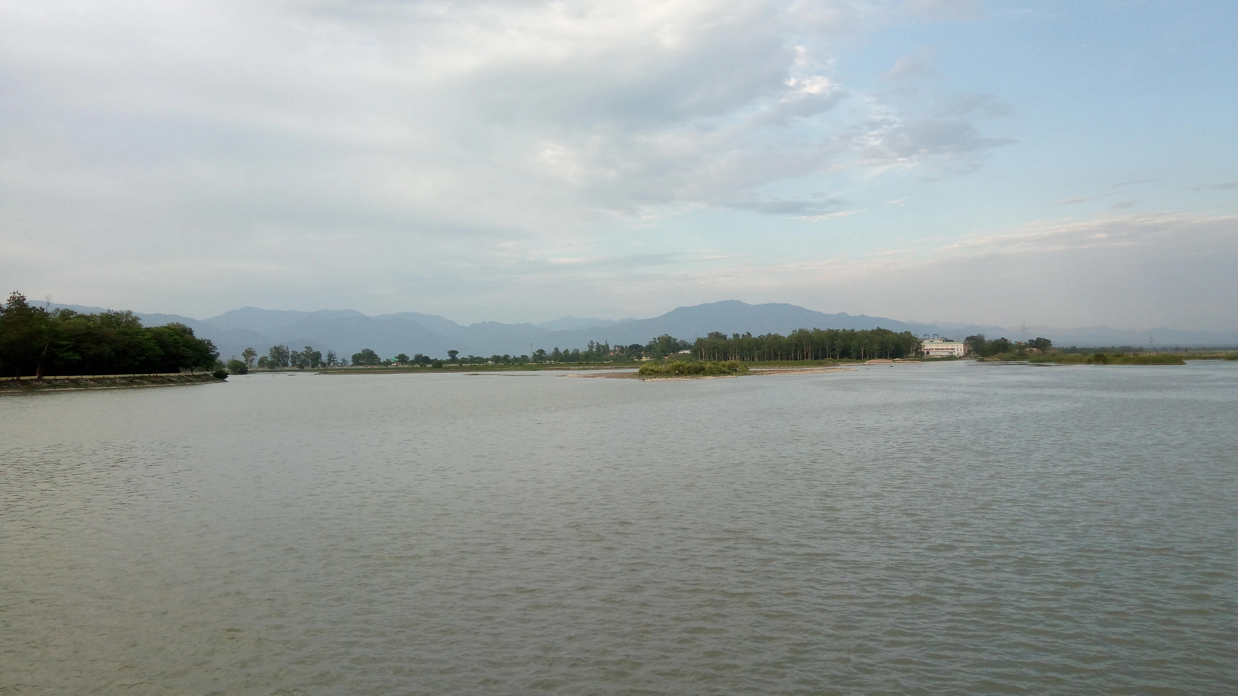
Wide shot of the Asan Barrage water reservoir with a distant shoreline, low hills, and a cloudy sky.
A view of the Asan Barrage; the primary water body within the Asan Conservation Reserve.

Asan Conservation Reserve history and protected-area timeline

The history of Asan Conservation Reserve begins with the construction of the Asan Barrage, which was completed and commissioned in 1967 at the confluence of the Eastern Yamuna Canal and the Asan River near Dakpathar. The barrage was originally built as part of a wider system of water management and hydropower infrastructure in the Doon Valley, a region where rivers descending from the Mussoorie range and the Shivalik Hills have long been tapped for irrigation and power. The 287.5-meter barrage created a stable, year-round reservoir upstream, fed by the Asan River and the discharge channel of the Yamuna system.

As the reservoir matured, its ecological value became apparent. By the latter decades of the twentieth century, the wetland had become recognized as an important habitat for waterbirds, including migratory species that visit the Doon Valley seasonally. A bird sanctuary was progressively acknowledged on the site, even though the underlying infrastructure remained fundamentally an engineered water body rather than a natural lake. Birdwatchers, naturalists, and conservation groups began documenting the site's avifauna, and the area became established as a popular birding destination within Uttarakhand.

The most significant milestone in the site's modern history came on 21 July 2020, when Asan Conservation Reserve was formally designated as Uttarakhand's first Ramsar site. Listed under reference number 2437 of the Ramsar Convention, the designation placed the wetland within the international system for the conservation of wetlands of importance, acknowledging its value for waterbirds, hydrology, and biodiversity. The recognition marked a formal transition for the site, from a reservoir with growing ecological recognition to a protected wetland of international standing, while the barrage itself continues to serve its original hydropower and water management roles.

Asan Conservation Reserve landscape and geographic character

The landscape of Asan Conservation Reserve is defined by contained, calm water framed by the foothills of the lower Doon Valley. The Asan Barrage holds back the waters of the Asan River and the discharge from the Eastern Yamuna Canal to form Dhalipur Lake, also called the Asan Reservoir, a roughly four square kilometer sheet of open water that lies just south of Dakpathar and close to the Uttar Pradesh and Himachal Pradesh borders. The reservoir is broad and relatively shallow, with shorelines that grade gently into reedbeds, marshy edges, and patches of surrounding woodland.

Surrounding terrain shapes the visual character of the reserve. To the north and east, the wooded slopes of the Doon Valley rise toward the Mussoorie range, while to the south, the lower Shivalik Hills form a softer, more broken skyline. The Asan River itself descends from Mussoorie, passing through Robber's Cave near Dehradun and gathering tributaries along the way before settling into the broad, flatter valley near Premnagar from which it enters the reservoir. The result is a transition zone between mountain stream and lowland river, condensed within the relatively small footprint of the reserve.

The engineered elements are integrated into this landscape in ways that have, over decades, become part of its character. The barrage itself stretches across the valley, and the Eastern Yamuna Canal carries water onward to the Kulhal and Khara power stations. The juxtaposition of calm reservoir water, the linear geometry of the barrage, and the surrounding forested foothills gives the reserve a distinctive setting among Uttarakhand's protected natural areas, one where constructed and natural landscapes meet rather than stand apart.

Asan Conservation Reserve ecosystems, habitats, and plant life

Ecologically, Asan Conservation Reserve is primarily a freshwater wetland system embedded within the broader forest mosaic of the Doon Valley and the lower Shivalik Hills. The reserve's habitats open with the broad surface of Dhalipur Lake, ringed by fringing shallows, reed-dominated margins, and areas of wet scrub where emergent vegetation has established itself along the fluctuating edges of the reservoir. Beyond these wetland margins, the reserve interfaces with forest and woodland typical of the middle and lower Doon Valley, supporting birds and other wildlife that move between the open water and the surrounding tree cover.

The vegetation of the area reflects a mix of wetland and sub-Himalayan forest communities. Aquatic and marsh plants provide structure along the shoreline, while the surrounding slopes support dry deciduous and mixed broadleaf forest characteristic of the lower elevations of Uttarakhand. The Asan River corridor upstream, including sections near Robber's Cave, Tapkeshwar Mahadev, and Premnagar, contributes to habitat heterogeneity by linking the reserve to a wider network of streams, banks, and wooded patches.

Because the reserve is a manmade wetland, its ecological profile has developed over time rather than emerging from an undisturbed natural baseline. The reservoir's hydrological stability, fed continuously by the Asan River and canal discharge, has allowed plant and animal communities to establish patterns that are now consistent enough to attract reliable seasonal use by migratory waterbirds. The result is a habitat that, while engineered in origin, behaves ecologically as a functioning wetland ecosystem within the Doon Valley.

Asan Conservation Reserve wildlife and species highlights

The wildlife profile of Asan Conservation Reserve is dominated by birds, which is the primary reason the site is recognized as a protected area and a popular destination for naturalists. The wetland hosts around fifty-three recorded species, of which a substantial share are migratory birds that visit the Doon Valley from breeding grounds across Eurasia. This mix of resident and migratory waterbirds, waders, and associated species gives the reserve a markedly seasonal character, with the bird community shifting through the autumn, winter, and spring months as different species arrive, replace one another, and depart.

Among the species recorded at Asan are birds considered threatened or otherwise significant on the IUCN Red List, a presence that has helped drive the site's recognition as a wetland of international importance. The combination of open water, shallow margins, and proximity to forested foothills allows the reserve to support a wide range of ecological guilds, from diving and dabbling waterfowl to shoreline waders and woodland species that use the reserve as part of broader foraging and roosting ranges.

Non-avian wildlife is shaped by the same mosaic of water and forest edge that defines the reserve's habitat structure. The wooded slopes and river corridors of the wider Doon Valley around the reserve carry the typical mammal and reptile communities of the lower Uttarakhand foothills, with the wetland itself providing seasonal abundance of food resources. While the reserve's main conservation identity is built around its birdlife, the broader ecological setting supports the wider forest and streamside fauna of the region.

Asan Conservation Reserve conservation status and protection priorities

Asan Conservation Reserve's conservation significance rests on its dual character as both a working reservoir and a recognized wetland of international importance. Designated as Uttarakhand's first Ramsar site in July 2020 under reference number 2437, the reserve is officially acknowledged as a wetland whose ecological character, hydrological function, and biodiversity value rise to international standards under the Ramsar Convention. The designation ties the site into a global framework for wetland protection and obliges continued attention to its ecological condition.

What makes the reserve's conservation profile notable is the way it has emerged from infrastructure rather than from wilderness. The Asan Barrage, completed in 1967, was originally conceived as a component of water management and hydropower generation in the Doon Valley, feeding the Kulhal and Khara power stations along the Eastern Yamuna Canal. Over time, the reservoir above the barrage matured into a wetland with recognized habitat value for resident and migratory birdlife, including species of conservation concern tracked by the IUCN. The Ramsar designation formalizes this transition, treating the wetland as a conservation asset alongside its continuing role in the regional water and power system.

For Uttarakhand, the reserve represents a meaningful addition to a state whose conservation profile is otherwise dominated by forests and high-elevation protected areas. As a lowland, wetland-centered Ramsar site close to Dehradun, Asan Conservation Reserve broadens the ecological scope of the state's protected-area network, adding river and wetland conservation to a portfolio that includes montane forest and alpine habitats. The reserve also provides a platform for ongoing bird monitoring, public engagement with wetland conservation, and the recognition of manmade wetlands as legitimate components of India's protected natural heritage.

Asan Conservation Reserve cultural meaning and human context

The Asan River, around which the reserve has grown, carries a cultural resonance that goes well beyond its modern hydrological role. The river has been identified with the Asmanvati of the Rigveda, the oldest stratum of Vedic literature, linking the watercourse to a layered religious and literary heritage that reaches back into early South Asian cultural history. The Tapkeshwar Mahadev temple near the river's course through the upper Doon Valley and other shrines along its banks reflect this continued cultural engagement with the river and its waters.

The Doon Valley itself has a long history as a threshold landscape between the Himalayan foothills and the Indo-Gangetic plains, and Dakpathar and Dehradun sit at the center of regional identity in Uttarakhand. Visitor engagement with the reserve often combines birdwatching and boating with a broader appreciation of the valley's geography, including nearby sites such as Robber's Cave and the Mussoorie range. While Asan Conservation Reserve is fundamentally an ecological and hydrological story, it sits within a regional cultural landscape where rivers, temples, and forested hills have held meaning for local communities over many centuries.

Top sights and standout views in Asan Conservation Reserve

The standout quality of Asan Conservation Reserve is the convergence of three unusual features within a single compact site: an engineered reservoir of mid-twentieth-century origin, a Ramsar-recognized international wetland, and one of the most accessible birdwatching locations in the lower Himalayas. The reserve delivers a layered visitor experience, combining the visual calm of Dhalipur Lake with the seasonal drama of migratory waterbird arrivals and the wider setting of the Doon Valley's forested foothills.

Equally distinctive is the reserve's role in Uttarakhand's conservation map. As the state's first Ramsar site, it sets a benchmark for how manmade wetlands can be reintegrated into conservation policy, and it broadens the geographic and ecological scope of protected natural areas in a state better known for its forest reserves and highland parks. The presence of threatened and IUCN-tracked species within a working hydropower reservoir offers a compelling example of how infrastructure and biodiversity can, under the right conditions, coexist and reinforce one another.

Best time to visit Asan Conservation Reserve

Asan Conservation Reserve has a strongly seasonal character driven by the migratory cycle of waterbirds in the northern Indian subcontinent and by the calmer weather of the cooler months in the Doon Valley. The period from October through December marks the arrival of many overwintering and passage migrants, filling the wetland with a rotating cast of species and making this one of the strongest windows for birdwatching. A second peak run runs from mid-March through the end of April, when late winter visitors are still present and spring migrants begin to move through, offering a distinct seasonal palette of species.

Outside these windows, the reserve remains accessible throughout the year because the reservoir is fed continuously by the Asan River and the discharge from the Eastern Yamuna Canal. Summer months tend to be hotter and quieter in terms of visitor activity, while the monsoon season can affect accessibility in the wider Doon Valley. Visitors focused on birdwatching and natural景观 photography will find the cool, clear months between late autumn and mid-spring most rewarding in terms of both weather and species variety, though the wetland itself supports meaningful wildlife interest across the broader year.
Monthly climate preview

Long-term representative monthly temperature and precipitation data for Uttarakhand

Asan Conservation Reserve Climate Normals and Annual Weather Patterns

Historical monitoring data records annual temperature variations from moderate winter lows to high summer maximums alongside distinct precipitation shifts. Examining the complete monthly climate dataset provides deeper insight into long-term environmental patterns across the protected terrain.
Annual mean22 °C
12 °C31 °C
Jan12°
Feb14°
Mar19°
Apr25°
May30°
Jun31°
Jul28°
Aug26°
Sep24°
Oct21°
Nov17°
Dec13°
Warmest month
June

30.6 °C

Coolest month
January

11.7 °C

Wettest month
August

12.1 mm/day

Driest month
November

0.2 mm/day

Park location guide

Geography guide, regional context, and park location map for Asan Conservation Reserve

Asan Conservation Reserve park geography, regions, and map view in India

Understand where Asan Conservation Reserve sits in India through a broader geographic reading of the surrounding landscape, nearby location context, and its mapped position within the national park landscape.

How Asan Conservation Reserve fits into India

India is a South Asian country bordered by the Indian Ocean, Arabian Sea, and Bay of Bengal. It shares land borders with Pakistan, China, Nepal, Bhutan, Bangladesh, and Myanmar. The country has a population of over 1.4 billion people and operates as a federal parliamentary republic with its capital in New Delhi.

Wider geography shaping Asan Conservation Reserve in India

India occupies the Indian subcontinent in South Asia, bordered by the Arabian Sea to the southwest, the Bay of Bengal to the southeast, and the Indian Ocean to the south. It shares land borders with Pakistan to the west, China, Nepal, and Bhutan to the north, and Bangladesh and Myanmar to the east. The territory also includes the Andaman and Nicobar Islands in the Indian Ocean.

Map view of Asan Conservation Reserve

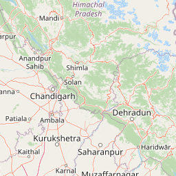
Use this park location map to pinpoint Asan Conservation Reserve in India, understand its exact geographic position, and read its mapped placement within the surrounding landscape more clearly.

Pigeon | © OpenStreetMap contributors

Location context for Asan Conservation Reserve

Uttarakhand
Recorded earthquake history

Examine the Asan Conservation Reserve Earthquake History and Seismic Records

Explore the historical collection of seismic events recorded in the vicinity of the Asan Conservation Reserve. This database offers a transparent look at past earthquake activity in the Doon Valley region, helping to build a comprehensive understanding of the local geographic context through structured, site-specific records.

Asan Conservation Reserve Earthquake History

Catalogued events

4 events

Strongest magnitude

Magnitude 4.2

Most recent event

Aug 10, 2021

This history includes earthquakes recorded inside the park or within 50 km of its borders

Visual exploration of wetland habitats, reservoir terrain, and Himalayan foothill views

Asan Conservation Reserve Photos, Landscapes, and Wetland Scenery

Examine detailed photographs of Asan Conservation Reserve to study open reservoir waters, marshy shorelines, and surrounding forest boundaries. Visual documentation reveals the distinct geography of the Doon Valley wetland, illustrating how engineered barriers and natural river confluences shape the protected habitat.

Wide shot of the Asan Barrage water reservoir with a distant shoreline, low hills, and a cloudy sky.

Park atlas

Compare regional wetland habitats and connected Himalayan foothill landscapes

Explore Protected Areas and Parks Near Asan Conservation Reserve

Browse other parks and protected areas located across the surrounding Doon Valley region to evaluate regional biodiversity patterns. Expand conservation comparisons by examining nearby reserves and wetland habitats that share similar lowland Himalayan geography.
National parkHaryana
About 14 km away#1 closest

Southwest

Kalesar National Park: Exploring Haryana's Unique Sal Forest Protected Landscape

Discover mapped terrain and regional geography within the Shivalik foothills.

Kalesar National Park, located in the Shivalik foothills of Haryana, is a crucial protected area renowned for its natural sal forest, a rare ecological feature in the state. Spanning approximately 53 square kilometers, the park's diverse terrain offers insights into regional geography and conservation, serving as a vital habitat for leopards and a corridor for wild elephants. Its mapped boundaries encompass a unique landscape that contrasts sharply with surrounding agricultural lands, making it a significant point of study for protected-area enthusiasts.

Area
53 km²
Established
2003
IUCN
IV
Relief
Highland
National parkIndia
About 18 km away#2 closest

West

Simbalbara National Park: National Park in India's Himalayan Foothills

Explore its dense sal forests and unique terrain.

Simbalbara National Park is a protected area recognized for its extensive sal forests and its role as a vital habitat for tigers and other large mammals in the Himalayan foothills of India. The park's landscape is defined by the Kiyarda Dun valley, featuring a mix of dense forest-covered slopes, open grassy glades, and a perennial stream. This protected area offers a representative sample of the sal-dominated forest ecosystems at lower Himalayan elevations, providing a distinct geographic and ecological context for exploration.

Area
27.88 km²
Established
2010
IUCN
II
Relief
Upland
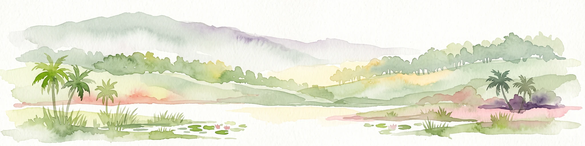
Watercolor painting of a lake surrounded by palms, reeds, and soft hills in the background.
Wildlife reserveHimachal Pradesh
About 27 km away#3 closest

Northwest

Renuka Sanctuary: Protected Wildlife Reserve and Ramsar Wetland Site in Himachal Pradesh

Ecological catchment and forest basin in the low Himalayan hills

Renuka Sanctuary is a dedicated wildlife reserve in Himachal Pradesh defined by the expansive Renuka Lake and its surrounding dry deciduous forest cover. This Ramsar wetland area protects the critical catchment zone of the state's largest natural lake, offering a unique intersection of conservation land and culturally significant natural terrain.

Area
4.028 km²
Water
Major water bodies
National parkUttarakhand
About 60 km away#4 closest

Southeast

Rajaji National Park: Uttarakhand National Park and Tiger Reserve Landscape

Sivalik Hills geography and protected area context

Rajaji National Park is a vital protected landscape situated in the Uttarakhand region of India, recognized as both a national park and a tiger reserve. Its territory spans across the Sivalik Hills, offering a diverse terrain characterized by deciduous forests and riparian ecosystems. The park's location along the Ganga river significantly influences its ecology, providing a unique geographic context for its protected status and wildlife significance.

Area
820.5 km²
Established
1983
IUCN
II
Relief
Highland
National parkUttarkashi District
About 92 km away#5 closest

Northeast

Govind Pashu Vihar National Park: Exploring India's Uttarkashi District Protected Landscape

Mapped protected area boundaries and regional geographic context.

Investigate Govind Pashu Vihar National Park, a key protected area in Uttarkashi District, India. This resource provides essential information on its designation as a national park, focusing on its geographic spread, mapped landscape features, and its placement within the regional atlas for comprehensive discovery. Understand the distinctiveness of this protected land's terrain and its role in conservation geography.

Area
958 km²
Established
1955
IUCN
II
Relief
Mountain
Wildlife reserveUttar Pradesh
109 km away#6 closest

South

Haiderpur Wetland Wildlife Reserve: Exploring the Ganges Floodplain and Migratory Flyways

A critical Ramsar-designated freshwater marshland within Uttar Pradesh

Spanning over 6,900 hectares, Haiderpur Wetland represents a significant protected area where open water and floodplain terrain create a haven for migratory birds along the Central Asian Flyway. The reserve, positioned within the broader Hastinapur Wildlife Sanctuary, offers a detailed look at how artificial water control impacts local riverine biodiversity and landscape development in North India.

Area
69 km²
Established
1984
Water
Water-dominated
A horizontal watercolor painting depicting a meandering river passing through green wetlands and low-lying hills with a soft, misty background.
Protected areaPunjab
About 128 km away#7 closest

Northwest

Ropar Wetland: Geographic Mapping of a Punjab Freshwater Protected Landscape

Riverine and lacustrine geography in the Shivalik foothills.

Ropar Wetland stands as a significant protected area within the Punjab region, defined by its man-made reservoir origin and subsequent ecological maturation. This site serves as a vital transition point between the Shivalik hills and the Indo-Gangetic plains, hosting a dense variety of marshland, forest, and open water habitats that support rare reptile species and extensive bird populations.

Area
13.65 km²
Established
1952
Relief
Lowland
Climate
Subtropical
National parkUttarakhand
130 km away#8 closest

Southeast

Jim Corbett National Park: Uttarakhand National Park and Protected Landscape Atlas

Mapped Boundaries and Regional Geographic Context

Jim Corbett National Park offers a specific entry point for understanding protected landscapes and their geographic significance. As a designated national park within Uttarakhand, India, it provides a distinct case study for exploring mapped boundaries and regional natural terrain. This detailed view allows for a deep dive into the park's identity as a protected area, highlighting its placement within the larger atlas of India's natural heritage and its contribution to the Himalayan geographic narrative.

Area
1,288.31 km²
Established
1936
IUCN
II
Visitors
365K annual

Common questions about visiting, size, designation, and location context for Asan Conservation Reserve

Asan Conservation Reserve FAQs for park facts, access, geography, and protected area context

Find quick answers about Asan Conservation Reserve, including protected-area facts, park geography, trail and visitor context, and how the park fits into its surrounding country and regional landscape.
MoriAtlas Explorer

Continue Your Protected Areas Search Across the Global Atlas

Deepen your exploration by continuing the structured search for national parks and protected areas worldwide. Utilize the comprehensive filtering capabilities to compare different conservation landscapes and refine your understanding of global park geography. Discover more about the distribution and characteristics of protected natural areas.

Global natural geography