
Mori Atlas logo
Wildlife reserveRenuka Sanctuary

A distinct Ramsar wetland environment featuring dry deciduous forest and critical lake catchment zones

Renuka Sanctuary: Exploring the Protected Wildlife Reserve and Sacred Lake Landscapes of Himachal Pradesh

Renuka Sanctuary serves as a significant protected wildlife reserve in the Sirmaur district of Himachal Pradesh, safeguarding the ecological integrity of Renuka Lake and its surrounding forest cover. This unique landscape of dry mixed deciduous and sal forest provides a specialized refuge for local flora and fauna, while functioning as a Ramsar wetland of international importance. Beyond its environmental status, the sanctuary is anchored by the deep cultural history of Renuka Lake, creating an integrated landscape where geological features and traditional values converge in the lower Himalayan hills.

wetlandRamsar sitelake ecosystemdry deciduous forestsal forestlow-altitude reserve
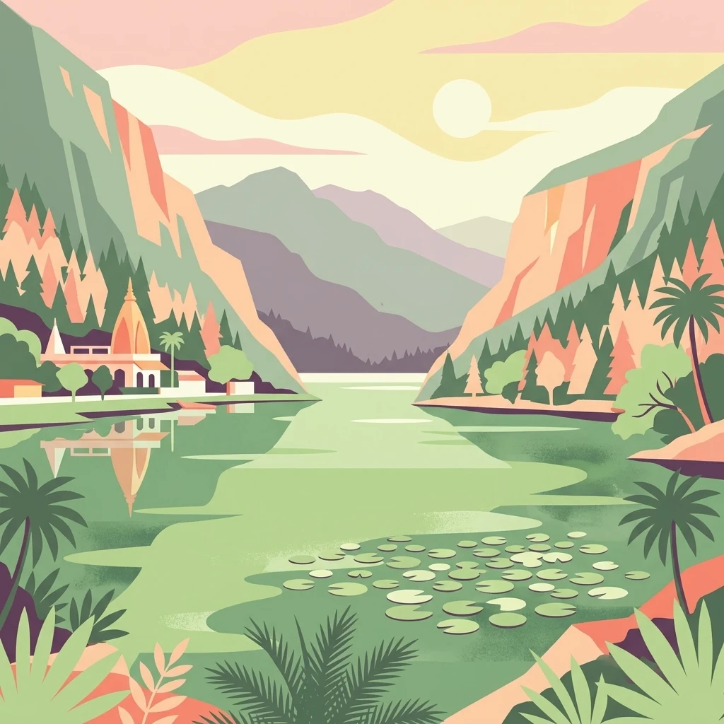
A stylized flat illustration of a lake surrounded by mountains and palm trees with a temple on the left shore.

Renuka Sanctuary

Wildlife reserve

Park overview

Structured park overview, official facts, and landscape profile for Renuka Sanctuary

Renuka Sanctuary park facts, protected area profile, and essential visitor context

Review the core facts for Renuka Sanctuary, including designation, size, terrain, visitor scale, habitats, and operating context in one park-focused overview.

About Renuka Sanctuary

Renuka Sanctuary is a small but meaningful protected area in the low hills of Sirmaur district in Himachal Pradesh. Unlike the high-altitude reserves of the greater Himalayas, Renuka sits at a modest elevation where forests and wetlands blend into a single protected landscape. Its center of gravity is Renuka Lake, a low-altitude natural lake widely regarded as the largest in Himachal Pradesh, around which the sanctuary's forest cover has been preserved.

The reserve is administered in conjunction with the Renuka Reserve Forest, an area designated as an Abhayaranya, a traditional Indian concept of protected refuge. This designation underlines both the ecological sensitivity of the forests around the lake and the cultural weight the landscape carries. A buffer zone of roughly 3 square kilometers has also been declared outside the formal sanctuary boundary, extending protected status to a wider fringe of land and helping shield the lake catchment from external pressures.

Ecologically, the sanctuary falls within biogeographical zone 4 under the Wildlife Institute of India's classification, an area characterized by dry tropical and subtropical forest types. The vegetation profile is dominated by dry mixed deciduous forest with patches of dry sal forest, marking the area as a transition landscape between the wetter forests of the outer Himalayas and the drier woodland communities further south.

Renuka's importance extends well beyond its modest footprint. The lake and surrounding sanctuary were jointly recognized as a Ramsar Wetland in 2005, drawing international attention to the site's ecological value and placing it on the global list of wetlands of conservation significance. This recognition is unusual for a wildlife sanctuary with such a small core area, and reflects the broader importance of the lake as a habitat and hydrological feature.

The sanctuary is also deeply woven into religious life in Himachal Pradesh. The lake is named for the goddess Renuka, mother of Parashurama, and the surrounding temples, sacred hillocks, and pilgrimage traditions make the area a focal point for devotees, particularly during seasonal fairs. This convergence of biodiversity, hydrology, and sacred geography gives Renuka Sanctuary a layered identity that sets it apart from other protected areas in northern India.

Quick facts and research context for Renuka Sanctuary

Renuka Sanctuary lies in Sirmaur district in southwestern Himachal Pradesh, India, covering roughly 4 square kilometers of forest wrapped around Renuka Lake. The surrounding lake is classified as a Ramsar wetland, an internationally recognized designation for sites of conservation value, since November 2005.

The sanctuary falls within biogeographical zone 4 of the Wildlife Institute of India's classification system, and its vegetation is characterized as dry mixed deciduous forest interspersed with dry sal woodland. An additional buffer belt of approximately 3 square kilometers has been declared on the periphery to strengthen protection around the lake and forest ecosystem.

Protection and recognition

Explore structured details regarding protected area designation and management scope.

Renuka Sanctuary Protection Status and Documented Conservation Record

Renuka Sanctuary features structured records detailing documented protection status, management scope, and official designation history where available. Review the compiled administrative facts to understand the conservation framework governing this protected natural area.

Protection details

Buffer area
3 km²
Park context

Deeper park guide and search-rich context for Renuka Sanctuary

Renuka Sanctuary history, landscape, wildlife, and travel context

Explore Renuka Sanctuary through its history, landscape character, ecosystems, wildlife, conservation priorities, cultural context, and seasonal travel timing in a structured park guide built for atlas discovery and search intent.

Why Renuka Sanctuary stands out

Renuka Sanctuary is best known for safeguarding the forested catchment around Renuka Lake, the largest lake in Himachal Pradesh, and for the lake's recognition as an internationally important Ramsar wetland. The reserve's identity is uniquely shaped by the overlap of ecological protection and deep religious tradition, since the lake itself is revered as the abode of the goddess Renuka and figures prominently in Hindu mythology. Its compact but ecologically representative dry deciduous and sal forest cover, set against a low-altitude lake environment, makes it a distinctive lowland protected area within a state otherwise known for its higher Himalayan landscapes. The annual Renuka fair and the Parashurama legend add a strong cultural layer that distinguishes the sanctuary from other wildlife reserves in the region.
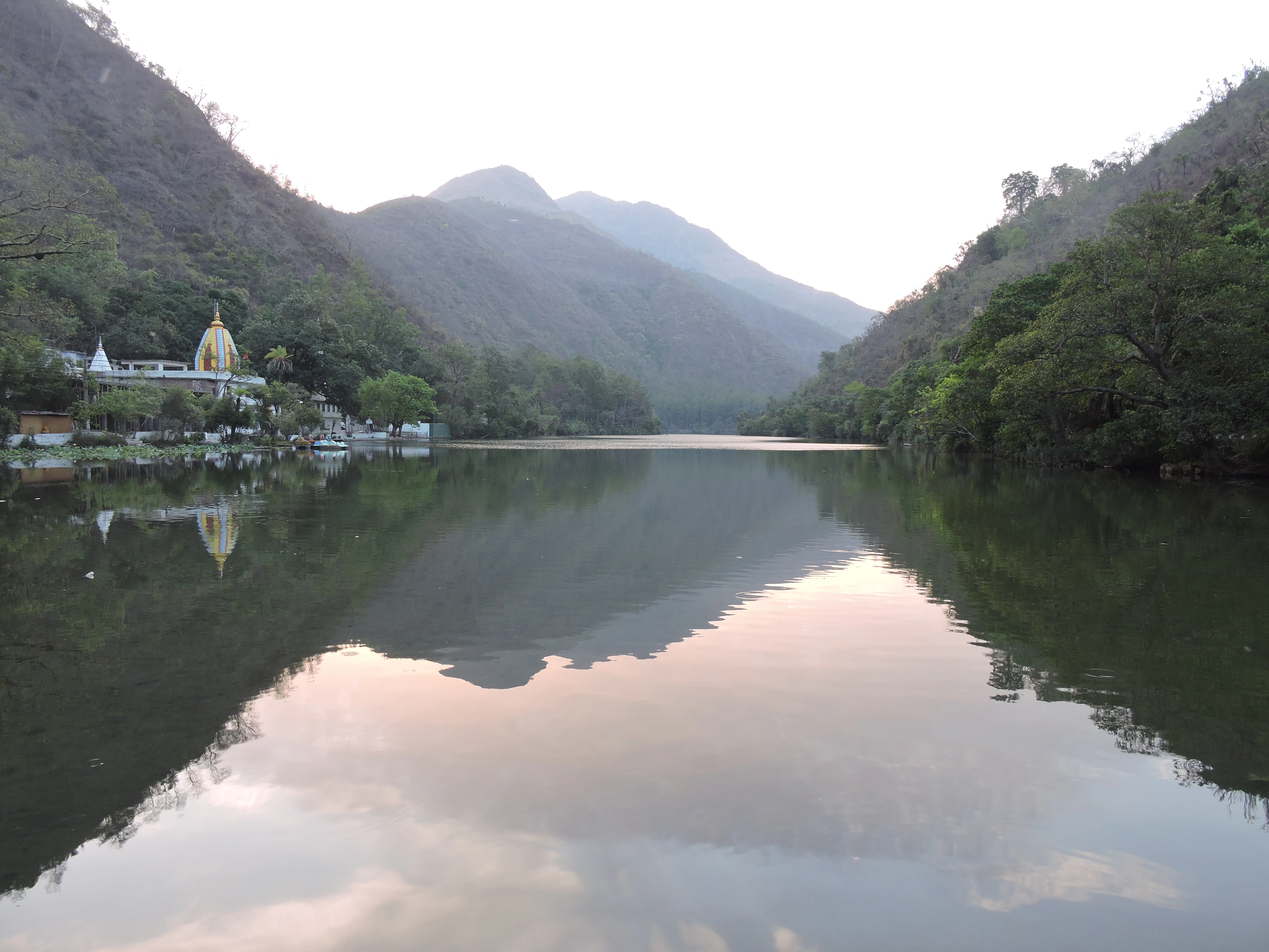
A wide view of a calm, reflective lake surrounded by forested mountains under a soft light, with a golden temple visible on the left shore.
Renuka Lake, the primary water feature within the Renuka Sanctuary in Himachal Pradesh.

Renuka Sanctuary history and protected-area timeline

The forested landscape around Renuka Lake has long carried both religious and ecological significance, but its modern protected status emerged as part of India's broader movement to designate forest reserves around culturally important natural sites. The sanctuary itself was formally established around Renuka Reserve Forest, an area designated as an Abhayaranya, a traditional term for a sanctuary or refuge preserving both natural and spiritual values.

In November 2005, the lake and surrounding wetland complex received international recognition when it was designated as a Ramsar Wetland under the Ramsar Convention, highlighting the global ecological value of a site that had historically been revered primarily in religious terms. The designation also reinforced the management framework for the sanctuary and brought additional attention to threats from siltation and waste dumping that had begun to affect the lake.

Over the years, conservation efforts around Renuka have been supplemented by buffer belt declarations and regional cleanup initiatives, including restrictions on plastic use across the area. These steps reflect an evolving recognition that the lake's cultural importance and its ecological function are inseparable, and that protecting the forest around it is essential for the health of the waterbody itself.

Renuka Sanctuary landscape and geographic character

Renuka Sanctuary occupies a gentle portion of the lower Himalayan hills in Sirmaur district, defined less by dramatic peaks than by the contrast between forested slopes and the calm surface of Renuka Lake. The lake itself sits at roughly 672 meters above sea level, making it a low-altitude lake surrounded by woodland rather than alpine terrain.

The shoreline circumference is approximately 3.2 kilometers, carving out a modest but well-defined basin that gives the sanctuary its distinct shape. Around the waterbody, the land rises into forested hillocks and ridges that frame the lake from multiple sides, creating a basin-like setting where water and woodland are visually inseparable.

The terrain includes the sacred hillock known locally as Tape Ka Tiba, traditionally associated with the meditation of sage Jamadagni, as well as the broader catchment of hills that channel rainwater and natural runoff into the lake. This catchment terrain is also the source of environmental pressures: soil, sediment, and debris washed down from surrounding slopes have become a key concern for the lake's long-term stability.
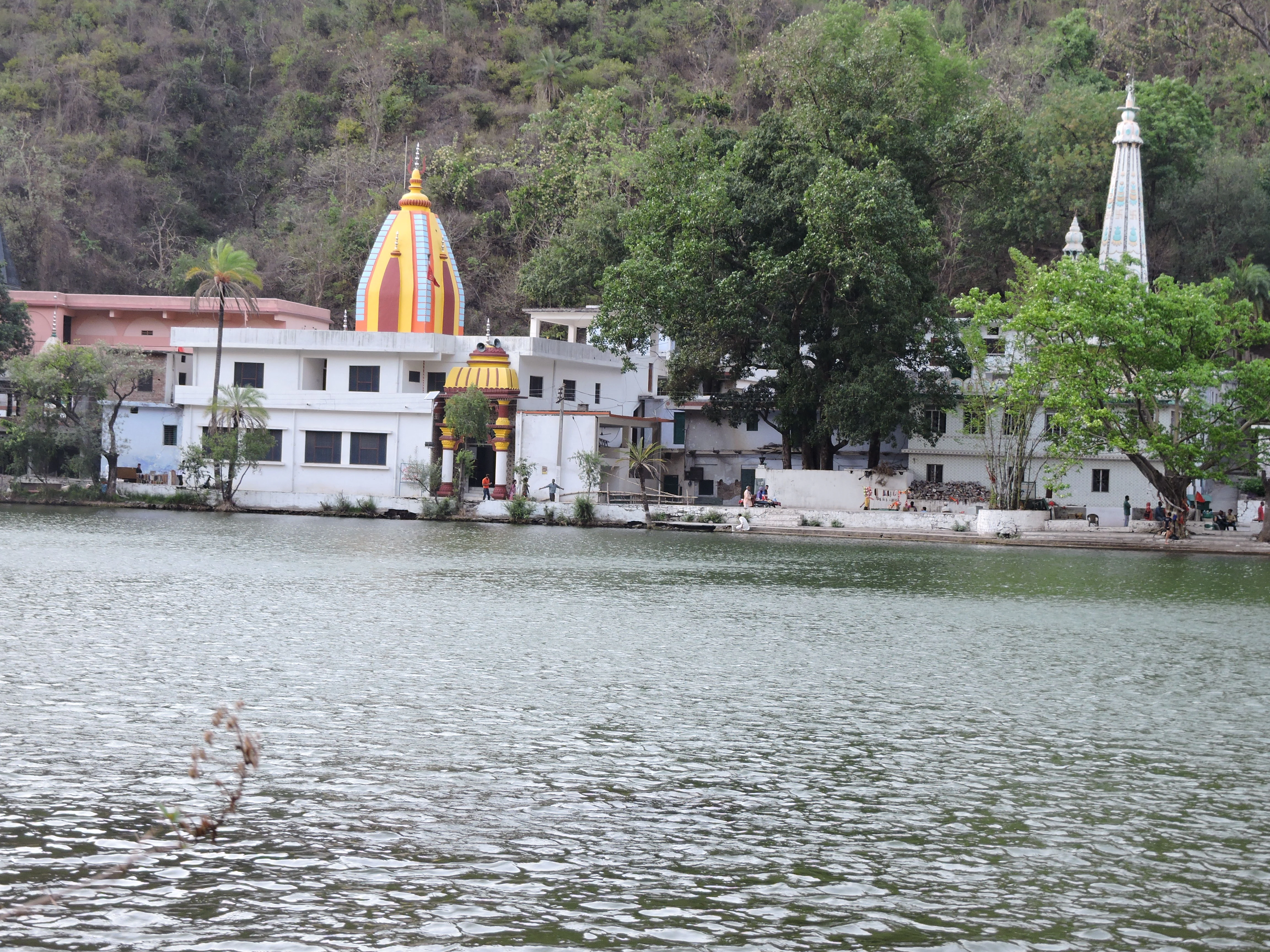
A white temple with a bright yellow and orange dome, and a tall, slender white spire, stands on the edge of a calm lake surrounded by trees and a forested hillside.
The Renuka Temple complex situated along the banks of Renuka Lake within the Renuka Sanctuary.

Renuka Sanctuary ecosystems, habitats, and plant life

The sanctuary's natural character is built around the integration of a fairly large lake with a stretch of dry tropical forest typical of the lower Himalayan foothills. This combination, while compact in area, represents a meaningful example of low-altitude forest-wetland habitat in Himachal Pradesh.

The forest cover is classified under group 5B/C2, dry mixed deciduous forest, and group 5/051, dry sal forest. The mixed deciduous component contributes a varied canopy of broadleaf species adapted to drier conditions, while the sal-dominated patches create denser, more uniform woodland stands in suitable patches. Together, these forest types form a transitional habitat where northern deciduous species share space with more drought-tolerant assemblages.

The lake system itself adds a strong aquatic and wetland dimension to the sanctuary. Lotus flowers observed within the lake's waters contribute seasonal floral interest and suggest conditions favorable for aquatic vegetation. The recognition of the lake as a Ramsar Wetland reflects the broader habitat value of the open water, fringing vegetation, and surrounding forest as a coherent ecological unit.
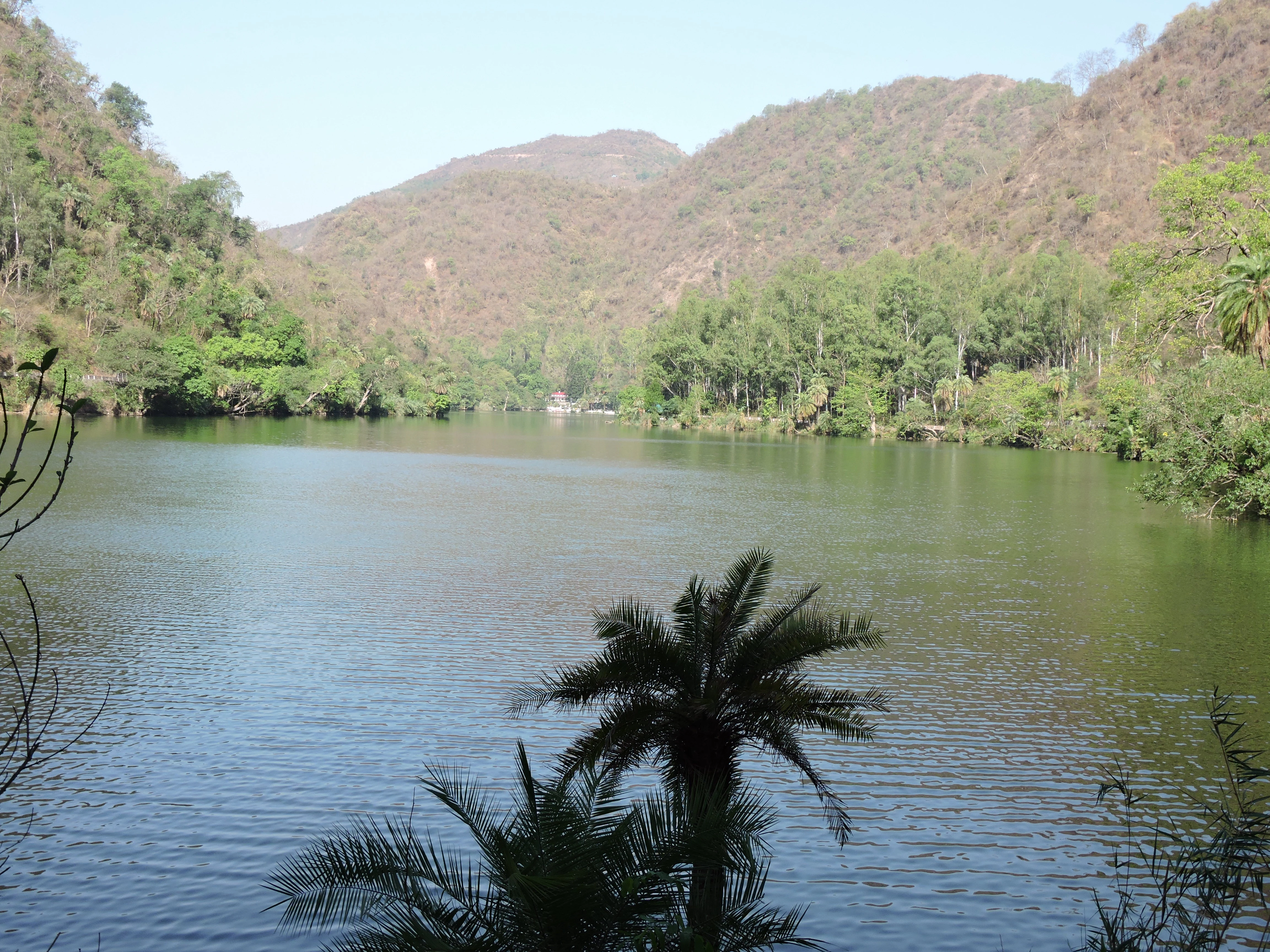
A wide shot of a calm lake surrounded by forested hills under a clear sky.
Renuka Lake, the central water body of Renuka Sanctuary in Himachal Pradesh.

Renuka Sanctuary wildlife and species highlights

Renuka Sanctuary's small area and low-elevation setting make it more of a forest-and-wetland refuge than a flagship tiger or large-mammal reserve. Its wildlife profile is oriented toward the species typical of dry deciduous and sal forests in the lower Himalayan foothills, where leopards, sambar deer, and wild boar are commonly associated with similar forest tracts.

The lake and its fringing habitat support a range of aquatic and semi-aquatic wildlife as well, including fish populations and birdlife drawn to open water, lotus beds, and forested shoreline. Seasonal visitors and resident species alike benefit from the protection the sanctuary offers against the encroachment and disturbance that have affected nearby unprotected landscapes.

Because the sanctuary is small and intensively used for religious events, wildlife observation here tends to be incidental rather than the primary draw. Nevertheless, the combination of forest cover and lake habitat gives the reserve real, if modest, ecological value as a refuge within a heavily visited cultural landscape.
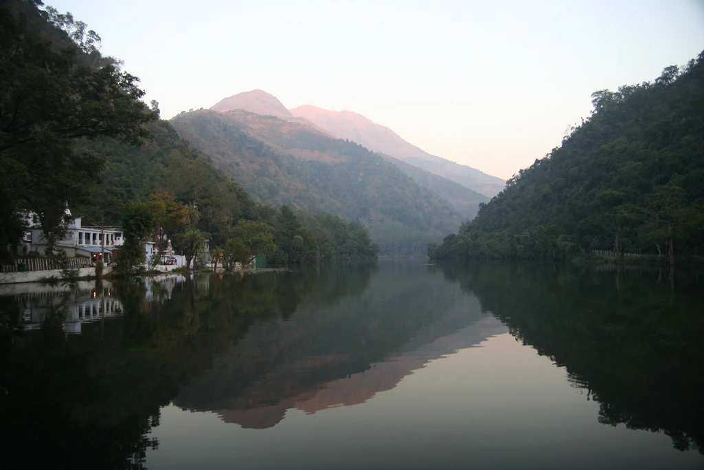
A calm lake reflects the image of surrounding green mountain slopes and a small white structure on the shore.
Renuka Lake reflects the surrounding forested slopes and mountains in the Renuka Sanctuary.

Renuka Sanctuary conservation status and protection priorities

Renuka Sanctuary stands out in conservation terms because it is one of the few protected areas in India centered on a lake-ecosystem complex that has been formally recognized as a Ramsar Wetland of international importance. The 2005 Ramsar designation placed it on a global framework for wetland conservation and drew attention to the need for coordinated protection of both the waterbody and the surrounding forest catchment.

The reserve's protected status is reinforced by its designation as an Abhayaranya, which extends the traditional concept of a refuge into formal forest protection. A buffer zone of roughly 3 square kilometers beyond the sanctuary boundary further cushions the reserve against development pressure and helps stabilize the hydro-ecological relationship between the forest and the lake.

Conservation concerns remain significant. Siltation is steadily reducing the lake's volume and surface area, fed by soil erosion from surrounding hills and the long-term dumping of construction debris into the water. Plastic use has been banned across the region to address one visible form of pollution, while administration and local groups such as the Renuka Vikas Samiti continue to work on broader cleanup and protection efforts.

Renuka Sanctuary cultural meaning and human context

Renuka Sanctuary is inseparable from the religious geography of Renuka Lake. The lake is widely regarded in local tradition as the very form assumed by the goddess Renuka, mother of Parashurama and wife of the sage Jamadagni. Hindu mythology places this region as a setting for the sage's long meditation and the birth of Parashurama, the sixth incarnation of Vishnu.

Each year, the Prabodhini Ekadashi fair brings an enormous influx of pilgrims. Devotees travel to the lake to mark the symbolic reunion of mother and son, and a day earlier, the palanquin of Parashurama is brought in procession from the ancient temple at Jamu Koti village to Renuka, a ritual known as the Shobha Yatra. These traditions elevate the sanctuary from a purely ecological landscape into one of Himachal Pradesh's most significant religious sites.

The sanctuary's small footprint operates within this larger cultural setting, where centuries-old pilgrimage routes, temples, and sacred hillocks coexist with protected forest. This interplay shapes both the management approach and the visitor experience at Renuka.
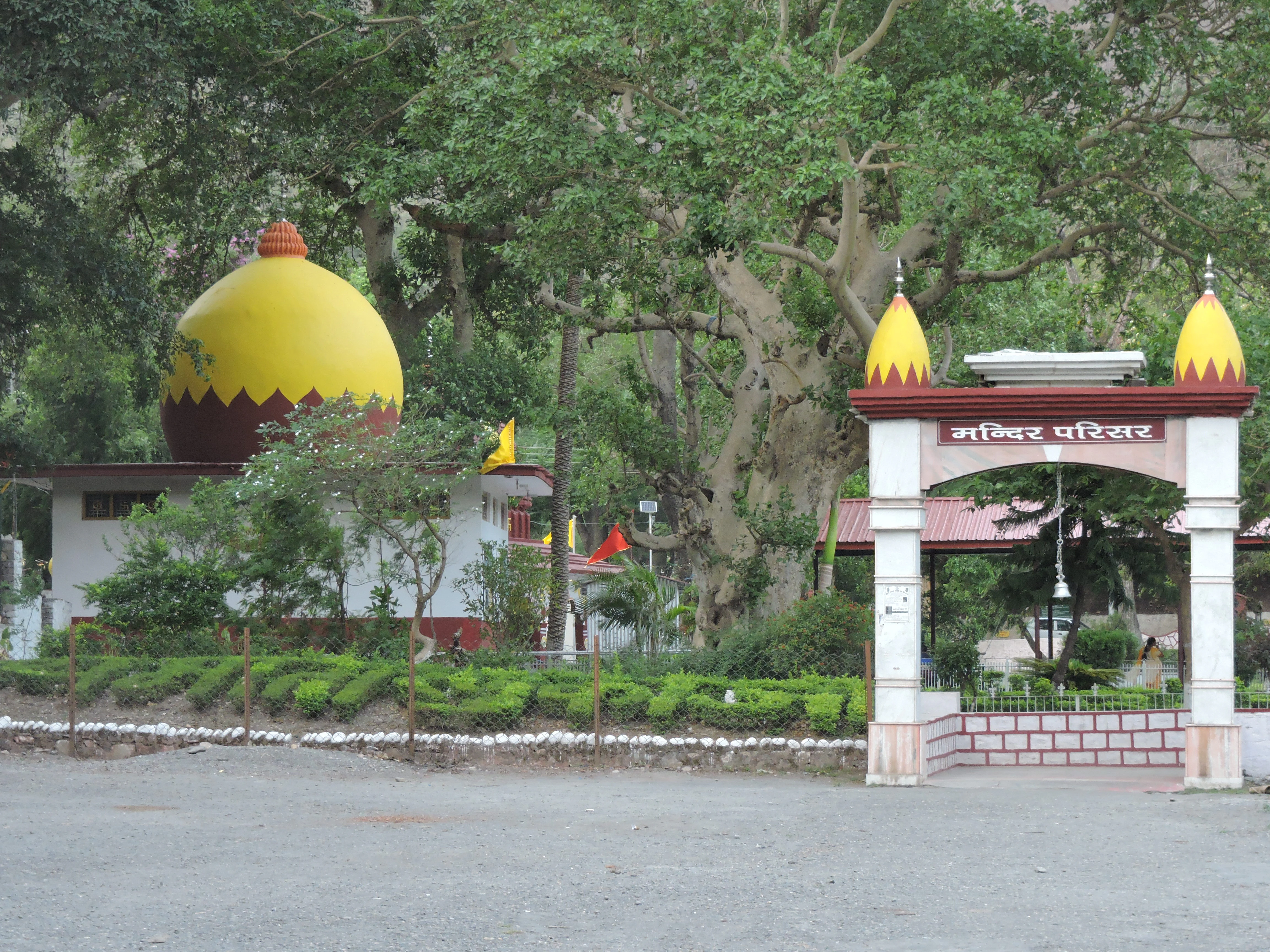
A white arched entrance gate with yellow domes leads into the Parshuram Temple complex, featuring a large yellow-domed building in the background surrounded by dense trees.
The entrance to the Parshuram Temple complex, situated near Renuka Lake.

Top sights and standout views in Renuka Sanctuary

Renuka Sanctuary is distinguished by the rare combination of a Ramsar-listed lake and a dry deciduous forest reserve in the same protected boundary, set within a landscape deeply embedded in Hindu mythology. The lake is the largest in Himachal Pradesh, while the surrounding forest contributes dry mixed deciduous and dry sal vegetation typical of the lower Himalayan transition zone.

The reserve's small core area, paired with its extensive buffer belt, reflects a layered conservation strategy designed to protect the lake catchment as much as the wildlife habitat itself. The cultural calendar, anchored by the Prabodhini Ekadashi fair, brings striking seasonal vitality to the area but also underscores the ongoing need to balance ecological protection with heavy human usage.
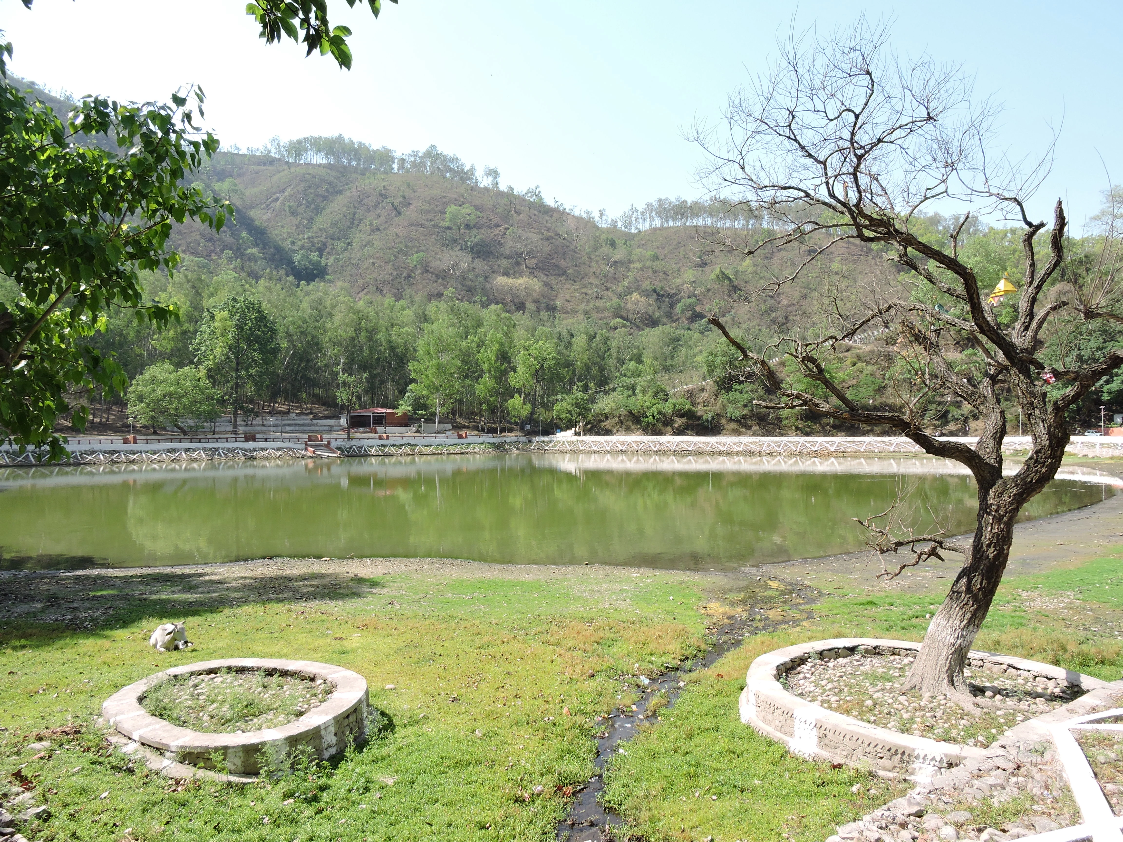
A calm, green-tinted pond surrounded by grassy banks and a dry, barren tree in the foreground, with forested hills in the background under a clear sky.
Parashuram Talab, a small pond situated near the main Renuka Lake within the sanctuary.

Best time to visit Renuka Sanctuary

The most culturally distinctive time to visit Renuka Sanctuary is around the Prabodhini Ekadashi period, when the five-day Renuka fair brings the area alive with religious processions, the Shobha Yatra from Jamu Koti, and a major influx of pilgrims. For visitors more focused on the natural setting, the cooler and drier months typical of Himachal's post-monsoon and winter seasons offer clearer basin views and comfortable forest-edge walking, while the monsoon period can leave the lake surroundings lush green but may also heighten concerns about siltation, water clarity, and slope stability. Lotus flowers visible in the lake during warmer months add a further seasonal dimension to the visit experience.
Monthly climate preview

Track measured monthly averages across the representative elevation of Himachal Pradesh

Renuka Sanctuary Climate Normals: Long Term Temperature and Precipitation Records

Historical monitoring points for Renuka Sanctuary record annual temperature and precipitation shifts from winter minimums to peak summer warmth. Detailed monthly records supply continuous baseline normals for researchers analyzing regional conservation environments.
Annual mean22 °C
12 °C31 °C
Jan12°
Feb14°
Mar19°
Apr25°
May30°
Jun31°
Jul28°
Aug26°
Sep24°
Oct21°
Nov17°
Dec13°
Warmest month
June

30.6 °C

Coolest month
January

11.7 °C

Wettest month
August

12.1 mm/day

Driest month
November

0.2 mm/day

Park location guide

Geography guide, regional context, and park location map for Renuka Sanctuary

Renuka Sanctuary park geography, regions, and map view in India

Understand where Renuka Sanctuary sits in India through a broader geographic reading of the surrounding landscape, nearby location context, and its mapped position within the national park landscape.

How Renuka Sanctuary fits into India

India is a South Asian country bordered by the Indian Ocean, Arabian Sea, and Bay of Bengal. It shares land borders with Pakistan, China, Nepal, Bhutan, Bangladesh, and Myanmar. The country has a population of over 1.4 billion people and operates as a federal parliamentary republic with its capital in New Delhi.

Wider geography shaping Renuka Sanctuary in India

India occupies the Indian subcontinent in South Asia, bordered by the Arabian Sea to the southwest, the Bay of Bengal to the southeast, and the Indian Ocean to the south. It shares land borders with Pakistan to the west, China, Nepal, and Bhutan to the north, and Bangladesh and Myanmar to the east. The territory also includes the Andaman and Nicobar Islands in the Indian Ocean.

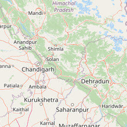
Map view of Renuka Sanctuary

Use this park location map to pinpoint Renuka Sanctuary in India, understand its exact geographic position, and read its mapped placement within the surrounding landscape more clearly.

Pigeon | © OpenStreetMap contributors

Location context for Renuka Sanctuary

Himachal Pradesh

Visualizing the dry deciduous forests and low altitude lake environment of Himachal Pradesh

Renuka Sanctuary Landscape Photos and Protected Area Scenery

Photographic records reveal the distinct topography, forested hill slopes, and calm water basins that define Renuka Sanctuary. Examining these protected area visuals helps observers understand the ecological character and terrain of the Ramsar wetland ecosystem.

A wide view of a calm, reflective lake surrounded by forested mountains under a soft light, with a golden temple visible on the left shore.

A calm lake surface covered with water lily pads, reflecting the dense, green, forested mountain slopes in the background.

A white temple with a bright yellow and orange dome, and a tall, slender white spire, stands on the edge of a calm lake surrounded by trees and a forested hillside.

A wide shot of a calm lake surrounded by forested hills under a clear sky.

A calm lake reflects the image of surrounding green mountain slopes and a small white structure on the shore.

A view of Renuka Lake featuring a shoreline with palm trees and several colorful paddle boats docked at the water edge, with forested hills in the background.

A white arched entrance gate with yellow domes leads into the Parshuram Temple complex, featuring a large yellow-domed building in the background surrounded by dense trees.

A calm, green-tinted pond surrounded by grassy banks and a dry, barren tree in the foreground, with forested hills in the background under a clear sky.

A view of the white and maroon entrance gate to the Mata Renuka Ji Temple with bright yellow domes in the background against a backdrop of green trees.

Park atlas

Compare adjacent wetland reserves and lower Himalayan wildlife habitats.

Explore Parks Near Renuka Sanctuary and Surrounding Protected Landscapes

Browse other parks near Renuka Sanctuary to examine similar low-altitude forest reserves and wetland habitats across the region. Continuing past the protected catchment unlocks broader geographical comparisons of regional conservation areas.
National parkIndia
About 19 km away#1 closest

South

Simbalbara National Park: National Park in India's Himalayan Foothills

Explore its dense sal forests and unique terrain.

Simbalbara National Park is a protected area recognized for its extensive sal forests and its role as a vital habitat for tigers and other large mammals in the Himalayan foothills of India. The park's landscape is defined by the Kiyarda Dun valley, featuring a mix of dense forest-covered slopes, open grassy glades, and a perennial stream. This protected area offers a representative sample of the sal-dominated forest ecosystems at lower Himalayan elevations, providing a distinct geographic and ecological context for exploration.

Area
27.88 km²
Established
2010
IUCN
II
Relief
Upland
Watercolor painting of a calm body of water surrounded by greenery and distant mountains under a light sky.
Wildlife reserveUttarakhand
About 27 km away#2 closest

Southeast

Asan Conservation Reserve: Protected Wetland and Reservoir Geography in Uttarakhand

Mapping the landscape of North India's premier Ramsar site

Located in the Doon Valley of Uttarakhand, Asan Conservation Reserve creates a distinct natural refuge within a working hydrological system. This wildlife reserve features shallow reservoir basins and marshy shorelines, providing a key corridor for migratory bird species and serving as an anchor for regional conservation efforts.

Area
4 km²
Established
1967
Water
Water-dominated
Season
Year-round
National parkHaryana
About 28 km away#3 closest

South

Kalesar National Park: Exploring Haryana's Unique Sal Forest Protected Landscape

Discover mapped terrain and regional geography within the Shivalik foothills.

Kalesar National Park, located in the Shivalik foothills of Haryana, is a crucial protected area renowned for its natural sal forest, a rare ecological feature in the state. Spanning approximately 53 square kilometers, the park's diverse terrain offers insights into regional geography and conservation, serving as a vital habitat for leopards and a corridor for wild elephants. Its mapped boundaries encompass a unique landscape that contrasts sharply with surrounding agricultural lands, making it a significant point of study for protected-area enthusiasts.

Area
53 km²
Established
2003
IUCN
IV
Relief
Highland
National parkUttarakhand
About 92 km away#4 closest

Southeast

Rajaji National Park: Uttarakhand National Park and Tiger Reserve Landscape

Sivalik Hills geography and protected area context

Rajaji National Park is a vital protected landscape situated in the Uttarakhand region of India, recognized as both a national park and a tiger reserve. Its territory spans across the Sivalik Hills, offering a diverse terrain characterized by deciduous forests and riparian ecosystems. The park's location along the Ganga river significantly influences its ecology, providing a unique geographic context for its protected status and wildlife significance.

Area
820.5 km²
Established
1983
IUCN
II
Relief
Highland
National parkUttarkashi District
About 96 km away#5 closest

Northeast

Govind Pashu Vihar National Park: Exploring India's Uttarkashi District Protected Landscape

Mapped protected area boundaries and regional geographic context.

Investigate Govind Pashu Vihar National Park, a key protected area in Uttarkashi District, India. This resource provides essential information on its designation as a national park, focusing on its geographic spread, mapped landscape features, and its placement within the regional atlas for comprehensive discovery. Understand the distinctiveness of this protected land's terrain and its role in conservation geography.

Area
958 km²
Established
1955
IUCN
II
Relief
Mountain
A horizontal watercolor painting depicting a meandering river passing through green wetlands and low-lying hills with a soft, misty background.
Protected areaPunjab
About 102 km away#6 closest

Northwest

Ropar Wetland: Geographic Mapping of a Punjab Freshwater Protected Landscape

Riverine and lacustrine geography in the Shivalik foothills.

Ropar Wetland stands as a significant protected area within the Punjab region, defined by its man-made reservoir origin and subsequent ecological maturation. This site serves as a vital transition point between the Shivalik hills and the Indo-Gangetic plains, hosting a dense variety of marshland, forest, and open water habitats that support rare reptile species and extensive bird populations.

Area
13.65 km²
Established
1952
Relief
Lowland
Climate
Subtropical
National parkHimachal Pradesh
About 114 km away#7 closest

North

Great Himalayan National Park: Protected Landscape and Mapped Geography

Explore this national park's dramatic elevation and rich biodiversity.

Great Himalayan National Park is a vital protected area within India's Himachal Pradesh, celebrated for its exceptional biodiversity and dramatic mountain geography. This national park encompasses a remarkable range of elevations, creating distinct ecological zones from lower forest elevations to high alpine meadows and glacial zones. Its significance as a mapped protected landscape makes it essential for understanding regional natural heritage and conservation efforts within the Himalayas.

Area
1,171 km²
Established
1984
IUCN
II
Relief
Mountain
Wildlife reservePunjab
About 135 km away#8 closest

Northwest

Nangal Wildlife Sanctuary: A Protected Wetland Refuge in the Punjab Foothills

Mapped riparian landscapes and reservoir habitats in the Sutlej River basin

Located within the Shivalik foothills, Nangal Wildlife Sanctuary preserves a unique man-made reservoir ecosystem. This record details the park's protected boundaries, riparian vegetation, and its role as a essential wetland habitat for regional migratory waterbirds and threatened species in the Punjab river landscape.

Area
1.16 km²
Established
2009
IUCN
IV
Relief
Upland

Common questions about visiting, size, designation, and location context for Renuka Sanctuary

Renuka Sanctuary FAQs for park facts, access, geography, and protected area context

Find quick answers about Renuka Sanctuary, including protected-area facts, park geography, trail and visitor context, and how the park fits into its surrounding country and regional landscape.
MoriAtlas Explorer

Continue Your Protected Areas Search Across the Global Atlas

Deepen your exploration by continuing the structured search for national parks and protected areas worldwide. Utilize the comprehensive filtering capabilities to compare different conservation landscapes and refine your understanding of global park geography. Discover more about the distribution and characteristics of protected natural areas.

Global natural geography