Mori Atlas logo
National parkBannerghatta National Park

Discover mapped park boundaries and the regional natural terrain of this Indian national park.

Bannerghatta National Park: A Protected Landscape within Karnataka's Geography

Bannerghatta National Park stands as a key protected area within the state of Karnataka, India, offering a distinct geographic identity. As a national park, it contributes to the region's natural landscape context, situated within the broader geographical framework of southwestern India and the Western Ghats. This page provides a focused exploration of Bannerghatta National Park, detailing its mapped boundaries and regional setting for atlas-based discovery and geographic understanding.

National ParkElephant CorridorWildlife SafariKarnatakaTiger ReserveDeciduous Forest
Digital illustration showing a waterfall cascading from cliffs into a river surrounded by forest

Bannerghatta National Park

National park

Park overview

Structured park overview, official facts, and landscape profile for Bannerghatta National Park

Bannerghatta National Park park facts, protected area profile, and essential visitor context
Review the core facts for Bannerghatta National Park, including designation, size, terrain, visitor scale, habitats, and operating context in one park-focused overview.

About Bannerghatta National Park

Bannerghatta National Park occupies a distinctive position as a protected area near one of India's largest urban centers, offering residents and visitors access to wildlife viewing, trekking, and nature experiences within easy reach of Bengaluru. The park's terrain consists of granite sheet formations creating a hilly landscape with elevations ranging from 1245 to 1634 meters above sea level. Moist deciduous forest fills the valleys while scrubland dominates higher elevations. The park's location in the Anekal range places it at the interface between urbanizing Karnataka and remaining wild spaces, making it both accessible and vulnerable to development pressures. Beyond its ecological function as an elephant corridor linking the BR Hills to Sathyamangalam forest, the park contains six rural villages enclosed within three large enclosures traditionally used for sheep and cattle farming. Ancient temples within the park provide religious significance and attract local worshippers, adding a cultural dimension to the natural landscape. The park offers guided bus tours along safari roads, allowing visitors to observe wildlife while minimizing disturbance to animal movements.

Quick facts and research context for Bannerghatta National Park

Bannerghatta National Park spans approximately 260.51 square kilometers in Karnataka state, India, situated in the Anekal hill range with elevations between 1245 and 1634 meters. The park features a hilly landscape of granite sheets with moist deciduous forests in the valleys and scrubland on higher terrain. It serves as a key wildlife corridor for elephants connecting the BR Hills and Sathyamangalam forest. Annual rainfall averages 700 millimeters, with the Suvarnamukhi stream flowing through the park. Sixteen villages border the protected area. The park supports significant populations of Royal Bengal tigers, Indian elephants, leopards, and gaur, among other wildlife.

Park context

Deeper park guide and search-rich context for Bannerghatta National Park

Bannerghatta National Park history, landscape, wildlife, and travel context
Explore Bannerghatta National Park through its history, landscape character, ecosystems, wildlife, conservation priorities, cultural context, and seasonal travel timing in a structured park guide built for atlas discovery and search intent.

Why Bannerghatta National Park stands out

Bannerghatta National Park is best known for its tiger and elephant populations, which inhabit a landscape of granite hills and deciduous forest on Bangalore's southern doorstep. The park's wildlife corridor significance, connecting fragmented forest landscapes across Karnataka, makes it ecologically important for elephant movement between protected areas. Its combination of ancient temple sites, trekking opportunities, and a guided safari experience distinguishes it from more remote wilderness areas, while the 2002 establishment of the Bannerghatta Biological Park added a zoological component that draws additional visitors.

Close-up of a white tiger with black stripes lying on the ground
White tiger in Bannerghatta National Park

Bannerghatta National Park history and protected-area timeline

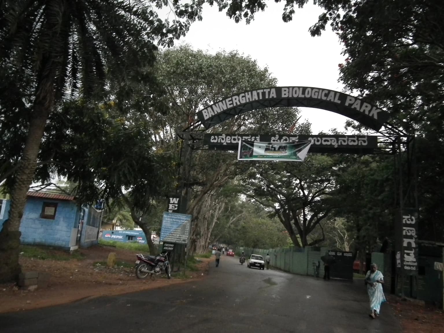
Bannerghatta National Park traces its formal establishment to 1970 when it was initially founded as a protected area, followed by its declaration as a national park in 1974 under India's wildlife protection framework. The area had long functioned as a wildlife habitat and forest zone before formal protection was enacted, with local communities including six villages maintaining agricultural activities within what would become the park boundaries. In 2002, a portion of the park was separated to establish the Bannerghatta Biological Park, a zoological garden that expanded the site's conservation and public education functions while maintaining the core national park designation for the larger area. The park's management falls under the Ministry of Environment and Forests at the national level, with the Government of India providing oversight, while day-to-day administration is handled by the Executive Director of the Bannerghatta Biological Park. The park has faced increasing pressures from urban expansion and agricultural conversion, with studies documenting significant forest loss in the dry deciduous areas between 1995 and 2021.

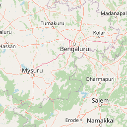
Bannerghatta National Park landscape and geographic character

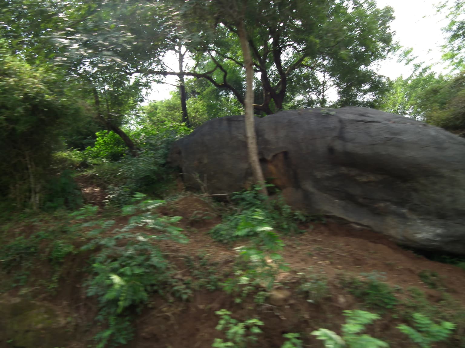
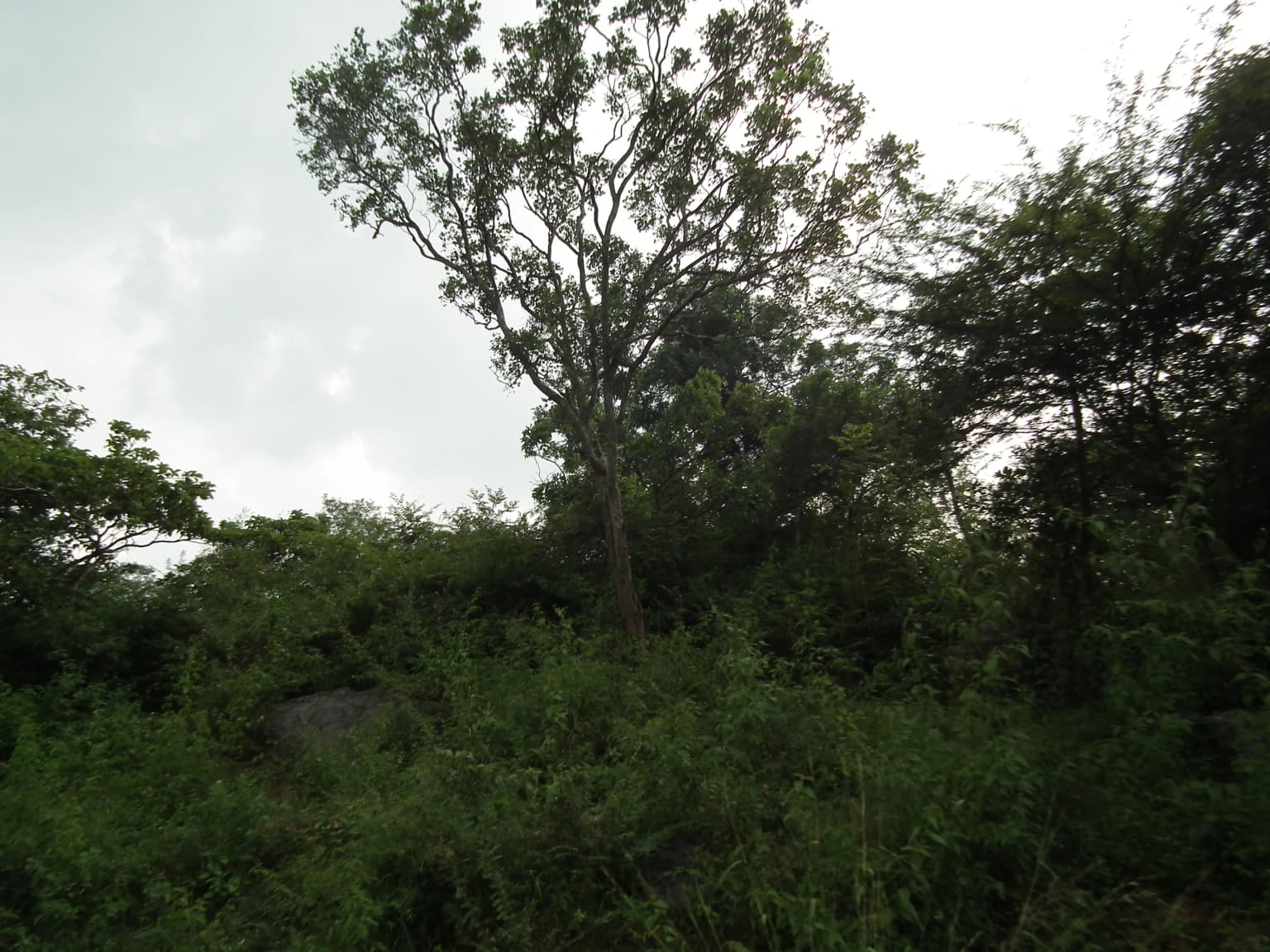
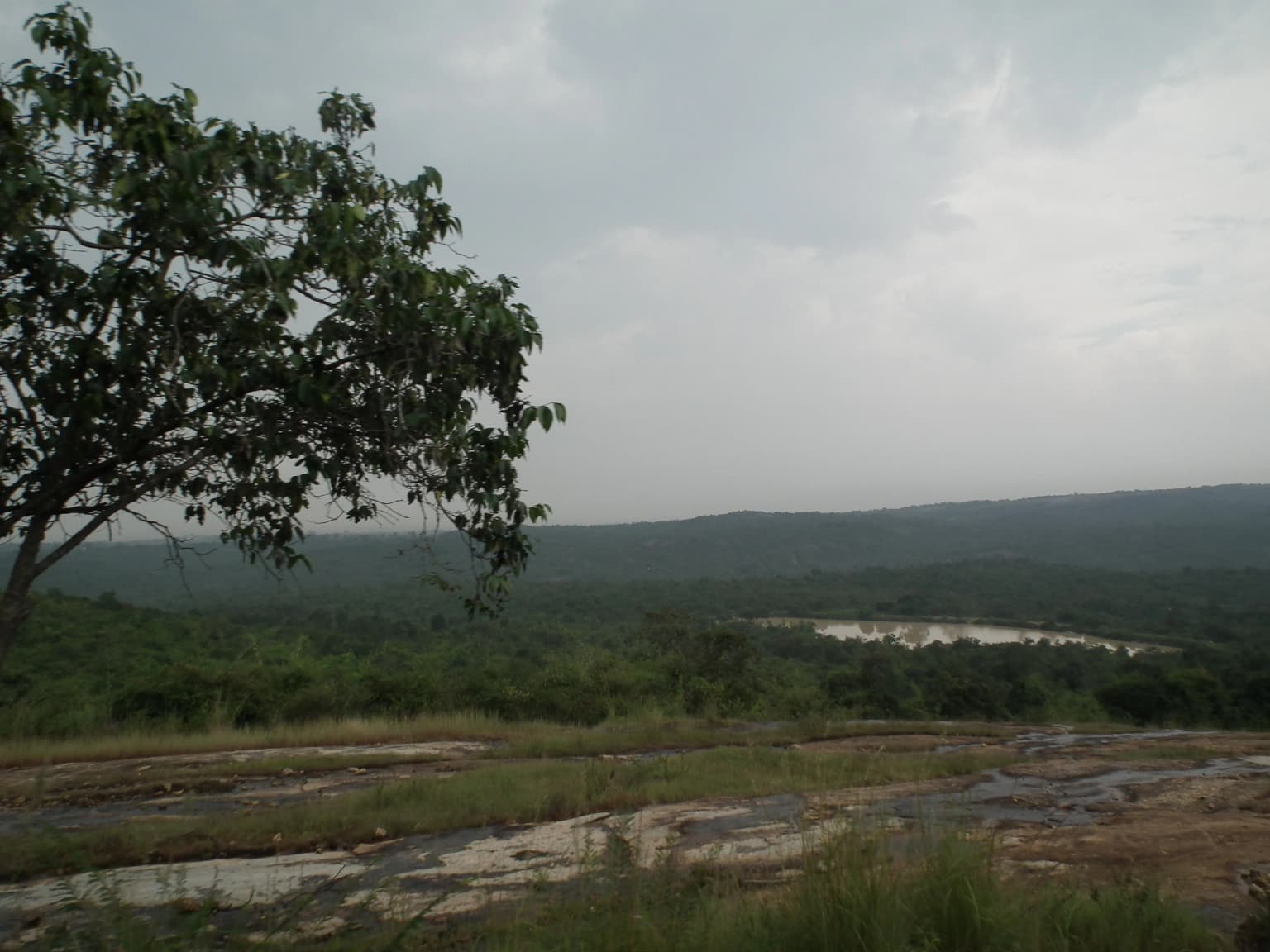
The landscape of Bannerghatta National Park centers on the granite hills of the Anekal range, a continuation of rocky terrain that characterizes much of southern Karnataka. The terrain consists of exposed granite sheets forming ridges and rocky outcrops interspersed with valleys where moisture accumulates and supports denser vegetation. Elevation varies from approximately 1245 to 1634 meters, creating a hilly terrain with varied aspect and microclimates across the park. The valley floors support moist deciduous forest characterized by taller trees and denser canopy, while the higher ridgelines and exposed areas feature scrubland with smaller trees and shrubs adapted to drier conditions. The park's drainage is served by the Suvarnamukhi stream, a perennial water source that supports wildlife especially during the dry seasons. The combination of permanent water, forest cover, and varied topography creates a heterogeneous landscape that supports diverse habitats within a relatively compact area, though much of the forest is now artificial plantation rather than old-growth vegetation.

Close-up of a bear with dark fur and light snout surrounded by green leaves
Close-up of a wild bear in forest foliage

Bannerghatta National Park ecosystems, habitats, and plant life

The nature of Bannerghatta National Park reflects its position in the transitional zone between moist and dry deciduous forest types in peninsular India. The park's vegetation includes species typical of southern Indian forests such as Schleichera oleosa, Terminalia tomentosa, and Terminalia arjuna in the valley areas, while sandalwood and neem appear throughout the park. Bamboo thickets occur in certain areas, and the park contains both native species and introduced plantation species including eucalyptus. The moist deciduous forest supports a more diverse community than the scrubland areas, with taller canopy trees providing habitat for arboreal species and creating stratified layers from ground-dwelling to canopy-dwelling animals. The wildlife corridor function connecting the BR Hills to Sathyamangalam represents a crucial ecological role, allowing elephants and other large mammals to move between larger forest blocks that would otherwise be isolated by agricultural and urban land. Despite pressures from surrounding development, the park maintains viable populations of several threatened species.

Large boulder amidst dense green foliage and trees in a forested area.
Lush green vegetation surrounding a large boulder in Bannerghatta National Park.

Bannerghatta National Park wildlife and species highlights

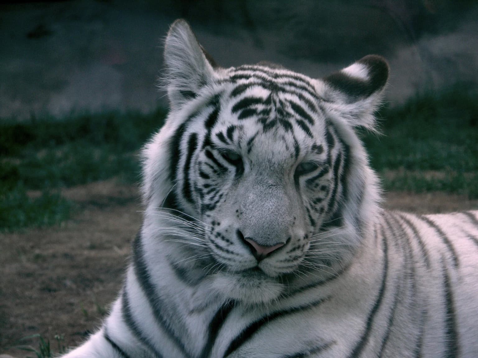
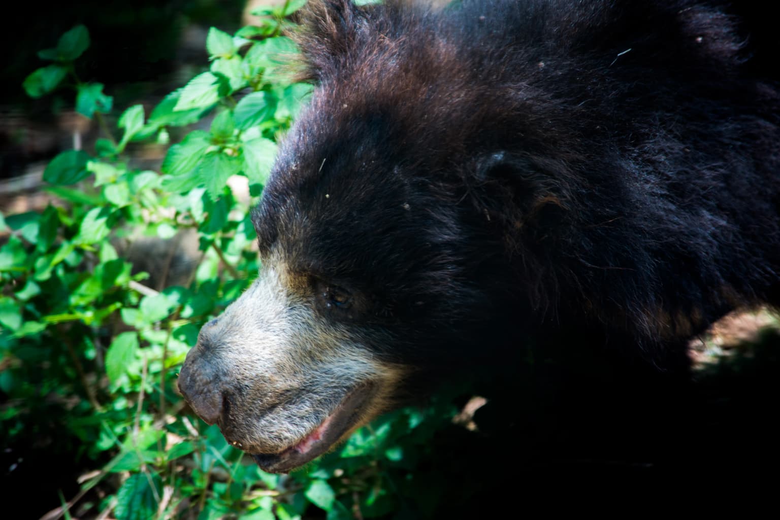
Bannerghatta National Park supports a notable assemblage of mammal species characteristic of peninsular Indian forests. The park's flagship species include the Royal Bengal tiger and Indian elephant, both present in population sizes that allow for regular sighting opportunities. Large mammals include gaur, the largest bovine in India, Indian leopards as the primary predator alongside tigers, and various cervids including spotted deer and barking deer. Sloth bears, Indian gazelles, and wild boar represent medium-sized mammals, while primates include common langur and bonnet macaque. Smaller mammals include porcupine, hare, and pangolin among the more distinctive species. The park's reptile population includes cobras, pythons, Russell's vipers, and kraits, along with monitor lizards. The avian population includes at least 101 recorded bird species, with peacock being prominent. Some exotic species including giraffes and hamadryas baboons are maintained in the zoo section rather than representing wild populations. Human-wildlife interaction incidents have occurred, including elephant deaths and leopard appearances in nearby areas.

A forest scene with dense green vegetation including a tall central tree under an overcast sky.
Dense forest vegetation in Bannerghatta National Park.

Bannerghatta National Park conservation status and protection priorities

Bannerghatta National Park faces significant conservation challenges despite its protected status. Research has documented approximately 44 percent loss of dry deciduous forest cover within the park between 1995 and 2021, driven by uncontrolled diversion of forest land for agriculture and urban development. The park is threatened by illegal granite quarrying operations in the surrounding area, with quarries operating dangerously close to critical elephant corridors such as the Kardikal-Madeswara corridor despite a one-kilometer safe zone designation around the park boundary. Explosives used in quarry operations generate tremors affecting wildlife within at least a five-kilometer radius, and uncontrolled vehicular movement around the park adds to disturbance pressures. The wildlife corridor connecting the BR Hills and Sathyamangalam forest depends on maintaining connectivity through Bannerghatta, making the park's conservation status important for regional elephant population viability beyond its own boundaries.

Bannerghatta National Park cultural meaning and human context

Bannerghatta National Park contains ancient temples within its boundaries that remain active places of worship, anchoring the landscape with cultural and religious significance for local communities. Six villages are enclosed within the park's boundaries in three large enclosures traditionally used for sheep and cattle farming, representing human communities whose livelihoods are intertwined with the protected landscape. The coexistence of wildlife, agricultural activity, and religious sites creates a cultural landscape where nature and human activity have historically intermingled. The park's proximity to Bengaluru has made it a destination for day-trippers seeking nature experiences, trekking, and wildlife viewing, with the 2021 Malayalam film "Bannerghatta" further raising the park's profile in popular culture. This combination of ecological, agricultural, and cultural elements makes the park representative of the complex interfaces between protected areas and human communities in Indian conservation.

Panoramic landscape showing grassy terrain, forested hills, and a water body in the distance under overcast sky
Panoramic view of forested hills and water body in Bannerghatta National Park

Top sights and standout views in Bannerghatta National Park

Bannerghatta National Park offers one of the most accessible wildlife experiences near any major Indian city, with its proximity to Bengaluru allowing visitors to encounter tigers, elephants, and leopards within a day's journey. The guided safari along six kilometers of roads provides structured wildlife viewing while the network of ancient temples adds cultural exploration opportunities. Trekking routes traverse the park's varied terrain from valley floors to granite hilltops, offering different perspectives on the landscape and its inhabitants. The wildlife corridor function makes the park important for regional elephant conservation, connecting populations that would otherwise be isolated. The Bannerghatta Biological Park component adds a zoological collection with additional species, expanding visitor experiences beyond the core national park area.

Entrance sign for Bannerghatta Biological Park with text in English and Kannada, road leading into park, trees and buildings visible
Entrance archway of Bannerghatta Biological Park with English and Kannada text, road leading into park, and surrounding greenery

Best time to visit Bannerghatta National Park

The best time to visit Bannerghatta National Park is during the dry winter months from October through March when wildlife is more easily spotted near remaining water sources and vegetation is less dense. The post-monsoon period brings lush greenery but can make animal spotting more difficult as cover thickens. Summer months from April to June offer the best wildlife viewing opportunities as animals congregate around the Suvarnamukhi stream and artificial water sources, though temperatures can be uncomfortable. The monsoon season from July to September brings heavy rainfall that can restrict access to certain trail areas but offers the landscape at its most verdant. Visitors seeking to avoid peak crowds may prefer weekdays over weekends, particularly given the park's popularity with Bengaluru residents.

Park location guide

Geography guide, regional context, and park location map for Bannerghatta National Park

Bannerghatta National Park park geography, regions, and map view in India
Understand where Bannerghatta National Park sits in India through a broader geographic reading of the surrounding landscape, nearby location context, and its mapped position within the national park landscape.

How Bannerghatta National Park fits into India

India is a South Asian country bordered by the Indian Ocean, Arabian Sea, and Bay of Bengal. It shares land borders with Pakistan, China, Nepal, Bhutan, Bangladesh, and Myanmar. The country has a population of over 1.4 billion people and operates as a federal parliamentary republic with its capital in New Delhi.

Wider geography shaping Bannerghatta National Park in India

India occupies the Indian subcontinent in South Asia, bordered by the Arabian Sea to the southwest, the Bay of Bengal to the southeast, and the Indian Ocean to the south. It shares land borders with Pakistan to the west, China, Nepal, and Bhutan to the north, and Bangladesh and Myanmar to the east. The territory also includes the Andaman and Nicobar Islands in the Indian Ocean.

Map view of Bannerghatta National Park

Use this park location map to pinpoint Bannerghatta National Park in India, understand its exact geographic position, and read its mapped placement within the surrounding landscape more clearly.

Pigeon | © OpenStreetMap contributors

Location context for Bannerghatta National Park

Karnataka

Visually explore Bannerghatta's unique granite hills, moist deciduous forests, and diverse wildlife habitats.

Bannerghatta National Park Photos: Discover Its Diverse Landscapes and Protected-Area Scenery
Explore a visual gallery showcasing the distinctive landscapes and terrain of Bannerghatta National Park, revealing its granite hills, moist deciduous forest valleys, and scrubland environments. This imagery provides essential context for understanding the park's diverse habitats and its critical role as an elephant corridor and protected area in Karnataka.

Close-up of a white tiger with black stripes lying on the ground

Tiger with orange and black stripes partially obscured by green leaves in a forested setting

Close-up of a bear with dark fur and light snout surrounded by green leaves

Large boulder amidst dense green foliage and trees in a forested area.

A forest scene with dense green vegetation including a tall central tree under an overcast sky.

Tall trees with green foliage in a forested area

Panoramic landscape showing grassy terrain, forested hills, and a water body in the distance under overcast sky

Entrance sign for Bannerghatta Biological Park with text in English and Kannada, road leading into park, trees and buildings visible

Dense green trees and undergrowth in Bannerghatta National Park

Green signboard with text about wildlife film show at auditorium, showing ticket prices and show details in English and Kannada

Rocky ground with patches of green vegetation and a large boulder in a forested area

A wide view of dense green trees under an overcast sky in Bannerghatta National Park

Dense green vegetation with trees and bushes under overcast sky, distant hills visible

Park atlas

Compare surrounding conservation landscapes, traced elephant corridors, and diverse habitats across southern India.

Explore Other National Parks and Protected Areas Near Bannerghatta National Park
Browse national parks and protected areas adjacent to Bannerghatta National Park, tracing regional elephant corridors and diverse habitats within the granite hills and deciduous forests of Karnataka. Discover other conservation landscapes in southern India, mapping their geographic spread and comparing their protected status for comprehensive atlas exploration.
National parkKarnataka

Bandipur National Park: Karnataka's Protected Landscape and National Park Atlas Entry

Discover mapped terrain and diverse forest ecosystems in South India.

Bandipur National Park, a prominent national park within Karnataka, serves as a vital hub for understanding protected area geography and landscape diversity. Its ecological significance is amplified by its location at the intersection of the Deccan Plateau and the Western Ghats, supporting a unique blend of forest types and rich biodiversity. This entry provides essential context for atlas-based discovery, detailing the park's mapped terrain, its role as a tiger reserve, and its contribution to the Nilgiri Biosphere Reserve's conservation landscape.

Area
1,456.3 km²
Established
1973
IUCN
II
Relief
Mixed relief
National parkKarnataka

Nagarahole National Park: National Park within Karnataka's Protected Geography

Explore mapped boundaries and regional landscape context.

Nagarahole National Park stands as a distinct national park entity within the state of Karnataka, India. This section focuses on its specific geographic footprint and the protected landscape it encompasses, offering valuable data for users engaged in atlas-based discovery of India's conservation areas and natural terrains. Understand its mapped geography and regional significance.

Area
847.98 km²
Established
1983
IUCN
II
Relief
Upland
Watercolor painting showing green fields, pink and yellow areas, and distant mountains
National parkNilgiri District

Mudumalai National Park: National Park Identity and Geographic Context in Nilgiri District

Mapped protected area and natural terrain details for this key Indian park.

Delve into the specific geographic identity of Mudumalai National Park, a protected national park situated in the Nilgiri District. This detail page provides access to its mapped natural landscape, helping users understand its protected boundaries and regional geographic significance. It serves as a foundational point for exploring the park's unique terrain within India's atlas of natural protected areas.

Area
321 km²
Established
1940
IUCN
II
Relief
Mountain
National parkNilgiri District

Mukurthi National Park: Nilgiri District's Protected Montane Grassland and Shola Ecosystem

Explore a vital refuge for the endangered Nilgiri tahr.

Mukurthi National Park, situated in the Nilgiri District of India, is an essential protected area celebrated for its distinctive montane landscape. This national park plays a critical role in the survival of the endangered Nilgiri tahr, protecting the rare shola-grassland ecosystem where they thrive. Its dramatic terrain, high elevations, and unique ecological associations make it a focal point for understanding conservation geography and the mapped boundaries of protected lands within the Western Ghats.

Area
78.46 km²
Established
1990
IUCN
II
Relief
Mountain
National parkAndhra Pradesh

Sri Venkateswara National Park: Andhra Pradesh National Park Protected Landscape Atlas

Mapped protected area, regional geography, and natural terrain.

Uncover the core geographic identity of Sri Venkateswara National Park, a designated national park within Andhra Pradesh. This resource delves into its protected landscape features, providing a mapped perspective on its boundaries and natural terrain. It serves as a crucial point for understanding the park's regional context and its significance as a mapped natural area for atlas-based exploration.

Area
353 km²
Established
1989
IUCN
II
Relief
Mountain
Watercolor illustration of green hills, a river, and distant pink mountains
National parkKerala

Silent Valley National Park: Kerala's Protected Landscape and Geographic Atlas

Explore mapped boundaries and regional terrain in South India.

Silent Valley National Park stands as a key protected area within Kerala, India, offering rich insights into its geographic setting. This destination provides an atlas-driven view of the park's mapped boundaries, its integration with the surrounding regional geography, and the character of its natural landscapes. Users can engage with detailed information designed for structured exploration of protected natural areas and their mapped contexts.

Area
89.52 km²
Established
1984
IUCN
II
Relief
Mountain
National parkAndhra Pradesh

Rajiv Gandhi National Park (Rameswaram) National Park: Exploring Andhra Pradesh's Protected Landscapes

Mapped geography and protected area context for Rajiv Gandhi National Park (Rameswaram).

Delve into the geographic identity of Rajiv Gandhi National Park (Rameswaram), a key protected area within Andhra Pradesh. This detail page serves as an atlas anchor for understanding the park's landscape, mapped features, and its significance as a national park. Users can explore its protected boundaries and appreciate its role within the regional geography of Andhra Pradesh.

Area
2.4 km²
Established
2005
IUCN
II
Relief
Lowland
Watercolor painting showing a landscape with rolling hills, forests, and distant mountains
National parkKarnataka

Kudremukh National Park: Karnataka's Protected Landscape and River Origin

Explore the geography of shola forests and grasslands.

Kudremukh National Park is a pivotal protected landscape in Karnataka, India, recognized for its distinctive montane grasslands and shola forests. This national park is a critical source for three major rivers: the Tunga, Bhadra, and Nethravathi, highlighting its ecological and geographic significance within the Western Ghats. The park's terrain features rolling hills and steep western slopes, contributing to its unique biodiversity and landscape character for atlas-based discovery.

Area
600.57 km²
Established
1987
IUCN
II
Relief
Mountain

Common questions about visiting, size, designation, and location context for Bannerghatta National Park

Bannerghatta National Park FAQs for park facts, access, geography, and protected area context
Find quick answers about Bannerghatta National Park, including protected-area facts, park geography, trail and visitor context, and how the park fits into its surrounding country and regional landscape.
MoriAtlas Explorer

Continue Your Protected Areas Search Across the Global Atlas

Deepen your exploration by continuing the structured search for national parks and protected areas worldwide. Utilize the comprehensive filtering capabilities to compare different conservation landscapes and refine your understanding of global park geography. Discover more about the distribution and characteristics of protected natural areas.

Global natural geography