
Peaks
Park geography
A technical map analysis of mountain peaks, forest habitats, and regional terrain extents
Baw Baw National Park Geographic Profile: Boundaries, Terrain, and Landscape Features
Examine the physical geography of Baw Baw National Park, spanning 135.3 square kilometers within Australia. This data profile details the park boundary, its peak elevation of 1566 meters, and internal landmarks including Mount Saint Gwinear, Mount Erica, and diverse montane forest environments.
Related tags
Subalpine EnvironmentGranite LandscapesEndemic SpeciesVictorian AlpsAlpine Wilderness
Subalpine wilderness on the southern edge of the Australian Alps
Baw Baw National Park
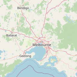
Baw Baw National Park is a protected wilderness area in the southeastern Australian state of Victoria, spanning approximately 13,530 hectares along the boundary between the Victorian Alps and the Gippsland region. The park is centered on the Baw-Baw Plateau, a subalpine landscape characterized by weathered granite boulder outcrops, snow gum forests, and alpine meadows. Located roughly 120 kilometers east of Melbourne and 50 kilometers north of the Latrobe Valley, this park represents the southerly extent of subalpine environments on mainland Australia. The plateau contains several peaks including Mount St Phillack, the park's highest point at 1,566 meters above sea level, alongside Mount Baw Baw, Mount St Gwinear, Mount Erica, and Mount Whitelaw. Baw Baw National Park was established in April 1979 and was added to the Australian National Heritage List in 2008 as part of the Australian Alps National Parks and Reserves.
- Location
- Australia
- Park type
- National park
- Established
- 1979
- Area
- 135.3 km²
- Highest point
- 1,566 m
Location overview
Regional alignment and geographic status within Australia
Baw Baw National Park Geographic Location and National Setting
Baw Baw National Park is situated entirely within Australia as a fully inland protected area. Database records verify that the park contains no marine, island, or transboundary territories.
- Countries
- Australia
- Primary location
- Australia
- Geographic setting
- Inland
Boundary and coordinates
Explore the coordinate limits, spatial span, and 135.3 square kilometer area.
Baw Baw National Park Boundary Mapping and Geographic Limits
Mapped spatial geometry displays the boundary outline of the park to provide geographic context. Accompanying datasets detail the land area of 135.3 square kilometers alongside coordinates and center points.
- Boundary area
- 127.8 km²
- Boundary perimeter
- 118.3 km
- Northernmost point
- 37.745° S
- Southernmost point
- 37.9367° S
- Easternmost point
- 146.4564° E
- Westernmost point
- 146.2082° E
- Geographic centre
- 37.8537° S, 146.3402° E
- North–south span
- 21.3 km
- East–west span
- 21.8 km
Elevation and terrain
Track peak elevations, ridgelines, and named watercourses
Baw Baw National Park Mountain Terrain and Elevation Summary
Recorded elevation data highlights mountain terrain reaching up to 1566 meters within protected boundaries. Associated feature records detail peaks, streams, and saddles located across the protected landscape.
- Maximum elevation
- 1,566 m
- Highest point
- 1,566 m
Selected named natural features
Peaks
South Tors
Streams
Christmas Creek
Peaks
Talbot Peak
1,517 m
Streams
Talbot Creek
Mountain saddles
The Narrows
Environmental setting
Alpine climate zones, montane forests, and major water features across mountain relief
Baw Baw National Park Environmental Classifications and Protected Landscape Setting
Recorded landscape features and habitat types provide complementary ways to read the physical setting of Baw Baw National Park. Connected categories link directly to relevant atlas destinations across mountain relief and alpine zones.
- Relief
- Mountain
- Climate
- Alpine
- Water
- Major water bodies
- Forest cover
- Mostly forested
- Seasonality
- Seasonal
Landscape features
Mountains · Plateau · Cliffs · Forest · Grassland · Lakes · Rivers
Habitat types
Montane forest · Alpine meadow · Grassland · Heath · Riverine habitat · Lacustrine habitat
Park atlas
Browse surrounding subalpine landscapes and connect with the diverse protected areas across Victoria's Gippsland region.
Discover More National Parks and Protected Areas Near Baw Baw National Park in Victoria
Expand your exploration beyond Baw Baw National Park to map additional national parks and protected areas within Victoria's unique subalpine environment. Compare diverse landscapes, trace regional protected-area spread, and understand the full geographic context of the Victorian Alps.
National parkAustralia
3.9 km away#1 closest
Northwest

Yarra Ranges National Park: Victoria's Towering Mountain Ash Forests and Protected Landscape Geography
Explore mapped boundaries and vital water catchment landscapes.
Yarra Ranges National Park in Victoria, Australia, represents a significant protected landscape within the Great Dividing Range. It is renowned for its exceptionally tall mountain ash forests, which are vital carbon stores and habitats, and its critical function as a water catchment area for Melbourne. This park offers a deep dive into a unique geographic setting defined by diverse mountain terrain, temperate rainforests, and subalpine environments, all preserved for their ecological and water security importance.
- Area
- 760 km²
- Established
- 1995
- IUCN
- II
- Visitors
- 800K annual
National parkAustralia
25 km away#2 closest
Northeast
Alpine National Park: Victoria's Expansive National Park in the Great Dividing Range
Mapping significant alpine, subalpine, and mountain wilderness landscapes.
Alpine National Park represents Victoria's largest protected area, safeguarding critical alpine and subalpine environments across the Great Dividing Range. This national park encompasses vast mountainous terrain, including Victoria's highest peaks like Mount Bogong, and the expansive Bogong High Plains known for their unique grassland and woodland ecosystems. The park's protected landscape offers rich opportunities for geographic discovery and understanding its place within Australia's significant mountain wilderness regions.
- Area
- 6,474 km²
- Established
- 1989
- IUCN
- II
- Relief
- Mountain
Wildlife reserveVictoria
25 km away#3 closest
East
Avon Wilderness Park: Protected Mountain Landscapes and Geography in Victoria
A remote wilderness reserve in the Victorian Alps highlands.
Avon Wilderness Park spans forty thousand hectares of continuous, roadless mountain forest and sub-alpine woodland. Serving as a crucial link in the Australian Alps conservation network, the reserve is characterized by steep, dissected terrain and tall eucalyptus canopy, preserved in an entirely undeveloped state without internal roads or infrastructure.
- Area
- 395.58 km²
- Established
- 1987
- IUCN
- Ib
- Relief
- Mountain
National parkAustralia
43 km away#4 closest
North
Lake Eildon National Park: Protected Landscape with Ancient Volcanic and Gold Mining Heritage
Explore mapped terrain and diverse eucalypt forests.
Lake Eildon National Park in Victoria's Central Highlands offers a unique protected landscape shaped by ancient volcanic activity and the region's gold rush era. This national park, centered around the large Lake Eildon reservoir, provides critical habitat within its diverse eucalypt forests. Discover its geological significance, historical mining sites, and mapped boundaries, offering a comprehensive view of its protected-area identity and regional geographic context.
- Area
- 277.5 km²
- Established
- 1997
- IUCN
- II
- Relief
- Mountain
National parkAustralia
45 km away#5 closest
South
Morwell National Park: Protected Landscape Diversity in Victoria's Strzelecki Ranges
Explore the mapped terrain and unique forest ecosystems.
Morwell National Park, an Australian national park in the Strzelecki Ranges, is celebrated for its extraordinary plant and animal diversity within a concentrated area. The park preserves critical wet sclerophyll forests and delicate temperate rainforest pockets within deep gullies, offering a distinct landscape character. Its establishment reflects a significant community-driven conservation effort, making it a valuable site for understanding regional protected-area geography and landscape richness.
- Area
- 5.65 km²
- Established
- 1966
- IUCN
- III
- Relief
- Highland
National parkAustralia
55 km away#6 closest
South
Tarra-Bulga National Park: Ancient Mountain Ash Forest Protected Landscape in Victoria
Explore mapped fern gullies and temperate rainforest ecosystems.
Tarra-Bulga National Park is a protected national park in Victoria, Australia, renowned for its spectacular old-growth mountain ash forests and lush fern gullies. This significant fragment of temperate rainforest offers a unique window into the region's natural heritage and geographic past. Discover the mapped landscape character, including towering trees and vibrant undergrowth, making it a key destination for protected-area exploration.
- Area
- 15.22 km²
- Established
- 1986
- IUCN
- II
- Visitors
- 80K annual
National parkAustralia
71 km away#7 closest
West
Dandenong Ranges National Park: A Protected National Park Landscape
Explore its mapped terrain and regional geographic context.
Dandenong Ranges National Park represents a significant protected area near Melbourne, Australia, characterized by its steep, undulating ridges and deep gullies supporting tall, wet forests. As a national park, it safeguards a vital natural landscape, providing context for regional geography and offering insights into its terrain. This entry facilitates detailed exploration of the park's protected boundaries and its place within the Australian protected-area atlas.
- Area
- 35.4 km²
- Established
- 1987
- IUCN
- II
- Visitors
- 1M annual
National parkAustralia
73 km away#8 closest
Northwest
Kinglake National Park: Protected Mountain Ash Forests and Geological Heritage
Explore the mapped landscape and regional geography of this Australian National Park.
Kinglake National Park is a significant protected natural area in Victoria, Australia, distinguished by its mountainous terrain dominated by eucalyptus forests, including towering mountain ash trees. The park's unique geology features sedimentary layers with marine fossils, offering a glimpse into its ancient submerged history. This National Park provides a rich environment for exploring diverse landscapes, understanding fire ecology, and appreciating the mapped boundaries of a resilient natural area.
- Area
- 232.1 km²
- Established
- 1928
- IUCN
- II
- Relief
- Upland
MoriAtlas Explorer
Continue Exploring Baw Baw National Park's Geographic Identity and Mapped Boundaries
Delve deeper into the structured data and mapped context of Baw Baw National Park, a vital protected landscape at the southern edge of Australia's alpine regions. Understanding its precise geographic setting and the characteristics of its unique subalpine terrain provides essential insights for any atlas-driven exploration of natural heritage and conservation areas.
Browse next
Global natural geography
Explore related park routes
Explore MoriAtlas Global ParksBrowse All MoriAtlas ParksGlobal Park Map DiscoveryMoriAtlas: Browse All CountriesBrowse All MoriAtlas ContinentsNational Park Environment AtlasGrand Canyon National Park AtlasYellowstone National Park AtlasYosemite National Park Atlas and GeographySerengeti National Park AtlasGalápagos National Park Protected LandscapeBanff National Park Geography and AtlasKruger National Park Atlas EntryUluṟu-Kata Tjuṯa National Park AtlasExplore Uluru-Kata Tjuta National Park GeographyPlitvice Lakes National Park AtlasFiordland National Park Protected LandscapeGreat Smoky Mountains National Park AtlasAfghanistan National Parks and Protected AreasAlbania National Parks and Protected AreasAlgeria National Parks and Protected AreasAmerican Samoa National Parks and Protected AreasAndorra National Parks and Protected AreasAngola National Parks and Protected AreasAntarctica National Parks and Protected AreasAntigua and Barbuda Park List