

Mori Atlas logo
National parkBaw Baw National Park

Discover the park's granite terrain, snow gum forests, and vital protected habitats.

Baw Baw National Park: A Unique Subalpine Protected Landscape in Victoria, Australia

Baw Baw National Park represents a crucial subalpine protected area situated at the southernmost extent of mainland Australia's alpine environments. This national park, centered on the Baw Baw Plateau, showcases a distinctive landscape shaped by weathered granite boulder outcrops, expansive snow gum woodlands, and alpine meadows. Its unique geology and critical habitats make it a significant site for understanding regional geography and protected land conservation within Victoria.

Subalpine EnvironmentGranite LandscapesEndemic SpeciesVictorian AlpsAlpine WildernessMountain Parks

Baw Baw National Park

National park

Park overview

Structured park overview, official facts, and landscape profile for Baw Baw National Park

Baw Baw National Park park facts, protected area profile, and essential visitor context
Review the core facts for Baw Baw National Park, including designation, size, terrain, visitor scale, habitats, and operating context in one park-focused overview.

About Baw Baw National Park

Baw Baw National Park occupies a unique position in Victoria's protected area network as the southernmost outpost of the subalpine environment on mainland Australia. The park's defining feature is the Baw-Baw Plateau, a broad subalpine plateau covered in snow gum woodland and punctuated by meadows and exposed granite boulder fields. This landscape was shaped by ancient geological processes, with weathered granite outcrops forming the characteristic peaks that rise from the plateau surface. The park sits at the intersection of two major Victorian regions, the Alpine region to the north and Gippsland to the south, creating a transitional environment of significant ecological interest. The slopes and valleys within the park form important catchment areas for several major river systems and reservoirs that supply water to the surrounding region. Beyond its ecological significance, the park provides essential habitat for species found nowhere else on Earth, most notably the critically endangered Leadbeater's possum and the Baw Baw frog, both of which face severe threats from habitat loss and changing fire regimes.

Quick facts and research context for Baw Baw National Park

Baw Baw National Park covers 13,530 hectares in eastern Victoria, Australia, situated on the boundary between the Victorian Alps and Gippsland regions. The park centers on the Baw-Baw Plateau, a subalpine granite terrain with peaks reaching over 1,500 meters. The area serves as a critical catchment for the Thomson River, Thomson Reservoir, Tanjil River, and Tyers River. The park is governed by Parks Victoria and was declared in 1979, later gaining National Heritage status in 2008. The park contains the Mount Baw Baw Alpine Resort within its boundaries.

Park context

Deeper park guide and search-rich context for Baw Baw National Park

Baw Baw National Park history, landscape, wildlife, and travel context
Explore Baw Baw National Park through its history, landscape character, ecosystems, wildlife, conservation priorities, cultural context, and seasonal travel timing in a structured park guide built for atlas discovery and search intent.

Why Baw Baw National Park stands out

Baw Baw National Park is best known for its distinctive subalpine environment, representing the southernmost extension of subalpine habitats on mainland Australia. The park is celebrated for its unique granite boulder formations rising from snow gum forests, creating a landscape unlike any other in Victoria. It is particularly famous for supporting critically endangered species including Leadbeater's possum, Victoria's state fauna emblem, and the Baw Baw frog. The area also serves as a year-round destination for both winter skiing and summer bushwalking, with the Australian Alps Walking Track traversing the entire park.

Baw Baw National Park history and protected-area timeline

The land surrounding Baw Baw National Park has been traditionally cared for by the Wurundjeri people of the Kulin nation, with the Gunai people also identifying the area as their traditional country. European exploration of the region began in 1860 when botanist Ferdinand von Mueller became the first documented explorer to visit the area, naming features after himself including Mount Mueller and Mount Erica. Mueller used this expedition to study vegetation patterns and compare the flora of Tasmania and Victoria. Gold was discovered in the area during the 1880s and 1890s, leading to settlement of the surrounding region. Baw Baw National Park was officially declared in April 1979, establishing protected status for this unique subalpine environment. In a significant milestone for Australian conservation, the park was added to the Australian National Heritage List on November 7, 2008, becoming one of eleven areas constituting the Australian Alps National Parks and Reserves.

Baw Baw National Park landscape and geographic character

The Baw-Baw Plateau forms the core landscape of Baw Baw National Park, a subalpine terrain characterized by its distinctive granite boulder outcrops and snow gum woodlands. The plateau contains several named peaks including Mount Baw Baw, Mount St Gwinear, Mount St Phillack, Mount Erica, and Mount Whitelaw, all of which rise as weathered granite monoliths from the surrounding forest. Mount St Phillack stands as the park's highest point at 1,566 meters, though the slightly higher Mount Baw Baw peak falls within the ski resort area rather than the national park proper. The landscape features low-lying grasslands, heathlands, and the iconic snow gum eucalyptus forest that characterizes subalpine Victoria. Unusual geological features including mushroom rocks and towering granite formations dot the landscape, adding to the park's visual distinctiveness. The plateau's slopes drain into multiple river catchment systems, feeding the Thomson River, Tanjil River, and Tyers River.

Baw Baw National Park ecosystems, habitats, and plant life

The ecological character of Baw Baw National Park is defined by its subalpine environment, one of the southernmost examples of this habitat type on mainland Australia. The park's vegetation community consists primarily of snow gum woodland, low-growing heathlands, and alpine grasses adapted to the cool, moist conditions. The Baw Baw berry, a distinctive red and yellow flowering plant scientifically known as Wittsteinia vacciniacea, is found exclusively on the plateau and represents the only Australian species in its genus. The park also supports the endemic Epacris breviflora, commonly known as drumstick heaths, which flowers from November to January and is native to the Baw Baw Plateau. These plant communities have evolved in isolation, creating a flora with strong Tasmanian affinities reflecting the historical connection between these landmasses. The subalpine environment supports a delicate ecological balance sensitive to climate changes and fire events.

Baw Baw National Park wildlife and species highlights

Baw Baw National Park provides crucial habitat for several critically endangered species, making it significant for Australian conservation. The park is home to Leadbeater's possum, a small marsupial that serves as Victoria's state fauna emblem and remains critically endangered following devastating impacts from the Saturday Bushfires. This nocturnal creature depends on old-growth snow gum forests for survival, and its population has declined sharply from its historical range. The Baw Baw frog, scientifically named Philoria frosti, is another critically endangered species found only in the limited habitat of the Mount Baw Baw Plateau. Listed on the IUCN Red List, this frog has experienced significant population decline and now occupies a restricted range within the park. The foothills and plateau areas support diverse fauna populations, though many species face pressures from habitat fragmentation and changed fire regimes. The park's wildlife significance derives from supporting these range-restricted species that exist nowhere else on Earth.

Baw Baw National Park conservation status and protection priorities

Baw Baw National Park holds significant conservation value as the southernmost extension of subalpine environments on mainland Australia and as habitat for critically endangered species found nowhere else. The park's inclusion in the Australian National Heritage List in 2008, as part of the Australian Alps National Parks and Reserves, recognizes its national significance within Australia's protected area network. The park protects critical habitat for Leadbeater's possum and the Baw Baw frog, both listed as critically endangered due to severe population declines. Management focuses on maintaining the ecological integrity of the subalpine environment, protecting water catchments, and preserving the unique biodiversity that defines this landscape. The subalpine environment's sensitivity to climate change and fire events makes ongoing conservation efforts essential for survival of the park's endemic species.

Baw Baw National Park cultural meaning and human context

Baw Baw National Park lies within the traditional Country of the Wurundjeri people of the Kulin nation, with the Gunai people also maintaining cultural connections to the land. These Aboriginal peoples have occupied and managed the landscape for thousands of years, with the mountain holding particular significance in their cultural traditions. The name Baw Baw derives from Aboriginal languages, with the Woiwurrung language suggesting origins in either bo-ye meaning ghost or bo-bo meaning bandicoot. The Bunurong language records the name as Bore Bore, while the Gunai language uses Bo Bo, both signifying echo. These linguistic connections reflect the deep relationship between Indigenous peoples and this landscape, which continues to hold cultural meaning for descendant communities today.

Top sights and standout views in Baw Baw National Park

The Baw Baw Plateau stands as the park's defining highlight, offering a subalpine landscape of weathered granite peaks, snow gum forests, and alpine meadows unique in Victoria. The park provides year-round outdoor activities including downhill and cross-country skiing in winter along the plateau and the Australian Alps Walking Track for multi-day summer treks. Wildlife viewing opportunities focus on the critically endangered Leadbeater's possum and Baw Baw frog, though sightings require patience and luck given their rarity. The geological features including mushroom rocks and granite boulder fields add visual interest to the landscape. The park's position at the southern edge of Australia's subalpine environment makes it ecologically significant and botanically distinctive, with plant species showing strong affinities to Tasmania.

Best time to visit Baw Baw National Park

Baw Baw National Park offers distinct seasonal experiences suited to different activities throughout the year. Winter transforms the plateau into a skiing destination, with the cold season bringing snow cover to the higher elevations and making this the primary period for downhill and Nordic skiing. Summer months from December through February provide ideal conditions for bushwalking, with the Australian Alps Walking Track offering multi-day hikes through the subalpine landscape. The mean annual rainfall of 606 to 2,344 millimeters means visitors should be prepared for variable weather, particularly given the subalpine climate where conditions can change rapidly. Spring and autumn offer transitional experiences, with autumn particularly noted for colorful displays as the snow gums display seasonal changes. The overnight minimum temperatures averaging between 6 and 13 degrees Celsius mean visitors should pack appropriately for cool conditions year-round.
Park location guide

Geography guide, regional context, and park location map for Baw Baw National Park

Baw Baw National Park park geography, regions, and map view in Australia
Understand where Baw Baw National Park sits in Australia through a broader geographic reading of the surrounding landscape, nearby location context, and its mapped position within the national park landscape.

How Baw Baw National Park fits into Australia

Australia is a constitutional monarchy and federal parliamentary democracy comprising six states and ten territories. With a population of nearly 28 million, it is one of the world's most urbanised countries, with most people concentrated on the eastern seaboard. The country has a high Human Development Index and is known for its cultural diversity, ancient Aboriginal heritage, and unique wildlife.

Wider geography shaping Baw Baw National Park in Australia

Australia occupies the entire Australian continent, the island of Tasmania, and numerous smaller islands. It is the world's flattest and driest inhabited continent, featuring vast deserts in the interior (the Outback), tropical rainforests along the eastern coast, and a coastline bordering the Indian and Pacific Oceans.

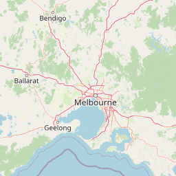
Map view of Baw Baw National Park

Use this park location map to pinpoint Baw Baw National Park in Australia, understand its exact geographic position, and read its mapped placement within the surrounding landscape more clearly.

Pigeon | © OpenStreetMap contributors
Park atlas

Browse surrounding subalpine landscapes and connect with the diverse protected areas across Victoria's Gippsland region.

Discover More National Parks and Protected Areas Near Baw Baw National Park in Victoria
Expand your exploration beyond Baw Baw National Park to map additional national parks and protected areas within Victoria's unique subalpine environment. Compare diverse landscapes, trace regional protected-area spread, and understand the full geographic context of the Victorian Alps.
National park

Yarra Ranges National Park: Victoria's Towering Mountain Ash Forests and Protected Landscape Geography

Explore mapped boundaries and vital water catchment landscapes.

Yarra Ranges National Park in Victoria, Australia, represents a significant protected landscape within the Great Dividing Range. It is renowned for its exceptionally tall mountain ash forests, which are vital carbon stores and habitats, and its critical function as a water catchment area for Melbourne. This park offers a deep dive into a unique geographic setting defined by diverse mountain terrain, temperate rainforests, and subalpine environments, all preserved for their ecological and water security importance.

Area
760 km²
Established
1995
IUCN
II
Visitors
800K annual
Watercolor illustration showing a lake surrounded by green hills and vegetation
National park

Lake Eildon National Park: Protected Landscape with Ancient Volcanic and Gold Mining Heritage

Explore mapped terrain and diverse eucalypt forests.

Lake Eildon National Park in Victoria's Central Highlands offers a unique protected landscape shaped by ancient volcanic activity and the region's gold rush era. This national park, centered around the large Lake Eildon reservoir, provides critical habitat within its diverse eucalypt forests. Discover its geological significance, historical mining sites, and mapped boundaries, offering a comprehensive view of its protected-area identity and regional geographic context.

Area
277.5 km²
Established
1997
IUCN
II
Relief
Mountain
National park

Alpine National Park: Victoria's Expansive National Park in the Great Dividing Range

Mapping significant alpine, subalpine, and mountain wilderness landscapes.

Alpine National Park represents Victoria's largest protected area, safeguarding critical alpine and subalpine environments across the Great Dividing Range. This national park encompasses vast mountainous terrain, including Victoria's highest peaks like Mount Bogong, and the expansive Bogong High Plains known for their unique grassland and woodland ecosystems. The park's protected landscape offers rich opportunities for geographic discovery and understanding its place within Australia's significant mountain wilderness regions.

Area
6,474 km²
Established
1989
IUCN
II
Relief
Mountain
National park

Morwell National Park: Protected Landscape Diversity in Victoria's Strzelecki Ranges

Explore the mapped terrain and unique forest ecosystems.

Morwell National Park, an Australian national park in the Strzelecki Ranges, is celebrated for its extraordinary plant and animal diversity within a concentrated area. The park preserves critical wet sclerophyll forests and delicate temperate rainforest pockets within deep gullies, offering a distinct landscape character. Its establishment reflects a significant community-driven conservation effort, making it a valuable site for understanding regional protected-area geography and landscape richness.

Area
5.65 km²
Established
1966
IUCN
III
Relief
Highland
National park

Dandenong Ranges National Park: A Protected National Park Landscape

Explore its mapped terrain and regional geographic context.

Dandenong Ranges National Park represents a significant protected area near Melbourne, Australia, characterized by its steep, undulating ridges and deep gullies supporting tall, wet forests. As a national park, it safeguards a vital natural landscape, providing context for regional geography and offering insights into its terrain. This entry facilitates detailed exploration of the park's protected boundaries and its place within the Australian protected-area atlas.

Area
35.4 km²
Established
1987
IUCN
II
Visitors
1M annual
National park

Tarra-Bulga National Park: Ancient Mountain Ash Forest Protected Landscape in Victoria

Explore mapped fern gullies and temperate rainforest ecosystems.

Tarra-Bulga National Park is a protected national park in Victoria, Australia, renowned for its spectacular old-growth mountain ash forests and lush fern gullies. This significant fragment of temperate rainforest offers a unique window into the region's natural heritage and geographic past. Discover the mapped landscape character, including towering trees and vibrant undergrowth, making it a key destination for protected-area exploration.

Area
15.22 km²
Established
1986
IUCN
II
Visitors
80K annual
National park

Churchill National Park: Remnant Woodland and Industrial Heritage in Victoria, Australia

Mapped protected area with notable bird diversity and historical quarry sites.

Churchill National Park offers a unique glimpse into Victoria's remnant woodland ecosystems and early twentieth-century industrial history. As a national park, it protects critical habitats for a variety of bird species and preserves the landscape features of historical quarrying operations, including the Scoresby Tramway ruins. The park's mapped geography and accessible walking tracks, like the Channel Track, provide opportunities for exploration and understanding its role as a protected natural and historical asset near Melbourne.

Area
2.71 km²
Established
1941
IUCN
II
Relief
Upland
National park

French Island National Park: Protected Island National Park with Coastal Wetland Habitats

Explore mapped boundaries and diverse terrain of this unique park.

French Island National Park preserves a vital island ecosystem in Victoria, Australia, featuring extensive mangrove forests, salt marshes, and open woodland. As one of Australia's most accessible island national parks, it offers a distinctive wilderness experience primarily reached by boat, showcasing coastal conservation and unique wetland habitats. The park's geography is defined by its low-lying terrain and tidal influences, creating a rich environment for mapped landscape exploration.

Area
111 km²
Established
1998
IUCN
II
Relief
Lowland

Common questions about visiting, size, designation, and location context for Baw Baw National Park

Baw Baw National Park FAQs for park facts, access, geography, and protected area context
Find quick answers about Baw Baw National Park, including protected-area facts, park geography, trail and visitor context, and how the park fits into its surrounding country and regional landscape.
MoriAtlas Explorer

Continue Your Protected Areas Search Across the Global Atlas

Deepen your exploration by continuing the structured search for national parks and protected areas worldwide. Utilize the comprehensive filtering capabilities to compare different conservation landscapes and refine your understanding of global park geography. Discover more about the distribution and characteristics of protected natural areas.

Global natural geography