
Peaks
Park geography
Detailed analysis of regional location, elevation statistics, and natural land features
Betung Kerihun National Park: Comprehensive Geographic Profile and Mapped Terrain Boundaries
Betung Kerihun National Park spans 8000 square kilometers within West Kalimantan, Indonesia. This geographic profile covers the mountain relief and forest landscape, including key peaks like Gunung Betung and major river systems such as the Sungai Kapuas and Sungai Mendalam.
Related tags
Montane RainforestBorneoTransboundary ConservationPrimatesOrangutan Habitat
Montane rainforest sanctuary protecting Borneo's transborder heritage
Betung Kerihun National Park
Betung Kerihun National Park is a vast protected area in West Kalimantan, Indonesian Borneo, established in 1995 as a premier conservation landscape for the island's montane and lowland rainforests. Spanning approximately 8,000 square kilometers, the park encompasses a dramatic terrain of steep hills and towering peaks including Mount Kerihun at 1,790 meters and Mount Lawit at 1,767 meters, positioning it as one of Borneo most significant mountainous protected areas. The park sits at the headwaters of the Kapuas River, the longest river in Indonesian Borneo, making it ecologically vital for downstream ecosystems and water security in the region.
- Location
- Indonesia
- Park type
- National park
- Established
- 1995
- Area
- 8,000 km²
- Highest point
- 1,790 m
Location overview
Regional data and island park status in West Kalimantan and Indonesia
Betung Kerihun National Park Geographic Profile and Location
The protected area is located in West Kalimantan, Indonesia, and maintains regional links to American Samoa. Geographic records document its official administrative bounds and island park status.
- Countries
- Indonesia
- Regions
- West Kalimantan
- Primary location
- West Kalimantan
- Geographic setting
- Island
Boundary and coordinates
Geolocation and boundary measurements across 8,000 square kilometers
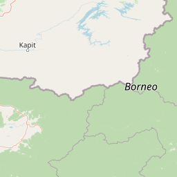
Betung Kerihun National Park Boundary Map and Geographic Limits
Interactive boundary mapping displays the spatial footprint of Betung Kerihun National Park to define its shape and position. Companion geographic facts detail the calculated land area, coordinate limits, and center points of the park.
- Boundary area
- 8,278.4 km²
- Boundary perimeter
- 804.1 km
- Northernmost point
- 1.5884° N
- Southernmost point
- 0.5978° N
- Easternmost point
- 114.2054° E
- Westernmost point
- 112.1997° E
- Geographic centre
- 1.2161° N, 113.3277° E
- North–south span
- 109.5 km
- East–west span
- 223.2 km
Elevation and terrain
Mountain relief statistics and internal natural features
Betung Kerihun National Park Terrain and Elevation Range
Elevation summary metrics detail the vertical range and mountain relief spanning Betung Kerihun National Park. Recorded natural features document the names, types, and spatial relationships found within the boundary.
- Minimum elevation
- 150 m
- Maximum elevation
- 1,790 m
- Highest point
- 1,790 m
Selected named natural features
Peaks
Gunung Condong
Peaks
Gunung Batu
Peaks
Gunung Lobang Ribut
Rivers
Kapuas River
Rivers
Sungai Sibau
Environmental setting
Tropical forest zones, mountainous relief, and riverine geography
Betung Kerihun National Park Environmental Classifications
Recorded landscape features, habitat types, and climate classifications provide complementary perspectives on the physical terrain of Betung Kerihun National Park. Stored environmental categories connect directly to relevant protected area destinations within the atlas.
- Relief
- Mountain
- Climate
- Tropical
- Water
- Major water bodies
- Forest cover
- Dense forest cover
Landscape features
Mountains · Hills · Forest · Rivers
Habitat types
Tropical forest · Montane forest · Riverine habitat
Park atlas
Trace the protected landscapes of Indonesian Borneo, extending from Betung Kerihun's montane rainforests.
Discover Nearby National Parks and Protected Areas Beyond Betung Kerihun in Borneo
Continue your exploration from Betung Kerihun National Park to discover other significant protected areas across Indonesian Borneo, tracing their unique montane and lowland rainforest ecosystems. This broader regional view allows for meaningful comparison of conservation efforts and diverse protected landscapes, revealing the interconnectedness of Borneo's natural heritage.
National parkSri Aman Division
About 41 km away#1 closest
West

Batang Ai National Park: National Park Landscape and Geographic Discovery
Explore the protected terrain and mapped boundaries of Sri Aman Division.
Batang Ai National Park serves as a distinct national park entity, vital for understanding the protected landscape and regional geography of Malaysia's Sri Aman Division. This resource offers detailed insights into the park's geographic scope, its mapped boundaries, and the natural terrain it encompasses, enabling structured exploration for atlas enthusiasts and geography researchers.
- Area
- 24 km²
- Established
- 1991
- IUCN
- II
- Relief
- Lowland
National parkIndonesia
About 51 km away#2 closest
West

Lake Sentarum National Park: Mapped Wetland Ecosystems and Protected Landscape in Indonesia
Explore the geographic context and protected area boundaries.
Lake Sentarum National Park represents a vital protected landscape within Indonesia, celebrated for its extensive lake ecosystems and wetland terrain. As a designated national park, it offers a rich area for geographic study, showcasing unique ecological features mapped within the Indonesian archipelago. Understanding its protected boundaries and the surrounding natural landscapes provides essential context for appreciating Indonesia's biodiversity and conservation efforts through an atlas-driven lens.
- Area
- 1,320 km²
- Established
- 1999
- IUCN
- VI
- Relief
- Lowland
National parkNorth Kalimantan
95 km away#3 closest
Northeast
Kayan Mentarang National Park: A Protected Landscape in North Kalimantan
Explore Borneo's critical protected area and its vast forest geography.
Kayan Mentarang National Park is an immense protected area in North Kalimantan, Indonesia, renowned for being a crucial part of the Heart of Borneo conservation initiative. This national park encompasses over 13,600 square kilometers of primary tropical rainforest, sheltering diverse montane and lowland habitats along the Indonesia-Malaysia border. Its importance lies in its vast, contiguous landscape, critical role in regional biodiversity, and its representation of one of Southeast Asia's last great wilderness expanses, offering significant insight into mapped protected areas.
- Area
- 13,605 km²
- Established
- 1996
- IUCN
- II
- Scope
- Mixed
National parkMalaysia
About 124 km away#4 closest
West
Maludam National Park: Southeast Asian Protected Landscape and National Park Geography
Mapped boundaries and natural terrain in Malaysia.
Maludam National Park offers a focused exploration of protected landscape identity and geographic context within Malaysia. As a designated national park, it serves as a vital component for understanding the distribution of protected areas and their mapped terrain. This detailed entry allows for an appreciation of the park's specific environmental character and its contribution to the broader atlas of natural landscapes in Southeast Asia, facilitating structured discovery for researchers and explorers.
- Area
- 432 km²
- Established
- 2000
- IUCN
- II
- Relief
- Lowland
National parkSarawak
About 126 km away#5 closest
West
Rajang Mangroves National Park: Borneo's Premier Mangrove Protected Landscape
Explore the mapped geography and wetland conservation of this Sarawak national park.
Rajang Mangroves National Park is a significant protected area dedicated to preserving the intricate mangrove swamp ecosystems of Sarawak's Rajang River delta. Encompassing a vast expanse of tidal channels and riverine forests, this national park serves as a critical habitat for unique wildlife and plays a vital role in coastal ecological health. Its landscape is defined by the dynamic interface between riverine and marine environments, offering a prime example of wetland conservation within Borneo's broader natural geography and atlas context.
- Area
- 107 km²
- Established
- 2000
- IUCN
- II
- Relief
- Lowland
National parkMiri Division
About 182 km away#6 closest
Northeast
Usun Apau National Park: National Park with Regional Geographic Context in Miri Division
Explore protected boundaries and mapped landscape details.
Usun Apau National Park represents a distinct protected landscape within the Miri Division, identified as a national park. This entry focuses on its geographic attributes, including its mapped boundaries and its contribution to the regional protected area network. Users can explore Usun Apau National Park to understand its specific role in the geography of Miri Division and to gain context on Malaysia's conservation landscapes.
- Area
- 471.22 km²
- Established
- 2005
- IUCN
- II
- Relief
- Mountain
National parkKuching Division
189 km away#7 closest
West
Bako National Park: Sarawak's Oldest National Park and Coastal Protected Landscape
Explore diverse ecosystems and dramatic mapped geology near Kuching Division.
Bako National Park, the oldest national park in Sarawak, Malaysia, offers a profound study in ecological concentration and geological drama. Covering a mere 27 square kilometers on the Muara Tebas peninsula, it encapsulates seven distinct ecosystem types, from coastal heath forest to mangrove areas, supporting significant biodiversity. The park's protected landscape is defined by its stunning sandstone coastline, carved by the sea into cliffs, arches, and seastacks, providing a unique geographic context. This makes Bako an essential destination for understanding Borneo's environmental diversity and the mapped boundaries of its conservation areas.
- Area
- 27.27 km²
- Established
- 1957
- IUCN
- II
- Relief
- Mixed relief
National parkCentral Kalimantan
About 198 km away#8 closest
South
Bukit Baka Bukit Raya National Park: Central Kalimantan's Protected Montane Rainforest Landscape
Explore the geographic core of Borneo's Schwaner mountain range.
Bukit Baka Bukit Raya National Park is a critical national park situated in Central Kalimantan, Indonesia, recognized for its extensive montane tropical rainforests and rugged topography. The park's landscape is dominated by the Schwaner mountain range, featuring prominent peaks like Bukit Raya, and functions as a vital watershed and biodiversity corridor. This protected area offers a rich subject for understanding regional geography, mapped landscapes, and the significance of Borneo's natural heritage within an atlas context.
- Area
- 1,810 km²
- Established
- 1992
- IUCN
- II
- Relief
- Mountain
MoriAtlas Explorer
Continue Exploring Betung Kerihun National Park's Geography and Mapped Landscape
Delve deeper into the geographic identity of Betung Kerihun National Park, understanding its role as a mapped protected area. Examine the relationship between its boundaries and the surrounding West Kalimantan geography to gain a more comprehensive appreciation of this national park's natural context. Continue your atlas exploration to uncover more about its unique landscape features.
Browse next
Global natural geography
Explore related park routes
Explore MoriAtlas Global ParksBrowse All MoriAtlas ParksGlobal Park Map DiscoveryMoriAtlas: Browse All CountriesBrowse All MoriAtlas ContinentsNational Park Environment AtlasGrand Canyon National Park AtlasYellowstone National Park AtlasYosemite National Park Atlas and GeographySerengeti National Park AtlasGalápagos National Park Protected LandscapeBanff National Park Geography and AtlasKruger National Park Atlas EntryUluṟu-Kata Tjuṯa National Park AtlasExplore Uluru-Kata Tjuta National Park GeographyPlitvice Lakes National Park AtlasFiordland National Park Protected LandscapeGreat Smoky Mountains National Park AtlasAfghanistan National Parks and Protected AreasAlbania National Parks and Protected AreasAlgeria National Parks and Protected AreasAmerican Samoa National Parks and Protected AreasAndorra National Parks and Protected AreasAngola National Parks and Protected AreasAntarctica National Parks and Protected AreasAntigua and Barbuda Park List