
Streams
Park geography
Analyzing the physical terrain, coastal landscape, and interior river networks
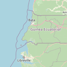
Campo Ma'an National Park: Comprehensive Geographic Profile and Mapped Boundaries
Examine the territorial footprint of Campo Ma'an National Park, covering approximately 2680 square kilometers of coastal and forest land in Cameroon. This geographic record maps the park boundaries, identifies major inland river systems like the Lobe and Rio Campo, and defines the environmental zones spanning from interior tropical forests to coastal reaches.
Related tags
national parklowland rainforestAtlantic Biafran forestgreat ape habitatgorilla conservation
Cameroon's biodiversity frontier protecting western lowland gorillas and central chimpanzees in Atlantic Biafran forest
Campo Ma'an National Park
Campo Ma'an National Park is a 2,680 square kilometer protected area in the South Region of Cameroon, situated in the Océan division along the Atlantic coast. The park forms part of the Atlantic Biafran forest ecosystem, one of Central Africa's most biodiverse rainforest regions. Established in 2000 as compensation for environmental impacts from the Chad-Cameroon oil pipeline, the park encompasses what was formerly the Campo Wildlife Reserve and the Ma'an forest plantation. It borders Equatorial Guinea to the south, the Atlantic Ocean to the west, and the Vallée-du-Ntem and Mvila regions to the east. The climate follows a bi-modal pattern with two dry seasons and two rainy seasons annually, supporting a closed evergreen canopy forest that has persisted as tropical rainforest since the Pleistocene era.
- Location
- Cameroon
- Park type
- National park
- Established
- 2000
- Area
- 2,680 km²
Location overview
National territorial alignment and coastal park status
Geographic Setting of Campo Ma'an National Park in Cameroon
Campo Ma'an National Park is located entirely within the sovereign territory of Cameroon. The conservation zone holds documented coastal status, defining its position along the regional shoreline.
- Countries
- Cameroon
- Primary location
- Cameroon
- Geographic setting
- Coastal
Boundary and coordinates
Geographic measurements and spatial extent across 2680 square kilometers
Campo Ma'an National Park Geographic Boundary Map and Spatial Scope
Map visualization of Campo Ma'an National Park provides spatial context for its conservation limits. Integrated geographic data highlights estimated area metrics, central coordinates, and spatial spans.
- Boundary area
- 2,601.5 km²
- Boundary perimeter
- 373.9 km
- Northernmost point
- 2.7472° N
- Southernmost point
- 2.1432° N
- Easternmost point
- 10.7986° E
- Westernmost point
- 9.8316° E
- Geographic centre
- 2.5019° N, 10.3467° E
- North–south span
- 66.8 km
- East–west span
- 107.5 km
Terrain and natural features
Explore recorded streams, rivers, islands, and waterfalls within the park
Campo Ma'an National Park Terrain and Named Natural Features
Examine recorded streams, rivers, and waterfalls located within the boundaries of Campo Ma'an National Park. Linked feature cards supply official names, types, and spatial relationships for each recorded natural feature.
Selected named natural features
Rivers
Bongola
Rivers
Bingang
Rivers
Rio Campo
Rivers
Mvini
Streams
Afane
Environmental setting
Tropical forest, coastal terrain, and dominant forest cover classifications
Environmental Classification and Setting for Campo Ma'an National Park
Recorded landscape features, tropical climate zones, and major water presence serve as complementary categories for reading the physical setting of Campo Ma'an National Park. Stored environmental classifications connect recorded attributes to relevant atlas destinations across the protected area.
- Climate
- Tropical
- Water
- Major water bodies
- Forest cover
- Dense forest cover
- Seasonality
- Seasonal
Landscape features
Forest · Coast · Beach
Habitat types
Tropical forest · Coastal habitat
Park atlas
Compare the regional geography of protected areas surrounding Campo Ma'an, exploring connected rainforest ecosystems.
Parks Near Campo Ma'an National Park: Trace Surrounding Protected Landscapes and Ecosystems
Explore national parks and protected areas geographically connected to Campo Ma'an National Park, spanning adjacent lowland rainforest and coastal landscapes of Central Africa. Comparing these protected landscapes provides crucial insights into regional biodiversity patterns and distinct ecological features within the broader Central African ecosystem.
Marine protected areaCameroon
5.7 km away#1 closest
Northwest

Parc national marin Manyange na Elombo-Campo: Marine Protected Area and Regional Geography
Coastal conservation mapping in the South Region of Cameroon
Spanning a vast offshore territory in the Atlantic Ocean, Parc national marin Manyange na Elombo-Campo represents a major step in Central African marine conservation. The park boundary encompasses complex seafloor topography and river-mouth influences that provide essential habitat for vulnerable marine species. This atlas entry provides a detailed look at its marine extent and its integration into the larger Gulf of Guinea protected corridor.
- Area
- 42,364 km²
- Established
- 2021
- Relief
- Lowland
- Climate
- Tropical
National parkCameroon
67 km away#2 closest
North
Douala-Edéa National Park: Coastal Mangrove and Tropical Forest Protected Landscape
Explore Cameroon's vital protected national park geography.
Douala-Edéa National Park is a protected national park in Cameroon's Littoral Region, defined by its extensive coastal geography where tropical lowland equatorial forests merge with significant Atlantic mangrove ecosystems. This area, encompassing roughly 2,715 square kilometers along the Bight of Biafra and the Sanaga River estuary, offers rich context for understanding Central Africa's coastal protected lands and diverse natural landscapes.
- Area
- 2,715.12 km²
- Established
- 2018
- IUCN
- II
- Relief
- Lowland
National parkEquatorial Guinea
About 68 km away#3 closest
South

Monte Alén National Park National Park: Mapped Protected Landscape in Equatorial Guinea
Explore regional geography and park boundaries.
Monte Alén National Park, a designated national park in Equatorial Guinea, offers a unique focal point for understanding protected landscapes. This entry provides detailed geographic context, highlighting the park's mapped boundaries and its significance within the atlas of Central African natural terrain. Investigate the terrain and regional setting of Monte Alén National Park for structured geographic discovery.
- Area
- 2,000 km²
- Established
- 1990
- IUCN
- II
- Relief
- Mountain
National parkWoleu-Ntem Province
126 km away#4 closest
South

Crystal Mountains National Park: National Park Protected Area and Geographic Context in Woleu-Ntem Province
Explore its mapped boundaries and regional landscape.
Crystal Mountains National Park is a designated national park offering critical insights into its protected landscape and geographic setting. Users can explore the mapped boundaries of this protected area, understand its regional terrain, and gain context within Woleu-Ntem Province through structured geographic data. This page provides the foundational atlas information for comprehending the park's conservation significance and natural features.
- Area
- 1,200 km²
- Established
- 2002
- IUCN
- II
- Relief
- Mountain
National parkEquatorial Guinea
About 153 km away#5 closest
Southeast
Altos de Nsork National Park: Equatorial Guinea's Protected Landscape and Map Context
Explore the mapped boundaries of this national park.
Altos de Nsork National Park stands as a designated national park within Equatorial Guinea, offering a distinct protected landscape. This entry provides essential atlas-driven details, emphasizing its geographic setting and mapped park boundaries. Understand its regional context and its significance as part of the conservation network in Central Africa, contributing to a richer understanding of mapped natural terrains.
- Area
- 700 km²
- Established
- 2000
- IUCN
- II
- Relief
- Highland
National parkGabon
167 km away#6 closest
South
Akanda National Park: A Key Protected Landscape on Gabon's Atlantic Coast
Explore Gabon's vital mangrove ecosystems and coastal protected areas.
Akanda National Park in Gabon is a significant protected area celebrated for its expansive mangrove forests and critical role in supporting migratory bird populations. Located along the Atlantic coast, this park's unique landscape at the nexus of tidal waters and coastal terrain makes it a valuable site for understanding regional ecology and mapped protected lands. It serves as a primary destination for exploring the natural geography and conservation significance of West African coastal environments.
- Area
- 540 km²
- Established
- 2002
- IUCN
- II
- Relief
- Lowland
National parkBioko Norte
About 184 km away#7 closest
Northwest
Pico Basilé National Park: Volcanic Peak National Park and Protected Landscape
Explore Bioko Norte's unique montane terrain and rich avifauna.
Pico Basilé National Park is a critical conservation zone encompassing Equatorial Guinea's highest point, Pico Basilé volcano. This national park protects unique montane forest ecosystems and their diverse inhabitants, including several threatened primate species and a significant bird population, making it a key protected area on Bioko Island. Understand its geographic setting within Bioko Norte and its role as a vital natural landscape.
- Area
- 300 km²
- Established
- 2000
- IUCN
- II
- Relief
- Mountain
National parkGabon
187 km away#8 closest
East
Minkébé National Park: Protected Area and Geographic Context in Gabon
Explore the mapped terrain and protected landscape of this national park.
Gain a structured understanding of Minkébé National Park, a designated national park situated in Gabon. This destination focuses on the park's protected landscape, its distinct mapped boundaries, and its contribution to the regional geography of Central Africa. Examine how its protected status shapes the natural terrain and offers a unique angle for geographic discovery.
- Area
- 7,570 km²
- Established
- 2002
- IUCN
- II
- Relief
- Upland
MoriAtlas Explorer
Continue Exploring Campo Ma'an National Park's Mapped Geography and Protected Landscape
Delve deeper into the geographic context of Campo Ma'an National Park, understanding its specific mapped boundaries and the role of its evergreen canopy ecosystem. This protected area in Cameroon is central to the Atlantic Biafran forest, providing critical habitat and serving as a vital location for regional conservation study. Continue your exploration to grasp the full atlas significance of this important national park.
Browse next
Global natural geography
Explore related park routes
Explore MoriAtlas Global ParksBrowse All MoriAtlas ParksGlobal Park Map DiscoveryMoriAtlas: Browse All CountriesBrowse All MoriAtlas ContinentsNational Park Environment AtlasGrand Canyon National Park AtlasYellowstone National Park AtlasYosemite National Park Atlas and GeographySerengeti National Park AtlasGalápagos National Park Protected LandscapeBanff National Park Geography and AtlasKruger National Park Atlas EntryUluṟu-Kata Tjuṯa National Park AtlasExplore Uluru-Kata Tjuta National Park GeographyPlitvice Lakes National Park AtlasFiordland National Park Protected LandscapeGreat Smoky Mountains National Park AtlasAfghanistan National Parks and Protected AreasAlbania National Parks and Protected AreasAlgeria National Parks and Protected AreasAmerican Samoa National Parks and Protected AreasAndorra National Parks and Protected AreasAngola National Parks and Protected AreasAntarctica National Parks and Protected AreasAntigua and Barbuda Park List