Mori Atlas logo
National parkChư Mom Ray National Park

Discover the geographic context and protected landscape of Chư Mom Ray National Park in Kon Tum Province.

Chư Mom Ray National Park: Vietnam's National Park with Mapped Protected Boundaries and Regional Geography

Chư Mom Ray National Park represents a key protected landscape within Vietnam, situated in the Kon Tum Province. As a designated national park, its mapped boundaries contribute to the understanding of regional geography and protected areas. This atlas-focused entry provides insight into the park's environmental context and its placement within Vietnam's network of conservation lands, facilitating detailed geographic exploration and landscape awareness.

national parksVietnamCentral HighlandsKon Tum Provinceprotected areasforest protection

Chư Mom Ray National Park

National park

Park overview

Structured park overview, official facts, and landscape profile for Chư Mom Ray National Park

Chư Mom Ray National Park park facts, protected area profile, and essential visitor context
Review the core facts for Chư Mom Ray National Park, including designation, size, terrain, visitor scale, habitats, and operating context in one park-focused overview.

About Chư Mom Ray National Park

Chư Mom Ray National Park represents a protected landscape in the mountainous interior of southern Vietnam. Established in 2002, the park occupies a substantial footprint of approximately 566 square kilometers within Kon Tum Province, one of the five provinces comprising the Central Highlands region. The area is characterized by its hilly and mountainous terrain, typical of the Central Highlands' topography. This national park was created through a formal government decision that upgraded the previous nature reserve status, reflecting Vietnam's commitment to expanding its network of protected areas. The park contributes to the country's ecological preservation efforts in a region that features complex landscapes, diverse forest types, and significant environmental value. Kon Tum Province, where the park is located, borders Laos and Cambodia and serves as an important ecological corridor within Indochina.

Quick facts and research context for Chư Mom Ray National Park

Chư Mom Ray National Park is situated in the Central Highlands of Vietnam, specifically within Kon Tum Province. The protected area spans roughly 566 square kilometers of land. It was established as a national park in 2002 through government Decision number 103/2002/QĐ-TTg, which elevated its status from a nature reserve to a national park. The park is positioned at coordinates approximately 14°28′00″N 107°38′00″E. As an IUCN Category II protected area, it receives formal designation as a national park focused on ecosystem preservation.

Park context

Deeper park guide and search-rich context for Chư Mom Ray National Park

Chư Mom Ray National Park history, landscape, wildlife, and travel context
Explore Chư Mom Ray National Park through its history, landscape character, ecosystems, wildlife, conservation priorities, cultural context, and seasonal travel timing in a structured park guide built for atlas discovery and search intent.

Why Chư Mom Ray National Park stands out

Chư Mom Ray National Park is known primarily as a forest protection area within Vietnam's Central Highlands. The park protects mountainous terrain and associated forest ecosystems in this northeastern section of the Central Highlands region. While specific biodiversity details are limited in available sources, the national park serves as a conservation space for the forest environments of Kon Tum Province, representing Vietnam's broader effort to preserve significant ecological zones in the Central Highlands.

Chư Mom Ray National Park history and protected-area timeline

Chư Mom Ray National Park was officially established through Decision number 103/2002/QĐ-TTg, issued by the government of Vietnam on July 30, 2002. This decision marked the formal transition of the area from its previous designation as a nature reserve to the status of a national park. The establishment of the park represented an expansion of Vietnam's protected area network during the early 2000s, a period when the country was actively developing its conservation framework. The governing body for the park is the People's Committee of Kon Tum Province, which oversees management and operational responsibilities at the provincial level. The elevation from nature reserve to national park status typically reflects increased protection standards and resource allocation for the area's conservation.

Chư Mom Ray National Park landscape and geographic character

The landscape of Chư Mom Ray National Park is characterized by mountainous and hilly terrain typical of Vietnam's Central Highlands region. This region features a complex topography with ridges, valleys, and elevated plateaus. The park's position in Kon Tum Province places it in an area of northeastern Central Highlands where forest cover remains significant. The terrain provides diverse microhabitats and ecological zones within the protected area. The broader Central Highlands region is known for its basalt-derived soils and subtropical highland environment.

Chư Mom Ray National Park ecosystems, habitats, and plant life

As a national park in the Central Highlands, Chư Mom Ray protects forest ecosystems characteristic of this region of Vietnam. The area likely contains a mix of forest types adapted to the subtropical highland conditions of the Central Highlands. The protection of these forest environments supports broader conservation objectives for Vietnam's mountainous interior. While specific vegetation details are limited in available sources, the park's establishment as a protected area reflects recognition of the ecological value of these Central Highlands forest ecosystems.

Chư Mom Ray National Park wildlife and species highlights

Specific wildlife details for Chư Mom Ray National Park are not extensively documented in available source material. As a protected area within the Central Highlands, the park likely supports wildlife populations typical of Vietnamese forest ecosystems in this region. The Central Highlands is known for diverse fauna including various mammal, bird, and reptile species adapted to forest and mountainous environments.

Chư Mom Ray National Park conservation status and protection priorities

Chư Mom Ray National Park operates under IUCN Category II designation, reflecting its classification as a national park with primary conservation objectives focused on ecosystem protection. The park contributes to Vietnam's network of protected areas, which collectively aim to preserve significant natural landscapes and biodiversity. The formal establishment in 2002 and provincial-level management through Kon Tum Province's People's Committee provide the institutional framework for ongoing conservation efforts.

Chư Mom Ray National Park cultural meaning and human context

Chư Mom Ray National Park is located in Kon Tum Province, a region with significant cultural diversity. The province is home to various ethnic minority communities whose traditional lands and livelihoods intersect with the forested landscapes of the Central Highlands. While the source material does not detail specific cultural connections to the park area, the broader Central Highlands region is known for its rich indigenous and ethnic minority heritage.

Top sights and standout views in Chư Mom Ray National Park

Chư Mom Ray National Park offers protection for Central Highlands forest ecosystems in Kon Tum Province. The park spans approximately 566 square kilometers of mountainous terrain. Established in 2002, it represents Vietnam's conservation commitment in this ecologically significant region. The area provides ecological value through its forest protection and contributes to the country's protected area network in the Central Highlands.

Best time to visit Chư Mom Ray National Park

Specific seasonal guidance for visiting Chư Mom Ray National Park is not provided in available source material. Visitors to Vietnam's Central Highlands typically consider the dry season from November to April as more favorable for outdoor activities, while the wet season from May to October brings higher rainfall and more challenging trail conditions. Travelers to the region should consult current management guidance and local conditions before planning visits.

Park location guide

Geography guide, regional context, and park location map for Chư Mom Ray National Park

Chư Mom Ray National Park park geography, regions, and map view in Vietnam
Understand where Chư Mom Ray National Park sits in Vietnam through a broader geographic reading of the surrounding landscape, nearby location context, and its mapped position within the national park landscape.

How Chư Mom Ray National Park fits into Vietnam

Vietnam, officially the Socialist Republic of Viet Nam, is a unitary communist state in Southeast Asia. It occupies roughly 331,000 square kilometres along the eastern edge of Mainland Southeast Asia, with a population exceeding 102 million. The country is bordered by China to the north, Laos and Cambodia to the west, and has maritime boundaries in the Gulf of Thailand and South China Sea.

Wider geography shaping Chư Mom Ray National Park in Vietnam

Vietnam occupies the eastern edge of Mainland Southeast Asia, stretching along the Gulf of Thailand to the southwest and the South China Sea to the east. The country is bordered by China to the north, and Laos and Cambodia to the west. It has a diverse landscape ranging from the Red River Delta in the north to the Mekong Delta in the south.

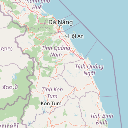
Map view of Chư Mom Ray National Park

Use this park location map to pinpoint Chư Mom Ray National Park in Vietnam, understand its exact geographic position, and read its mapped placement within the surrounding landscape more clearly.

Pigeon | © OpenStreetMap contributors

Location context for Chư Mom Ray National Park

Central HighlandsKon Tum Province
Park atlas

Compare adjacent protected landscapes and trace forest ecosystems across the Central Highlands region

Explore National Parks and Protected Areas Near Chư Mom Ray National Park in Vietnam's Central Highlands
Discover other national parks and protected areas geographically proximate to Chư Mom Ray National Park, tracing the distribution of forest ecosystems across Vietnam's Central Highlands region. This curated selection allows for comparison of conservation landscapes, revealing broader patterns in protected terrain and ecological zones within the country.
National parkRatanakiri province

Virachey National Park: Cambodia's Vast Highland Protected Landscape in Ratanakiri

Explore its remote montane forest ecosystems and diverse terrain.

Virachey National Park, Cambodia's largest national park, offers a profound glimpse into one of mainland Southeast Asia's last great wildernesses. Spanning remote highland terrain in Ratanakiri province, it features dramatic elevation changes from 400 to 1,500 meters, supporting diverse ecosystems including dense lowland forests, unique montane cloud forests, and upland savannahs. Its recognition as an ASEAN Heritage Park underscores its critical regional conservation value, making it a significant destination for understanding protected landscapes and their geographic context.

Area
3,380.57 km²
Established
1993
IUCN
II
Relief
Mountain
National parkVietnam

Kon Ka Kinh National Park: Vietnam National Park Protected Landscape Atlas

Explore mapped geography and protected area details.

Kon Ka Kinh National Park is a protected natural area situated in Vietnam, designated as a national park to preserve its unique geographic and landscape features. This entry serves as a focused point for atlas-driven discovery, detailing the park's mapped boundaries and its significance within the broader context of Vietnam's regional geography. Understand the protected land's identity and its role in mapping natural landscapes.

Area
417.8 km²
Established
2002
IUCN
II
Relief
Mountain
National parkRatanakiri province

Veun Sai, Siem Pang National Park: Northeastern Cambodia's Protected Lowland Forest Landscape

Mapped Boundaries and Primate Conservation Habitat

Veun Sai, Siem Pang National Park in Cambodia's Ratanakiri province is a vital protected area featuring expansive lowland evergreen and semi-evergreen forests. Its designation as a national park underscores its role in safeguarding critical habitat for diverse primate populations, notably the endangered Northern buffed-cheeked gibbon. The park's geography, characterized by gentle terrain and extensive forest cover, makes it a significant component of the region's biodiversity corridor and a key site for understanding Cambodia's natural landscapes.

Area
574.69 km²
Established
2016
IUCN
II
Relief
Lowland
National parkRatanakiri province

O'Yadav National Park: Protected Forest Conservation in Ratanakiri Province

Explore mapped boundaries and regional landscape context.

O'Yadav National Park is a national park located in northeastern Cambodia's Ratanakiri province, designated to protect significant forest ecosystems and serve as a vital link in the nation's biodiversity corridor system. Spanning 105,019 hectares, the park encompasses forested terrain and includes the historically significant Yak Nang temple site. Its conservation efforts contribute to the ecological integrity of the broader Indochinese region, making it a key protected landscape for atlas-based geographic study.

Area
1,050.19 km²
Established
2016
IUCN
II
Scope
Terrestrial
National parkĐắk Lắk Province

Yok Đôn National Park: Vietnam's Expansive Lowland Forest Protected Landscape and Regional Geography

Mapped boundaries within Đắk Lắk Province, part of a transboundary conservation area.

Yok Đôn National Park is Vietnam's largest lowland forest national park, covering approximately 1,155 square kilometers in Đắk Lắk Province. This protected area is characterized by its rare khộp forest ecosystem and serves as a crucial refuge for large mammals. Situated near the Cambodian border, it forms a key component of one of Southeast Asia's largest continuous protected area networks, offering significant insights into regional protected landscape geography and conservation connectivity.

Area
1,155.45 km²
Established
1986
IUCN
II
Relief
Lowland
National parkVietnam

Bach Ma National Park: Protected Area and Mountain Landscape in Vietnam

Explore the biodiversity and unique geography of this vital national park.

Bach Ma National Park in Vietnam is a protected area defined by its steep, granite-rich mountainous terrain within the Annamite Range. The park’s location at a significant biogeographical crossroads contributes to its exceptional biodiversity, particularly its documented birdlife and varied forest ecosystems. Understanding Bach Ma National Park through its mapped landscape provides critical insight into Vietnam's natural heritage and the ecological dynamics shaped by its unique regional geography.

Area
220 km²
Established
1986
IUCN
II
Relief
Mountain
Watercolor illustration of a river, trees, and hills in a natural landscape.
National parkĐắk Lắk Province

Chư Yang Sin National Park: Mapped Protected Landscape in Đắk Lắk Province

Explore its protected boundaries and regional geographic context.

Chư Yang Sin National Park stands as a key protected natural area within Vietnam's Central Highlands. This national park, located in the expansive Đắk Lắk Province, provides a rich subject for geographic discovery. Understanding its mapped boundaries and position within the regional landscape offers valuable context for atlas-based exploration of Vietnam's protected lands.

Area
589.47 km²
Established
2002
IUCN
II
Scope
Terrestrial
National parkLâm Đồng Province

Bidoup Nui Ba National Park: Vietnam National Park Atlas and Protected Landscape

Explore mapped boundaries and regional geography of this protected area.

Bidoup Nui Ba National Park is a prominent national park located within the Lâm Đồng Province of Vietnam's Central Highlands. This park serves as a focal point for understanding the regional geography and the distribution of protected lands across Vietnam. Its mapped boundaries define a significant natural landscape, offering users detailed atlas-style context for geographic exploration and protected-area research.

Area
648 km²
Established
2004
IUCN
II
Relief
Mountain

Common questions about visiting, size, designation, and location context for Chư Mom Ray National Park

Chư Mom Ray National Park FAQs for park facts, access, geography, and protected area context
Find quick answers about Chư Mom Ray National Park, including protected-area facts, park geography, trail and visitor context, and how the park fits into its surrounding country and regional landscape.
MoriAtlas Explorer

Continue Your Protected Areas Search Across the Global Atlas

Deepen your exploration by continuing the structured search for national parks and protected areas worldwide. Utilize the comprehensive filtering capabilities to compare different conservation landscapes and refine your understanding of global park geography. Discover more about the distribution and characteristics of protected natural areas.

Global natural geography