
Mountain saddles
Park geography
Detailed spatial analysis of marine environments, island landscapes, and terrain features
Comprehensive Geographic Profile and Mapped Boundaries of Dadohaehaesang National Park
Analyze the formal geographic framework of Dadohaehaesang National Park in South Korea. This structured dataset covers the park's expansive marine and land boundaries, defining a total area of over 2,300 square kilometers across diverse coastal and island terrains.
Related tags
Marine national parkArchipelagoCoastal ecosystemsIsland landscapeSouth Korea national parks
South Korea's largest marine national park protecting a scenic archipelago of islands, coves, and rich coastal ecosystems
Dadohaehaesang National Park
Dadohaehaesang National Park is South Korea's largest national park, established in 1981 to protect a spectacular stretch of coastal islands, marine waters, and rugged landscapes along the country's southern coastline. The park encompasses a total area of 2,321.5 square kilometers, of which approximately 1,986.6 square kilometers consists of marine territory and 334.8 square kilometers is land area. This maritime orientation makes it distinctive among South Korea's protected areas, as it combines terrestrial mountain and forest ecosystems with extensive tidal zones, open sea, and island environments. The park spans a chain of islands and adjacent coastal regions known for their dramatic scenery, with prominent attractions including Hongdo Island, Heuksando, and Baekdo. The park holds IUCN Category II designation and is managed by the Korea National Park Service, welcoming approximately 560,000 visitors annually who come to experience its unique blend of island landscapes, coastal cliffs, and marine biodiversity.
- Location
- South Korea
- Park type
- National park
- Established
- 1981
- Area
- 2,321.5 km²
Location overview
Island and coastal jurisdictions in South Korea and American Samoa
Dadohaehaesang National Park Regional and Coastal Geography
Dadohaehaesang National Park holds documented geographic relationships with South Korea and American Samoa. Geographic data details its status as a coastal, marine, and island protected area.
- Countries
- South Korea
- Primary location
- South Korea
- Geographic setting
- Coastal · Island · Marine
Boundary and coordinates
Mapping more than 2,300 square kilometers of marine and island territory
Dadohaehaesang National Park Boundary Map and Spatial Dimensions
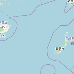
The mapped boundary outlines the spatial distribution of the protected marine and island zones. Accompanying geographic metrics detail the calculated total area, regional center, and coordinate limits of the park.
- Boundary area
- 2,276.5 km²
- Boundary perimeter
- 1,479.8 km
- Northernmost point
- 34.7978° N
- Southernmost point
- 33.9635° N
- Easternmost point
- 127.9072° E
- Westernmost point
- 125.1699° E
- Geographic centre
- 34.3578° N, 126.4782° E
- North–south span
- 92.5 km
- East–west span
- 251.7 km
Terrain and natural features
Mapped island formations, peaks, and coastal landforms
Dadohaehaesang National Park Terrain and Named Natural Features
Browse recorded natural features located within the park boundary, including named peaks, islands, beaches, and caves. Individual feature cards detail types and spatial relationships across the protected terrain.
Selected named natural features
Islands
고여
Peaks
도끼바위
12.1 m
Peaks
돈대산
218.3 m
Peaks
광대봉
312.5 m
Islands
명도
Environmental setting
Analysis of recorded coastal landscapes, island geography, and dominant water systems
Dadohaehaesang National Park Environmental Classifications and Physical Setting
Recorded coastal and island landscape categories frame the physical setting of Dadohaehaesang National Park through dominant water presence indicators. Stored classifications connect physical geography data to related protected area destinations across the atlas.
- Water
- Water-dominated
Landscape features
Coast · Islands
Park atlas
Trace the Regional Geography and Protected Landscape Spread Around Dadohaehaesang National Park, Exploring Connected Coastal and Island Ecosystems.
Continue Your Discovery: Nearby National Parks and Protected Areas Around Dadohaehaesang National Park
After exploring Dadohaehaesang National Park's unique maritime archipelago, browse other prominent national parks and protected areas across South Korea's southern coastline and adjacent marine environments. Compare distinct park geographies, conservation priorities, and diverse coastal, island, and terrestrial landscapes to expand your understanding of the region's interconnected protected-area network.
National parkSouth Korea
About 23 km away#1 closest
Northeast

Hallyeohaesang National Park: South Korea National Park Geographic Atlas Entry
Explore mapped protected area boundaries and natural terrain.
As a designated national park in South Korea, Hallyeohaesang National Park offers a distinct geographic profile crucial for atlas exploration. This entry focuses on its protected landscape features, mapped territorial extent, and regional context within the Republic of Korea. Understand the park's specific geographical markers and its significance as a mapped protected area.
- Area
- 545.63 km²
- Established
- 1968
- IUCN
- II
- Access
- Access unknown
National parkJeollanam-do
About 46 km away#2 closest
North
Wolchulsan National Park: Detailed Geographic and Protected Landscape Atlas Entry
Explore mapped boundaries and natural terrain context.
This MoriAtlas entry for Wolchulsan National Park provides a detailed look at its identity as a protected landscape within Jeollanam-do, South Korea. Focus is placed on its geographic context and mapped park boundaries, offering a foundation for understanding its place in the regional atlas. Discover the structured details of this national park's natural terrain and its significance as a preserved natural area.
- Area
- 56.6 km²
- Established
- 1988
- IUCN
- II
- Relief
- Mountain
National parkJeollanam-do
About 68 km away#3 closest
North
Mudeungsan National Park: Mapped Protected Landscape and Regional Geography Context
Explore Mudeungsan National Park's geographic setting in Jeollanam-do.
Mudeungsan National Park offers a distinct protected landscape within the Jeollanam-do region of South Korea. This atlas-focused page details its mapped geographic boundaries and the surrounding natural terrain, providing essential context for understanding its role as a national park. Explore the park's identity through its unique landscape and regional geography.
- Area
- 75.45 km²
- Established
- 2012
- IUCN
- II
- Relief
- Mountain
National parkSouth Korea
About 74 km away#4 closest
Northeast
Jirisan National Park: South Korea's Premier Protected Landscape and Map Resource
Explore the mapped terrain and protected area geography.
Jirisan National Park is a key protected area within South Korea, serving as a vital component of the nation's natural landscape. This atlas-focused content provides detailed geographic information, highlighting the park's mapped boundaries and its role within the regional context of the Korean Peninsula. Understand the distinct characteristics of this protected national park for comprehensive geographic discovery.
- Area
- 471.75 km²
- Established
- 1967
- IUCN
- II
- Visitors
- 1.5M annual
National parkJeju Province
About 75 km away#5 closest
South
Hallasan National Park: South Korea's Highest Mountain National Park on Jeju
Volcanic Terrain and Mapped Protected Boundaries
Hallasan National Park encompasses South Korea's highest mountain, a massive shield volcano on Jeju Island. This page details the park's protected landscape, from sub-tropical forests to alpine environments, and its prominent role within Jeju Province's geography. Discover its mapped terrain and unique geological features, including the summit crater lake Baekrokdam.
- Area
- 153.11 km²
- Established
- 1970
- IUCN
- II
- Relief
- Mountain
National parkSouth Korea
About 100 km away#6 closest
North
Naejangsan National Park: South Korea's Mapped Protected Landscape and Geography
Discover the park's protected boundaries and regional context.
Investigate Naejangsan National Park, a protected area within South Korea, through its mapped geography and landscape context. This detailed atlas entry provides insight into the park's specific geographic identity and its role as a national park, offering a structured understanding of its protected natural features for focused exploration and research.
- Area
- 81.45 km²
- Established
- 1971
- IUCN
- II
- Relief
- Mountain
National parkJeollabuk-do
About 111 km away#7 closest
North
Byeonsan-bando National Park: Protected Landscape and Geographic Context in Jeollabuk-do
Explore mapped terrain and regional park geography.
This detail page provides an in-depth look at Byeonsan-bando National Park, a protected area located in South Korea's Jeollabuk-do region. Users can discover the park's specific geographic identity, understand its mapped boundaries, and explore its role within the broader regional landscape. The content is structured for atlas exploration, offering detailed insights into the park's natural terrain and its significance as a national park.
- Area
- 154.71 km²
- Established
- 1988
- IUCN
- II
- Relief
- Mixed relief
National parkSouth Gyeongsang Province
128 km away#8 closest
Northeast
Gayasan National Park: National Park Identity and Mapped Geographic Context in South Korea
Discover Protected Landscape and Regional Terrain
Gayasan National Park presents a distinct protected-area entity within South Gyeongsang Province, serving as a crucial point for atlas-driven geographic exploration. As a designated national park in South Korea, it offers insights into its specific mapped boundaries and the surrounding natural terrain. Understanding this park's role within the regional geography provides a foundational element for comprehending broader landscape patterns and protected land distribution across the country.
- Area
- 167.6 km²
- Established
- 1972
- IUCN
- II
- Relief
- Mountain
MoriAtlas Explorer
Continue Exploring Dadohaehaesang National Park's Geographic Identity
Further your understanding of Dadohaehaesang National Park by examining its specific geographic features and protected landscape context. This detailed exploration provides essential data for anyone interested in the mapped terrain and regional distribution of national parks, offering a precise look at this South Korean protected area's role within a global atlas.
Browse next
Global natural geography
Explore related park routes
Explore MoriAtlas Global ParksBrowse All MoriAtlas ParksGlobal Park Map DiscoveryMoriAtlas: Browse All CountriesBrowse All MoriAtlas ContinentsNational Park Environment AtlasGrand Canyon National Park AtlasYellowstone National Park AtlasYosemite National Park Atlas and GeographySerengeti National Park AtlasGalápagos National Park Protected LandscapeBanff National Park Geography and AtlasKruger National Park Atlas EntryUluṟu-Kata Tjuṯa National Park AtlasExplore Uluru-Kata Tjuta National Park GeographyPlitvice Lakes National Park AtlasFiordland National Park Protected LandscapeGreat Smoky Mountains National Park AtlasAfghanistan National Parks and Protected AreasAlbania National Parks and Protected AreasAlgeria National Parks and Protected AreasAmerican Samoa National Parks and Protected AreasAndorra National Parks and Protected AreasAngola National Parks and Protected AreasAntarctica National Parks and Protected AreasAntigua and Barbuda Park List