
Lakes
Park geography
A comprehensive analysis of terrain, environmental zones, and regional landscape context.
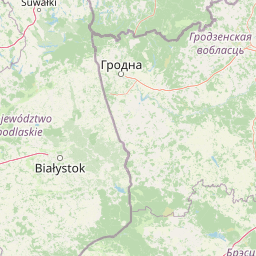
Detailed Geographic Profile and Mapped Boundaries of Dzūkija National Park in Lithuania
This geographic overview provides a structural analysis of Dzūkija National Park in Lithuania. It features detailed measurements covering 584.53 square kilometers, including mapped boundary parameters and diverse landscape characteristics such as forests, wetlands, and riverine habitats. The record includes specific natural features like springs, rocky formations, and elevated viewpoints located within the park boundary.

Lithuania's largest national park, protecting the primeval forests and inland dunes of the Dainava region
Dzūkija National Park
Dzūkija National Park is Lithuania's largest and most ecologically significant protected area, established in 1991 to preserve the extraordinary natural and cultural heritage of the Dainava region in the country's southeastern corner. Located approximately 100 kilometers southwest of Vilnius and 100 kilometers south of Kaunas, the park encompasses a vast landscape of ancient pine forests, extensive wetlands, inland dune systems, and river valleys carved by the Nemunas River and its tributaries. The park protects the largest contiguous forest area in Lithuania, where forests cover approximately 85% of the territory, predominantly consisting of pine-dominated woodlands with birch, spruce, and alder in lower-lying areas. The park's most distinctive geographical features are the remarkable inland dune massifs rising from the sandy plains around Marcinkonys, Lynežeris, Grybaulia, and Šunupis, remnants of the last Ice Age that now support unique heathland and lichen communities. The park belongs to both the Association of Baltic National Parks and the Federation of European National Parks, and since 2011 has been part of the prestigious PAN Parks network, representing the only Lithuanian member of this European wilderness preservation initiative.
- Location
- Lithuania
- Park type
- National park
- Established
- 1991
- Area
- 584.5 km²
Location overview
Territorial positioning and national status within Lithuanian borders
Dzūkija National Park: Geographic Location and Setting in Lithuania
Dzūkija National Park is situated entirely within the national borders of Lithuania. Records confirm its status as an interior terrestrial protected area with no coastal or marine boundaries.
- Countries
- Lithuania
- Primary location
- Lithuania
- Geographic setting
- Inland
Boundary and coordinates
Spatial extent and geographic limits of the 584 square kilometer reserve
Mapping the Geographic Boundaries of Dzūkija National Park
Detailed cartographic outlines reveal how the protected territory sits within the regional landscape. Derived measurements display the calculated area, center coordinates, and spatial spans of the reserve.
- Boundary area
- 583.7 km²
- Boundary perimeter
- 212.1 km
- Northernmost point
- 54.257° N
- Southernmost point
- 53.9017° N
- Easternmost point
- 24.5827° E
- Westernmost point
- 23.9423° E
- Geographic centre
- 54.0997° N, 24.2746° E
- North–south span
- 39.5 km
- East–west span
- 41.9 km
Terrain and natural features
Recorded lowland relief classifications and internal water bodies
Dzūkija National Park Terrain and Named Natural Features
Stored terrain classifications identify lowland relief across the protected area, alongside recorded lakes, streams, and wetlands. Linked feature cards supply names, types, and spatial relationships for each mapped natural element within the boundary.
Selected named natural features
Named stones
Akmuo „Jaučio pėda“
Named stones
Petriuko akmuo
Wetlands
Kundryno raistėlis
Streams
Lynupis
Viewpoints
Liskiava Hillfort
Environmental setting
Temperate lowland terrain featuring extensive forest cover, major river networks, and diverse wetland habitats.
Dzūkija National Park Environmental Classifications and Physical Setting
Recorded landscape features and habitat types serve as complementary frameworks for reading the physical setting of Dzūkija National Park. Structured environmental categories connect directly to related atlas destinations and regional records.
- Relief
- Lowland
- Climate
- Temperate
- Water
- Major water bodies
- Forest cover
- Mostly forested
- Seasonality
- Year-round
Landscape features
Dunes · Forest · Wetland · Rivers · Lakes · Marsh · Grassland
Habitat types
Temperate broadleaf forest · Boreal forest · Wetland · Riverine habitat · Peatland
Park atlas
Explore the Surrounding Protected Landscapes and Regional Park Geography in Lithuania and the Baltic Region
Discover Other National Parks and Protected Areas Near Dzūkija National Park
After exploring Dzūkija National Park, compare its unique pine forests and inland dune systems with other significant protected areas across the broader Baltic region. Trace the geographic spread of national parks and conservation landscapes, understanding how they connect ecologically and culturally across the Eastern European terrain.
Nature reserveVarėna District Municipality
Mapped location lies within the park boundary#1 closest
East

Povilnio Rezervatas: Protected Nature Reserve and Glacial Valley Geography in Varėna District
Glacial landscape study within the Dainava Forest massif
Located in the Varėna District, Povilnio Rezervatas is a protected nature reserve defined by its striking glacial spillway valley and diverse forest communities. This area encompasses a complex mosaic of lichen-rich pine heaths, spruce forests, and alder mires, making it a critical site for botanical conservation and regional geomorphology studies.
- Area
- 1.832 km²
- Established
- 1997
- IUCN
- Ia
- Relief
- Lowland
Nature reserveVarėna District Municipality
Mapped location lies within the park boundary#2 closest
West
Skroblaus rezervatas: Protected Nature Reserve and Baltic Upland Geographic Reference Site
Natural hydrological basin and inland dune landscapes in Varėna District Municipality
Skroblaus rezervatas functions as a strict nature reserve protecting the natural hydrological regime of the Baltic uplands. Located in the Varėna District Municipality, the terrain features deep stream valleys, thermokarst depressions, and inland dune massifs. This mapped area offers a deep look into the geomorphology and forest ecology of southern Lithuania, providing essential context for understanding undisturbed upland water systems.
- Area
- 8.107 km²
- Established
- 1983
- IUCN
- Ia
- Relief
- Upland
Nature reserveVarėna District Municipality
About 4.7 km away#3 closest
Southeast
Čepkeliai Nature Reserve: Mapped Geography and Protected Wetland Landscape in Lithuania
A wild expanse of raised bogs and inland dunes.
Čepkeliai Nature Reserve features an exceptionally large and undisturbed raised bog complex situated in southern Lithuania. This protected territory within the Varėna District Municipality spans varied terrain, including stabilized sandy dunes, forested islands, and the Katra River valley. Its complex ecological structure preserves rare bird populations and deep peat deposits that reflect centuries of post-glacial history.
- Area
- 112.12 km²
- Established
- 1975
- IUCN
- Ia
- Relief
- Lowland

Nature reservePodlaskie Voivodeship
30 km away#4 closest
West

Ostoja Augustowska Nature Reserve: Protected Forest and Wetland Atlas of Podlaskie
Mapped wilderness corridors in the Polish lowlands
Ostoja Augustowska serves as a major ecological hub in Podlaskie Voivodeship, comprising extensive pine and spruce woodlands linked with diverse peatland systems. The site provides a critical corridor for rare forest wildlife while preserving ancient stands of old-growth timber. Gain insights into the complex geography of this Natura 2000 protected territory through its documented terrain, hydrological networks, and mosaic of rare boreal habitat types.
- Area
- 1,070.69 km²
- Established
- 2009
- Relief
- Lowland
- Climate
- Temperate
Nature reserveTrakai District Municipality
About 45 km away#5 closest
North
Mergiškių gamtinis rezervatas Protected Nature Reserve in Trakai District Municipality
Strictly protected hornbeam woodland and hilly glacial terrain
Mergiškių gamtinis rezervatas is a protected area in Lithuania dedicated to conserving mature hornbeam-dominated hill forest. Located within the Trakai District Municipality, the reserve provides a critical habitat for threatened species and maintains the natural integrity of hilly glacial landscapes typical of the Aukštadvaris region.
- Area
- 1.57 km²
- Established
- 1996
- IUCN
- Ia
- Relief
- Upland
National parkLithuania
About 46 km away#6 closest
North
Trakai National Historic Park: Medieval Heritage and Lake District Protected Landscape
Explore Lithuania's historic park and its mapped geographic context.
Trakai National Historic Park offers a rich tapestry of medieval history intertwined with a captivating lake district landscape. As a protected area in southeastern Lithuania, it preserves significant architectural monuments, including the iconic Trakai Castle, set against a backdrop of interconnected lakes, forests, and wetlands. MoriAtlas provides a structured overview of its geographic boundaries and regional setting, facilitating atlas-style exploration of this historically significant protected landscape.
- IUCN
- V
- Access
- Moderate access
- Scope
- Mixed
National parkPodlaskie Voivodeship
48 km away#7 closest
West
Wigierski Park Narodowy: Mapped Protected Landscapes of Northeastern Poland
A regional atlas of postglacial terrain and lake ecosystems.
Wigierski Park Narodowy represents a vital expanse of protected land in the Podlaskie Voivodeship. This profile offers insights into its glacial moraine ridges, kettle hole topography, and the specific distribution of forest-fringed bog habitats that define this distinct segment of the Lithuanian Lake District.
- Area
- 150.898 km²
- Established
- 1989
- Visitors
- 110K annual
- Relief
- Upland
National parkPodlaskie Voivodeship
48 km away#8 closest
West
Wigry National Park: Protected Area Atlas of Poland's Glacial Lake District
Explore mapped landscapes and wetland ecosystems in Podlaskie Voivodeship
Delve into the geography of Wigry National Park, a national park situated in the Podlaskie Voivodeship of northeastern Poland. This protected area is defined by its glacial landscape, featuring 42 lakes including the expansive Lake Wigry, alongside critical wetland habitats and significant peat bogs. Discover the mapped boundaries and ecological importance of Wigry National Park, renowned as a prime location for beaver populations and a vital component of Poland's protected lands atlas.
- Area
- 150.86 km²
- Established
- 1989
- IUCN
- II
- Visitors
- 110K annual
MoriAtlas Explorer
Continue Exploring the Mapped Geography and Protected Landscape of Dzūkija National Park
Deepen your understanding of Dzūkija National Park by exploring its detailed geographic context and protected landscape features. This national park offers significant insights into Lithuania's natural atlas through its mapped terrain, extensive forests, and unique dune systems. Continue your discovery of this vital protected territory and its place within the broader regional geography, appreciating the structured data available for atlas exploration.
Browse next
Global natural geography
Explore related park routes
Explore MoriAtlas Global ParksBrowse All MoriAtlas ParksGlobal Park Map DiscoveryMoriAtlas: Browse All CountriesBrowse All MoriAtlas ContinentsNational Park Environment AtlasGrand Canyon National Park AtlasYellowstone National Park AtlasYosemite National Park Atlas and GeographySerengeti National Park AtlasGalápagos National Park Protected LandscapeBanff National Park Geography and AtlasKruger National Park Atlas EntryUluṟu-Kata Tjuṯa National Park AtlasExplore Uluru-Kata Tjuta National Park GeographyPlitvice Lakes National Park AtlasFiordland National Park Protected LandscapeGreat Smoky Mountains National Park AtlasAfghanistan National Parks and Protected AreasAlbania National Parks and Protected AreasAlgeria National Parks and Protected AreasAmerican Samoa National Parks and Protected AreasAndorra National Parks and Protected AreasAngola National Parks and Protected AreasAntarctica National Parks and Protected AreasAntigua and Barbuda Park List