
Peaks
Park geography
Detailed terrain analysis, administrative location, and natural feature distribution data.
Comprehensive Geographic Profile and Mapped Boundaries of Fulufjället National Park
This geographic profile examines the structural composition of Fulufjället National Park in Dalarna County, Sweden. The data provides a technical overview of its 385 square kilometer footprint, elevation spans reaching 1042 meters, and identified natural landmarks including the Njupeskär waterfall and various mountain peaks.
Sweden's southernmost mountain park with the country's tallest waterfall and one of the world's oldest trees
Fulufjället National Park
Fulufjället National Park is a protected mountain area in northwestern Dalarna County, Sweden, established in 2002 and representing the southernmost extension of the Scandinavian Mountains in the country. The park covers 385 square kilometers of high plateau terrain centered around Fulufjället mountain at 1,044 meters elevation, deeply gouged by river valleys flowing toward the Dalälven river system. Its landscape is characterized by extensive lichen-covered heaths, bare mountain plateaus, and valleys harboring dense old-growth forests of Scots pine, Norway spruce, and moor birch. The park shares its border with Norway's Fulufjellet National Park, creating a coordinated transboundary protection of the entire massif. Notable attractions include Njupeskär, Sweden's highest waterfall at 93 meters with a 70-meter free fall, and Old Tjikko, a Norway spruce clone estimated at 9,550 years old, recognized as one of the oldest living trees on Earth.
- Location
- Sweden
- Park type
- National park
- Established
- 2002
- Area
- 385 km²
- Highest point
- 1,042 m
Location overview
Transboundary Context within Sweden and Dalarna County
Geographic Boundaries and Regional Setting of Fulufjället National Park
Fulufjället National Park is situated within Dalarna County in Sweden. Geographic records detail its transboundary status across national borders without marine or coastal elements.
- Countries
- Sweden
- Regions
- Dalarna County
- Primary location
- Dalarna County
- Geographic setting
- Transboundary · Inland
Boundary and coordinates
Geographic footprint and spatial dimensions covering 385 square kilometers
Boundary Map and Spatial Limits of Fulufjället National Park
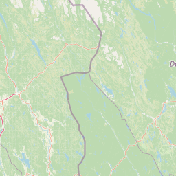
Interactive spatial mapping traces the park perimeter to provide essential geographic context. Structured data details the total area of 385 square kilometers alongside calculated center points and spatial spans.
- Boundary area
- 384.6 km²
- Boundary perimeter
- 103 km
- Northernmost point
- 61.6755° N
- Southernmost point
- 61.3903° N
- Easternmost point
- 12.9384° E
- Westernmost point
- 12.5133° E
- Geographic centre
- 61.5456° N, 12.7394° E
- North–south span
- 31.8 km
- East–west span
- 22.6 km
Elevation and terrain
Mountain relief metrics and recorded natural water and peak features
Fulufjället National Park Terrain and Elevation Range Geography
Recorded elevation metrics span from six hundred to one thousand forty two meters across the mountain terrain. Linked feature cards supply names, types, and spatial relationships for peaks, streams, and lakes.
- Minimum elevation
- 600 m
- Maximum elevation
- 1,042 m
- Highest point
- 1,042 m
Selected named natural features
Streams
Getsjöbrunnan
Peaks
Summelhön
Rivers
Gira
Lakes
Styggåstjärnen
Viewpoints
Njupeskär
Environmental setting
Boreal mountain terrain, plateau relief, and major water systems
Fulufjället National Park Environmental Classification and Landscape Settings
Recorded landscape features, habitat types, and climate zones combine to frame the physical setting of Fulufjället National Park. Associated classifications connect individual environmental records directly to broader atlas destinations.
- Relief
- Mountain
- Climate
- Boreal
- Water
- Major water bodies
- Forest cover
- Partial forest
- Seasonality
- Seasonal
Landscape features
Mountains · Plateau · Valleys · Forest · Wetland · Lakes · Rivers · Waterfalls · Cliffs · Bog
Habitat types
Boreal forest · Temperate coniferous forest · Montane forest · Wetland · Peatland · Riverine habitat · Lacustrine habitat
Park atlas
Explore the regional spread of protected landscapes and mountain terrain surrounding Fulufjället National Park, comparing features and geography.
Discover Other National Parks and Protected Areas Near Fulufjället
Continue exploring national parks and protected areas near Fulufjället National Park, tracing the distinct mountain plateaus, old-growth forests, and water features across Dalarna County. Compare these unique conservation landscapes and regional park geography to deepen your understanding of Sweden's protected wilderness atlas.
National parkNorway
About 1.4 km away#1 closest
South

Fulufjellet National Park: Protected Boreal Forest Landscape and Regional Geography
Explore mapped boundaries, rolling terrain, and transboundary conservation.
Fulufjellet National Park offers a detailed look at a protected boreal forest ecosystem in southeastern Norway. This page details the park's gently rolling hills, dominated by Norway spruce and Scots pine, interspersed with lakes and peat bogs. It highlights the park's designation as a national park, its establishment in 2012, and its contiguous protected status with Sweden's Fulufjället National Park, contributing to a significant transboundary conservation area. Users can explore its geographic features and protected landscape context within Scandinavia.
- Area
- 82.5 km²
- Established
- 2012
- IUCN
- II
- Relief
- Mountain
National parkInnlandet
About 44 km away#2 closest
Northwest
Gutulia National Park: Protected Southernmost Mountain Birch Forest Landscape Atlas
Explore Norway's unique subarctic forest geography and park boundaries.
Gutulia National Park stands as a key protected area within Norway's Innlandet region, distinguished by its role in preserving the country's southernmost mountain birch forest ecosystem. Covering approximately 23 square kilometers, this national park provides critical insights into subarctic forest ecology at the southern extent of its natural range. MoriAtlas enables detailed exploration of its mapped terrain and geographic context, offering a valuable resource for understanding this significant protected landscape.
- Area
- 23 km²
- Established
- 1968
- IUCN
- II
- Scope
- Terrestrial
National parkDalarna County
53 km away#3 closest
North

Töfsingdalen National Park: Ancient Old-Growth Forest in Rugged Terrain
Remote protected landscape within Dalarna County, Sweden.
Töfsingdalen National Park showcases a rare example of an ancient, up-to-500-year-old pine forest thriving in extremely rugged, boulder-strewn valley terrain. This protected area, located in Sweden's Dalarna County, offers a glimpse into a near-wilderness landscape shaped by glacial forces and defined by its remoteness and ecological integrity. Discover the mapped park boundaries and the unique geographic context of this remarkably untouched natural reserve.
- Area
- 16.15 km²
- Established
- 1930
- IUCN
- II
- Relief
- Lowland
National parkInnlandet
About 65 km away#4 closest
North
Femundsmarka National Park: Exploring Norway's Distinctive Wetland and Boreal Protected Landscape
Mapped boundaries and regional geography in Innlandet.
Femundsmarka National Park in Innlandet, Norway, offers a profound look into a preserved wetland wilderness characterized by vast marshlands, numerous lakes, and scattered boreal forests. As a designated national park, its ecological significance is tied to the surrounding water systems and the unique landscape stretching towards the Swedish border. This entry provides detailed geographic context, mapping information, and an understanding of its protected area status, inviting exploration of its remote boreal terrain and notable wildlife habitats.
- Area
- 573 km²
- Established
- 1971
- IUCN
- II
- Relief
- Mixed relief
National parkSweden
74 km away#5 closest
Northeast
Sonfjället National Park: Mapped Alpine Terrain and Protected Landscape in Sweden
Explore the glacial geography and subalpine transition zones.
Sonfjället National Park is a key protected area in central Sweden, offering a unique glimpse into an alpine environment shaped by glacial forces. The park's landscape is characterized by the prominent Sånfjället mountain, steep glacial valleys, mires, and small lakes, showcasing raw, natural terrain. As a southern outpost for subalpine ecosystems, it presents a distinct ecological transition zone valuable for geographic discovery and understanding protected nature.
- IUCN
- II
National parkGävleborg County
99 km away#6 closest
East
Hamra National Park: Ancient Forests, Mires, and Protected Landscape in Gävleborg County
Discover pristine Swedish nature and mapped park boundaries.
Hamra National Park in Gävleborg County, Sweden, protects an extraordinary natural landscape. At its heart lies a distinct moraine hill adorned with some of central Sweden's oldest coniferous trees, some reaching 400 years. Surrounding this ancient forest is a vast, unbroken expanse of mire and wetland, a landscape preserved from drainage and modification. This park offers a profound insight into pristine ecosystems and geographic context, making it a key destination for atlas exploration of protected natural areas.
- Area
- 13.83 km²
- Established
- 1909
- IUCN
- II
- Relief
- Lowland
Nature reserveInnlandet
About 114 km away#7 closest
Southwest
Åkersvika naturreservat: Protected Wetland Ecosystems and Geography in Innlandet
A vital Ramsar wetland and avian sanctuary in Southern Norway
Åkersvika naturreservat functions as a key wetland protected area at the northern end of Lake Mjøsa. The reserve preserves diverse aquatic habitats including shallow bays, reed beds, and shoreline meadows. It serves as a landmark example of lowland wetland conservation in Norway, providing essential breeding and migration grounds for waterfowl and waders within the Innlandet geographic context.
- Area
- 3.25 km²
- Established
- 1974
National parkInnlandet
124 km away#8 closest
West
Rondane National Park: Norway's Premier Alpine Protected Landscape and Historic National Park
Mapped glacial terrain, iconic peaks, and wild reindeer sanctuary.
As Norway's first national park, Rondane offers a profound exploration of a protected alpine environment. Situated in Innlandet county, its 963 square kilometers showcase a landscape sculpted by glaciers, featuring a striking array of ten peaks exceeding 2,000 meters. This page details Rondane National Park's distinct mapped boundaries, dramatic mountain geography, and its ecological significance as a refuge for wild reindeer, making it a cornerstone of Scandinavian natural heritage.
- Area
- 963 km²
- Established
- 1962
- IUCN
- II
- Relief
- Mountain
MoriAtlas Explorer
Continue Exploring Fulufjället National Park's Geographic Context and Mapped Terrain
Delve deeper into the unique protected landscape of Fulufjället National Park. Understand its position within Dalarna County and the broader Scandinavian Mountain range through detailed maps and geographic context. Discover how this national park's ancient geology and natural landmarks contribute to its distinct atlas profile and protected area significance.
Browse next
Global natural geography
Explore related park routes
Explore MoriAtlas Global ParksBrowse All MoriAtlas ParksGlobal Park Map DiscoveryMoriAtlas: Browse All CountriesBrowse All MoriAtlas ContinentsNational Park Environment AtlasGrand Canyon National Park AtlasYellowstone National Park AtlasYosemite National Park Atlas and GeographySerengeti National Park AtlasGalápagos National Park Protected LandscapeBanff National Park Geography and AtlasKruger National Park Atlas EntryUluṟu-Kata Tjuṯa National Park AtlasExplore Uluru-Kata Tjuta National Park GeographyPlitvice Lakes National Park AtlasFiordland National Park Protected LandscapeGreat Smoky Mountains National Park AtlasAfghanistan National Parks and Protected AreasAlbania National Parks and Protected AreasAlgeria National Parks and Protected AreasAmerican Samoa National Parks and Protected AreasAndorra National Parks and Protected AreasAngola National Parks and Protected AreasAntarctica National Parks and Protected AreasAntigua and Barbuda Park List