
Beaches
Park geography
A detailed study of island terrain, coastal boundaries, and forest landscapes in Sweden.
Geographic Profile of Gotska Sandön National Park: Mapped Boundaries and Natural Features
Examine the precise geographic configuration of Gotska Sandön National Park, encompassing its total area of 44.607 square kilometers. This profile details the park's distinct island geography, including its primary forest cover, dune systems, and coastal features such as Säludden and Vinbukten.
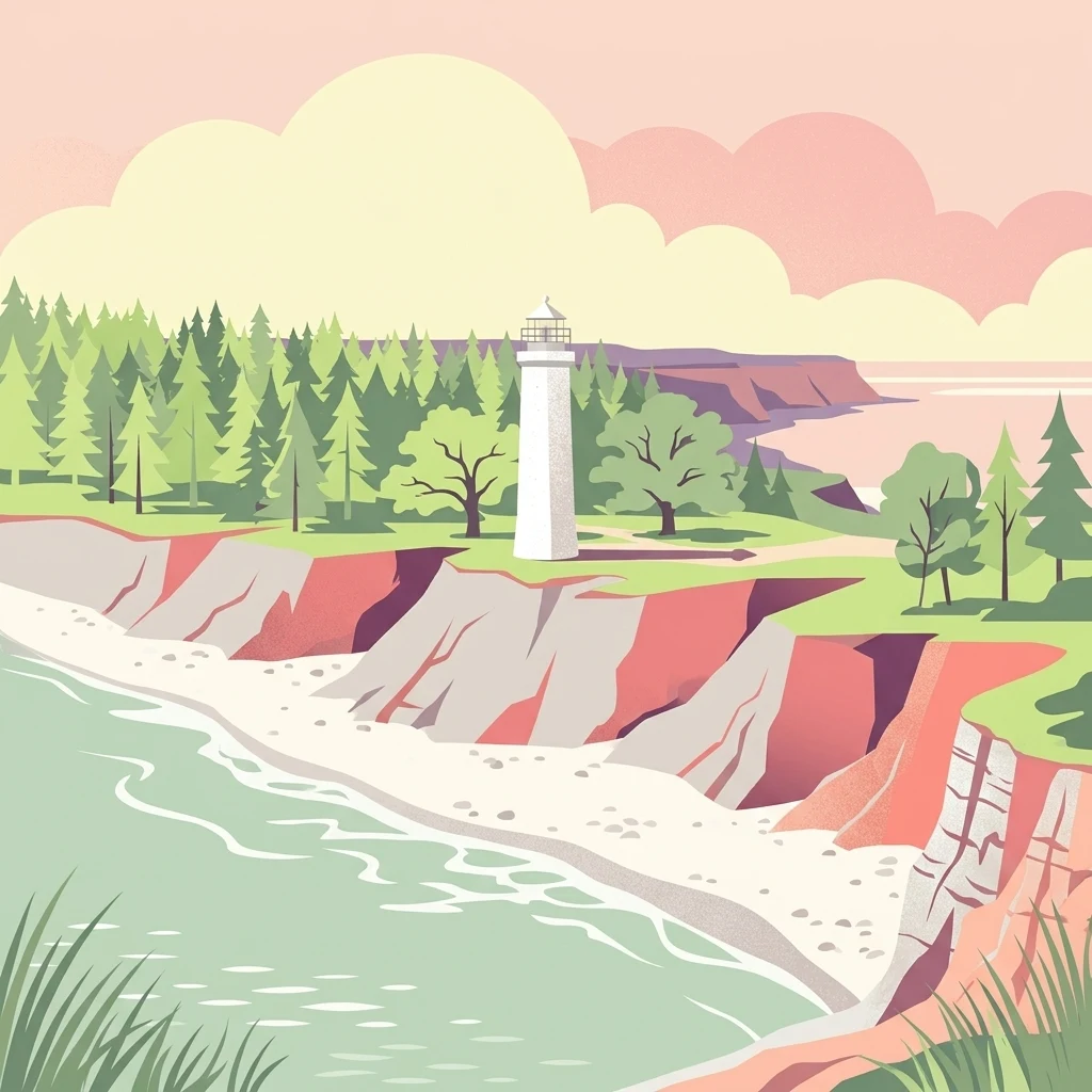
Baltic island wilderness with sand dunes and boreal forest
Gotska Sandön National Park
Gotska Sandön National Park protects a remote island in the Baltic Sea off the coast of Gotland, Sweden. The park encompasses the entire island of Gotska Sandön, a sandy island known for its distinctive dune landscapes, ancient pine forests, and relatively untouched coastal environments. Located in the northern Baltic Sea, the island represents a rare example of a well-preserved sandy ecosystem in Scandinavian waters. The park was established to preserve this unique combination of coastal dune habitats, coniferous woodland, and the island's ecological integrity as a whole.
- Location
- Sweden
- Park type
- National park
- Established
- 1963
Location overview
Map placement and island coastal designation within Sweden
Geographic Setting of Gotska Sandön National Park in Sweden
Gotska Sandön National Park is located entirely within Sweden as a protected area under national jurisdiction. National records confirm its status as an isolated island and coastal park contained within a single country.
- Countries
- Sweden
- Primary location
- Sweden
- Geographic setting
- Coastal · Island
Boundary and coordinates
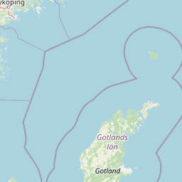
Geographic coordinates and calculated area of 44.6 square kilometers
Gotska Sandön National Park Boundary Map and Spatial Dimensions
Interactive boundary layers display the spatial outline and relative geographic coordinates of the protected island. Accompanying metrics provide estimated values for the total area, span, and center point.
- Boundary area
- 44.6 km²
- Boundary perimeter
- 27.4 km
- Northernmost point
- 58.4024° N
- Southernmost point
- 58.3326° N
- Easternmost point
- 19.3292° E
- Westernmost point
- 19.1703° E
- Geographic centre
- 58.3663° N, 19.2461° E
- North–south span
- 7.8 km
- East–west span
- 9.3 km
Terrain and natural features
Catalog of beaches, capes, and forests recorded within the park boundary
Gotska Sandön National Park Terrain and Named Natural Features
Recorded natural features include beaches, capes, forests, and bays situated directly within the park boundary. Linked feature cards supply type classifications and spatial relationships for each mapped locality.
Selected named natural features
Capes
Stora Beckrevet
Capes
Sankt Annae udde
Islands
Gotska Sandön
Capes
Säludden
Capes
Kyrkudden
Environmental setting
Temperate forest cover, coastal dunes, and island landscape classifications
Gotska Sandön National Park Environmental Setting and Physical Geography Classifications
Recorded classifications group island, forest, dune, and coastal attributes as complementary interpretations of physical settings. Mapped connections link these recorded categories directly to relevant protected area destinations within the regional atlas.
- Water
- Minor water
- Forest cover
- Mostly forested
Landscape features
Islands · Forest · Dunes · Beach
Habitat types
Temperate broadleaf forest · Dune habitat · Coastal habitat
Park atlas
Compare regional protected landscapes, tracing diverse coastal ecosystems, island wilderness, and forest reserves across the Baltic Sea geography.
Browse Nearby National Parks and Protected Areas Beyond Gotska Sandön National Park
Continue exploring national parks and other protected areas situated near Gotska Sandön National Park, featuring diverse island wilderness, significant sand dune systems, and old-growth pine forests within the broader Baltic Sea region. This contextual view allows for geographic comparison of different conservation landscapes and a deeper understanding of regional protected-area patterns and ecological variations.
National parkStockholm County
About 101 km away#1 closest
Northwest

Tyresta National Park: Explore Protected Old-Growth Forest and Rift Valley Landscape
Stockholm County National Park, Sweden
Tyresta National Park stands as a crucial protected area, showcasing one of southern Sweden's largest expanses of old-growth coniferous forest, featuring trees up to 400 years old. Its distinctive rift valley terrain, lakes, and post-fire recovery zones offer a rich geographic profile for atlas exploration. Within Stockholm County, this national park provides essential context for understanding the preservation of ancient forest ecosystems and unique geological formations.
- Area
- 20 km²
- Established
- 1993
- IUCN
- II
- Relief
- Mixed relief
National parkStockholm County
137 km away#2 closest
North
Ängsö National Park: Flower-Rich Cultural Landscape in Stockholm County's Archipelago
Mapped protected area and historic island geography
Ängsö National Park, a protected national park in Stockholm County, offers a rare glimpse into a flower-rich cultural landscape shaped by history and nature. The island's mapped boundaries encompass idyllic meadows, mature deciduous forests, and a unique archipelago setting. MoriAtlas highlights its significance as one of Sweden's earliest national parks, providing context for its distinctive natural terrain and protected landscape identity within the Roslagen region.
- Area
- 1.68 km²
- Established
- 1909
- IUCN
- II
- Relief
- Lowland
Marine protected areaSaare County
143 km away#3 closest
East

Vilsandi National Park: Marine Protected Area Atlas and Archipelago Geography
Explore the protected landscape of Western Saaremaa's coast.
Vilsandi National Park is an integral part of Saare County's protected lands, recognized as a significant marine protected area. This page offers an atlas-style exploration of its geography, focusing on the distinctive archipelago terrain, coastal formations along Saaremaa's western edge, and its vital importance as a stopover for migratory birds. Understand the park's mapped boundaries and its place within the broader Baltic Sea ecosystem through detailed geographic context.
- Area
- 241 km²
- Established
- 1957
- IUCN
- II
- Relief
- Lowland
National parkLatvia
187 km away#4 closest
Southeast

Slītere National Park: Latvia's Protected Coastal Landscape with Blue Hills and Bird Flyways
Explore the unique terrain and protected geography of this Baltic national park.
Slītere National Park represents a distinctive protected landscape on Latvia's Courland Peninsula, celebrated for its ancient geological formations like the Blue Hills (Zilie Kalni) and its role as a crucial bird migration corridor. The park's geography encompasses varied dune systems, wetland habitats, and rich broadleaf forests, offering a unique mapped environment. Discover the park's protected area boundaries and its significance within the regional Baltic geography, highlighting its unique ecosystem features and landscape context.
- Area
- 164.14 km²
- Established
- 2000
- IUCN
- II
- Relief
- Mixed relief
National parkSweden
187 km away#5 closest
Southwest
Blå Jungfrun National Park: Baltic Sea Island National Park with Blue Granite Cliffs
Explore its mapped boundaries and distinct coastal terrain.
Blå Jungfrun National Park is a distinctive Swedish national park situated on a Baltic Sea island, immediately recognizable by its prominent blue-hued granite cliffs. As a protected landscape, it offers a unique glimpse into island ecosystems and rugged coastal geography. MoriAtlas provides detailed context for its mapped boundaries, showcasing the natural and geological significance of this solitary protected area within the regional atlas.
- IUCN
- II
- Relief
- Mixed relief
- Access
- Moderate access
- Scope
- Mixed
National parkFinland
190 km away#6 closest
Northeast

Archipelago National Park: Mapped Protected Landscape and Geographic Context in Finland
Explore protected area boundaries and natural terrain.
Archipelago National Park represents a vital component of Finland's protected lands. This page serves as an atlas-focused entry point, detailing the park's specific geographic context, its mapped protected area boundaries, and the nature of its landscape. Understand how this national park contributes to the broader regional geography of Finland and the Nordic region, aiding structured discovery through maps and geographic data.
- Area
- 500 km²
- Established
- 1983
- IUCN
- II
- Visitors
- 78.8K annual
National parkKalmar County
222 km away#7 closest
West
Norra Kvill National Park: Ancient Coniferous Forest Protected Landscape in Kalmar County
Discover its unique mapped terrain and natural forest heritage.
Norra Kvill National Park safeguards a remarkable old-growth coniferous forest ecosystem, a rarity in southern Sweden. This park is characterized by ancient pines, some dating back over 350 years, thriving on steep fault-formed terrain and amid boulder fields. Its protected status ensures the preservation of this unique natural landscape, providing invaluable insight into forest ecology and regional geography within Kalmar County. MoriAtlas offers a structured approach to understanding its mapped boundaries and ecological significance.
- Area
- 1.14 km²
- Established
- 1927
- IUCN
- II
- Relief
- Highland
National parkVästmanland County
234 km away#8 closest
Northwest
Färnebofjärden National Park: Protected River Landscape and Birdlife Atlas
Explore Västmanland County's unique riverine protected area and mapped terrain.
Färnebofjärden National Park offers a unique geographic perspective as a protected national park situated in Sweden's Västmanland County. This page details the park's distinct riverine landscape, characterized by the Dalälven River's intricate network of channels, wetlands, and islands, and its position at a critical ecological frontier. Discover the mapped boundaries and regional context of this important protected area, renowned for its exceptional bird populations and diverse natural habitats.
- Area
- 101 km²
- Established
- 1998
- IUCN
- II
- Relief
- Lowland
MoriAtlas Explorer
Continue Exploring Gotska Sandön National Park's Mapped Geography and Dune Landscapes
Deepen your understanding of Gotska Sandön National Park by exploring its specific geographic features and protected area context. MoriAtlas provides the tools to navigate this unique island landscape, compare its terrain with surrounding regions, and appreciate the detailed mapping of its rare sandy ecosystems and ancient forests. Discover the structured atlas information that frames Gotska Sandön as a significant protected natural entity.
Browse next
Global natural geography
Explore related park routes
Explore MoriAtlas Global ParksBrowse All MoriAtlas ParksGlobal Park Map DiscoveryMoriAtlas: Browse All CountriesBrowse All MoriAtlas ContinentsNational Park Environment AtlasGrand Canyon National Park AtlasYellowstone National Park AtlasYosemite National Park Atlas and GeographySerengeti National Park AtlasGalápagos National Park Protected LandscapeBanff National Park Geography and AtlasKruger National Park Atlas EntryUluṟu-Kata Tjuṯa National Park AtlasExplore Uluru-Kata Tjuta National Park GeographyPlitvice Lakes National Park AtlasFiordland National Park Protected LandscapeGreat Smoky Mountains National Park AtlasAfghanistan National Parks and Protected AreasAlbania National Parks and Protected AreasAlgeria National Parks and Protected AreasAmerican Samoa National Parks and Protected AreasAndorra National Parks and Protected AreasAngola National Parks and Protected AreasAntarctica National Parks and Protected AreasAntigua and Barbuda Park List