Mori Atlas logo
National parkGotska Sandön National Park

Discover the geography and ancient pine forests of this unique Swedish island national park.

Gotska Sandön National Park: Mapped Protected Landscape and Baltic Dune Ecosystems

Gotska Sandön National Park is a protected island sanctuary in the Baltic Sea, celebrated for its extensive and rare sand dune formations and ancient coniferous forests. This national park offers a unique window into Scandinavian coastal ecosystems, characterized by vast sandy landscapes and a sense of pristine island wilderness. Use MoriAtlas to explore the mapped boundaries and distinctive geographic identity of Gotska Sandön, understanding its place as a rare example of a preserved sandy island environment.

Baltic islandsSand dunesPine forestsOld-growth forestCoastal ecosystemsIsland wilderness
Illustration of a lighthouse on a cliff overlooking the sea with forested terrain and sandy beach

Gotska Sandön National Park

National park

Park overview

Structured park overview, official facts, and landscape profile for Gotska Sandön National Park

Gotska Sandön National Park park facts, protected area profile, and essential visitor context
Review the core facts for Gotska Sandön National Park, including designation, size, terrain, visitor scale, habitats, and operating context in one park-focused overview.

About Gotska Sandön National Park

Gotska Sandön National Park occupies the entirety of Gotska Sandön island, a isolated landmass in the northern Baltic Sea approximately 40 kilometers north of Gotland. The island's geology is characterized by glacial deposits and sandy soils, creating a landscape distinct from the typical rocky coastal environments found throughout the Baltic region. The park was formally established to protect the island's unique combination of dune ecosystems, boreal forest communities, and coastal habitats that have remained relatively undisturbed compared to other coastal areas in Scandinavia.

The park's interior features patches of old-growth pine forest that have developed on the island's sandy substrate, creating conditions unlike typical Swedish forest environments. These forests, combined with the island's extensive dune systems, form a landscape that supports specialized plant and animal species adapted to dry, sandy conditions. The coastline features beaches and rocky shores that provide additional habitat diversity.

Gotska Sandön has a long history of conservation awareness. The island's forests were protected as early as 1909, making them among the earliest forest reserves in Sweden. This early protection reflected recognition of the island's unusual character and the scientific value of its natural communities. The national park status, formally established in 1963, consolidated the island's protection under modern conservation frameworks.

Quick facts and research context for Gotska Sandön National Park

Gotska Sandön is a Swedish national park located on a small island in the Baltic Sea, north of Gotland. The park covers the entire island and protects a rare sandy ecosystem in the Baltic region, characterized by coastal dunes, pine woodlands, and heathland. The island's remote location has helped maintain relatively natural conditions, supporting a distinctive combination of species adapted to sandy and coastal habitats.

Park context

Deeper park guide and search-rich context for Gotska Sandön National Park

Gotska Sandön National Park history, landscape, wildlife, and travel context
Explore Gotska Sandön National Park through its history, landscape character, ecosystems, wildlife, conservation priorities, cultural context, and seasonal travel timing in a structured park guide built for atlas discovery and search intent.

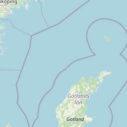
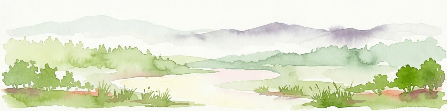
Why Gotska Sandön National Park stands out

Gotska Sandön is best known for its extensive sand dune systems, which are among the most significant in the Baltic region. The island's ancient pine forests, some of which have been protected for centuries, represent a rare old-growth coniferous environment in this part of Scandinavia. The park also protects important nesting habitats for seabirds and provides one of the few remaining relatively unmodified coastal sand ecosystems in the Baltic.

Wide view of dense green forest with distant blue sea horizon
Dense forest landscape extending to the Baltic Sea coastline on Gotska Sandön

Gotska Sandön National Park history and protected-area timeline

The protection of Gotska Sandön's forests began in 1909 when significant portions of the island were declared nature reserves, recognizing the scientific and scenic value of the old-growth pine forests. This early conservation action reflected growing environmental awareness in Sweden during the early twentieth century and the unique character of the island's sandy woodland ecosystems.

The national park was formally established in 1963, covering the entire island and providing comprehensive protection under Sweden's national park legislation. This designation consolidated the earlier forest reserves and extended protection to include the dune systems, coastal areas, and the island's complete ecosystem. The establishment reflected increasing post-war interest in preserving representative examples of Sweden's natural landscapes.

Management of the park has focused on maintaining natural processes and preserving the relatively unmodified character of the island. Unlike many Swedish national parks that have historical agricultural landscapes, Gotska Sandön has been allowed to develop with minimal human intervention, resulting in a more naturalized ecosystem.

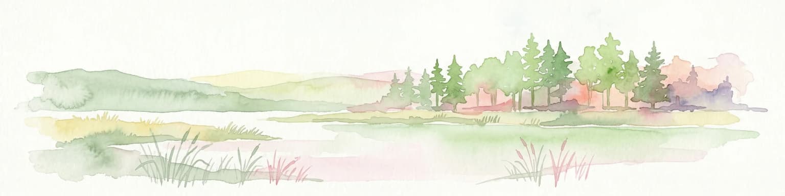
Gotska Sandön National Park landscape and geographic character

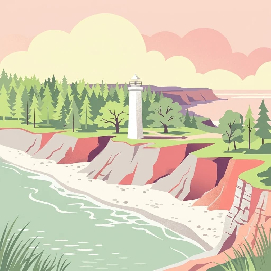
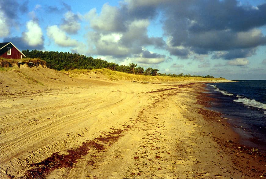
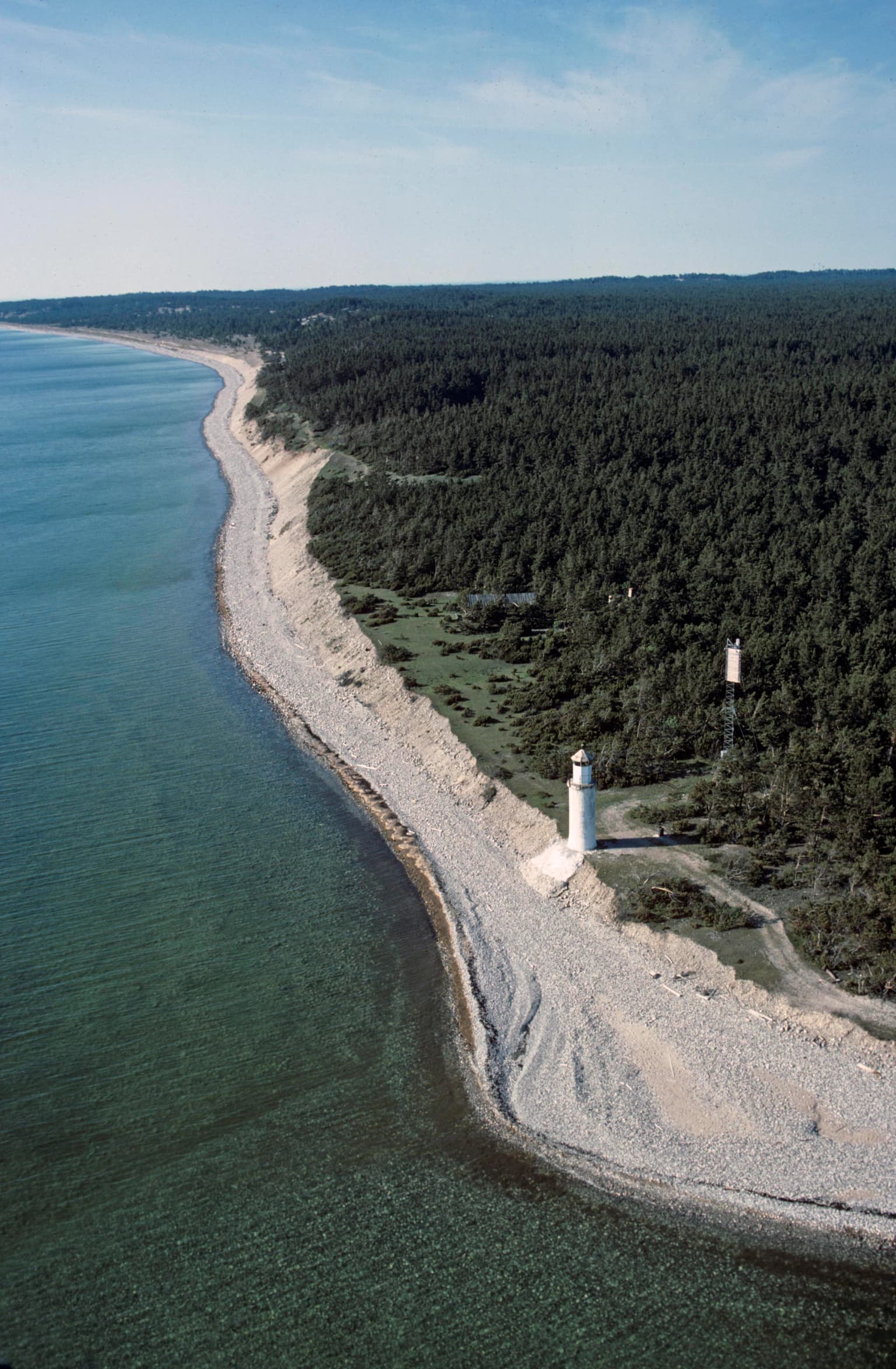
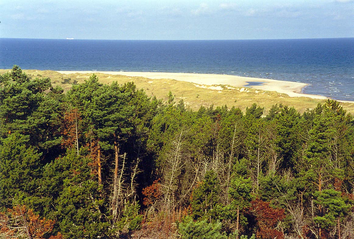
Gotska Sandön's landscape is defined by its sandy nature, a rare feature among Baltic islands. The island features extensive dune systems that shape much of its interior topography, with sand deposits creating gently undulating terrain rather than the rocky hills typical of the region. The dunes support specialized plant communities adapted to shifting sand conditions and dry soil environments.

The island's forests grow on sandy soils that create challenging conditions for tree growth, resulting in open pine woodlands with sparse understory vegetation. These forests differ markedly from the denser coniferous forests found on mainland Sweden, reflecting the island's unique edaphic conditions. Coastal areas transition from sandy beaches to rocky shores, providing visual variety along the island's perimeter.

Sandy beach with tire tracks and seaweed, coastal waters, red house, trees on dunes, partly cloudy sky
Gotska Sandön's northeast coast beach with sandy shoreline, dunes, and scattered seaweed under a partly cloudy sky

Gotska Sandön National Park ecosystems, habitats, and plant life

The ecological character of Gotska Sandön reflects its isolated island setting and sandy substrates. The dune systems support specialized plant communities including sand-adapted grasses, herbs, and low-growing vegetation that can survive in these dynamic, dry environments. These habitats are rare in the Baltic region, making the park significant for conserving specialized sand-dune ecosystems.

The pine forests represent an unusual forest type in Sweden, developing on nutrient-poor sandy soils in a relatively open structure. These woodlands support specialized invertebrates and fungi associated with old-growth pine habitats. The island's position in the Baltic Sea also makes it important for migratory birds that use the island as a stopping point during migration across the sea.

Aerial view of rocky coastline with white lighthouse, adjacent forested area, and calm sea under clear sky
Coastline with Hamnudden lighthouse on Gotska Sandön National Park

Gotska Sandön National Park wildlife and species highlights

Gotska Sandön supports wildlife adapted to the island's distinctive sandy and forested habitats. The old-growth pine forests provide habitat for species associated with ancient woodland, including various beetles, fungi, and invertebrates that depend on dead wood and veteran trees. The island's isolated position in the Baltic makes it significant for breeding seabirds, with species including various terns and gulls nesting in the coastal areas.

The dune environments support specialized invertebrate communities adapted to sandy conditions, while the heath-like areas between forest patches provide additional habitat diversity. The park's position along migration routes means birdlife varies considerably between seasons, with passage migrants using the island as a rest point during their journeys across the Baltic.

Panoramic landscape of Gotska Sandön National Park with pine forest in foreground, sand dunes and beach, and Baltic Sea under a partly cloudy sky
North side view of Gotska Sandön National Park showing forested dunes and Baltic Sea coastline

Gotska Sandön National Park conservation status and protection priorities

Gotska Sandön National Park protects one of the Baltic region's most significant intact sandy island ecosystems. The combination of dune systems, old-growth pine forests, and relatively unmodified coastal environments makes the park valuable for conserving habitats that have become rare in heavily developed Baltic coastal areas. The park's early forest protection in 1909 established a conservation legacy that has allowed natural processes to proceed with minimal intervention.

The park represents a relatively natural environment where ecological processes continue largely unchanged, providing a reference ecosystem for understanding Baltic sandy island ecology. The protection of the entire island as a national park ensures that the interconnected dune-forest-coastal systems are maintained as an integrated whole, rather than as fragmented habitats.

Gotska Sandön National Park cultural meaning and human context

Gotska Sandön has limited historical human occupation, which has contributed to the preservation of its natural character. The island's name reflects its location and sandy nature, with "Sandön" meaning "sand island" in Swedish. The relatively light human impact over time has allowed the island's natural ecosystems to develop with less modification than many other coastal areas in the Baltic region.

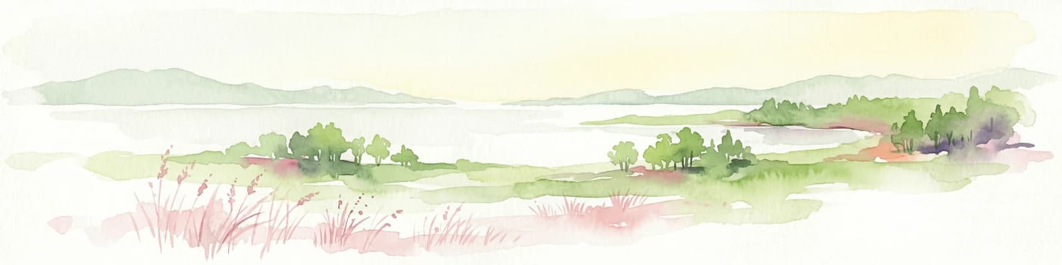
Top sights and standout views in Gotska Sandön National Park

Gotska Sandön offers visitors the opportunity to experience a rare sandy island ecosystem in the Baltic Sea. The park's dune landscapes are among the most significant in Scandinavia, while the old-growth pine forests represent unusual woodland development on sandy soils. The island's relatively untouched character provides a sense of wilderness unusual for the Baltic region, with vast skies, sandy beaches, and quiet forests creating a distinctive atmosphere.

Best time to visit Gotska Sandön National Park

The summer months offer the warmest conditions for exploring Gotska Sandön's beaches and dune landscapes, though the island can be visited throughout the year. Winter visits provide a very different experience of the island's stark beauty, though access may be more limited. The island's position in the Baltic means weather conditions can be changeable regardless of season.

Park location guide

Geography guide, regional context, and park location map for Gotska Sandön National Park

Gotska Sandön National Park park geography, regions, and map view in Sweden
Understand where Gotska Sandön National Park sits in Sweden through a broader geographic reading of the surrounding landscape, nearby location context, and its mapped position within the national park landscape.

How Gotska Sandön National Park fits into Sweden

Sweden, formally the Kingdom of Sweden, is a highly developed Nordic country on the Scandinavian Peninsula in Northern Europe. With a population of 10.6 million and an area of 450,295 km², it is the largest Nordic country by both area and population. Sweden is a constitutional monarchy with Stockholm as its capital and largest city, known for its advanced economy, social welfare system, and membership in the European Union and NATO.

Wider geography shaping Gotska Sandön National Park in Sweden

Sweden occupies the eastern portion of the Scandinavian Peninsula in Northern Europe. It borders Norway to the west and north, Finland to the east, and shares a maritime border with Denmark to the southwest across the Øresund. The country has an extensive coastline along the Baltic Sea and Gulf of Bothnia, dotted with thousands of islands. The terrain varies from mountainous regions in the northwest to low-lying coastal areas and inland lakes in the south and central parts.

Map view of Gotska Sandön National Park

Use this park location map to pinpoint Gotska Sandön National Park in Sweden, understand its exact geographic position, and read its mapped placement within the surrounding landscape more clearly.

Pigeon | © OpenStreetMap contributors

Explore Gotska Sandön's distinctive sandy terrain, ancient pine forest habitats, and untouched coastal protected area character through immersive imagery.

Gotska Sandön National Park Photos: Visual Guide to Baltic Sea Island Landscapes and Unique Dune Scenery
Discover the striking landscapes of Gotska Sandön National Park through a comprehensive image gallery, revealing the unique visual identity of this remote Baltic Sea island. Browse photography showcasing its extensive sand dunes, ancient pine forests, and pristine coastal environments to understand the park's distinct terrain, specialized habitats, and overall protected-area character.

Wide view of dense green forest with distant blue sea horizon

Weathered white lighthouse with metal railing, steps leading to entrance, surrounded by pine trees and sandy ground

Sandy beach with tire tracks and seaweed, coastal waters, red house, trees on dunes, partly cloudy sky

Aerial view of rocky coastline with white lighthouse, adjacent forested area, and calm sea under clear sky

Panoramic landscape of Gotska Sandön National Park with pine forest in foreground, sand dunes and beach, and Baltic Sea under a partly cloudy sky

Large oak tree in a grassy field with two wooden cabins in the background, surrounded by trees.

Park atlas

Compare regional protected landscapes, tracing diverse coastal ecosystems, island wilderness, and forest reserves across the Baltic Sea geography.

Browse Nearby National Parks and Protected Areas Beyond Gotska Sandön National Park
Continue exploring national parks and other protected areas situated near Gotska Sandön National Park, featuring diverse island wilderness, significant sand dune systems, and old-growth pine forests within the broader Baltic Sea region. This contextual view allows for geographic comparison of different conservation landscapes and a deeper understanding of regional protected-area patterns and ecological variations.
National parkStockholm County

Tyresta National Park: Explore Protected Old-Growth Forest and Rift Valley Landscape

Stockholm County National Park, Sweden

Tyresta National Park stands as a crucial protected area, showcasing one of southern Sweden's largest expanses of old-growth coniferous forest, featuring trees up to 400 years old. Its distinctive rift valley terrain, lakes, and post-fire recovery zones offer a rich geographic profile for atlas exploration. Within Stockholm County, this national park provides essential context for understanding the preservation of ancient forest ecosystems and unique geological formations.

Area
20 km²
Established
1993
IUCN
II
Relief
Mixed relief
Watercolor painting of a grassy field with trees and a soft sky
National parkStockholm County

Ängsö National Park: Flower-Rich Cultural Landscape in Stockholm County's Archipelago

Mapped protected area and historic island geography

Ängsö National Park, a protected national park in Stockholm County, offers a rare glimpse into a flower-rich cultural landscape shaped by history and nature. The island's mapped boundaries encompass idyllic meadows, mature deciduous forests, and a unique archipelago setting. MoriAtlas highlights its significance as one of Sweden's earliest national parks, providing context for its distinctive natural terrain and protected landscape identity within the Roslagen region.

Area
1.68 km²
Established
1909
IUCN
II
Relief
Lowland
Watercolor painting showing a landscape with a body of water, rolling hills, and distant mountains under a soft sky
Marine protected areaSaare County

Vilsandi National Park: Marine Protected Area Atlas and Archipelago Geography

Explore the protected landscape of Western Saaremaa's coast.

Vilsandi National Park is an integral part of Saare County's protected lands, recognized as a significant marine protected area. This page offers an atlas-style exploration of its geography, focusing on the distinctive archipelago terrain, coastal formations along Saaremaa's western edge, and its vital importance as a stopover for migratory birds. Understand the park's mapped boundaries and its place within the broader Baltic Sea ecosystem through detailed geographic context.

Area
241 km²
Established
1957
IUCN
II
Relief
Lowland
Watercolor illustration of a mountain range with trees and a winding path
National park

Blå Jungfrun National Park: Baltic Sea Island National Park with Blue Granite Cliffs

Explore its mapped boundaries and distinct coastal terrain.

Blå Jungfrun National Park is a distinctive Swedish national park situated on a Baltic Sea island, immediately recognizable by its prominent blue-hued granite cliffs. As a protected landscape, it offers a unique glimpse into island ecosystems and rugged coastal geography. MoriAtlas provides detailed context for its mapped boundaries, showcasing the natural and geological significance of this solitary protected area within the regional atlas.

IUCN
II
Relief
Mixed relief
Access
Moderate access
Scope
Mixed
Watercolor illustration of a river flowing through a forested landscape with mountains in the background
National park

Slītere National Park: Latvia's Protected Coastal Landscape with Blue Hills and Bird Flyways

Explore the unique terrain and protected geography of this Baltic national park.

Slītere National Park represents a distinctive protected landscape on Latvia's Courland Peninsula, celebrated for its ancient geological formations like the Blue Hills (Zilie Kalni) and its role as a crucial bird migration corridor. The park's geography encompasses varied dune systems, wetland habitats, and rich broadleaf forests, offering a unique mapped environment. Discover the park's protected area boundaries and its significance within the regional Baltic geography, highlighting its unique ecosystem features and landscape context.

Area
164.14 km²
Established
2000
IUCN
II
Relief
Mixed relief
Watercolor illustration of a lake surrounded by trees and hills
National parkKalmar County

Norra Kvill National Park: Ancient Coniferous Forest Protected Landscape in Kalmar County

Discover its unique mapped terrain and natural forest heritage.

Norra Kvill National Park safeguards a remarkable old-growth coniferous forest ecosystem, a rarity in southern Sweden. This park is characterized by ancient pines, some dating back over 350 years, thriving on steep fault-formed terrain and amid boulder fields. Its protected status ensures the preservation of this unique natural landscape, providing invaluable insight into forest ecology and regional geography within Kalmar County. MoriAtlas offers a structured approach to understanding its mapped boundaries and ecological significance.

Area
1.14 km²
Established
1927
IUCN
II
Relief
Highland
Watercolor illustration showing a coastal landscape with small islands, green vegetation, and calm water
National parkFinland

Archipelago National Park: Mapped Protected Landscape and Geographic Context in Finland

Explore protected area boundaries and natural terrain.

Archipelago National Park represents a vital component of Finland's protected lands. This page serves as an atlas-focused entry point, detailing the park's specific geographic context, its mapped protected area boundaries, and the nature of its landscape. Understand how this national park contributes to the broader regional geography of Finland and the Nordic region, aiding structured discovery through maps and geographic data.

Area
500 km²
Established
1983
IUCN
II
Visitors
78.8K annual
Watercolor illustration of a river flowing through a forested landscape with hills in the background.
National parkVästmanland County

Färnebofjärden National Park: Protected River Landscape and Birdlife Atlas

Explore Västmanland County's unique riverine protected area and mapped terrain.

Färnebofjärden National Park offers a unique geographic perspective as a protected national park situated in Sweden's Västmanland County. This page details the park's distinct riverine landscape, characterized by the Dalälven River's intricate network of channels, wetlands, and islands, and its position at a critical ecological frontier. Discover the mapped boundaries and regional context of this important protected area, renowned for its exceptional bird populations and diverse natural habitats.

Area
101 km²
Established
1998
IUCN
II
Relief
Lowland

Common questions about visiting, size, designation, and location context for Gotska Sandön National Park

Gotska Sandön National Park FAQs for park facts, access, geography, and protected area context
Find quick answers about Gotska Sandön National Park, including protected-area facts, park geography, trail and visitor context, and how the park fits into its surrounding country and regional landscape.
MoriAtlas Explorer

Continue Your Protected Areas Search Across the Global Atlas

Deepen your exploration by continuing the structured search for national parks and protected areas worldwide. Utilize the comprehensive filtering capabilities to compare different conservation landscapes and refine your understanding of global park geography. Discover more about the distribution and characteristics of protected natural areas.

Global natural geography