
Why Archipelago National Park stands out
Archipelago National Park is best known for its extraordinary archipelago landscape, one of the most extensive and ecologically significant in the Baltic Sea region. The park protects a complex network of islands, islets, and skerries that provide critical habitat for marine birds and seals. Its bird populations are particularly notable, with over 130 species known to nest within the park boundaries, including the white-tailed eagle which serves as the park's symbol. The park is also renowned for its successful mink removal program, which has led to measurable recovery of ground-nesting bird populations. The combination of pristine island wilderness, rich maritime biodiversity, and living cultural landscapes makes this park a flagship example of Finnish conservation.
Archipelago National Park history and protected-area timeline
The archipelago of Southwest Finland has been inhabited since approximately 2000 BCE, making it one of the longest-continuously inhabited regions in northern Europe. Early settlers were attracted by the rich natural resources of the post-glacial archipelago, including abundant fish populations in the then-salttier Baltic Sea, large colonies of grey seals, and diverse seabirds that provided eggs, meat, and down. The warmer climate during the Neolithic and Bronze Ages also supported small-scale agriculture and cattle herding on the islands.
During the Iron Age, which began around 500 BCE in this region, the present national park area became inhabited. Archaeological investigations within the cooperative area have revealed Iron Age settlements and two prehistoric fort islets. The archipelago contains numerous protected archaeological sites dating from the Iron Age through the 18th and 19th centuries, including approximately 40 burial mounds called cairns. These low stone heaps, some extending tens of meters in length, represent significant prehistoric heritage protected by Finland's Antiquities Act.
Swedish settlers arrived in the late 13th century, substantially increasing the population and establishing many of the villages that still exist today. The population grew steadily through the Middle Ages until the mid-16th century, after which decline set in due to insufficient natural resources. Further population losses occurred during the Great Northern War and bubonic plague in the early 18th century. The mid-19th century brought technical advances in fishing methods that enabled population recovery, and by the early 20th century, many islanders began leaving for mainland opportunities. Unused agricultural lands reforested naturally. Starting in the 1970s, the archipelago experienced renewed population growth as it became a popular summer destination.
Archipelago National Park landscape and geographic character
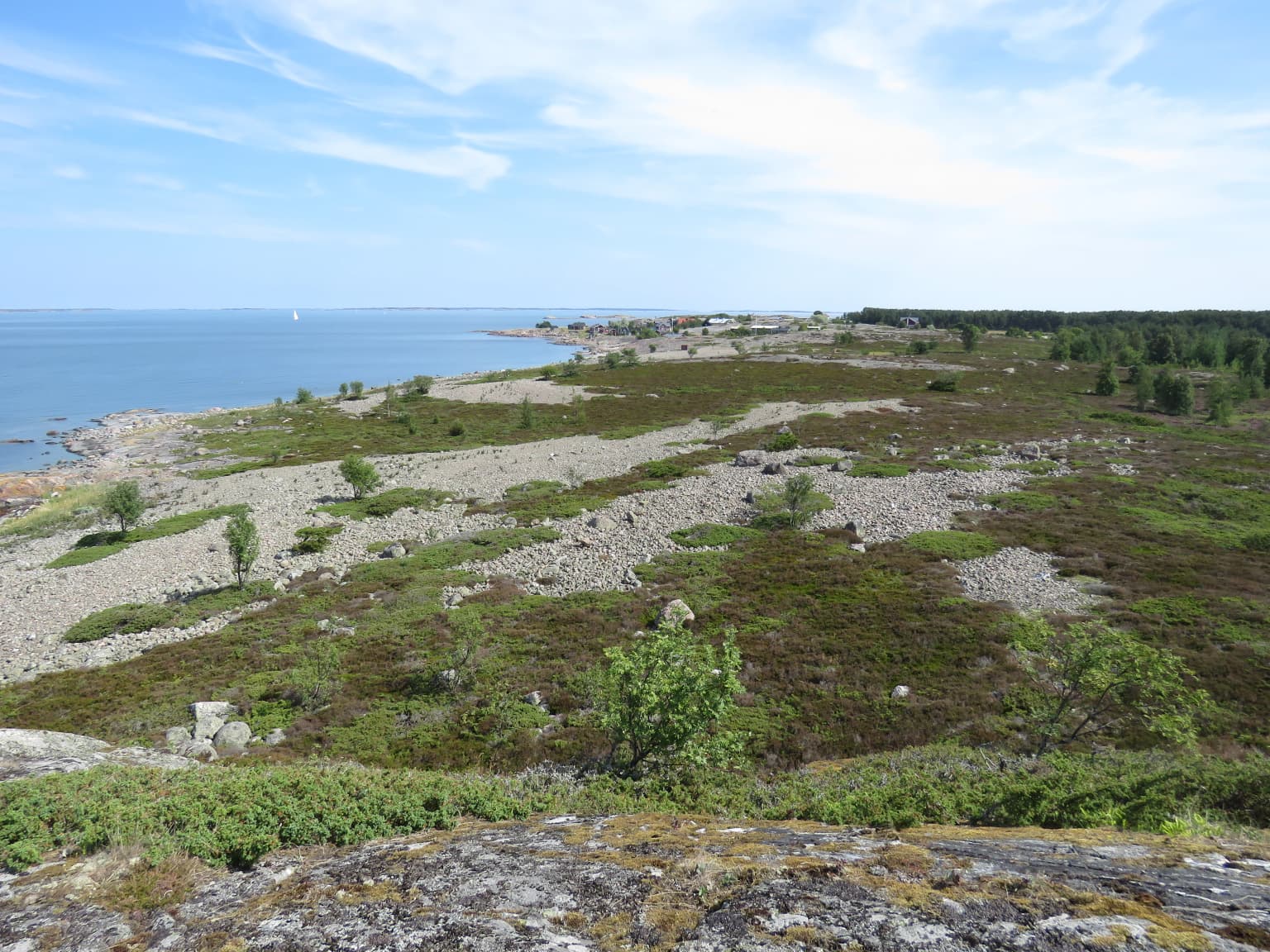
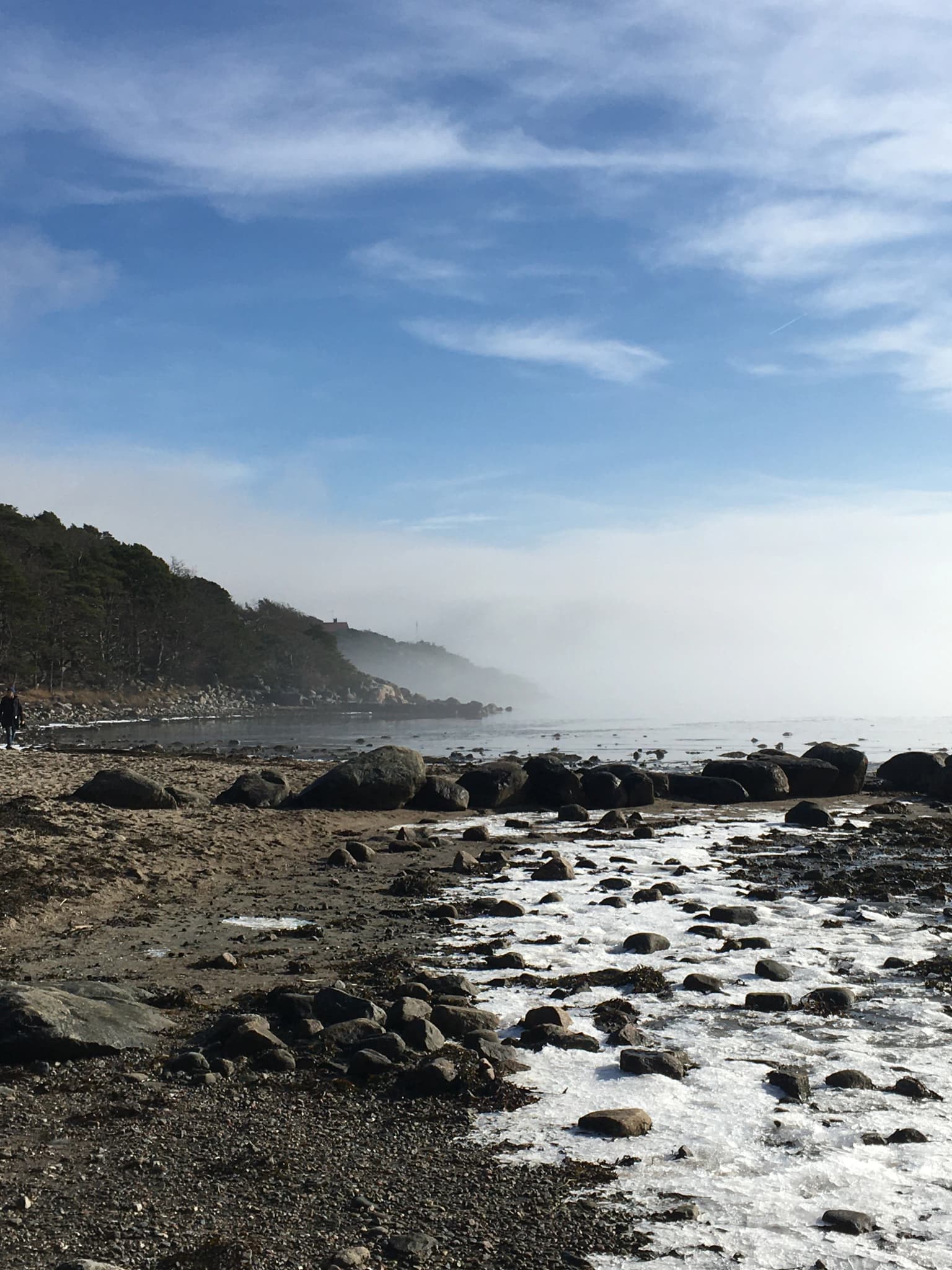
The physical landscape of Archipelago National Park is defined by its marine setting among thousands of islands in the Baltic Sea. The terrain is predominantly flat to gently rolling, with bare granite bedrock exposed on many islands while others support thin soils capable of supporting coniferous and deciduous forests. The islands range from tiny skerries barely above sea level to larger islands with more varied topography, though the archipelago lacks the dramatic elevation changes found in mountain parks elsewhere.
Shallow waters, bays, and straits separate the islands, creating a complex coastal environment that changes with tides and seasons. The interaction between land and sea produces distinctive habitats including rocky shores, sandy beaches, meadows, and marshy areas. Post-glacial rebound continues to reshape the coastline, with the ground rising approximately 3 to 4.2 millimeters annually, meaning islands are gradually increasing in area and new land emerges from the sea over time. This ongoing geological process gives the archipelago a dynamic character unlike static mainland landscapes.
The cooperative area encompasses both the protected core zones and surrounding inhabited islands where traditional cultural landscapes persist. These cultural landscapes include farmland, pastures, and meadows maintained through generations of agricultural use, creating a mosaic of natural and semi-natural habitats across the archipelago.
Archipelago National Park ecosystems, habitats, and plant life
The ecological character of Archipelago National Park reflects its unique position in the Baltic Sea, where marine and terrestrial environments intersect across thousands of islands. The park protects a range of habitat types including coastal forests, rocky islands, meadowlands, and marine shallow waters. The islands support both coniferous and deciduous woodland, though the forest cover is often sparse due to thin soils and the exposed nature of the archipelago environment.
The marine component is essential to the park's ecological identity, with the surrounding waters providing critical habitat for fish populations and marine mammals. The park is situated within the broader Archipelago Sea Biosphere Reserve, recognized by UNESCO for its exceptional biodiversity and conservation value. The combination of protected islands and the surrounding marine environment creates a coherent ecological system where the health of terrestrial and marine components are intimately linked.
The ecosystem has evolved under the influence of Finland's northern climate and the Baltic Sea's brackish waters, producing distinctive species assemblages adapted to these conditions. The park's ecological significance extends beyond individual species to encompass the overall integrity of the archipelago ecosystem, which represents one of the most important coastal wilderness areas in the Baltic region.
Archipelago National Park wildlife and species highlights
The wildlife of Archipelago National Park is notable for its diversity, particularly among bird species, with over 130 known to nest within the park boundaries. The white-tailed eagle, Finland's national bird, serves as the park's symbol and represents one of the success stories of European conservation, as populations have recovered dramatically from previous declines. The park provides critical nesting habitat for numerous seabird species including Arctic terns, black guillemots, various gull species, and the distinctive Eurasian oystercatcher.
Mammal populations in the park include approximately 25 identified species, with the most common being common shrew, pygmy shrew, mountain hare, bank vole, red fox, raccoon dog, mink, and moose. Grey seal populations have increased in recent years, though ringed seal numbers have shown decline. The marine environment supports important fish populations including Baltic herring, European perch, northern pike, common roach, bream, and several other species that form the basis of the archipelago's ecological and cultural fishing traditions.
The park's wildlife management has included successful mink removal programs, begun in the 1990s, which have led to significant increases in bird populations and improved nesting success for ground-nesting species. Studies documented increases in 14 of 22 bird species studied following mink removal, with species such as tufted duck, velvet scoter, and Arctic tern showing particularly dramatic population recovery. This program demonstrates the park's active approach to ecosystem management and conservation.
Archipelago National Park conservation status and protection priorities
Archipelago National Park represents a flagship conservation area within Finland's protected areas network, holding IUCN Category II designation as a national park. The park is part of the larger Archipelago Sea Biosphere Reserve, recognized by UNESCO for its exceptional ecological value and successful integration of conservation with sustainable human use. The PAN Parks certificate awarded in 2007 further validates the park's conservation standards and sustainable management approach.
The conservation approach here extends beyond typical wildlife protection to encompass the broader cultural landscape, recognizing that the archipelago's ecological integrity is inseparable from the traditional land use practices that have shaped it over millennia. The cooperative area system allows for protection of both core wilderness zones and surrounding cultural landscapes, including traditional agricultural areas that would otherwise fall outside strict nature protection boundaries. This innovative approach acknowledges that cultural landscapes can harbor significant biodiversity and represent valuable conservation heritage.
The park's conservation challenges include managing the impacts of increasing visitor numbers, addressing changing climate conditions affecting marine ecosystems, and maintaining the ecological connections between islands and surrounding waters. The successful mink removal program demonstrates the park's capacity for active conservation intervention when needed, and ongoing monitoring programs track the status of key species and habitats to inform management decisions.
Archipelago National Park cultural meaning and human context
The cultural heritage of Archipelago National Park is deeply intertwined with the marine environment and the long history of human habitation in the archipelago. The islands have been continuously inhabited since approximately 2000 BCE, creating a cultural landscape shaped by generations of fishing, agriculture, and maritime traditions. This living cultural heritage distinguishes the park from purely wilderness preserves, as the cooperative area explicitly includes inhabited islands where traditional practices continue.
The archaeological heritage within the park includes significant prehistoric sites, particularly burial mounds and cairns from the Iron Age, protected under Finland's Antiquities Act. These sites, numbering approximately 40 within the cooperative area, represent physical evidence of the archipelago's ancient settlement history and the cultural traditions of its early inhabitants. The landscape also bears traces of later historical periods, including evidence of medieval and early modern settlement patterns.
The villages scattered across the islands maintain cultural connections to traditional maritime livelihoods, though many now serve as summer destinations for visitors from the Finnish mainland. This blend of continued habitation, seasonal use, and conservation creates a distinctive cultural context where natural and cultural values reinforce each other, making the archipelago a living landscape rather than a museum of past human activity.
Top sights and standout views in Archipelago National Park
Archipelago National Park offers visitors access to one of the most extensive and ecologically significant archipelago wilderness areas in the Baltic Sea region. The park's thousands of islands provide opportunities for exploration by boat, with shuttle connections to inhabited islands and designated camping areas. The white-tailed eagle, which serves as the park's symbol, can often be observed soaring over the islands, representing one of Europe's great conservation success stories. The bird-rich islands support diverse nesting populations, particularly notable during the breeding season when thousands of seabirds occupy the coastal habitats.
The park provides excellent opportunities for nature observation, with nature trails on several islands and an underwater diving trail on Stora Hästö in Korpo for those interested in the marine environment. The Blue Mussel visitor center in Kasnäs and the Archipelago Centre in Korpoström offer information about the park's natural and cultural values. Visitors can experience the traditional cultural landscape of the archipelago through the ferry connections to inhabited islands where agriculture and fishing traditions continue. The park's successful conservation programs, particularly the mink removal initiative that led to dramatic bird population recovery, demonstrate active ecological management.
Best time to visit Archipelago National Park
The most favorable time to visit Archipelago National Park depends on what visitors hope to experience, though the summer months of June through August offer the warmest conditions and longest daylight hours for exploring the islands. During this period, the full range of park services operates, including shuttle boat connections to inhabited islands and visitor center facilities. The breeding bird season in late spring and early summer provides excellent wildlife viewing opportunities, though visitors should be mindful of nesting birds when landing on islets.
The shoulder seasons of spring and autumn offer different experiences, with fewer visitors and the possibility of observing migratory bird movements through the archipelago. The winter months present a very different character, with ice forming between islands and many services suspended, though the stark island landscapes under snow or ice offer a distinctive wilderness experience for those prepared for challenging conditions. The park's maritime setting means weather can change rapidly throughout the year, and visitors should be prepared for variable conditions regardless of season.