Mori Atlas logo
National parkNuuksio National Park

Discover the geographic boundaries and natural terrain context of this Finnish national park.

Nuuksio National Park: Mapped Protected Landscape Identity in Uusimaa, Finland

(Nuuksion kansallispuisto)

Nuuksio National Park stands as a distinct protected area within the Uusimaa region of southern Finland. This page offers an atlas-centric view, detailing the park's mapped geographic boundaries and the surrounding natural terrain. Understand its place within Finland's landscape context for structured discovery and exploration of national parks.

Boreal forestLake districtGlacial landscapeNear HelsinkiOld-growth forestWetlands

Nuuksio National Park

National park

Park overview

Structured park overview, official facts, and landscape profile for Nuuksio National Park

Nuuksio National Park park facts, protected area profile, and essential visitor context
Review the core facts for Nuuksio National Park, including designation, size, terrain, visitor scale, habitats, and operating context in one park-focused overview.

About Nuuksio National Park

Nuuksio National Park represents a significant protected area in southern Finland, created to preserve the natural character of the Nuuksio lake highlands region while providing outdoor recreation opportunities for the capital region’s population. The park’s territory spans multiple municipalities and is not entirely contiguous, consisting of a main area plus several smaller sections including lands around lakes Saarijärvi and Suolikas and a strip between Velskolan Pitkäjärvi and Kattilajärvi. The landscape was shaped during the Weichselian glaciation, resulting in characteristic valleys, ravines, and rocky hills that dominate the terrain. Lichen-covered sparse pine forest clothes much of the higher ground, while wetter areas support old-growth forest, bog ecosystems, and heritage biotopes such as meadows. The park contains roughly thirty lakes that form an interconnected hydrological network, making it a distinctive lake-forest landscape in an otherwise urbanized region.

Quick facts and research context for Nuuksio National Park

Nuuksio National Park lies in southern Finland within the Uusimaa region, covering roughly 53 square kilometers across Espoo, Kirkkonummi, and Vihti municipalities. The park was established in 1994 and is managed by Metsähallitus. The terrain consists of glacial valleys, ravines, and rocky hills reaching a maximum elevation of 110 meters above sea level. Approximately thirty lakes dot the landscape, with notable water bodies including Nuuksion Pitkäjärvi, Tervalampi, Mustalampi, Kurjolampi, Saarilampi, and Ruuhilampi. The park contains eight marked hiking trails ranging from 1.5 to 17 kilometers, along with cycling and horse riding networks.

Park context

Deeper park guide and search-rich context for Nuuksio National Park

Nuuksio National Park history, landscape, wildlife, and travel context
Explore Nuuksio National Park through its history, landscape character, ecosystems, wildlife, conservation priorities, cultural context, and seasonal travel timing in a structured park guide built for atlas discovery and search intent.

Why Nuuksio National Park stands out

Nuuksio National Park is best known for its high density of Siberian flying squirrels, which serve as the park’s emblematic species. The park protects a diverse array of endangered and near-threatened species across animals, plants, and fungi, including the European nightjar and woodlark. Its landscape of forested lake highlands, characterized by rugged hills, glacial ravines, and interconnected ponds, offers a distinctive natural environment relatively close to a major capital city. The combination of accessibility, biodiversity, and a relatively wild character within a metropolitan hinterland defines the park’s identity.

Nuuksio National Park history and protected-area timeline

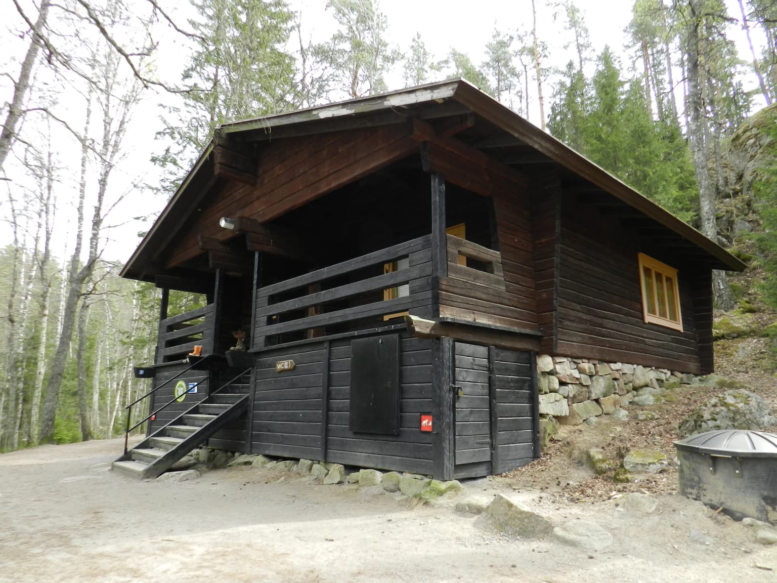
Nuuksio National Park was established in 1994 as part of Finland’s expanding national park network. The park was created through the consolidation of several previously separate land holdings: the forest area of Tervalampi manor, which had functioned as a state-owned hiking area, combined with the Nuuksionpää outdoor recreation area and the southern portion of the Salmi outdoor recreation area. The latter two areas were acquired by the City of Helsinki during the 1960s. The remaining northern sections of the Salmi outdoor recreation area remain under city ownership adjacent to the national park. In 2013, the Finnish Nature Centre Haltia opened adjacent to the park in the Nuuksio district, providing visitor services, exhibitions on Finnish nature, and educational facilities.

Nuuksio National Park landscape and geographic character

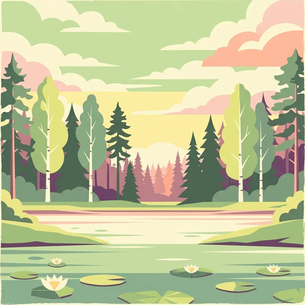
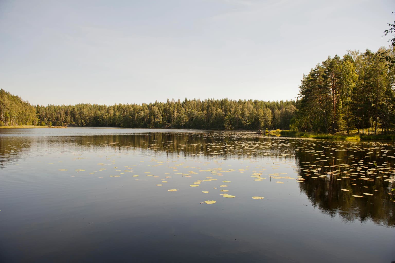
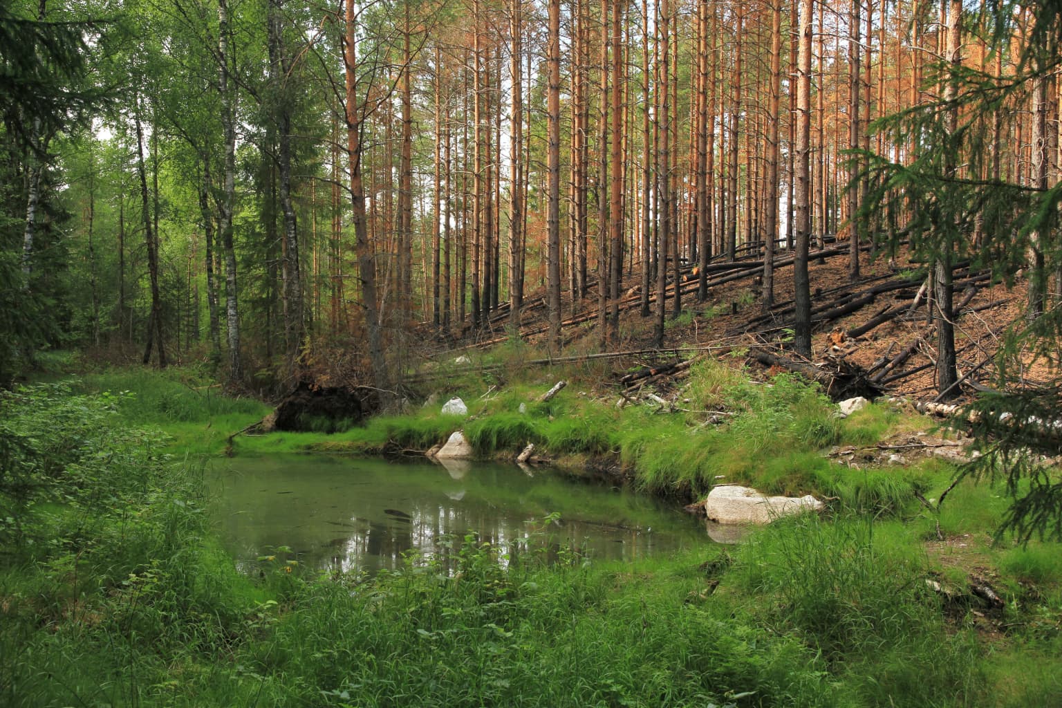
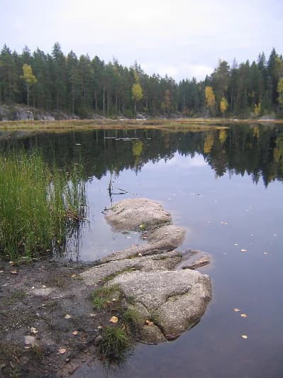
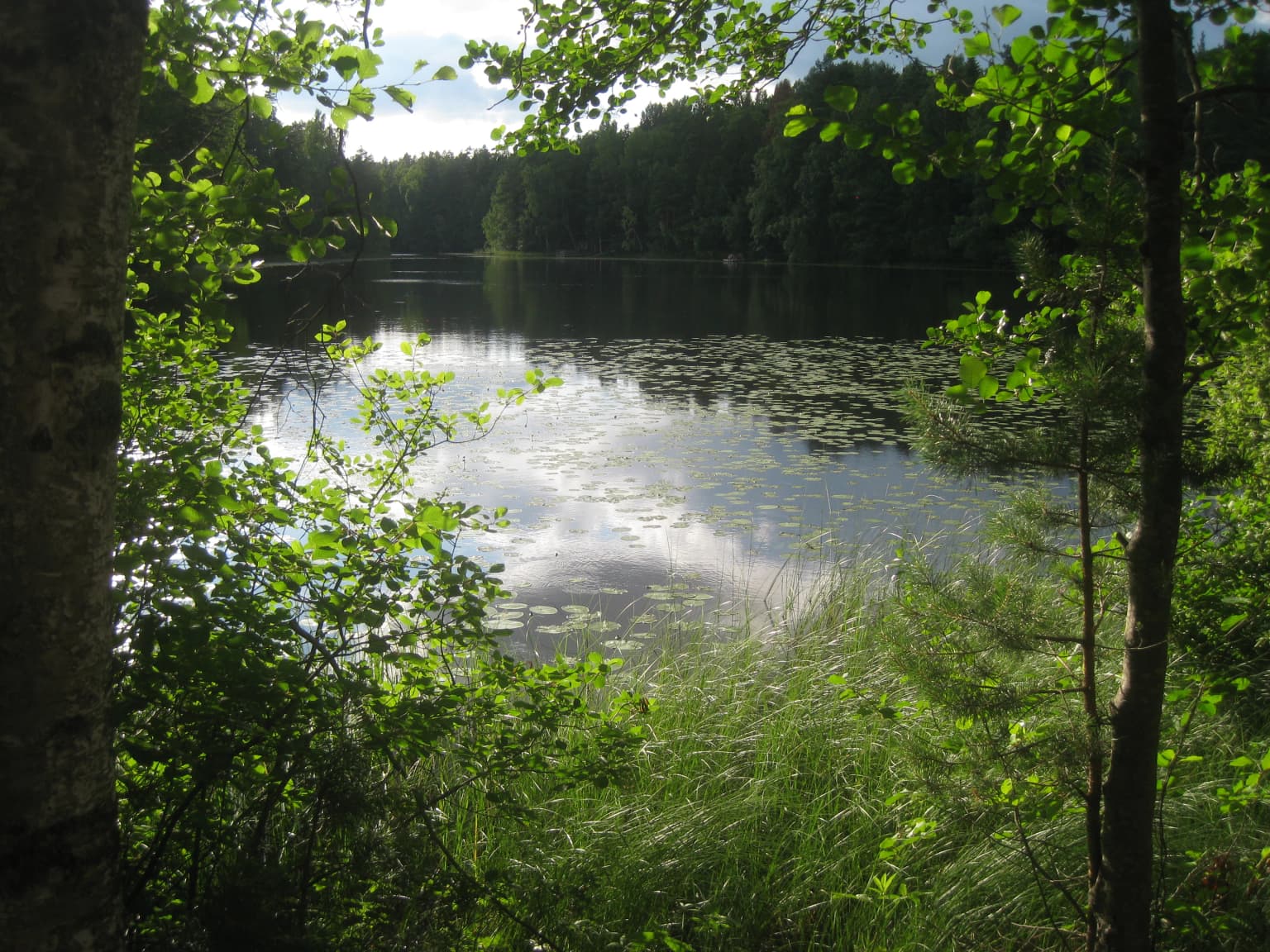
The physical landscape of Nuuksio National Park is defined by its position as the westernmost part of the Nuuksio Lake Upland. Glacial processes during the Weichselian glaciation produced the characteristic terrain of broad valleys, deep ravines, and rugged rocky hills that dominate the park’s topography. The highest points reach approximately 110 meters above sea level, while the lower valleys contain the numerous lakes that give the area its name. Rocky exposures on hills are typically covered in lichen and support sparse pine woodland. The park’s lakes, including prominent bodies such as Nuuksion Pitkäjärvi along the southeastern boundary and Tervalampi in the western portion, are connected by small streams and surrounded by forested margins. Bog areas and meadow habitats add ecological and visual diversity to the predominantly forested terrain.

Nuuksio National Park ecosystems, habitats, and plant life

The ecological character of Nuuksio National Park centers on a boreal forest and lake ecosystem that supports notable biodiversity. The park contains old-growth forest patches, bog wetlands, and heritage meadow biotopes that together provide varied habitats. The interconnected lake system creates a mosaic of aquatic and terrestrial environments supporting diverse plant and animal communities. The park is notable for the presence of numerous endangered or near-threatened species, reflecting the ecological value of maintaining this near-natural landscape within a densely populated region. The combination of forest types, wetland areas, and the lake network creates a relatively intact ecological unit that serves as an important green corridor for species movement through the Helsinki metropolitan area.

Nuuksio National Park wildlife and species highlights

Nuuksio National Park supports significant wildlife populations, most notably the Siberian flying squirrel, which has been adopted as the park’s emblem due to its exceptionally high population density within the protected area. The park is home to several bird species of conservation concern, including the European nightjar and the woodlark, both of which inhabit the open forest and heathland habitats found in the park. The diversity of habitats, from rocky pine-covered hills through forested lake margins to wetland bogs, supports a range of fauna. The presence of dozens of endangered or near-threatened animal, plant, and fungal species underscores the park’s importance as a biodiversity refuge in southern Finland.

Nuuksio National Park conservation status and protection priorities

The conservation significance of Nuuksio National Park derives from its role in protecting a near-natural forest and lake landscape within one of Finland’s most densely populated regions. The park preserves habitat for numerous endangered and near-threatened species across multiple taxonomic groups, including the emblematic Siberian flying squirrel, which reaches particularly high densities here. The protected area functions as an ecological corridor connecting green spaces throughout the Helsinki metropolitan region, allowing for species movement and maintaining ecological connectivity. As one of Finland’s national parks managed by Metsähallitus, Nuuksio receives formal protection under national conservation frameworks and contributes to Finland’s commitments to biodiversity preservation.

Nuuksio National Park cultural meaning and human context

The Nuuksio area carries cultural significance as part of theEspoo region’s historical landscape. The park’s name derives from the Nuuksio district of Espoo, reflecting the local toponymic heritage. The historical land use patterns are evident in the heritage biotopes, including meadows, preserved within the park boundaries. The former Tervalampi manor lands and the outdoor recreation areas established by the City of Helsinki in the 1960s represent more recent cultural layers in the landscape’s history. The Finnish Nature Centre Haltia, opened in 2013, serves as a contemporary cultural facility that connects visitors to Finnish nature and the history of national parks in the country.

Top sights and standout views in Nuuksio National Park

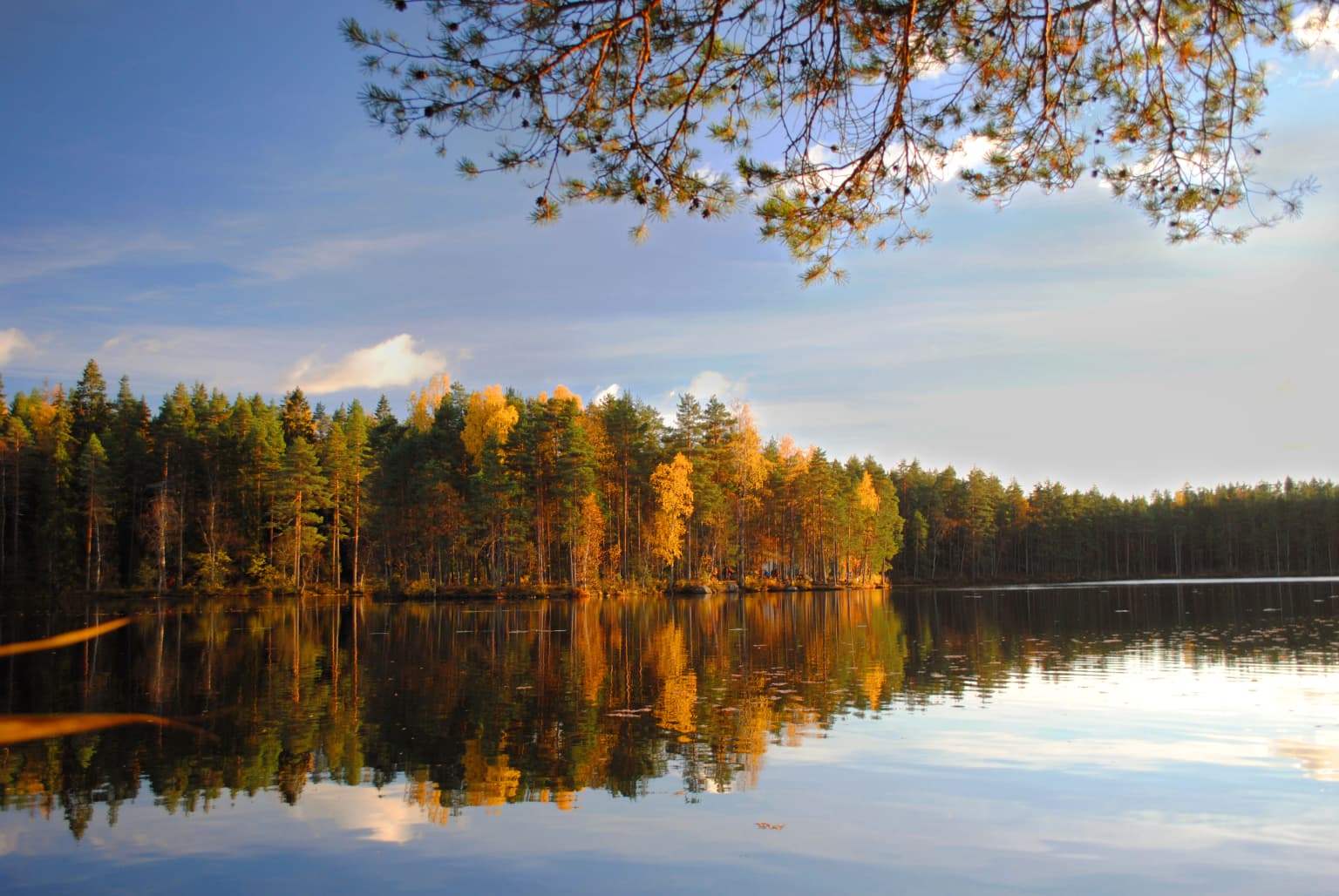
Nuuksio National Park offers a distinctive combination of accessibility and wild character within the Helsinki region. The park’s eight marked hiking trails traverse diverse terrain through forested lake landscapes, with routes ranging from casual 1.5-kilometer loops to challenging 17-kilometer circuits. The high density of Siberian flying squirrels provides a unique wildlife observation opportunity, while the network of thirty lakes creates scenic variety throughout the seasons. The Finnish Nature Centre Haltia provides an excellent visitor introduction to the park’s natural values. Autumn brings particularly notable coloration to the deciduous and coniferous forests, while the winter months offer skiing opportunities on designated trails.

Best time to visit Nuuksio National Park

Nuuksio National Park can be enjoyed throughout the year, with each season offering a distinct character. Summer and early autumn typically provide the most accessible hiking conditions, with fully operational trail networks, accessible camping areas, and warm weather suitable for outdoor recreation. The autumn season, known locally as ruska, transforms the landscape with vivid coloration as deciduous trees change, offering particularly scenic hiking experiences. Winter brings snow cover and opportunities for cross-country skiing on maintained trails, though some facilities operate on reduced schedules. Spring offers emerging vegetation and migratory bird activity, while the relatively mild southern Finnish climate allows for year-round visitation. The park’s proximity to Helsinki makes it suitable for day visits in any season.

Park location guide

Geography guide, regional context, and park location map for Nuuksio National Park

Nuuksio National Park park geography, regions, and map view in Finland
Understand where Nuuksio National Park sits in Finland through a broader geographic reading of the surrounding landscape, nearby location context, and its mapped position within the national park landscape.

How Nuuksio National Park fits into Finland

Finland, officially the Republic of Finland, is a Nordic country in Northern Europe with a population of 5.6 million. It borders Sweden, Norway, and Russia, with the Gulf of Bothnia to the west and the Gulf of Finland to the south. The country gained independence from Russia in 1917 and is a unitary parliamentary republic. Its landscape is characterized by extensive boreal forests and over 180,000 lakes.

Wider geography shaping Nuuksio National Park in Finland

Finland is located in Northern Europe, occupying a peninsula bordered by the Gulf of Bothnia to the west and the Gulf of Finland to the south. It shares land borders with Sweden to the northwest, Norway to the north, and Russia to the east. The terrain is predominantly flat with extensive forest coverage and numerous lakes.

Map view of Nuuksio National Park

Use this park location map to pinpoint Nuuksio National Park in Finland, understand its exact geographic position, and read its mapped placement within the surrounding landscape more clearly.

Pigeon | © OpenStreetMap contributors

Location context for Nuuksio National Park

Uusimaa
Park atlas

Browse protected areas and their geographic spread in the Uusimaa region and beyond, tracing Finland's diverse natural terrain.

Explore National Parks Near Nuuksio National Park: Discover Finland's Protected Landscapes
After exploring Nuuksio National Park, delve into an atlas of nearby national parks and other protected areas, mapping the surrounding forested lake highlands and glacial landscapes of the Uusimaa region. Compare these diverse conservation landscapes to understand their regional context, physical geography, and unique ecological characteristics within Finland's broader protected area network.
Watercolor illustration showing green trees, a river, and rolling hills under a soft sky
National parkUusimaa

Sipoonkorpi National Park: Protected Landscape and Geography in Uusimaa

Explore Finland's key national park and its natural terrain.

Discover Sipoonkorpi National Park, a vital protected landscape in Finland's Uusimaa region. This page offers detailed insight into its mapped boundaries, diverse boreal forests, extensive swamp areas, and the unique terrain that defines this significant natural area. Understand its role as one of the last undeveloped green spaces near the Helsinki metropolitan area and explore its geographic context within southern Finland.

Area
18.57 km²
Established
2011
IUCN
II
Visitors
165.5K annual
Watercolor painting showing a lake surrounded by vegetation with rolling hills in the background
National parkKanta-Häme

Liesjärvi National Park: Protected Landscape in Kanta-Häme's Finnish Lakeland

Explore its mapped geography and protected area context.

Liesjärvi National Park is a designated national park situated in the Kanta-Häme region, a landscape rich with the characteristic features of southern Finland's Finnish Lakeland. This page serves as a focused entry point for understanding the park's protected status, its unique geographic setting, and its contribution to the regional atlas of natural landscapes. By examining Liesjärvi National Park, users gain insight into the mapped terrain and conservation efforts that define this part of Finland, fostering a deeper appreciation for protected areas.

Area
22 km²
Established
1956
IUCN
II
Visitors
57.3K annual
Watercolor illustration of a landscape featuring a body of water, trees, and distant mountains
National parkKanta-Häme

Torronsuo National Park: Explore Finland's Exceptional Raised Bog Ecosystem and Kanta-Häme Geography

Discover mapped peatlands, unique birdlife, and protected boreal wilderness.

Torronsuo National Park stands as a testament to Finland's remarkable wetland conservation efforts, presenting a striking example of a raised bog ecosystem. Located within the Kanta-Häme region, this national park is celebrated for its vast, domed peat landscape, some of the thickest peat layers ever measured in Finland, and its status as a Ramsar-designated wetland. The park's protected status ensures the preservation of its unique natural terrain, which supports a rich diversity of northern bird species and specialized bog flora, making it a significant area for ecological and geographic exploration.

Area
25.5 km²
Established
1990
IUCN
II
Visitors
58.6K annual
National parkUusimaa

Ekenäs Archipelago National Park: Mapped Baltic Sea Archipelago Landscape

Protected marine area with island geography in Uusimaa, Finland.

Delve into the unique protected landscape of Ekenäs Archipelago National Park, a premier example of a Baltic Sea marine protected area. Located in the Uusimaa region, this national park encompasses a vast expanse of coastal waters dotted with hundreds of rocky islets and skerries. MoriAtlas provides detailed geographic context, allowing for exploration of its mapped boundaries, island formations, and critical role as a sanctuary for breeding aquatic birds. Understand its place within Finland's protected areas atlas and appreciate its distinctive marine archipelago character.

Area
52 km²
Established
1989
IUCN
II
Visitors
53.6K annual
National parkSouthwest Finland

Teijo National Park: Mapped Boundaries of a Protected National Park in Southwest Finland

Explore the geographic context and protected landscape of Teijo National Park.

Teijo National Park is a designated national park within Southwest Finland, offering a distinct protected landscape for atlas exploration. This entry focuses on its geographic identity, mapped park boundaries, and its place within the broader regional geography. Discover the structured details of Teijo National Park as a key protected area, providing valuable context for understanding natural landscapes and conservation efforts in Finland.

Area
34 km²
Established
2015
IUCN
II
Visitors
92.1K annual
National park

Lahemaa National Park: Explore Estonia's Coastal Geography and Protected Landscape Atlas

Mapped terrain, bogs, and coastal peninsulas of a major protected area.

Delve into the detailed geography of Lahemaa National Park, Estonia's largest national park situated on the southern coast of the Gulf of Finland. This protected landscape encompasses a diverse range of terrain, from the deeply indented coastline and ancient glacial boulders to expansive raised bogs and rolling boreal forests. Understand the park's mapped boundaries and its significance as a premier destination for exploring distinct Baltic natural environments and historical coastal villages. The park's unique blend of natural features and cultural heritage makes it a key point of reference in any protected-area atlas.

Area
747 km²
Established
1971
IUCN
II
Relief
Lowland
Watercolor painting showing green hills, trees, and a stream in a landscape
National parkSouthwest Finland

Kurjenrahka National Park: Southwest Finland's Protected Landscape Atlas Entry

Discover geographic context and park boundaries.

Delve into Kurjenrahka National Park, a designated national park situated in Southwest Finland. This page provides an atlas-focused view of the park, detailing its protected landscape identity, mapped terrain, and its specific geographic location within the broader Finnish region. Understand the park's ecological context and its significance as a key protected area for regional geographic exploration.

Area
29 km²
Established
1998
IUCN
II
Visitors
66.8K annual
National parkKymenlaakso

Valkmusa National Park: Protected Area Atlas & Kymenlaakso Geography

Mapped natural landscape context within southeastern Finland.

Valkmusa National Park offers a unique opportunity for structured exploration of Finland's protected areas. Within the Kymenlaakso region, this national park presents a specific geographic identity for map-based discovery. Understand its protected landscape, mapped terrain, and regional context to build a comprehensive picture of southeastern Finland's natural geography through MoriAtlas.

Area
17 km²
Established
1996
IUCN
II
Visitors
20.3K annual

Common questions about visiting, size, designation, and location context for Nuuksio National Park

Nuuksio National Park FAQs for park facts, access, geography, and protected area context
Find quick answers about Nuuksio National Park, including protected-area facts, park geography, trail and visitor context, and how the park fits into its surrounding country and regional landscape.
MoriAtlas Explorer

Continue Your Protected Areas Search Across the Global Atlas

Deepen your exploration by continuing the structured search for national parks and protected areas worldwide. Utilize the comprehensive filtering capabilities to compare different conservation landscapes and refine your understanding of global park geography. Discover more about the distribution and characteristics of protected natural areas.

Global natural geography