Mori Atlas logo
National parkLahemaa National Park

Explore the mapped boundaries and diverse terrains of Lahemaa National Park's peninsulas and bogs.

Lahemaa National Park: Estonia's Premier Protected Landscape and Coastal Geography

Lahemaa National Park, Estonia's largest and most historically significant protected area, offers a unique exploration of the Baltic landscape. Spanning over 747 square kilometers along the Gulf of Finland, the park features four prominent peninsulas and numerous bays, contributing to its name, 'Land of Bays.' Discover its varied geography, from the dramatic North Estonian cliff formations and glacial boulders along the coast to vast raised bogs and pristine boreal forests inland. This atlas-driven view highlights the park's extensive protected land, providing context for its natural and cultural heritage.

Boreal ForestsRaised BogsCoastal PeninsulaHistoric ManorsLarge MammalsBaltic Landscape

Lahemaa National Park

National park

Park overview

Structured park overview, official facts, and landscape profile for Lahemaa National Park

Lahemaa National Park park facts, protected area profile, and essential visitor context
Review the core facts for Lahemaa National Park, including designation, size, terrain, visitor scale, habitats, and operating context in one park-focused overview.

About Lahemaa National Park

Lahemaa National Park represents the ecological and cultural heart of northern Estonia, protecting a landscape that has evolved over thousands of years since the retreat of continental glaciers. The park's territory encompasses three main landscape regions: the Gulf of Finland coastal lowlands and islands, the Harju plateau, and the Viru plateau, with the distinctive North Estonian cliff marking much of the exposed coastline. The marine component, comprising roughly one-third of the total area, includes shallow Gulf of Finland waters with highly variable bottom relief ranging from a few meters to over 100 meters depth. The park's terrestrial portion is dominated by forests—approximately 73% of the land area—classified primarily as pine forests, with significant areas of mixed forests and bog woodlands. This forest cover, combined with extensive protected bog systems and the complex coastal geometry, creates one of the most ecologically diverse protected landscapes in the Baltic region.

Quick facts and research context for Lahemaa National Park

Lahemaa National Park covers 747 km² in northern Estonia, making it the country's largest protected area and one of Europe's biggest national parks. Established on July 1, 1971, it was the first national park designated in the former Soviet Union. The park features a highly indented coastline along the Gulf of Finland, with four major peninsulas and four bays creating a complex coastal landscape. Over 70% of the land area is forested, predominantly with pine forests covering approximately 60% of the woodland. The park protects significant raised bog systems, including the 7,000-year-old Laukasoo Reserve, and represents one of Europe's most important forest conservation areas. Four historic manor complexes—Palmse, Vihula, Kolga, and Sagadi—sit within the park boundaries.

Park context

Deeper park guide and search-rich context for Lahemaa National Park

Lahemaa National Park history, landscape, wildlife, and travel context
Explore Lahemaa National Park through its history, landscape character, ecosystems, wildlife, conservation priorities, cultural context, and seasonal travel timing in a structured park guide built for atlas discovery and search intent.

Why Lahemaa National Park stands out

Lahemaa is best known for its exceptional combination of pristine boreal forests, extensive raised bog systems, and a dramatic rocky coastline characterized by glacial boulders and the striking North Estonian cliff (Balti klint). The park protects significant populations of large mammals including grey wolves, brown bears, Eurasian lynx, red deer, and wild boar. Its network of nature trails through Viru Bog and along the coastal peninsulas offers visitors accessible encounters with pristine bog ecosystems and historic fishing villages. The four baroque and classical manors, particularly Sagadi Manor, Estonia's most visited manor, provide a unique cultural heritage dimension uncommon in European national parks.

Lahemaa National Park history and protected-area timeline

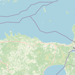
Lahemaa National Park was established on July 1, 1971, becoming the first national park designated in the Soviet Union and marking a significant moment in Estonian environmental conservation history. The creation of the park represented a pioneering effort to preserve representative North Estonian landscapes during an era when protected area designation was rare in Soviet-era Europe. The park's name derives from the region's distinctive geography—four large peninsulas (Juminda, Pärispea, Käsmu, and Vergi) separated by four bays (Kolga, Hara, Eru, and Käsmu), giving the area its characteristic "Land of Bays" identity. Prior to Estonia's independence in 1991, the Soviet military operated a large secret submarine base at Hara, constructed in the 1950s during the Cold War; the ruins of this former installation now lie within the park near the Lahemaa lighthouse, serving as an unusual historical footnote to the region's more recent past.

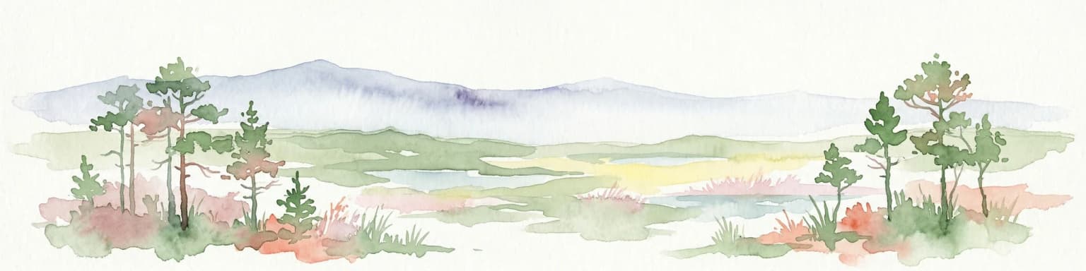
Lahemaa National Park landscape and geographic character

The landscape of Lahemaa National Park is defined by the interplay between its forested interior, extensive bog systems, and a dramatically indented rocky coastline along the Gulf of Finland. The coastal section features the prominent North Estonian cliff (Balti klint), a geological formation exposing ancient sedimentary layers along much of the shoreline. Glacial boulders and rocky shores dominate the headlands, particularly on the Pärispea Peninsula, creating a rugged and photogenic maritime landscape. The interior is characterized by rolling terrain covered in boreal forest, interspersed with numerous lakes, rivers, and raised bog complexes. The park contains eight major river systems—Altja, Kolga, Loo, Loobu, Mustoja, Pudisoo, Valgejõgi, and Võsu—along with four significant waterfalls including Nõmmeveski and Turjekeldri. Major lakes within the park include Kahala (346 hectares), Lohja (57 hectares), and Käsmu (43 hectares).

Lahemaa National Park ecosystems, habitats, and plant life

The nature of Lahemaa reflects the ecological character of North Estonia's boreal landscape, with forests dominating approximately 73% of the terrestrial area. Pine forests constitute the predominant forest type, covering about 60% of the woodland, while spruce accounts for roughly 20% and various birch species for approximately 15%. The park contains significant areas of semi-natural habitats—approximately 2,543 hectares including wooded meadows, coastal meadows, floodplain grasslands, and rare alvar grasslands—that represent traditional land use patterns now maintained through conservation management. The raised bog systems, particularly the ancient Laukasoo Reserve at over 7,000 years old, represent some of the best-preserved peatland ecosystems in the Baltic region. The marine component protects coastal waters of the Gulf of Finland with their characteristic biodiversity.

Lahemaa National Park wildlife and species highlights

Lahemaa supports notable populations of large mammals that represent the apex of the park's terrestrial ecosystems. Grey wolves, brown bears, and Eurasian lynx all maintain viable populations within the park, making it one of the few areas in Europe where visitors can encounter these secretive predators. Red deer and wild boar are more commonly observed, particularly in the forest interiors and along the network of nature trails. The park's coastline serves as an important migratory corridor for cranes, which stop annually on their journey between northern breeding grounds and wintering areas in the Bosphorus region and Egypt, utilizing the rocky shores and shallows as resting points. The diverse habitats support a rich bird fauna, and the coastal waters provide feeding grounds for various waterfowl species.

Lahemaa National Park conservation status and protection priorities

Lahemaa National Park holds significant conservation importance as Estonia's premier protected area and one of Europe's largest national parks. The park's conservation framework divides the territory into three reserves (117 hectares), 43 protected zones (17,760 hectares), and nine restriction zones (56,907 hectares), creating a zoned approach to protection that balances ecological preservation with sustainable use. The protection of old-growth forest ecosystems makes Lahemaa one of Europe's most important forest conservation areas, preserving representative boreal forest communities that have become rare across the continent. The bog systems, with their carbon storage capacity and unique ecological functions, represent critical habitats for conservation in the Baltic region. The park's designation as Estonia's first national park established a conservation precedent that has shaped environmental protection policy across the country.

Lahemaa National Park cultural meaning and human context

Lahemaa contains a rich cultural heritage element through its four historic manor complexes: Palmse Manor, Vihula Manor, Kolga Manor, and Sagadi Manor. Sagadi Manor, with its baroque architecture, has become Estonia's most visited manor and serves as a focal point for understanding the region's aristocratic history. The traditional fishing village of Altja preserves authentic coastal heritage with its historic fishermen's huts and net stores, offering a window into traditional maritime livelihoods that shaped the region for centuries. These cultural elements—the manors representing estate-based agriculture and the fishing villages representing coastal community traditions—create a cultural landscape that complements the natural values, demonstrating the long human relationship with this coastal environment.

Top sights and standout views in Lahemaa National Park

The park's standout features include the network of accessible bog trails at Viru Bog, where wooden boardwalks allow visitors to experience the unique ecosystem of raised peatlands safely. The dramatic coastal peninsulas, particularly Pärispea with its glacial boulders and panoramic views of the Gulf of Finland, offer exceptional hiking opportunities. The four historic manors provide cultural sightseeing opportunities unique among European national parks, with Sagadi Manor serving as a visitor center and museum. The underwater ruins of the Soviet-era Hara submarine base add an unusual Cold War historical dimension. The Juminda lighthouse marks one of the park's northernmost points, while the fishing village of Altja preserves traditional coastal architecture.

Best time to visit Lahemaa National Park

The optimal visiting season for Lahemaa extends from late spring through early autumn, when temperatures are moderate and the network of nature trails is fully accessible. Summer months (June through August) offer the warmest conditions for hiking and outdoor exploration, though they also bring the highest visitor numbers. Autumn brings exceptional color to the deciduous and coniferous forests, with September and October offering particularly striking displays in the bog systems and forest interiors. Winter transforms the landscape dramatically, with frozen bogs and snow-covered forests creating a starkly beautiful environment, though trail conditions become more challenging. The shoulder seasons of May and September typically offer a balance between favorable weather conditions and fewer visitors.

Park location guide

Geography guide, regional context, and park location map for Lahemaa National Park

Lahemaa National Park park geography, regions, and map view in Estonia
Understand where Lahemaa National Park sits in Estonia through a broader geographic reading of the surrounding landscape, nearby location context, and its mapped position within the national park landscape.

How Lahemaa National Park fits into Estonia

Estonia is a parliamentary republic and member of the European Union and NATO. With a population of about 1.4 million, it is one of the least populous EU member states. The official language is Estonian, and the currency is the Euro.

Wider geography shaping Lahemaa National Park in Estonia

Estonia is situated on the eastern coast of the Baltic Sea in Northern Europe. It borders the Gulf of Finland to the north, Latvia to the south, and Russia to the east. The territory includes the mainland, the islands of Saaremaa and Hiiumaa, and over 2,300 smaller islands and islets.

Map view of Lahemaa National Park

Use this park location map to pinpoint Lahemaa National Park in Estonia, understand its exact geographic position, and read its mapped placement within the surrounding landscape more clearly.

Pigeon | © OpenStreetMap contributors
Park atlas

Trace the geographic spread of protected landscapes surrounding Lahemaa and compare nearby Baltic conservation areas.

Discover National Parks and Protected Areas Beyond Lahemaa National Park, Estonia's Baltic Coasts
Continue your exploration from Lahemaa National Park to browse a curated selection of other national parks and protected areas in the surrounding Baltic region. Compare diverse protected landscapes, mapped geography, and conservation efforts across similar boreal forests, coastal ecosystems, and historic territories adjacent to Estonia's largest park.
Watercolor illustration showing green trees, a river, and rolling hills under a soft sky
National parkUusimaa

Sipoonkorpi National Park: Protected Landscape and Geography in Uusimaa

Explore Finland's key national park and its natural terrain.

Discover Sipoonkorpi National Park, a vital protected landscape in Finland's Uusimaa region. This page offers detailed insight into its mapped boundaries, diverse boreal forests, extensive swamp areas, and the unique terrain that defines this significant natural area. Understand its role as one of the last undeveloped green spaces near the Helsinki metropolitan area and explore its geographic context within southern Finland.

Area
18.57 km²
Established
2011
IUCN
II
Visitors
165.5K annual
Watercolor illustration of a lake, forests, and hills
National park

Alutaguse National Park: Eastern Estonia's Vast Peat Bog and Forest Protected Landscape

Mapping Protected Wetlands and Boreal Ecosystems in Estonia

Alutaguse National Park, a newly established national park in eastern Estonia, offers a unique atlas perspective on extensive peat bog ecosystems and boreal forests. Covering over 443 square kilometers, it represents some of the most intact wetland landscapes in the country. The park's creation unified eleven protected areas, safeguarding a critical habitat for rare species and showcasing the distinctive geography of the Alutaguse Lowland.

Area
443.31 km²
Established
2018
Relief
Lowland
Climate
Temperate
National parkUusimaa

Nuuksio National Park: Uusimaa Region Protected Landscape Atlas Entry

Mapped boundaries and geographic context for a Finnish National Park.

Access detailed geographic information and mapped boundaries for Nuuksio National Park, a protected national park within the Uusimaa region. This MoriAtlas entry provides context for understanding its landscape within Finland, focusing on atlas-style exploration and the identification of protected natural areas.

Area
53 km²
Established
1994
IUCN
II
Visitors
312.6K annual
National parkKymenlaakso

Eastern Gulf of Finland National Park: Kymenlaakso's National Park and Coastal Geography

Explore protected lands and mapped terrain.

The Eastern Gulf of Finland National Park is a designated national park located in the Kymenlaakso region of southeastern Finland. This entry provides specific geographic context for the park, detailing its role as a protected landscape and its mapped boundaries within the coastal atlas of the Gulf of Finland. Understanding its regional setting within Kymenlaakso allows for a more structured exploration of Finland's protected natural areas and their unique geographic identities.

Area
6 km²
Established
1982
IUCN
II
Visitors
15.8K annual
National parkKymenlaakso

Valkmusa National Park: Protected Area Atlas & Kymenlaakso Geography

Mapped natural landscape context within southeastern Finland.

Valkmusa National Park offers a unique opportunity for structured exploration of Finland's protected areas. Within the Kymenlaakso region, this national park presents a specific geographic identity for map-based discovery. Understand its protected landscape, mapped terrain, and regional context to build a comprehensive picture of southeastern Finland's natural geography through MoriAtlas.

Area
17 km²
Established
1996
IUCN
II
Visitors
20.3K annual
Watercolor painting showing a wetland landscape with scattered trees, marshy areas, and distant mountains under a muted sky
National parkViljandi County

Soomaa National Park: Estonia's Wilderness Wetland Landscape Atlas

Explore mapped protected peat bogs and dynamic floodplains in Viljandi County.

Soomaa National Park is a protected wilderness area in Estonia renowned for its extensive peat bog systems and unique floodplains. This national park, located primarily in Viljandi County, showcases some of Europe's largest intact wetland landscapes, characterized by seasonal floods that transform the terrain into vast aquatic environments. MoriAtlas provides detailed geographic context for Soomaa, allowing for exploration of its protected boundaries and landscape features within the broader atlas of European natural areas.

Area
359 km²
Established
1993
Relief
Lowland
Climate
Boreal
National parkUusimaa

Ekenäs Archipelago National Park: Mapped Baltic Sea Archipelago Landscape

Protected marine area with island geography in Uusimaa, Finland.

Delve into the unique protected landscape of Ekenäs Archipelago National Park, a premier example of a Baltic Sea marine protected area. Located in the Uusimaa region, this national park encompasses a vast expanse of coastal waters dotted with hundreds of rocky islets and skerries. MoriAtlas provides detailed geographic context, allowing for exploration of its mapped boundaries, island formations, and critical role as a sanctuary for breeding aquatic birds. Understand its place within Finland's protected areas atlas and appreciate its distinctive marine archipelago character.

Area
52 km²
Established
1989
IUCN
II
Visitors
53.6K annual
Watercolor illustration showing a wetland landscape with grassy fields, a river, and trees in the background
National parkLääne County

Matsalu National Park: Explore Estonia's Premier Wetland National Park Geography and Protected Area

Discover mapped landscapes and bird migration routes in Lääne County.

Matsalu National Park, located in Lääne County, Estonia, is a prime example of a protected wetland ecosystem of international significance. This page delves into the park's unique geographic features, including the shallow brackish Matsalu Bay, the expansive Kasari River delta, and the numerous islands that form its coastal mosaic. Users can explore the park's protected boundaries and understand its critical function as a major staging area for migratory birds, offering a detailed atlas-level view of this important natural landscape.

Area
486.1 km²
Established
1957
Relief
Lowland
Climate
Temperate

Common questions about visiting, size, designation, and location context for Lahemaa National Park

Lahemaa National Park FAQs for park facts, access, geography, and protected area context
Find quick answers about Lahemaa National Park, including protected-area facts, park geography, trail and visitor context, and how the park fits into its surrounding country and regional landscape.
MoriAtlas Explorer

Continue Your Protected Areas Search Across the Global Atlas

Deepen your exploration by continuing the structured search for national parks and protected areas worldwide. Utilize the comprehensive filtering capabilities to compare different conservation landscapes and refine your understanding of global park geography. Discover more about the distribution and characteristics of protected natural areas.

Global natural geography