Mori Atlas logo
National parkEkenäs Archipelago National Park

Navigate the mapped terrain and marine geography of Finland's iconic island national park.

Ekenäs Archipelago National Park: A Unique Baltic Sea Protected Landscape in Uusimaa

Ekenäs Archipelago National Park represents a significant protected marine area situated in the Uusimaa region of southern Finland. Established in 1989, this national park safeguards a distinct Baltic Sea archipelago characterized by numerous rocky islets, small islands, and the productive coastal waters that define its geography. Spanning approximately 52 square kilometers, the park's vastness is primarily aquatic, with water bodies constituting about 85 percent of its territory, underscoring its role as a vital marine protected area. MoriAtlas allows for structured discovery of this unique landscape, highlighting its mapped boundaries and ecological importance for bird protection within the broader Finnish atlas.

archipelagocoastal landscapeBaltic Seabird protectionmarine protected areaislands

Ekenäs Archipelago National Park

National park

Park overview

Structured park overview, official facts, and landscape profile for Ekenäs Archipelago National Park

Ekenäs Archipelago National Park park facts, protected area profile, and essential visitor context
Review the core facts for Ekenäs Archipelago National Park, including designation, size, terrain, visitor scale, habitats, and operating context in one park-focused overview.

About Ekenäs Archipelago National Park

Ekenäs Archipelago National Park represents one of Finland's premier coastal wilderness areas, protecting a living archipelago ecosystem in the Gulf of Finland. The park's creation built upon an earlier conservation foundation—the Jussarö nature reserve established in 1956—before being formally designated as a national park in 1989. The landscape is quintessential Baltic: a scattered archipelago of bare rock islets, larger forested islands, and extensive shallow marine waters teeming with life. Unlike Finland's many forested inland parks, this national park is fundamentally defined by its marine character, with water comprising the overwhelming majority of its protected area. The archipelago has deep historical roots, with Älgö (formerly Elgö) and Rödjan mentioned in Danish sailing guides dating back to the 1240s, indicating the islands' long-standing significance in regional maritime culture. Today, the park provides a rare opportunity to experience an undeveloped coastal island environment relatively close to Finland's capital region, while serving as a crucial habitat for seabirds and marine species.

Quick facts and research context for Ekenäs Archipelago National Park

The park lies in the Ekenäs archipelago off the town of Raasepori in western Uusimaa, Finland. Its territory is dominated by water, with rocky islets near the open sea forming the primary land features. The largest islands include Älgö and Jussarö, which host visitor facilities and nature trails. The park is managed by Metsähallitus (Finnish Forestry Administration) and receives approximately 53,600 visitors annually. Landing restrictions apply to many islands from April 1 to July 17 to protect nesting bird populations.

Park context

Deeper park guide and search-rich context for Ekenäs Archipelago National Park

Ekenäs Archipelago National Park history, landscape, wildlife, and travel context
Explore Ekenäs Archipelago National Park through its history, landscape character, ecosystems, wildlife, conservation priorities, cultural context, and seasonal travel timing in a structured park guide built for atlas discovery and search intent.

Why Ekenäs Archipelago National Park stands out

Ekenäs Archipelago National Park is best known for its raw Baltic Sea archipelago character, a landscape of countless rocky islets rising from productive coastal waters. The park serves as a critical sanctuary for breeding aquatic birds, with strict protections during the nesting season. Its boat-only access and European Diploma of Protected Areas status (valid until 2031) distinguish it among Finland's protected areas. The historic Rödjan farmstead on Älgö island functions as the park's information center, while Jussarö offers visitor accommodations and services.

Aerial view showing red farm buildings, green fields, and surrounding water with forested islands in the background
Aerial view of Rödjan farmstead within Ekenäs Archipelago National Park

Ekenäs Archipelago National Park history and protected-area timeline

The national park traces its origins to 1956 when Jussarö was established as a nature reserve, providing the initial protected-area foundation for what would later become a larger archipelago park. In 1989, Ekenäs Archipelago National Park was formally established, consolidating the surrounding archipelago waters and islands under national park protection. The park is administered by Metsähallitus, which manages all of Finland's national parks. A significant milestone in the park's conservation history came in 1996 when it received the European Diploma of Protected Areas from the Council of Europe—a recognition of exceptional European conservation value. This diploma has been renewed and remains valid until June 19, 2031, placing Ekenäs among the elite protected areas on the European continent. Visitor access has evolved over time, with water taxi services and, more recently, a scheduled ferry service from Ekenäs harbour to Jussarö during summer months making the park more accessible to those without private boats.

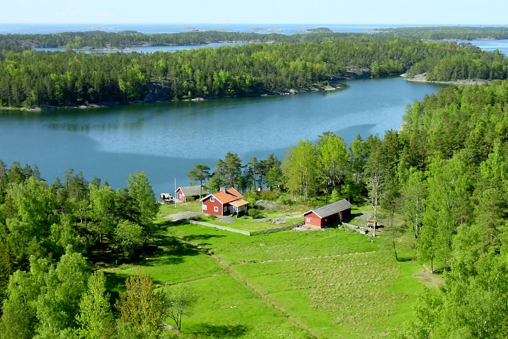
Ekenäs Archipelago National Park landscape and geographic character

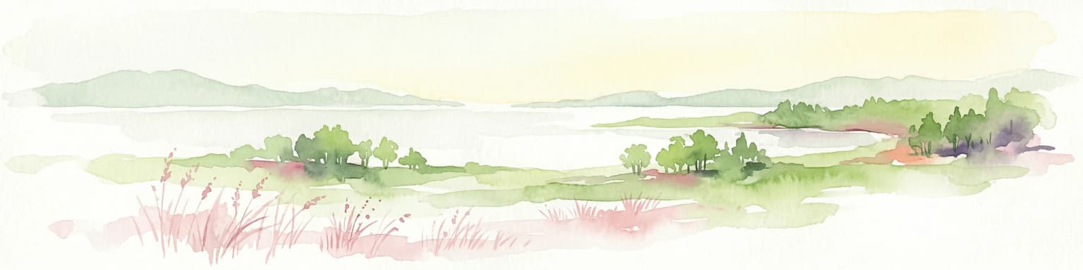
The physical landscape of Ekenäs Archipelago National Park is defined by the distinctive Baltic Sea archipelago environment. The territory consists of hundreds of rocky islets and skerries scattered across coastal waters, with larger islands such as Älgö and Jussarö providing the main land areas. The geology is characterized by granite bedrock typical of the Fennoscandian shield, with bare rock exposures and thin soils supporting limited vegetation. The marine component dominates the park—approximately 85 percent of the total area is water, reflecting the archipelago's fundamental nature as a marine-protected area. The surrounding waters of the Gulf of Finland are relatively shallow and productive, supporting rich ecosystems. The islands themselves range from tiny unvegetated skerries to larger islands with some forest cover, though the tree growth is typically stunted due to the coastal exposure and thin soils.

Ekenäs Archipelago National Park ecosystems, habitats, and plant life

The ecological character of Ekenäs Archipelago is fundamentally marine and coastal. The productive Baltic Sea waters support diverse fish populations, marine invertebrates, and the bird species that feed upon them. The archipelago provides critical breeding habitat for a variety of aquatic birds, including species that nest on the ground in open coastal areas. The park's ecosystem reflects the transition between boreal and maritime influences, with species adapted to the brackish waters of the Gulf of Finland. The surrounding waters serve as a foraging area for seabirds, while the islands provide sheltered nesting sites. The marine vegetation in shallow areas includes bladderwrack and other brown algae characteristic of Baltic rocky coasts, supporting specialized invertebrate communities.

Ekenäs Archipelago National Park wildlife and species highlights

Ekenäs Archipelago supports important populations of nesting aquatic birds, which form the centerpiece of the park's wildlife significance. During the breeding season from April 1 to July 17, landing restrictions apply to the most important bird islands to protect nesting success. The waters around the islands attract diverse waterfowl and seabirds that feed in the productive coastal marine environment. While the English source emphasizes general aquatic bird protection, the Finnish source notes the park's symbol is the common eider (haahka), a characteristic Baltic Sea diving duck that breeds on the islands. The marine environment also supports fish species important to both wildlife and local fishing traditions.

Ekenäs Archipelago National Park conservation status and protection priorities

The park's European Diploma of Protected Areas status, awarded in 1996 and valid until 2031, represents the highest level of conservation recognition for this archipelago ecosystem. This diploma indicates exceptional biological diversity, ecological integrity, and management quality. The nesting bird protection measures—temporary landing restrictions during breeding season—demonstrate active conservation management. The park's protection extends across both the terrestrial islets and the surrounding marine waters, recognizing that the archipelago ecosystem functions as an integrated whole. Approximately 85 percent of the protected area being water emphasizes that effective conservation must include the marine component, not just the visible islands.

Ekenäs Archipelago National Park cultural meaning and human context

The Ekenäs archipelago has a long human history intertwined with maritime activities. The islands were referenced in Danish sailing guides from the 1240s, showing their historical role in coastal navigation. The Rödjan farmstead on Älgö island represents traditional island settlement and fishing use, now repurposed as the park's nature information center. This former fishing farm also serves as a popular stop for boaters traveling between Helsinki and Stockholm, reflecting the archipelago's ongoing significance as a maritime route. The Finnish name Tammisaaren saariston kansallispuisto references the town of Tammisaari (Raasepori), the regional center that gave the archipelago its identity. The Swedish name Ekenäs skärgårds nationalpark reflects the bilingual nature of coastal Finland.

Top sights and standout views in Ekenäs Archipelago National Park

The park's standout features include its accessible-but-remote archipelago character, the historic Rödjan farmstead serving as a visitor information center, the boat-only access that preserves the wilderness atmosphere, and the European Diploma recognition. Three marked nature trails offer hiking opportunities—2 km on Älgö from Rödjan, 1.5 km on Modermagan, and 4.7 km on Jussarö. Jussarö provides the most developed visitor infrastructure with accommodations and a cafe-restaurant. The park is particularly significant for breeding birds, with the common eider as its symbolic species. The combination of natural values, cultural heritage, and marine character makes it one of Finland's most distinctive national parks.

Best time to visit Ekenäs Archipelago National Park

The summer months offer the most accessible experience, with the scheduled ferry service operating from Ekenäs harbour to Jussarö during the warm season. However, the nesting bird protection period from April 1 to July 17 means that many islands are closed to landing during spring and early summer—the very time when the archipelago is most alive with breeding birds. Late summer through early autumn (August to September) provides a good balance of accessible islands, comfortable weather, and fewer visitors. Winter access is possible but requires own boat and brings challenging conditions. The boat-only access requirement means that visiting the park is inherently tied to having water transportation or using the summer ferry services.

Park location guide

Geography guide, regional context, and park location map for Ekenäs Archipelago National Park

Ekenäs Archipelago National Park park geography, regions, and map view in Finland
Understand where Ekenäs Archipelago National Park sits in Finland through a broader geographic reading of the surrounding landscape, nearby location context, and its mapped position within the national park landscape.

How Ekenäs Archipelago National Park fits into Finland

Finland, officially the Republic of Finland, is a Nordic country in Northern Europe with a population of 5.6 million. It borders Sweden, Norway, and Russia, with the Gulf of Bothnia to the west and the Gulf of Finland to the south. The country gained independence from Russia in 1917 and is a unitary parliamentary republic. Its landscape is characterized by extensive boreal forests and over 180,000 lakes.

Wider geography shaping Ekenäs Archipelago National Park in Finland

Finland is located in Northern Europe, occupying a peninsula bordered by the Gulf of Bothnia to the west and the Gulf of Finland to the south. It shares land borders with Sweden to the northwest, Norway to the north, and Russia to the east. The terrain is predominantly flat with extensive forest coverage and numerous lakes.

Map view of Ekenäs Archipelago National Park

Use this park location map to pinpoint Ekenäs Archipelago National Park in Finland, understand its exact geographic position, and read its mapped placement within the surrounding landscape more clearly.

Pigeon | © OpenStreetMap contributors

Location context for Ekenäs Archipelago National Park

Uusimaa

Understand the distinctive coastal terrain, marine ecosystems, and vital bird habitats defining this Finnish protected area's visual identity.

Ekenäs Archipelago National Park Photography: Visualizing Finland's Baltic Sea Archipelago Landscapes
Browse a curated collection of Ekenäs Archipelago National Park photos, showcasing its distinctive Baltic Sea coastal landscape, rocky islets, and productive marine environments. These images provide an essential visual reference for understanding the park's unique protected-area character, key habitats, and overall environmental setting.

Aerial view showing red farm buildings, green fields, and surrounding water with forested islands in the background

Park atlas

Trace Finland's coastal protected landscapes, map archipelago geography, and compare conservation areas around the Uusimaa region.

Explore Other National Parks and Protected Areas Near Ekenäs Archipelago National Park
Continue your exploration beyond Ekenäs Archipelago National Park by browsing other national parks and protected areas across southern Finland, with a focus on Uusimaa's coastal geography and archipelago landscapes. Compare these diverse marine and terrestrial conservation areas to understand their unique regional context and the broader network of Finland's protected natural spaces.
National parkSouthwest Finland

Teijo National Park: Mapped Boundaries of a Protected National Park in Southwest Finland

Explore the geographic context and protected landscape of Teijo National Park.

Teijo National Park is a designated national park within Southwest Finland, offering a distinct protected landscape for atlas exploration. This entry focuses on its geographic identity, mapped park boundaries, and its place within the broader regional geography. Discover the structured details of Teijo National Park as a key protected area, providing valuable context for understanding natural landscapes and conservation efforts in Finland.

Area
34 km²
Established
2015
IUCN
II
Visitors
92.1K annual
National parkUusimaa

Nuuksio National Park: Uusimaa Region Protected Landscape Atlas Entry

Mapped boundaries and geographic context for a Finnish National Park.

Access detailed geographic information and mapped boundaries for Nuuksio National Park, a protected national park within the Uusimaa region. This MoriAtlas entry provides context for understanding its landscape within Finland, focusing on atlas-style exploration and the identification of protected natural areas.

Area
53 km²
Established
1994
IUCN
II
Visitors
312.6K annual
National parkFinland

Archipelago National Park: Mapped Protected Landscape and Geographic Context in Finland

Explore protected area boundaries and natural terrain.

Archipelago National Park represents a vital component of Finland's protected lands. This page serves as an atlas-focused entry point, detailing the park's specific geographic context, its mapped protected area boundaries, and the nature of its landscape. Understand how this national park contributes to the broader regional geography of Finland and the Nordic region, aiding structured discovery through maps and geographic data.

Area
500 km²
Established
1983
IUCN
II
Visitors
78.8K annual
Watercolor painting showing a lake surrounded by vegetation with rolling hills in the background
National parkKanta-Häme

Liesjärvi National Park: Protected Landscape in Kanta-Häme's Finnish Lakeland

Explore its mapped geography and protected area context.

Liesjärvi National Park is a designated national park situated in the Kanta-Häme region, a landscape rich with the characteristic features of southern Finland's Finnish Lakeland. This page serves as a focused entry point for understanding the park's protected status, its unique geographic setting, and its contribution to the regional atlas of natural landscapes. By examining Liesjärvi National Park, users gain insight into the mapped terrain and conservation efforts that define this part of Finland, fostering a deeper appreciation for protected areas.

Area
22 km²
Established
1956
IUCN
II
Visitors
57.3K annual
Watercolor illustration of a landscape featuring a body of water, trees, and distant mountains
National parkKanta-Häme

Torronsuo National Park: Explore Finland's Exceptional Raised Bog Ecosystem and Kanta-Häme Geography

Discover mapped peatlands, unique birdlife, and protected boreal wilderness.

Torronsuo National Park stands as a testament to Finland's remarkable wetland conservation efforts, presenting a striking example of a raised bog ecosystem. Located within the Kanta-Häme region, this national park is celebrated for its vast, domed peat landscape, some of the thickest peat layers ever measured in Finland, and its status as a Ramsar-designated wetland. The park's protected status ensures the preservation of its unique natural terrain, which supports a rich diversity of northern bird species and specialized bog flora, making it a significant area for ecological and geographic exploration.

Area
25.5 km²
Established
1990
IUCN
II
Visitors
58.6K annual
Watercolor illustration showing green trees, a river, and rolling hills under a soft sky
National parkUusimaa

Sipoonkorpi National Park: Protected Landscape and Geography in Uusimaa

Explore Finland's key national park and its natural terrain.

Discover Sipoonkorpi National Park, a vital protected landscape in Finland's Uusimaa region. This page offers detailed insight into its mapped boundaries, diverse boreal forests, extensive swamp areas, and the unique terrain that defines this significant natural area. Understand its role as one of the last undeveloped green spaces near the Helsinki metropolitan area and explore its geographic context within southern Finland.

Area
18.57 km²
Established
2011
IUCN
II
Visitors
165.5K annual
Watercolor painting showing green hills, trees, and a stream in a landscape
National parkSouthwest Finland

Kurjenrahka National Park: Southwest Finland's Protected Landscape Atlas Entry

Discover geographic context and park boundaries.

Delve into Kurjenrahka National Park, a designated national park situated in Southwest Finland. This page provides an atlas-focused view of the park, detailing its protected landscape identity, mapped terrain, and its specific geographic location within the broader Finnish region. Understand the park's ecological context and its significance as a key protected area for regional geographic exploration.

Area
29 km²
Established
1998
IUCN
II
Visitors
66.8K annual
Watercolor illustration showing a wetland landscape with grassy fields, a river, and trees in the background
National parkLääne County

Matsalu National Park: Explore Estonia's Premier Wetland National Park Geography and Protected Area

Discover mapped landscapes and bird migration routes in Lääne County.

Matsalu National Park, located in Lääne County, Estonia, is a prime example of a protected wetland ecosystem of international significance. This page delves into the park's unique geographic features, including the shallow brackish Matsalu Bay, the expansive Kasari River delta, and the numerous islands that form its coastal mosaic. Users can explore the park's protected boundaries and understand its critical function as a major staging area for migratory birds, offering a detailed atlas-level view of this important natural landscape.

Area
486.1 km²
Established
1957
Relief
Lowland
Climate
Temperate

Common questions about visiting, size, designation, and location context for Ekenäs Archipelago National Park

Ekenäs Archipelago National Park FAQs for park facts, access, geography, and protected area context
Find quick answers about Ekenäs Archipelago National Park, including protected-area facts, park geography, trail and visitor context, and how the park fits into its surrounding country and regional landscape.
MoriAtlas Explorer

Continue Your Protected Areas Search Across the Global Atlas

Deepen your exploration by continuing the structured search for national parks and protected areas worldwide. Utilize the comprehensive filtering capabilities to compare different conservation landscapes and refine your understanding of global park geography. Discover more about the distribution and characteristics of protected natural areas.

Global natural geography