
Mountain saddles
Park geography
Review recorded boundaries, mountain elevations, and diverse environmental features.
Comprehensive Geographic Profile and Mapped Terrain of Grampians National Park
This geographic profile details the physical characteristics of Grampians National Park in Australia. Examine structured metrics including the mapped perimeter, total area of 1672 square kilometers, and mountain terrain reaching a maximum elevation of 1167 meters. Explore key natural features such as peaks, waterfalls, and cliff formations within the park boundaries.
Related tags
Mountain parksAboriginal heritage sitesRock art locationsSandstone landscapesVictoria national parks
Victoria's mountain wilderness with exceptional Aboriginal rock art and sandstone peaks
Grampians National Park
Grampians National Park is a sprawling protected area in the state of Victoria, Australia, encompassing a dramatic landscape of sandstone mountain ranges that rise abruptly from the surrounding Wimmera plains. Located approximately 260 kilometres west of Melbourne, the park covers 167,219 hectares making it one of Victoria's largest national parks. The ranges feature steep sandstone ridges, dramatic cliff faces, and numerous waterfalls, with Mount William reaching 1,167 metres as the highest peak. The park holds exceptional significance as one of the richest Aboriginal rock art sites in southeastern Australia, containing approximately 90 percent of Victoria's rock art heritage. Listed on the National Heritage List in 2006, the park preserves both outstanding natural beauty and deep continuing Aboriginal cultural associations tied to the Jardwadjali and Djab Wurrung peoples, for whom Gariwerd was central to the dreaming of the creator being Bunjil and the two brothers Bram.
- Location
- Australia
- Park type
- National park
- Established
- 1984
- Area
- 1,672.2 km²
- Highest point
- 1,167 m
Location overview
National territorial placement and regional location details
Geographic Positioning of Grampians National Park in Australia
Grampians National Park is located entirely within Australia as a dedicated inland sanctuary. Factual records confirm its status as a non-transboundary, non-coastal protected landscape.
- Countries
- Australia
- Primary location
- Australia
- Geographic setting
- Inland
Boundary and coordinates
Mapping the spatial footprint of the 1,672 square kilometer protected area
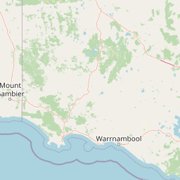
Grampians National Park Interactive Boundary Map and Spatial Limits
Interactive geometry outlines the regional footprint to provide clear spatial context for the park terrain. Companion facts detail the calculated area, perimeter, coordinates, center point, and general geographic spans.
- Boundary area
- 1,683 km²
- Boundary perimeter
- 1,109.3 km
- Northernmost point
- 36.8687° S
- Southernmost point
- 37.6386° S
- Easternmost point
- 142.6851° E
- Westernmost point
- 142.1803° E
- Geographic centre
- 37.2542° S, 142.4098° E
- North–south span
- 85.4 km
- East–west span
- 44.8 km
Elevation and terrain
Analyzed vertical relief and recorded natural features across the park
Grampians National Park Elevation Range and Mountain Terrain Mapping
Recorded mountain relief data details the maximum elevation peak within the protected landscape. Associated feature cards outline specific internal saddles, streams, peaks, and waterfalls.
- Maximum elevation
- 1,167 m
- Highest point
- 1,167 m
Selected named natural features
Mountain saddles
Stockyard Saddle
Peaks
The Fortress
Reservoirs
Lake Wartook
Waterfalls
Epacris Falls
Waterfalls
Tilwinda Falls
Environmental setting
Mediterranean forest habitats, mountain relief, and seasonal climate classifications
Grampians National Park Environmental Setting and Physical Geography
Recorded landscape features and habitat types frame the physical setting through complementary environmental categories. Stored classifications connect recorded terrain data to relevant atlas destinations.
- Relief
- Mountain
- Climate
- Mediterranean
- Water
- Minor water
- Forest cover
- Mostly forested
- Seasonality
- Seasonal
Landscape features
Mountains · Hills · Plateau · Cliffs · Forest · Waterfalls · Cave
Habitat types
Mediterranean forest · Montane forest · Karst habitat
Park atlas
Discover the broader protected landscapes and adjacent geographic regions surrounding Grampians National Park.
Explore Other National Parks and Protected Areas Near Grampians, Victoria's Sandstone Ranges
After exploring Grampians National Park's dramatic sandstone ranges and Aboriginal heritage, continue your park discovery by browsing other national parks and protected areas in Victoria. Compare diverse landscapes, conservation efforts, and regional geographic contexts to deepen your understanding of Australia's natural and cultural heritage.
National parkAustralia
47 km away#1 closest
Northwest

Little Desert National Park: Victoria's Semi-Arid National Park and Protected Landscape
Explore mapped boundaries and unique mallee heathland ecosystems.
Delve into the protected landscape of Little Desert National Park, a significant national park covering over 1,300 square kilometers of Victoria's semi-arid western region. This area is characterized by its deep sandy soils, mallee heathlands, and diverse wildlife, including important populations of native birds. Understanding its geographic setting and mapped boundaries provides crucial insight into Australia's conservation efforts and the preservation of unique desert ecosystems.
- Area
- 1,326.47 km²
- Established
- 1988
- IUCN
- II
- Visitors
- 50K annual
National parkAustralia
58 km away#2 closest
Southwest
Budj Bim National Park: Ancient Volcanic Landscapes and World Heritage Protected Area
Explore the unique geography of Budj Bim National Park's crater lakes and lava tubes.
Budj Bim National Park offers an exceptional exploration of volcanic geography and ancient human ingenuity. This protected area features a dramatic landscape dominated by volcanic cones, lava tubes, and the picturesque Lake Surprise crater lake. Its significance is amplified by the presence of sophisticated Aboriginal aquaculture systems, developed thousands of years ago by the Gunditjmara people, which have contributed to its UNESCO World Heritage status. Discover the mapped terrain and protected land context of this geologically and culturally rich Australian national park.
- Area
- 54.7 km²
- Established
- 1960
- IUCN
- II
- Relief
- Mixed relief
National parkAustralia
60 km away#3 closest
Northeast
Kara Kara National Park: Mapped Protected Landscape and Box-Ironbark Forest Ecology
Explore Victoria's protected natural geography and woodland habitats.
Kara Kara National Park is an essential protected area in Victoria, Australia, recognized for its significant box-ironbark forest ecosystems and the conservation of the endangered swift parrot. The park's geography is defined by the St Arnaud Range, offering a distinct topography of ridges and valleys that contrast with the surrounding plains. Understanding this park's mapped boundaries and its role within the regional landscape provides critical insight into its ecological value and its representation of historical woodland environments.
- Area
- 139.9 km²
- Established
- 2002
- IUCN
- II
- Relief
- Upland
Protected areaVictoria
About 62 km away#4 closest
Southwest
Budj Bim heritage areas: Mapped Volcanic Landscapes and Ancient Aquaculture Systems
Regional protected geography in Victoria, Australia
Budj Bim heritage areas encompass a complex volcanic terrain in south-western Victoria, featuring extensive stone channel networks and managed wetland systems. This protected landscape documents thousands of years of Gunditjmara land engineering, from the dormant Budj Bim crater to the diverse marshlands of Tyrendarra. Access detailed map context and geographical data on this vital cultural and geological site.
- Area
- 99.35 km²
- IUCN
- VI
- Relief
- Upland
- Climate
- Temperate
National parkAustralia
About 62 km away#5 closest
Southwest
Mount Eccles National Park: Geographic Atlas of Volcanic Protected Landscapes
Explore mapped boundaries and regional park geography.
Delve into the structured geographic information for Mount Eccles National Park, a significant protected area in Victoria, Australia. This component of Budj Bim National Park showcases a distinct volcanic landscape and its surrounding terrain. Understand the park's mapped boundaries, regional setting, and its place within Australia's diverse protected land atlas, offering a clear view of its natural geography.
Protected areaVictoria
About 74 km away#6 closest
South
Framlingham Forest Indigenous Protected Area: Geography and Landscape Overview
Aboriginal-owned savanna woodlands in Western Victoria
Framlingham Forest Indigenous Protected Area is an important cultural and ecological site in south-western Victoria. Spanning over 1,100 hectares of stringybark and manna gum savannah, this protected area offers a unique glimpse into the native woodland ecosystems that once defined the Western District plains near the Hopkins River.
- Area
- 11.3 km²
- Established
- 2009
- Relief
- Lowland
- Scope
- Terrestrial
Protected areaVictoria
About 80 km away#7 closest
South
Deen Maar Indigenous Protected Area: Mapped Geography and Coastal Landscape Profile
Gunditjmara country coastal terrain in south west Victoria.
Situated between the Eumeralla River and Bass Strait, Deen Maar Indigenous Protected Area features an unusual concentration of habitats within a small footprint. From calcareous limestone ridges to shallow lake systems and shifting dunes, the reserve serves as a crucial bird conservation area while maintaining deep ties to Gunditjmara cultural identity and management practices.
- Area
- 4.53 km²
- Established
- 1999
- IUCN
- VI
- Relief
- Lowland
National parkBarwon South West
87 km away#8 closest
Southwest
Cobboboonee National Park: A Protected Landscape in Australia's Barwon South West Region
Explore its mapped geography and natural terrain.
Cobboboonee National Park represents an important protected area within the Barwon South West region of Australia. This destination offers users a deep dive into the park's specific geography, providing context on its mapped boundaries and the surrounding natural landscapes. It is designed for exploration of the park's protected-area identity and its place within the regional geography, offering structured data for landscape context.
- Area
- 185.1 km²
- Established
- 2008
- IUCN
- II
- Climate
- Temperate
MoriAtlas Explorer
Continue Exploring Grampians National Park's Protected Landscape and Regional Geography
Delve deeper into the geography and protected-area context of Grampians National Park. By examining its mapped terrain, distinctive sandstone formations, and its significance as a national park, you can gain a comprehensive understanding of this vital Australian landscape. Continue your exploration to uncover the rich natural and cultural layers that define Grampians National Park within its regional geographic setting.
Browse next
Global natural geography
Explore related park routes
Explore MoriAtlas Global ParksBrowse All MoriAtlas ParksGlobal Park Map DiscoveryMoriAtlas: Browse All CountriesBrowse All MoriAtlas ContinentsNational Park Environment AtlasGrand Canyon National Park AtlasYellowstone National Park AtlasYosemite National Park Atlas and GeographySerengeti National Park AtlasGalápagos National Park Protected LandscapeBanff National Park Geography and AtlasKruger National Park Atlas EntryUluṟu-Kata Tjuṯa National Park AtlasExplore Uluru-Kata Tjuta National Park GeographyPlitvice Lakes National Park AtlasFiordland National Park Protected LandscapeGreat Smoky Mountains National Park AtlasAfghanistan National Parks and Protected AreasAlbania National Parks and Protected AreasAlgeria National Parks and Protected AreasAmerican Samoa National Parks and Protected AreasAndorra National Parks and Protected AreasAngola National Parks and Protected AreasAntarctica National Parks and Protected AreasAntigua and Barbuda Park List