
Capes
Park geography
Detailed spatial analysis of regional terrain, coastal landscapes, and islands.
Comprehensive Geographic Profile and Mapped Boundaries of Jaragua National Park
Examine the physical geography of Jaragua National Park, covering 1374 square kilometers across Pedernales Province. This profile details the distribution of land and marine territory, mountain relief, and the structural relationships of islands and capes within the protected boundary.
Related tags
National ParkCaribbean Protected AreaDry Forest EcosystemImportant Bird AreaMarine Protected Area
Caribbean's largest protected area spanning dry forests, coastal wetlands, and pristine marine habitats
Jaragua National Park
Jaragua National Park is the largest protected area in the Caribbean, located in the Pedernales Province at the extreme southwest of the Dominican Republic. Established in 1983 through Presidential Decree No. 1315, the park encompasses a diverse landscape spanning 1,374 square kilometers, including approximately 905 square kilometers of offshore marine habitats. The park is named after the historic Taíno chiefdom of Xaragua and protects a significant portion of the Hispaniolan dry forests ecoregion, one of the most threatened forest types in the Caribbean. Jaragua National Park stretches from Oviedo to Cabo Rojo along the southern slopes of the Baoruco Mountain Range, creating a complex mosaic of dry forest, coastal mangroves, scrubland, inland terrestrial areas, and protected marine environments. The park holds distinction as the only protected area of the Paleoisla del Sur geoformation, a land mass that emerged from the foundation of Hispaniola between 20,000 and 30,000 B.C.
- Location
- Dominican Republic
- Park type
- National park
- Established
- 1983
- Area
- 1,374 km²
Location overview
Regional mapping and coastal island profile in Pedernales Province
Geographic Setting of Jaragua National Park in the Dominican Republic
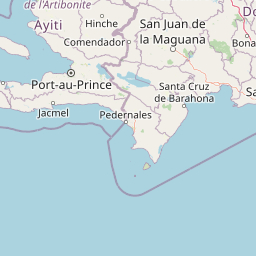
Jaragua National Park is located within Pedernales Province in the Dominican Republic. Marine, island, and coastal classifications define the high-level geographic status of the protected landscape.
- Countries
- Dominican Republic
- Regions
- Pedernales Province
- Primary location
- Pedernales Province
- Geographic setting
- Coastal · Island · Marine
Boundary and coordinates
Visualizing spatial limits across 1,374 square kilometers of protected area
Jaragua National Park Geographic Boundary Map and Spatial Dimensions
The mapped outline displays the spatial footprint of the protected area across land and sea. Derived measurements detail the land and marine distribution, spatial center, and geographic span.
- Boundary area
- 1,534.1 km²
- Boundary perimeter
- 264.1 km
- Northernmost point
- 18.0989° N
- Southernmost point
- 17.4672° N
- Easternmost point
- 71.2546° W
- Westernmost point
- 71.7346° W
- Geographic centre
- 17.7298° N, 71.5334° W
- North–south span
- 69.9 km
- East–west span
- 50.9 km
Terrain and natural features
Explore recorded peaks, islands, caves, and coastal features within the park
Jaragua National Park Mountain Terrain and Named Natural Features
Jaragua National Park features a mountain relief classification encompassing various recorded peaks, islands, caves, and coastal formations. Linked feature cards supply specific names, types, and spatial relationships for each recorded natural landmark.
Selected named natural features
Islands
Cayo Mondesí
Islands
Beata Island
Islands
Cayo del Papayo
Peaks
Cerro La Isleta
Forests
Bosque Loma de Guano
Environmental setting
Tropical relief, coastal terrain, and broad habitat classifications across the protected area
Jaragua National Park Environmental Classifications and Physical Settings
Recorded landscape and habitat categories provide complementary ways to read physical settings across Jaragua National Park. Stored environmental attributes connect recorded classifications to relevant atlas destinations.
- Relief
- Mountain
- Climate
- Tropical
- Water
- Major water bodies
- Forest cover
- Partial forest
Landscape features
Mountains · Forest · Wetland · Lakes · Islands · Coast
Habitat types
Tropical forest · Coastal habitat · Wetland · Shrubland · Marine habitat · Lacustrine habitat
Park atlas
Compare surrounding protected landscapes, tracing coastal zones and dry forest ecoregions across the Dominican Republic.
Discover Other National Parks and Protected Areas Near Jaragua National Park
Discover other national parks and protected areas neighboring Jaragua National Park, allowing a direct comparison of diverse coastal habitats and inland dry forest ecosystems. Expand your atlas exploration by understanding the regional spread of conservation efforts and the distinct protected landscapes across the Dominican Republic.
National parkSud Department
About 40 km away#1 closest
Northwest

Forêt des Pins National Park: Geographic Overview of Haiti's Highland Protected Landscapes
Mapping the pine-forested terrain and high-altitude mountain ecosystems of the southern massif.
Explore the expansive geography of Forêt des Pins National Park, which protects the remnants of Haiti's highland Caribbean pine forests. This protected area spans critical high-elevation slopes and mountain watersheds, offering a detailed look at the rugged natural terrain of the southern massif surrounding Pic la Selle.
- Area
- 187.8 km²
- Established
- 1937
National parkHaiti
About 43 km away#2 closest
Northwest
Parc national La Visite: Atlas and Geographic Overview of Haiti Protected Highlands
Highland pine forest refuges and karst limestone landscapes.
Located in the Chaîne de la Selle, Parc national La Visite serves as a key conservation anchor for the unique upland ecosystems of Haiti. This detailed atlas entry maps the park's steep limestone plateaus, deep gorges, and expansive pine forests, providing essential context on one of the Caribbean's most significant transboundary protected mountain landscapes.
- Established
- 1983
National parkIndependencia Province
About 45 km away#3 closest
North

La Gran Sabana National Park: National Park Identity and Geographic Mapping
Exploring protected landscapes and regional context.
This detail entry focuses on La Gran Sabana National Park, delineating its identity as a protected national park within Independencia Province. It provides essential context for understanding the park's mapped boundaries, its specific geographic setting, and its role within the natural landscape. Users can explore its atlas-relevant features and understand its place in the broader geography of the Dominican Republic.
- Area
- 219.58 km²
- Established
- 2009
- IUCN
- II
- Relief
- Lowland
National parkHaiti
About 72 km away#4 closest
Northwest
La Visite National Park: Protected Highland Terrain and Endemic Pine Forest Landscape
Explore the geography and mapped park boundaries of Haiti's significant national park.
La Visite National Park is a vital protected area located in Haiti's mountainous Massif de la Selle region. It is distinguished by its rare montane ecosystems, including extensive Hispaniolan pine forests and high-altitude grasslands, creating a unique landscape within the Caribbean. This atlas entry focuses on the park's geographic setting, its mapped protected boundaries, and its ecological significance as a key component of Haiti's natural heritage, offering a detailed look at its distinctive terrain.
- Area
- 30 km²
- Established
- 1983
- IUCN
- II
- Relief
- Mountain
National parkHaiti
About 72 km away#5 closest
Northwest
Parc national La Visite: Protected Highland Plateau and Pine Forest Geography in Haiti
Mapping the Massif de la Selle mountain ecosystems.
Parc national La Visite occupies a critical position in southeastern Haiti, protecting a rugged highland plateau defined by dense ravines and Haiti's largest surviving pine forest. This protected area offers a distinct geographic window into the cool, montane terrain of the Massif de la Selle, serving as an essential core zone for regional conservation and mountain landscape study.
- Area
- 30 km²
- Established
- 1983
- IUCN
- II
National parkDominican Republic
108 km away#6 closest
Northeast
Valle Nuevo National Park: Nearctic Highland Ecosystem and Glacial Landscapes
Mapped protected area in the Dominican Republic's Cordillera Central.
Valle Nuevo National Park in the Dominican Republic offers a rare glimpse into a Nearctic ecosystem within the Caribbean. Spanning 910 square kilometers in the Cordillera Central, it features dramatic mountain peaks like Loma Alto de la Bandera and distinctive glacial landforms. The park protects extensive Hispaniolan pine forests and cloud forest habitats, supporting remarkable endemic biodiversity and serving as a critical watershed for the region.
- Area
- 910 km²
- Established
- 1996
- IUCN
- II
- Relief
- Mountain
National parkDominican Republic
122 km away#7 closest
North
José Armando Bermúdez National Park: Dominican Republic National Park Atlas and Landscape Context
Discover the mapped protected area and geographic setting of this Dominican Republic national park.
Gain an understanding of José Armando Bermúdez National Park as a distinct protected landscape within the Dominican Republic. This entry focuses on its role as a national park, providing geographic context and highlighting its mapped boundaries for atlas exploration. Explore the park's specific terrain and its place within the nation's conservation network.
- Area
- 766 km²
- Established
- 1956
- IUCN
- II
- Relief
- Mountain
National parkDominican Republic
About 166 km away#8 closest
Northeast
The Three Eyes National Park: Dominican Republic National Park Geography and Atlas Context
Mapped protected landscapes and natural terrain within Hispaniola.
Delve into the protected area details of The Three Eyes National Park, a designated national park situated in the Dominican Republic. This page facilitates a structured discovery of its geographic scope, mapped boundaries, and the surrounding natural landscapes, offering essential context for anyone exploring the atlas of protected areas within Hispaniola. Understand its unique character as a key element of the country's conservation geography.
- IUCN
- II
- Relief
- Lowland
- Climate
- Tropical
- Access
- Easy access
MoriAtlas Explorer
Continue Exploring Jaragua National Park's Geographic and Landscape Context
Delve deeper into the structured atlas data for Jaragua National Park. Understand its mapped boundaries, regional geographic setting within Pedernales Province, and its importance as a protected landscape. Continue your discovery of this national park's unique place in the Dominican Republic's natural heritage through detailed geographic context.
Browse next
Global natural geography
Explore related park routes
Explore MoriAtlas Global ParksBrowse All MoriAtlas ParksGlobal Park Map DiscoveryMoriAtlas: Browse All CountriesBrowse All MoriAtlas ContinentsNational Park Environment AtlasGrand Canyon National Park AtlasYellowstone National Park AtlasYosemite National Park Atlas and GeographySerengeti National Park AtlasGalápagos National Park Protected LandscapeBanff National Park Geography and AtlasKruger National Park Atlas EntryUluṟu-Kata Tjuṯa National Park AtlasExplore Uluru-Kata Tjuta National Park GeographyPlitvice Lakes National Park AtlasFiordland National Park Protected LandscapeGreat Smoky Mountains National Park AtlasAfghanistan National Parks and Protected AreasAlbania National Parks and Protected AreasAlgeria National Parks and Protected AreasAmerican Samoa National Parks and Protected AreasAndorra National Parks and Protected AreasAngola National Parks and Protected AreasAntarctica National Parks and Protected AreasAntigua and Barbuda Park List