Mori Atlas logo
National parkKahuzi-Biéga National Park

Tracing the transition from Albertine Rift volcanic mountains to dense lowland rainforests.

Kahuzi-Biéga National Park: A Comprehensive Geographic Atlas of Protected Tropical Landscapes

(Parc National de Kahuzi-Biega)

Kahuzi-Biéga National Park encompasses a sprawling 6,000 square kilometers across South Kivu Province, serving as a critical conservation landscape. The geography transitions dramatically from humid Guineo-Congolian rainforests in the west to the rugged, high-altitude volcanic peaks of the Mitumba Mountains in the east. This park provides a vital corridor for diverse ecosystems, mapping the unique transition from equatorial lowlands to subalpine habitats within the Albertine Rift region.

Eastern lowland gorilla habitatAlbertine RiftBiodiversity hotspotUNESCO World Heritage SiteVolcanic mountainsTropical rainforest

Kahuzi-Biéga National Park

National park

Park overview

Structured park overview, official facts, and landscape profile for Kahuzi-Biéga National Park

Kahuzi-Biéga National Park park facts, protected area profile, and essential visitor context

Review the core facts for Kahuzi-Biéga National Park, including designation, size, terrain, visitor scale, habitats, and operating context in one park-focused overview.

About Kahuzi-Biéga National Park

Kahuzi-Biéga National Park stands as one of Africa's most significant protected areas, both for its ecological richness and its conservation challenges. Located in the eastern Democratic Republic of the Congo near the Rwandan border and Lake Kivu, the park encompasses a remarkable diversity of landscapes within its 6,000 square kilometer boundary. The eastern sector rises into the Mitumba Mountains along the Albertine Rift, while the western lowland sector contains dense tropical rainforest that forms part of the Northeastern Congolian lowland forests ecoregion. A narrow seven-kilometer corridor connects these two distinct zones. The park's two namesake volcanoes, Kahuzi and Biéga, dominate the eastern skyline and contribute to the spectacular variety of habitats found within the protected area. Since its designation as a UNESCO World Heritage Site in 1980 under Criterion (x) for its unique rainforest habitat and mammalian diversity, the park has faced mounting pressures from regional instability, population displacement concerns, and illegal resource extraction. Despite these challenges, Kahuzi-Biéga remains critical for global biodiversity conservation, particularly for the survival of eastern lowland gorillas whose population has tragically declined from approximately 600 individuals in the pre-1990s period to fewer than 200 today.

Quick facts and research context for Kahuzi-Biéga National Park

Kahuzi-Biéga National Park covers 6,000 km² in eastern Democratic Republic of the Congo, near the Rwandan border and Lake Kivu. Established in 1970 and designated a UNESCO World Heritage Site in 1980, it has been on the World Heritage in Danger list since 1997. The park features two dormant volcanoes, Kahuzi (3,308m) and Biéga (2,790m), and is managed by the Institut Congolais pour la Conservation de la Nature. It protects one of the highest concentrations of mammal diversity in the Albertine Rift, with 136 species recorded, and is particularly significant for eastern lowland gorillas.

Protection and recognition

Documented terrestrial protection scope and international heritage records

Kahuzi-Biéga National Park Protection Status and UNESCO Recognition

Terrestrial protection status and documented UNESCO World Heritage recognition define the official conservation framework for Kahuzi-Biéga National Park. Structured designation records outline the management scope and international status assigned to this protected area.

International recognition

Protection details

Protection scope
Terrestrial
Park context

Deeper park guide and search-rich context for Kahuzi-Biéga National Park

Kahuzi-Biéga National Park history, landscape, wildlife, and travel context

Explore Kahuzi-Biéga National Park through its history, landscape character, ecosystems, wildlife, conservation priorities, cultural context, and seasonal travel timing in a structured park guide built for atlas discovery and search intent.

Why Kahuzi-Biéga National Park stands out

Kahuzi-Biéga National Park is best known as the last refuge of the eastern lowland gorilla, one of the rarest primate subspecies on Earth. The park protects a greater diversity of mammal species than any other protected area in the Albertine Rift, including forest elephants, chimpanzees, and numerous endemic species. Its significance is amplified by the extraordinary vegetation gradient spanning from lowland Guineo-Congolian rainforest through montane forest to subalpine heather zones, representing one of the few sites in Sub-Saharan Africa displaying all stages of low to highland forest transition.

Kahuzi-Biéga National Park history and protected-area timeline

The conservation history of Kahuzi-Biéga began in 1937 when the Zoological and Forest Reserve of Mount Kahuzi was established by the Belgian Colonial administration on July 27 of that year. This early protected area formed the foundation for what would become one of Congo's most significant national parks. In November 1970, the park was formally established as Kahuzi-Biéga National Park through the efforts of Belgian photographer and conservationist Adrien Deschryver. Five years later, in 1975, the park was dramatically expanded from its original size to cover the full 6,000 square kilometers it encompasses today, though this expansion included inhabited lowland areas and resulted in forced evacuations affecting approximately 13,000 people from the Shi, Tembo, and Rega tribal communities. In 1980, the park achieved international recognition when it was designated a UNESCO World Heritage Site. However, by 1997, the park was placed on the List of World Heritage in Danger due to regional political instability, refugee influxes, and increasing wildlife exploitation. The park has remained on the danger list continuously since that time, reflecting the ongoing conservation challenges it faces.

Kahuzi-Biéga National Park landscape and geographic character

The landscape of Kahuzi-Biéga National Park is defined by a dramatic transition from lowland tropical rainforest to highland volcanic terrain. The western lowland sector features dense Guineo-Congolian wet equatorial rainforest, characterized by tall canopy trees, lianas, and the humid atmosphere typical of central African tropical forests. This region is drained by the Luka and Lugulu rivers, which flow southward into the Lualaba River. The eastern sector rises sharply into the Mitumba Mountains, part of the Albertine Rift and the broader Great Rift Valley system. Here, the terrain becomes mountainous and rugged, dominated by the imposing forms of Mount Kahuzi and Mount Biéga, two dormant volcanoes that reach elevations of 3,308 meters and 2,790 meters respectively. The summit regions above 2,600 meters feature subalpine conditions with heather-covered slopes, dry savanna, and grasslands, creating an unexpected alpine character in the heart of equatorial Africa. The connecting corridor between the two sectors, while narrow at 7.4 kilometers, allows for ecological continuity across this varied terrain.

Kahuzi-Biéga National Park ecosystems, habitats, and plant life

The ecological significance of Kahuzi-Biéga cannot be overstated. The park represents one of the few places in Sub-Saharan Africa where visitors can witness a complete vegetation gradient from lowland rainforest through montane forest to subalpine ecosystems. In the western lowlands, the Guineo-Congolian wet equatorial rainforest forms part of the Northeastern Congolian lowland forests ecoregion, providing habitat for numerous species adapted to lowland tropical conditions. The eastern mountains support the Albertine Rift montane forests ecoregion, with distinct vegetation zones ranging from swamp and peat bogs at lower elevations through swamp forest, high-altitude rainforest, and mountain rainforest to bamboo forest between 2,350 and 2,600 meters. Above this, the subalpine heather zone crowns the highest peaks. The park's swamps, bogs, marshland, and riparian forests on hydromorphic ground are considered rare worldwide. Over 1,178 plant species have been recorded in the highland regions alone, and the park is recognized as a biodiversity hotspot for plants and endemic vertebrates.

Kahuzi-Biéga National Park wildlife and species highlights

Kahuzi-Biéga protects a remarkable assemblage of wildlife, with 136 mammal species and 349 bird species documented within its boundaries. The eastern lowland gorilla represents the park's most celebrated resident and the primary reason for its global conservation significance. Once numbering around 600 individuals before the conflicts of the 1990s, the population has declined to approximately 181 gorillas according to a 2011 census, making this the last stronghold for this endangered subspecies. Other primates include the eastern chimpanzee, several cercopithecine species such as the olive baboon, various colobine monkeys, and Hamlyn's monkey. The mammal community also includes forest elephants, forest buffalo, hippopotamus, leopards, giant forest hogs, bongo antelopes, and unique species such as the needle-clawed bushbaby and the Ruwenzori otter shrew. The avian population is equally remarkable, with at least 42 bird species endemic to the region, including the threatened Albertine owlet, Congo peafowl, African green broadbill, and Rockefeller's sunbird. The park's freshwater fish community includes 147 species, with 11 endemic to the Lowa River basin.

Kahuzi-Biéga National Park conservation status and protection priorities

Kahuzi-Biéga National Park faces significant conservation challenges despite its protected status. The park was placed on the UNESCO World Heritage in Danger list in 1997 and has remained there continuously due to political instability, poaching, and illegal resource extraction. Illegal artisanal mining, particularly for coltan, poses a direct threat to the forest cover and wildlife within the park boundaries. Management by the Institut Congolais pour la Conservation de la Nature has been complicated by the park's 1975 expansion, which displaced local communities and created lasting tensions. Community cooperation efforts, including employment of Twa people in park protection, have been pursued. The park's ranger force has reported challenges including low salaries, lack of support, and poor living conditions. Beyond ecological concerns, the park has faced scrutiny for human rights issues involving indigenous Batwa communities who were evicted from ancestral lands when the protected area was created.

Kahuzi-Biéga National Park cultural meaning and human context

The cultural context of Kahuzi-Biéga National Park is marked by the complex history of indigenous communities and conservation in eastern Congo. The 1975 expansion of the park to encompass inhabited lowland areas resulted in the forced evacuation of approximately 13,000 people from the Shi, Tembo, and Rega tribal communities. The Twa people, an indigenous forest-dwelling community, have historically been involved in park protection efforts through employment as rangers and in community outreach roles. In recent years, the park has been the subject of significant human rights attention. In 2019, park rangers allegedly engaged in violence against Batwa people who had returned to the park in 2018, including allegations of killings, village burnings, and sexual violence. In 2022, the African Commission on Human and Peoples' Rights ruled that the Democratic Republic of the Congo violated the human rights of Batwa people according to the African Charter, specifically regarding their eviction from ancestral territories without prior consent when the park was created.

Top sights and standout views in Kahuzi-Biéga National Park

Kahuzi-Biéga National Park represents an extraordinary conservation priority as the last refuge of the eastern lowland gorilla and one of the most biodiverse protected areas in Africa. The park's complete vegetation gradient from lowland rainforest to subalpine heather is exceptionally rare in Sub-Saharan Africa. Its 136 mammal species represent the highest diversity in the Albertine Rift, while 42 bird species are endemic to the region. The dual landscape of volcanic mountains and extensive lowland forest, connected by a narrow corridor, creates a unique ecological tapestry. Despite its UNESCO World Heritage status and placement on the Danger List since 1997, the park continues to face existential threats from illegal mining, poaching, and regional instability.

Best time to visit Kahuzi-Biéga National Park

Kahuzi-Biéga National Park experiences a tropical highland climate with average temperatures ranging from 10.4°C to 18°C and annual precipitation of approximately 1,800 millimeters. The drier months typically offer better conditions for wildlife viewing and trekking, though the park's accessibility and operational status can be affected by the broader political and security situation in eastern Democratic Republic of the Congo. Visitors should consult current travel advisories and work with experienced operators familiar with the region's complex conditions.
Monthly climate preview

Long-term representative point measurements tracking monthly temperature and precipitation variation

Kahuzi-Biéga National Park Climate Normals and Annual Weather Rhythm

Representative coordinates at 1871 meters elevation record sustained monthly temperature ranges alongside distinct precipitation shifts throughout the annual cycle. Detailed monthly climate normals provide a complete comparative baseline for analyzing long-term atmospheric patterns across the protected landscape.
Annual mean18 °C
17 °C19 °C
Jan18°
Feb19°
Mar19°
Apr18°
May18°
Jun17°
Jul17°
Aug18°
Sep19°
Oct19°
Nov18°
Dec18°
Warmest month
March

19 °C

Coolest month
July

17.3 °C

Wettest month
November

7.9 mm/day

Driest month
July

0.9 mm/day

Park location guide

Geography guide, regional context, and park location map for Kahuzi-Biéga National Park

Kahuzi-Biéga National Park park geography, regions, and map view in Democratic Republic of the Congo

Understand where Kahuzi-Biéga National Park sits in Democratic Republic of the Congo through a broader geographic reading of the surrounding landscape, nearby location context, and its mapped position within the national park landscape.

How Kahuzi-Biéga National Park fits into Democratic Republic of the Congo

The Democratic Republic of the Congo is a Central African country bordered by the Republic of the Congo, Angola, Zambia, Tanzania, Uganda, Rwanda, Burundi, and the Central African Republic, with a small Atlantic coastline. It occupies the Congo Basin, one of the world's largest tropical rainforest regions. French is the official language, though over 200 indigenous languages are spoken. Kinshasa is the capital and largest city.

Wider geography shaping Kahuzi-Biéga National Park in Democratic Republic of the Congo

The DRC occupies a central position in Central Africa, bordering the Republic of the Congo and the South Atlantic Ocean to the west, the Central African Republic and South Sudan to the north, Uganda, Rwanda, Burundi, and Tanzania to the east (across Lake Tanganyika), and Zambia and Angola to the south. The country's terrain is dominated by the Congo Basin, a vast lowland plain covered in equatorial rainforest, while the eastern and southeastern regions feature highlands and mountains including the Albertine Rift.

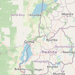
Map view of Kahuzi-Biéga National Park

Use this park location map to pinpoint Kahuzi-Biéga National Park in Democratic Republic of the Congo, understand its exact geographic position, and read its mapped placement within the surrounding landscape more clearly.

Pigeon | © OpenStreetMap contributors

Location context for Kahuzi-Biéga National Park

South Kivu Province
Natural feature types

Explore the Geographic Features and Landscapes of Kahuzi-Biéga National Park

Delve into the specific natural landforms associated with Kahuzi-Biéga National Park. MoriAtlas provides a structured view of the complex topography and hydrological patterns that define this essential protected landscape within the Democratic Republic of the Congo.
Recorded earthquake history

View the Kahuzi-Biéga National Park Earthquake History Catalogue

Review documented seismic records associated with the geography of Kahuzi-Biéga National Park. This MoriAtlas collection presents historical event data including magnitude and epicentre distance, providing a clear reference for regional seismic activity within the South Kivu Province.

Kahuzi-Biéga National Park Earthquake History

Catalogued events

88 events

Strongest magnitude

Magnitude 6.2

Most recent event

Mar 12, 2026

This history includes earthquakes recorded inside the park or within 50 km of its borders

Park atlas

Compare regional park geography and connected Albertine Rift protected landscapes

Explore Parks Near Kahuzi-Biéga National Park and Surrounding Protected Areas

Browse other parks near Kahuzi-Biéga National Park to examine regional terrain transitions and adjacent tropical forest habitats. Continuing into surrounding protected areas reveals broader ecological patterns across the Albertine Rift.
Watercolor illustration of a landscape with mountains, water bodies, and grassy fields
National parkDemocratic Republic of the Congo
About 6.4 km away#1 closest

Kahuzi-Biega National Park: Protected Volcanic and Rainforest Landscapes in the Congo

Geographic atlas of the Mitumba Mountains and lowland rainforest transition

Kahuzi-Biega National Park occupies a significant expanse in the eastern Democratic Republic of the Congo, connecting mountainous volcanic terrain with sprawling tropical lowland forests. The area supports an unparalleled diversity of vegetation, tracking from subalpine summits down to rare swamp and riparian habitats. This site acts as a key reference for understanding the ecological richness of the Albertine Rift and the broader Congo Basin landscape.

Area
6,000 km²
Established
1970
IUCN
II
Relief
Mixed relief
Watercolor illustration of rolling hills, mountains, and a river or lake
National parkDemocratic Republic of the Congo
62 km away#2 closest

North

Virunga National Park: Democratic Republic of the Congo's Premier Protected Landscape

Mapped boundaries and diverse Albertine Rift endemic geography.

Virunga National Park represents a pivotal protected area within the Democratic Republic of the Congo, characterized by an exceptional range of geographic features and vital ecosystems. Its protected landscape includes active volcanoes like Nyiragongo with its lava lake, the towering Rwenzori Mountains, and diverse lowland savannas. This atlas-focused entry highlights the park's unique position in the Albertine Rift, crucial for numerous endemic species and offering significant insight into regional geography and protected land context.

Area
7,800 km²
Established
1925
IUCN
II
Relief
Mountain
National parkRwanda
About 62 km away#3 closest

East

Nyungwe Forest National Park: Protected Landscape in Rwanda's Geography

National park mapping and regional context discovery.

Understand Nyungwe Forest National Park as a distinct protected landscape within the atlas of Rwanda. This page details its status as a national park, focusing on its geographic positioning and mapped protected boundaries. Explore the park's integral role in the regional geography of East Africa, providing a foundation for structured discovery of its natural terrain and conservation importance.

National parkRwanda
About 62 km away#4 closest

East

Nyungwe National Park: Rwanda's Protected National Park for Geographic Discovery

Explore its mapped natural landscape and protected terrain.

Nyungwe National Park represents a vital protected area within Rwanda, contributing a unique landscape to the nation's geographic atlas. This national park offers a specific focus for understanding protected lands, their mapped boundaries, and the natural terrain they encompass. By examining Nyungwe National Park, users gain insight into Rwanda's regional geography and the significance of its conservation efforts within the broader context of East African natural landscapes.

National parkDemocratic Republic of the Congo
80 km away#5 closest

Northwest

Maiko National Park National Park: Map and Protected Landscape Exploration

Discover primary forest terrain and endemic species sanctuary.

Maiko National Park, situated in the Democratic Republic of the Congo, is a cornerstone of central African conservation, protecting over 10,000 square kilometers of pristine tropical rainforest. This national park is recognized globally for its critical role in harboring endemic species such as Grauer's gorilla and the okapi, alongside significant populations of forest elephants and chimpanzees. Its extensive river systems and varied terrain within the Ituri Rainforest ecosystem provide essential habitat, establishing Maiko as a key area for understanding and preserving central African biodiversity and landscape context.

Area
10,885 km²
Established
1970
IUCN
II
Relief
Mixed relief
National parkWestern Province
About 80 km away#6 closest

Northeast

Gishwati Forest National Park: Discover Rwanda's Protected Landscape Geography

Mapped protected area boundaries and regional natural landscape.

Gishwati Forest National Park offers a focused exploration of a significant protected natural landscape in Rwanda's Western Province. This resource provides detailed geographic context, highlighting the park's mapped boundaries and its role within the country's conservation areas. Understand its terrain and regional landscape importance through an atlas-centric view.

Area
32.02 km²
Established
2015
IUCN
IV
Relief
Mountain
National parkRwanda
About 80 km away#7 closest

Northeast

Gishwati-Mukura National Park: Rwanda's Protected Montane Forest Landscape in the Albertine Rift

Explore its mapped boundaries and regional geography.

Gishwati-Mukura National Park, located in western Rwanda, is a vital protected area renowned for its montane forest ecosystems. This national park occupies mountainous terrain characteristic of the Albertine Rift, contributing significantly to watershed protection and regional biodiversity. Users can explore its specific geographic context, mapped landscape features, and its role within Rwanda's broader conservation atlas.

Area
32.02 km²
Established
2015
IUCN
II
Relief
Highland
National parkBurundi
About 95 km away#8 closest

Southeast

Kibira National Park: Burundi's Protected National Park Landscape and Geography

Mapped protected area within the Great Rift Valley region.

Kibira National Park represents a vital protected national park entity within Burundi's diverse geography. As part of the Great Rift Valley's expanse, its mapped boundaries and landscape identity offer a focal point for understanding regional protected areas. This park's presence in Burundi contributes essential data to a structured atlas of natural landscapes and conservation lands across East Africa.

Area
400 km²
IUCN
II
Relief
Mountain
Climate
Tropical

Common questions about visiting, size, designation, and location context for Kahuzi-Biéga National Park

Kahuzi-Biéga National Park FAQs for park facts, access, geography, and protected area context

Find quick answers about Kahuzi-Biéga National Park, including protected-area facts, park geography, trail and visitor context, and how the park fits into its surrounding country and regional landscape.
MoriAtlas Explorer

Continue Your Protected Areas Search Across the Global Atlas

Deepen your exploration by continuing the structured search for national parks and protected areas worldwide. Utilize the comprehensive filtering capabilities to compare different conservation landscapes and refine your understanding of global park geography. Discover more about the distribution and characteristics of protected natural areas.

Global natural geography